
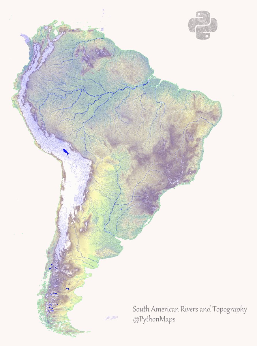
This is a map combining rivers and topography in the South America. Hopefully it shows the cool link between mountain ranges and waterways. This map was made with #Python using #geopandas and #matplotlib. #DataScience #Data #DataVisualization #SouthAmerica.

Great tweet! Thank you for putting this out for all of us to see! 💯 Check out our account, you might find some interesting tips for you & your business! 😉
United States Trends
- 1. Justin Fields 8,905 posts
- 2. Jets 65K posts
- 3. Patriots 139K posts
- 4. Drake Maye 17.4K posts
- 5. Henderson 20.2K posts
- 6. Jalen Johnson 3,516 posts
- 7. AD Mitchell 2,203 posts
- 8. Pats 13.6K posts
- 9. Judge 176K posts
- 10. Diggs 9,325 posts
- 11. Cal Raleigh 7,061 posts
- 12. #TNFonPrime 3,024 posts
- 13. #GreysAnatomy 1,955 posts
- 14. Santana 13.4K posts
- 15. #criticalrolespoilers 1,819 posts
- 16. Mike Vrabel 5,534 posts
- 17. Purdue 8,873 posts
- 18. #TNAiMPACT 5,484 posts
- 19. #JetUp 2,047 posts
- 20. Mack Hollins 2,814 posts
Loading...
Something went wrong.
Something went wrong.