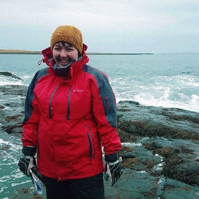
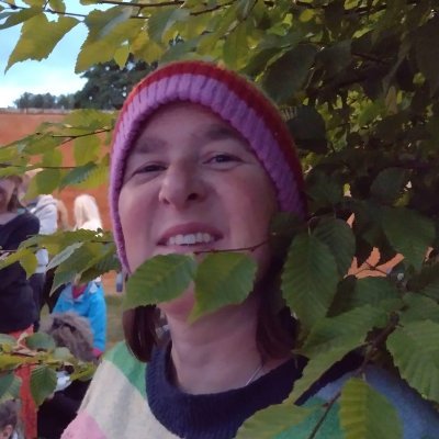
Jess Baker
@GeospatialJess
GeoDataViz @OrdnanceSurvey and graduate from @GeogDurham. Interested in funky cartography, glacial science, and the environment. 🌿🏳️🌈 She/They
You might like


Finally got a chance to make a map using the census sexuality data 🌈

Where are all the Bi-cons? Technical Relationship Consultant Jessica Baker joined the census maps portal data with the local authority district polygons from Boundary Line - and then turned the polygon count attribute into points. For Day 4 of the #30DayMapChallenge - Hexagons.

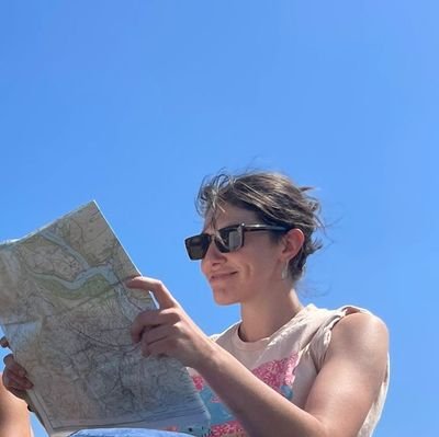
Ooh hello, it's me! Chatting all things accessible mapping with @Rose_Road and the LGBT+ at OS Network
Meet Jess, OS Cartographic Designer who is passionate about connecting with others, providing accessible mapping, and helping people to feel included 🤝 Discover how Jess helps others to #SeeABetterPlace 👇 #OSPlacemakers
Fascinating data and really brilliantly visualised - highly reccommend a look
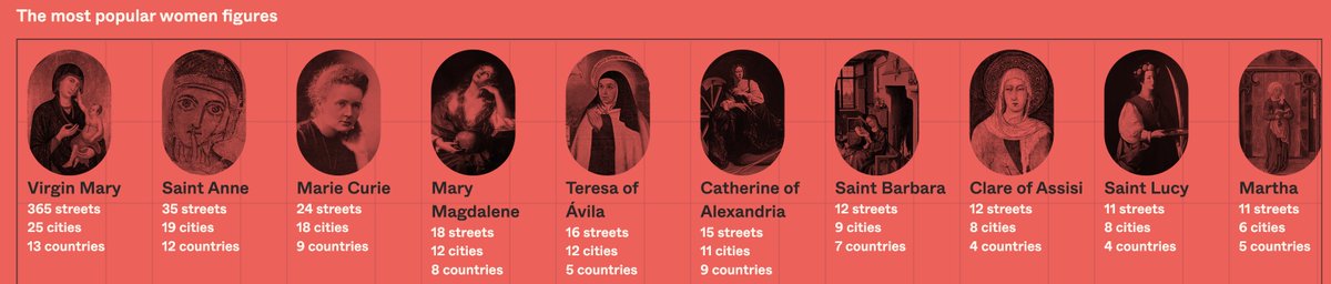
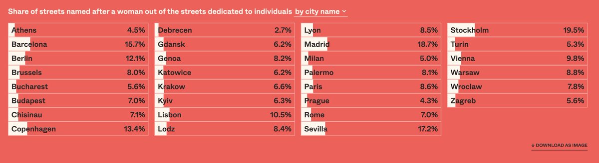
« Mapping Diversity » a compilé et cartographié les noms de rues de 30 villes européennes dans 17 pays. Sur les 145 933 rues, seules 4 779 portent le nom d'une femme Mais alors, qui est la personnalité la plus représentée ? La réponse va vous étonner ⬇️ mappingdiversity.eu


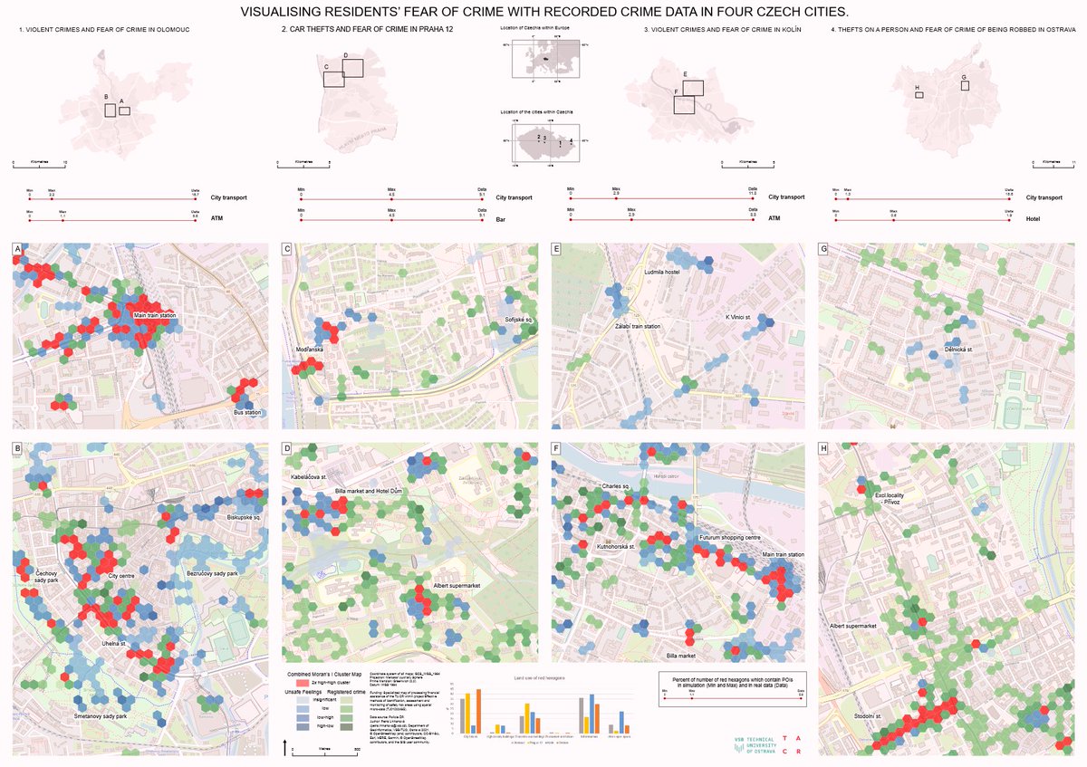
(1/10) Kicking off the joint-runners up for the 2022 JoM best map award 🏆 is "Visualising residents’ fear of crime with recorded crime data from four Czech cities" by Petra Linhartová, Igor Ivan and Jiří Pánek doi.org/10.1080/174456…

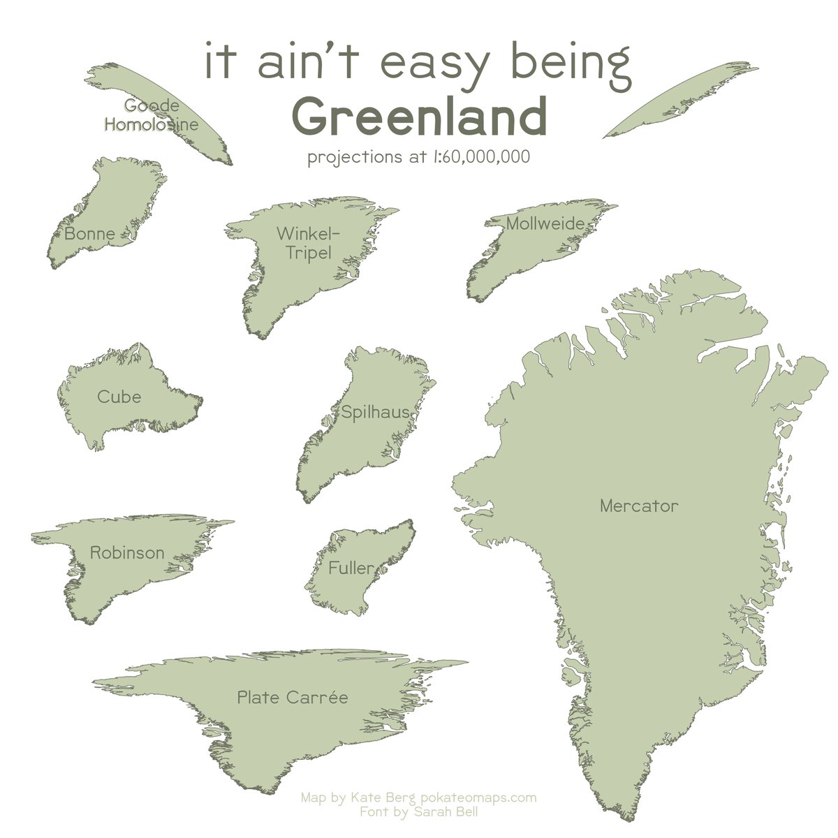
Trying to recreate this in @qgis. It's SO MUCH easier to do multiple data frames if only the projection changes. Awesome! BUT, I'm running into issues with several projections: When I use Cube, Spilhaus, and Fuller, everything goes totally blank. What's up with that? #gischat.
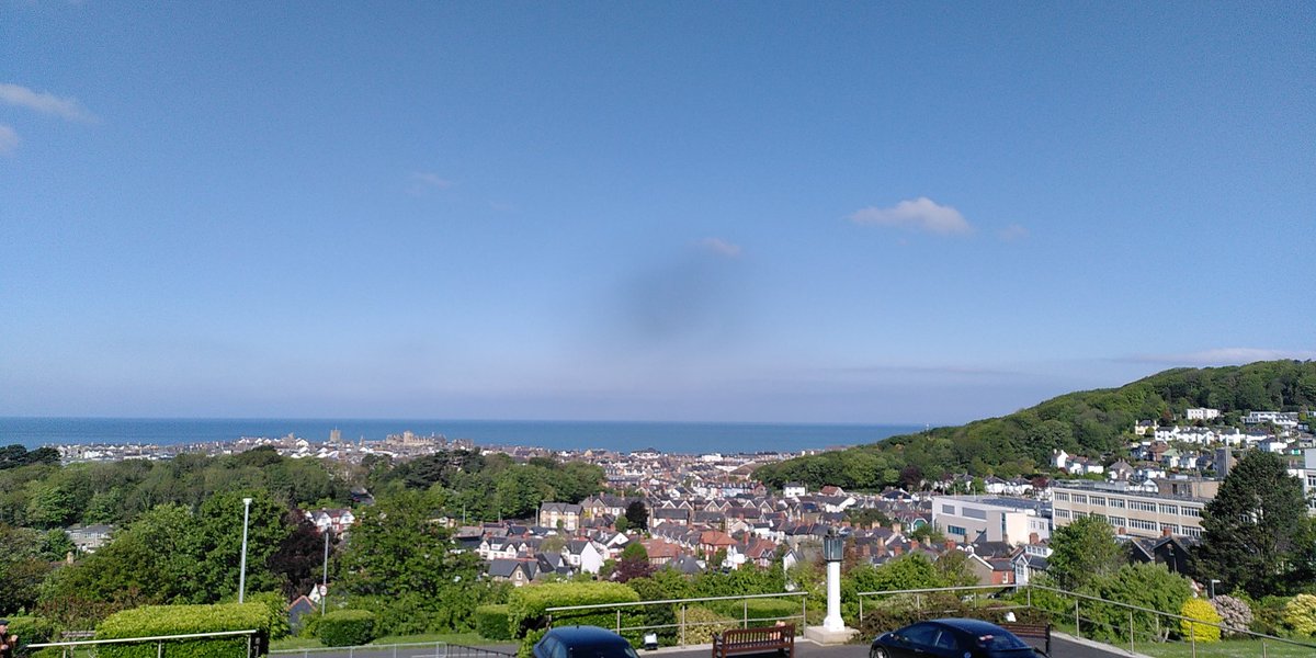
A real pleasure to speak at @NLWales Carto Cymru conference this morning. This venue & sunny views over Aberystwyth certainly beats Microsoft Teams!

OS and @BritishCycling are supporting people to try cycling and discover fun, accessible routes on their doorstep. Riders in the #WestMidlands can now access cycling routes in their local area - available through the @OSleisure OS Maps web and mobile app: ow.ly/zFKe50NZAYM

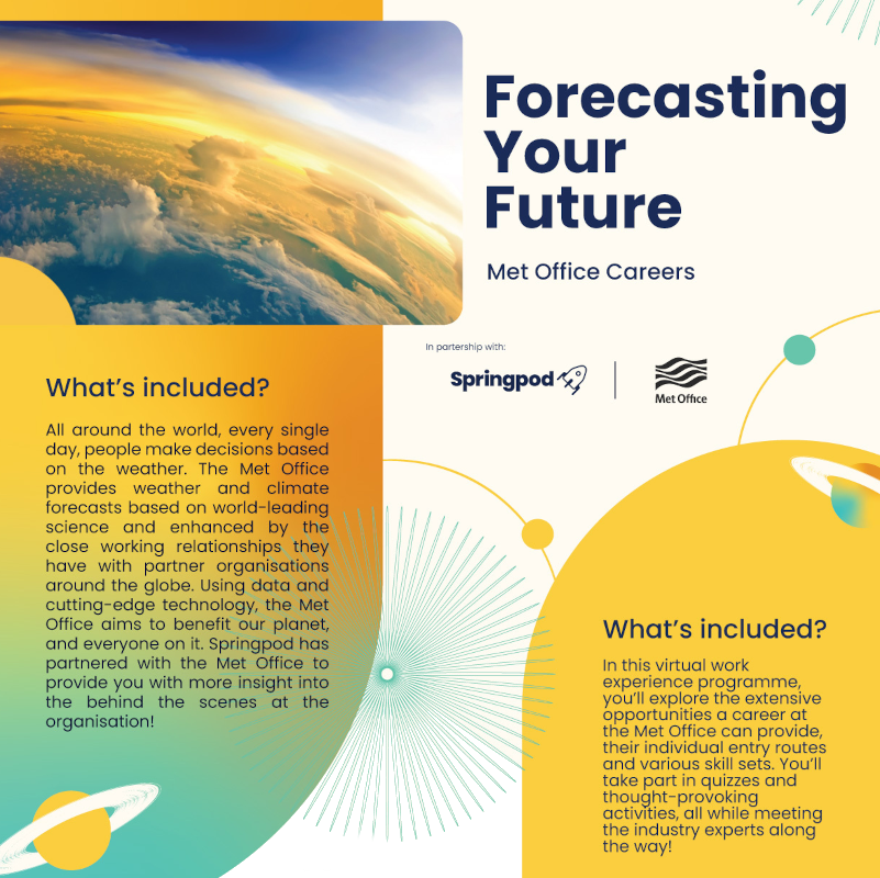
We have some exciting news! Come join us for our first ever virtual work experience for students aged 13–18. It will take place between 3-21 July and will contain a range of modules, work-based assignments, and the opportunity to join our live webinars!

Here is the complete ribbon #map and container, 12 feet long, featuring the Suwannee River and its adjacent conservation lands.
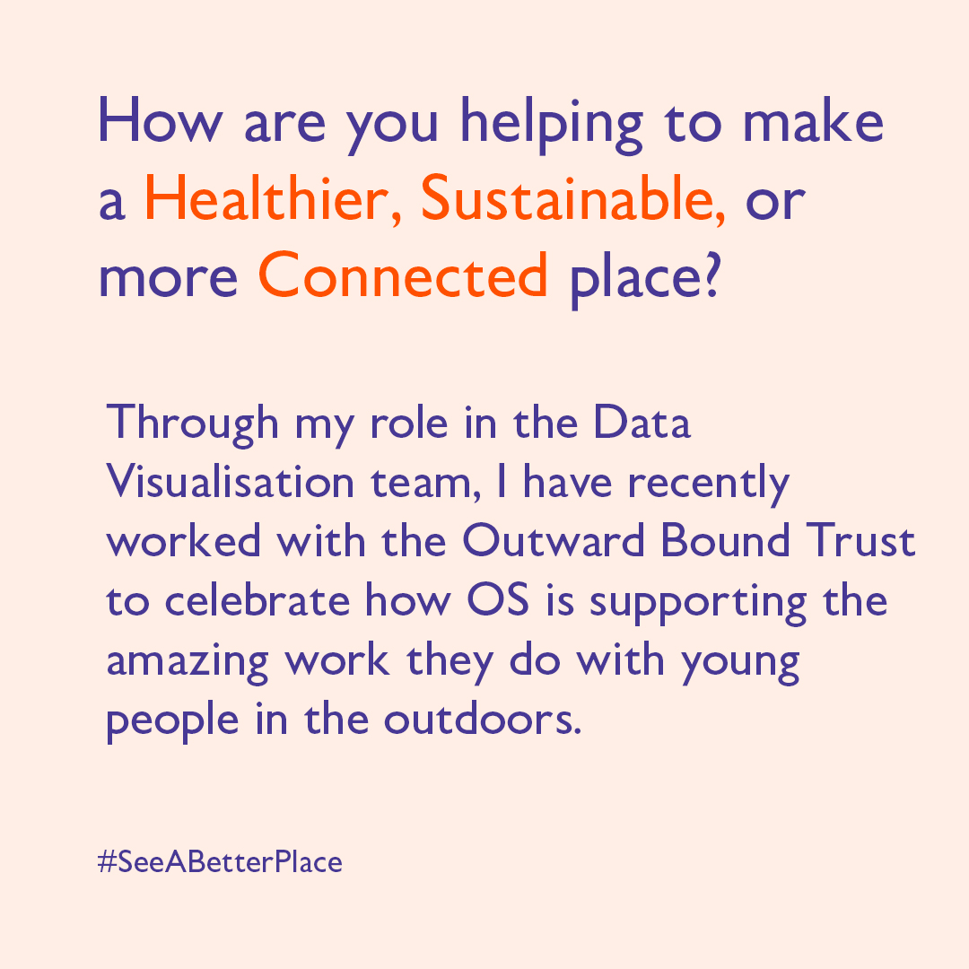
"Through my role in the Data Visualisation team, I work with a whole range of customers, helping them to solve problems and make better decisions." Meet Hannah Wright, as she tells what Embrace Equity means to her, and how she's helping to create a better place 👇


Getting to the Point? Rethinking Arrows on Maps: tandfonline.com/doi/full/10.10… @cartohype and I took a deep dive into how arrows came to be used on maps...and what they've come to mean. It's a fascinating history!

Carto-Cymru - Symposiwm Mapiau Cymru 2023 📆 12.05.23 🕤 9.30am @GeospatialJess yw trydydd siaradwr #CartoCymru2023. Yn Ymgynghorydd yn yr Arolwg Ordnans, bydd ei sgwrs nhw'n edrych ar fapio'r cerrig milltir yn hanes yr Arolwg. 🎫 digwyddiadau.llyfrgell.cymru


Carto-Cymru - The Wales Map Symposium 2023 📆 12.05.23 🕤 9.30am @GeospatialJess is our third announced speaker for #CartoCymru2023. A Technical Relationship Consultant at @OrdnanceSurvey their talk looks at mapping the milestones in OS's history. 🎫 events.library.wales

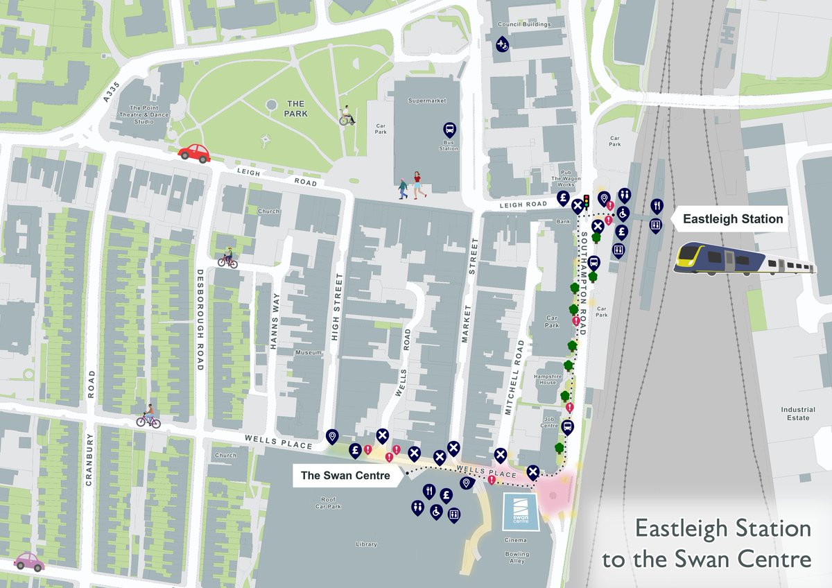
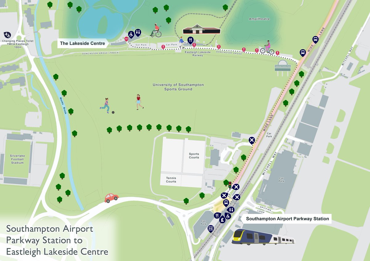
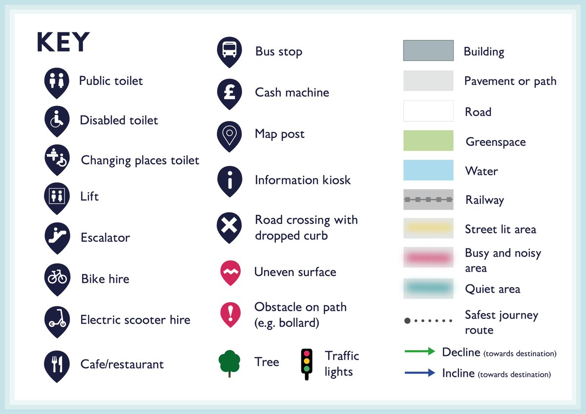
It's important that public spaces and transport are accessible for all. We worked with @Rose_Road to help people with disabilities get to locations accessible by rail, and allow them to plan their trips with ease. #DisabledAccessDay #Southampton #Eastleigh #Hampshire

Important words ⬇️
The ONS census data on gender identity & sexuality is out! Any other LGBTQ+ data viz nerds as excited to make some maps with this as I am? 🗺️🏳️🌈 ons.gov.uk/census/maps/ch…
ons.gov.uk
Census Maps - Census 2021 data interactive, ONS
Census maps is an interactive tool to explore Census 2021 data across England and Wales for different topics down to a neighbourhood level.
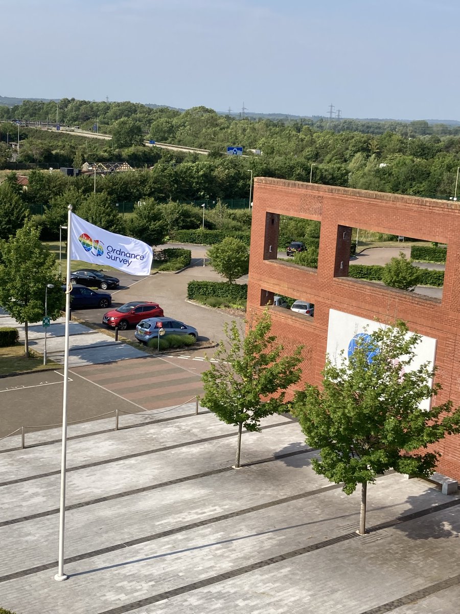
The 2022 British Cartographic Society Awards were recently awarded at our annual conference. To promote our worthy winners the Ordnance Survey, as part of a 3D virtual gallery, has created the Octagon Event Space dedicated to this year's winners. bit.ly/3v7qDYF


United States Trends
- 1. Kevin James N/A
- 2. Bubba 23.1K posts
- 3. #CashAppGreen 1,202 posts
- 4. Hayley 17.9K posts
- 5. Bill Clinton 103K posts
- 6. Rondo 2,603 posts
- 7. Hunter Biden 16.6K posts
- 8. Wale 45K posts
- 9. Jaylon Johnson 2,059 posts
- 10. #BravoCon 3,057 posts
- 11. #FanCashDropPromotion 3,646 posts
- 12. Crooks 75.5K posts
- 13. Vatican 13.4K posts
- 14. #FursuitFriday 14.3K posts
- 15. Metroid 9,168 posts
- 16. #LCxCODSweepstakes 1,200 posts
- 17. Accidentally 29.7K posts
- 18. Hilary Duff 2,977 posts
- 19. Bart Scott N/A
- 20. Fanfest 1,632 posts
You might like
-
 Helen McKenzie
@helenmakesmaps -
 Spiros Staridas
@StaridasGeo -
 British Cartographic Society
@bcsmaps -
 Rhodes Cartography
@RhodesMaps -
 Tom Armitage
@MapNav_Tom -
 Olive Powell 🌍 (she/her)
@olivepowell -
 Nick Bearman
@NickBearmanUK -
 Astun Technology
@astuntech -
 Nicolas Lambert 🦋 🐘
@neocartocnrs -
 Jeremy Morley
@jeremy_morley -
 Christopher Wesson
@ChrisWesson_UK
Something went wrong.
Something went wrong.