
InternationalMapping
@Intl_Mapping
Custom cartography. Print media, interactive maps, and everything in between. Specializing in legal consulting for international boundary disputes.
You might like


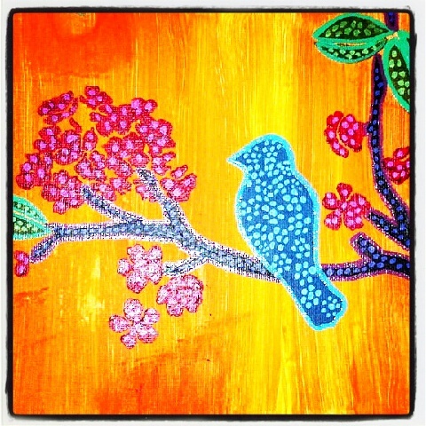
Nice color choices 🇺🇦🇺🇦🇺🇦 #Ukraine #CartographicProtest #gooddesign
It's here - PolGeoNow's new map of territorial control in #Russia's invasion of #Ukraine! Full map and free timeline report: buff.ly/3M8hnuN #UkraineRussiaWar #UkraineConflict #RussiaInvadesUkraine #mapping #cartographer #conflictmap #controlmap #conflicttracking

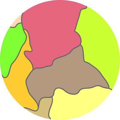
Almost every river, stream or canal of metropolitan France, and their navigability redd.it/6o11pc #MapPorn

Thread: #Turkey is reportedly planning to register a change to its English name with #UnitedNations soon, replacing traditional English name with Turkish version "Türkiye": buff.ly/3ruJNWi #geographyteacher #geography #placenames #toponymy #languagepolitics #namechange
The "Island of Sand" or #SableIsland merited its own chart and whole plate for sailing directions in the #AtlanticNeptune due to the significant number of shipwrecks that occurred around this small crescent of land over 100 miles southeast of Nova Scotia. #maps #HarvardLibrary


I've shared topographic maps of countries many times before. Never a topographic view of a single city. Here is the topography of London. Source: buff.ly/3c6azgy

We've taken another look into the history of segregation in #Baltimore neighborhoods. internationalmapping.com/blog/a-brief-h…
internationalmapping.com
A Brief History of Housing Segregation in Baltimore - International Mapping
How Roland Park in Baltimore City and other garden suburbs across the United States led to segregation and redlining.
Neat #maps on the La Palma 🌋 english.elpais.com/science-tech/2…


I love this map. 1852 US Coast Survey of Cedar Key, FL. Just something about those loose watercolors.


How did your favourite typeface get their name? Source: buff.ly/3kL3WG5

Some really #coolmaps in Gestalten's "Mind the Map" book. Can't wait to read! theguardian.com/travel/gallery…
theguardian.com
Cool cartography: the art of mapmaking
Mind the Map, a new collection of artwork published by Gestalten, shows the skill, humour and care involved in map design, including one depicting New York’s smells, and a meticulously hand-painted...
Star Chart carried to the Lunar Surface on Apollo 11 redd.it/akfnox #MapPorn

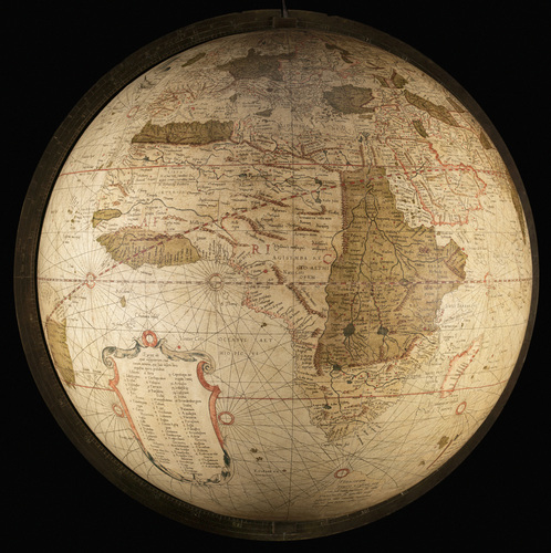
The double hemispheric #Earth, spun around all topsy-turvy by the surrounding winds into a variety of surrounding orthographic projections; appropriately crafted by Matthäus Seutter, the erstwhile brewer's apprentice, around 1720. #maps #HarvardLibrary

Neat to see one of our @SovereignLimits maps picked up by @VeryStrangeMaps! bigthink.com/strange-maps/k…


The Canada–USA international boundary is weirder than you might think. #PointRoberts #StoryMaps sovereignlimits.com/blog/a-brief-h…

Using #maps for historic research can be misleading without properly situating an atlas in the place, time, and purpose of its creators. New blog on the Baist Atlas! internationalmapping.com/blog/lines-in-…
internationalmapping.com
Old Maps, Modern Influences - International Mapping
The Baist Atlas, a series of historic real estate maps, can lead readers astray when attempting to learn about life in a neighborhood.
Check out our new blog on an underused historic mapping series of US cities: the Baist Atlases! #maps #History internationalmapping.com/blog/using-bai…
internationalmapping.com
Using Baist Atlases - International Mapping
The G. William Baist Company of Philadelphia produced detailed atlases of American cities from the 1880s to the 1920s.
African River Basins (with major basins named) redd.it/37lmsk #MapPorn

For #BlackHistoryMonth we look back on Baltimore City and celebrate #BlackOwnedBusiness in a new blog post. Nice work @safaroms! internationalmapping.com/blog/mapping-b…


United States Trends
- 1. #hazbinhotelseason2 33.9K posts
- 2. Good Wednesday 19.4K posts
- 3. Northern Lights 48.4K posts
- 4. ADOR 30.5K posts
- 5. #HazbinHotelSpoilers 3,416 posts
- 6. #huskerdust 9,280 posts
- 7. Vaggie 6,534 posts
- 8. Hanni 9,847 posts
- 9. MIND-BLOWING 35.3K posts
- 10. #chaggie 5,134 posts
- 11. #Aurora 10.5K posts
- 12. SPECTACULAR 25.5K posts
- 13. Carmilla 2,662 posts
- 14. Wike 240K posts
- 15. H-1B 40K posts
- 16. Superb 23K posts
- 17. Justified 18.8K posts
- 18. H1-B 4,574 posts
- 19. TERRIFIC 15.9K posts
- 20. STEM 15.5K posts


Something went wrong.
Something went wrong.