
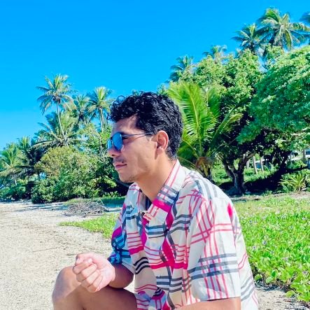
NicholasMetherall🏞🌌🛰️🌏🌳🚣🇦🇺🇲🇾🇹🇱🇵🇬🇫🇯
@NMetherall
#Hydrologist #Forestry applied #Enviro🏞+#Climate #Science🌌 Alumni #ANU #USP #LaTrobe #WPapua Uni. Field survey data collection, geospatial, earth observation.
You might like


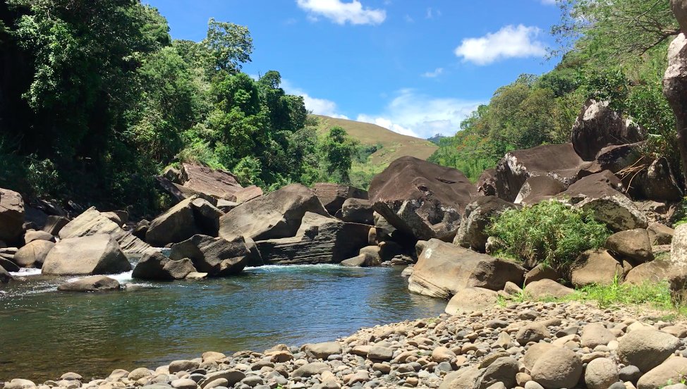
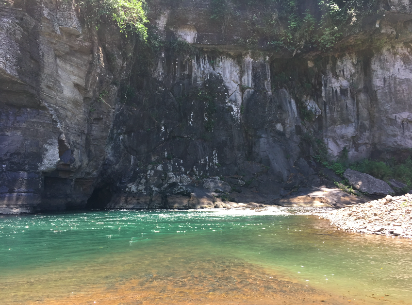
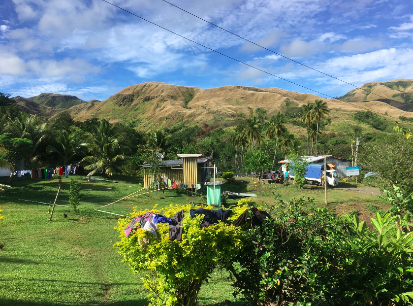
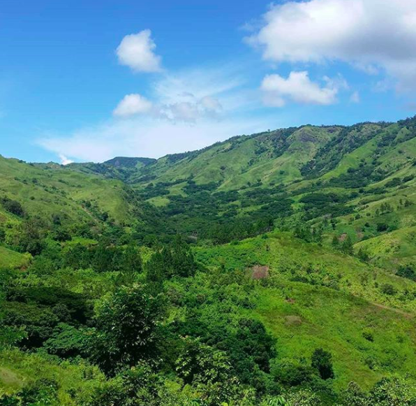
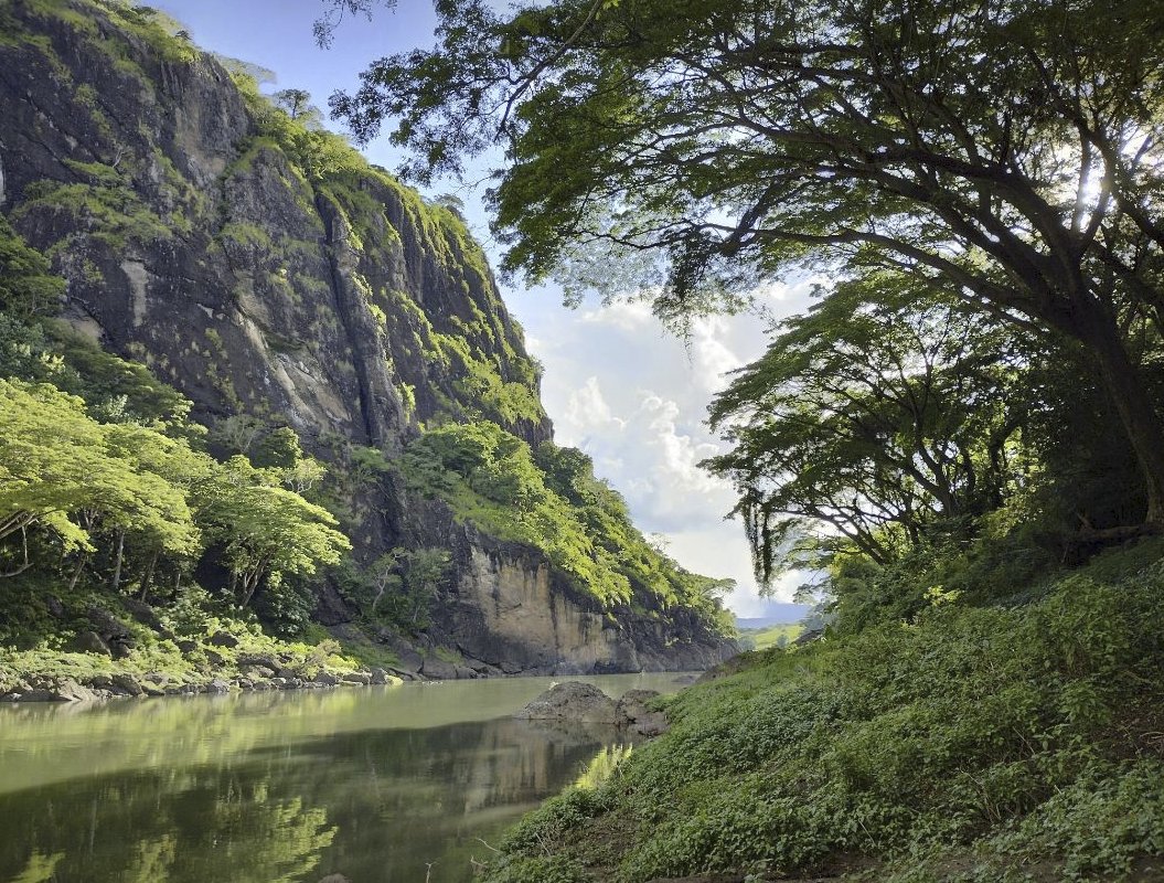
#Fiji is more than just #BeachIslands. It's also #Highlands. Exactly a year ago, I began a #13days #GeoScience #trek through the #mountains of #Nadarivatu and #Ba starting at the #headwaters to study #rivers and #rocks. I worked with #villages and @ItaukeiAffairs @UNDP_Pacific

SPC's DE Pacific team won 3rd place in the EO4SDG Mini-projects and the Earth at Risk image contest organised by the #IEEE Geoscience nd Remote Sensing Society by presenting a poster on the Mineral Resources Extraction Detection (MRED) Tool. Read more: bit.ly/473Z2fw


The @DEarthPacific is using LiDAR-trained deep-learning on Sentinel-2 to detect vegetation height/cover up to 30m height, 10m/pixel, scalable across all PICTS, for change monitoring, and unprecedented deforestation tracking, above-ground biomass, habitat/restoration planning.

Want to know more about the MACBLUE GIS Workshop? Hear from the participants who were out in the field & onsite during the workshop, which brought together participants from across Fiji for a week of hands-on training in mapping seagrass and mangrove ecosystems. #DEPacific

Big thanks @nicholasmetherall for the love and support🙌 Super cool to see #QField, #QFieldCloud & #QGIS helping out in the field like this! #Opensource only works because of awesome folks like you — if you use these tools, consider giving back too 💚 👉 github.com/sponsors/openg…
Working with communities and government partners in collecting GPS field data, we deeply appreciate and depend upon free and open-source software (@QFieldForQGIS @QFieldCloud @qgis) 🌏 I just sponsored opengisch. Go sponsor your open source dependencies! github.com/sponsors/openg…
Working with communities and government partners in collecting GPS field data, we deeply appreciate and depend upon free and open-source software (@QFieldForQGIS @QFieldCloud @qgis) 🌏 I just sponsored opengisch. Go sponsor your open source dependencies! github.com/sponsors/openg…
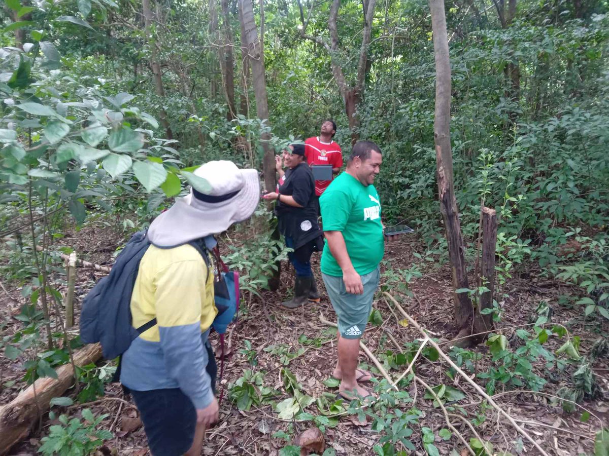
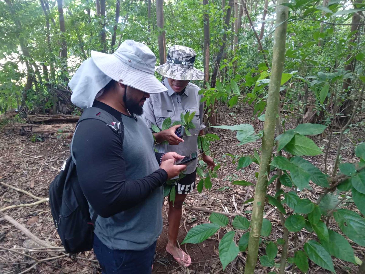
Upcoming #riparian #vegetation and #fluvial #geomorphology field survey coming up this October. Will be documenting the four day Fiji highland rivers trek for #ForestInventories, #biodiversity and #erosion #RiskAssessments and sharing results with villages. Raica na veikau🌳⛰️
Poison Ivy League : youtube.com/watch?v=LmSTwI…

youtube.com
YouTube
The Harvard Scam: How Elite Schools Steal From You
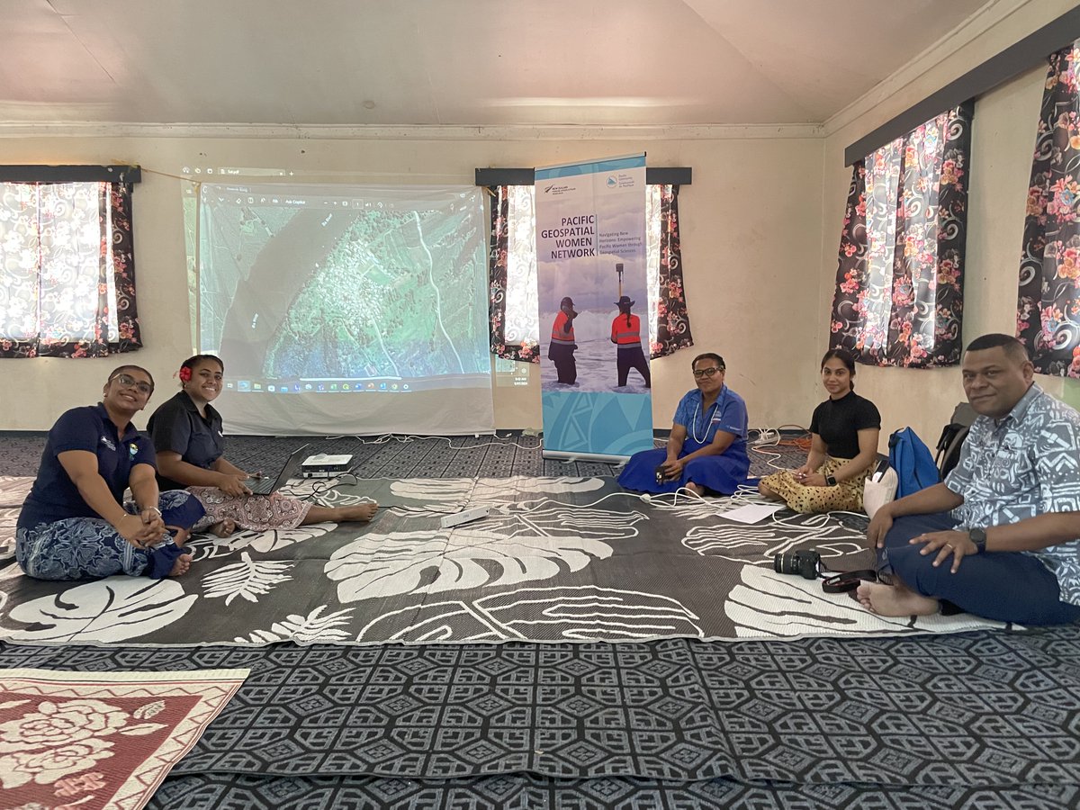
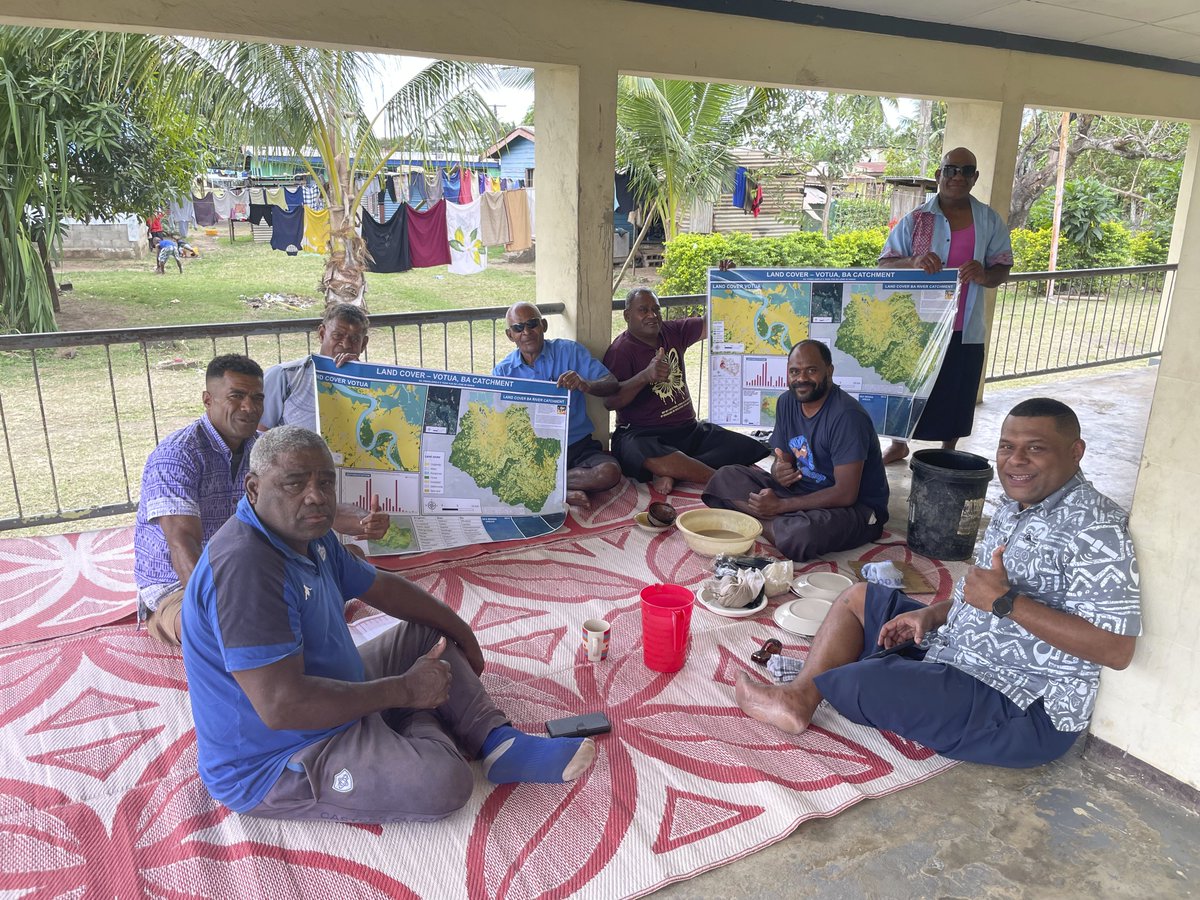
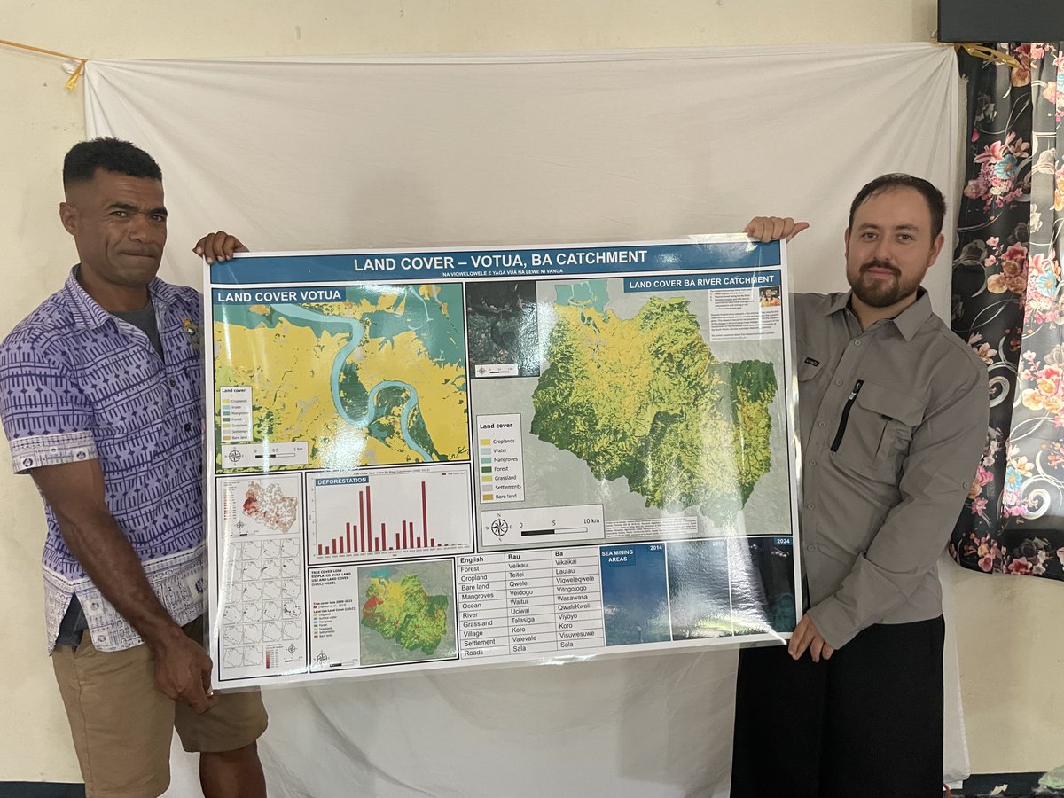
Sharing research results including #landcover, #deforestation and #mining maps and posters with communities who helped build them in Votua Village in Ba, Fiji. These posters and resources will be used by the village community for land use and #NaturalResourceManagement planning.

⏩ Read about how the Digital Earth Pacific (DEP) and MACBLUE projects, in collaboration with Pacific country and territory partners, are developing decision-ready DEP products to help map valuable coastal ecosystems: bit.ly/3WHRZCn 📖 Latest FNL: bit.ly/3Yz4y5d

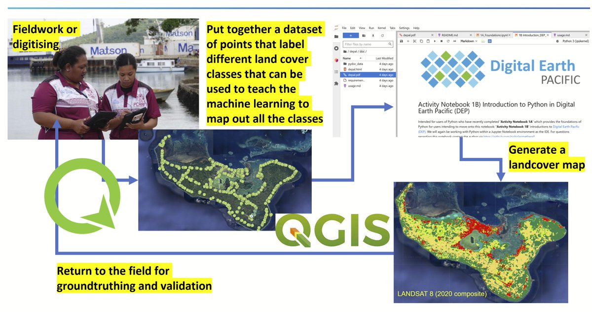
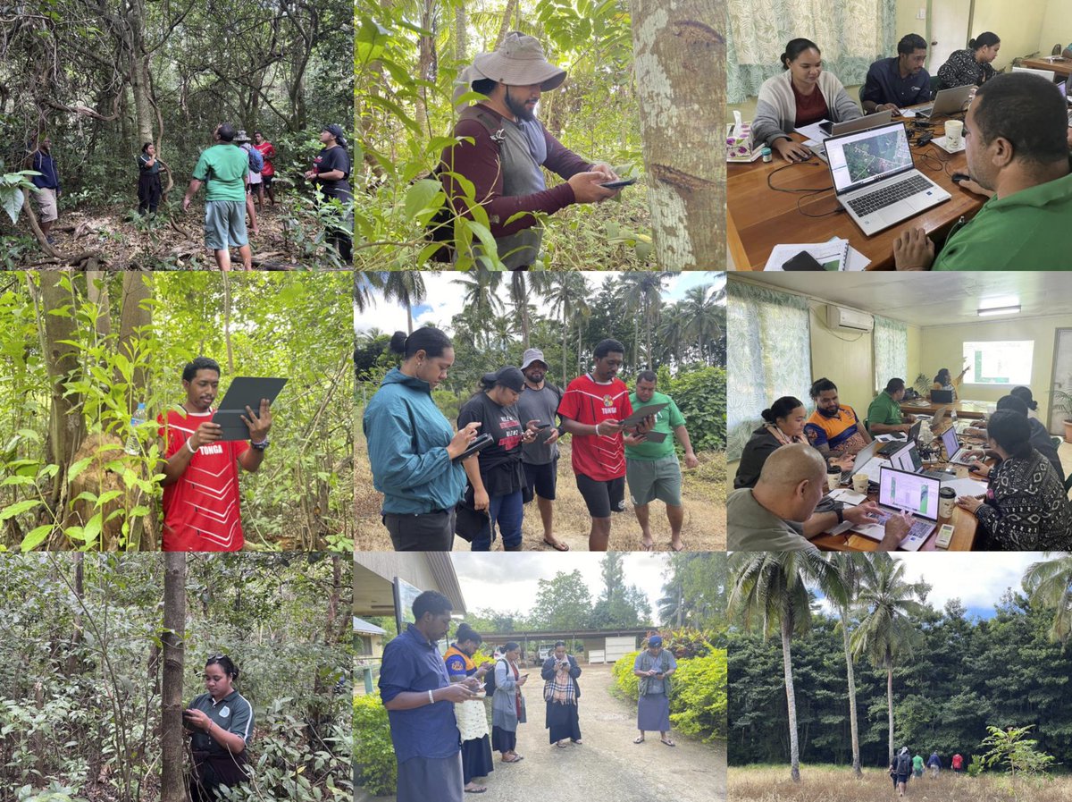
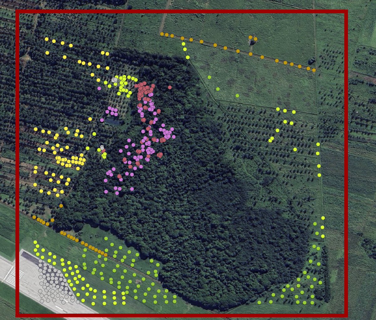
Part of Managing Coastal Aquifer Project, SPC facilitated a @DEarthPacific Land Cover Assessment and Skills Transfer in #Majuro supporting #RMI, #Palau and #Tuvalu through new capacity in applying machine learning techniques using field collected data for Earth Observations #EO


Majuro sunset - in front of the Waan Aelõñ in Majel (WAM) Sail Centre. Their program is committed to empowering young Marshallese by giving them the skills they need to move forward into a sustainable future. ⛵️ canoesmarshallislands.com @RmiR2r @MarshallIslandD @marshalleseB

Automatic code generation and data visualization for #EarthEngine and #geemap using #Gemini 🚀 Explore the power of cloud computing and #geospatial big data with minimal coding 🌎. Gemini can interpret the data on the map and iteratively improve the visualization. Check out the…

EPISODE 3 out now. I’m at Melbourne's Fijian kava bar Pyls Cafe for the screening of Fijian doco @ElecInParaDoc I talanoa with film makers @TumeliTuqota & @dave_lavaki We talk about expired visas, missed flights and their musings about politics 🎧👉🏾open.spotify.com/episode/2QWVDS…
Week-long @DEarthPacific capacity and skill transfer in #Majuro for Marshall Islands, Tuvalu & Palau to undertake land, marine & coastal classification and change detection analysis from 2017-2024, along with using water/moisture indices as a proxy to identify groundwater lenses.


The recording of my 3-hr AMS SatMOC short course on Drought Monitoring with #EarthEngine 🌎 Explore drought analysis, precipitation data, and more with cloud computing and open-source geospatial tools! Video: youtu.be/Wqs4nYjiX94 Notebook: geemap.org/workshops/SatM……
Invasive species mapping and technical collaboration on National Forest Inventory (NFI) work with the Ministry of Agriculture Food and Forests (MAFF). Day 2 - Toloa forest, Tongatapu. @UNDP_CF @ForestPeoplesP @gfoi_forest


Final touches for main #FestPAC13 village at the #Hawaii Convention Centre! In a few days, this venue will be bustling with artists, traditional knowledge holders & cultural practitioners from over 25 #PacificIsland countries! Ho’oulu Lāhui, Regenerating Oceania @FestpacHawaii


Over 30 volunteers showed up and showed out for #InternationalCoastalCleanupDay2023, Suva. Aside from collecting a bunch of litter off the beach, the volunteers sorted, weighed and use the litter to make a couple pieces of very creative artwork.


#DEPacific | 🗣️ “The importance of this cannot be overstated. By leveraging the #DEP and open EO tools and data, we will not only fulfil our international reporting requirements but also empower ourselves.” Mr Rovereto Nayacalevu during @DEarthPacific's workshop in Fiji. 🤝@Mfat


United States Trends
- 1. Epstein 872K posts
- 2. Steam Machine 46.2K posts
- 3. Virginia Giuffre 50.9K posts
- 4. Bradley Beal 4,485 posts
- 5. Boebert 37K posts
- 6. Jake Paul 3,537 posts
- 7. Valve 31.5K posts
- 8. Xbox 63.4K posts
- 9. Rep. Adelita Grijalva 18.2K posts
- 10. Anthony Joshua 2,644 posts
- 11. Clinton 105K posts
- 12. GabeCube 3,242 posts
- 13. Dana Williamson 5,229 posts
- 14. Scott Boras 1,083 posts
- 15. #dispatch 54.9K posts
- 16. Dirty Donald 17.9K posts
- 17. H-1B 104K posts
- 18. Michigan State 9,722 posts
- 19. Clippers 8,549 posts
- 20. Jameis 10.6K posts
You might like
-
 Rens
Rens
@rravfj -
 Moira Vilsoni
@mvilsoni_fj -
 Aseri
Aseri
@SonOfAKingTui -
 🇫🇯 Renee Lewenilovo 🦈
@fishy_chick -
 In682from679👑
@kaiRassia -
 🔥Stevie Chute🔥
@StevieDntCare -
 Shritika Prakash
@ShritikaFJ -
 Cagi ni Pasifika
@ShadyIslander -
 Iliesa
@iliesa_ -
 Lini
Lini
@saucabulou -
 namecannotbeblank
@LastBornDomain -
 𝕝 𝕚 𝕡 𝕖
@lipe_enn -
 Queen May 🇫🇯
@queen_may10 -
 Fiona Hukula
@finah_k -
 Api Cokanasiga
@pmlkcokanasiga
Something went wrong.
Something went wrong.