
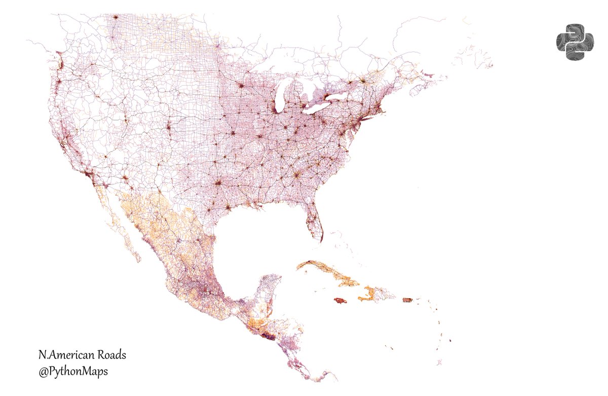
Roads of North America! Shows all roads from highways down to lanes and everything in between! The USA really is a country with two halves! This map was generated using #Matplotlib #Numpy #Geopandas. #Python #DataScience #Data #DataVisualization #Europe #infastructure.


United States Trends
- 1. #FanCashDropPromotion N/A
- 2. #NXXT_Earnings N/A
- 3. Summer Walker 22.7K posts
- 4. Good Friday 51.5K posts
- 5. #FridayVibes 4,355 posts
- 6. Wale 36.3K posts
- 7. #GringosVenezuelaNoSeToca 2,510 posts
- 8. #FinallyOverIt 7,083 posts
- 9. Happy Friyay 1,314 posts
- 10. Doug McMillon N/A
- 11. Meek 6,274 posts
- 12. Saylor 34.2K posts
- 13. Go Girl 24K posts
- 14. Red Friday 3,108 posts
- 15. $BTC 118K posts
- 16. Robbed You 4,828 posts
- 17. Finally Friday 2,447 posts
- 18. SONIC RACING 2,560 posts
- 19. CONGRATULATIONS JIN 25K posts
- 20. Bill Clinton 55.3K posts
Loading...
Something went wrong.
Something went wrong.