
SPH Engineering
@SPHEngineering
SPH Engineering is a global provider of UAV software solutions, integration services, consulting and custom development to expand drone applications.
You might like


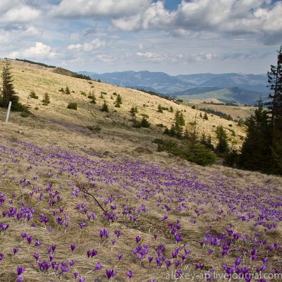
The only flight planning software with a dedicated #LiDAR toolset? #UgCS The best part? UgCS Open is free. In our most recent video we show an example of a survey on a sledge track in #Latvia youtu.be/J3sd-eI297Y?si…

youtube.com
YouTube
Best FREE flight planning solution for LiDAR
Discover the future of subsurface exploration with the new 600 MHz GPR models for drones. Live session unveiling the new MALÅ GeoDrone 600 & RadSys Zond Aero 600, featuring insights on technology, applications, and integration with DJI M400. Register: us02web.zoom.us/webinar/regist…

DJI Mini + #UgCS = a professional mapping machine. Our new video covers the full workflow - flight planning, data capture, processing, all of it. Everything you need to start billing for mapping work with a sub-$1K drone. Give it a watch! youtu.be/4NwL3CE-cXU?si…

youtube.com
YouTube
How I Made a 3D Church Model With a Tiny Drone for FREE
Join a free 90-minute workshop that teaches you #UgCS flight planning. After the Workshop, access the UgCS Course & get certified, for free ☝️only for participants. 📌 Slot 1: us02web.zoom.us/.../851.../WN_… 📌Slot 2: us02web.zoom.us/.../811.../WN_…

Same camera. Same drone. Different drone flight planning software. #UgCS makes the difference. When your #photogrammetry depends on flying below 12m with terrain-following, altitude capability isn't optional. Read the full Case Study here: sphengineering.com/news/case-stud…

Your #LiDAR workflow just got automated. Your Mini 4 Pro just got professional. #UgCS 5.14: 🔥 Auto DJI L2/L1 calibrations 🔥 Mini 4 Pro, M400, Matrice 4 support via Companion 1.7 🔥 35% off UgCS Pro (code: PRO35, auto-applied) Fly Pro with UgCS: sphengineering.com/news/ugcs-5-14…

75 flights. 436 survey lines. 10 km² of unforgiving Norwegian mountains. The mission: Find graphite deposits with a magnetometer flying just 35 meters off the ground. Check out #UgCS in-depth case study: sphengineering.com/news/case-stud…

What’s the best drone mapping software? We tested 5 top planners on complex sites to find out — focusing on what matters most: clean data capture. Full review:🚁 sphengineering.com/news/best-dron…

Join our Free Live #DJI Mini Mapping Workshop to see exactly how #UgCS turns your small drone into a professional powerhouse for automated missions. Register here: us02web.zoom.us/webinar/regist…

Our client, firm Ileron, traded the old way for the new - a drone carrying our complete Methane Detection Kit, a combination of #UgCS, #SkyHub, and #Falcon 2. They surveyed an entire LNG plant in one day! Full case study below: sphengineering.com/news/drone-met…

Revolutionize your underwater #mapping capabilities. Experience precision underwater mapping like never before with advanced multibeam echosounder (#MBES) technology mounted on state-of-the-art #UAV platforms. Register for a free #webinar: us02web.zoom.us/webinar/regist…

Experience the Power of Drones 📅 15 October 2025 📍 Pflugerville, Texas, USA Live Demo Day at our Texas office! 🔹UAV Magnetometers 🔹GPR 🔹Echo Sounders 🔹Real-time data workflows ✨Official Launch of Multibeam Echosounder ➡️Register & join us on site! bit.ly/DemoDayTexas_a…
NGU's official report concluded: “Without this software, the complex terrain would have made the survey impossible." Review the full case study and technical breakdown: sphengineering.com/news/aeromagne…


@SPHEngineering has released a multibeam echosounder system for UAVs that uses the Cerulean Surveyor 240-16, a compact bathymetric sensor designed for shallow-water mapping. Read more: heyor.ca/ii3cBb Photo: SPH Engineering gpsworld.com/sph-engineerin…
Flawless drone missions aren't luck! They result from a rigorous pre-flight process that starts long before takeoff. ✅ Our guide covers three critical phases. Get the complete checklist here: sphengineering.com/news/drone-pre…

When geophysicists go to Naples, they don’t just eat pizza. They scan beneath it. @SPHEngineering is at #EAGE2025 in Naples together with our friends from @Radar_Systems🍕+📡 = the perfect combo. We’ve brought our drone-based #GPRs, #magnetometers, and more. See you in Naples! 🇮🇹
When your drone insists on fishing but forgot the rod. Just another #MBES survey in peaceful #Koknese. #NoFishJustData #sphengineering


United States Trends
- 1. Epstein 420K posts
- 2. Rosalina 47.2K posts
- 3. #NASDAQ_MYNZ N/A
- 4. Bowser Jr 15K posts
- 5. Virginia Giuffre 14.4K posts
- 6. Michael Wolff 8,771 posts
- 7. H-1B 79.1K posts
- 8. The Devil Wears Prada 2 20.4K posts
- 9. AJ Brown 6,604 posts
- 10. Delaware 11.4K posts
- 11. Jeezy 9,935 posts
- 12. #NASDAQ_NXXT N/A
- 13. Steam Machine 3,017 posts
- 14. MEDICA 2025 N/A
- 15. Jameis 6,629 posts
- 16. Tim Kelly N/A
- 17. Mario Galaxy 99.9K posts
- 18. Marvin Harrison Jr. N/A
- 19. #wednesdaymotivation 5,778 posts
- 20. Humanity 99.5K posts


Something went wrong.
Something went wrong.