
GIS_STEVE
@gis_steve
Geospatial enthusiast. BYU fan and Pokémon Trainer
قد يعجبك


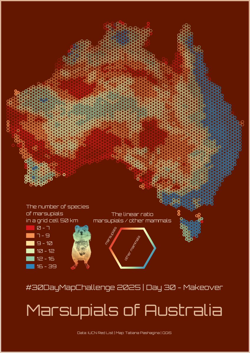
#30DayMapChallenge Day 30 – Makeover. I remade my map of Australian marsupials I made for Hexagon Day. I added a linear ratio (the hexagons are scaled by linear dimensions, not area) of marsupials to other mammals. 🐭🦇✨🦘🐨

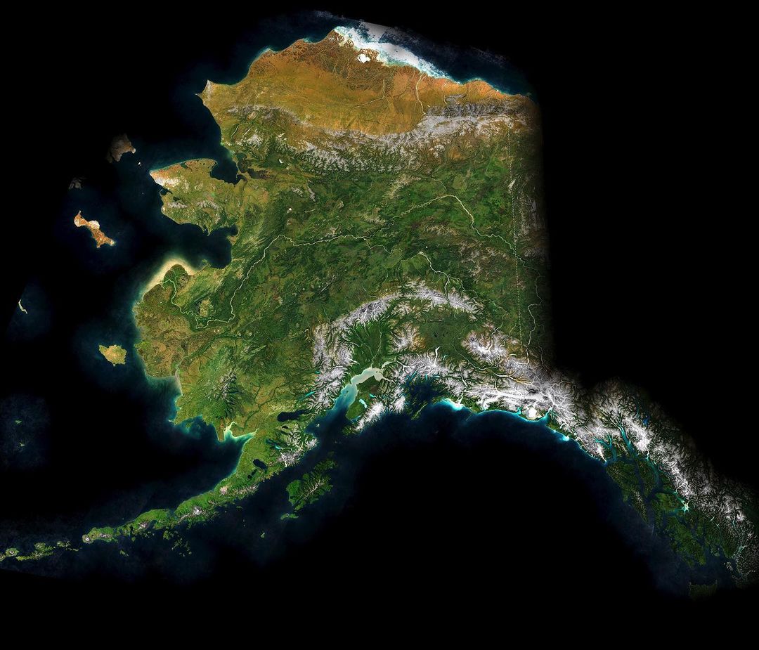
The Great State of Alaska by Greg Fiske. 🏔 Sentinel-2 mosaic with an added TopoBathy layer from ArcGIS Living Atlas. Learn about the special multiscale hillshade technique used for this map here: ow.ly/z6ck50XffW4
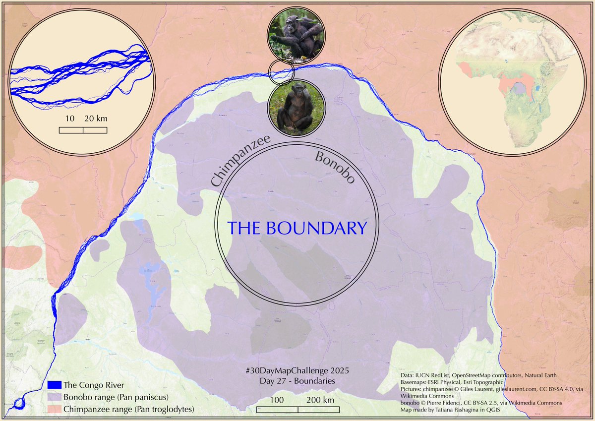
#30DayMapChallenge Day 27 – Boundaries. A map showing the natural boundary between chimpanzees and bonobos — the vast Congo River🌊 #map #gis #qgis #dataviz

#30DayMapChallenge Day 26 — Transport Alberto Meouchi from MIT’s Civic Data Design Lab demonstrates how the Atlas of Popular Transport uses Mapbox tools and GTFS feeds to animate commuting and mobility patterns around the world. Watch the BUILD with Mapbox session to learn…


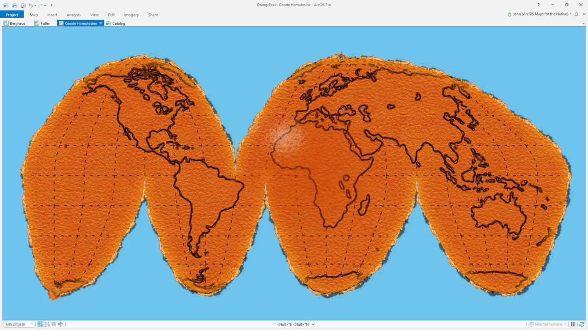
Download this Earth-peel project for ArcGIS Pro and really lean into that peeled orange map-projection illustration. Orange-ify any projection. esri.com/arcgis-blog/pr…
Ohhh a favorite of mine! Reaching across the generations to collaborate with my geographer father!

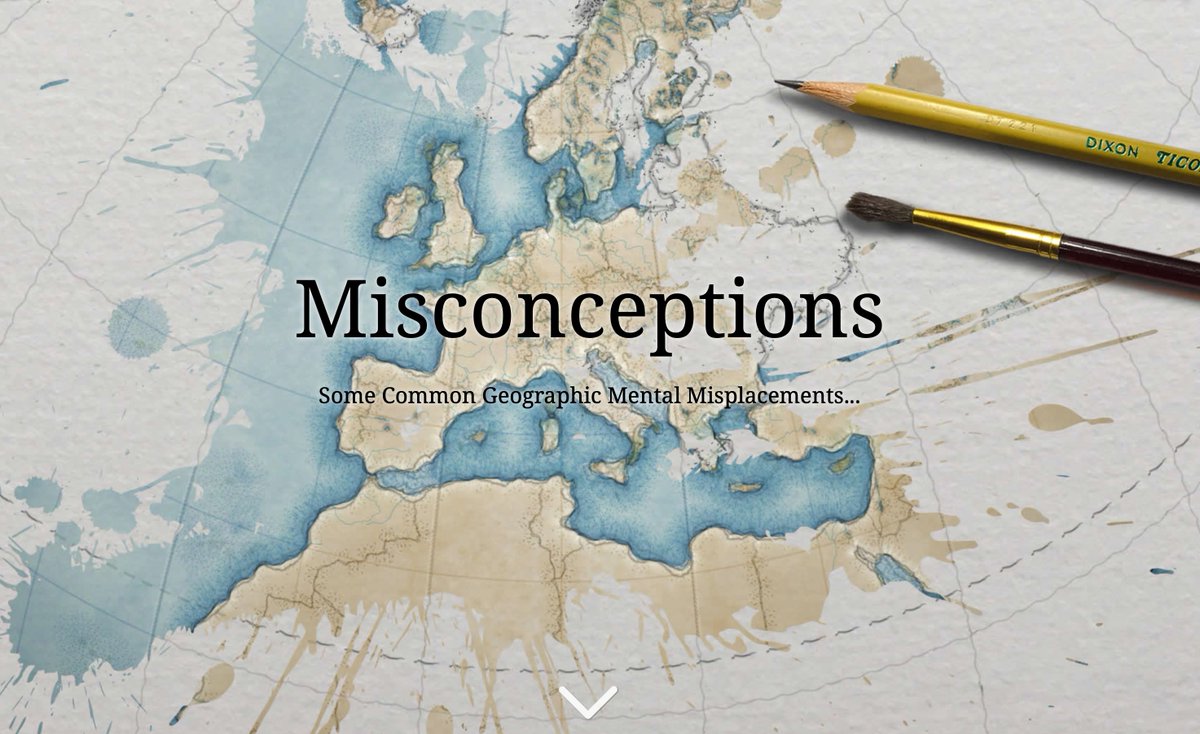
It’s #geographyawarenessweek! Test your geo skills with a favorite story— Misconceptions by @John_M_Nelson 🌐ow.ly/WmAO50XrTiB

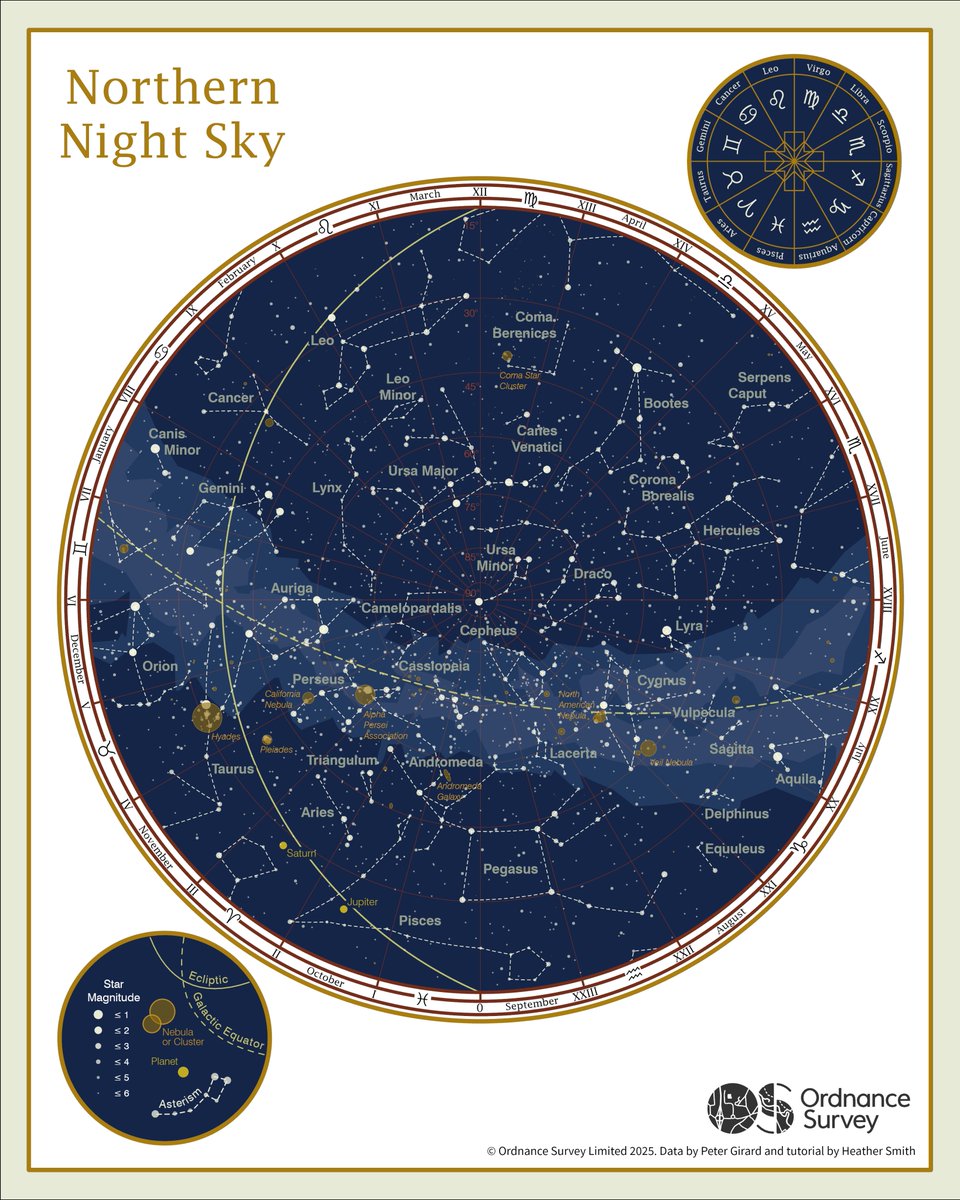
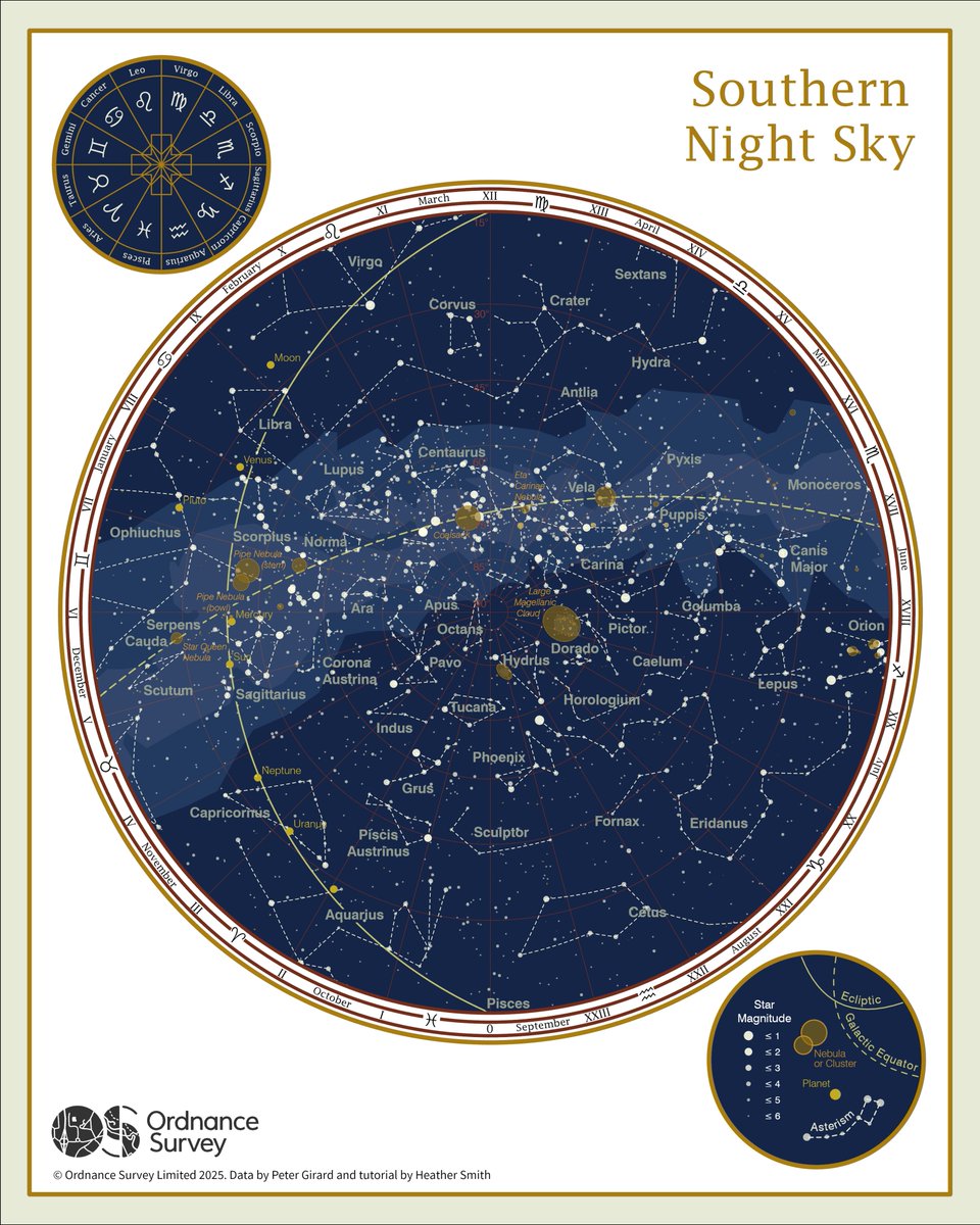
Graduate Rebekah Spratt maps the northern and southern night skies for Day 18 of the #30DayMapChallenge - Out of This World. Using colours from Van Gogh’s Starry Night, these celestial charts bring art and astronomy together. 🌌

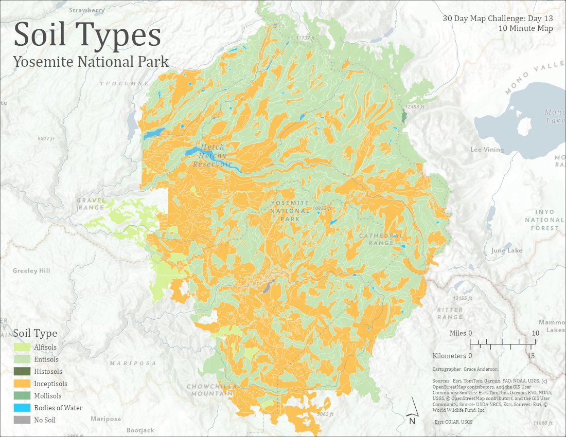
Grace Anderson mapped Yosemite National Park's soil types in under 10 minutes using #ArcGISPro and ArcGIS Living Atlas data. New tools like Spatial Definition Query and Search for Colors made for quicker mapping. #30DayMapChallenge day 13: ow.ly/mM4e50Xr89r
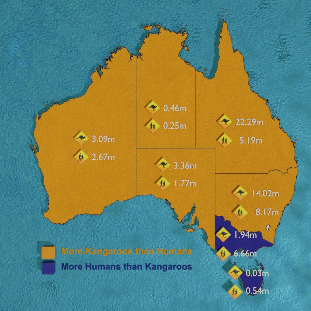
🇦🇺 Australia’s population showdown — Kangaroos 🦘 🆚 🧍 Humans

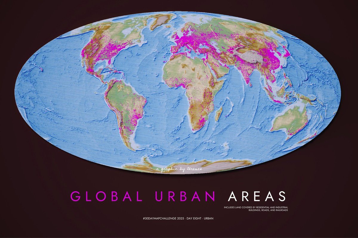
In this map @researchremora shows us the urban footprint around the world. I pondered this map for quite a bit. Few of us venture outside of the pink areas for any long stretch of time.

I love how Dina brought my tutorial to life in this map! Watch it here 👉 youtu.be/q4GIQGRnTNI

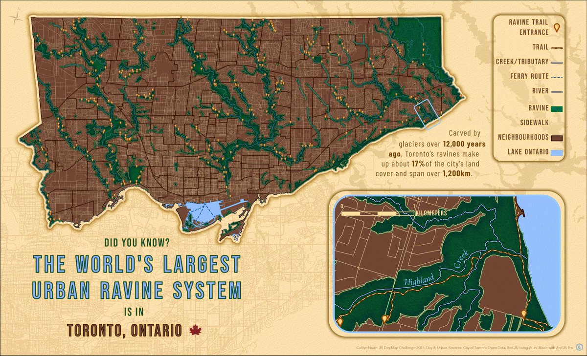
Using #ArcGISPro, Caitlyn North mapped the urban sanctuary many Torontonians use to escape the hustle and bustle of the city. ArcGIS Living Atlas data and custom symbology brought Toronto’s 1,200 km ravine system to life! #30DayMapChallenge day 8: ow.ly/FwzE50XoBn4
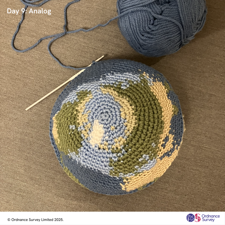
Geospatial Analyst Hannah Brooks crocheted a globe using a pattern by KaperCrochet, adapting colours for land and sea. The northern hemisphere is complete, with the rest to follow soon. For Day 9 of the #30DayMapChallenge - Analog.

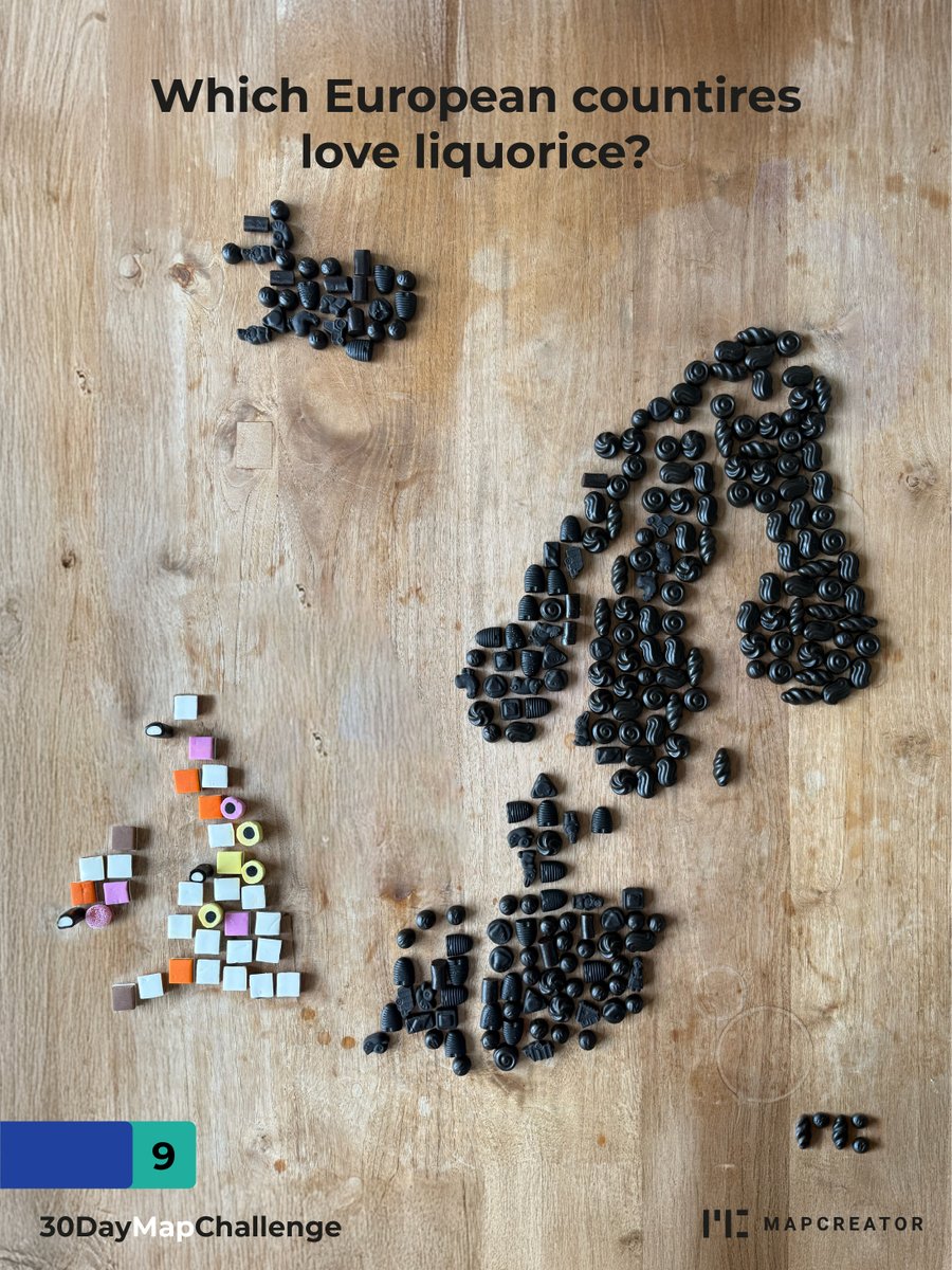
We made a liquorice map… using real liquorice. Would you dare to eat it? ⚫️ #30daymapchallenge #dropit #liquorice

#30DayMapChallenge · Day 8 · Urban. Global urban areas. #rayshader adventures, an #rstats tale


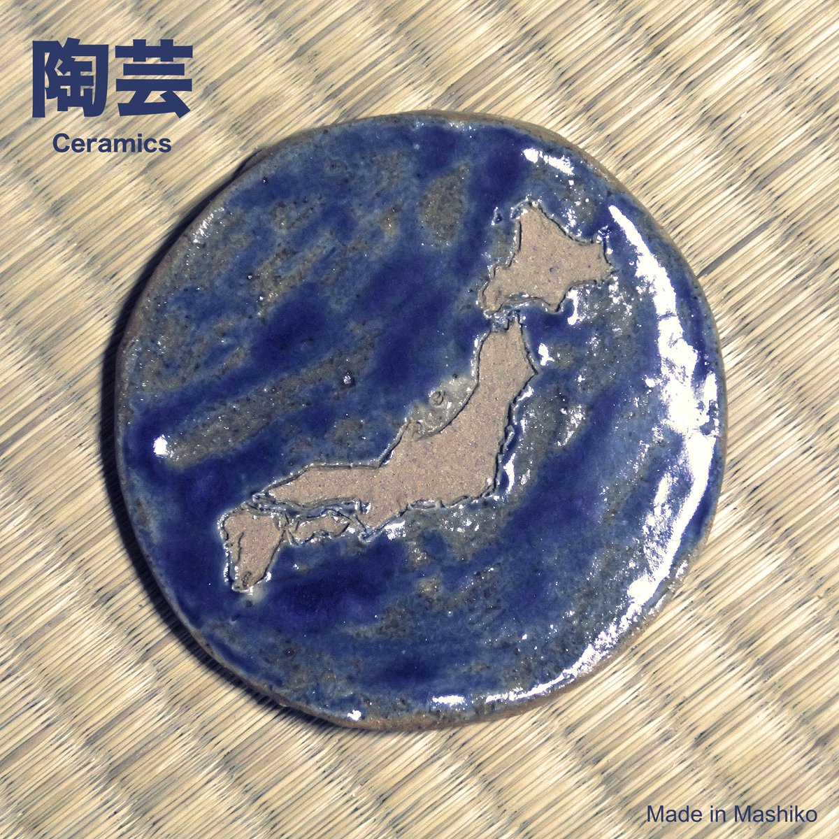
#30DayJLPTMapChallenge Each map features a Japanese word Day 9 - Analog Japan shaped by Earth ※ Keywords 陶芸 (tougei) - ceramics 粘土 (nendo) - clay 窯 (kama) - stove, kiln #30DayMapChallenge

#30DayMapChallenge Jour 9 : Analog A la carte aujourd'hui : Spaghettis au double pesto (rosso et basilic) sur un fin coulis au chocolat français.


United States الاتجاهات
- 1. Lakers 47.7K posts
- 2. Dillon Brooks 5,305 posts
- 3. Giants 81.3K posts
- 4. #WWERaw 65.6K posts
- 5. Bron 22.6K posts
- 6. Patriots 121K posts
- 7. Drake Maye 22.8K posts
- 8. Dart 34.2K posts
- 9. Suns 16.6K posts
- 10. Collin Gillespie 1,606 posts
- 11. Diaz 33.6K posts
- 12. Devin Williams 7,404 posts
- 13. Ryan Nembhard 3,306 posts
- 14. Pats 15.4K posts
- 15. Gunther 14.1K posts
- 16. Devin Booker 2,396 posts
- 17. Joe Schoen 3,249 posts
- 18. Younghoe Koo 6,368 posts
- 19. Abdul Carter 10.4K posts
- 20. Mets 18.4K posts


Something went wrong.
Something went wrong.