
You might like


~ 10 cm of snow as of 9 pm in Burlington. First flakes of the season adding up to 10 cm is not a bad start for the winter season ... right @gtaweather1 🎉 #onstorm
Temperatures were close to average overall for summer 2025 in Winnipeg (June to August). It was the smokiest summer on record by far, beating the previous record by almost 100 hours. August rainfall resulted in only a 32nd driest summer, but June-July were very dry.


19 cm of snow in Burlington. A tough measure with all the blowing snow. #ONStorm @ECCCWeatherON @weathernetwork

With the rain seen today (as of 8:30 pm), St. John's has now had it's wettest November on record! #nlwx


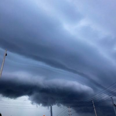
Many highways on #VancouverIsland remain CLOSED due to #BCStorm: -#BCHwy4: Errington to #PortAlberni; Port Alberni to #Tofino & #Ucluelet -#BCHwy14: West of #Sooke -#BCHwy18: At Hillcrest -#BCHwy28: Gold River to #CampbellRiver Strong winds continue. Avoid travel. Updates:…

On top of the severe weather that occurred last night in southern Ontario (theweathernetwork.com/en/news/weathe……), Toronto Airport recorded enough rain to make it the wettest year on record. #onstorm #ONwx #Toronto


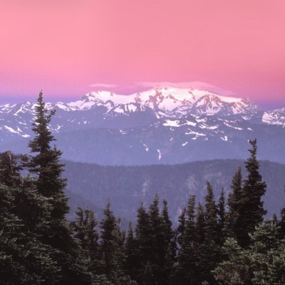
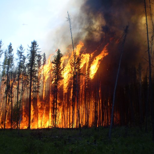
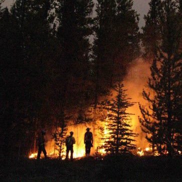
Myth or truth - everything you need to know about our FIRE SEASON and the link to Climate Change here in Canada - I put @mikeflannigan ‘s feet to the fire 🔥 in my latest piece @weathernetwork
Updated boards to reflect the correction.


Correction, final number is 128.3 mm. The 0.1 early in the day counts as a trace. H/T @s_flisfeder #onstorm #onwx
Correction, final number is 128.3 mm. The 0.1 early in the day counts as a trace. H/T @s_flisfeder #onstorm #onwx
Here's a look at stats for Toronto Pearson Airport (YYZ) from today (as of 8 pm): - Wettest day on record with 128.4 mm, beating the old record of 126.0 mm from July 8, 2013 - Wettest Summer on record with 475.8 mm beating 396.2 mm from 2008. #onstorm #onwx


At only 2:00 PM Inuvik, NT (ZEV) already set an all-time record high with 33.1° at the hour, and 33.7° in the past hour. Previous all-time record was 33.0° on July 4, 2023. Data since 1957. Temperature could reach 35°C by early evening. #NTstorm #Arctic

It's official! July 2024 is now the wettest month on record for Toronto airport beating October 1954 (Hurricane Hazel). The station started recording data back in 1937. #onstorm #onwx


It’s official - a 70 year old record has been washed away ! 🏆 With the 6.79 mm of rain we’ve seen today, July 2024 will go down in the history books as the wettest month ever recorded at Toronto Pearson, according to historic data provided by Environment Canada. 🌧️ In total,…


United States Trends
- 1. #CashAppGreen N/A
- 2. hayley 16.5K posts
- 3. Bubba 18.6K posts
- 4. Rondo 2,462 posts
- 5. #FanCashDropPromotion 3,245 posts
- 6. Wale 43.9K posts
- 7. Bill Clinton 91.6K posts
- 8. Hunter Biden 14K posts
- 9. Summer Walker 35.2K posts
- 10. Bart Scott N/A
- 11. #FursuitFriday 13.6K posts
- 12. #Talus_Labs N/A
- 13. #FridayVibes 7,025 posts
- 14. Ticketmaster 9,341 posts
- 15. Hilary Duff 2,722 posts
- 16. Thomas Crooks 55.2K posts
- 17. Reid Hoffman 29K posts
- 18. Vatican 12.5K posts
- 19. Jaylon Johnson 1,462 posts
- 20. Morocco 118K posts
You might like
-
 Isabel
@isabel_ONwx -
 Melinda Singh TWN
@WxMelinda21 -
 NTP Reports
@NTP_Reports -
 Brad Rousseau
@bradrousseau -
 Stormwx1
@stormwx1 -
 Adam Skinner
@AdamSkinnerWX -
 Ethan Sacoransky
@blizzardof96 -
 Chris Murphy TWN
@MurphTWN -
 Doug Gillham
@gtaweather1 -
 Rob Kuhn
@KuhnyRob -
 Corey Elder
@coreywxelder -
 York Atmospheric Science Club
@YASC_online -
 Andrew Macklin-WX
@amacklin10 -
 Simon Lam Eng
@SimonLamEng
Something went wrong.
Something went wrong.