
Paul R Close
@prctbw
Lead Meteorologist @NWSTampaBay, B.S. from Millersville University of Pennsylvania @millersvilleu @MUweather, Gardening Enthusiast
Vous pourriez aimer


🥶Lowest Temperatures by County this Morning 🥶 Here's the breakdown from this morning 📷 #flwx

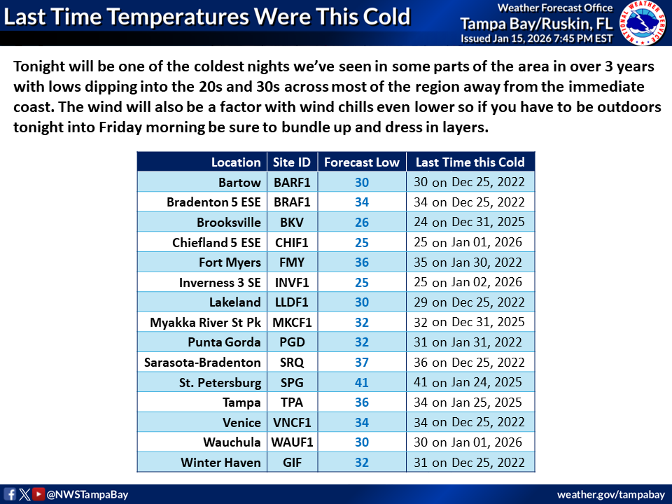
Tonight will be one of the coldest nights we’ve seen in parts of the area in over 3 years with lows dipping into the 20s and 30s across most of the region away from the coast. Winds will make it feel even colder so if you have to be outdoors bundle up and dress in layers.🥶#FLwx
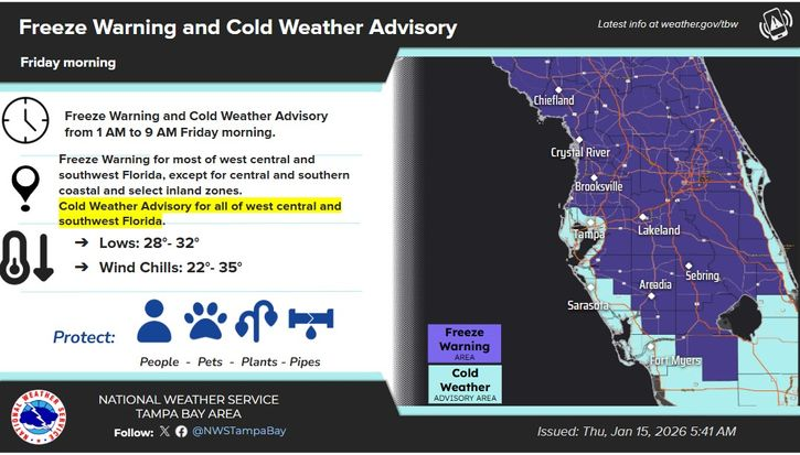
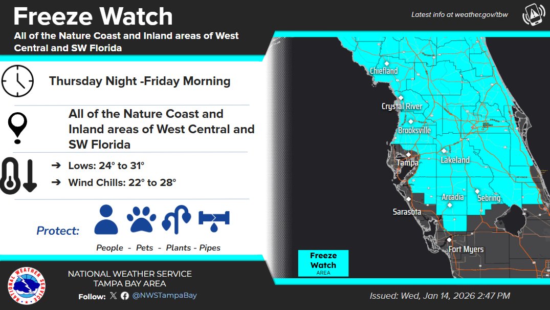
The coldest air of the season will arrive tonight. Most of the area is in a freeze warning for tonight into Friday morning. This cold weather will linger over the weekend and into early next week. #FLwx

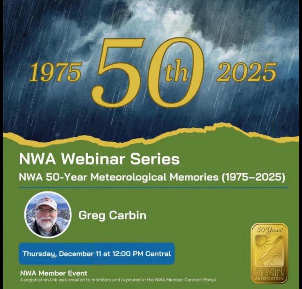
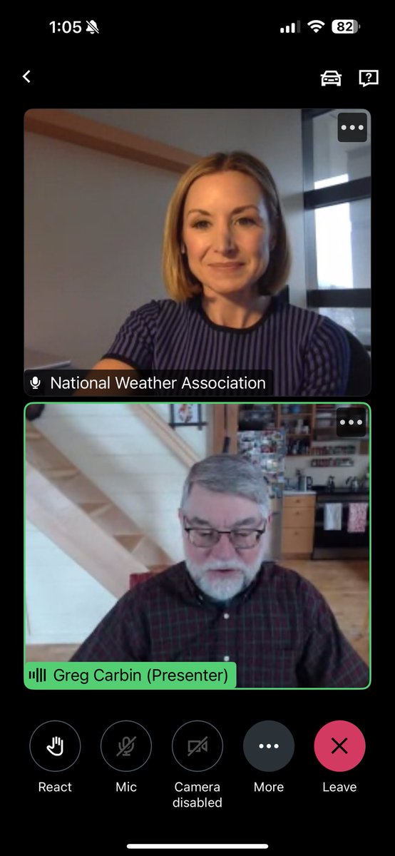
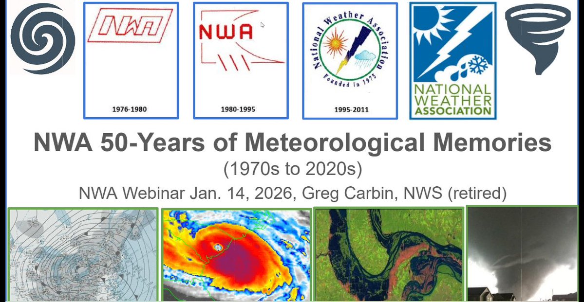
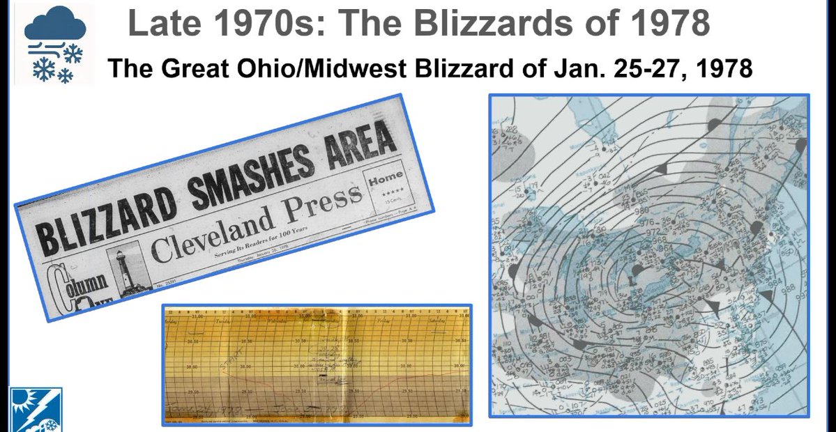
Part 1: An incredible presentation from Greg Carbin (retired @NWS) on his historical #weather perspective of memorable (not all inclusive) events spanning the decades of the @nwas National Weather Association during today’s webinar. Well done! #flwx
A cold front moves through the area bringing scattered showers tonight and freezing temperatures to the area on Friday morning. A Freeze Watch is in effect for Friday morning, as well as a Small Craft Advisory for late tonight through Friday morning. #flwx

A cold front will be coming through tonight bringing scattered showers to the area. Behind it will be the coldest air of the season with most of West Central Florida getting below Freezing Friday Morning.

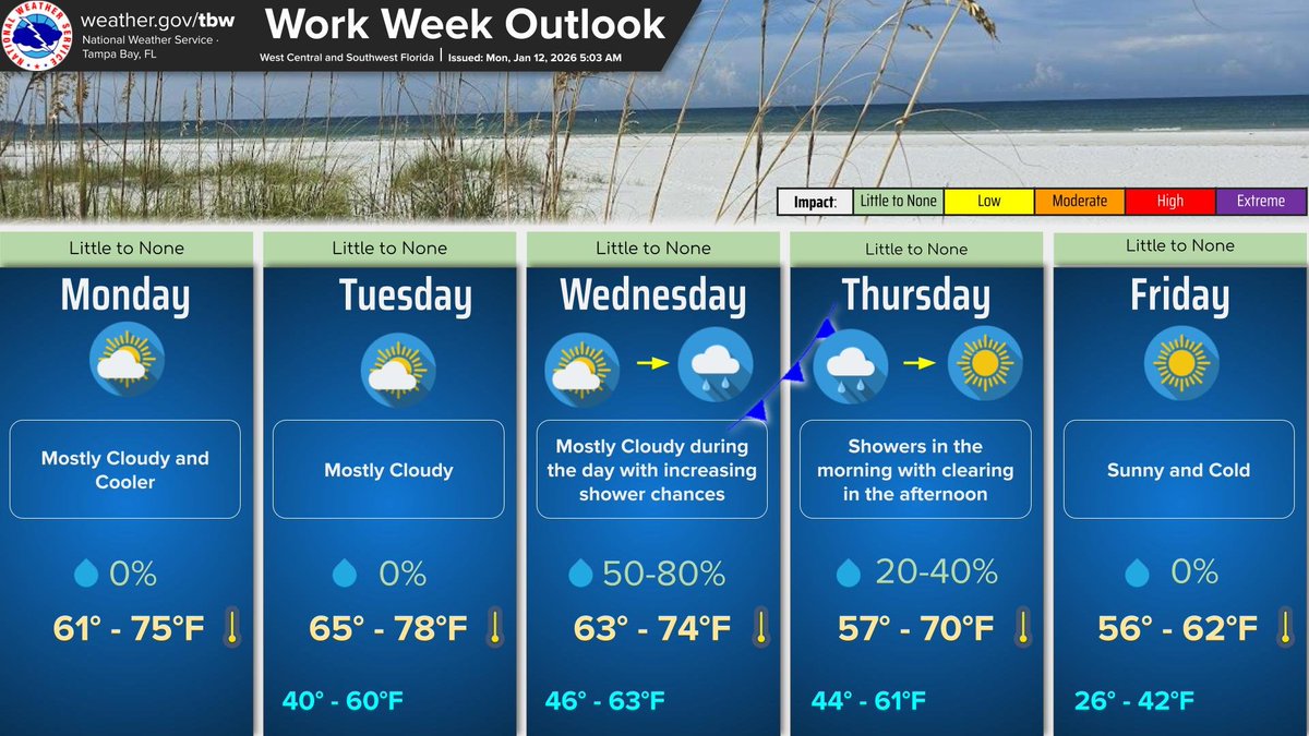
The cold front that pushed through yesterday will keep temperatures cool for the first half of the week. A second cold front will push through overnight on Wednesday bringing scattered showers and even colder temps to end the work week.
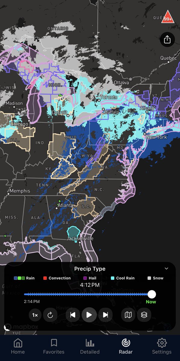
📡Radar Update 1 PM Sunday 🌦️A narrow broken band of showers is moving through the #TampaBay area along a cold front 🤞While beneficial rain is not expected with this activity, a few lucky areas may get a couple of showers and/or sprinkles #FLwx
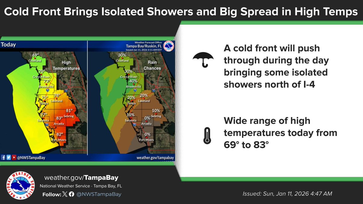
A cold front will bring some isolated showers north of I-4 through the morning and early afternoon. Due to the front pushing through we will see a wide range of high temperatures from the upper 60's to mid 80's.

MRMS precipitation type is coming with the next EverythingWx update!
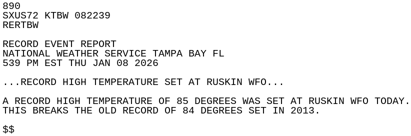
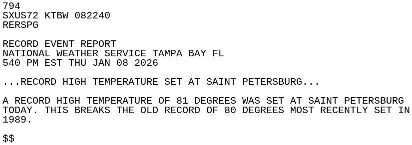
Another hot January afternoon in West Central and SW FL today with another day of multiple record high temps set or tied around the area in the fast few days. Cooler weather is on the way for early next week though. #flwx
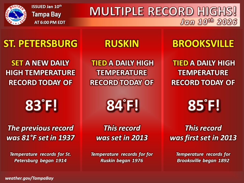
🌡️ Record highs were set here at the forecast office this afternoon, as well as St. Pete's Albert Whitted Airport. 😶🌫️ Warm conditions with morning fogginess continue the next few days before a weekend cold front brings a cooler drier air mass for early next week. #FLwx
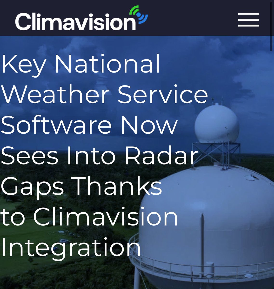
A critical step in expanding radar datasets into @NWS field offices for 24/7 meso-analysis in the short-term forecast and warning decision-making process. #flwx It was exciting to learn of these data a few years ago in coordinating with @climavision while serving as the…
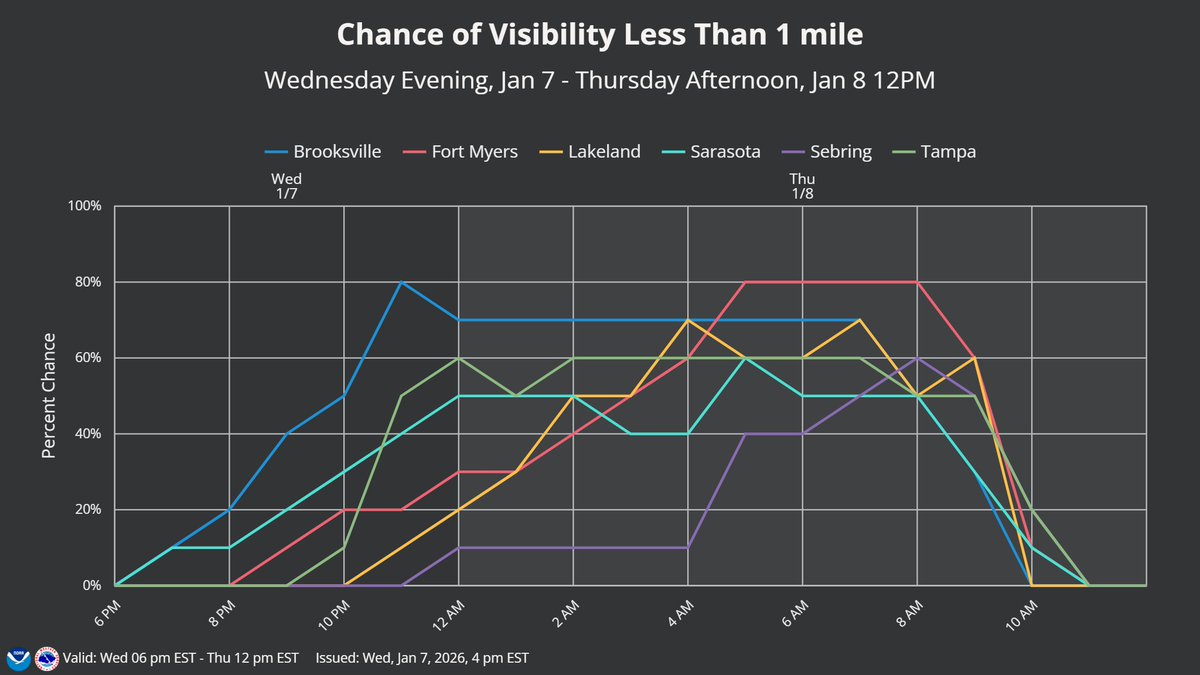
Fog impacts expected again tonight, with development likely beginning late this evening over the Nature Coast, then spreading south and east across much of West Central and Southwest Florida overnight into Thursday morning, before clearing by noon. #FLwx
V1.3.90 live now (iOS & Android)! Brand new look throughout much of the app. New custom forecast threshold alerts, SPC/WPC Outlook alerts, daily summary alerts (now unlimited for pro users, everyone can set up one), radar now shows QC'd MRMS data (extends into Canada, updated…
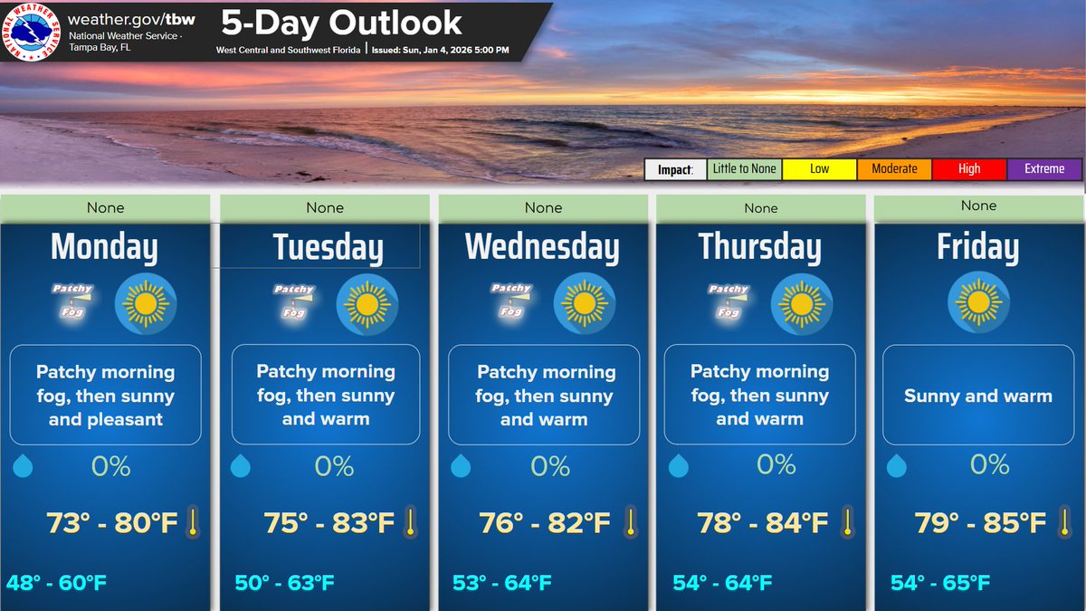
High pressure will dominate the weather pattern through the upcoming week. This will result in sunny skies, rain-free conditions and warming temperatures through the week. The only weather concern will be late night and early morning fog through Thursday. #flwx
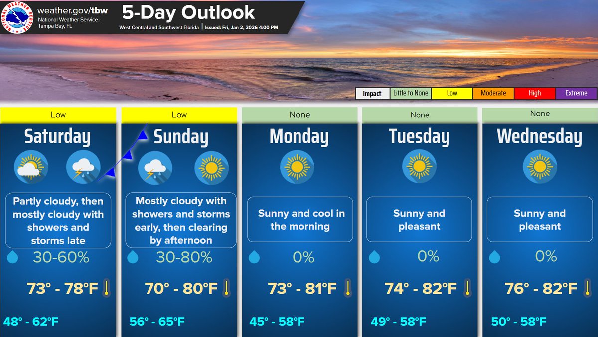
High pressure remains in control through Saturday afternoon with partly cloudy skies and warm temperatures expected. A cold front moves through the area on Saturday night into Sunday morning producing scattered showers and isolated storms. #flwx
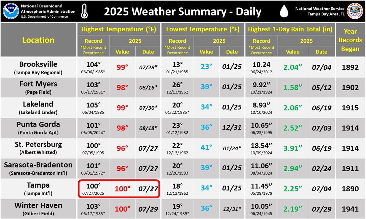
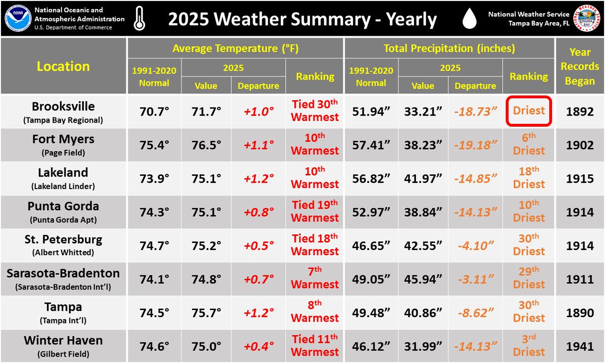
As we kick off 2026, here is a look back at some area weather statistics from 2025. You can read even more statistics for both December 2025 and the full year here: weather.gov/media/tbw/clim…
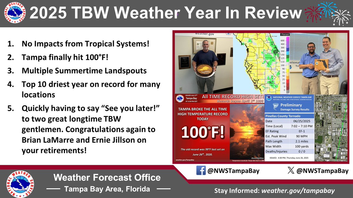
Happy New Year Y’all from NWS TBW🎉! Here's a look back at some of the local events from last year. #flwx


United States Tendances
- 1. Good Sunday N/A
- 2. 49ers N/A
- 3. Seahawks N/A
- 4. finn N/A
- 5. Super Bowl N/A
- 6. Venus Williams N/A
- 7. Cooks N/A
- 8. Niners N/A
- 9. #ALGS N/A
- 10. #JimmyGraduationDay N/A
- 11. Congratulations Jack N/A
- 12. Stidham N/A
- 13. baekhyun N/A
- 14. #Mashle N/A
- 15. #Toonami N/A
- 16. Purdy N/A
- 17. sabrina N/A
- 18. gaten N/A
- 19. Lenoir N/A
- 20. Korda N/A


Something went wrong.
Something went wrong.