#openlayers search results

Don’t get left behind! 🔄 Power your maps with the newest, fastest APIs for a seamless user experience. Tap Learn More and stay updated. wpmapspro.com/map-hooks/wpgm… #wpmapspro #googlemaps #openlayers #APIs


A good web map doesn’t start with tiles—it starts with architecture. Before adding layers, define how they load, update, and dispose. Performance is not about code tricks—it’s about predictable flow. #OpenLayers #WebPerformance #EngineeringMindset


"Today, I learned 🖍️ how to implement a map in our Airbnb-style website using MapTiler . with the OpenLayers library! 🗺️ Now, locations are interactive and visually appealing. Excited to refine it further! #WebDevelopment #OpenLayers #MapTiler"


Every map viewer I’ve had to fix shared the same issue: logic and rendering mixed like spaghetti. When data flow and visual state live in the same place, you can’t scale—only patch. Separate data → state → view, and everything else becomes easier. #OpenLayers #Architecture


🌟 Bring vibrant and fresh satellite 🛰️ image with our Alidade Satellite basemaps. 👌 Easy integration with your favorite vector or raster library, including #MapLibre, #Leaflet, & #OpenLayers. 👉 Get started here! docs.stadiamaps.com/map-styles/ali… #mapping


Completely agree! Decentralization offers a fresh approach to creating structure and rebuilding trust. #OpenLayers

Decentralization isn’t a rejection of structure, it’s a new way of building it. The idea is simple: trust rebuilt in open layers where protocols, not gatekeepers, define the rules. @Polkadot makes this vision practical, instead of one size fits all chains, it gives developers…


Cómo utilizar las imágenes #Sentinel en #OpenLayers rviv.ly/8MeUqa #NDVI


Participants in @opengeospatial Code Sprint using #OpenLayers to visualize Releasable Basemap Tiles (RBT) from GeoPackage… Nice! #mapping #geospatial


Ever wondered how to use custom projections like Albers in web mapping? 🗺️ a guide showing how to implement Albers projection step-by-step using both Leaflet and OpenLayers — complete with code snippets and live demos. #WebGIS #OpenLayers #Leaflet #Albers #GIS #WebMapping


“No need to pay more for paid GIS APIs, here’s a free alternative.” by Ömür Bilgili #openlayers #gis #geoserver link.medium.com/FER5Odq4Yxb


Here is an example using chart icons as cluster with ol-ext #Openlayers 🗺 viglino.github.io/ol-ext/example…

Don’t get left behind! 🔄 Power your maps with the newest, fastest APIs for a seamless user experience. Tap Learn More and stay updated. wpmapspro.com/map-hooks/wpgm… #wpmapspro #googlemaps #openlayers #APIs
🌟 Bring vibrant and fresh satellite 🛰️ image with our Alidade Satellite basemaps. 👌 Easy integration with your favorite vector or raster library, including #MapLibre, #Leaflet, & #OpenLayers. 👉 Get started here! docs.stadiamaps.com/map-styles/ali… #mapping
Every map viewer I’ve had to fix shared the same issue: logic and rendering mixed like spaghetti. When data flow and visual state live in the same place, you can’t scale—only patch. Separate data → state → view, and everything else becomes easier. #OpenLayers #Architecture

🌐💻 Este curso enseñará al alumno a programar desde cero un visor de mapas con herramientas 𝘰𝘱𝘦𝘯 𝘴𝘰𝘶𝘳𝘤𝘦 de acceso libre. 🔗 Web: bit.ly/Curso_Web-GIS_… Contáctenos: 📧 [email protected] 📱 +34 635 619 882 #WebGIS #OpenLayers #Leaflet #GeoServer #curso

Cómo utilizar las imágenes #Sentinel en #OpenLayers rviv.ly/8MeUqa #NDVI
🌏 OpenLayers is a mature and feature rich JavaScript mapping library. 👇 Learn verything you need to get started with Stadia Maps' raster tiles and OpenLayers. docs.stadiamaps.com/tutorials/rast… #openlayers #maps #mapping

A good web map doesn’t start with tiles—it starts with architecture. Before adding layers, define how they load, update, and dispose. Performance is not about code tricks—it’s about predictable flow. #OpenLayers #WebPerformance #EngineeringMindset
🌐💻 Este curso enseñará al alumno a programar desde cero un visor de mapas con herramientas 𝘰𝘱𝘦𝘯 𝘴𝘰𝘶𝘳𝘤𝘦 de acceso libre. 🔗 Web: bit.ly/Curso_Web-GIS_… 💻 Online 📅 3 de noviembre 🕘 120 horas ✅ Descuentos ℹ bit.ly/Form_Web-GIS_L… #WebGIS #OpenLayers #Leaflet

Completely agree! Decentralization offers a fresh approach to creating structure and rebuilding trust. #OpenLayers
Decentralization isn’t a rejection of structure, it’s a new way of building it. The idea is simple: trust rebuilt in open layers where protocols, not gatekeepers, define the rules. @Polkadot makes this vision practical, instead of one size fits all chains, it gives developers…
Ever wondered how to use custom projections like Albers in web mapping? 🗺️ a guide showing how to implement Albers projection step-by-step using both Leaflet and OpenLayers — complete with code snippets and live demos. #WebGIS #OpenLayers #Leaflet #Albers #GIS #WebMapping
🌟 Bring vibrant and fresh satellite 🛰️ imagery to your projects with our Alidade Satellite basemaps. 👌 Easy integration with your favorite vector or raster library, including #MapLibre, #Leaflet, & #OpenLayers. 👉 Get started here! docs.stadiamaps.com/map-styles/ali… #mapping

🌐💻 Este curso enseñará al alumno a programar desde cero un visor de mapas con herramientas 𝘰𝘱𝘦𝘯 𝘴𝘰𝘶𝘳𝘤𝘦 de acceso libre. 🔗 Web: bit.ly/Curso_Web-GIS_… 📧 [email protected] #WebGIS #OpenLayers #Leaflet #GeoServer #WebMapping #curso
🌐💻 Último día para matricularte en el curso que enseñará al alumno a programar desde cero un visor de mapas con herramientas 𝘰𝘱𝘦𝘯 𝘴𝘰𝘶𝘳𝘤𝘦 de acceso libre. 🔗 Web: bit.ly/Curso_Web-GIS_… 📧 [email protected] #WebGIS #OpenLayers #Leaflet #GeoServer #WebMapping

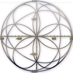
Isometric 2.5 would be better; and you can do this with #openLayers, if you like.
🌐💻 Este curso enseñará al alumno a programar desde cero un visor de mapas con herramientas 𝘰𝘱𝘦𝘯 𝘴𝘰𝘶𝘳𝘤𝘦 de acceso libre. 🔗 Web: bit.ly/Curso_Web-GIS_… 💻 online 📅 26 de marzo 🕘 120 horas ✅ Descuentos ℹ bit.ly/Form_Web-GIS_L… #WebGIS #OpenLayers #Leaflet

🌏 OpenLayers is a mature and feature rich JavaScript mapping library. 👇 We show you everything you need to get started with Stadia Maps' raster styles and OpenLayers. docs.stadiamaps.com/tutorials/rast… #openlayers #maps #mapping

Sabías que puedes integrar gráficos #interactivos de #Plotly en tus mapas de #OpenLayers? Con nuestra guía paso a paso y con código, convierte tus datos en una experiencia visual atractiva. Descubre cómo aquí: i.mtr.cool/stgbgbpmku


A good web map doesn’t start with tiles—it starts with architecture. Before adding layers, define how they load, update, and dispose. Performance is not about code tricks—it’s about predictable flow. #OpenLayers #WebPerformance #EngineeringMindset


"Today, I learned 🖍️ how to implement a map in our Airbnb-style website using MapTiler . with the OpenLayers library! 🗺️ Now, locations are interactive and visually appealing. Excited to refine it further! #WebDevelopment #OpenLayers #MapTiler"

Released: OpenLayers 7.5 geoobserver.wordpress.com/2023/08/30/rel… via @openlayers #OpenLayers #gistribe #gischat #fossgis #foss4g #opensource #spatial #geospatial #mapping #gis #geo #geoObserver

Released: OpenLayers 9.0! geoobserver.wordpress.com/2024/03/05/rel… #ol #openlayers #gistribe #gischat #fossgis #foss4g #OSGeo #spatial #geospatial #opensource #mapping #gis #geo #geoObserver pls RT via @openlayers

“No need to pay more for paid GIS APIs, here’s a free alternative.” by Ömür Bilgili #openlayers #gis #geoserver link.medium.com/FER5Odq4Yxb
Ever wondered how to use custom projections like Albers in web mapping? 🗺️ a guide showing how to implement Albers projection step-by-step using both Leaflet and OpenLayers — complete with code snippets and live demos. #WebGIS #OpenLayers #Leaflet #Albers #GIS #WebMapping
Here is an example using chart icons as cluster with ol-ext #Openlayers 🗺 viglino.github.io/ol-ext/example…
Participants in @opengeospatial Code Sprint using #OpenLayers to visualize Releasable Basemap Tiles (RBT) from GeoPackage… Nice! #mapping #geospatial
Don’t get left behind! 🔄 Power your maps with the newest, fastest APIs for a seamless user experience. Tap Learn More and stay updated. wpmapspro.com/map-hooks/wpgm… #wpmapspro #googlemaps #openlayers #APIs

Using #OpenLayers and #CSS filters to style #OSM #WebMaps in your application into greyscale, dark mode and more. Some note and sample filters at: notepad.onghu.com/2024/open-laye… #programming #maps #cartography

🌐💻 Mañana empieza el #curso que enseñará al alumno a programar desde cero un visor de mapas con herramientas open source de acceso libre. 💻 Online 📅 21 de agosto 🕘 120 horas ✅ Descuentos ℹ bit.ly/Form_Web-GIS_L… #WebGIS #OpenLayers #Leaflet #GeoServer #SIG


🔥 A BLACK FRIDAY DA GEOCURSOS VEM AÍ!🔥 Já anota na agenda ai para não esquecer! 🔥 CURSOS COM ATÉ 50%OFF entre os dias 06 a 10 de novembro!🔥 Participe do nosso Grupo VIP para ficar por dentro de tudo: geocursos.com.br/blackfriday #postgresql #openlayers #postgis #geoserver

🌐💻 Último día para matricularte en el #curso que enseñará al alumno a programar desde cero un visor de mapas con herramientas open source de acceso libre. 💻 Online 🕘 120 horas ✅ Descuentos ℹ bit.ly/Form_Web-GIS_L… 📧 [email protected] #WebGIS #OpenLayers #Leaflet


✨[magisAR9] [Carte blanche] webinaire #13 #CartoGeoViz @GdrMagis ➡️ol-ext et cie. by @jmviglino développements sur et autour de #openlayers 🎥4 avril 2024 en visio : 12h30-13h30 Accéder : 🔗github.com/magisAR9/webin…
![fbahoken's tweet image. ✨[magisAR9] [Carte blanche] webinaire #13 #CartoGeoViz @GdrMagis
➡️ol-ext et cie. by @jmviglino
développements sur et autour de #openlayers
🎥4 avril 2024 en visio : 12h30-13h30
Accéder : 🔗github.com/magisAR9/webin…](https://pbs.twimg.com/media/GJqzSc8WsAA44NR.jpg)
Something went wrong.
Something went wrong.
United States Trends
- 1. Kevin James 1,778 posts
- 2. Bubba 26.6K posts
- 3. RIP Coach Beam N/A
- 4. Jack Hughes N/A
- 5. Bill Clinton 111K posts
- 6. #BravoCon 3,964 posts
- 7. #CashAppGreen 1,311 posts
- 8. Last Chance U 3,181 posts
- 9. Hunter Biden 19K posts
- 10. Metroid 10.2K posts
- 11. Wale 46.3K posts
- 12. Crooks 77.9K posts
- 13. Paul Blart N/A
- 14. Hayley 18.5K posts
- 15. Vatican 14.4K posts
- 16. Oakland 7,859 posts
- 17. Zverev 2,753 posts
- 18. Rondo 2,662 posts
- 19. Bondi 104K posts
- 20. Jaylon Johnson 2,319 posts