#pix4dreact نتائج البحث

This article features a hands-on project where university students used drones and #PIX4Dreact to map their campus grounds, identifying new building locations and planning recreational areas: pix4d.com/blog/drones-fo… #dronesforgood #PIX4Dreact #Pix4D

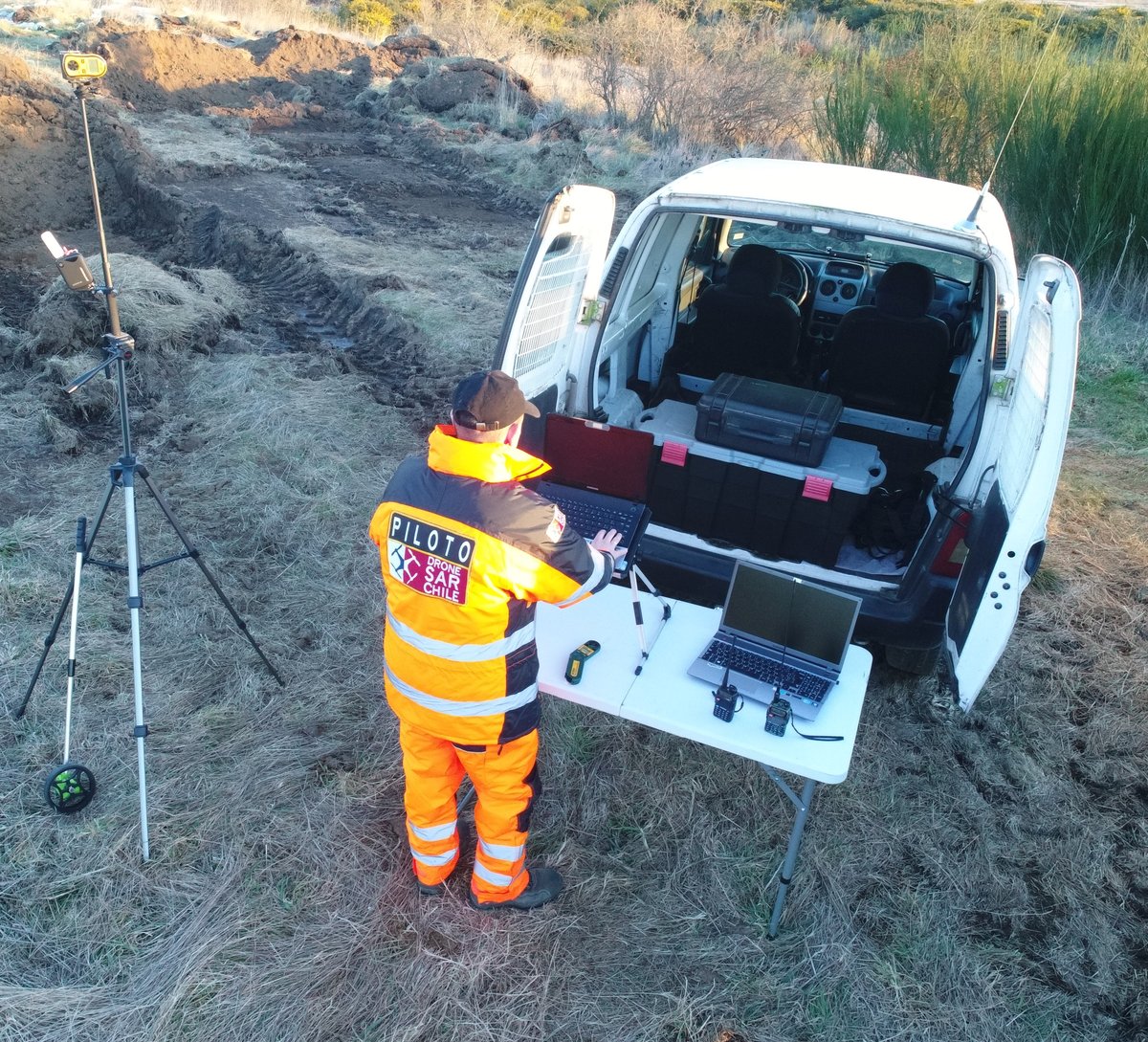
🚨 #PIX4Dreact is built for #emergencyresponse teams needing speed and accuracy. Gain detailed insights by classifying objects of the same class like cars or damaged areas with a single annotation! Try PIX4Dreact for free hubs.li/Q02WCB-00
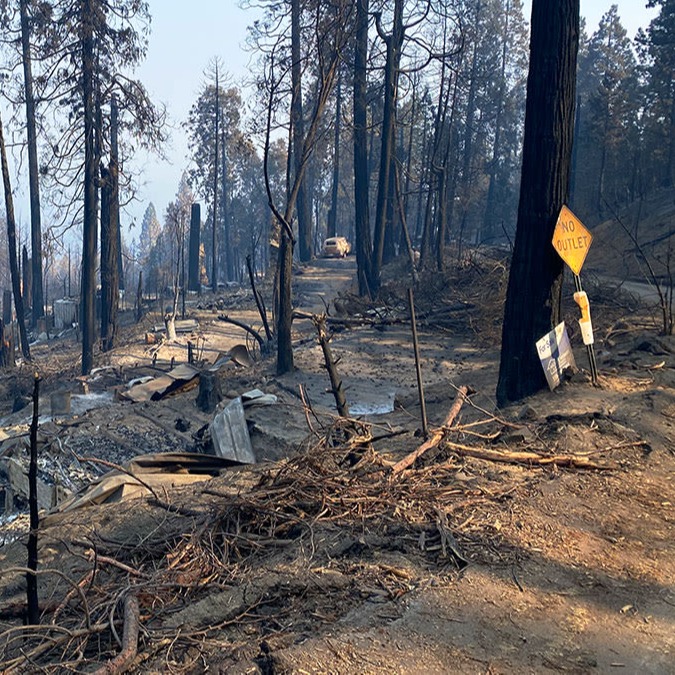
As wildfires cause widespread devastation, having accurate, up-to-date information is essential for saving lives. With #PIX4Dreact, responders can create maps from aerial imagery in minutes. Learn how to use PIX4Dreact for fire response: hubs.li/Q02L5J8B0
Students use #PIX4Dreact to learn #photogrammetry, processing drone images to create maps, identifying spaces & buildings for situational awareness. Advantages: ➡️ Immediate area assessment ➡️ Enhanced coordination ➡️ Offline processing Read more here: hubs.li/Q02DpvKv0
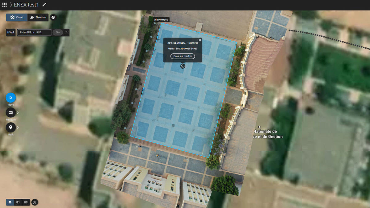
🌏 Empowering the youth for positive change with #PIX4Dreact. Morocco Flying Labs and Pix4D educate students to tackle local challenges through mapping skills and #photogrammetry. Teaching future generations to use drones for good: hubs.li/Q02hHfNh0 #DronesForGood

Following the earthquake in Turkey, rescue teams effectively used drones and #PIX4Dreact to respond to the disaster. We cover ten critical ways drones can be used for emergency response in our article: hubs.li/Q02bvhtC0

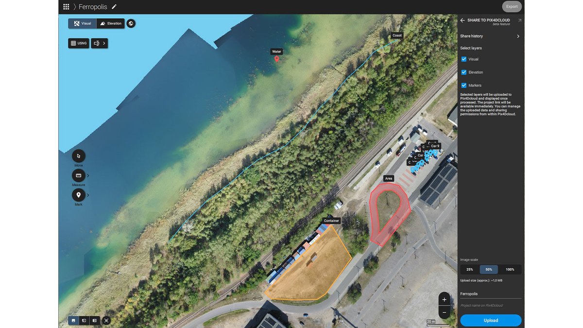
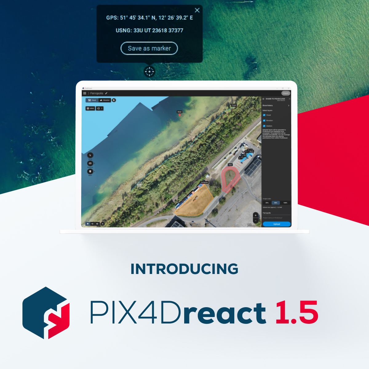
Quick and effective action relies on precise location information. #PIX4Dreact 1.5 offers the option to switch from decimal degrees to degrees, minutes, seconds. The new update offers the option to export high-resolution JPEGs for large-format printing: hubs.li/Q028GlqL0

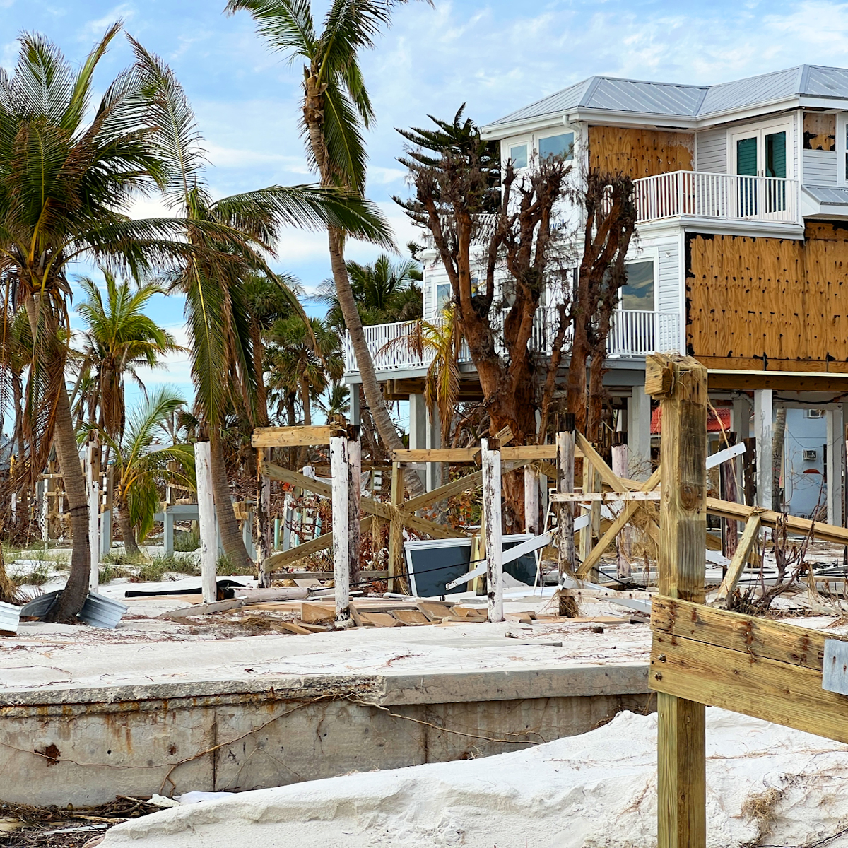
Drones played a vital role in damage assessment after Hurricane Ian. #PIX4Dreact was used to create high-resolution 2D maps, enabling a detailed analysis of the damage. The aerial maps created were used to advise for better preparedness in the future: hubs.li/Q025fY-y0

In the aftermath of Turkey's devastating earthquakes, #PIX4Dreact swiftly provided critical data for rescue teams. Learn how #aerialmapping and #drones can make a difference in emergencies: hubs.li/Q021qZcj0 #DronesForGood

#PIX4Dreact 1.5 is here!🚨 Get high-resolution snapshots for large-format printing, support for uploading markers to PIX4Dcloud, and new location display in degrees, minutes, and seconds to further facilitate the valuable work of search and rescue teams! hubs.li/Q021613F0
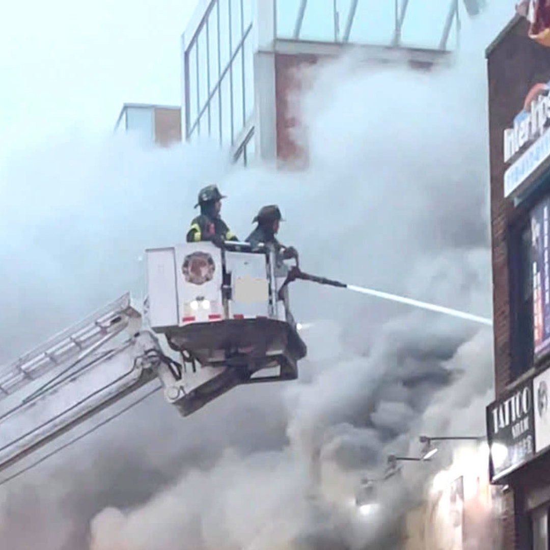
Fighting fire with #drones! Learn how a career #firefighter is using #PIX4Dreact for pre-planning situational awareness and #emergency response. Check out the interview here: hubs.li/Q01-3ptL0 #PublicSafety

When #HurricaneIan swept along the coast of Florida in 2022, it caused a huge amount of damage. A specialized research team has been assessing the impact with #drones and #PIX4Dreact. This is their story: hubs.li/Q01Q95pq0

Here’s a look at at the classroom section of the #pix4dreact workshop presented by @pix4d and @Parrot!

Wildfire season is here. To keep people safe, emergency resopnders must evacuate, extinguish, and assess damage. This is how a Californian fire team maps #wildfires with #drones and checks it is safe for residents to return with #PIX4Dreact: hubs.li/Q01h63MP0 #dronesforgood
A fast response is critical for #publicsafety operations - getting situational awareness is key to effectively deploying resources. See how #PIX4Dreact was used to respond to and investigate a #fire in France: hubs.li/Q01c_bPZ0

Discover #PIX4Dreact, the #emergencyresponse fast mapping software, and the viDoc RTK Rover, the terrestrial scanner, with Aerialsolutions at @Infopol_Xpo112 on May 10 - 12! Meeting point: Booth 3128!
Something went wrong.
Something went wrong.
United States Trends
- 1. Lando 412K posts
- 2. Pearl Harbor 37.5K posts
- 3. #AskFFT N/A
- 4. Tulane 20.5K posts
- 5. Roman Wilson N/A
- 6. Oscar 192K posts
- 7. McLaren 117K posts
- 8. Go Bills 5,129 posts
- 9. #sundayvibes 6,894 posts
- 10. Full PPR 1,100 posts
- 11. #AbuDhabiGP 313K posts
- 12. Yuki 132K posts
- 13. Good Sunday 80K posts
- 14. #CFBPlayoff 4,129 posts
- 15. Neal 3,816 posts
- 16. Harry Wilson N/A
- 17. Duke 65K posts
- 18. Kincaid 1,756 posts
- 19. Charles 122K posts
- 20. Verstappen 171K posts