#seabedmapping resultados de búsqueda
🇺🇳 The recent ratification of the #Biodiversity Beyond National Jurisdiction (BBNJ) Treaty marks a historic step for ocean protection. But it also highlights the urgency of #seabedmapping. After all, how can we protect what we don’t fully know?


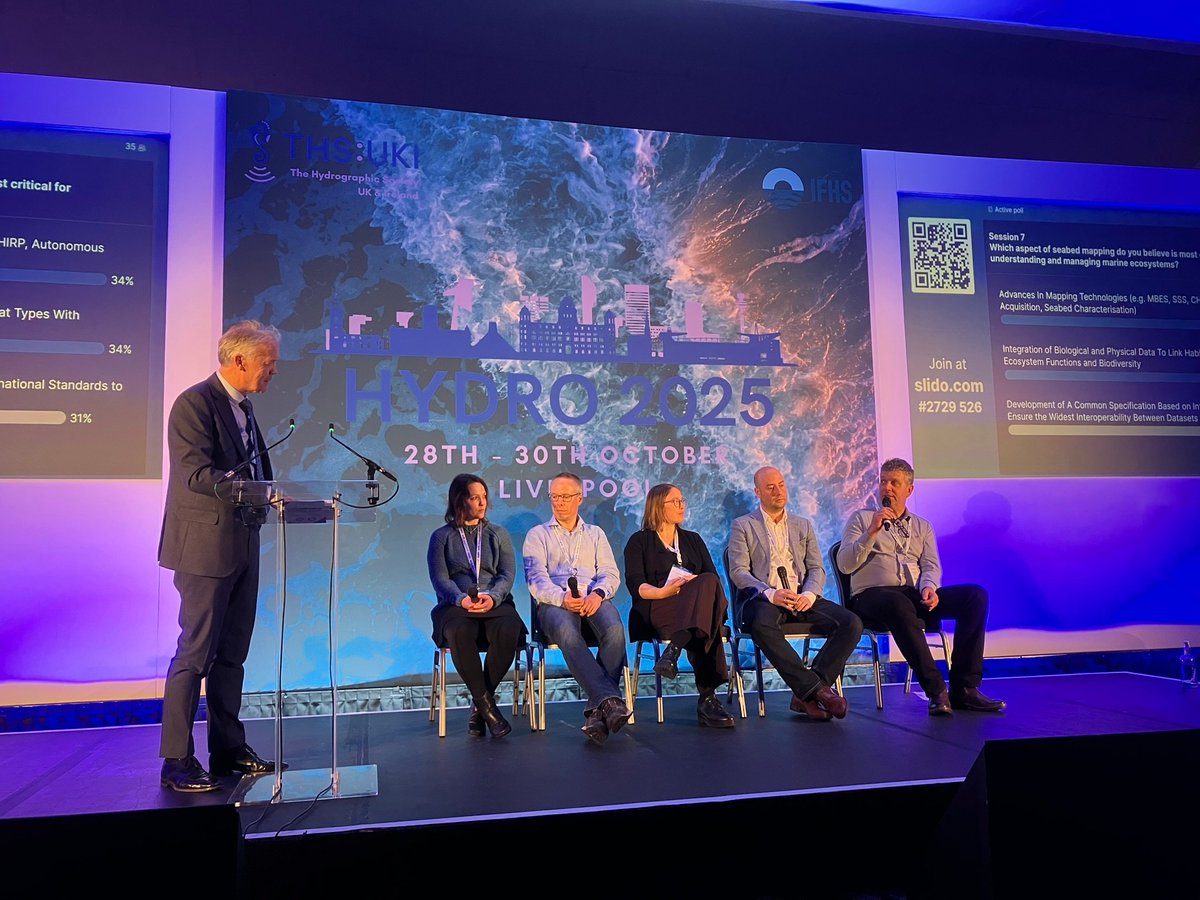
It was great to engage with members across the hydrographic community at #HYDRO25. The UK CSM demonstrated how it has established a collaborative seabed mapping community among over 30 public sector organisations. Thanks to @THS_UKI for organising a great event. #SeabedMapping

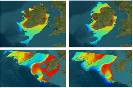
INFOMAR, Ireland's national #seabedmapping programme, are pleased to announce the release of its latest data update. This release encompasses essential enhancements including updated bathymetric & backscatter surfaces reflecting new specification, higher resolution, increased…
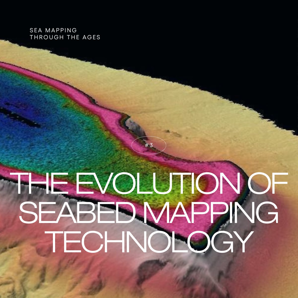
🎛 Technology allows us to work in new ways and expand our horizons, especially in #seabedmapping. As part of today’s Sea Mapping Through The Ages series, we’re looking at the history and role of #technology in mapping the #ocean floor. Let's take a dive👇
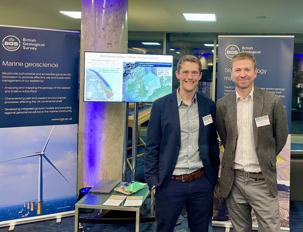
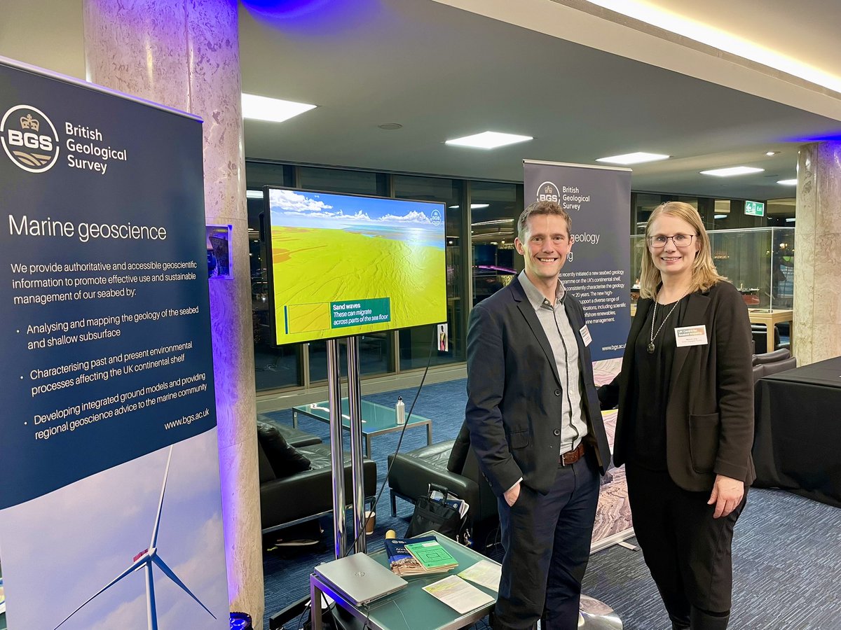
Show casing @BritGeoSurvey seabed mapping capability at the #SeabedMapping showcase #CSM #CenterForSeabedMapping
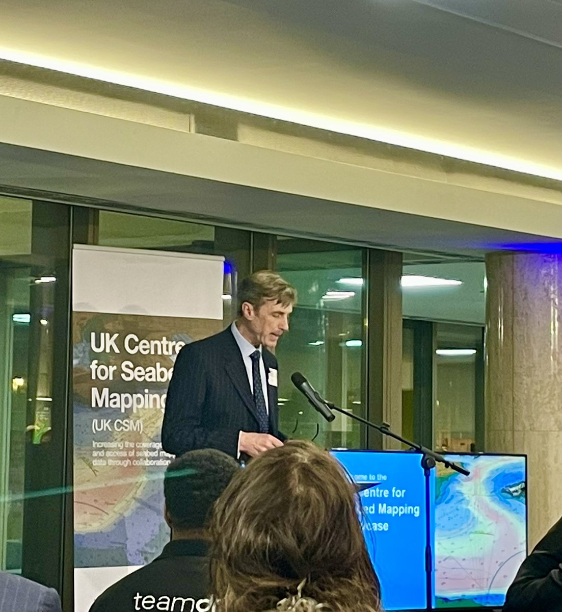

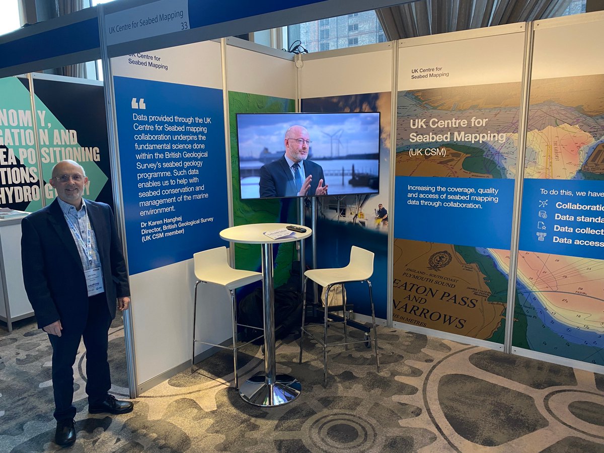
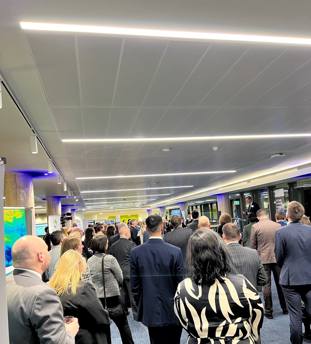
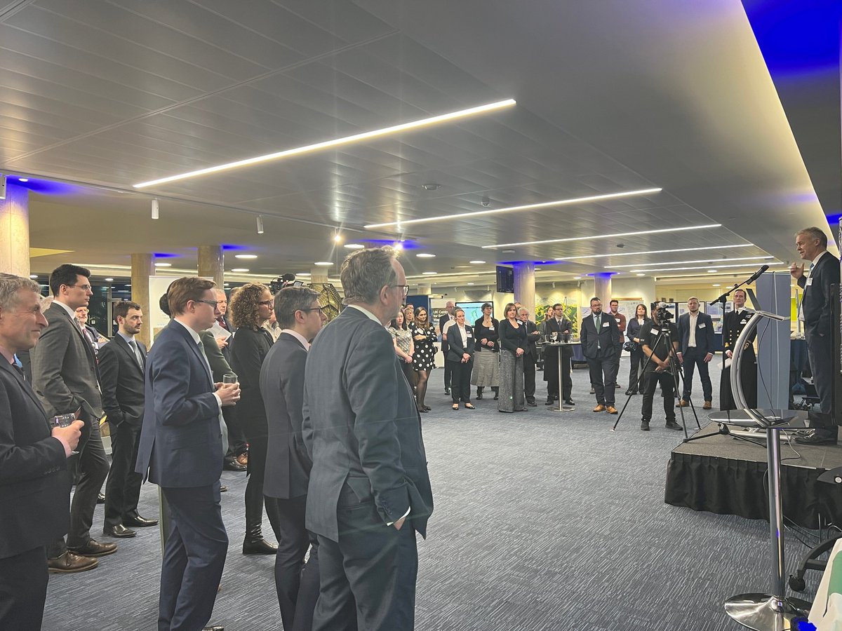
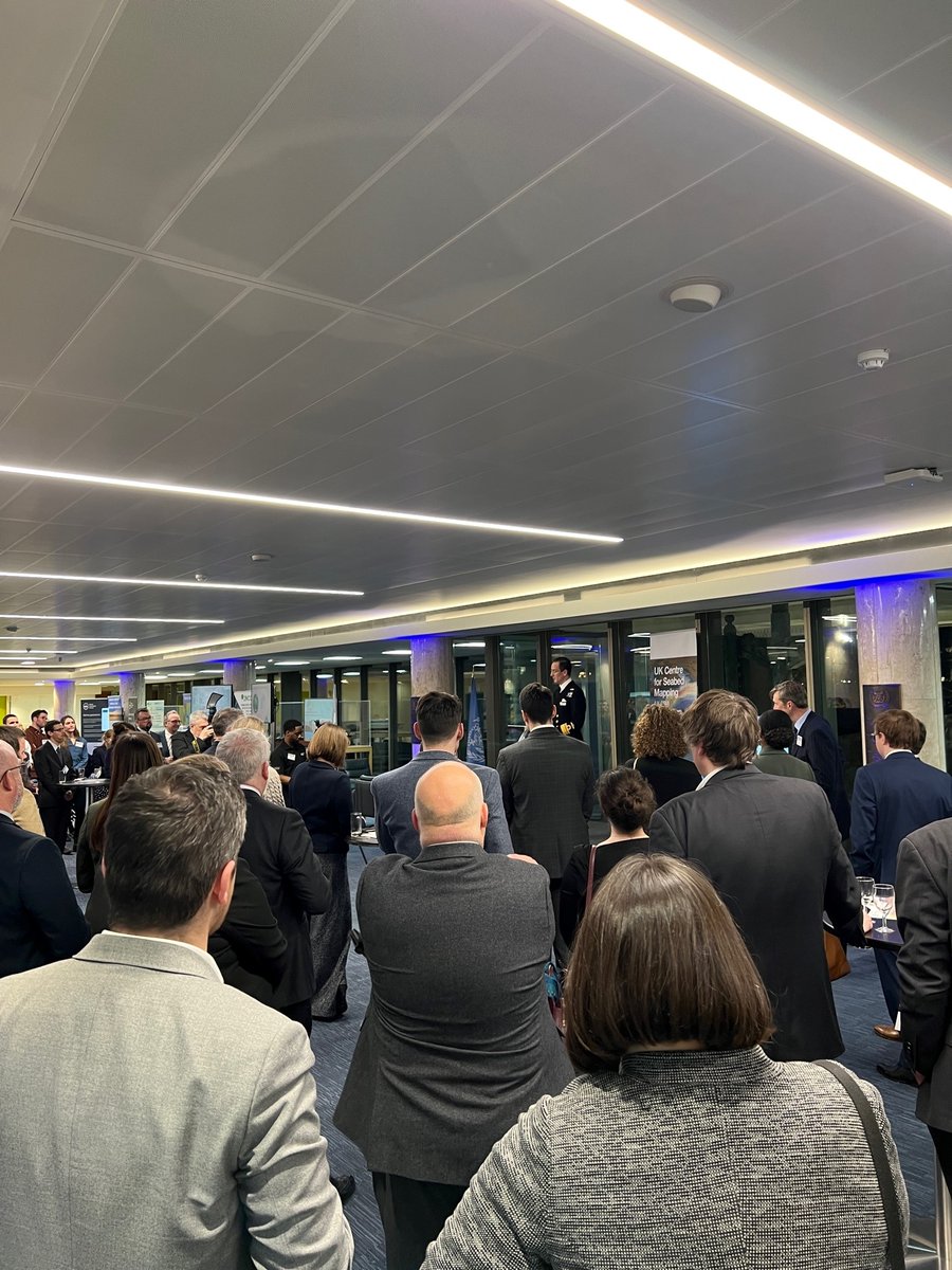
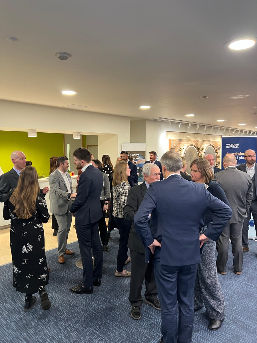
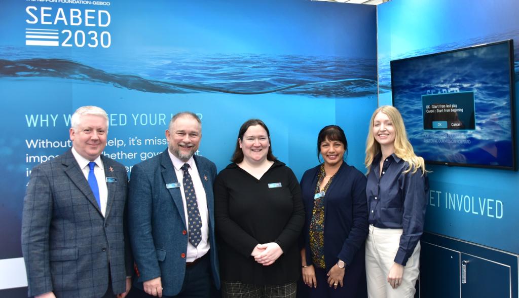
The recent UK Centre of Seabed Mapping (UK CSM) showcase held @IMOHQ, brought together stakeholders from across the UK maritime industry to explore the benefits of sharing and harnessing #SeabedMapping data. ow.ly/VTuV50OkwQy
Pakistan Navy celebrates World Hydrography Day 2025 with the international community, focusing on the theme "Seabed Mapping: Enabling Ocean Action" #WorldHydrographyDay2025 #PakNavy #SeabedMapping #OceanAction
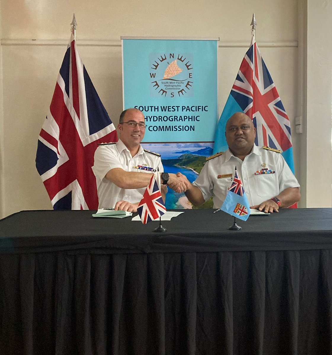
Last week, UK National Hydrographer Angus Essenhigh and the Chief of Fiji Navy signed an MOU in Nadi, Fiji, demonstrating the importance of long friendships and collaboration to support safe, secure and thriving oceans. #Hydrography #SeabedMapping @ukinfiji @FijiNavy
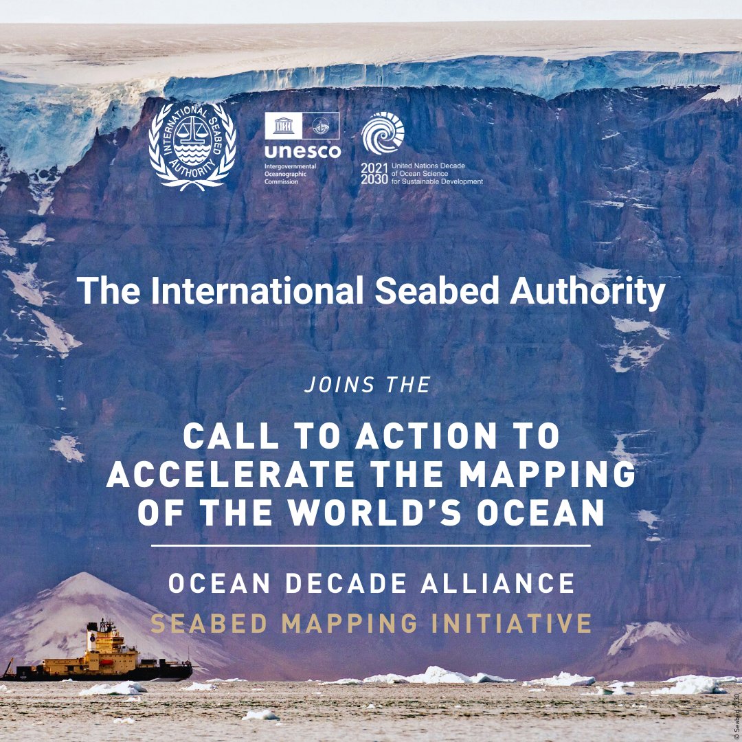
🌊 #DidYouKnow? Only 26.1% of the world’s ocean has been mapped in high-resolution. ➡️ The Ocean Decade Alliance just launched a Call to Action to accelerate the mapping of the world’s ocean 🔗 Learn more: isa.org.jm/area-2030/ #UNESCO #SeabedMapping #Ocean
Yesterday, with @MCA_media we hosted members of the UK Centre for Seabed Mapping #UKCSM at @IMOHQ. Members had the opportunity to demonstrate their involvement in #SeabedMapping and learn more about the activities and priorities of their peers. ow.ly/t8TO50N88iW

📢 Big News from the Deep! The Nippon Foundation-GEBCO @seabed2030 Project has announced that 27.3% of the world’s ocean floor is now mapped to modern standards. 🤝 Join #OceanDecade Alliance’s call to action to help accelerate this global #SeabedMapping effort. #OceanScience


Do you need seabed mapping data? Private, government, academic or community, all can share their data needs through the AusSeabed Survey Coordination tool to increase exposure and boost opportunities to collaborate! bit.ly/3L0Z49o #oceans #marinescience #seabedmapping
🌊 Beneath the surface lies a world we’re only beginning to understand. This #WorldOceansDay, discover why seabed mapping matters, and how the Marine Institute and INFOMAR is helping chart a sustainable future for our ocean. #SeaTheWonder #SeabedMapping #MarineScience
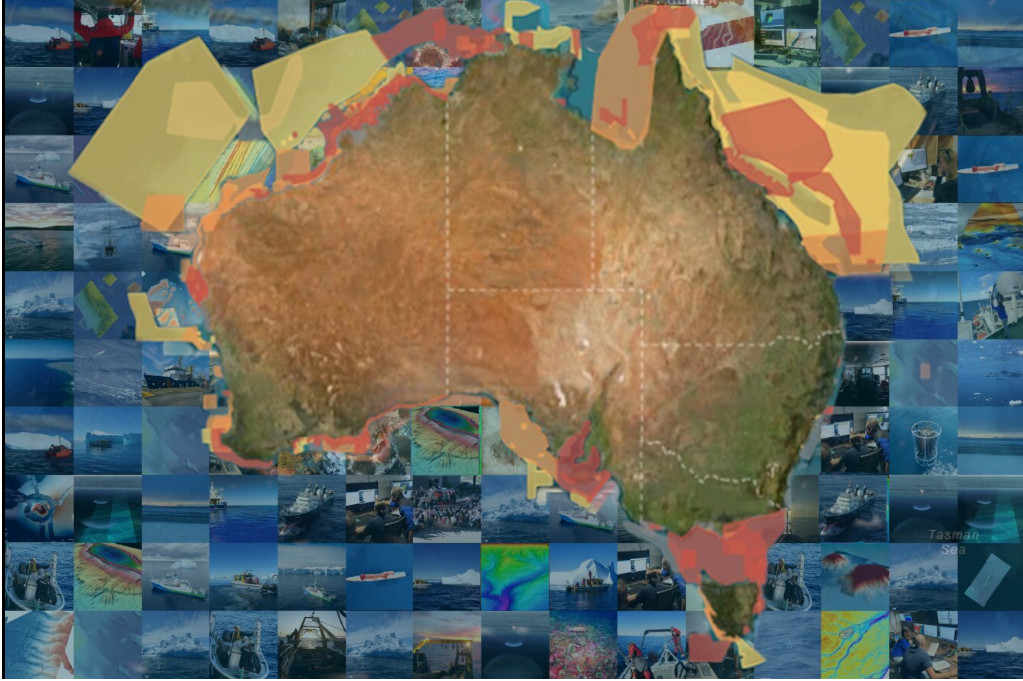
🌏 What is AREA2030? → It is a collective initiative implemented by ISA and the International Hydrographic Organization (IHO) to foster partnerships and collaboration for the high-resolution mapping of the international seabed area (the Area) by 2030. #AREA2030 #SeabedMapping
🌊 Do you need seabed mapping data? Share your data needs with the AusSeabed Survey Coordination tool to increase exposure and boost the opportunity for collaborations! 👉 bit.ly/3L0Z49o to submit your Areas of Interest! #oceans #marinescience #seabedmapping #oceannews
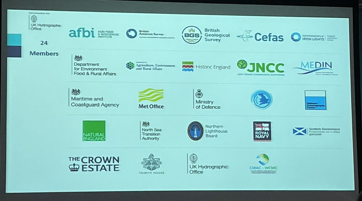
The UK Centre for Seabed Mapping recently celebrated its 2nd anniversary. The #UKCSM aims to bring together the existing #SeabedMapping community across UK government and embed common approaches to data collection, data standards and data sharing. ow.ly/Pmk750SMV4c

Really pleased that @HistoricEngland has joined so many other public bodies involved in #SeabedMapping through the #UKCSM to help increase sector collaboration.
It was great to engage with members across the hydrographic community at #HYDRO25. The UK CSM demonstrated how it has established a collaborative seabed mapping community among over 30 public sector organisations. Thanks to @THS_UKI for organising a great event. #SeabedMapping
🇺🇳 The recent ratification of the #Biodiversity Beyond National Jurisdiction (BBNJ) Treaty marks a historic step for ocean protection. But it also highlights the urgency of #seabedmapping. After all, how can we protect what we don’t fully know?

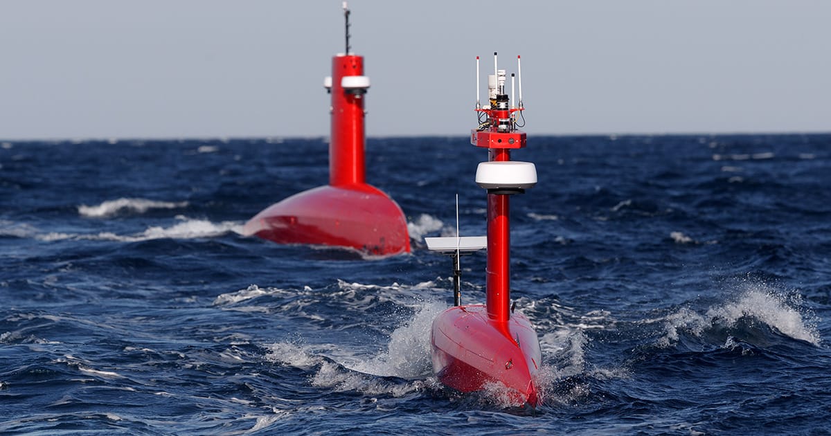
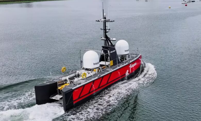
Exail secures sale of Drix H-9 long-range uncrewed surface vessel #uncrewedsurfacevehicles #maritimeindustry #seabedmapping oceannews.com/news/subsea-an…

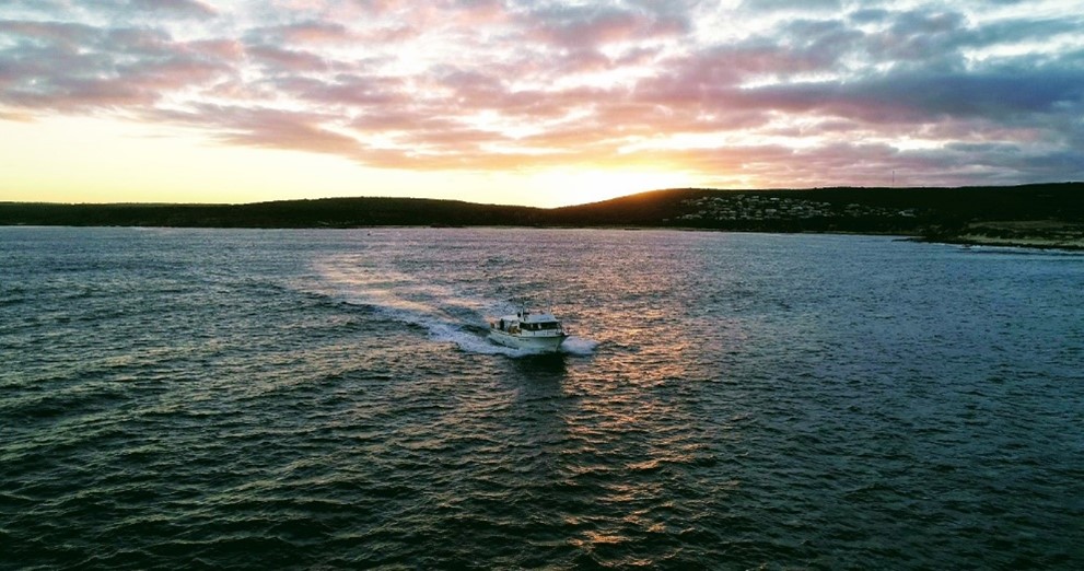
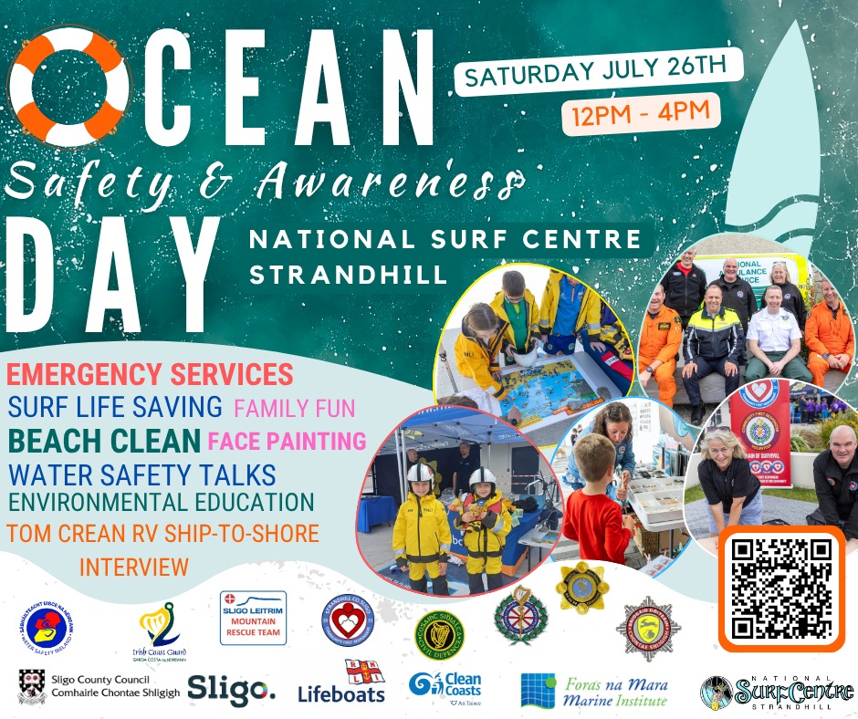
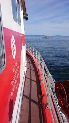
Great to be part of @sligococo Ocean Safety Awareness Day. INFOMAR’s Oisín McManus joined the event live from RV Tom Crean, sharing insights into our role in safe navigation and environmental monitoring. #OceanAwareness #SeabedMapping @DeptCEE @GeolSurvIE @MarineInst

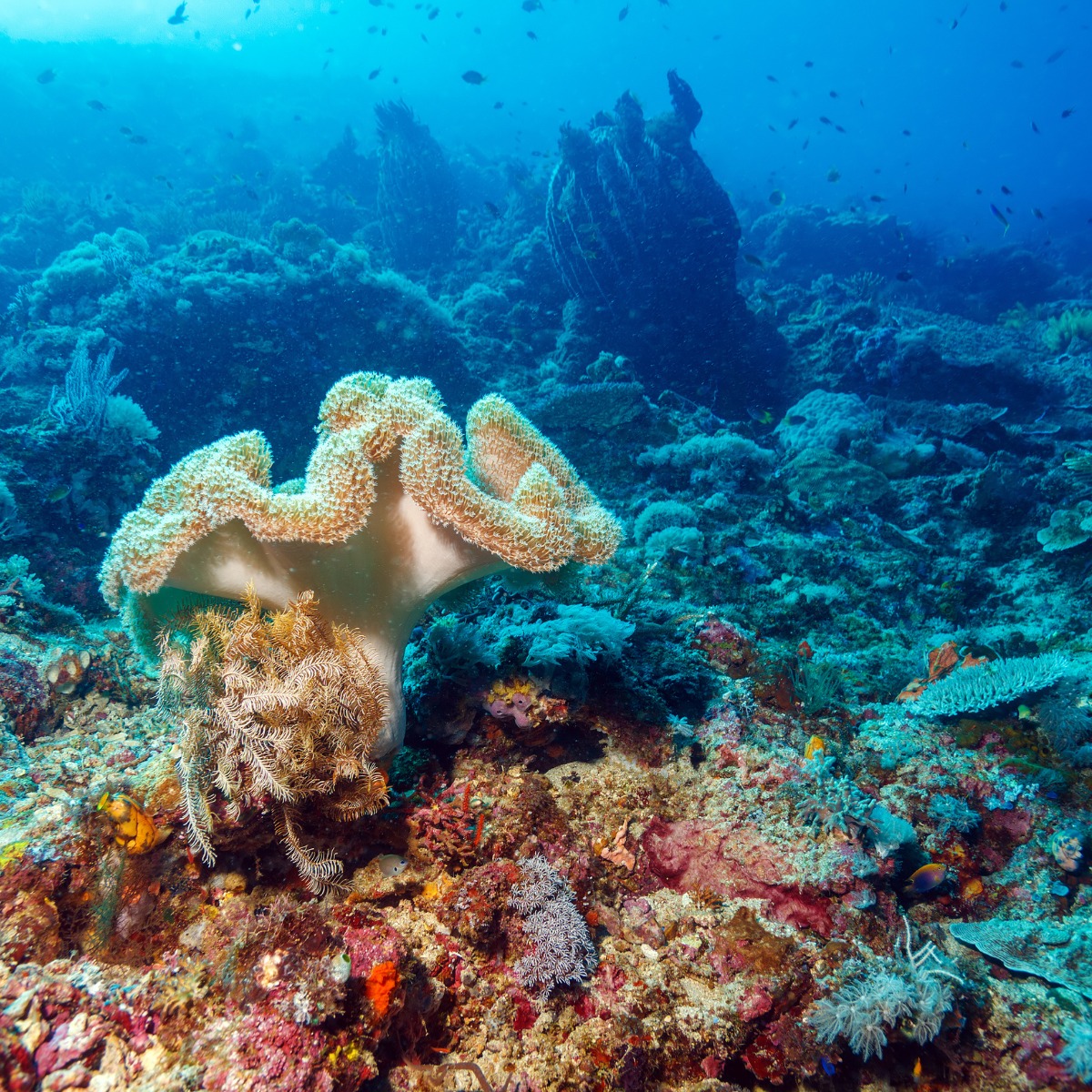
Undersea aggregate mining pilot used precisely mapped extraction zones to minimize seabed disturbance and protect key coral habitats in 2023. #SeabedMapping #Pilot
tinyurl.com/39vmzs4x Seabed Mapping: Enabling Ocean action takes center stage as Navy observes World Hydrography Day #TheIsland #TheIslandnewspaper #SeabedMapping #WorldHydrographyDay #SriLankaNavy
📢 Big News from the Deep! The Nippon Foundation-GEBCO @seabed2030 Project has announced that 27.3% of the world’s ocean floor is now mapped to modern standards. 🤝 Join #OceanDecade Alliance’s call to action to help accelerate this global #SeabedMapping effort. #OceanScience
safety and environmental stewardship. 🔍🌐 #HydrographyDay #SeabedMapping #OceanAction #IHO #HydrographyMatters
Pakistan Navy celebrates World Hydrography Day 2025 with the international community, focusing on the theme "Seabed Mapping: Enabling Ocean Action" #WorldHydrographyDay2025 #PakNavy #SeabedMapping #OceanAction
Last night, we attended the Global Ocean Data Sharing event on #seabedmapping and #data sharing co-organized by @UNOceanDecade Corporate Data Group, Ocean Decade Alliance, @globalcompact, @IocUnesco, @IHOhydro, @gebcobathymetry, and the #Seabed2030 project.
🌊 Beneath the surface lies a world we’re only beginning to understand. This #WorldOceansDay, discover why seabed mapping matters, and how the Marine Institute and INFOMAR is helping chart a sustainable future for our ocean. #SeaTheWonder #SeabedMapping #MarineScience
🌊 #DidYouKnow? Only 26.1% of the world’s ocean has been mapped in high-resolution. ➡️ The Ocean Decade Alliance just launched a Call to Action to accelerate the mapping of the world’s ocean 🔗 Learn more: isa.org.jm/area-2030/ #UNESCO #SeabedMapping #Ocean
Sulmara reports increase in USV and mapping service demand #seabedmapping #offshorewind #uncrewedsurfacevessels oceannews.com/news/subsea-an…

🌊 Fugro hired for USV seabed mapping project off Norway’s coast. @Splash_247 #OffshoreTech #SeabedMapping #Fugro #Norway splash247.com/fugro-hired-fo…

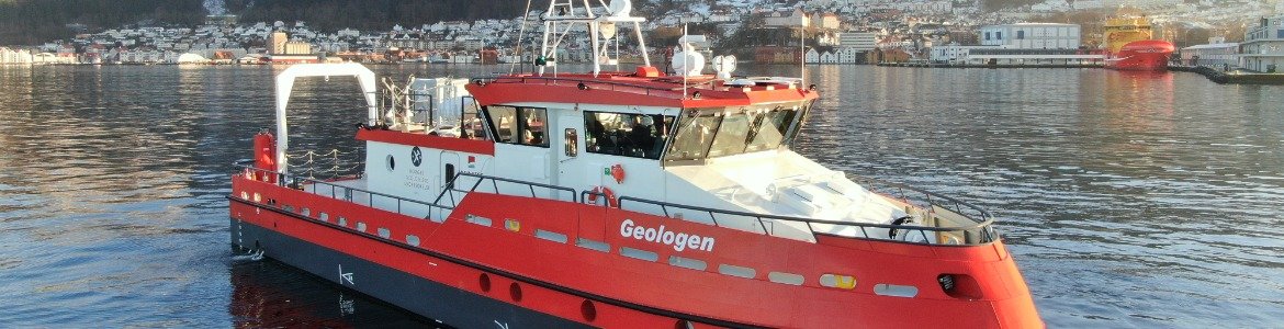
Fugro has been awarded a contract by the Norwegian Hydrographic Service (NHS) to support the 2025 MAREANO seabed mapping program. More: ecomagazine.com/news/research/… #oceanresearch #seabedmapping
ecomagazine.com
e-FishMed and RESUP Engage in the Blue Economy with New Training - environment coastal & offshore
The European Fisheries Control Agency has organized a training for Fisheries Monitoring Centre operators within the framework of the e-FishMed project, initiated by the European Commission and funded...
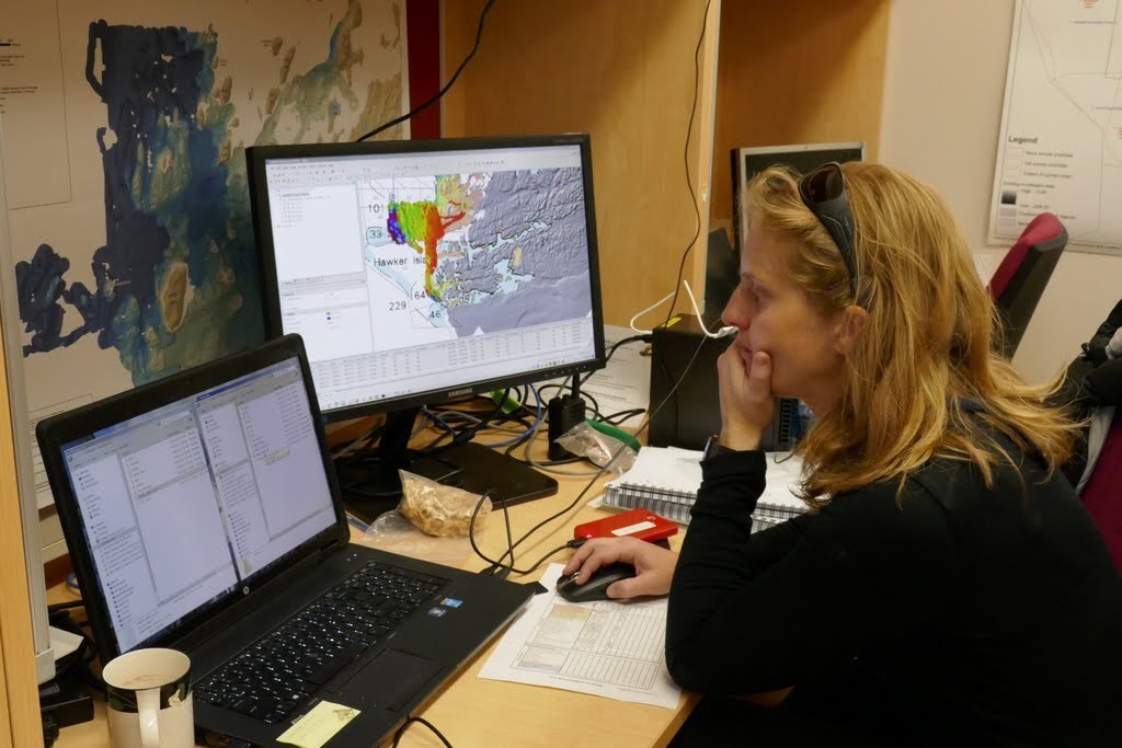
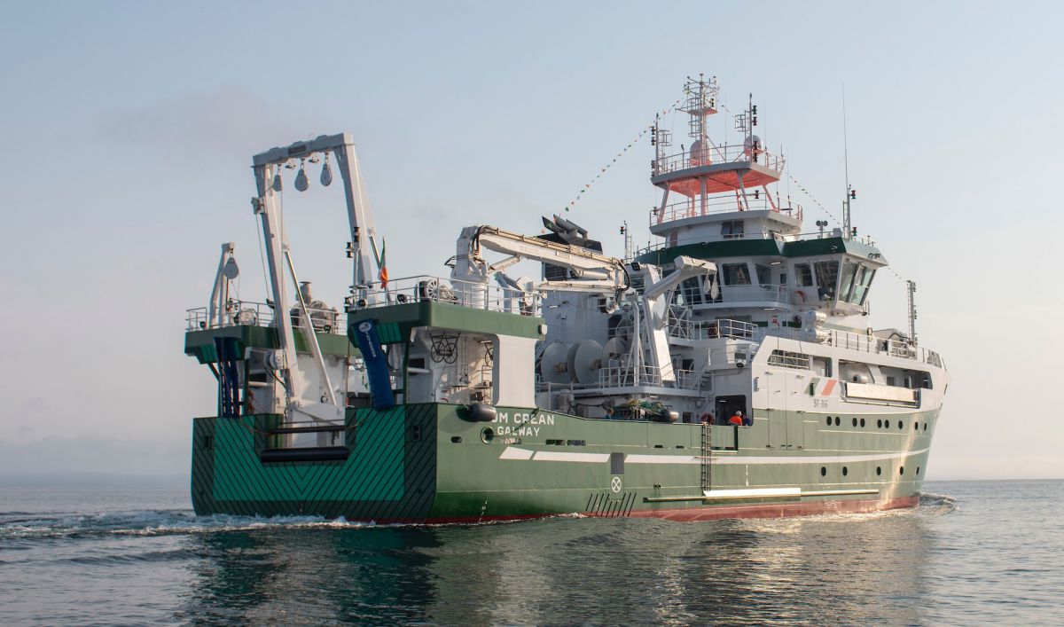
AQUARIUS with the support of INFOMAR and in collaboration with HydroOctave is offering hands-on #seabedmapping training for early career scientists aboard RV Tom Crean Oct 3-6. Read more and apply now: bit.ly/4iUWr9N @Dept_ECC @GeolSurvIE @MarineInst

🇺🇳 The recent ratification of the #Biodiversity Beyond National Jurisdiction (BBNJ) Treaty marks a historic step for ocean protection. But it also highlights the urgency of #seabedmapping. After all, how can we protect what we don’t fully know?
It was great to engage with members across the hydrographic community at #HYDRO25. The UK CSM demonstrated how it has established a collaborative seabed mapping community among over 30 public sector organisations. Thanks to @THS_UKI for organising a great event. #SeabedMapping
Yesterday, with @MCA_media we hosted members of the UK Centre for Seabed Mapping #UKCSM at @IMOHQ. Members had the opportunity to demonstrate their involvement in #SeabedMapping and learn more about the activities and priorities of their peers. ow.ly/t8TO50N88iW
Last week, UK National Hydrographer Angus Essenhigh and the Chief of Fiji Navy signed an MOU in Nadi, Fiji, demonstrating the importance of long friendships and collaboration to support safe, secure and thriving oceans. #Hydrography #SeabedMapping @ukinfiji @FijiNavy
Show casing @BritGeoSurvey seabed mapping capability at the #SeabedMapping showcase #CSM #CenterForSeabedMapping
Do you need seabed mapping data? Private, government, academic or community, all can share their data needs through the AusSeabed Survey Coordination tool to increase exposure and boost opportunities to collaborate! bit.ly/3L0Z49o #oceans #marinescience #seabedmapping
INFOMAR, Ireland's national #seabedmapping programme, are pleased to announce the release of its latest data update. This release encompasses essential enhancements including updated bathymetric & backscatter surfaces reflecting new specification, higher resolution, increased…
🌊 Do you need seabed mapping data? Share your data needs with the AusSeabed Survey Coordination tool to increase exposure and boost the opportunity for collaborations! 👉 bit.ly/3L0Z49o to submit your Areas of Interest! #oceans #marinescience #seabedmapping #oceannews
🎛 Technology allows us to work in new ways and expand our horizons, especially in #seabedmapping. As part of today’s Sea Mapping Through The Ages series, we’re looking at the history and role of #technology in mapping the #ocean floor. Let's take a dive👇
📢 Big News from the Deep! The Nippon Foundation-GEBCO @seabed2030 Project has announced that 27.3% of the world’s ocean floor is now mapped to modern standards. 🤝 Join #OceanDecade Alliance’s call to action to help accelerate this global #SeabedMapping effort. #OceanScience
The UK Centre for Seabed Mapping recently celebrated its 2nd anniversary. The #UKCSM aims to bring together the existing #SeabedMapping community across UK government and embed common approaches to data collection, data standards and data sharing. ow.ly/Pmk750SMV4c
#jobalert Want to work with seabed mapping @NGUgeology? @NGUmarin has a permanent position available as a researcher/engineer - apply by 1.5.24😉 #marinegeology #seabedmapping
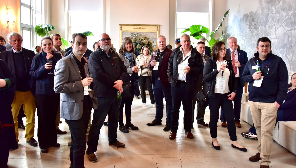
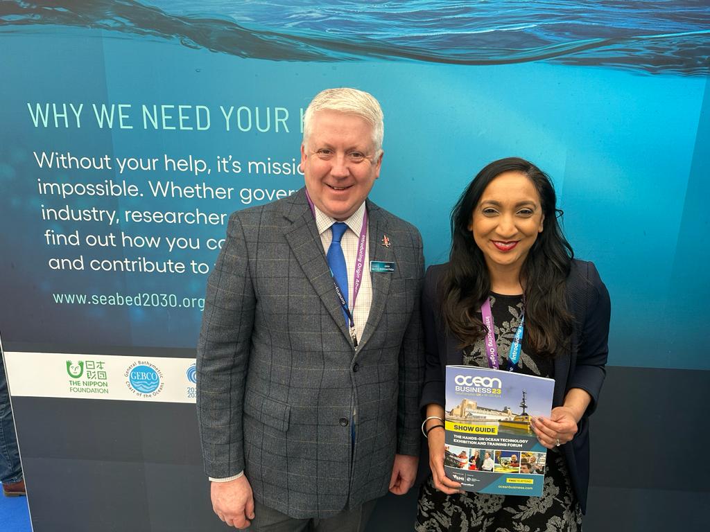
What a week at #OceanBusiness23! Thank you to everyone who stopped by to say hello and discuss the importance of #seabedmapping #UnitedWeDiscover #JointheMission #Seabed2030 #Partnerships @IHOhydro @gebcobathymetry @NipponF_pr @UNOceanDecade @IocUnesco
🌊 This #WorldEnvironmentDay, we’re excited about what the future of ocean #conservation holds and the role #seabedmapping can play. Earlier this year, the landmark #HighSeasTreaty created a legally binding instrument to protect our #ocean. 🧵 1/2
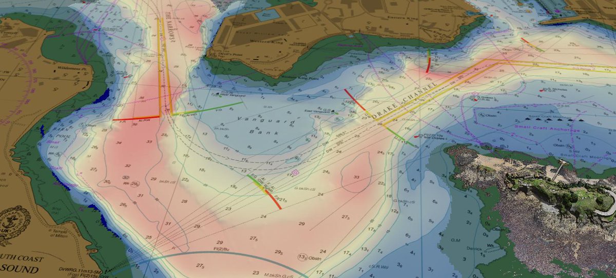
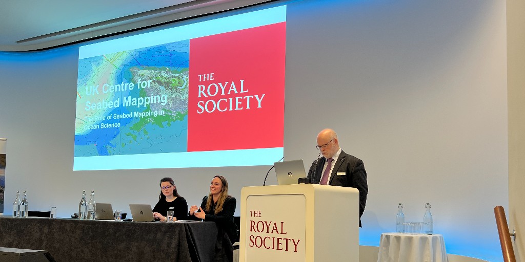
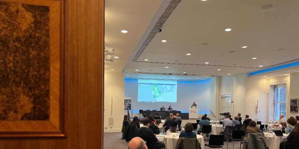
The @royalsociety and members of the UK Centre for Seabed Mapping met yesterday to discuss the role of #SeabedMapping in ocean science and how quality marine geospatial information can support knowledge sharing between academia and the public sector. ow.ly/LCqr50QQmOQ
How is #Seabed2030 supporting efforts to map the #ocean floor by 2030? ✔️ Feeding bathymetric data into a digital map ✔️ Forging partnerships to support future expeditions ✔️ Raising awareness about the importance of #seabedmapping Learn more: seabed.org/our-mission
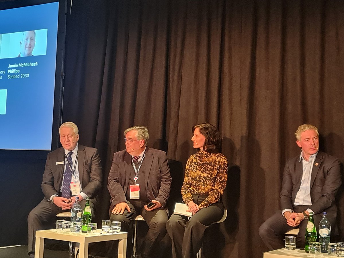
"Mars is more than 137 million kilometers from Earth. And yet, we've mapped nearly 90% of its surface. Back on Earth, we've mapped less than 25% of our own ocean," @JamieMcMP #seabedmapping #oceandata #ocean #datasharing @Economist_WOI @IHOhydro @gebcobathymetry @IocUnesco
🌏 What is AREA2030? → It is a collective initiative implemented by ISA and the International Hydrographic Organization (IHO) to foster partnerships and collaboration for the high-resolution mapping of the international seabed area (the Area) by 2030. #AREA2030 #SeabedMapping
Something went wrong.
Something went wrong.
United States Trends
- 1. Thanksgiving 722K posts
- 2. #StrangerThings5 289K posts
- 3. BYERS 68K posts
- 4. robin 103K posts
- 5. Afghan 322K posts
- 6. Dustin 67.8K posts
- 7. Holly 69.4K posts
- 8. Reed Sheppard 6,853 posts
- 9. Vecna 67.1K posts
- 10. Jonathan 75.5K posts
- 11. #DareYouToDeath 57.5K posts
- 12. Podz 5,174 posts
- 13. hopper 17.2K posts
- 14. mike wheeler 10.6K posts
- 15. derek 21.2K posts
- 16. Lucas 85.9K posts
- 17. Nancy 70.4K posts
- 18. noah schnapp 9,358 posts
- 19. Erica 19.5K posts
- 20. Tini 10.8K posts