
You might like


NEW: Highway 1 has been closed in both directions in Abbotsford between Sumas Way and No. 3 Rd due to flooding. There is no estimated time of reopening. #BCHwy1 #bcstorm
Some preliminary rainfall totals an daily records broken: weather.gc.ca/warnings/weath…
Special Weather Statement for weekend rain event: weather.gc.ca/warnings/repor…

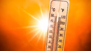
Get ready for the heat! An extreme heat wave is set to kick off tomorrow through Tuesday. weather.gc.ca/warnings/repor…

Wind warnings are in effect for Metro Vancouver and the Southern Gulf Islands. cbc.ca/news/canada/br…
cbc.ca
Ferries cancelled as high winds hit Metro Vancouver, Gulf Islands | CBC News
Several BC Ferries sailings between the mainland and Vancouver Island were cancelled Friday due to high winds blasting across the Strait of Georgia.
In for a stormy Tuesday as a system is set to first hit Vancouver Island before moving over to the South Coast. Winds gusting up to 70 km/h and heavy rainfall will ease tomorrow morning.
A rainy start to the day. Expect winds to gust 40-70km/h later this morning. Some afternoon clearing. A rainy start to the day. weather.gc.ca/warnings/repor…
A windy morning expected for Vancouver Island and the South Coast this morning -snow fall warnings are still in place for the norther, central areas of the province. weather.gc.ca/warnings/index…
Mainly cloudy today with a slight chance of afternoon showers. Are you ready for overnight temps to dip near zero by the end of the week?
Welcome to Fall! You may now don your cozy cardigans and fire up the pumpkin spiced candles.


#EnvironmentCanada has isuused a specical weather statment for the #Shuswap weather.gc.ca/warnings/repor… Daytime maximum temperatures are forecast to be 5 to 10 degrees above seasonal on Wednesday and Thursday.
We head into a few day of cooler temperatures, but we get to keep the sunshine in the forecast! Day time highs linger around the 20 degree mark until Friday, when we see the heat sneaking back into the forecast.
After this morning's drizzle and cooler temps were are back on track for a stretch of truly sunny and warm - dare I say hot?- weather! Temps in mid-high with Monday looking to hit 30 inland! Keep that sunscreen handy!
Another lovely day for the Lower Mainland. Mix of sun/cloud with a hight temps around 19-22. Clouds roll in overnight and bring some early morning showers for Tuesday with afternoon sunshine and a high of 19.
Clouds close in tonight with rain arriving late tomorrow morning and sticking around through the afternoon. Just a chilly high of 15 expected. Back to sunshine and temper near 20 for Wed, Thurs, Friday.


United States Trends
- 1. #LittleMissDramaTour N/A
- 2. #AEWDynamite N/A
- 3. Bondi N/A
- 4. Ciampa N/A
- 5. Culver City N/A
- 6. Thekla N/A
- 7. Cam Thomas N/A
- 8. Fletcher N/A
- 9. Spurs N/A
- 10. #GagCity N/A
- 11. Private Party N/A
- 12. Bates N/A
- 13. Northwestern N/A
- 14. Jake Hall N/A
- 15. #LoveIsBlind N/A
- 16. The Dow N/A
- 17. Keldon Johnson N/A
- 18. Kyle Busch N/A
- 19. Jose Alvarado N/A
- 20. Kris Statlander N/A


Something went wrong.
Something went wrong.