DollarLakeFire
@DollarLakeFire
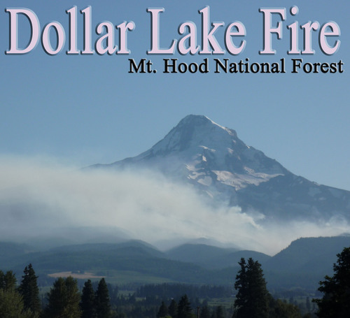
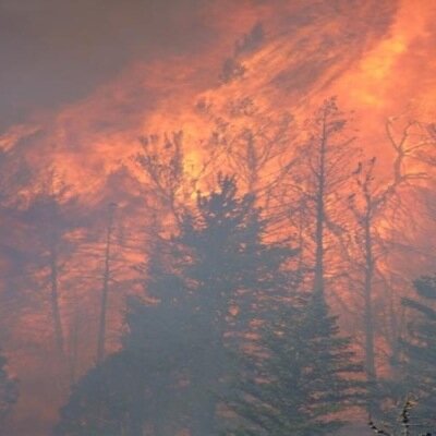
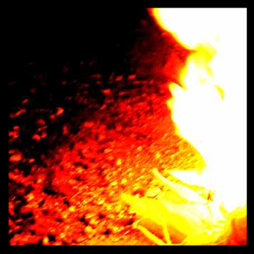
Dollar Lake Fire was caused by lightning on August 27, 2011. It is located about 20 miles southwest of Hood River, Oregon.
You might like


Fire 90% contained. Some smoke visibile inside perimeter. Unless fire activity increases, no more info via Twitter. See bit.ly/ny4v5w
Light rain and drizzle were prevalent across the fire throughout yesterday's operational period. With the cool… (cont) deck.ly/~Mz8Pr
Crews strengthen/improve firelines. Mop-up along perimeter. Work on fireline rehabilitation & remove hose where mop-up standards are met.
Firefighters take advantage of brief cool & damp period to finish mop-up activities, line construction & rehabilitation bit.ly/ny4v5w
BAER Team flew Dollar Lake Fire today to map burn severity. Also using landsat image maps to aid recovery efforts 1.usa.gov/psMsdQ
There was light rain on the incident today as firefighters continue working to strengthen and improve containment lines and mop-up hot spots
Hand-held infrared sensors helping firefighters locate & eliminate hot spots www.inciweb.org/incident/2563
Firefighters continue fireline construction & mop-up. West wind flow expected to continue. See today's update www.inciweb.org/incident/2563
Community Briefing about Dollar Lake Fire tomorrow night Thursday September 15, 7:00pm @ the Parkdale Fire Station, Parkdale, OR
Tuesday Dollar Lake Fire crept & smoldered throughout understory, producing less smoke & consuming unburned areas bit.ly/ny4v5w
Continued smoldering & slow surface fire spread. Periodic single tree torching today. Crews worked on mop-up, containment lines & hoselays.
Real-time smoke monitors deployed @ Parkdale & Sandy. Hourly data available at www.wrcc.dri.edu/cgi-bin/smoke.pl.
Excellent progress was made in putting a line around parts of the northern reaches of the fire. Fire fighter… (cont) deck.ly/~F1fxN
Moderate fire activity. Westerly wind flow pushing smoke east into Elliot Ck Drainage. Unburned fuel inside perimeter is now burning.
Dollar Lake Fire Update for 9/12/2011 is available at: inciweb.org/incident/artic…
Lost Lk CG & Resort, Whatem Lk CG & Rd13 now open. Surface of Lost Lk closed; helicopters are using it as a dip site
Today: Isolated torching. Short crown runs where wind/terrain/slope aligned with heat sources. Backing/creeping/smoldering in other areas.
A map showing the daily growth of the Dollar Lake Fire is available online bit.ly/qZP1nS yfrog.com/h39o2uvj
Less active fire behavior so far today. Visibility is improving though - an indication that smoke could lift & fire activity may pick-up.


United States Trends
- 1. Indiana N/A
- 2. Mendoza N/A
- 3. Miami N/A
- 4. Carson Beck N/A
- 5. #NationalChampionship N/A
- 6. Curt Cignetti N/A
- 7. #CFBPlayoff N/A
- 8. Malachi Toney N/A
- 9. Abella Danger N/A
- 10. Heisman N/A
- 11. #iufb N/A
- 12. Natty N/A
- 13. Big Ten N/A
- 14. Michael Irvin N/A
- 15. Big 10 N/A
- 16. #NeverDaunted N/A
- 17. Fletcher N/A
- 18. Raiders N/A
- 19. Jimmy Butler N/A
- 20. Saleh N/A
You might like

Something went wrong.
Something went wrong.