Geospatial Research Forum 🌍
@GeospatialRF
we use #Al to model climate patterns, LULC change, identify trends and make predictions|Email; [email protected]


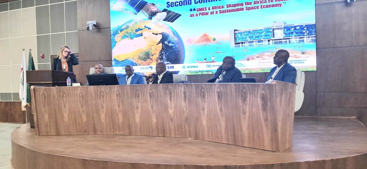
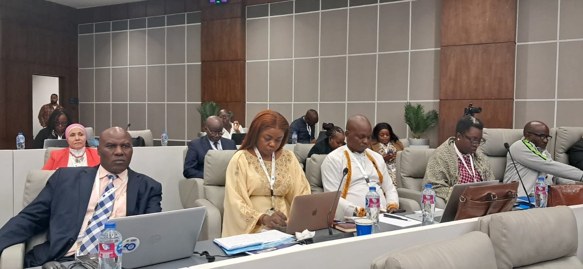
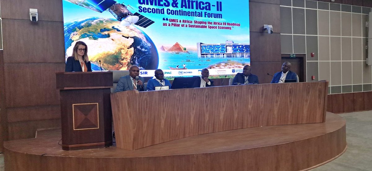
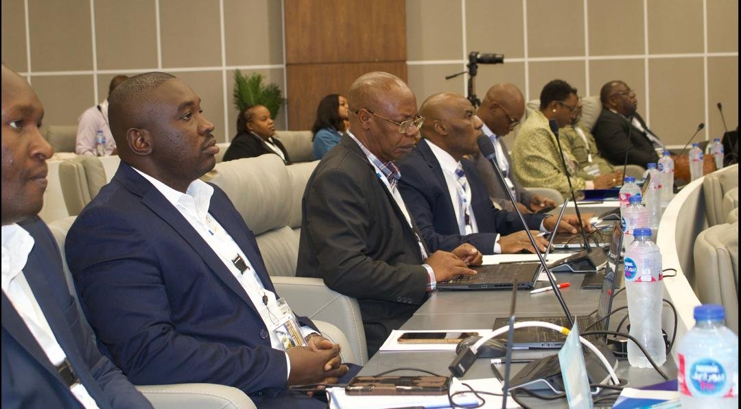
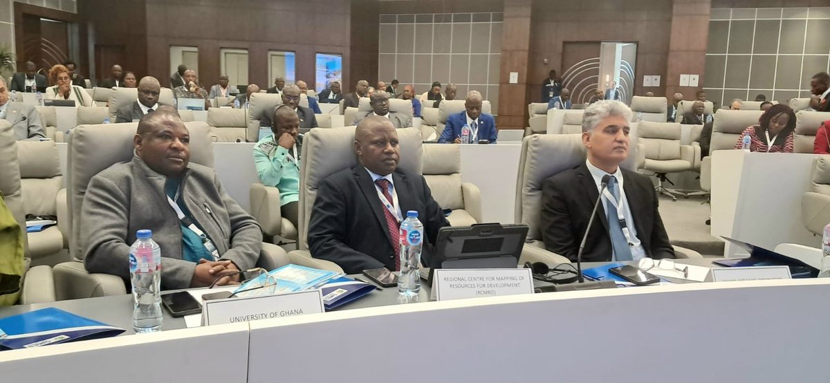
RCMRD joined a panel moderated by @CatherineGhyoot. The discussion emphasized the need for sustainable EO tools-through consortium ownership, private-sector commercialization, or joint business proposals—to ensure long-term impact of the @GMESAfrica programme. @EU_Commission
EO continues to prove its value in strengthening climate resilience & evntal monitoring in Africa. we see major opportunities to elevate these successes thru stronger intra-African collaboration and international partnerships that expand research, capacity building, & innovation
2/2. ..and strengthen EO successes by identifying opportunities for enhanced intra-African and international partnerships.
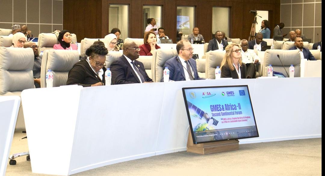
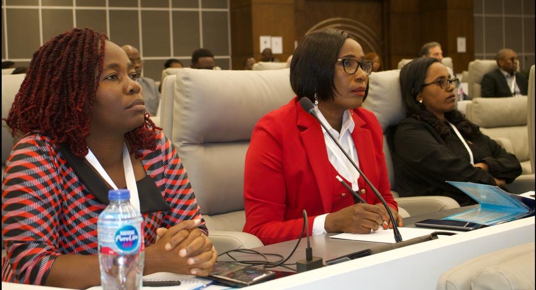
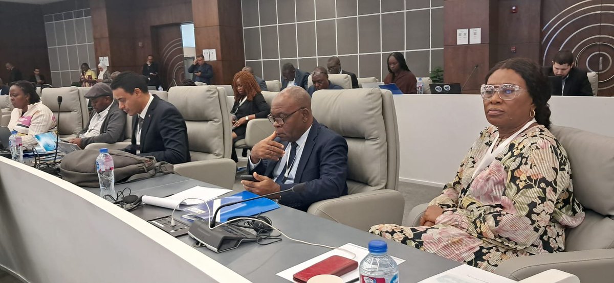
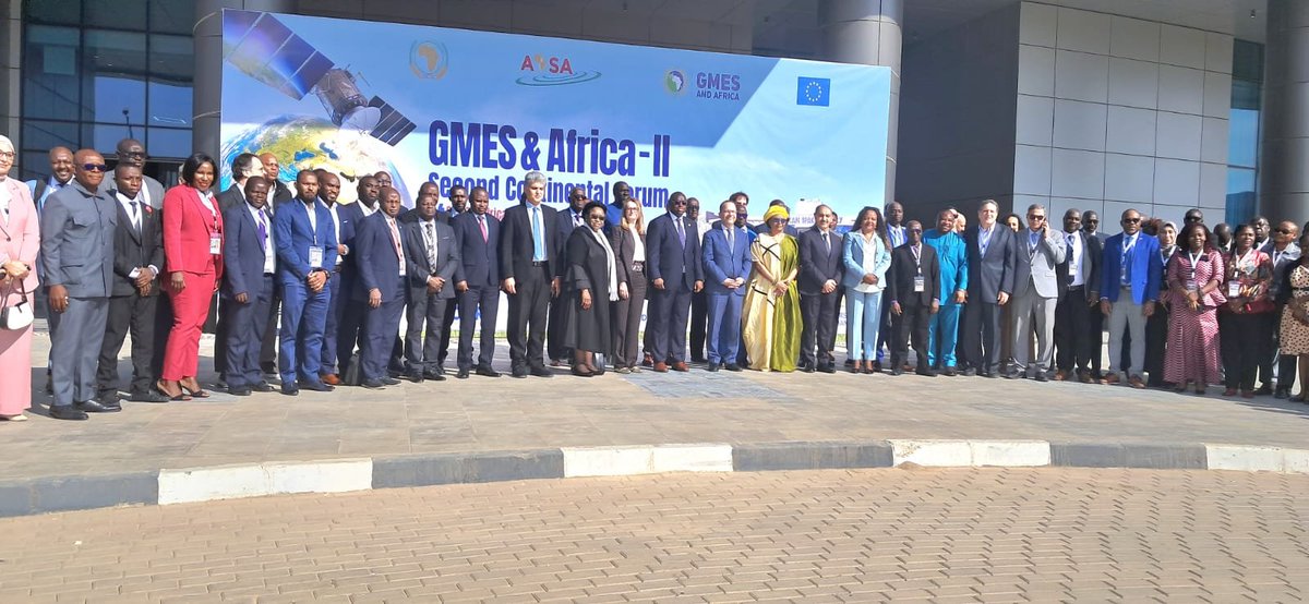
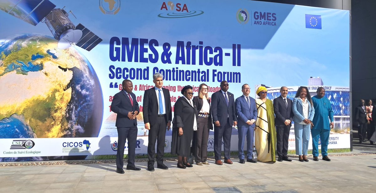
The 2nd & final @GMESAfrica Phase 2 Continental Forum kicks off in Cairo, Egypt at the @AfSA_AU headquarters. The forum brings together all the implementing consortia, policymakers, scientists, academia, RECs, @_AfricanUnion, @EU_Commission among other key stakeholders.
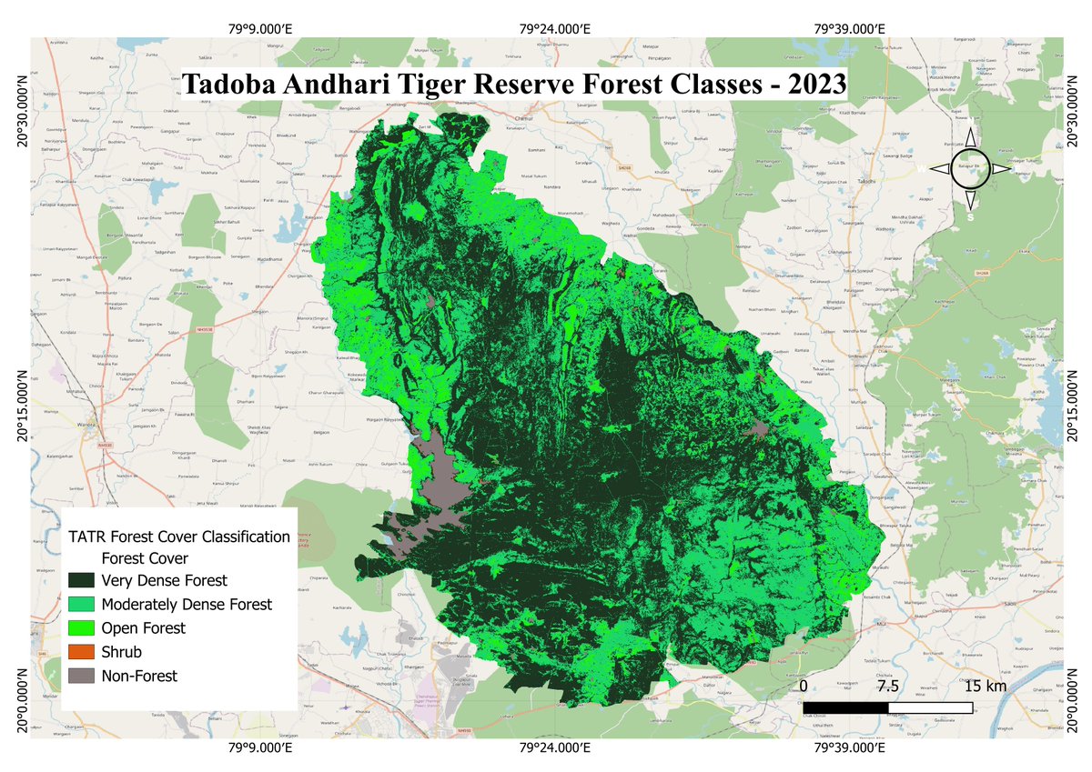
Geospatial Research Forum (GRF) is pleased to showcase an outstanding contribution for the #GISDay Map Challenge 2025, developed by Ritika Ghog, demonstrating the power of #geospatial analysis in conservation science. More details; linkedin.com/feed/update/ur…
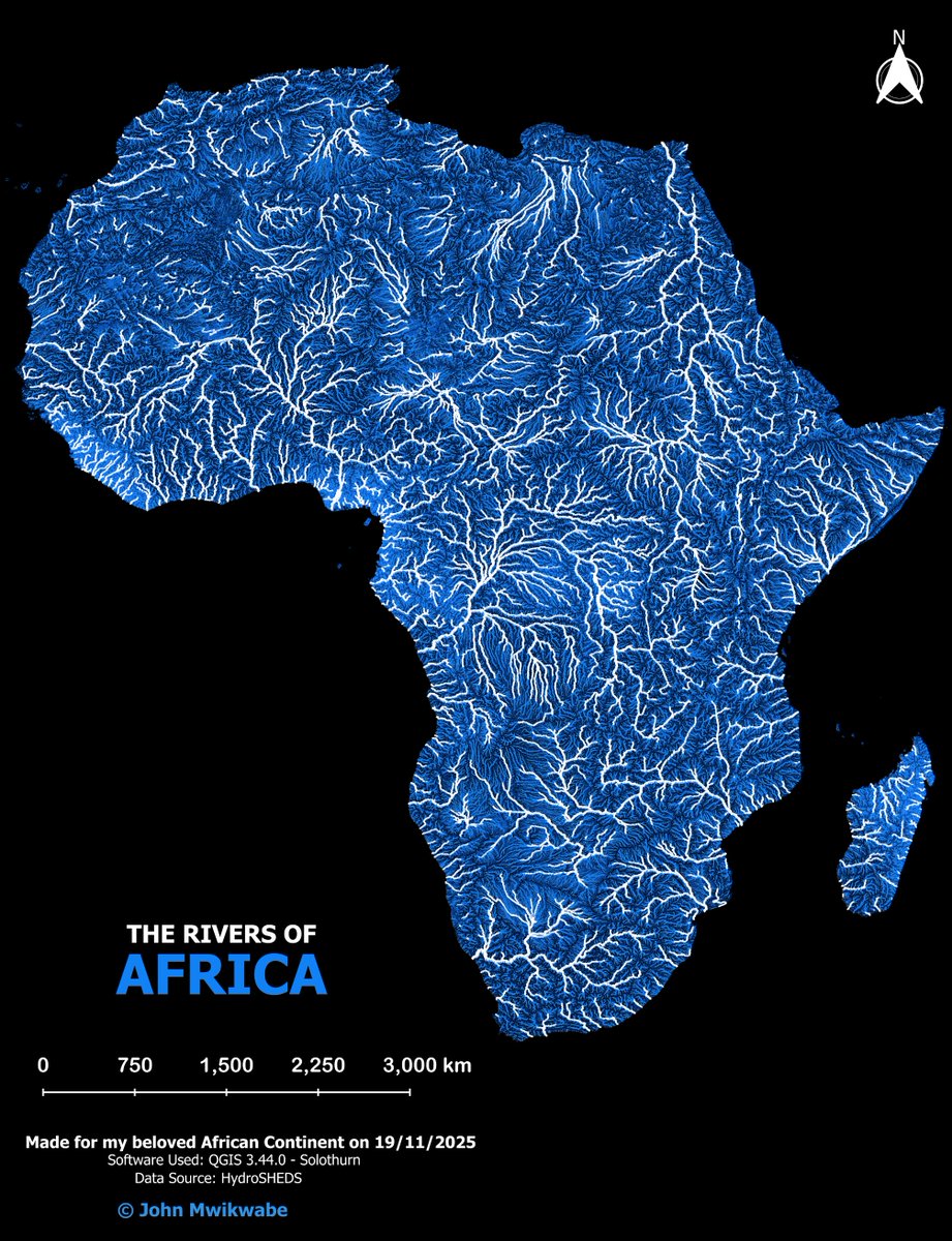
Understanding the structure and connectivity of Africa’s rivers is essential for advancing #watershed protection, restoring riparian ecosystems, and designing sustainable water management strategies. More details; linkedin.com/feed/update/ur…
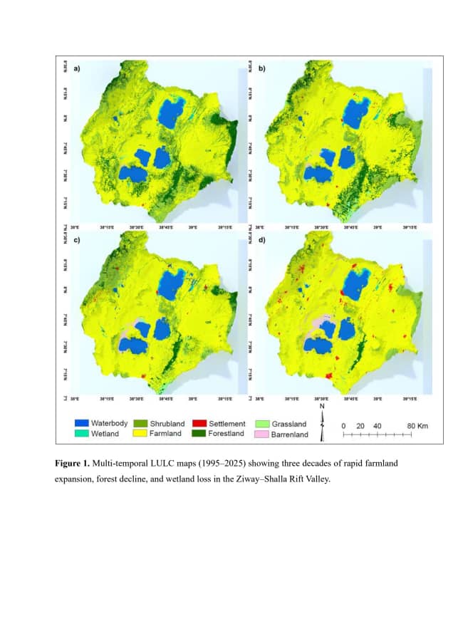
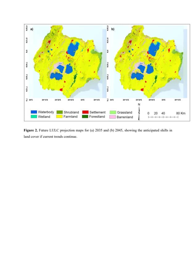
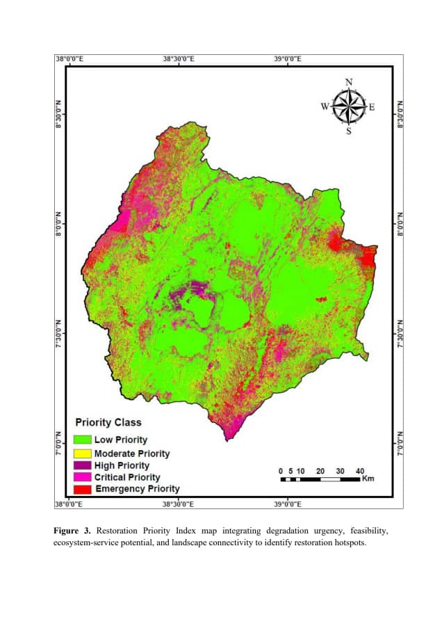
In the heart of Ethiopia’s #Ziway–Shalla Rift Valley, the landscape tells a story etched across time a story of what once existed, what has changed, and what the future may hold. More details; linkedin.com/feed/update/ur…

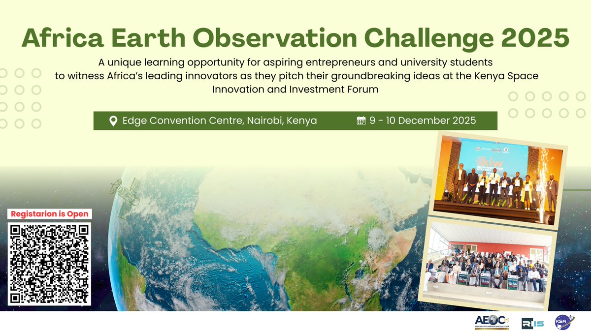
Only a few days left to enter the Africa Earth Observation Challenge, the largest space tech open innovation challenge and incubation programme in Africa.. The challenge seeks to drive entrepreneurial activity in the African space industry and promote awareness of the value of…
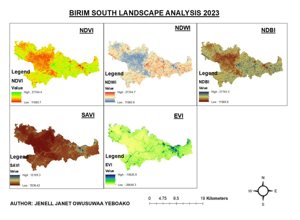
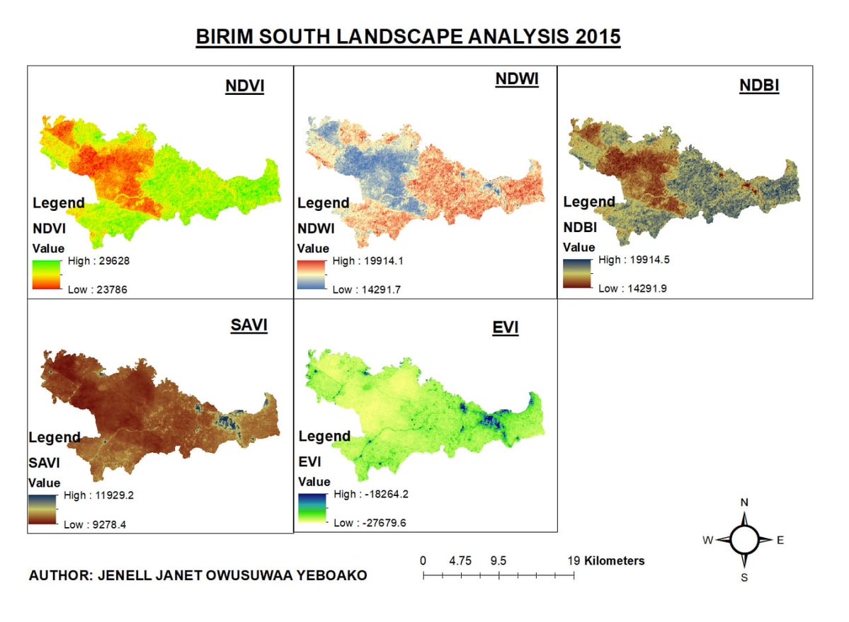
🌍 GRF GIS Day Map Challenge #Spotlight | Birim South Landscape Change Assessment (2015–2023) Details: linkedin.com/feed/update/ur…
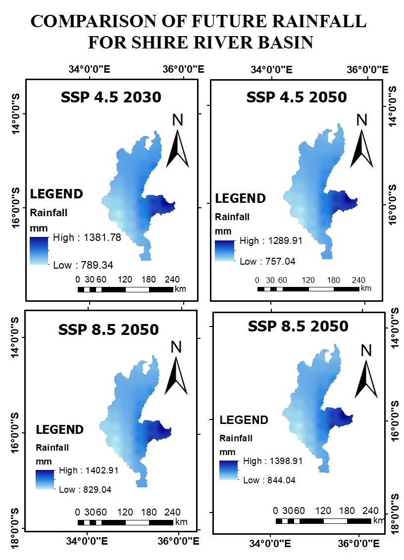
A compelling climate-focused #geospatial analysis contributed by @FGoloma . His work examines future rainfall projections in the Shire River Basin under the Shared Socioeconomic Pathway (SSP) 4.5 scenario, Details; linkedin.com/feed/update/ur…
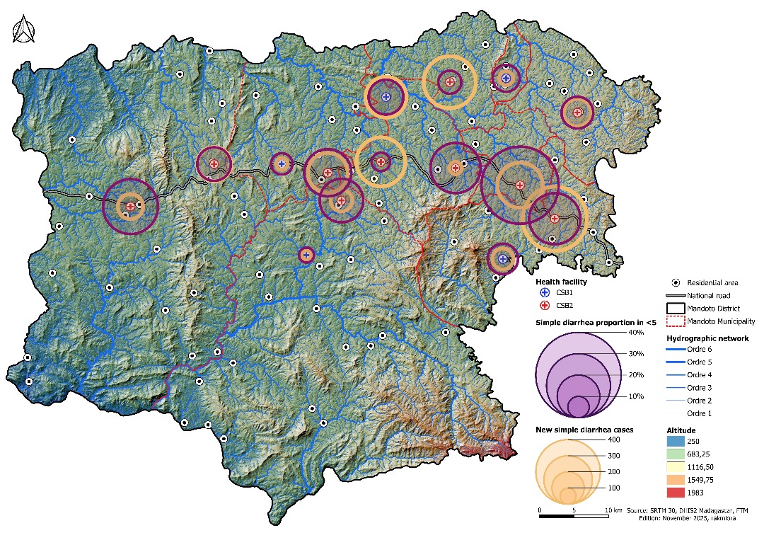
Today, we highlight an exceptional One Health–oriented #spatial analysis developed by Miora Harivony, focusing on the #Mandoto District in Madagascar’s Vakinankaratra Region. Details; linkedin.com/feed/update/ur…
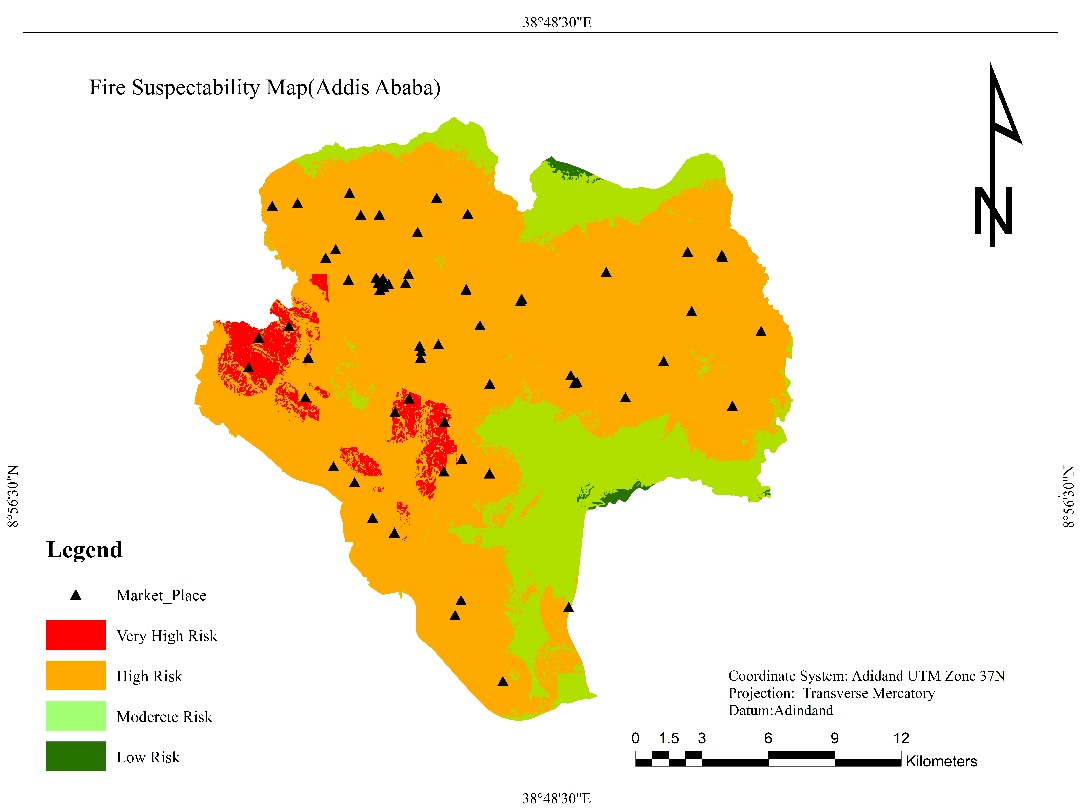
🔥 Fire Susceptibility Mapping for Addis Ababa. This map presents a comprehensive fire risk #assessment for Addis Ababa, developed through the integration of environmental and infrastructural variables. More details; linkedin.com/feed/update/ur… Map credit: Aster Chalchisa
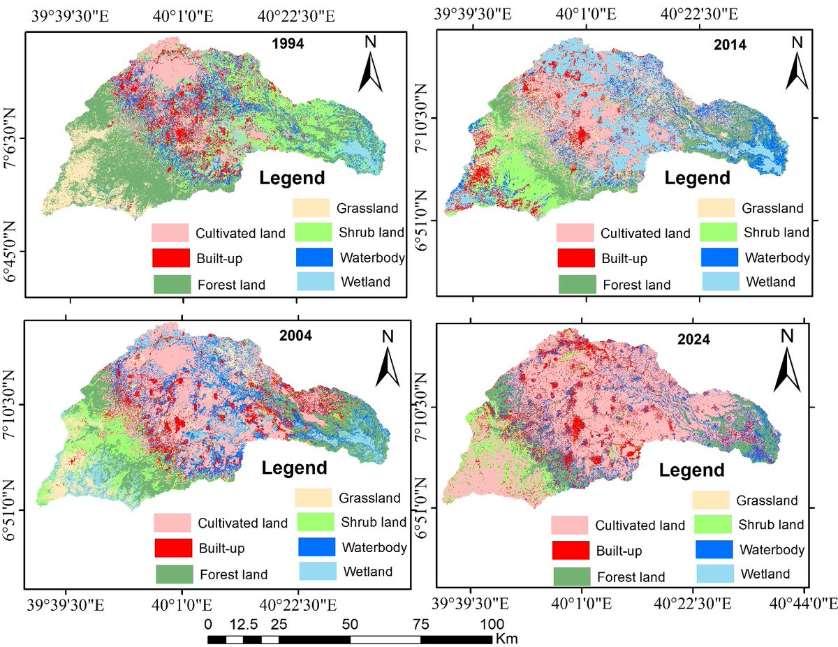
Spatiotemporal Dynamics of Land #LULC Change and its Effects on Land Surface Temperature in the Weyib Watershed, South-Eastern Ethiopia Using #Landsat imagery from 1994, 2004, 2014, and 2024. Details: linkedin.com/feed/update/ur… Map credit; Kanenus Fufa Dararo
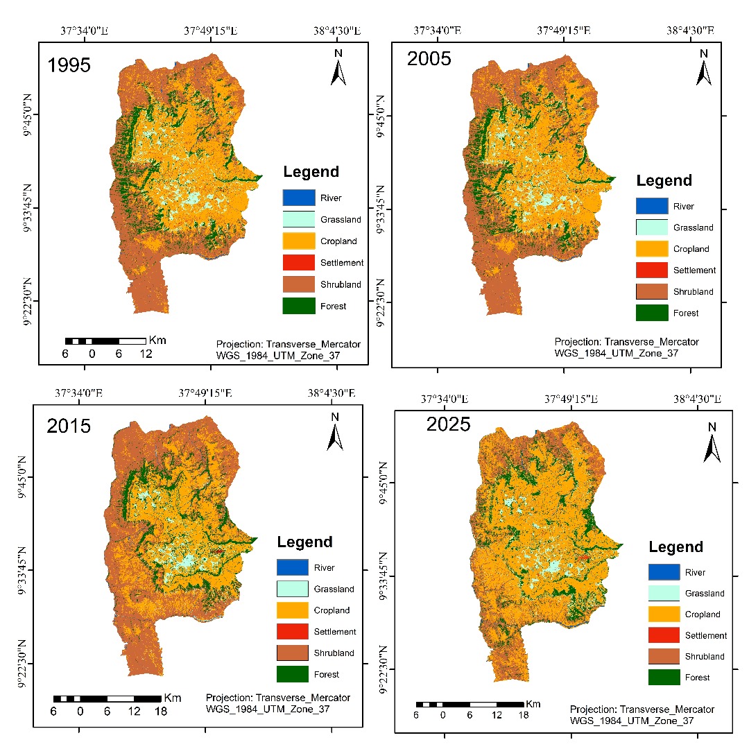
🗺️ Spotlight Map: Land Use/Land Cover Dynamics of Gindabart (1995–2025) This work illustrates how #geospatial technologies can reveal long-term environmental change. Details; linkedin.com/feed/update/ur… Map credit; Moibon Gabisa wekjira

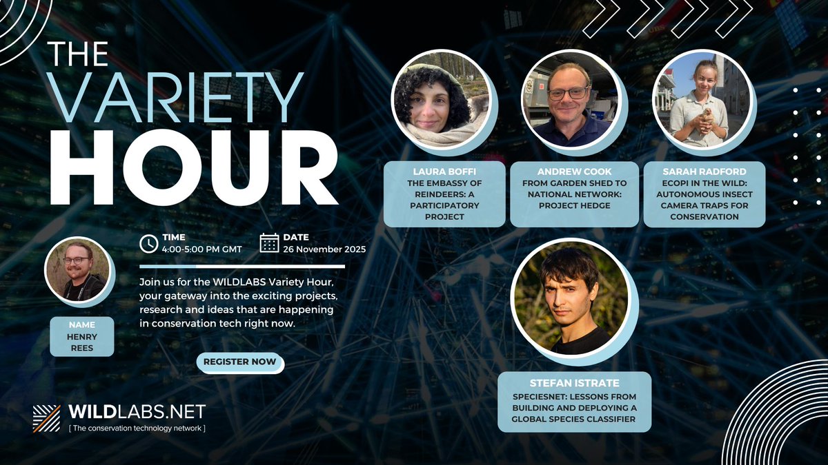
Join us on November 26 at 11am EST / 4pm GMT for Variety Hour! Hear about interspecies reindeer experiments, hedgehog networks, autonomous insect traps, and global species classifiers. Register here: wildlabs.net/event/variety-…
Happy GIS Day 2025! From all of us at Geospatial Research Forum (GRF), we join the global community in celebrating the power of geography, data, and spatial thinking in shaping a better world. #GISDay2025 #GeospatialResearchForum #GeoGeneralistEra


🚀 VH-RODA 2025 is GO! Day #1 kicks off today at 14:00 at @esa -ESRIN 🎉 We’re looking forward to a full programme of discussions, demonstrations, and collaboration. 📄 Follow the agenda here: earth.esa.int/eogateway/even…

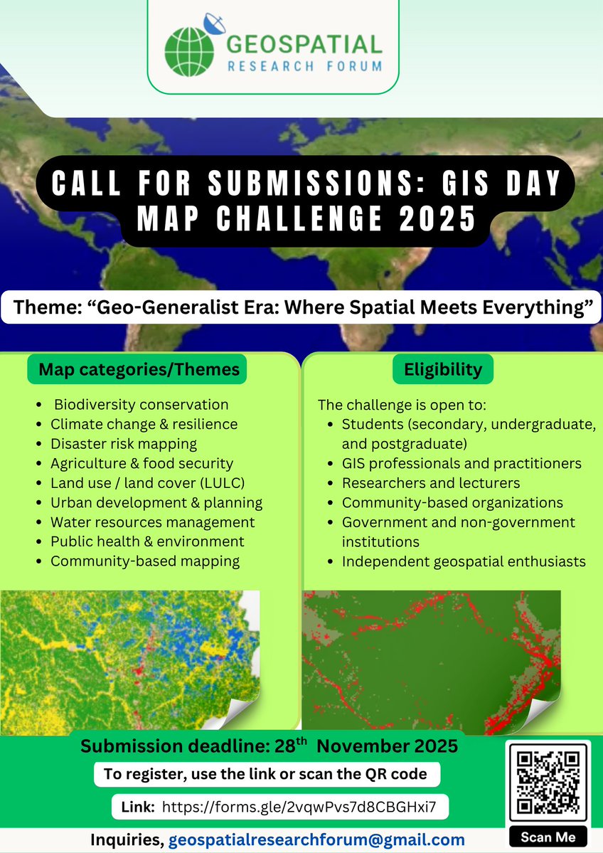
Geospatial Research Forum (GRF) invites global participants to showcase their mapping creativity & geospatial skills! 🗺️🔥 All disciplines • All regions • All experience levels welcome! 🔗 Enter the challenge: linkedin.com/feed/update/ur… #GISDay2025 #MappingChallenge


United States 趋势
- 1. Chris Paul 3,748 posts
- 2. Pat Spencer 2,575 posts
- 3. Kerr 5,454 posts
- 4. Podz 3,233 posts
- 5. Shai 15.1K posts
- 6. Jimmy Butler 2,606 posts
- 7. Seth Curry 4,614 posts
- 8. Hield 1,565 posts
- 9. Pope 46.8K posts
- 10. Carter Hart 3,984 posts
- 11. #DubNation 1,413 posts
- 12. Derek Dixon 1,279 posts
- 13. Connor Bedard 2,370 posts
- 14. Kuminga 1,436 posts
- 15. Caleb Wilson 1,172 posts
- 16. #SeanCombsTheReckoning 4,624 posts
- 17. #ThunderUp N/A
- 18. Brunson 7,343 posts
- 19. Brandy 8,174 posts
- 20. Elden Campbell N/A


Something went wrong.
Something went wrong.