
おすすめツイート


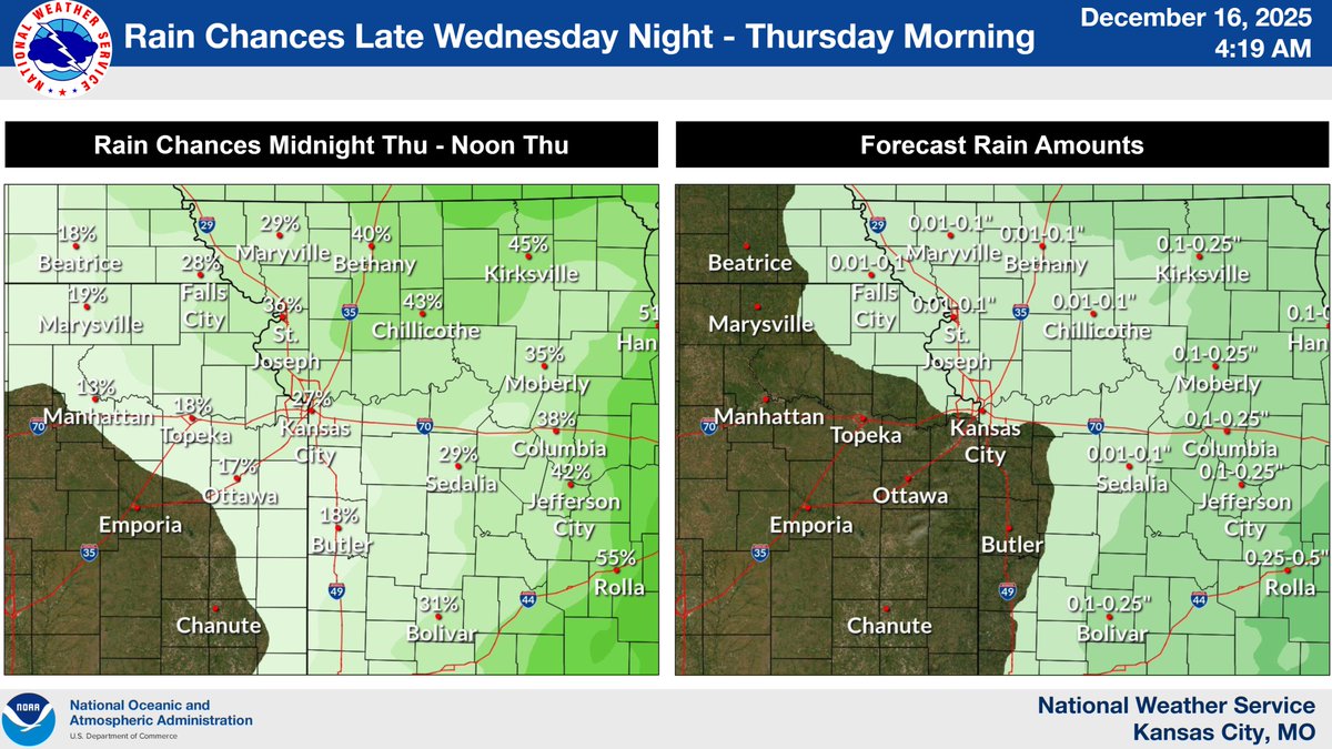
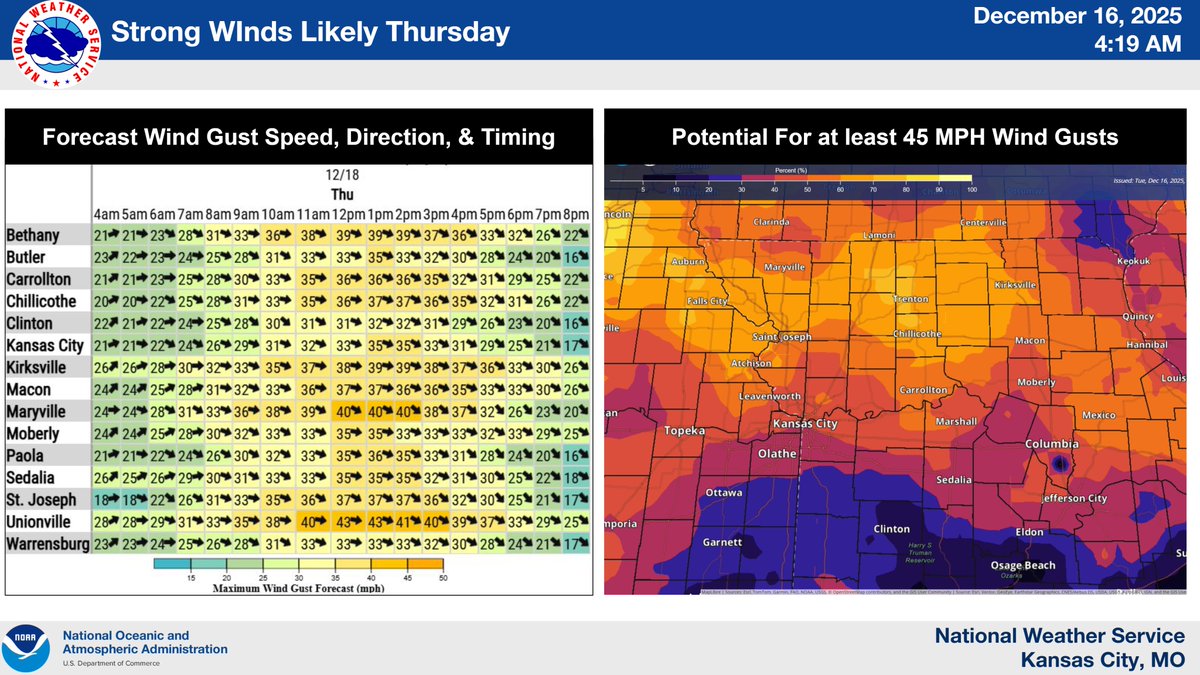
Showers are expected early Thursday morning with winds becoming gusty by the afternoon. Gusts up to 45 mph from the northwest expected across portions of the area through the afternoon.

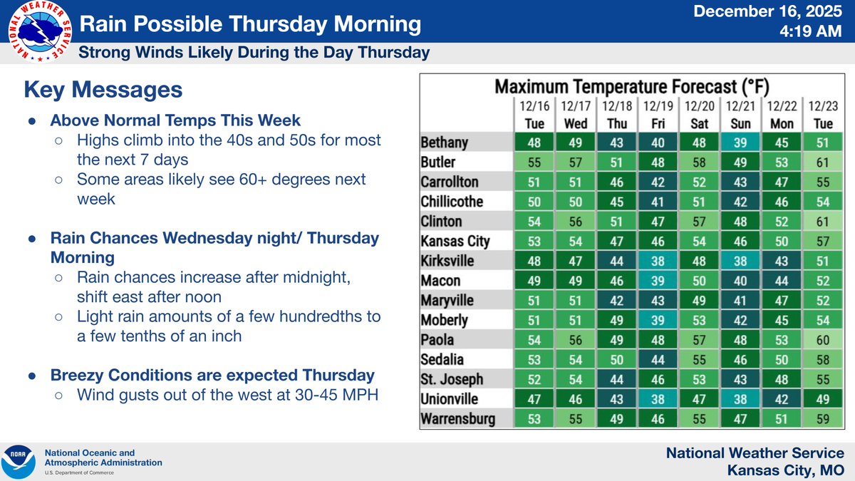
Above-normal temps are forecast for the next week, with potential for 60+ degree highs heading into Christmas. Rain chances move through between midnight and noon Thu. Winds are expected to be strong and gusty on Thu, with gusts potentially exceeding 45 mph in the afternoon.
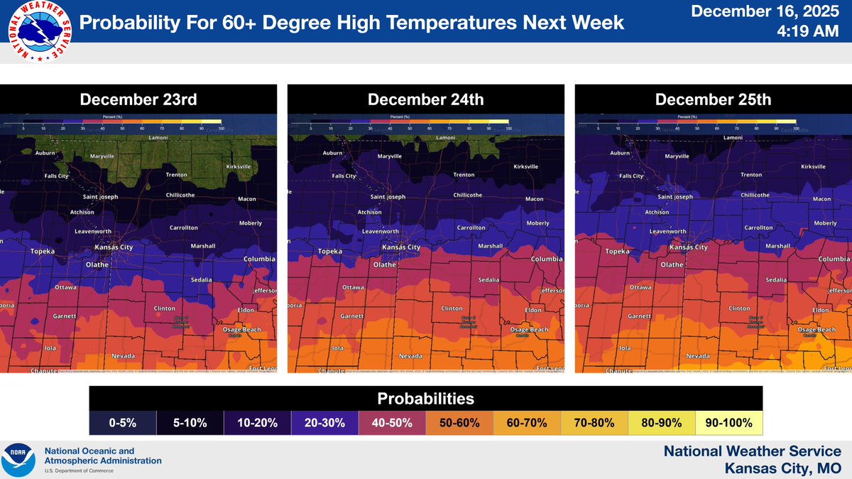
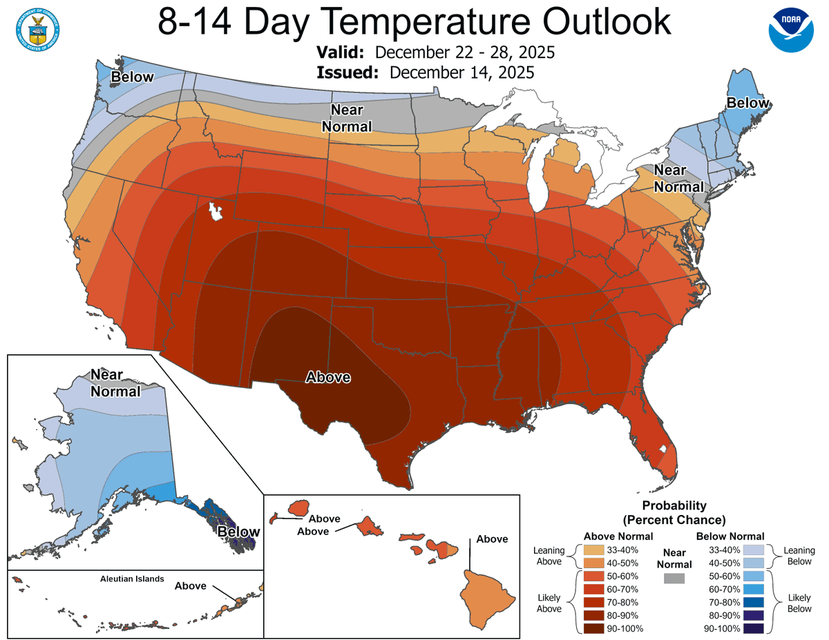
We don't like to rain on anyone's parade but we are fairly confident we won't be snowing on anyone's parade! A White Christmas is looking very unlikely (famous last words?) w/ above normal temps strongly favored for the holiday week (Dec 22-28). #ChristmasOutlook #BrownChristmas
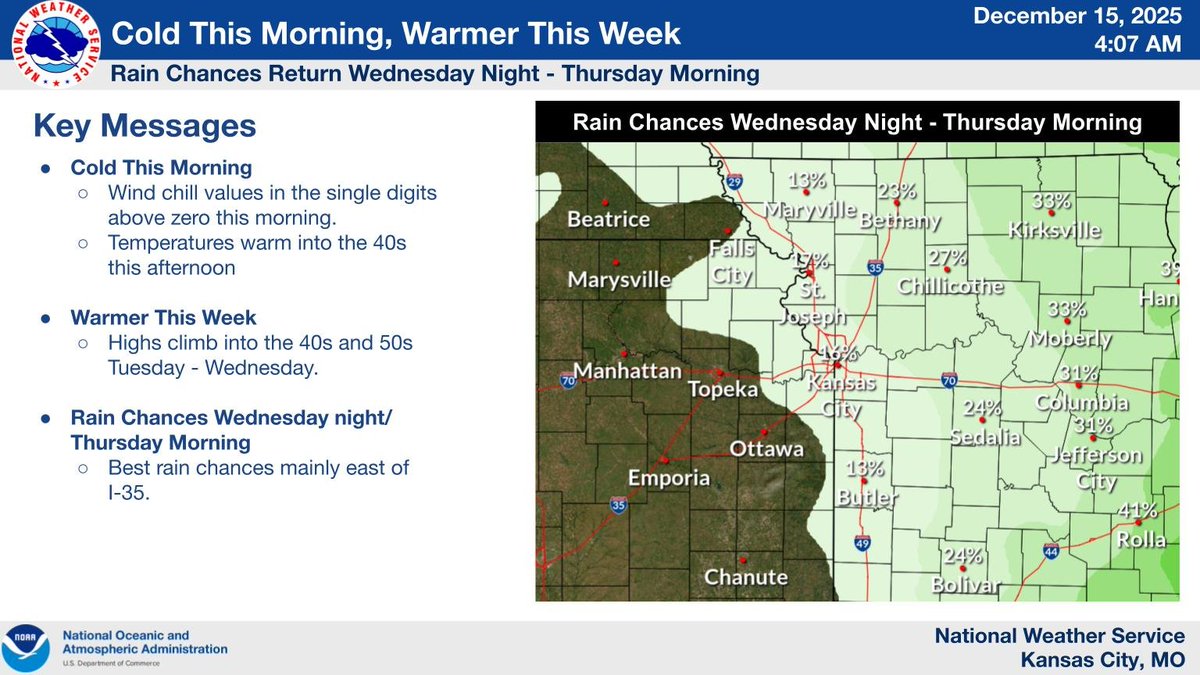
Cold start to the week with morning wind chills in the single digits above zero. Highs warm into the 40s today, then 40s–50s through midweek. Rain chances Wednesday night into Thursday morning, followed by a brief cool-down late week.
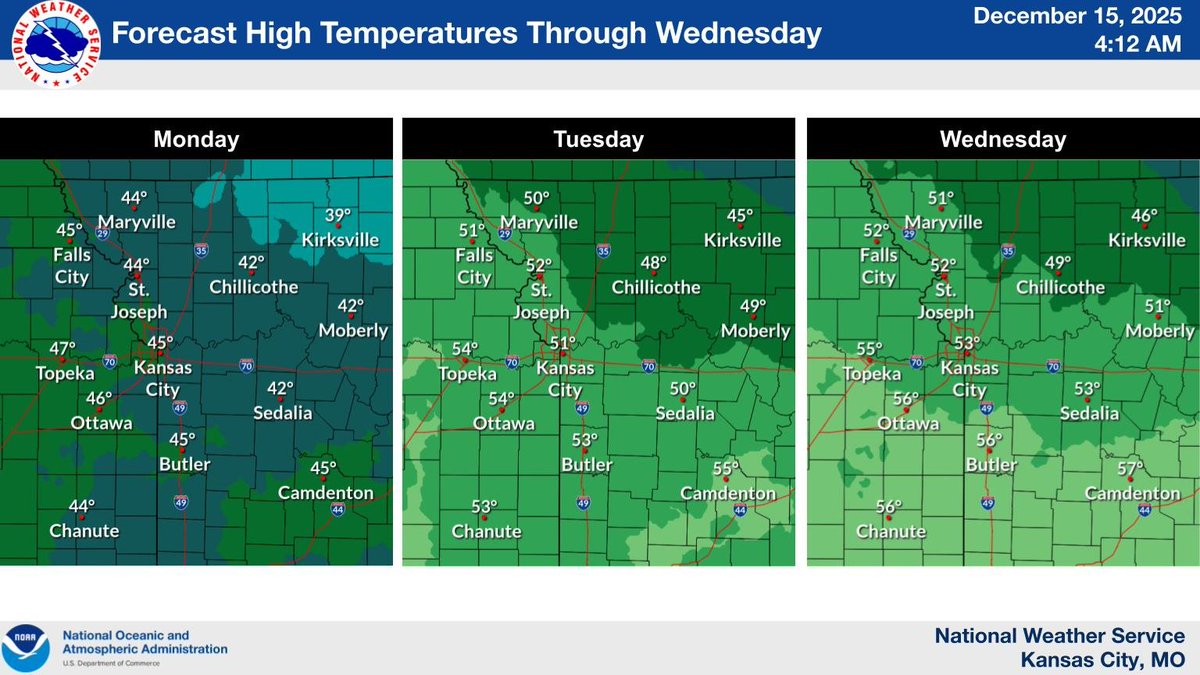
High temperatures will warm into the 40s today, then into the 40s and 50s through the middle of the week.
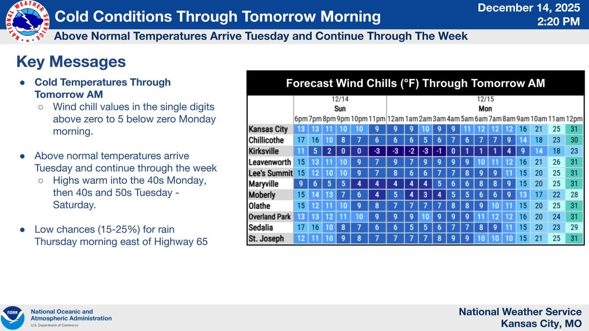
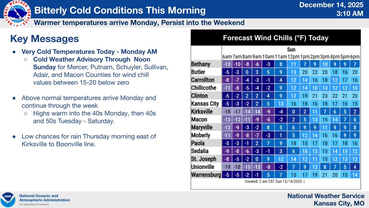
Cold conditions will continue through tomorrow morning as wind chill values drop into the single digits above zero to 5 below zero. A warming trend is expected to begin tomorrow afternoon with highs return to near normal in the 40s.
The low at Kansas City this morning was 4°...while that fell well short of the record daily low of -8° set in 1901, it was certainly the coldest day of the season thus far and coldest day since February 21st when we reached -5°. #KCCold
Bitter cold this morning: lows below 0° in far northern/northeastern MO and single digits elsewhere. Wind chills as low as -20° north, 0 to -10° south. A warmup follows, with highs in the 40s on Monday, then 40s to 50s Tuesday through Saturday.
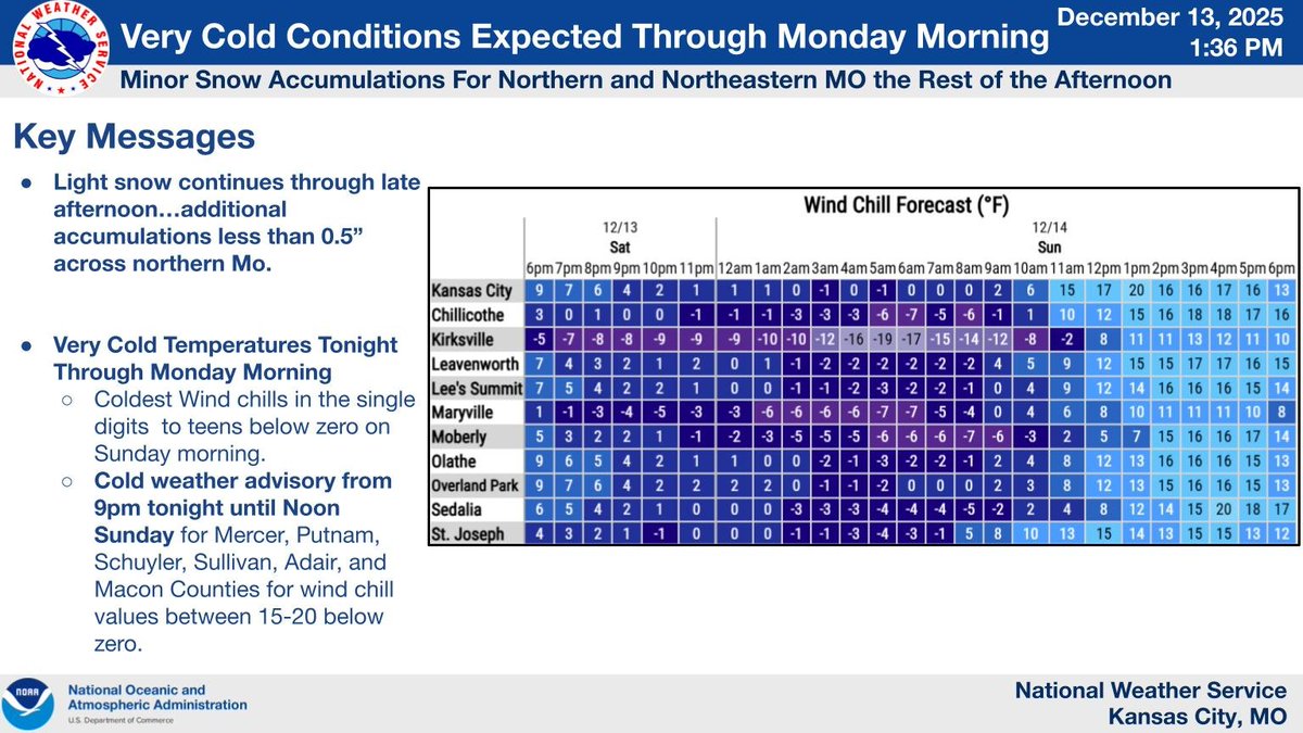
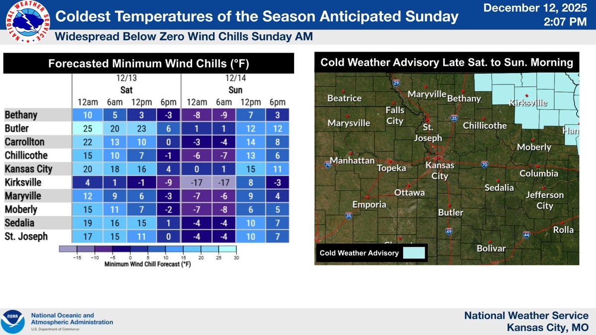
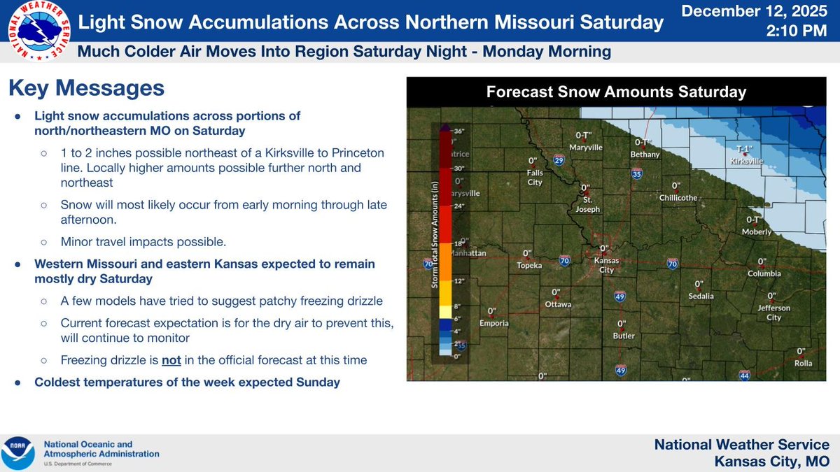
Snow will be winding down this afternoon however, areas across northern Missouri could see an additional half an inch. Tonight very cold conditions will move into the area with wind chill values dropping into the single digits below zero to the teens below zero by Sunday morning.
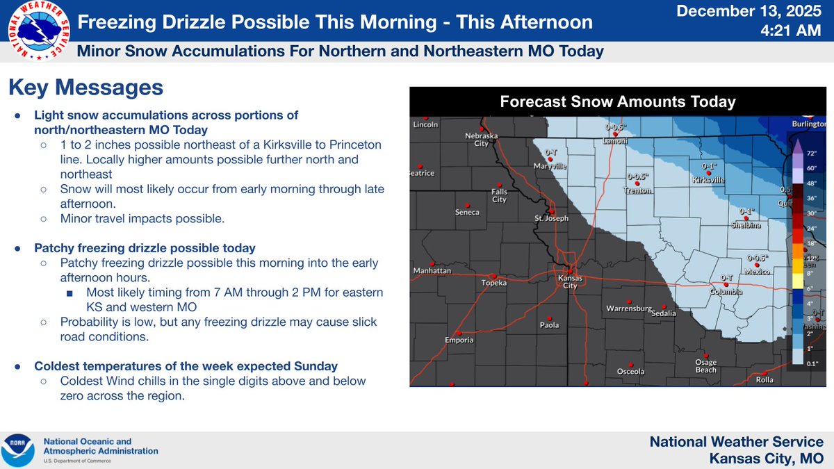
Snow remains on track across northern MO. Patchy freezing drizzle is possible this AM - early PM across eastern KS and western MO, including the KC area. Light freezing drizzle can quickly create slick roads. Use caution if traveling. Bitterly cold Sunday AM.
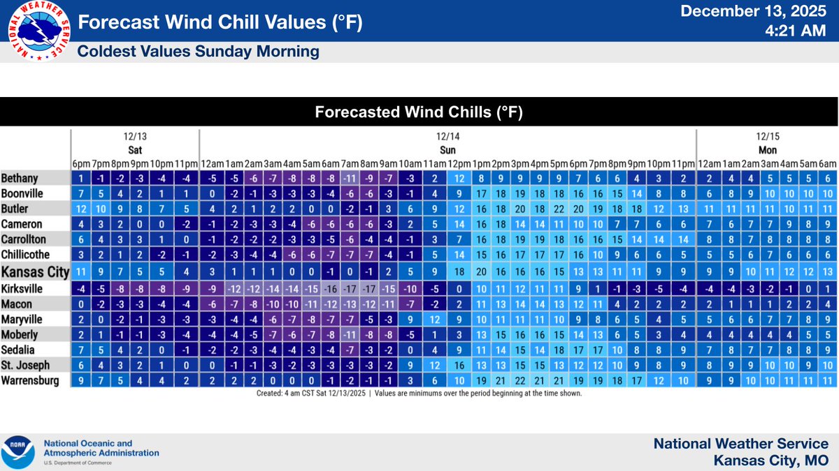
Sunday morning lows will be in the single digits across most locations with wind chill values well below zero across north-central and northeast Missouri.
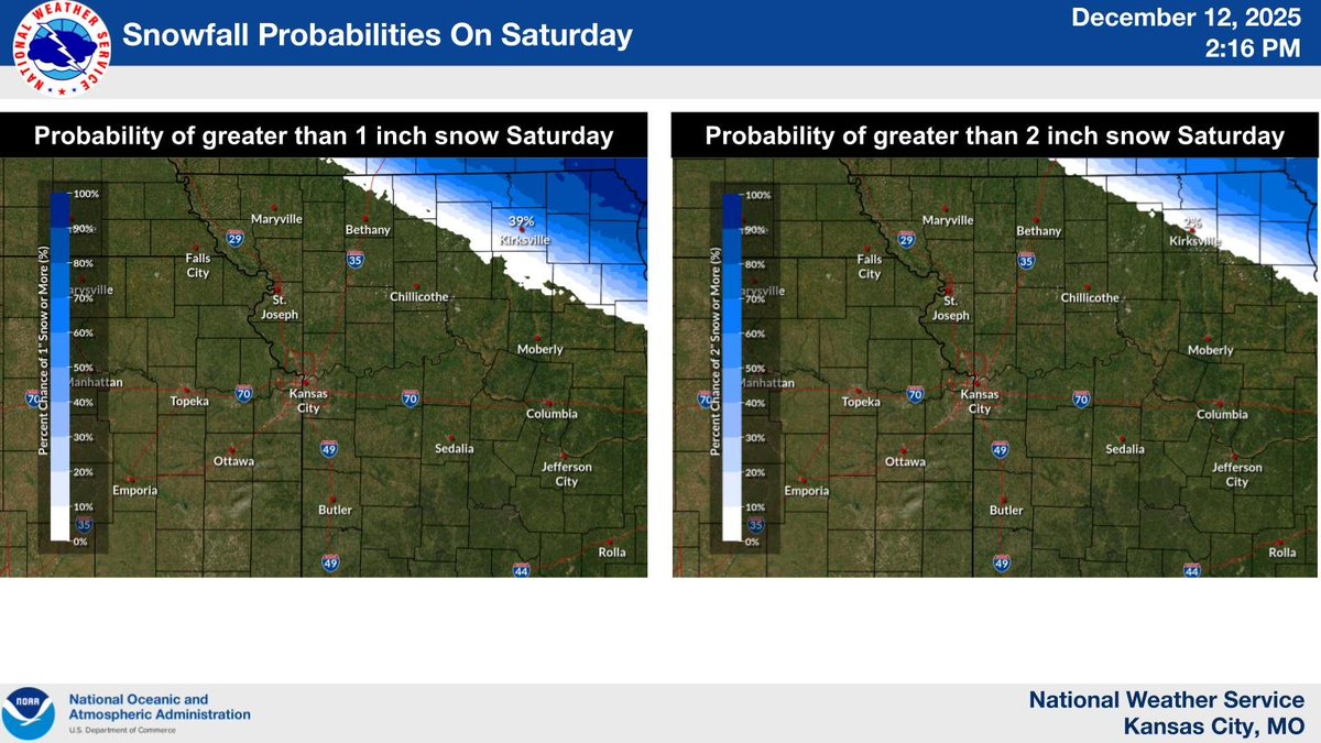
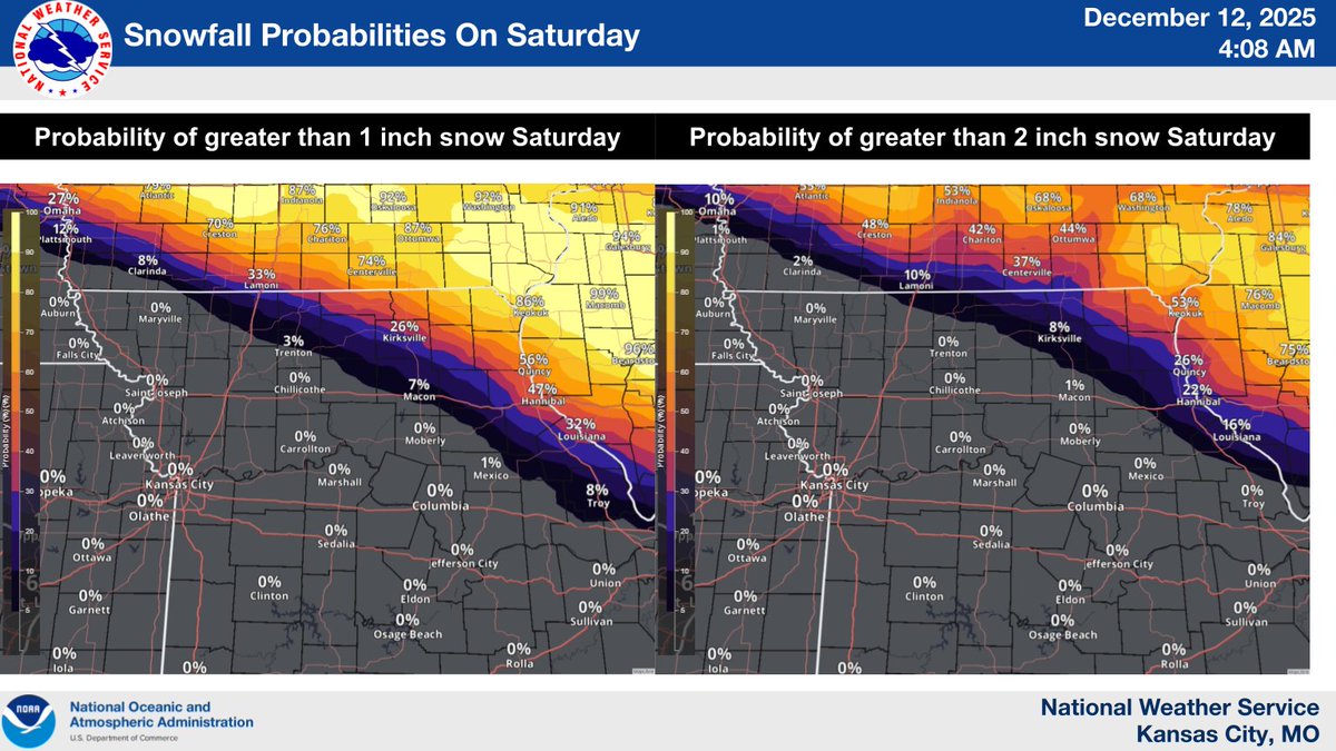
Probabilities for at least one and two inches of snow on Saturday are mainly confined to areas of far northern and northeastern Missouri. We cannot rule out patchy freezing drizzle to the southwest of these areas, but chances for this remain low at this time (less than 20%).
Minor snow accumulations are possible Saturday for far northern to northeastern Missouri. Then, bitterly cold temperatures move into the area Saturday night through Monday morning. Fortunately, temperatures are expected to warm later next week.
Flurries are possible today. Light snow possible for northern/northeastern MO on Saturday. Bitter cold settles in Saturday night–Monday, with subzero wind chills Sunday and values near -20 in northern/northeastern MO. Temps rebound into the 40s and 50s later next week.
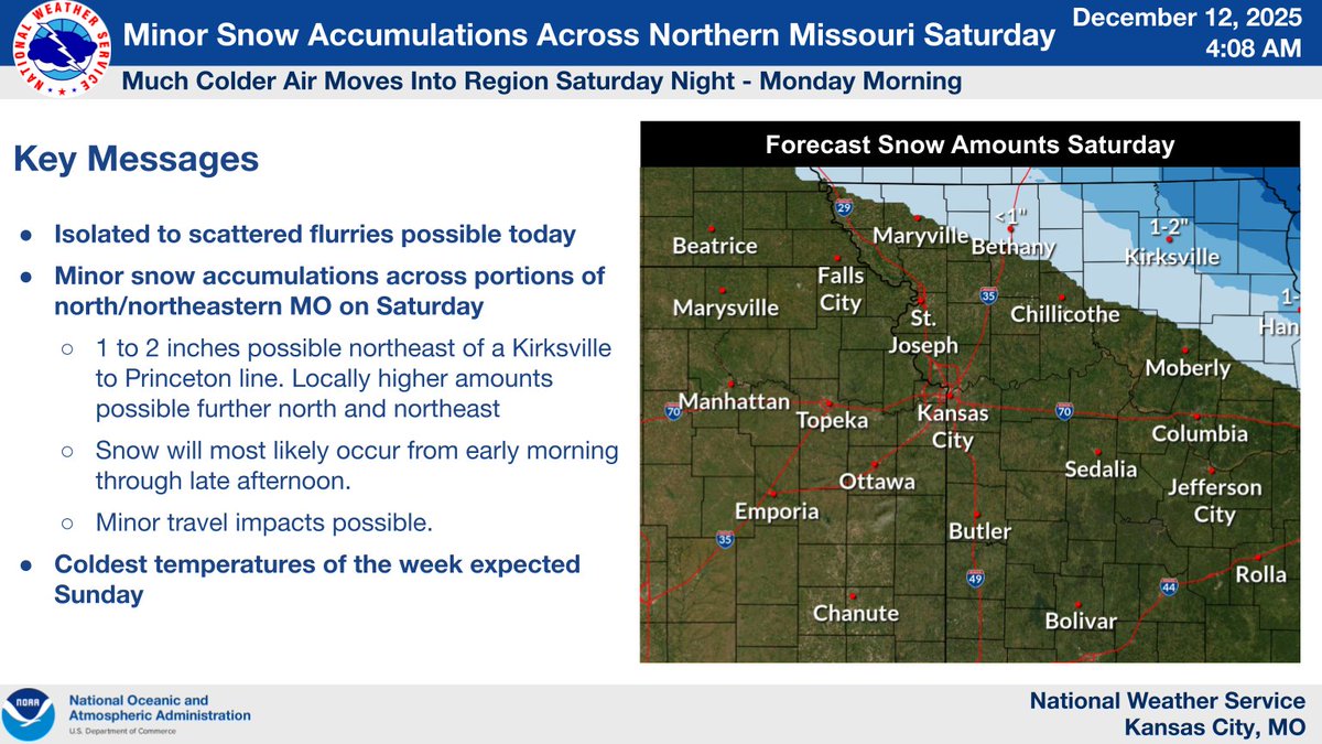

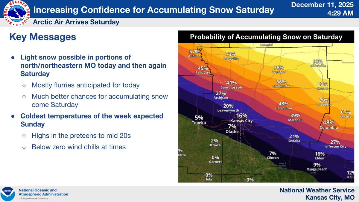
A few chances for light snow for north/northeastern MO today and SAT. Mostly flurries expected today with much better chances for accumulating snow on SAT. Coldest temps of the season expected SUN with highs in the preteens to mid 20s and below zero wind chills at times.
A cold front will produce gusty morning winds ushering in colder air. Temperatures will fall through the day, and winds will slowly subside throughout the day.
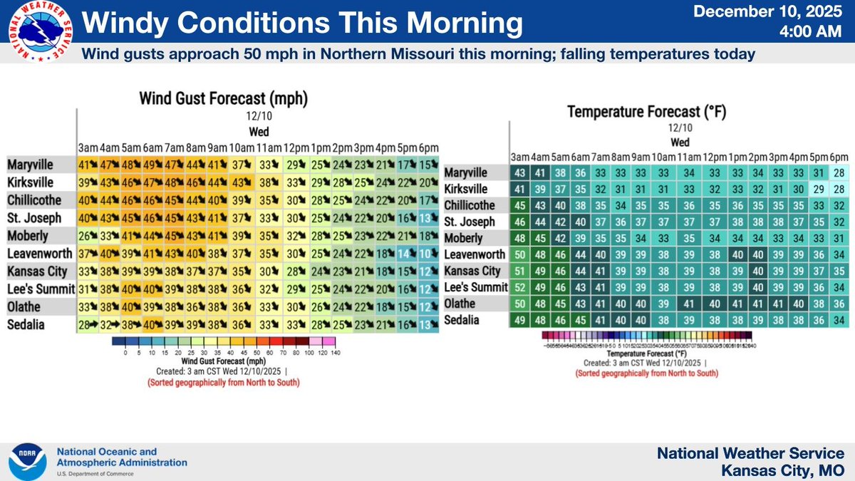
A strong cold front will move through the region late tonight into early Wednesday morning, with wind gusts of 35-45 mph. The strongest winds are expected across northern Missouri and are expected to decrease throughout the day on Wednesday. A Wind Advisory is in effect.

Wind Advisory in effect late tonight into Wednesday morning for northern Missouri. South winds will shift to the northwest while gusting as high as 45 mph!

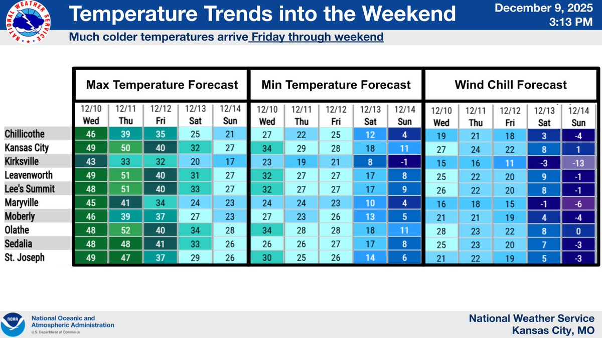
A couple cold fronts will pass through region tonight and again Thursday night into Friday. The late week cold front will bring much colder temperatures with highs in the teens and 20s and wind chill readings dropping into the single digits above and below zero by Sat and Sun.
Breezy southwest winds will propel temperatures well above normal today. A strong cold front will move through the region early Wednesday morning, with wind gusts of 35-50 mph. The strongest winds are expected across northern Missouri, and are expected to decrease during the day.


United States トレンド
- 1. Merry Christmas Eve 49K posts
- 2. Spurs 50K posts
- 3. #Pluribus 21.1K posts
- 4. Rockets 25.1K posts
- 5. Cooper Flagg 12.6K posts
- 6. UNLV 2,603 posts
- 7. Chet 10.5K posts
- 8. SKOL 1,751 posts
- 9. Ime Udoka N/A
- 10. Dillon Brooks 4,898 posts
- 11. Rosetta Stone N/A
- 12. Mavs 6,407 posts
- 13. #PorVida 1,791 posts
- 14. Yellow 60.4K posts
- 15. #VegasBorn N/A
- 16. Kawhi Leonard 1,210 posts
- 17. Randle 2,695 posts
- 18. connor 155K posts
- 19. Logan's Run N/A
- 20. #ClipperNation N/A
おすすめツイート
-
 Gary Lezak
@glezak -
 KMBC
KMBC
@kmbc -
 Kansas City
@KansasCity -
 MoDOT Kansas City
@MoDOT_KC -
 KSHB 41 News
@KSHB41 -
 Mayor Quinton Lucas
@MayorLucasKC -
 Jackson County MO
@JacksonCountyMO -
 The Kansas City Star
@KCStar -
 Kansas City International Airport
@Fly_KansasCity -
 FOX4 News Kansas City
@fox4kc -
 Downtown Kansas City
@godowntownkc -
 KCTV5 News
@KCTV5 -
 Union Station KC
@UnionStationKC -
 Kansas City Zoo & Aquarium
@KansasCityZoo -
 NWS LMRFC
@NWSLMRFC
Something went wrong.
Something went wrong.