
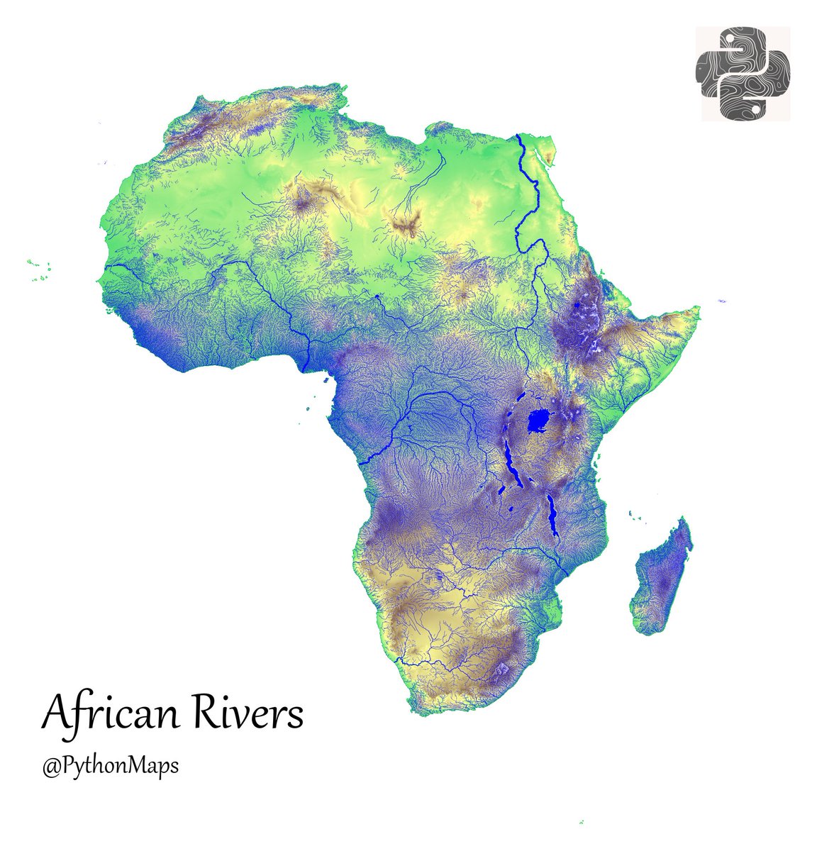
Tbf, I could have used a better colourmap. This makes the Sahara look green 😂


Top 10 Longest Rivers in the World: 1. Nile - 6659 km 2. Amazon - 6575 km 3. Yangtze - 6300 km 4. Mississippi - 6275 5. Yenisei-Angara-Selenge-Ider - 5539 km 6. Yellow - 5464 km 7. Ob-Irtysh - 5410 km 8. Parana - 4880 km 9. Congo - 4700 km 10. Amur - 4480 km

thats super cool mapping rivers with the terrain gives such a unique perspective on geography keep exploring and sharing your insights 🌍✨🗺️


Where did you download the data to make this map? I’d love to train my map plotting skills with some topography data as well :)

United States 趋势
- 1. Good Monday 24.1K posts
- 2. Happy New Month 265K posts
- 3. #MondayMotivation 4,954 posts
- 4. Broncos 48.9K posts
- 5. #CyberMonday 5,701 posts
- 6. Mariota 13.5K posts
- 7. Victory Monday N/A
- 8. #WorldAIDSDay 24.8K posts
- 9. Ertz 3,153 posts
- 10. Bo Nix 10.3K posts
- 11. Root 41K posts
- 12. #RaiseHail 5,860 posts
- 13. Washington 122K posts
- 14. #BaddiesUSA 28.6K posts
- 15. Commanders 34.2K posts
- 16. Chrisean 10.5K posts
- 17. BURKS 16.3K posts
- 18. Deebo 3,162 posts
- 19. Sean Payton 1,697 posts
- 20. Riley Moss 2,317 posts
Loading...
Something went wrong.
Something went wrong.