
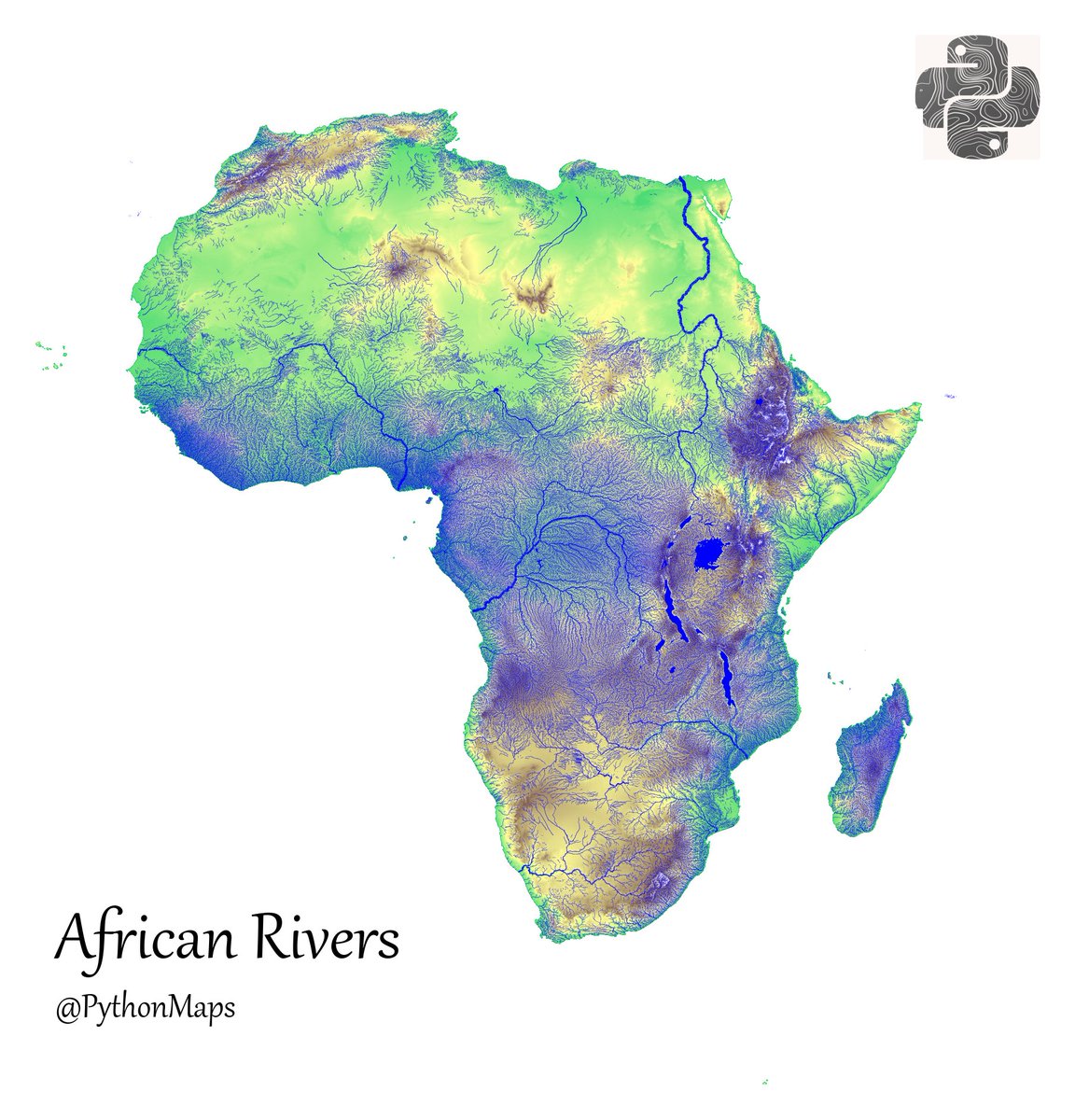
Tbf, I could have used a better colourmap. This makes the Sahara look green 😂


is there another version of the topography one with more intuitive colours
United States 趨勢
- 1. #Fivepillarstoken 1,303 posts
- 2. $TCT 1,659 posts
- 3. Cyber Monday 31.2K posts
- 4. #IDontWantToOverreactBUT N/A
- 5. #MondayMotivation 7,264 posts
- 6. Good Monday 36.6K posts
- 7. TOP CALL 10.6K posts
- 8. Victory Monday N/A
- 9. Alina Habba 9,402 posts
- 10. #MondayVibes 3,123 posts
- 11. Market Focus 2,257 posts
- 12. New Month 396K posts
- 13. Mainz Biomed N/A
- 14. Check Analyze N/A
- 15. Token Signal 2,450 posts
- 16. Clarie 2,639 posts
- 17. #WorldAIDSDay 31.2K posts
- 18. John Denver 1,671 posts
- 19. Rosa Parks 3,031 posts
- 20. Home Is Where the Heart 3,985 posts
Loading...
Something went wrong.
Something went wrong.