
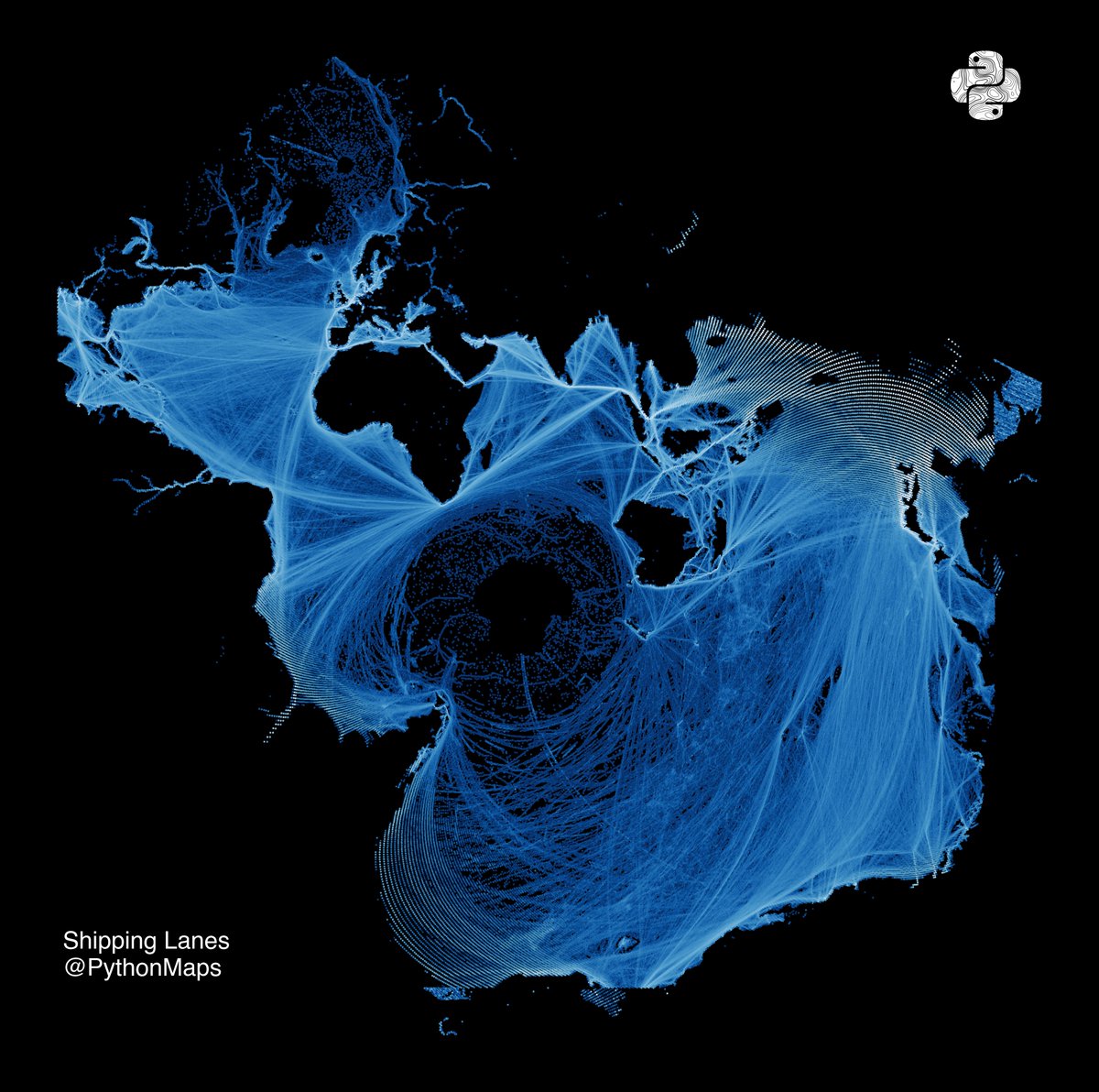
Here is an old favourite. Shipping lanes. This time drawn using the Spilhaus projection, which centers the map on Antartica and presents the worlds oceans as one continuous body. Created by Athelstan F. Spilhaus, a South African-American geophysicist and oceanographer in 1942


Will be nice if South America is less deformed


United States トレンド
- 1. vmin 32.1K posts
- 2. Good Saturday 22.4K posts
- 3. #SaturdayVibes 3,422 posts
- 4. Christmas 119K posts
- 5. Nigeria 482K posts
- 6. Big Noon Kickoff N/A
- 7. Social Security 47.6K posts
- 8. #River 5,498 posts
- 9. New Month 311K posts
- 10. #AllSaintsDay 1,351 posts
- 11. IT'S GAMEDAY 1,864 posts
- 12. seokjin 250K posts
- 13. Chovy 13.8K posts
- 14. #saturdaymorning 1,568 posts
- 15. #SaturdayMotivation 1,200 posts
- 16. VOCAL KING TAEHYUNG 41.1K posts
- 17. GenG 22.6K posts
- 18. Championship Saturday N/A
- 19. Spring Day 61.2K posts
- 20. MEET DAY 11.2K posts
Loading...
Something went wrong.
Something went wrong.