Sensors & Software
@SensorsSoftware
#GroundPenetratingRadar #GPR #GoFarWithGPR
Tal vez te guste


The latest version of EKKO_Project GPR software enables users to draw interpretations right onto GPR depth slices and plot them in 3D to gain more insight into your GPR project. EKKO_Project takes your GPR data from field to final report. #GPR #EKKO_Project #GPRsoftware
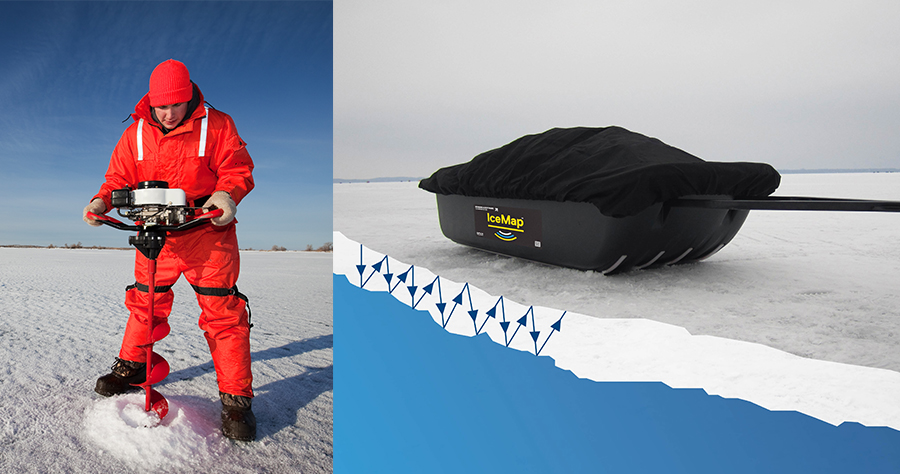
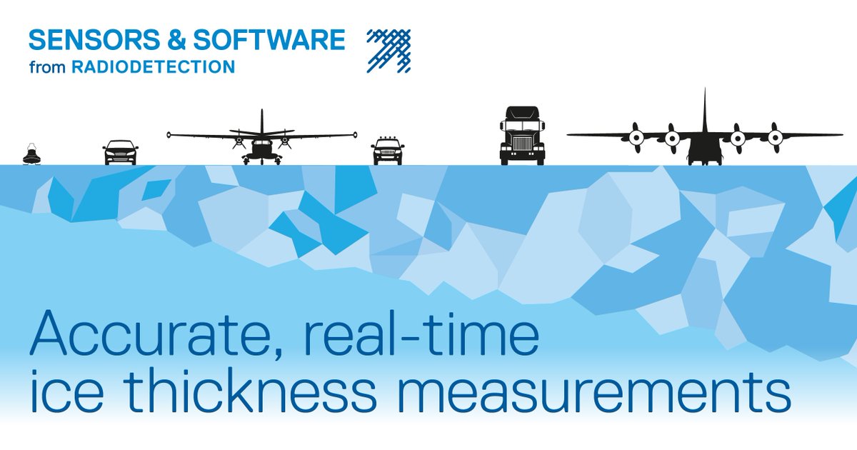
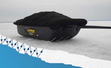
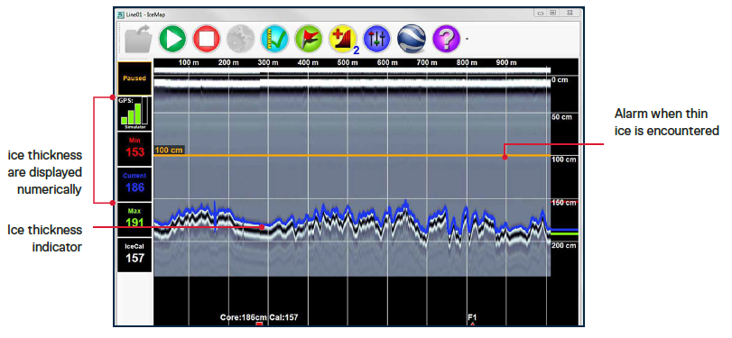
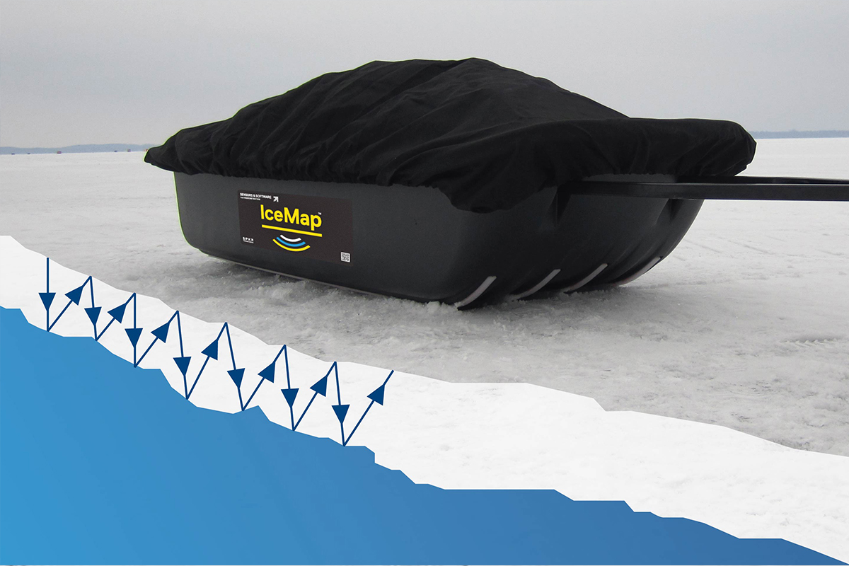
Did you know that ice thickness is crucial for determining how much weight an ice road can safely support? Traditional coring methods might leave thin spots undetected. With IceMap, you can measure ice thickness at intervals as small as 5 cm (2 in). sensoft.ca/products/icema…
The LMX® GPR systems are purpose-built for locating and mapping buried utilities with confidence. Featuring an ultra-wideband antenna, high-visibility touchscreen interface, and Dynamic Target Enhancement (DynaT™), the LMX systems deliver high-resolution data in real time.
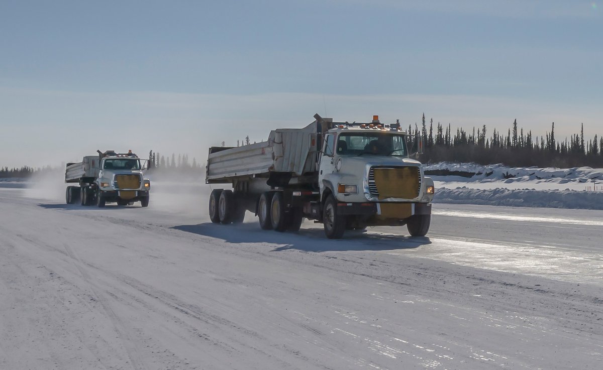
Ice roads and bridges across lakes and rivers play a crucial role in transportation for northern communities. Knowing the thickness of the ice is vital to ensuring safety and determining which vehicles can travel safely. Stay safe on the ice! ❄️ sensoft.ca/products/icema…
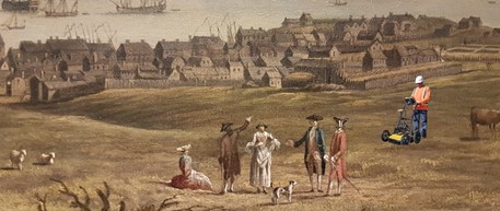
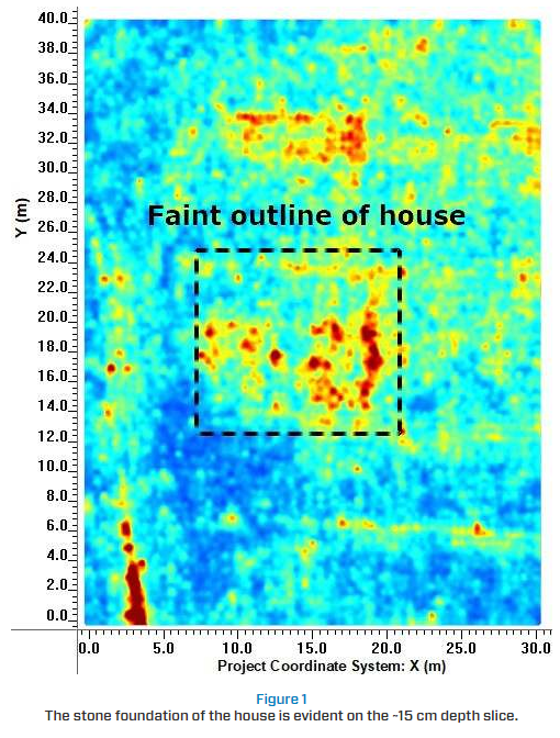
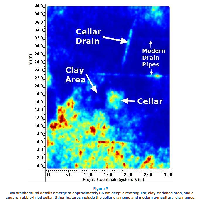
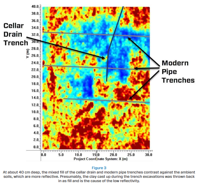
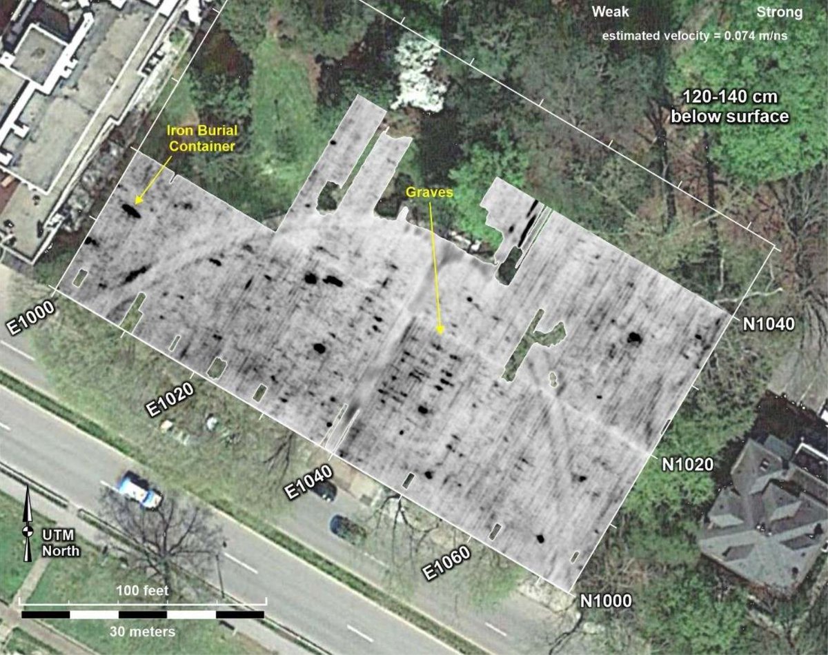
While we typically associate utility locating with modern times, one GPR survey in Nova Scotia has located buried infrastructure from Canada’s early colonial period. sensoft.ca/blog/using-gpr…
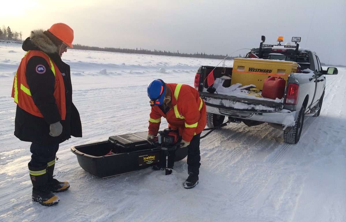
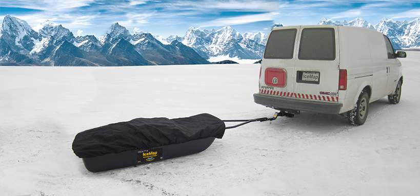
IceMap is a turn-key GPR system designed for real-time, continuous measurement of ice thickness. Engineered for ice road construction and monitoring, IceMap enables operators to quickly identify areas of thin or unsafe ice. 🔗 Learn more: sensoft.ca/products/icema…

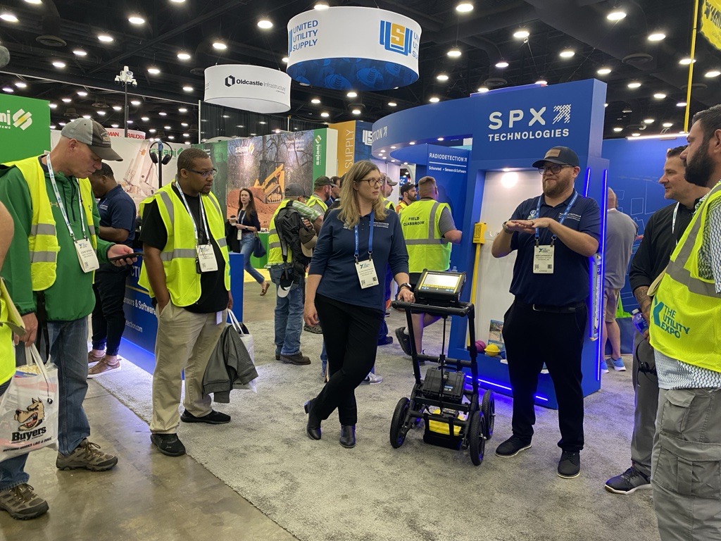
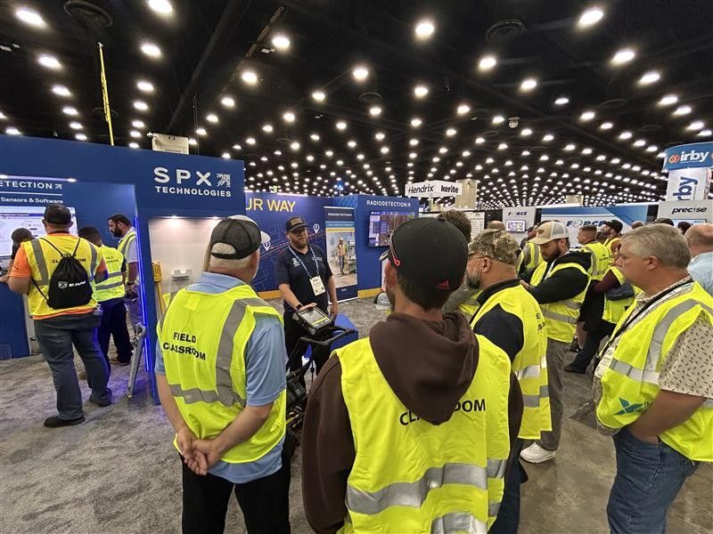
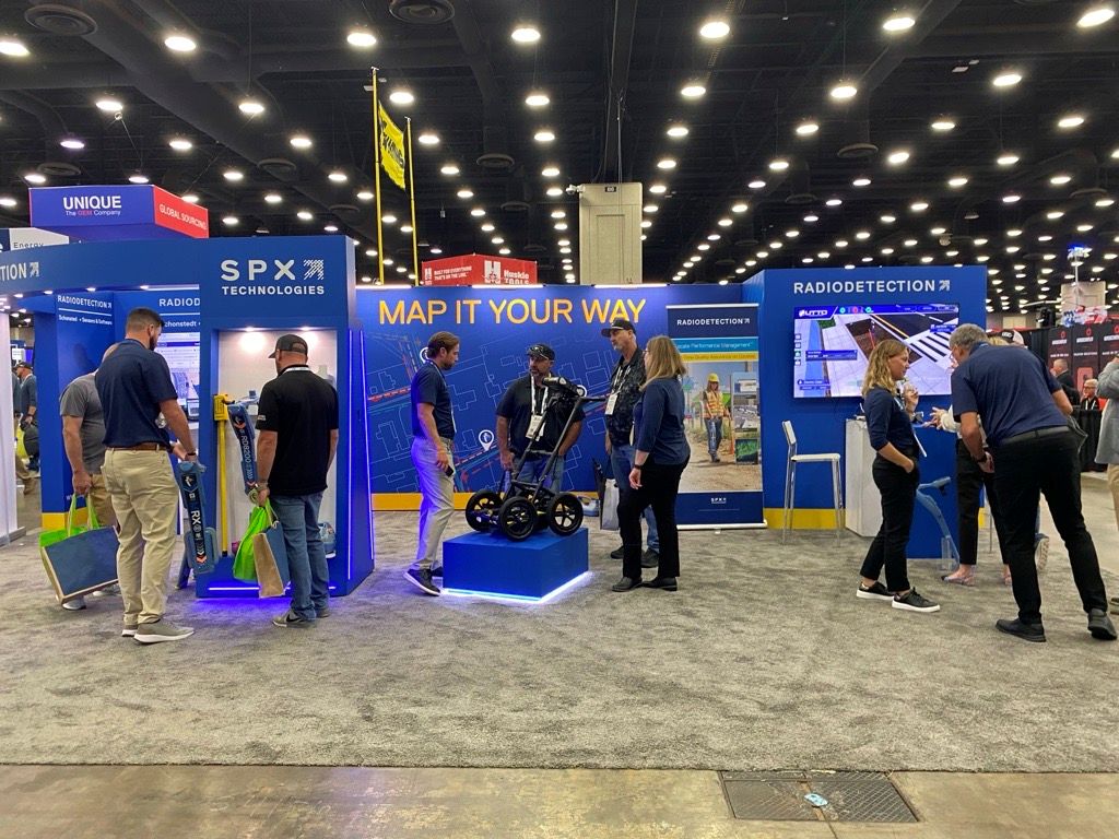
Day 2 at the Utility Expo in Louisville, Kentucky! If you’re at the show, visit booth S4106 to experience Sensors & Software GPR in action. Our GPR gives accurate, real-time data to locate metallic and non-metallic utilities.

The LMX system allows users to apply Soil Cal values to account for variations such as dry sand, wet clay, or concrete, improving the depth accuracy in subsurface surveys. 👉 Learn more about optimizing your results with Soil Cal: sensoft.ca/products/lmx/o…

Visualize. Understand. Report. EKKO_Project is a GPR processing and reporting software that makes powerful GPR analysis simple – giving you more time to interpret the data, extract your insights and drive informed decisions for your project. sensoft.ca/products/ekko-…
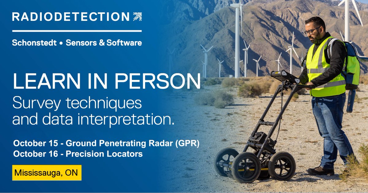
Sign up for an in-person course on Precision Locating and/or GPR for Locating Utilities in Mississauga, ON. Attend this training to learn all aspects of locating, from theory and instrumentation, to survey techniques and data interpretation. sensoftu.com/catalog/index/…
IceMap is a GPR system designed to measure and map ice thickness on winter ice roads. ❄️ By identifying thin or problematic ice areas in real time, IceMap supports safer travel and informed decisions in ice road construction and maintenance. sensoft.ca/products/icema…
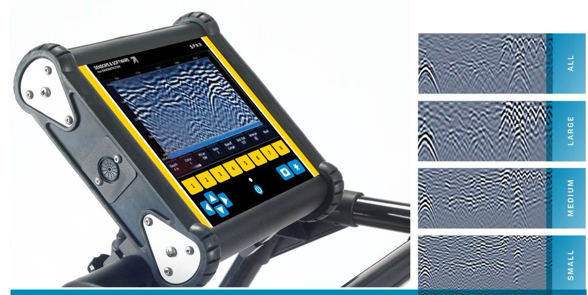
Understanding GPR resolution is essential for maximizing your GPR applications. Dive into our TIPS article to learn more about how resolution impacts target detection and get the most out of your GPR technology! #GPR #GroundPenetratingRadar 👉 Read more: sensoft.ca/blog/understan…

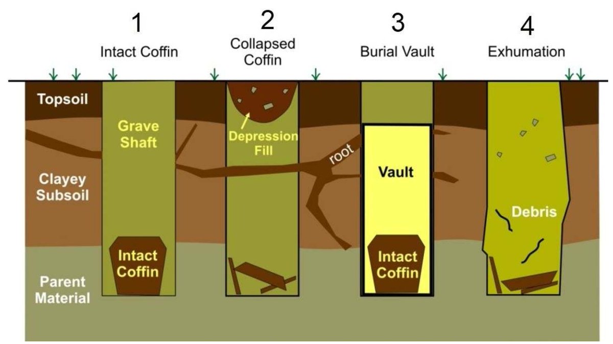
Archaeologists in Charleston, WV, used GPR to identify 207 graves and 41 buried markers at Ruffner Memorial Park. This project demonstrates how GPR supports the preservation of historic sites while strengthening community connections to the past. sensoft.ca/blog/historic-…

Wondering how to accurately measure the true dip angle of a sloping reflector in a GPR cross-section? It might seem tricky, but it's easier than you think. Check out our latest article for a step-by-step guide and discover some common pitfalls to avoid. sensoft.ca/blog/gpr-tips-…

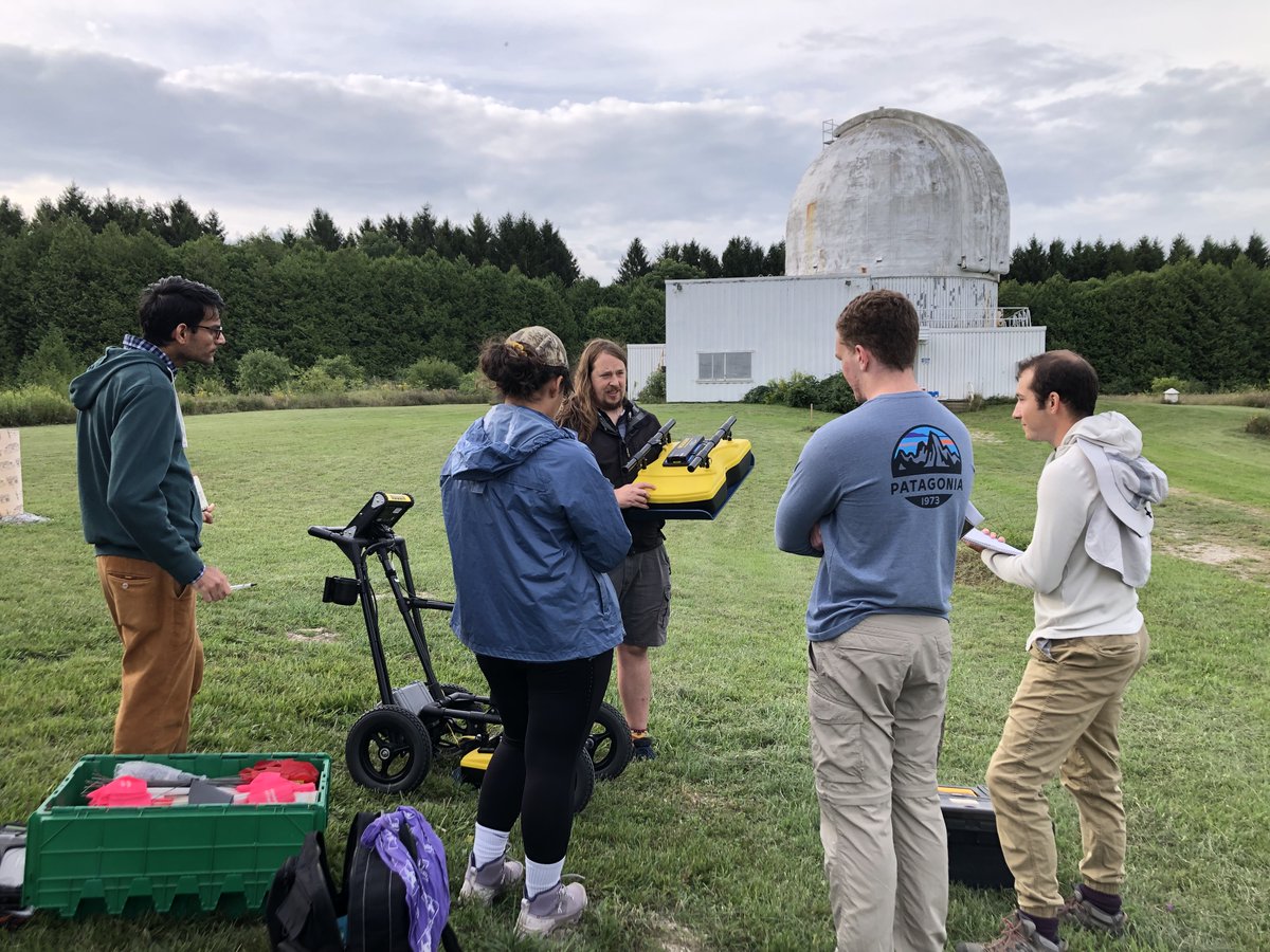
Sensors & Software participated in the 2025 #Western University Geophysics Field School. We assisted the students in using #GPR systems to survey the site to search for subsurface objects and near surface soil stratigraphy. @westernuEarth , uwo.ca/earth


IceMap provides real-time ice thickness measurements, essential information for safe travels on ice roads. ❄️ Learn to operate an IceMap system or refresh your knowledge with our on-demand training course. Sign up now! sensoftu.com/catalog/info/i…
Each winter, the Rideau Canal in Ottawa becomes the world’s largest skating rink, stretching more than 7 km through the city. To help ensure safe conditions for skaters, IceMap™ GPR system has been used to monitor ice thickness in real time. sensoft.ca/blog/icemap-mo…


Sensors & Software is joining Radiodetection at the Water Expo on August 20 and 21 in Miami. We'll be showcasing the LMX. Stop by Booth 919 to meet our team and get a hands-on demo. sensoft.ca/events/the-wat…

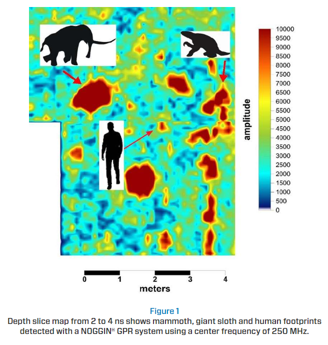
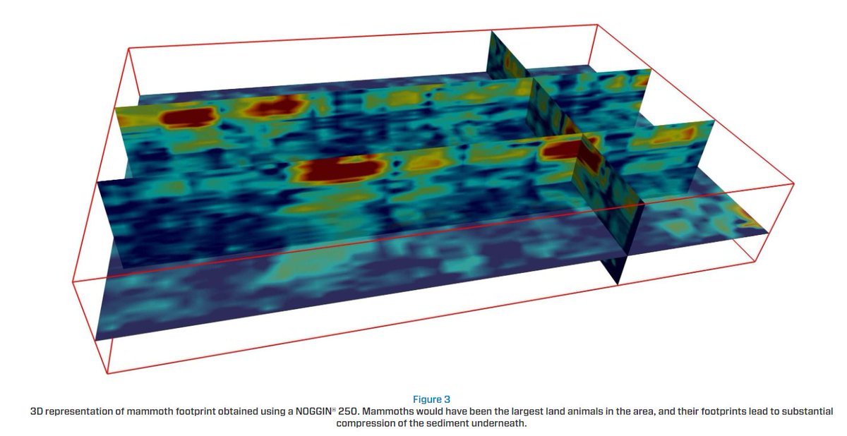
Thanks to new research using ground penetrating radar, we can now see footprints that tell a story of life long gone in White Sands National Monument! 👉 Dive into the findings by T. M. Urban et al. sensoft.ca/blog/gpr-detec…


🌍✨ Discover the power of NOGGIN GPR systems! With four center frequencies and five standard configurations, our versatile GPR solutions are perfect for any environment and application. 👉 Learn more: sensoft.ca/products/noggi…


United States Tendencias
- 1. Cheney 78.7K posts
- 2. Sedition 151K posts
- 3. First Take 45.7K posts
- 4. Seditious 83.1K posts
- 5. Jeanie 1,759 posts
- 6. Mark Walter 1,301 posts
- 7. Seager N/A
- 8. Constitution 107K posts
- 9. Lamelo 3,883 posts
- 10. Commander in Chief 48.3K posts
- 11. Elon Musk 276K posts
- 12. Cam Newton 4,120 posts
- 13. Trump and Vance 35.7K posts
- 14. Coast Guard 20.2K posts
- 15. Shayy 12.8K posts
- 16. UNLAWFUL 72.8K posts
- 17. #WeekndTourLeaks 1,446 posts
- 18. Nano Banana Pro 23K posts
- 19. UCMJ 9,555 posts
- 20. Dameon Pierce N/A


Something went wrong.
Something went wrong.