
You might like


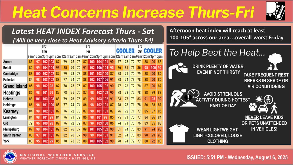
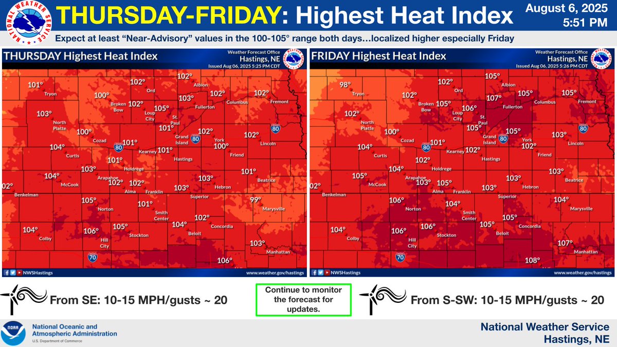
THURS-FRI Heat: Afternoon heat index values will be at least 100-105° both days (overall slightly worse Friday), putting us right on the brink of possible Heat Advisory issuance. Whether or not Advisories are issued, please take any necessary heat-related precautions. #NEwx #KSwx
Strong to severe storms will likely impact the area tomorrow afternoon and night, capable of producing 60 MPH gusts and up to ping pong sized hail. There is some uncertainty in regards to where storms will initiate. The overall best chances lie towards the southeast of the area.

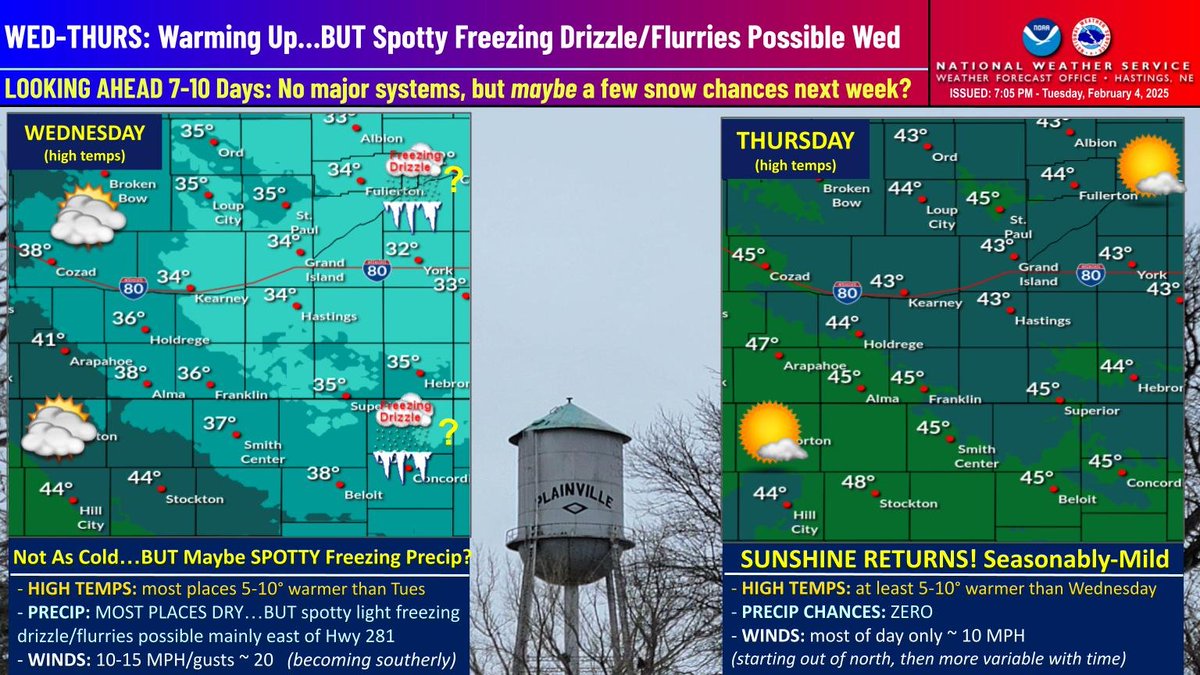
WED-THURS Focus: 1) The good news: temps will gradually warm and widespread sunshine returns Thurs...2) The bad news: Although we are not expecting it be a major concern, spotty light freezing drizzle cannot be ruled out Wed AM...especially counties east of Hwy 281. #NEwx #KSwx
Dry through mid-week, with increasing precipitation chances Thursday on into the weekend. Elevated fire weather concerns continue Monday afternoon with warmer temps & gusty west winds. Tuesday looking to have highs in the 50s area-wide. #newx #kswx

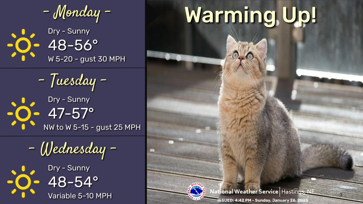
Warmer temperatures are expected Monday through Wednesday with highs in the 40s and 50s. Near critical fire weather conditions are expected on Monday as winds increase out of the west with gusts up to 25-30 mph. #newx #kswx
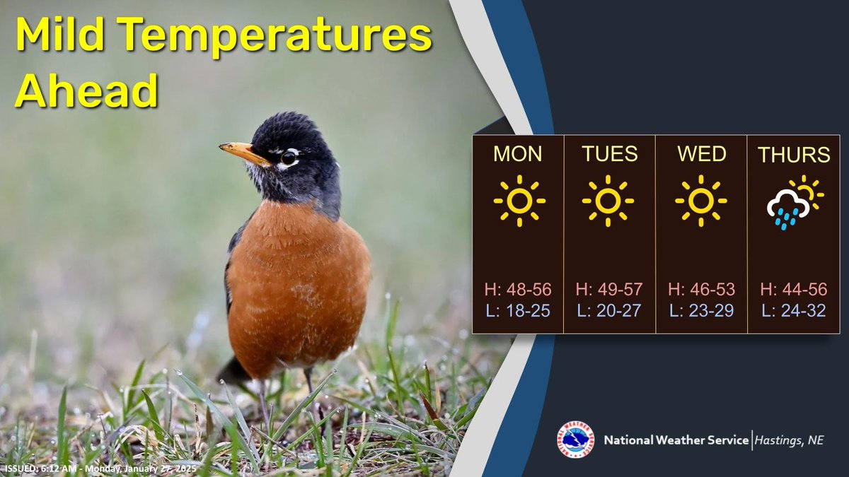
Spring-like temperatures are expected for much of the week, with high temperatures in the 40s and 50s. Chances for precipitation, mainly in the form of rain, return to the area on Thursday. #kswx #newx
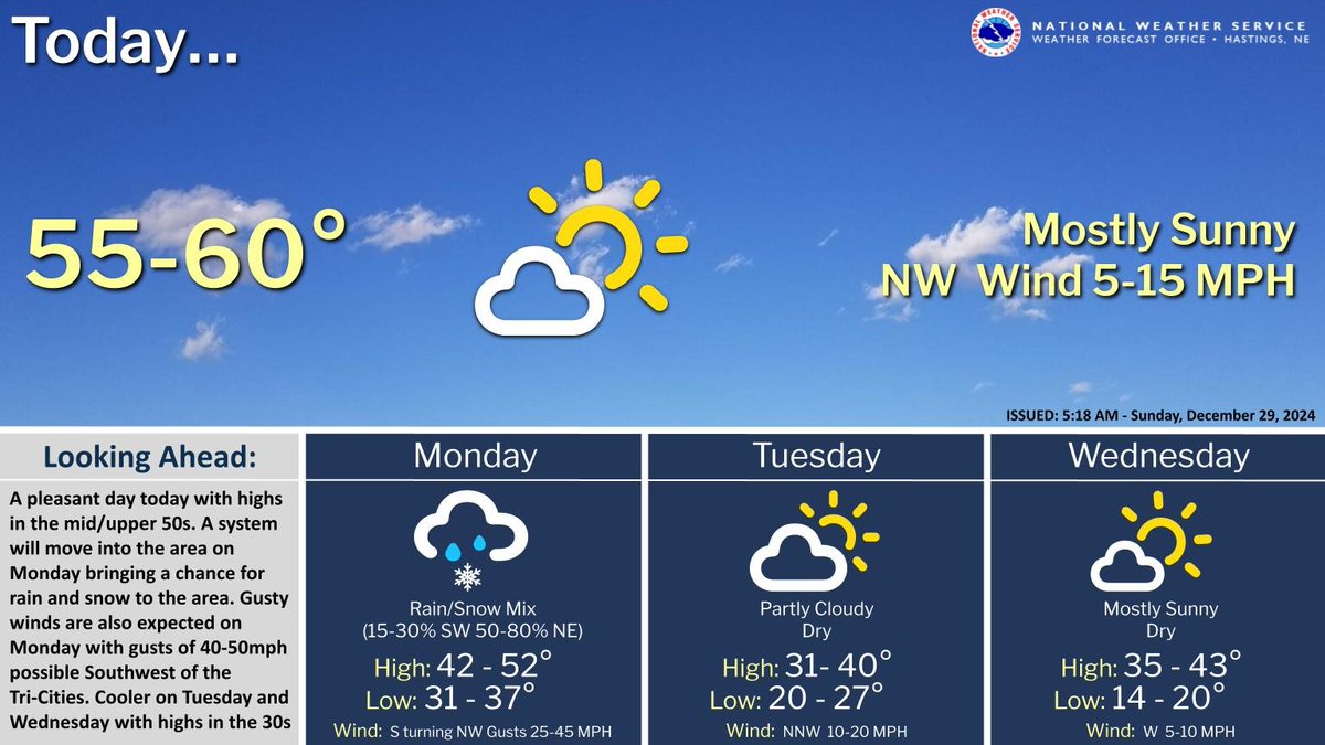
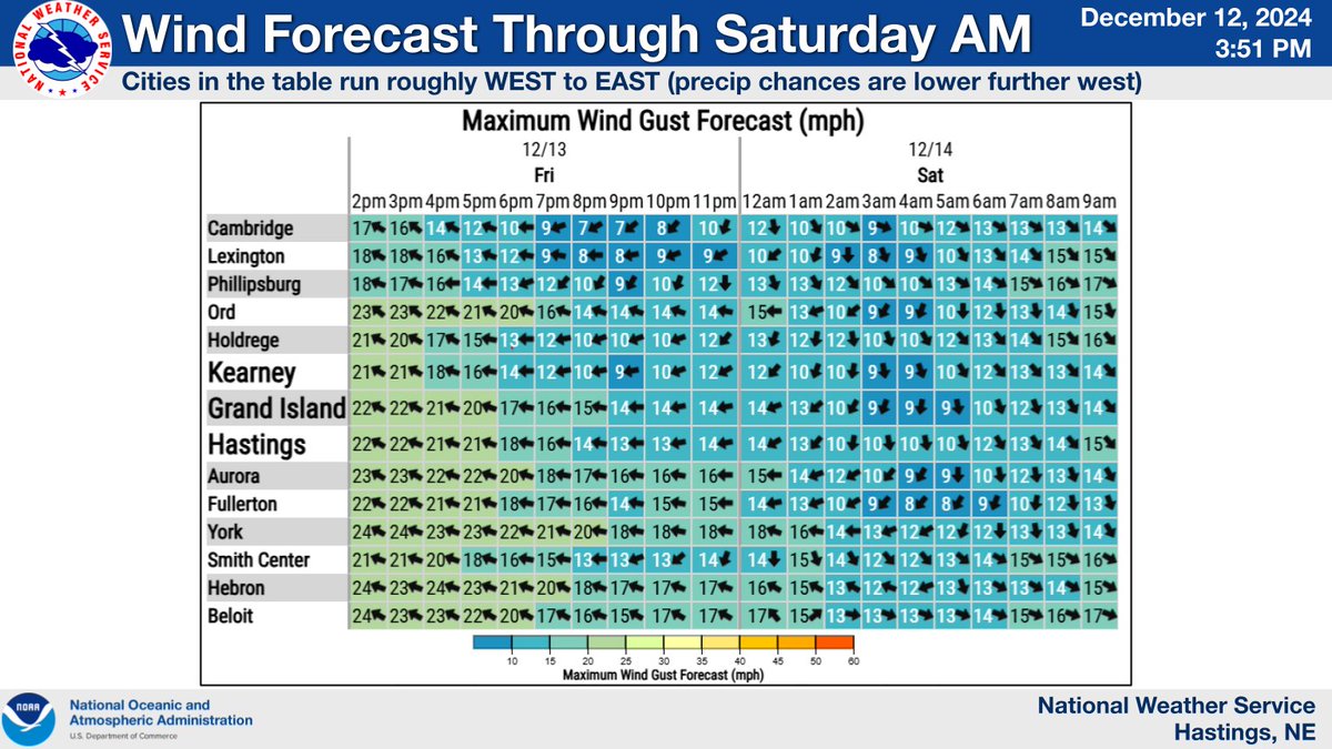
Another nice day is expected today, with highs in the mid to upper 50s. Rain will transition to snow Monday evening with accumulations generally under an inch. Gusty winds are also expected on Monday with gusts of 35-50mph possible southwest of the Tri-Cities. #NEwx #KSwx
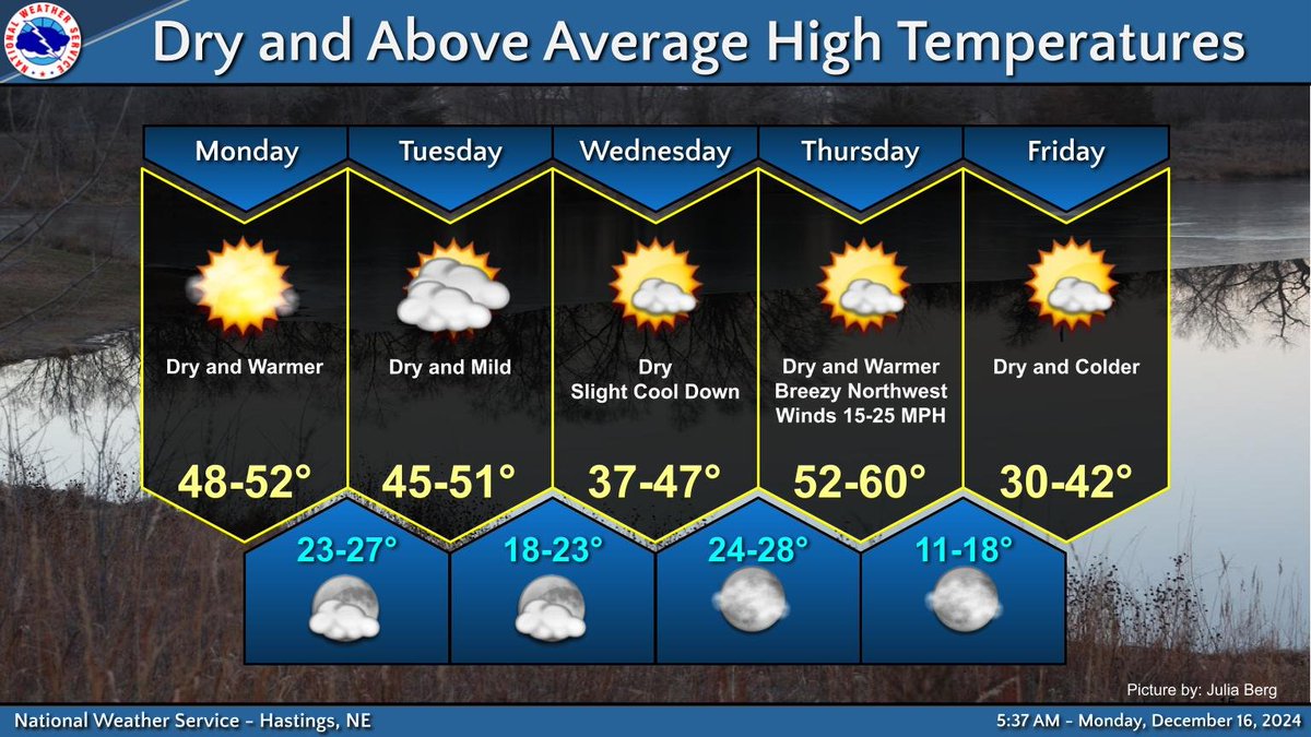
We expect dry conditions with above normal temperatures through at least Thursday. At this point a white Christmas seems rather unlikely with very little chance (<5%) of a winter storm system on the horizon before Christmas Day. #newx #kswx
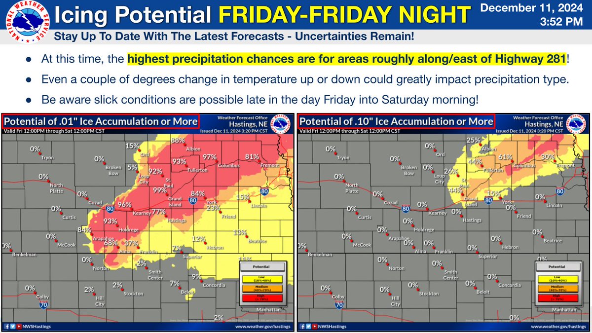
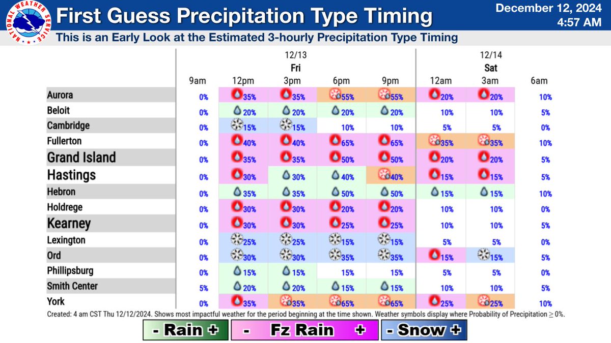
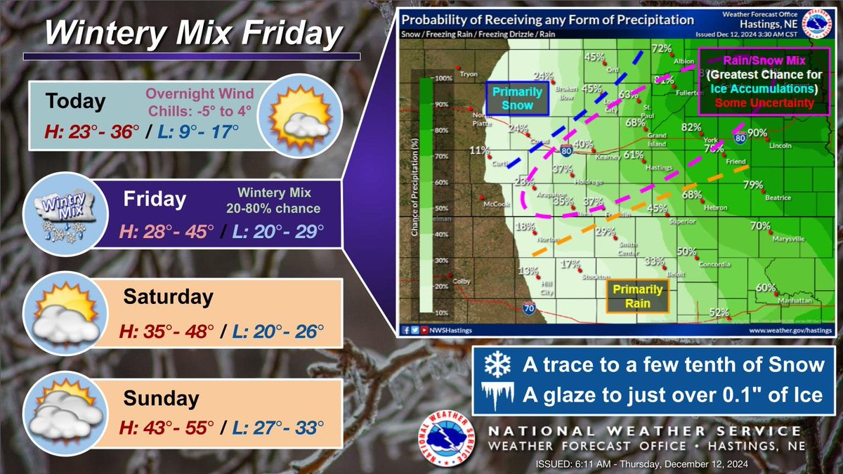
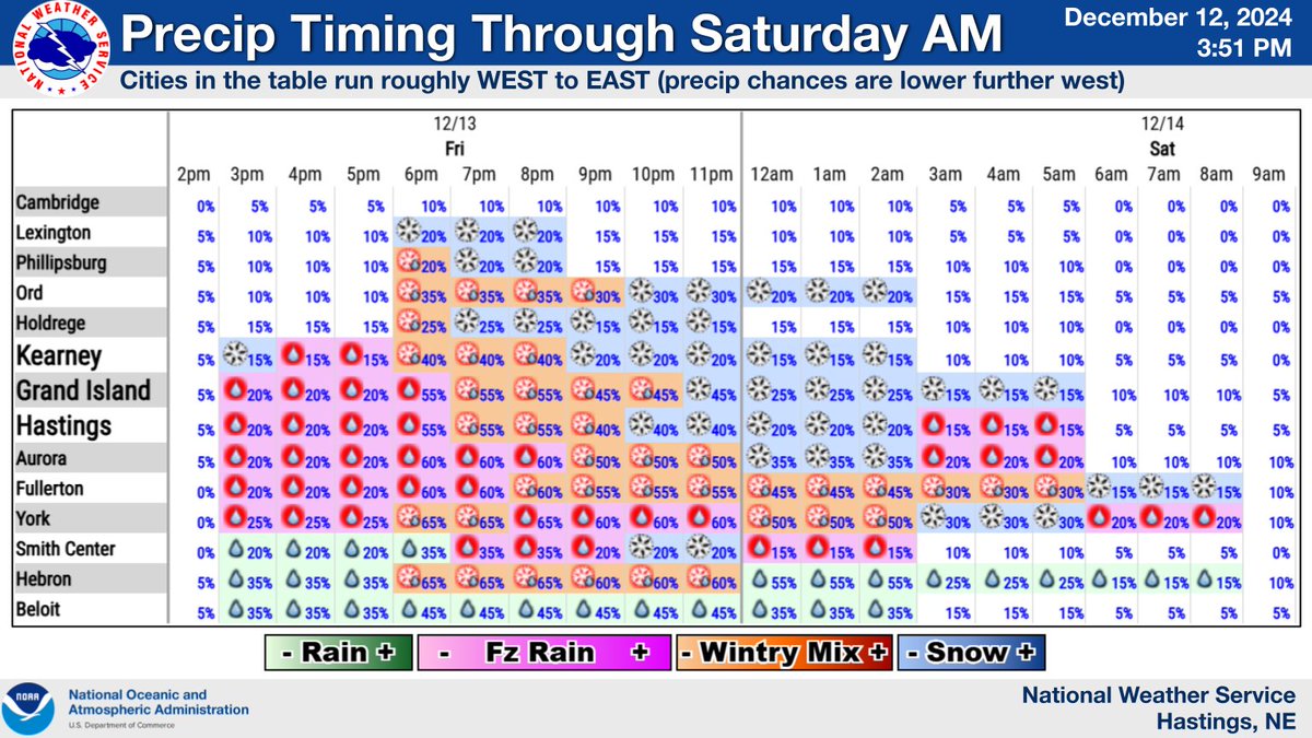
Wintry precip (including freezing drizzle/rain) remains a possibility Friday afternoon-night, with some ice accumulation not out of the question! Best precip chances are mainly along/east of Highway 281. Uncertainties remain-stay up to date with the latest forecast! #newx #kswx
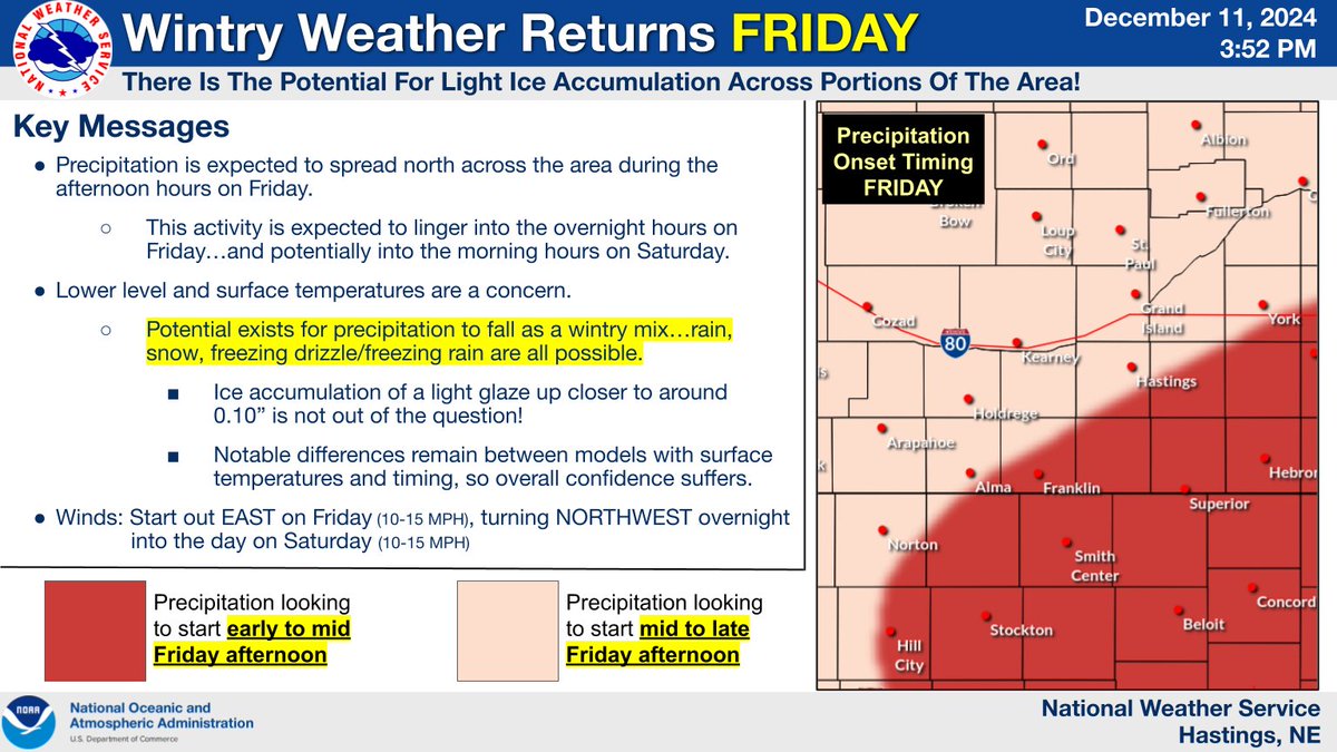
Dry tonight. Partly cloudy. Lows: 14-21. Thur highs: 24-36. Dry. Clouds clearing. E winds 10 mph. Chances for wintry mix Friday afternoon into Sat AM. Be prepared for possibly slick road conditions. Stay up to date with the forecast for Friday/Saturday. #NEwx #KSwx

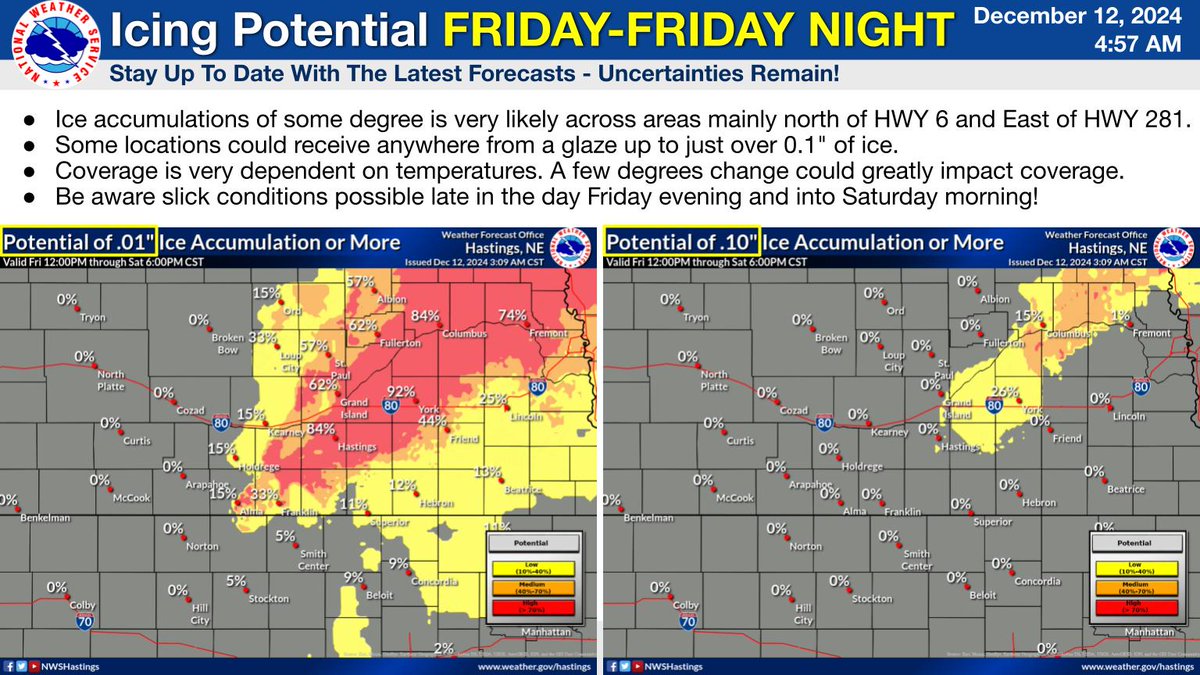
A system passing through the area Friday afternoon will impact parts of the area, bringing a chance for all precipitation types (Rain/Snow/Freezing Rain/Freezing Drizzle). Their is a potential for up to just over 0.1" of ice for areas mainly north of HWY 6 and east of HWY 281.
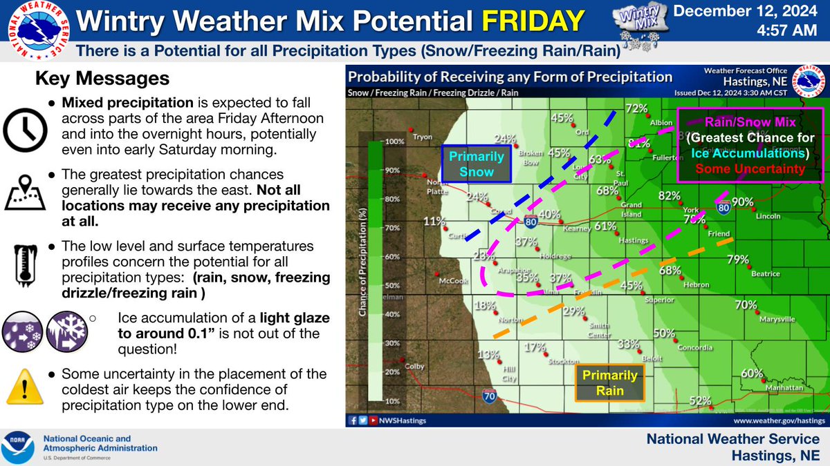
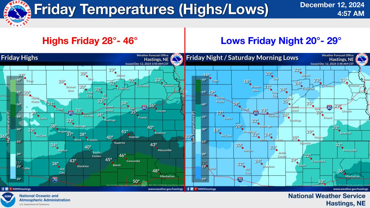
A chilly next two days with the coolest temperatures concentrated towards the north and east. Wind chills overnight tonight could drop as low as -5 to 4 degrees. All forms of precipitation could be possible (rain/snow/ice) Friday followed by a warm up over the weekend. #NEWX#KSWX
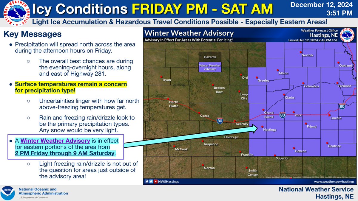
A Winter Weather Advisory has been issued for portions of south central Nebraska along/east of Highway 281, where best potential for light icing exists. Prepare for slick conditions as the afternoon passes on Friday into the evening/overnight hours! #newx #kswx

The average temperature on Monday was 30.5 degrees at Grand Island. Which makes today the coldest day we've seen in almost 8 months. Winter is coming! #NEwx

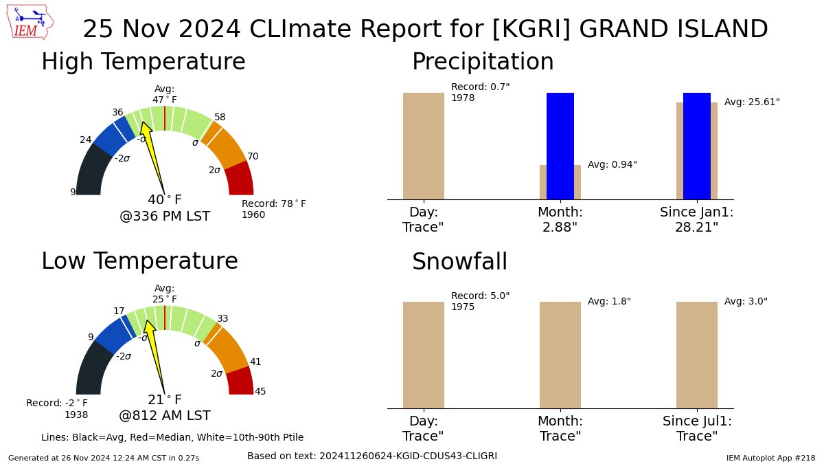
GRAND ISLAND NE Nov 25 Climate: High: 40 Low: 21 Precip: Trace Snow: Trace Snow Depth: 0" mesonet.agron.iastate.edu/p.php?pid=2024…
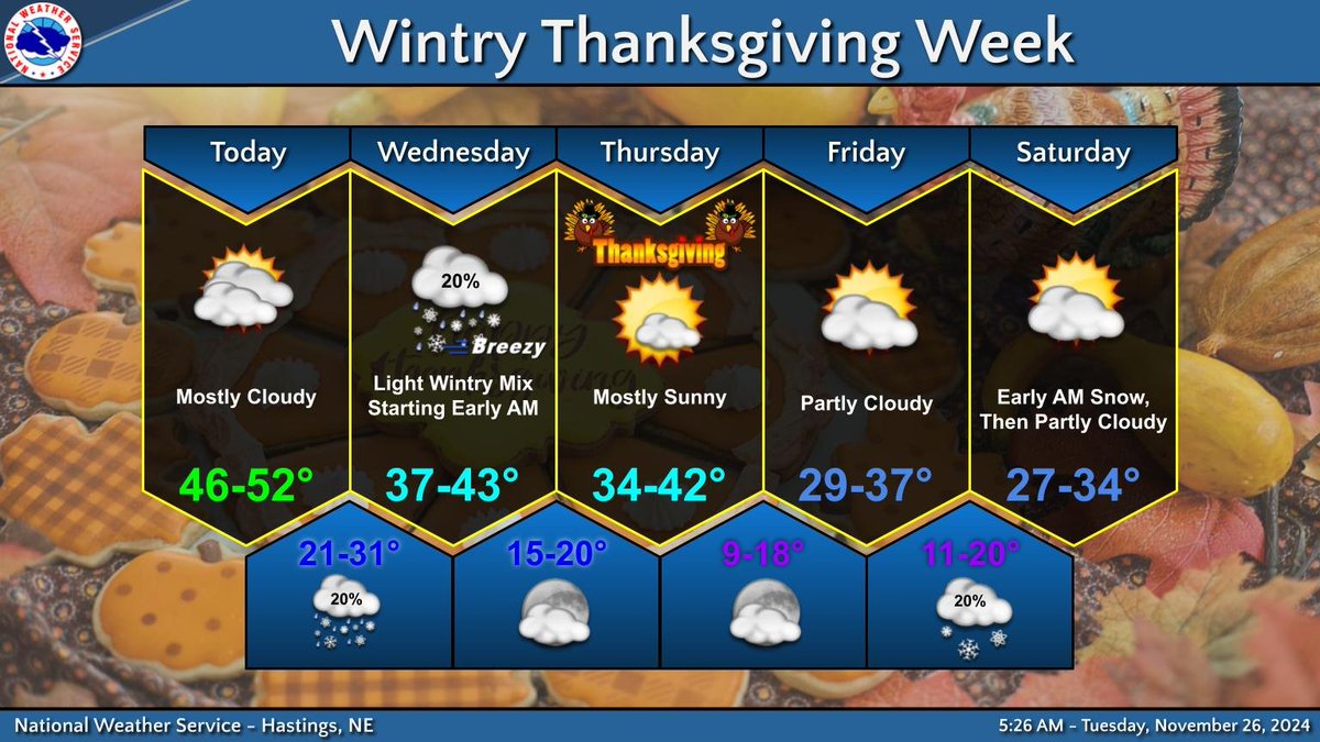
Snow on Thanksgiving isn't common in central #NEwx and northern #KSwx, but it happens occasionally. Some light wintry precipitation is possible tonight into Wednesday, but is unlikely to be anything measurable.
Light snow, possibly mixed with light rain and/or freezing rain moves through the area late tonight through Wednesday. Thanksgiving Day should remain dry and cool. Even colder air arrives for the weekend, along with another chance for light snow. #NEwx #KSwx
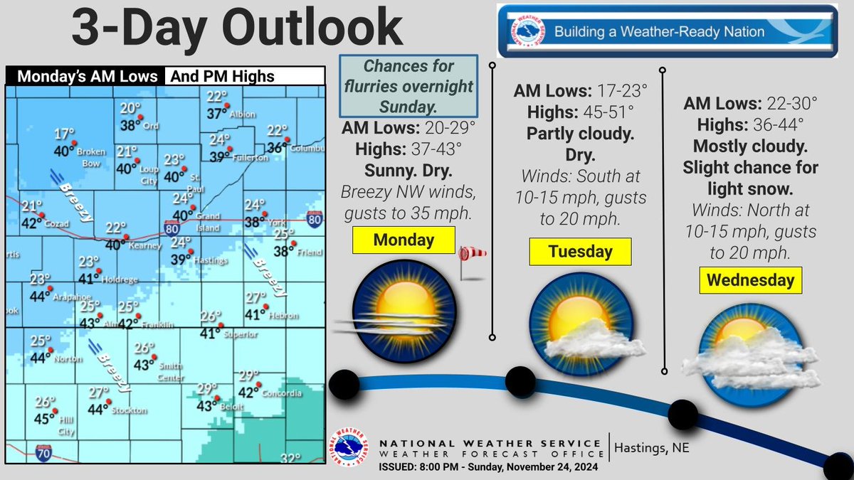
Slight chances for snow flurries overnight. Brisk Monday. Highs: Upper 30s - lower 40s. NW winds 10-20 mph, gusts to 35 mph. Dry conditions. Mostly sunny skies. Tue highs: 45-51. Dry. Partly cloudy. S winds gust to 20 mph. Wed highs: 36-44. Light snow chances. #NEwx #KSwx
After a mostly dry weekend, rain returns to the area on Monday. Heaviest rain totals favor eastern parts of the area. No snow is expected. #NEwx #KSwx
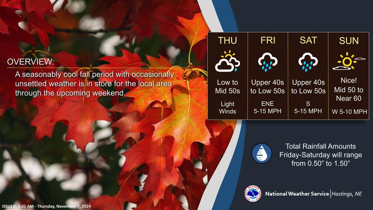
A seasonably cool and occasionally unsettled period of weather the next few days. Best chance for widespread/beneficial rainfall Friday PM through Saturday AM. Nicer by Sunday! #NEwx #KSwx


United States Trends
- 1. HARRY STYLES 21K posts
- 2. Clemson 3,791 posts
- 3. WE BELONG TOGETHER N/A
- 4. Wirtz 39.8K posts
- 5. Minnesota 731K posts
- 6. Gyokeres 11.6K posts
- 7. Saka 37.1K posts
- 8. #NightOfTheSamurai 17K posts
- 9. #ARSBHA 5,676 posts
- 10. Inoue 20.9K posts
- 11. Martinelli 5,608 posts
- 12. Elder Holland N/A
- 13. Odegaard 9,763 posts
- 14. Raya 17.6K posts
- 15. Pinstripe Bowl 1,668 posts
- 16. Brighton 34.4K posts
- 17. Tim Walz 232K posts
- 18. Yankee Stadium N/A
- 19. Arteta 14.2K posts
- 20. #LIVWOL 13.8K posts
You might like

Something went wrong.
Something went wrong.