#kswx search results


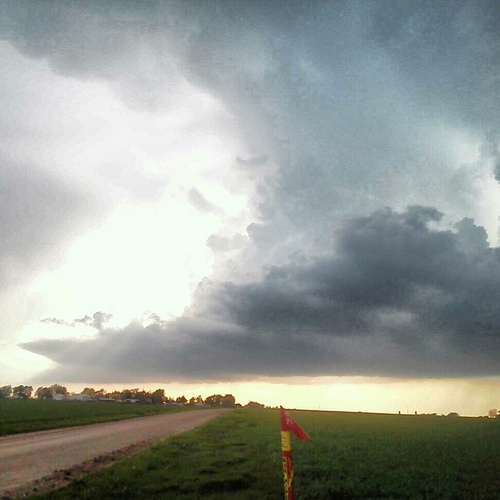
We likely watched a tornado cross K-7 on Monday night It was a classic supercell with a clear “beaver tail” feeder band pulling in warm, moist air. #kswx #kcwx

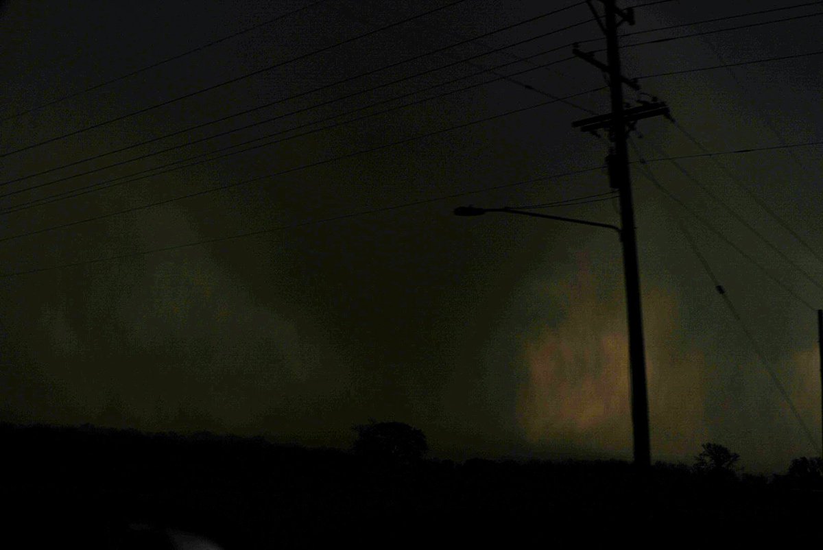
Rainwrapped tornado in progress just south of Spring Hill, Kansas. Numerous power flashes observed with this as well. #kswx

I was honestly amazed by this… Clinton, Missouri avoided the worst of the two tornadoes that moved through A lot of the damage paths missed residential areas. Just how close things can be. Thinking of those recovering this week #mowx #kswx #kcwx


Pretty remarkable signal this far out for a significant severe weather event taking place across the Plains on Sunday. Thinking a 30% contour is likely warranted in the next outlook cycle. #severewx #okwx #kswx
8:47pm CDT #SPC_Watch WW 132 SEVERE TSTM AR KS MO OK 180145Z - 180700Z, #arwx #kswx #mowx #okwx, spc.noaa.gov/products/watch…


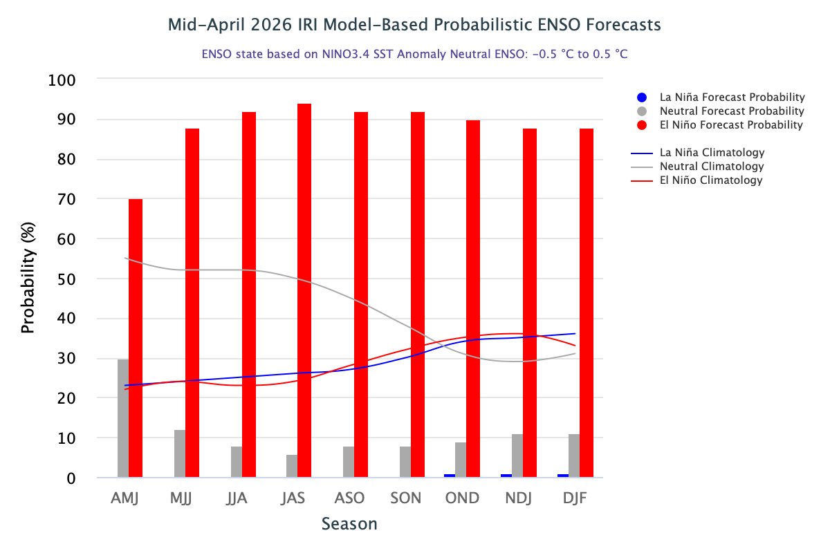
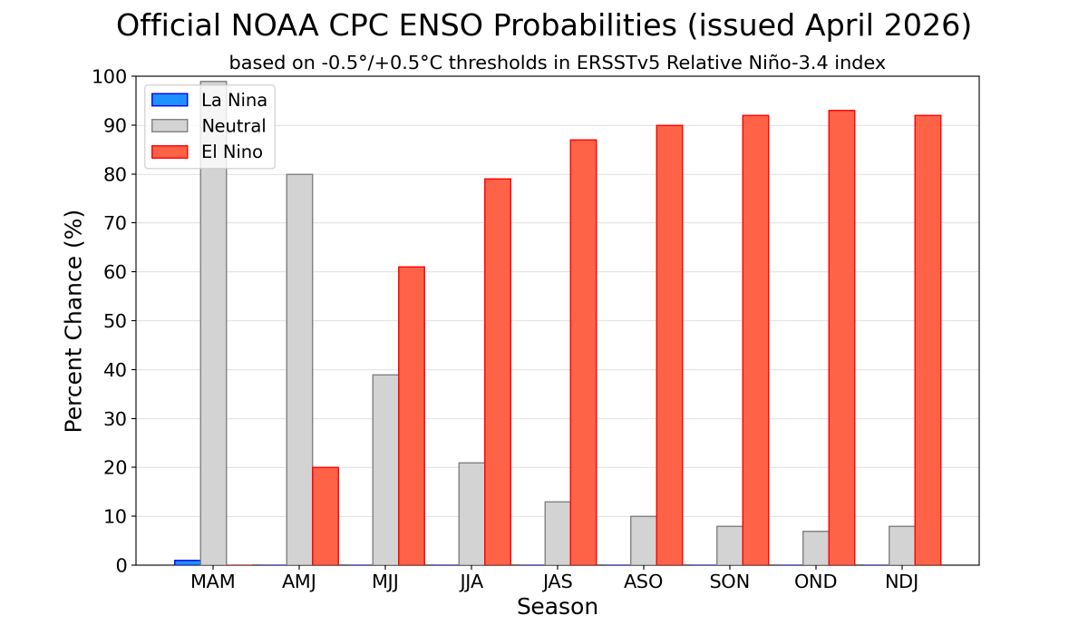
April update from the IRI model, show El Niño probability for April/May/June hitting 70%. April update from the CPC shows it to be 20%. Again, discuss amongst yourselves...you know my opinion. It's already here and CPC is always playing catch up #desertfarmers #cowx #kswx #newx

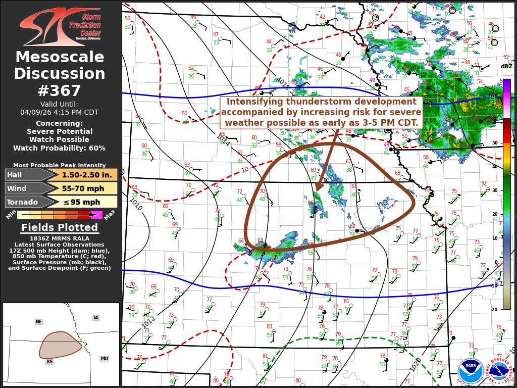
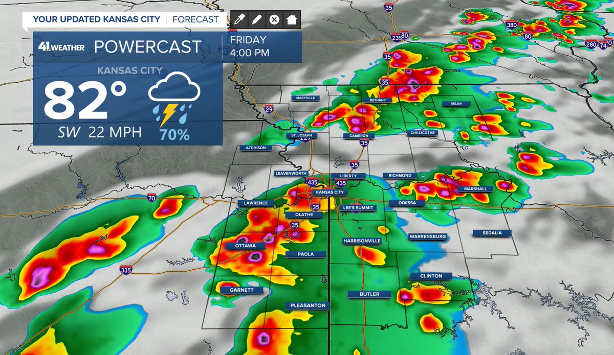
|RRFS A Radar // Thursday Night-Early Friday| A intense line of storms along cold front is possible late Thursday night/early Friday across Eastern KS/Western MO. Occasional very large hail 1.5" diameter & 70mph wind gusts possible. I'll monitor trends. @NWSSPC #kswx #mowx

This evening at 6pm we will be presenting our virtual advanced spotter presentation. This presentation is open to any weather enthusiast who is looking to learn more of the science behind severe storm forecasting. Talk can be viewed here: stream.meet.google.com/stream/440c5ac… #kswx

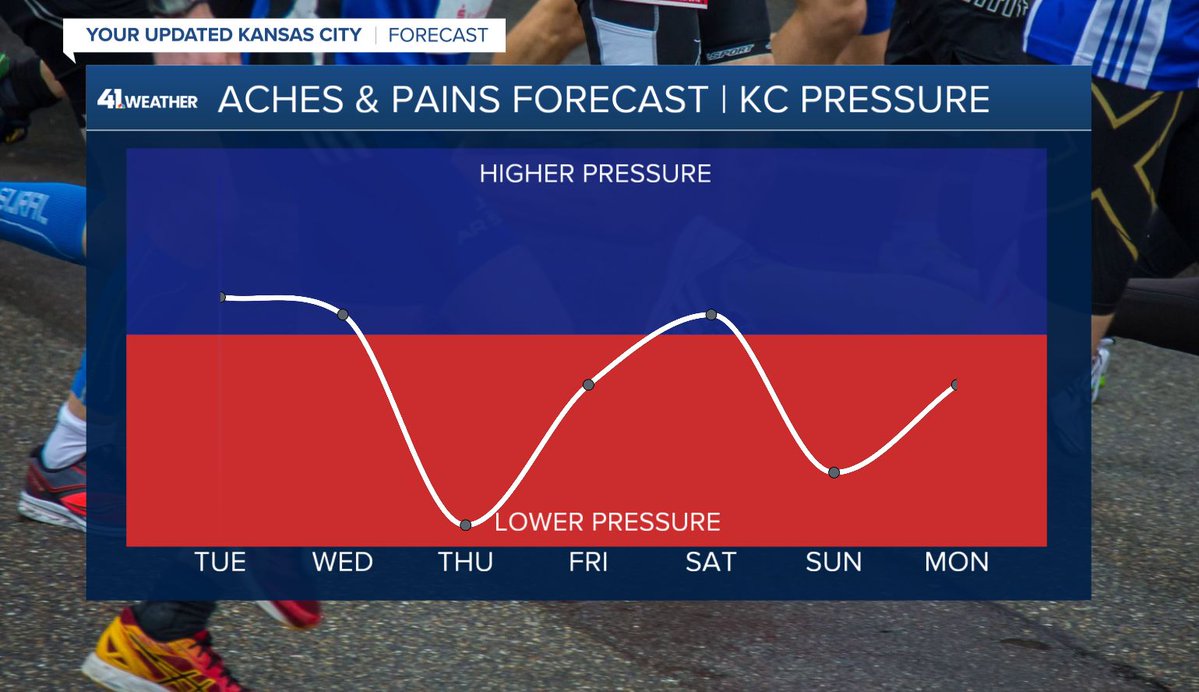
OOOF-PRESSURE PAINS ALERT! Significant pressure changes around Thursday and Sunday will likely cause aches, pains, and sinus pressure problems. #mowx #kswx #kcwx


Current weather conditions on 4/21/2026 at 11:00 PM in Piper, KS are mostly cloudy with a temp of 63. Winds are out of the South west at 16 MPH gusting to 21 MPH making it feel like 63.5. Rainfall today is 0.00. #KsWx #KcWx
Pretty remarkable signal this far out for a significant severe weather event taking place across the Plains on Sunday. Thinking a 30% contour is likely warranted in the next outlook cycle. #severewx #okwx #kswx
Current weather conditions on 4/21/2026 at 10:00 PM in Piper, KS are clear with a temp of 64. Winds are out of the South south west at 15 MPH gusting to 21 MPH making it feel like 65.3. Rainfall today is 0.00. #KsWx #KcWx

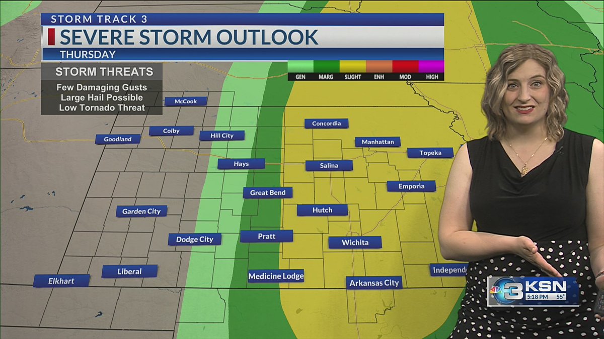
Thursday is a day to be watching especially areas along I-35 from OKC up to Kansas City with a threat for supercells posing all hazards. I wouldn't be surprised if we also see strong tornadoes as well. Sunday though will be a bigger day for sure. More to come soon #okwx #kswx #wx

Current weather conditions on 4/21/2026 at 9:00 PM in Piper, KS are partly cloudy with a temp of 66. Winds are out of the South south west at 23 MPH gusting to 32 MPH making it feel like 66.9. Rainfall today is 0.00. #KsWx #KcWx

⛈️ An active pattern sets up as we head into the weekend that will bring storm chances and the possibility of severe weather. ⚠ Our next risk for severe storms will be Thursday evening as our next cold front arrives. kmbc.com/weather @KMBC #Mowx #Kswx #Kcwx

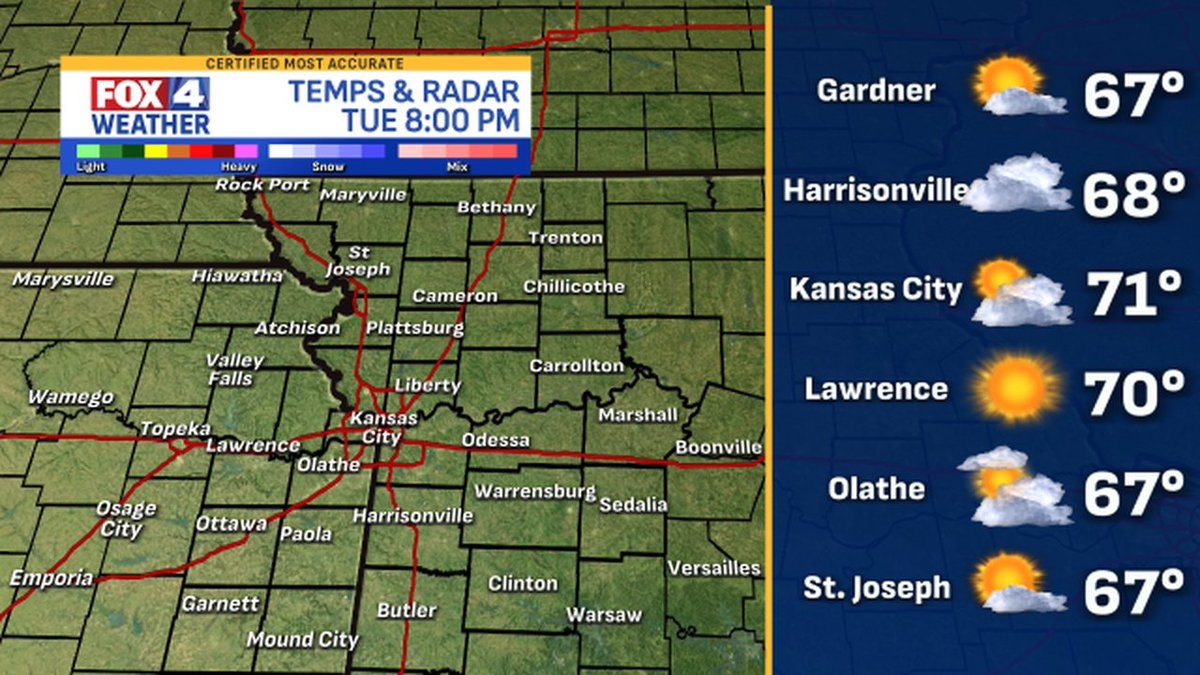
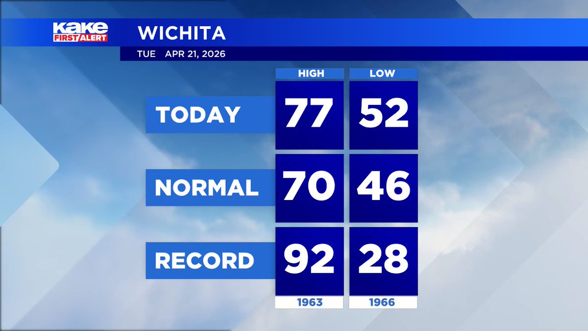
Goodevening.. You can expect AM Clouds/PM Sun tomorrow in Piper, KS with a high of 76 F and a low of 64 F. #KSwx #KCwx

Current weather conditions on 4/21/2026 at 8:00 PM in Piper, KS are partly cloudy with a temp of 68. Winds are out of the South south west at 18 MPH gusting to 20 MPH making it feel like 73.1. Rainfall today is 0.00. #KsWx #KcWx
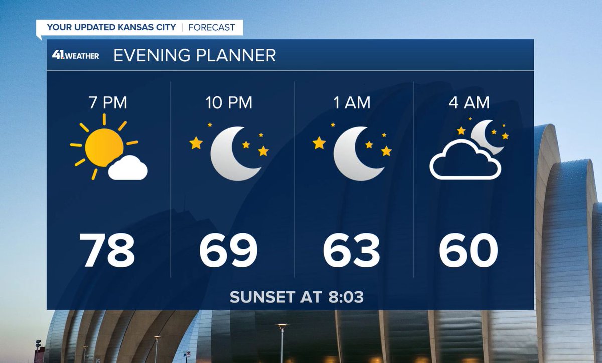
Sunset for Piper, KS will occur today April 21, 2026 at 08:02PM The day's High was F with a Low of 59 F. Currently it is Sunny/Wind. #KSwx #KCwx

Oh yeah Sunday is a guaranteed chase day activation for me. Thread is coming soon on @StormChaserRadi page. #okwx #arwx #kswx #wxtwitter
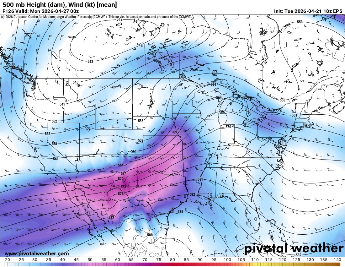
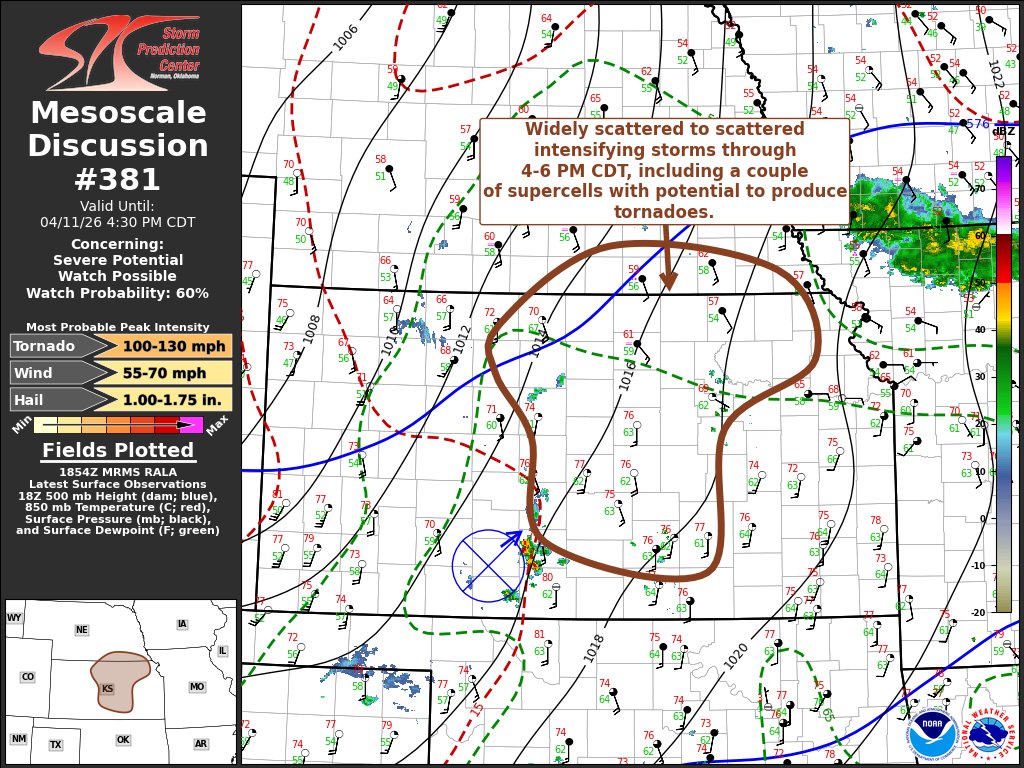
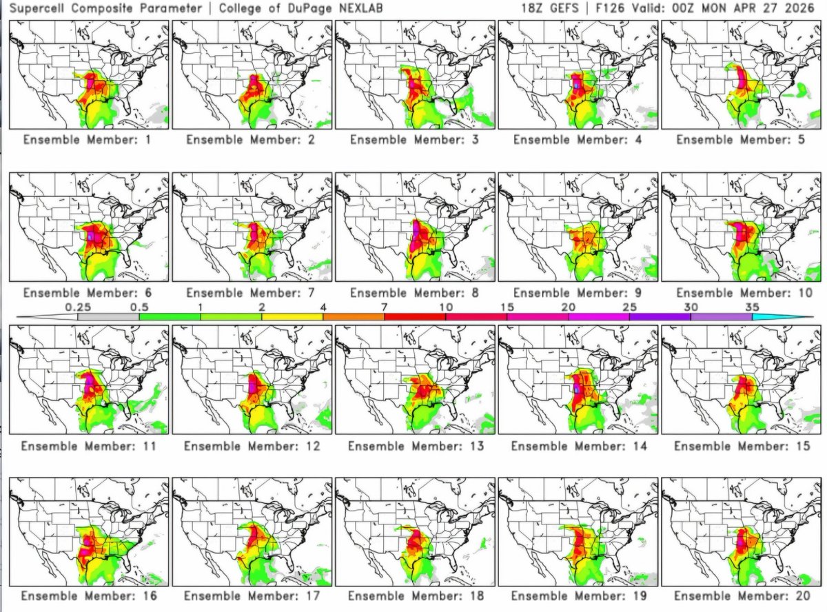
|18z GEFS Ensemble SCP // Sunday| More than half of GEFS ensemble guidance members show significant severe/tornado outbreak across OK/KS/MO Sunday. I definitely see outlook upgrades coming for these areas. Trends to monitor. @NWSSPC @hellohannav #okwx #kswx #mowx #kcwx #SevereWx

Current weather conditions on 4/21/2026 at 7:00 PM in Piper, KS are mostly clear with a temp of 73. Winds are out of the South south west at 12 MPH gusting to 14 MPH making it feel like 76.4. Rainfall today is 0.00. #KsWx #KcWx
OOOF-PRESSURE PAINS ALERT! Significant pressure changes around Thursday and Sunday will likely cause aches, pains, and sinus pressure problems. #mowx #kswx #kcwx
We are sorry about the link not working tonight, as we want people to enjoy this presentation. Therefore we will re-schedule for a later date yet to be determined. #kswx


An unsettled pattern brings multiple rounds of storms to the Sunflower State for the second half of the week. Tracking out timing and impacts in your Storm Track 3 Forecast. ksn.com/weather/weathe… @KSNNews @KSNStormTrack3 #kswx
Current weather conditions on 4/21/2026 at 6:00 PM in Piper, KS are mostly clear with a temp of 75. Winds are out of the South south west at 24 MPH gusting to 30 MPH making it feel like 77.8. Rainfall today is 0.00. #KsWx #KcWx


![kswxxu's profile picture. [?]](https://pbs.twimg.com/profile_images/1068132734592139269/3MQe0Hmk.jpg)


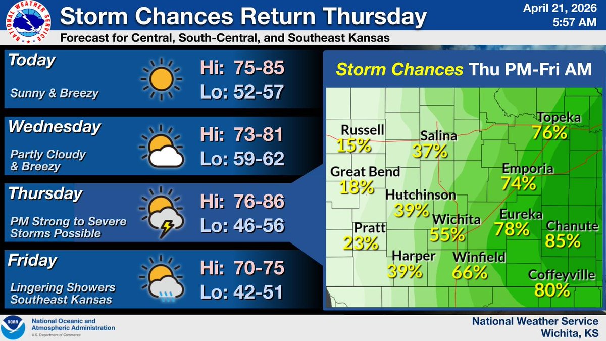
Warm and breezy conditions will continue through mid-week. Then, chances for showers and storms return on Thursday and will linger into Friday, mainly for areas east of I-135. A few strong to severe storms will be possible. #kswx
Enjoy the beautiful, breezy weather this evening! Clouds return Wednesday, but with lighter winds, temperatures stay comfortably in the 70s. #mowx #kswx #kcwx

8:47pm CDT #SPC_Watch WW 132 SEVERE TSTM AR KS MO OK 180145Z - 180700Z, #arwx #kswx #mowx #okwx, spc.noaa.gov/products/watch…


MODERATE RISK The Storm Prediction Center has upgraded the severe weather risk today to a level 4 out of 5 in the Central Plains/Midwest, including Kansas City. Huge hail and intense winds are expected, in addition to tornadoes. #KSwx #OKwx #MOwx


OOOF-PRESSURE PAINS ALERT! Significant pressure changes around Thursday and Sunday will likely cause aches, pains, and sinus pressure problems. #mowx #kswx #kcwx

1:41pm CDT #SPC_Watch WW 130 TORNADO KS MO OK 171835Z - 180200Z, #kswx #mowx #okwx, spc.noaa.gov/products/watch…


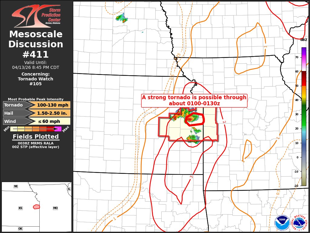
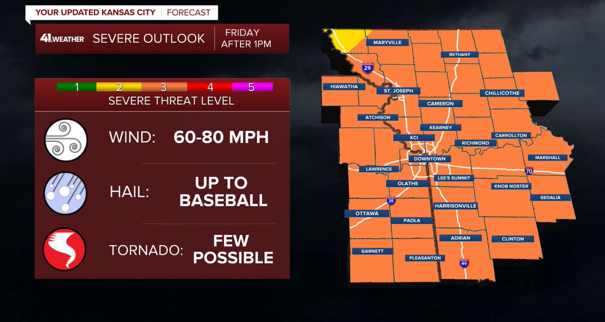
I’m not being dramatic… Friday after 1 PM could bring: -Baseball-size hail -Tornadoes -80 mph winds We’ve already seen it all this week. Be ready for watches and warnings! #mowx #kswx #kcwx

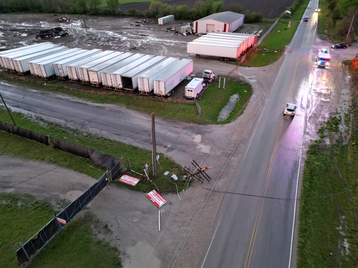
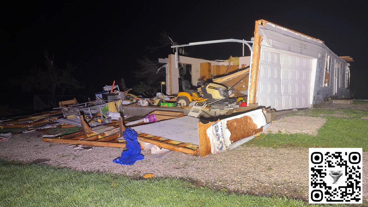
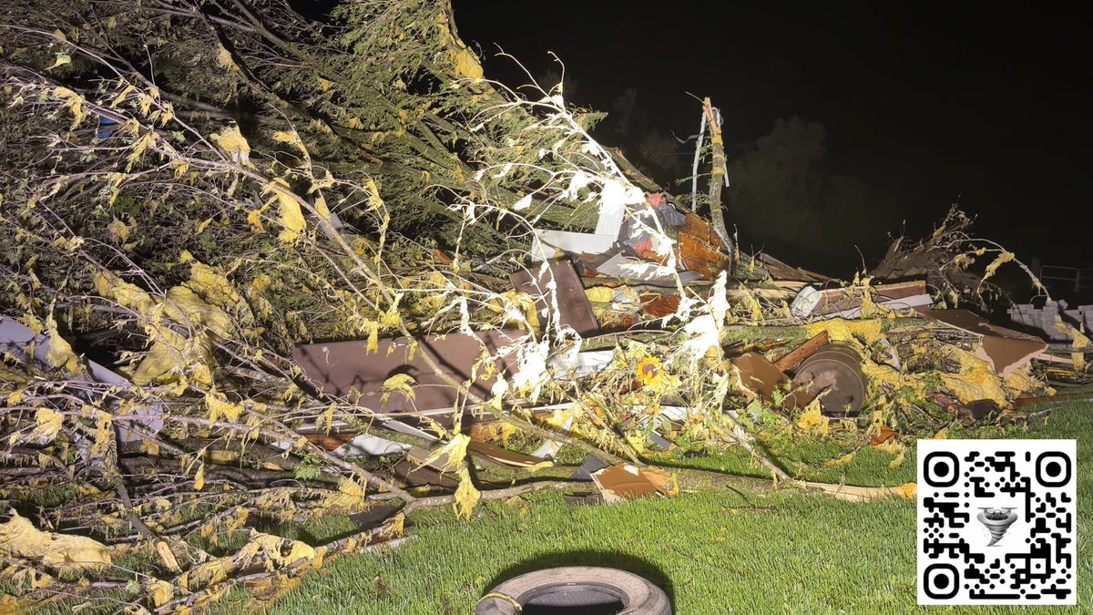
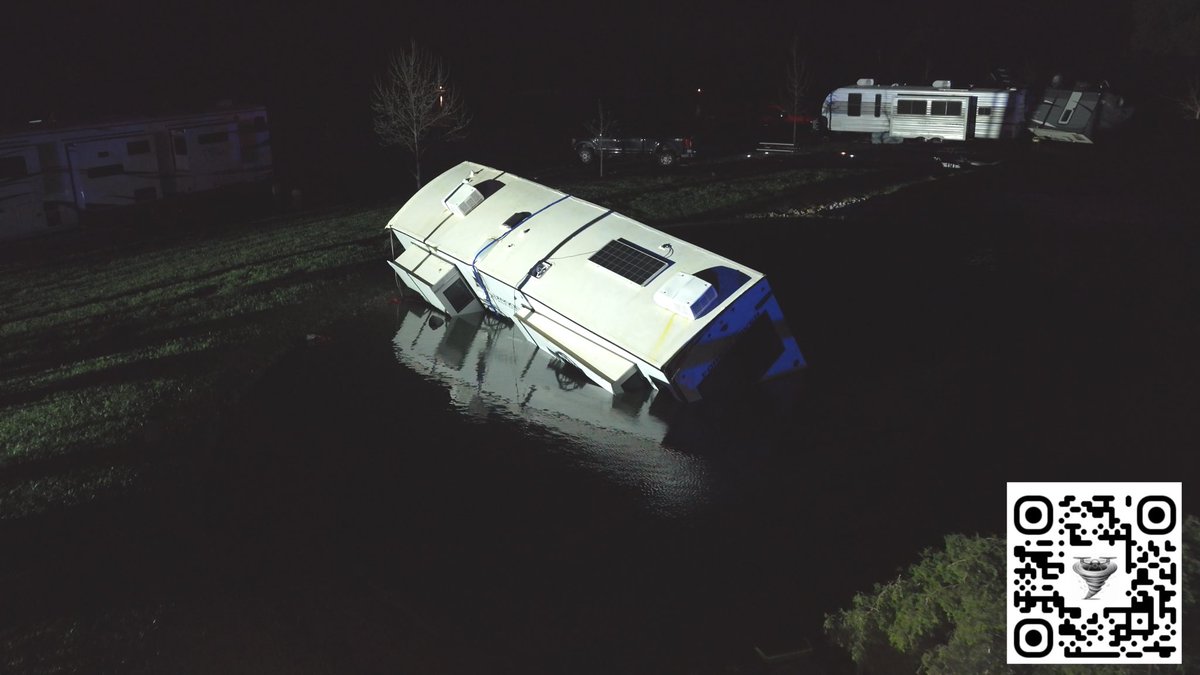
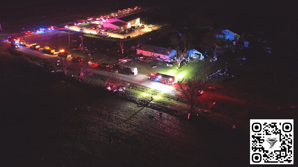
Hillsdale, Kansas is tore up pretty good from apparent tornado from late yesterday. #kswx #tornado #kansas

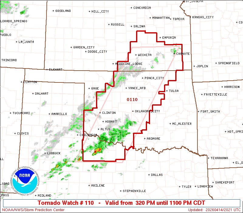
3:22pm CDT #SPC_Watch WW 110 TORNADO KS OK TX 142020Z - 150400Z, #kswx #okwx #txwx, spc.noaa.gov/products/watch…
4:32pm CDT #SPC_Watch WW 99 TORNADO KS NE 112130Z - 120400Z, #kswx #newx, spc.noaa.gov/products/watch…


#WPC_MD 0091 affecting Northeastern Kansas...Northwest Missouri, #mowx #kswx #newx, wpc.ncep.noaa.gov/metwatch/metwa…

Something went wrong.
Something went wrong.
United States Trends
- 1. Virginia N/A
- 2. SPLC N/A
- 3. Texas N/A
- 4. Marcus Smart N/A
- 5. Wemby N/A
- 6. Sengun N/A
- 7. Scoot Henderson N/A
- 8. Rockets N/A
- 9. Pizza Hut N/A
- 10. Devin Williams N/A
- 11. #LakeShow N/A
- 12. #DaredevilBornAgain N/A
- 13. Ayton N/A
- 14. Jake LaRavia N/A
- 15. #WWENXT N/A
- 16. Celtics N/A
- 17. Blazers N/A
- 18. Fairfax N/A
- 19. Ryan Walker N/A
- 20. Kevin Durant N/A