
おすすめツイート


Severe Thunderstorm Warning for Cleveland County in NC until 8:00pm.
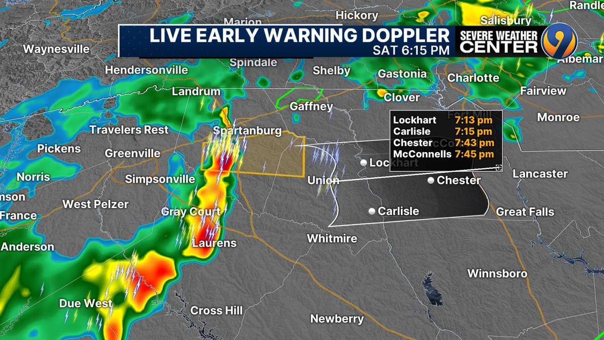
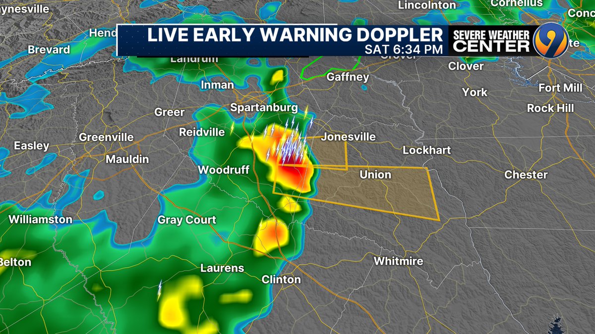
SEVERE THUNDERSTORM WARNING Chester, Union and southern York Counties until 8pm.
Severe Thunderstorm Warning for Chester and York County in SC until 8:00pm.
SEVERE THUNDERSTORM WARNING central/western Union County, SC until 7:15pm. Cell heading towards Union over next 30-45 minutes MAY produce gusty winds, hail. @wsoctv
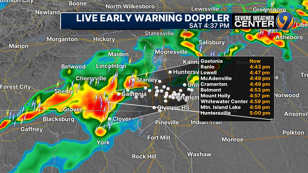
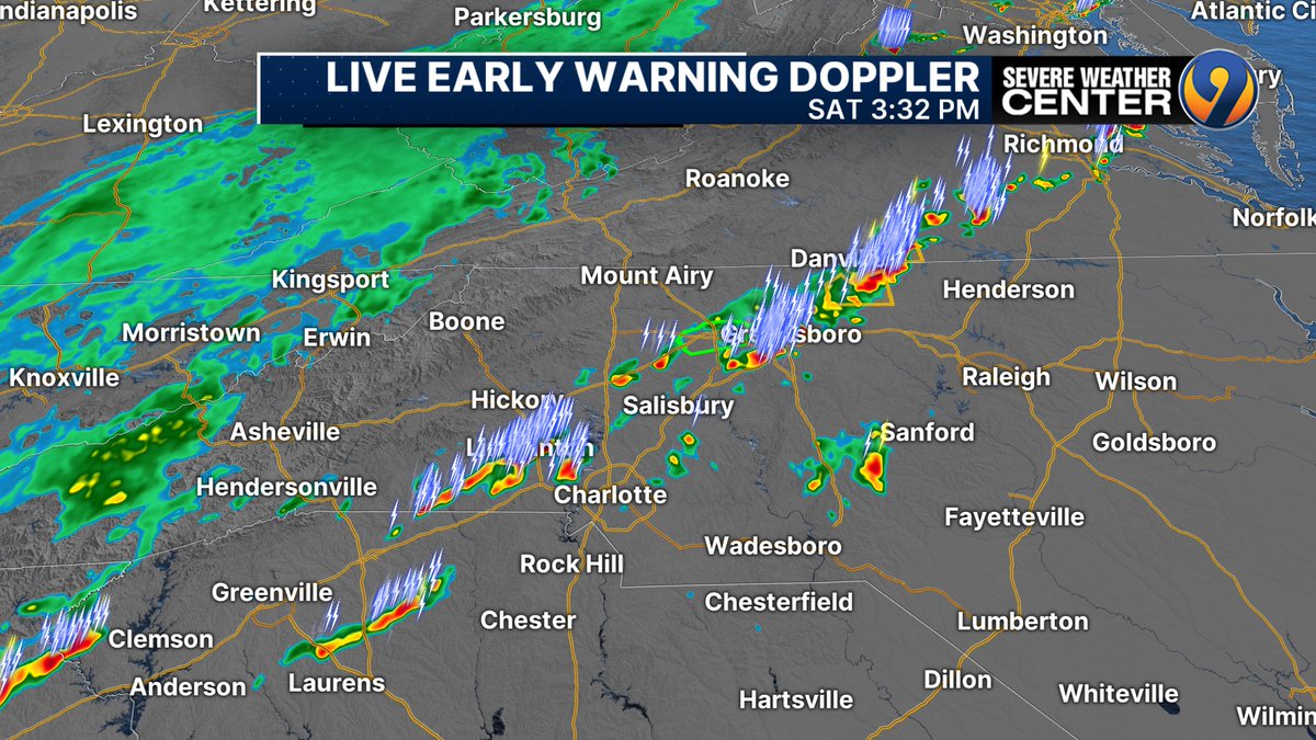
STAY ALERT. At 4:40pm batch of storms, localized gusty winds, possibly small hail, definitely some lightning Stanley-Gastonia-Clover heading northeast...likely reaching Uptown Charlotte 5:00-5:30pm.
AT 3:30 PM BROKEN LINE strong thunderstorms Greensboro along I40, north/west of Charlotte to Greenville. Individual storms heading northeast while entire area sliding slowly east. ALERT for localized wind gusts/pea sized hail/lightning possible into this evening.
Severe Thunderstorm Warning for Cleveland County in NC until 9:30pm.
Severe Thunderstorm Warning for Catawba, Iredell, Lincoln and Mecklenburg County in NC until 6:15pm.
Severe Thunderstorm Warning for Burke and Caldwell County in NC until 4:00pm.
Severe Thunderstorm Warning for Ashe and Watauga County in NC until 2:00pm.
Flash Flood Warning for Ashe and Watauga County in NC until 10:00pm Wednesday.
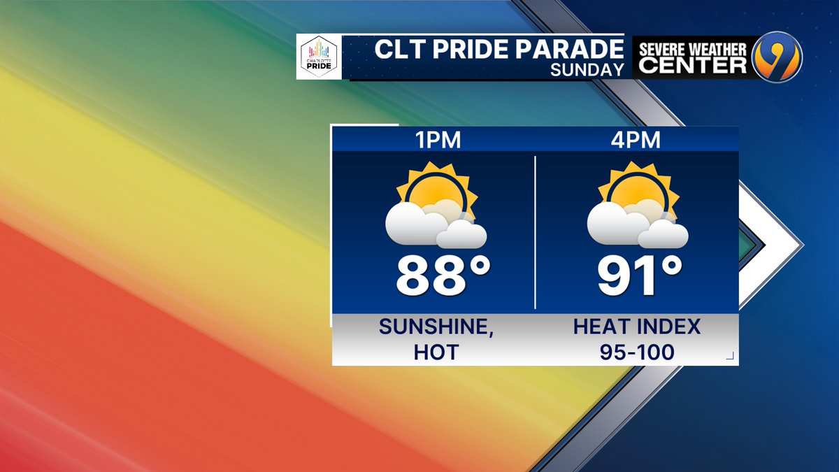
STAY SAFE in the sunshine, heat & humidity this afternoon during the parade. Peak Heat Index during parade time 95-100 degrees. Stay hydrated. Get into shade at times. Think safety. @CLTgov, @MeckCounty,
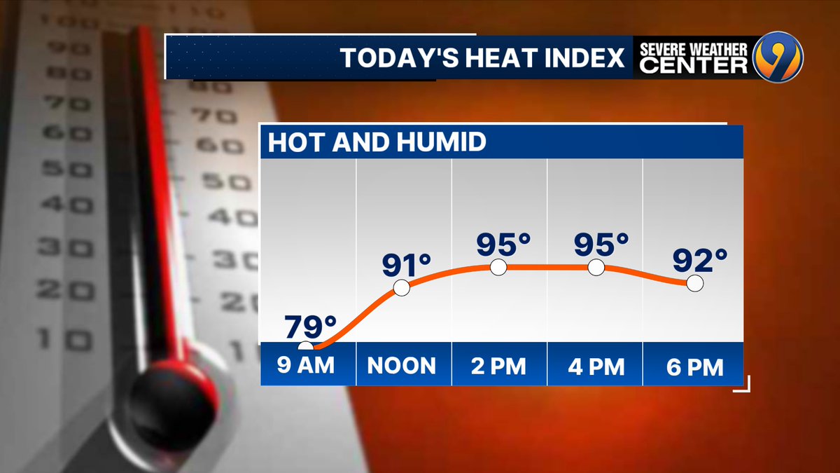
HEAT & HUMIDITY still an issue across the Carolinas this weekend as we add on more 90 degree days to the 48 days we have already this summer. Stay hydrated and get shade when needed.
Flash Flood Warning for Richmond County in NC until 12:00pm Wednesday.


United States トレンド
- 1. Peggy 27.5K posts
- 2. Zeraora 9,444 posts
- 3. Berseria 2,839 posts
- 4. #FaithFreedomNigeria 1,436 posts
- 5. Luxray 1,589 posts
- 6. Dearborn 336K posts
- 7. Cory Mills 20.4K posts
- 8. Good Wednesday 34.6K posts
- 9. #Wednesdayvibe 2,483 posts
- 10. #wednesdaymotivation 7,260 posts
- 11. Hump Day 17.5K posts
- 12. Xillia 2 N/A
- 13. #MissUniverse 26.2K posts
- 14. Tom Steyer N/A
- 15. International Men's Day 65.6K posts
- 16. Sonic 06 1,336 posts
- 17. $NVDA 40.2K posts
- 18. Happy Hump 11.4K posts
- 19. #LosVolvieronAEngañar 1,999 posts
- 20. Jessica Tisch N/A
おすすめツイート
-
 WSOCTV
@wsoctv -
 WCCB Charlotte
@WCCBCharlotte -
 WCNC Charlotte
@wcnc -
 WBTV News
@WBTV_News -
 Spectrum News 1 CLT
@SpecNews1CLT -
 NCDOT Charlotte Area
@NCDOT_Charlotte -
 CLT Airport
@CLTAirport -
 John Ahrens
@JohnAhrensWSOC9 -
 Charlotte-Mecklenburg Emergency Management
@CharMeckEM -
 Brad Panovich
@wxbrad -
 Steve Udelson
@SUdelson -
 The Charlotte Observer
@theobserver -
 NCDOT I-77
@NCDOT_I77 -
 Total Traffic Charlotte
@totaltrafficclt -
 Queen City News
@Queen_City_News
Something went wrong.
Something went wrong.