
Eric Jeansonne
@Weatheric
| Chief Meteorologist @WLOX | University of Oklahoma Alum | Louisiana Native | Amateur Photographer |Tweets links pics retweets not endorsements | #mswx #lawx
You might like


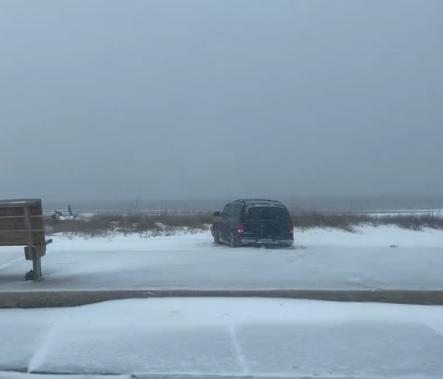
My snowboard in the French Quarter is approaching 9 inches. The snow fall is fairly uniform where the board is, but winds have been so strong. Models think we still have several more inches coming. Just insane.


Snow starting to come down in Gulfport! ❄️⛄️

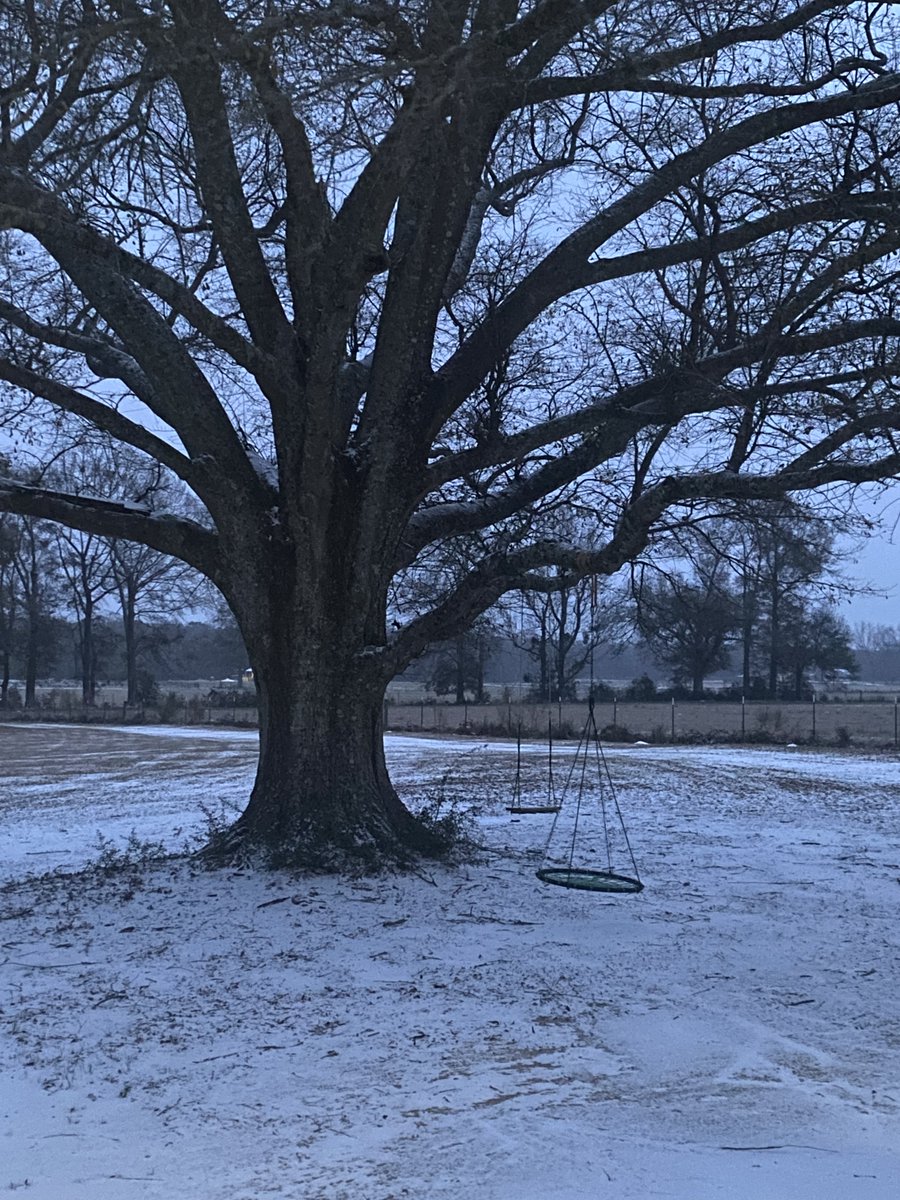
Snow on the ground in Perkinston! Photo by Darlene via the @WLOX Weather APP. 1.21.25 #mswx @NWSMobile
Wow! Crane Creek in Hancock County is getting snow this morning. Video by Jessica Christensen via the @WLOX Weather APP. 1.21.25 #mswx @NWSNewOrleans
Accumulating sleet and snow in Benndale, MS this morning in George County. Photo by Jeffery Anderson. @WLOX @NWSMobile #mswx


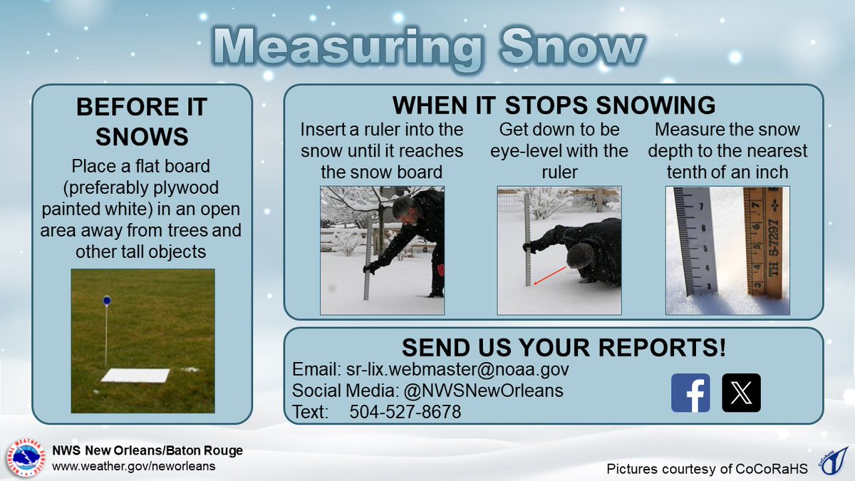
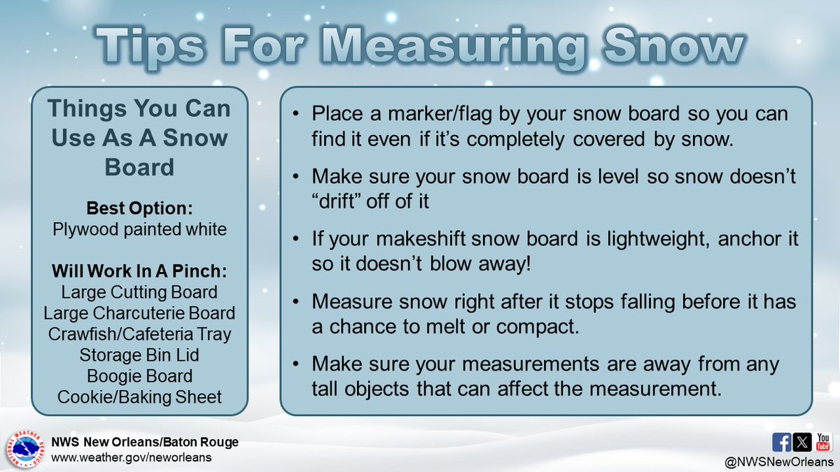
❄️If you're thinking about trying to measure the snow tomorrow, here are some good tips! Main goal is to have a flat surface away from trees or buildings so they can be as accurate as possible. And yes, crawfish trays can be used for this!😉
First snowflakes showing up in Rayne and elsewhere across Acadiana! Video courtesy of Windy Trahan Babin! #lawx
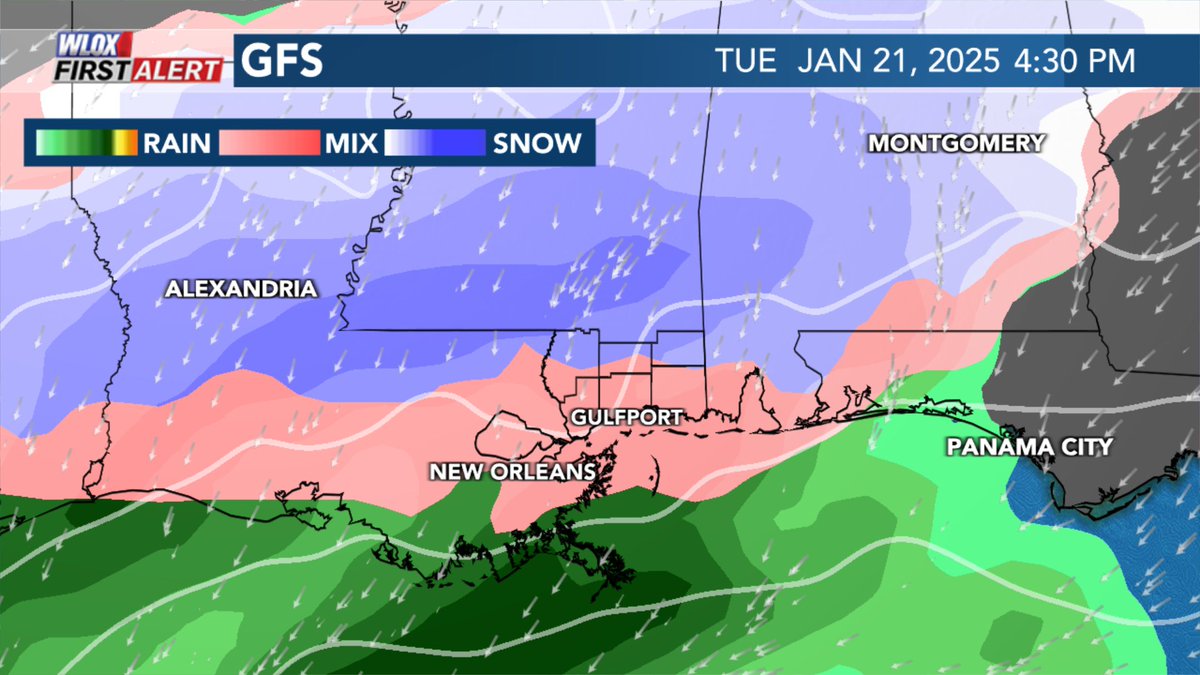
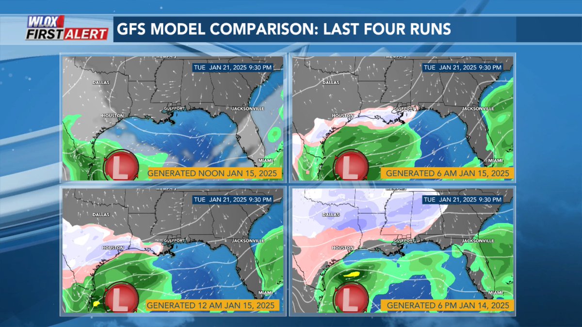
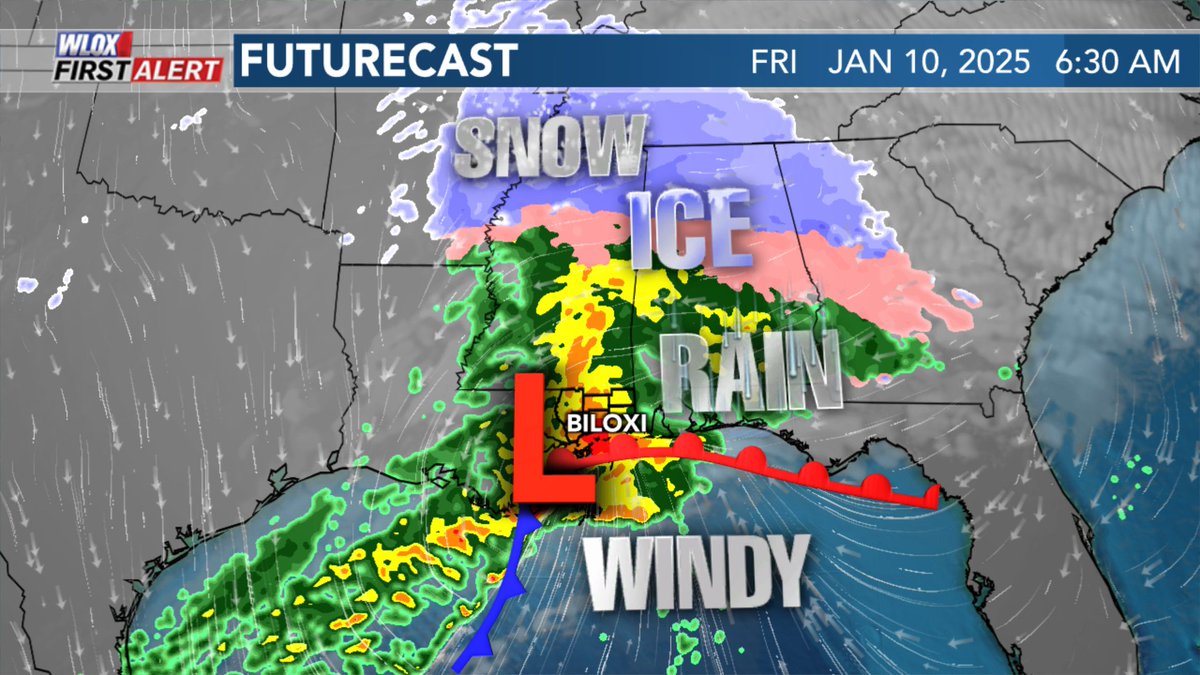
Trend with the GFS today has been for a mix of freezing rain, sleet, and snow along and south of I-10. Main takeaway is that winter weather disruptive to travel is increasingly likely Tuesday. #mswx @WLOX
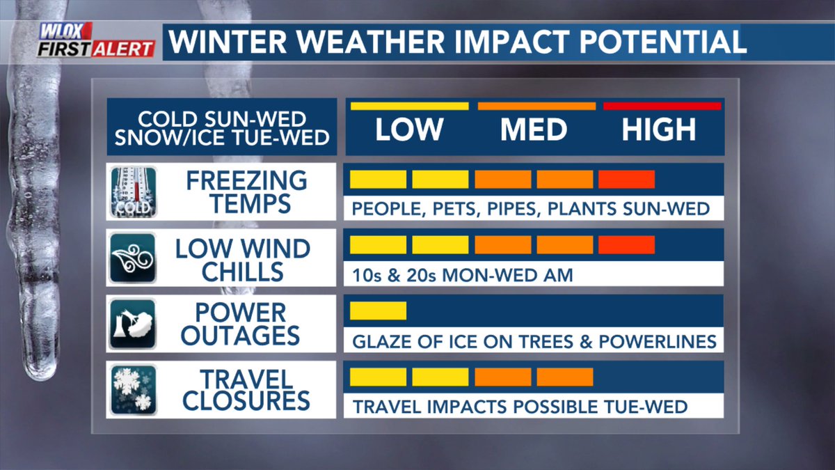
We are still a few days out and much can change between now and then. But, the potential is increasing for wintry weather across South MS with impact to travel, possibly power depending on where freezing rain sets up. #mswx @WLOX


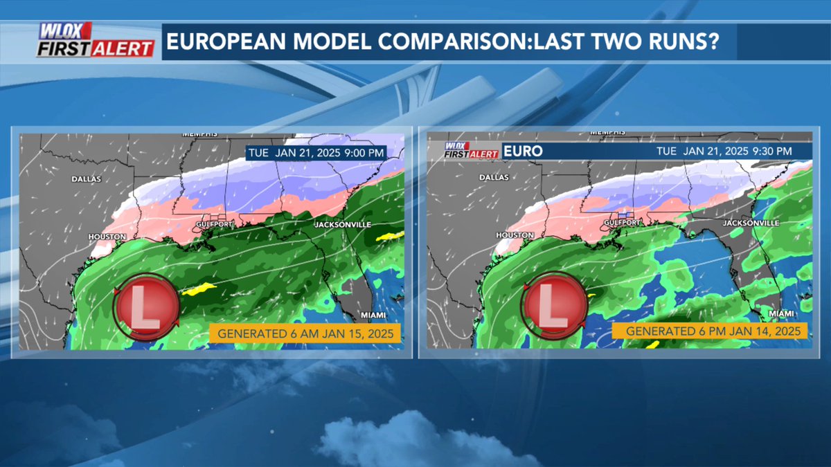
Up late tonight watching latest Euro model run come in. It falls in line with tonight's GFS run showing potential for a winter storm along the I-10 corridor. This is still not locked in. A lot can change over the next 4-5 days, but trends are getting interesting. #mswx @WLOX
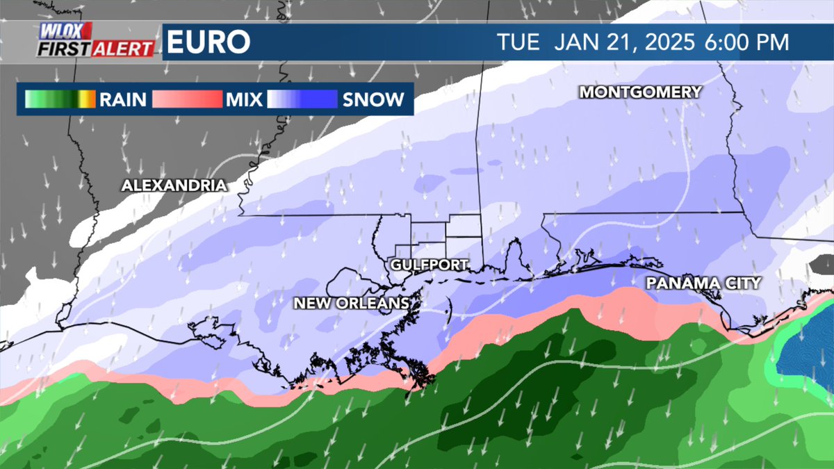

Signal for a winter storm across the Gulf coast has been most persistent Euro model. GFS has backed off over the past 4 runs. Regardless, arctic air moves in Sun with bitter cold wind chills in the teens by Mon morning. If there is a winter storm, track will be key. #mswx @WLOX

Beautiful hole punch cloud spotted in Poplarville, MS 1.9.25 by Tyler Mcinnis. This photo was sent to us via the @WLOX Weather App. #mswx @NWSNewOrleans @spann
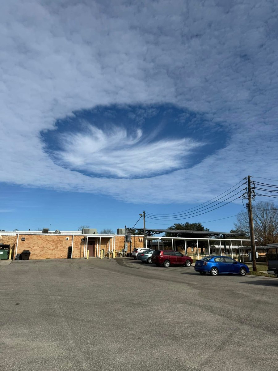
Awesome shot of a hole punch cloud or fallstreak cloud by Valerie Hildreth in D'Iberville, MS via the @WLOX Weather App. Even looks like a sun dog in the middle of it. #mswx @spann @NWSNewOrleans

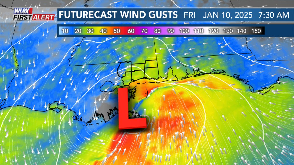
Nasty morning along the MS Gulf Coast Friday. Heavy rain, strong winds, minor coastal flooding depending on where low tracks. #mswx @WLOX
We had dinner here New Year's Eve. Great food and service

Extremely kind gesture. Restaurant Medium Rare in New Orleans handing out hot meals to members of the media covering the terrorist attack that took place this morning before the Sugar Bowl.


United States Trends
- 1. Minneapolis N/A
- 2. Alex Pretti N/A
- 3. Alex Pretti N/A
- 4. Minnesota N/A
- 5. Steelers N/A
- 6. Keaton Wagler N/A
- 7. McCarthy N/A
- 8. Sixers N/A
- 9. Embiid N/A
- 10. Maxey N/A
- 11. Kyle Rittenhouse N/A
- 12. Purdue N/A
- 13. 2nd Amendment N/A
- 14. Insurrection Act N/A
- 15. National Guard N/A
- 16. #UFC324 N/A
- 17. Kingston Flemings N/A
- 18. Mikal N/A
- 19. Stephen Miller N/A
- 20. #Illini N/A
You might like
-
 WLOX
WLOX
@WLOX -
 Meteorologist Taylor Graham
@TaylorGrahamWX -
 Megan McClellan
@mmcclellanwx -
 WXXV 25
@WXXV25 -
 Bill Snyder
@BillSnyderWLOX -
 ͏Josh Cozart
@JoshCozartWx -
 James Parish
@JamesParishWX -
 Patrick Bigbie WDAM 🌪️
@PatrickWDAM -
 Meteorologist John Zeigler
@JohnZeiglerWX -
 Hugh Keeton
@HughKeeton -
 Brian LaMarre
@blamarre -
 Alexa Santa
@alexa_santa -
 Taylor Sarallo
@TaylorWVTM13 -
 Dave_Elliott
@theRealDElliot -
 Meteorologist Ryan Mahan
@RyanMahanWx
Something went wrong.
Something went wrong.