
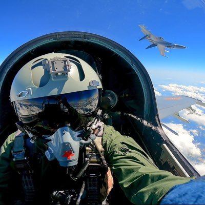
Amir
@x4rius
Just having a fair dinkum go at life 🌴 🇦🇺 Doing lots of cool stuff at @soaratlas, Detail and IREX (👽)
You might like


Climate change via summer snowline in Tochal Ski Resort in Tehran Iran CC: @hadinik @ResindScientist @BabakTaghvaee1 @IranianPlateau @antsharwood

Do you notice something about this vintage satellite map of Tochal, Iran in 1979? That’s a lot of snow for mid-summer! Fast forward to recent summer imagery: the snow is now mostly stuck near the very summit. Let's dive deeper... 👇 [1/3] 🧵
What a compelling way to test a theory of human migration. How were the Pacific Islands discovered by modern humans? The Kon Tiki Expedition. Now thats an adventure!🤩 soaratlas.com/maps/kon-tiki-…

Oghab 44 (Eagle 44) is Iran’s underground airbase. It has runways & hangars buried in the Zagros foothills, built to protect fighter jets, bombers & UAVs deep underground. Direct map link: soaratlas.com/maps/14406 #Iran #Eagle44 #Military #MiddleEastCrisis #IranDefense

🎉 To mark the release of over 700 georeferenced declassified spy satellite images, Harry has made his 1960-1984 map collection fully searchable: spacefromspace.com/declassified-s… Explore anywhere in the world and jump straight to the interactive maps to compare them to modern day.
Only 1 million? Come on kids!! 😜 ...wait til the new satellite imagery supplier comes online 🤫
Imagine opening any map, and instantly seeing it in 3D! Soon on soaratlas.com over 1,000,000+ maps will be explorable as a 3D model. Check out the teaser below. This is going to be a game changer. 🚀
Beautiful isn't it? The name is often said to combine Swahili and Chagga words meaning roughly “Mountain of Greatness”. It really pops in 3D! tinyurl.com/28j3pmut
This happens often actually! Back in 2017 you could easily see it from space (Dec vs March): tinyurl.com/y4yccwjr
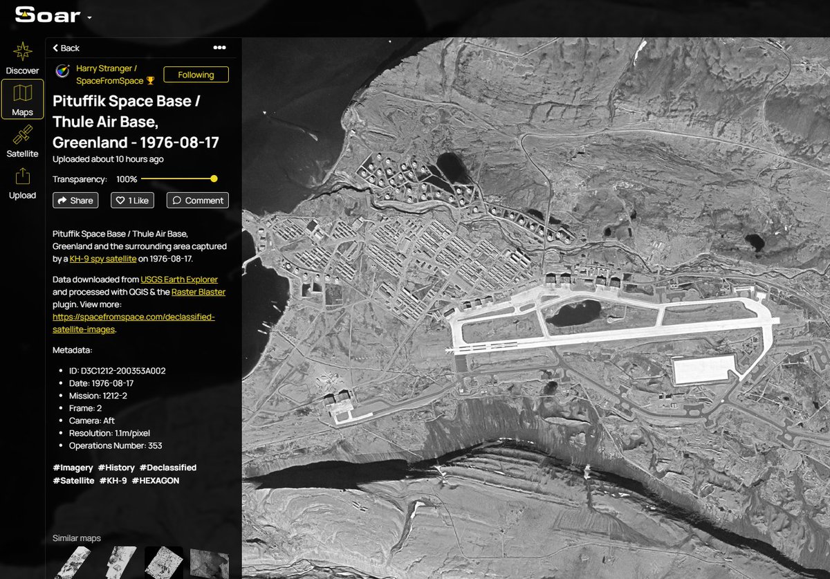
A Cold War snapshot frozen in time. This declassified KH-9 image captures Pituffik Space Base (then known as Thule Air Base) and the stark Arctic landscape of ?#Greenland all the way back in 1976: tinyurl.com/4877fujc Miles of ice on one of the most remote outposts ever
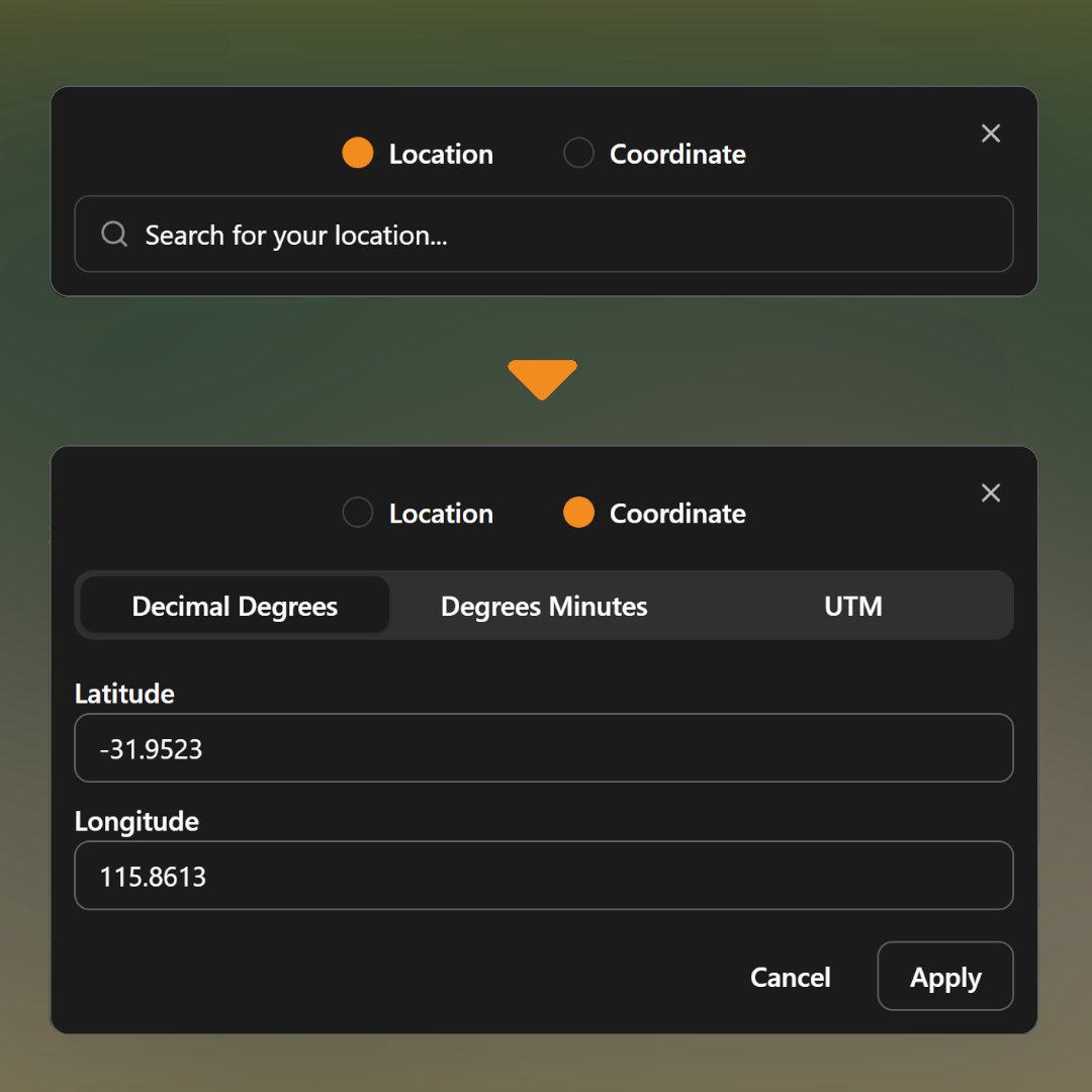
Georeferencer.ai has been updated with some improvements that'll help you georeference easier. - Search by location OR coordinate - Live coordinates now display where your mouse location is, letting you place markers over maps with coordinate grids easier Give it a try:
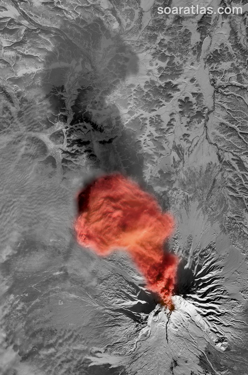
This is epic!! the shadow as well. Im gonna download, print and frame. Thank you sir! 🌋
🚨A dramatic eruption at Shiveluch Volcano in Kamchatka, captured today from space: tinyurl.com/4h6u7ysn #volcano #Shiveluch #Kamchatka
Ive never been good at computer games 😅 but now cheaper satellite imagery might be the catalyst to winning 👽
Want cheaper high-resolution satellite imagery? It's yours... IF you can beat our mini-game. 😎 Make 30 connections before time runs out and you win discounts! Share your score below. Play here:👉 tinyurl.com/3vdnbbm4
Want cheaper high-resolution satellite imagery? It's yours... IF you can beat our mini-game. 😎 Make 30 connections before time runs out and you win discounts! Share your score below. Play here:👉 tinyurl.com/3vdnbbm4
There are more tools than ever for free satellite imagery, but none are as easy to use as this.
There are multiple areas so explore each: 🗺tinyurl.com/4bbj8csz 🗺tinyurl.com/2y3j2k35 🗺tinyurl.com/jw7efxtk Thanks to NOAA for the amazing imagery. 😎


This is stunning Joseph! Cold this morning, right? Here's that area from space today: tinyurl.com/46a6sr56

So easy to use...a GIS person can even use it 🥹😅

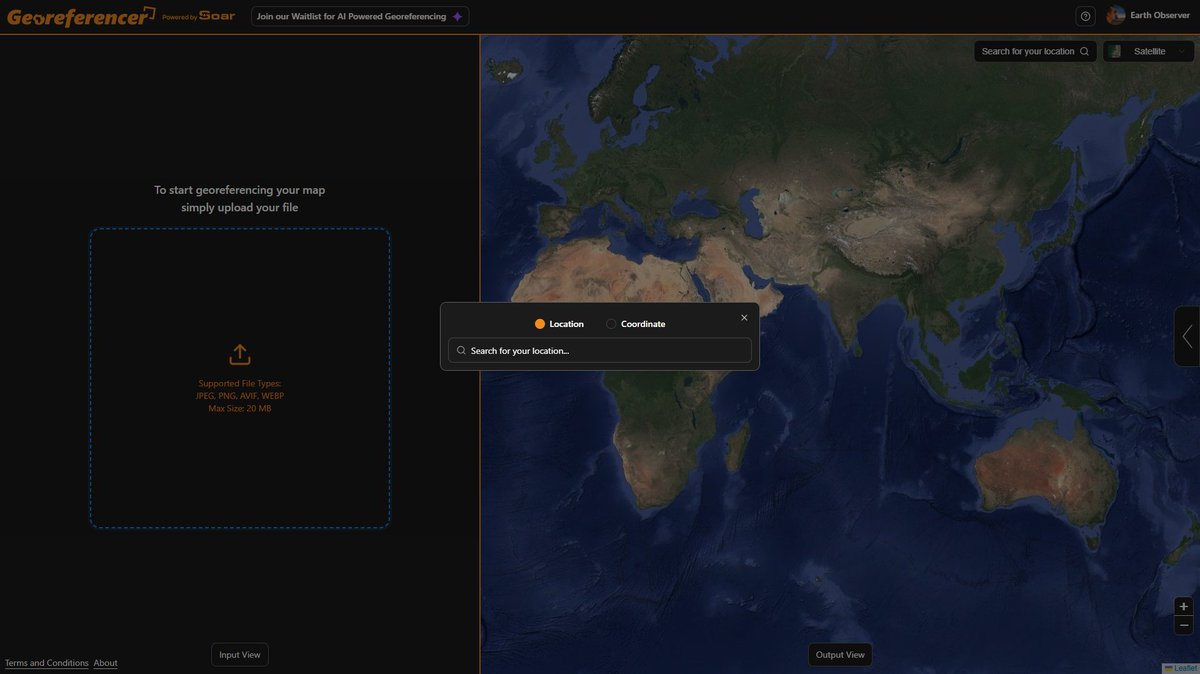
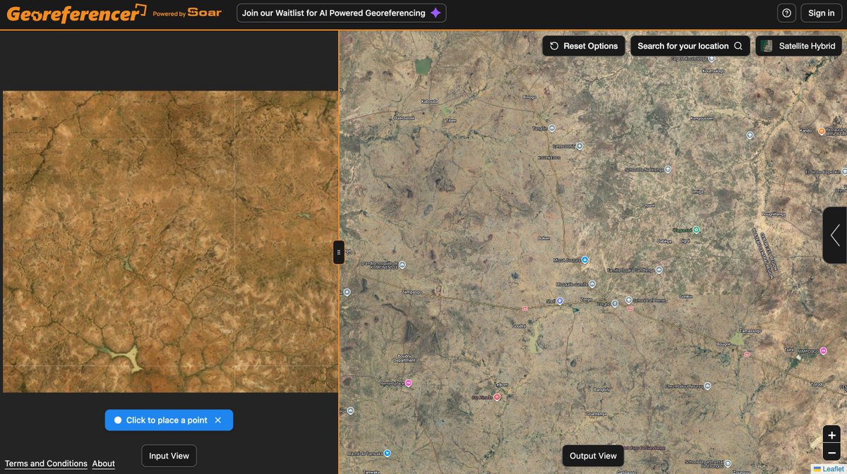
GEOREFENCER Simple free online tool that help anchor any image to its real-world location by matching points on your image with the same spots on the map. georeferencer.ai #geoint
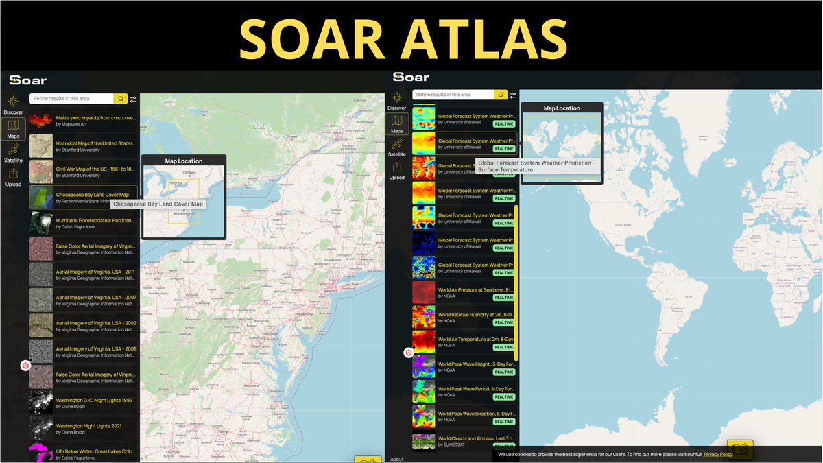
SOAR ATLAS A huge, incredibly huge collection of maps - live maps (weather, fire, clouds) - historic maps (worldwide, countries, towns) - local conflicts and disasters maps - satellite maps - ability to upload your own maps soaratlas.com Creator @SoarAtlas
US Library of Congress aerial photo showing the aftermath of the September 11 attacks in New York City at incredible resolution: 📸💔 soaratlas.com/maps/america-u…

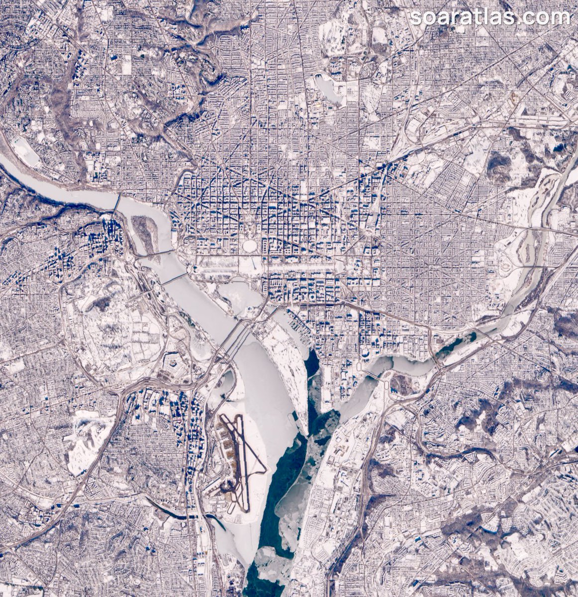
Washington DC from space right now! Nice and frosty. ⛄Direct Map Link: tinyurl.com/2ucy3vvt #WashingtonDC #Winter


United States Trends
- 1. #WWERaw N/A
- 2. AJ Styles N/A
- 3. Spurs N/A
- 4. Pistons N/A
- 5. The Vision N/A
- 6. Wemby N/A
- 7. Undertaker N/A
- 8. Kansas N/A
- 9. Bronson Reed N/A
- 10. Big Monday N/A
- 11. Houston N/A
- 12. WWE Hall of Fame N/A
- 13. Tre White N/A
- 14. Raquel N/A
- 15. #WWEHOF N/A
- 16. WrestleMania N/A
- 17. Bill Self N/A
- 18. #TheRookie N/A
- 19. #kubball N/A
- 20. NYPD N/A


Something went wrong.
Something went wrong.