
Lin Xiong
@lin_umd
Currently @umdgeography, postdoc at @CoastalECU, PhD @UHEAS. Remote sensing for Earth science. Geospatial data scientist.
You might like


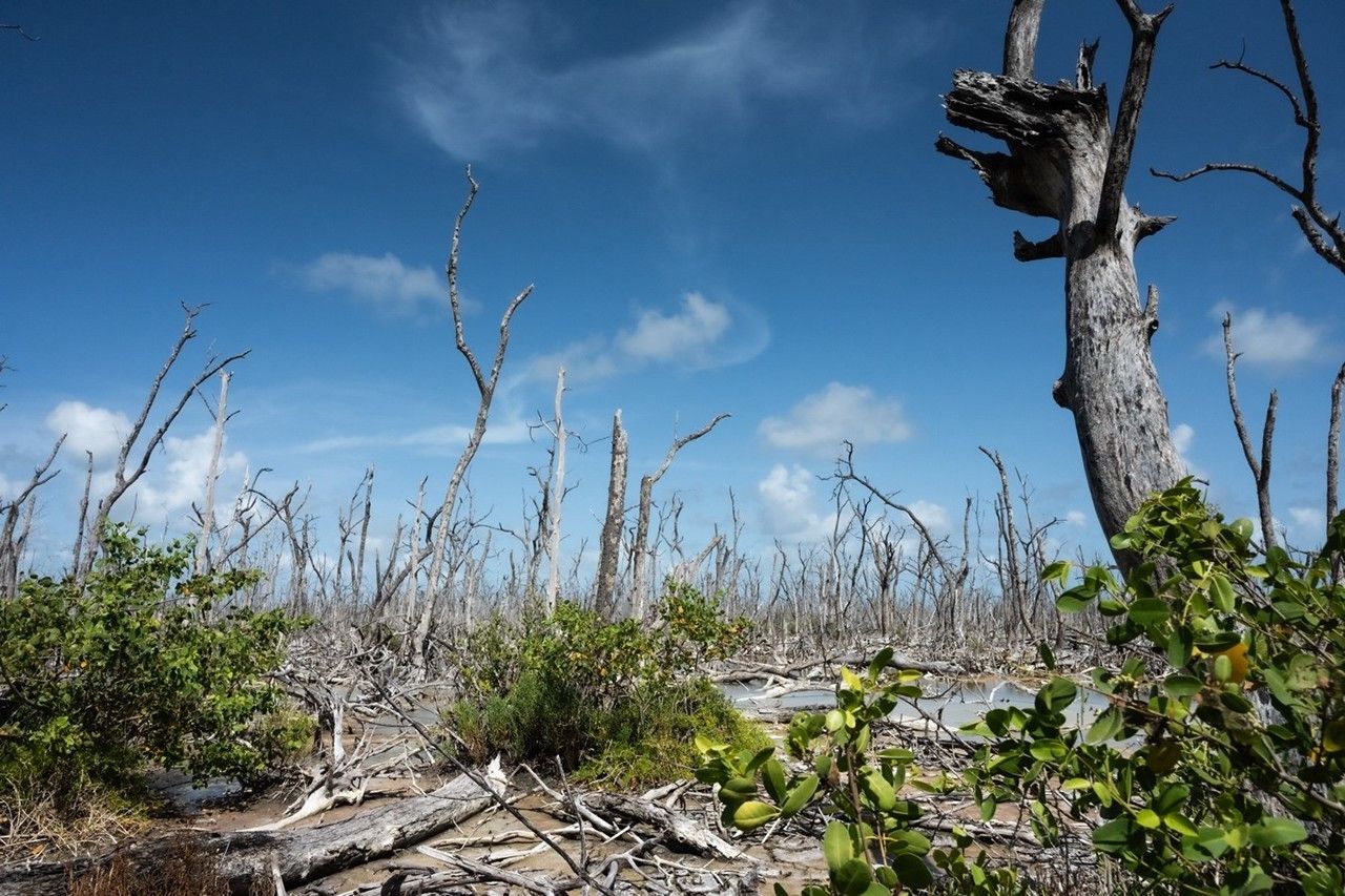
🎉🎉👇Paper Alert👇🎉🎉 sciencedirect.com/science/articl… I am super excited that my first #mangrove paper is available online! With tremendous help from co-authors! @DLagomasino, Dr. Edward Castaneda, @EarthToLola , Dr. Bruce Cook, and all others.
Interested in ✨Spaceborne Lidar for Monitoring Vegetation Structure and Biomass using #GEDI✨? Join the upcoming @NASAEarth ARSET training! 🌳English session: Oct. 23-Nov. 6, 2025, 11am-1pm EDT 🌳Spanish session: Oct. 23-Nov. 6, 2025, 2-4pm EDT earthdata.nasa.gov/learn/training…
Now That NISAR Launched, Here's What You Can Expect From the Data earthdata.nasa.gov/news/now-that-…
Curious about #GEDI mission status, competed science team projects, and applications? Look no further than our latest article in The Earth Observer👇👇👇 Summary of the 2025 GEDI Science Team Meeting science.nasa.gov/uncategorized/… via @NASA

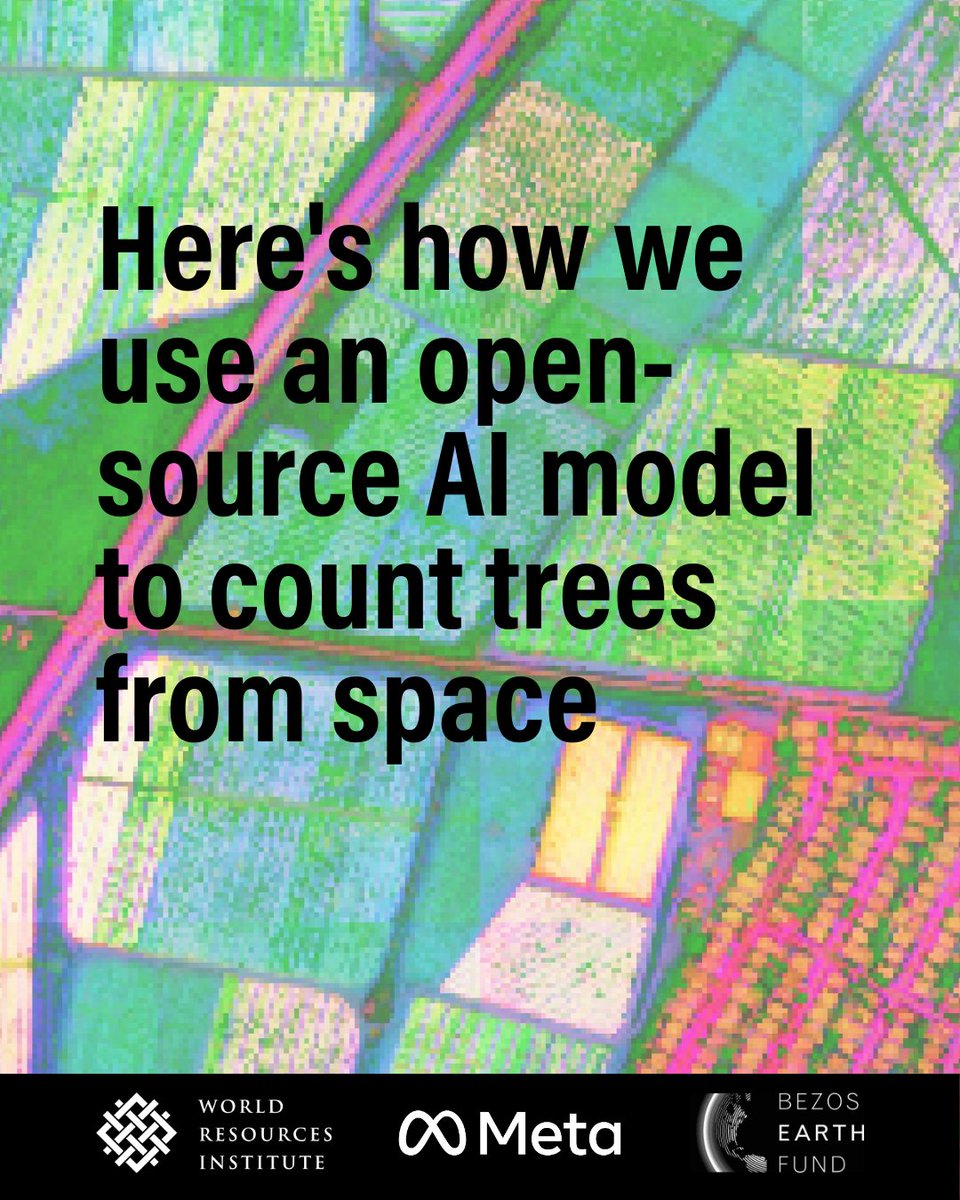
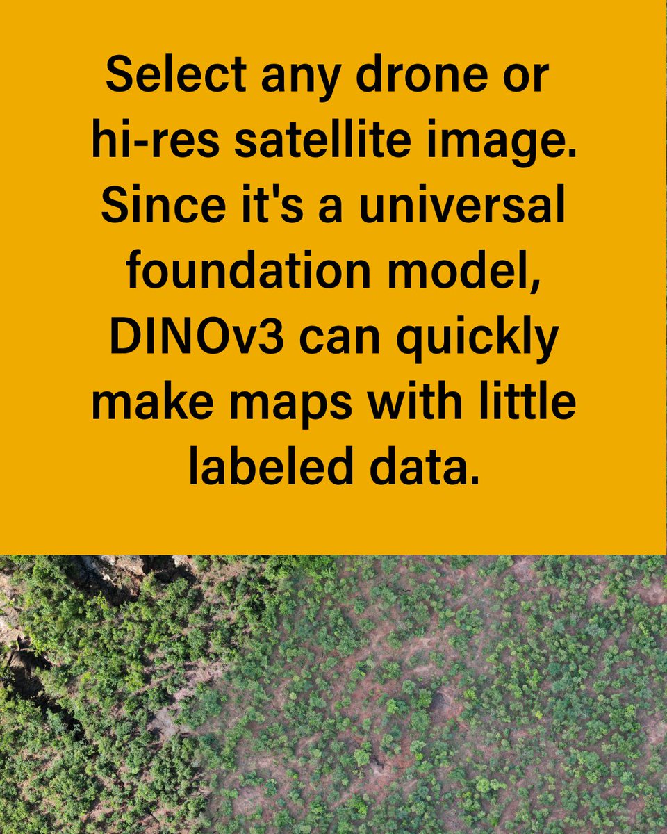
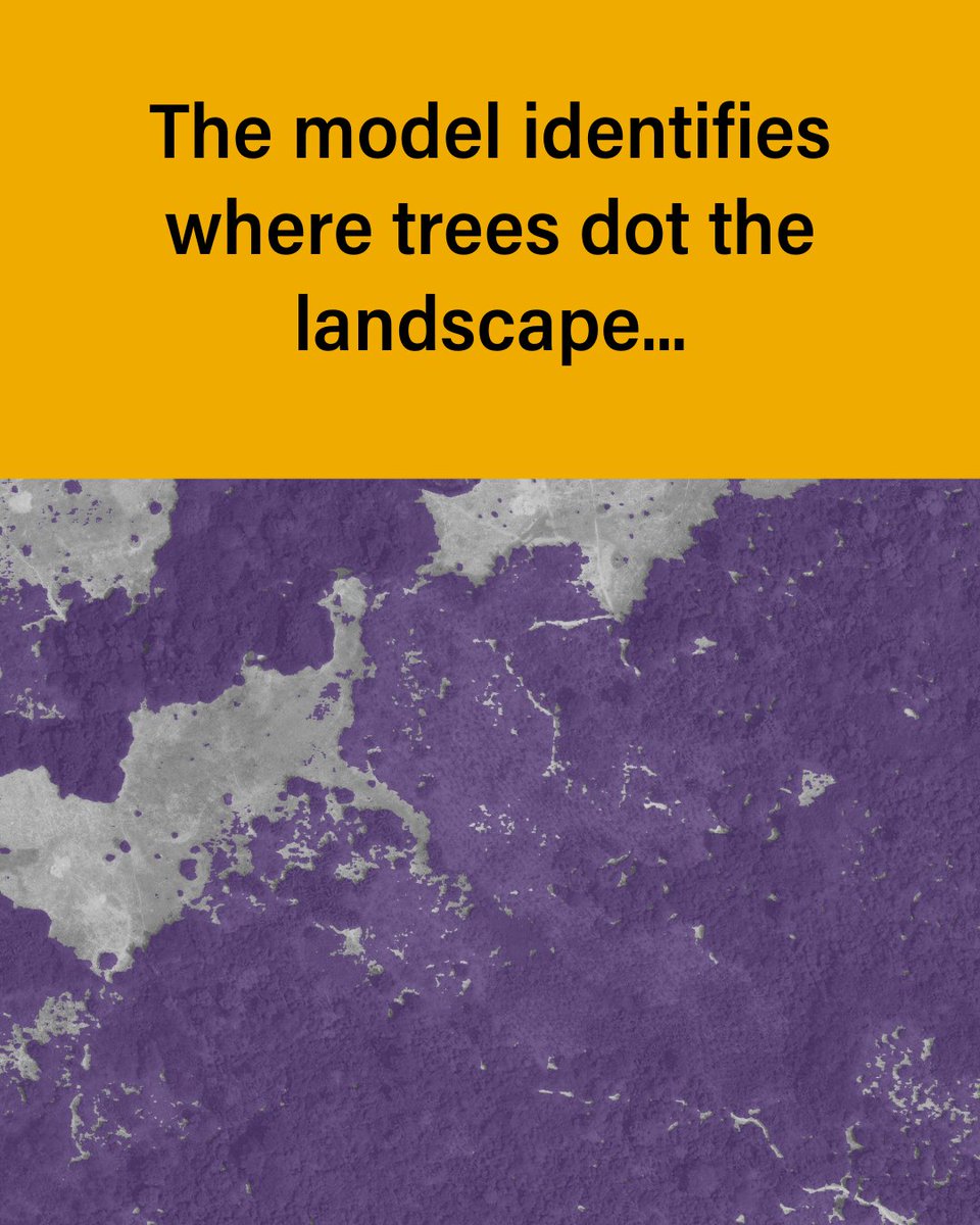
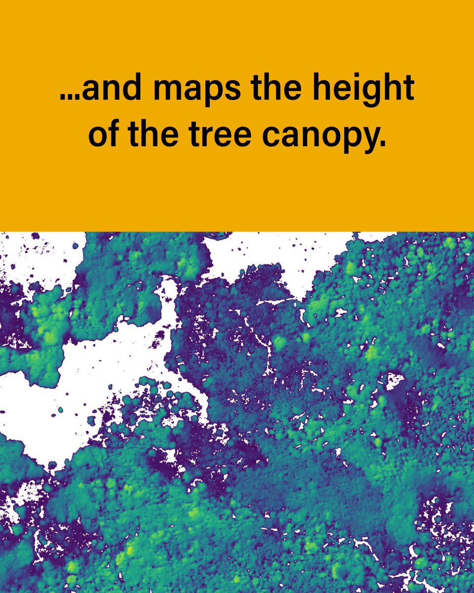
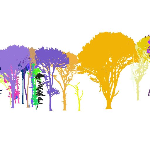
DINOv3, developed by @AIatMeta with support from @WorldResources is setting a new standard for environmental monitoring. This is how we use it to map the height of individual trees globally — faster & more accurately than ever before: 🔗 bit.ly/4oyZqZs @BezosEarthFund

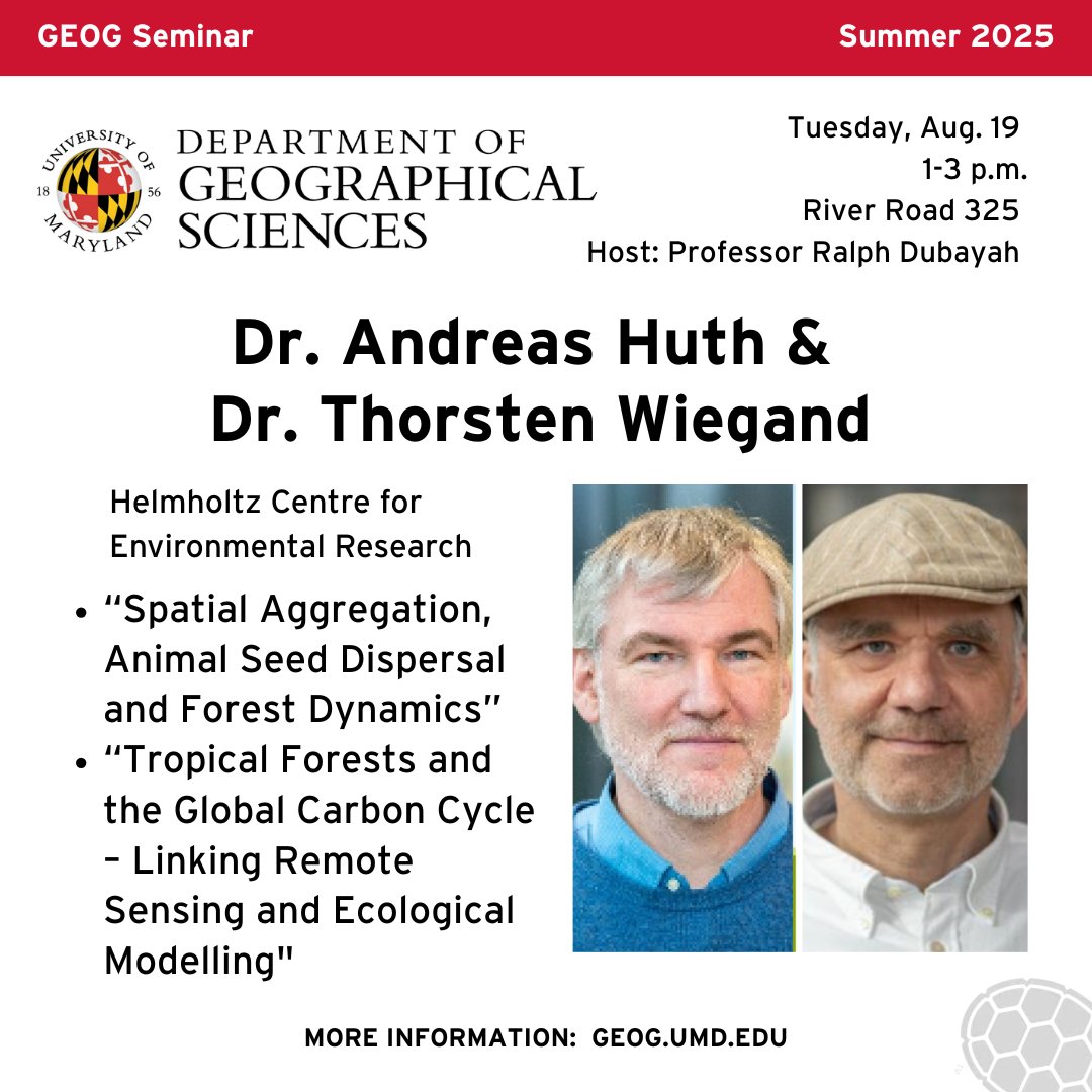
Join us tomorrow at 1 p.m. in River Road 🎯
🌍 Save the Date: Aug. 19 🌳 We'll welcome Drs. Thorsten Wiegand & Andreas Huth from the Helmholtz Centre for Environmental Research for a seminar. 🌱 Forest spatial dynamics & species coexistence 🌲 Tropical forests & carbon cycle modeling Details: go.umd.edu/20qa

NISAR is one big step closer to beginning its mission to study Earth’s changing surfaces 🌏 Today, the satellite successfully unfurled its 39-foot-wide (12-meter-wide) antenna reflector. It’s the largest reflector NASA has ever deployed in space! go.nasa.gov/41Iu20T
Google AI model mines trillions of images to create maps of Earth ‘at any place and time’ nature.com/articles/d4158… Not only optical, but with SAR and GEDI @GEDI_Knights

Google Earth AI: Our state-of-the-art geospatial AI models @google blog.google/technology/ai/…
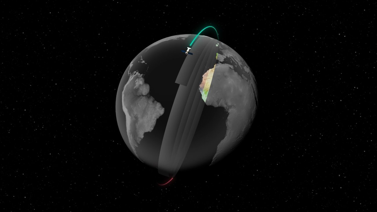
The NISAR satellite’s L-band radar penetrates deep into forest canopies, providing insights into forest structure!


Dr. Ralph Dubayah & Global Ecosystem Dynamics Investigation (GEDI): lidarmag.com/podcast_episod…

Annual global biomass map! climate.esa.int/en/news-events…
climate.esa.int
ESA Releases Longest-Ever Earth Observation Dataset on Biomass to Support Forest Monitoring
Latest update provides most comprehensive satellite-based maps of above-ground forest carbon to date
Release of GEDI L4A Footprint-Level Aboveground Biomass Data for April-November 2024 gedi.umd.edu/release-of-ged…
gedi.umd.edu
Release of GEDI L4A Footprint-Level Aboveground Biomass Data for April-November 2024 - GEDI
Release of GEDI L4A Footprint-Level Aboveground Biomass Data for April-November 2024 - GEDI
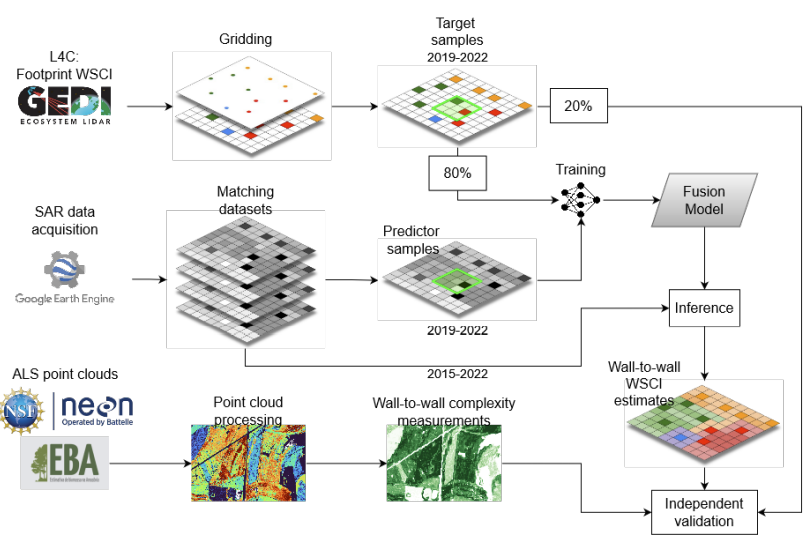
📩 All GEDI L4A post-storage datasets are now available on @NASAEarthData via the @ORNL DAAC! With this release, all #GEDI footprint level datasets from Level 1 to Level 4 are publicly available up until mission week 311 (except L4C WSCI). search.earthdata.nasa.gov/search/granule…
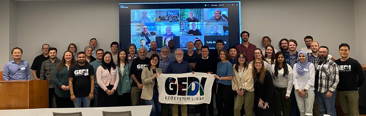
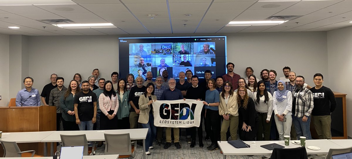
Another invigorating #GEDI Science Team meeting in the books, our first with this competed science team cohort! ✨ Thank you to everyone who attended both in-person and virtually. @umdgeography @bsosumd

Dr. David Lagomasino and the Coasts and Oceans Observing Lab are part of an ongoing project in the Florida Everglades! Learn more in this recently published NASA Science web story ⤵️ science.nasa.gov/earth/nasa-res…
NASA-ISRO Mission Will Map Farmland From Planting to Harvest jpl.nasa.gov/news/nasa-isro… via @NASAJPL
jpl.nasa.gov
NASA-ISRO Mission Will Map Farmland From Planting to Harvest
Data from the NISAR satellite will be used to map crop growth, track plant health, and monitor soil moisture — offering detailed, timely information for decision making.
Join our EEBIOMASS SPECIAL on "Upcoming opportunities and challenges in Forest missions" featuring BIOMASS, NISAR, GEDI and Geo-Trees! eebiomass.org/workshops/ The workshop will take place on March 27, 2025 (Thursday), 13:00-16:00 CET. 📢Register here: survey.academiccloud.de/index.php/9885…

Environmental drivers of spatial variation in tropical forest canopy height: Insights from NASA’s GEDI spaceborne LiDAR ✨🌳🛰️ pnas.org/doi/10.1073/pn…


United States Trends
- 1. #DWTS 85.4K posts
- 2. Luka 39K posts
- 3. Robert 123K posts
- 4. Alix 14.4K posts
- 5. Elaine 44.2K posts
- 6. Jordan 117K posts
- 7. Dylan 34.9K posts
- 8. NORMANI 5,201 posts
- 9. Collar 34.5K posts
- 10. Daniella 3,890 posts
- 11. #DancingWithTheStars 2,181 posts
- 12. Carrie Ann 4,140 posts
- 13. Anthony Black 3,305 posts
- 14. Bennett Stirtz N/A
- 15. Drummond 3,082 posts
- 16. Godzilla 34.7K posts
- 17. Michigan 86K posts
- 18. Donovan Dent N/A
- 19. #WWENXT 8,876 posts
- 20. Suggs 2,833 posts
You might like


Something went wrong.
Something went wrong.