
Mapmapnmap
@mapmapnmap
Dealer de map 🗺🌎🌍🌏🌕 http://linktr.ee/mapmapnmap
Bạn có thể thích


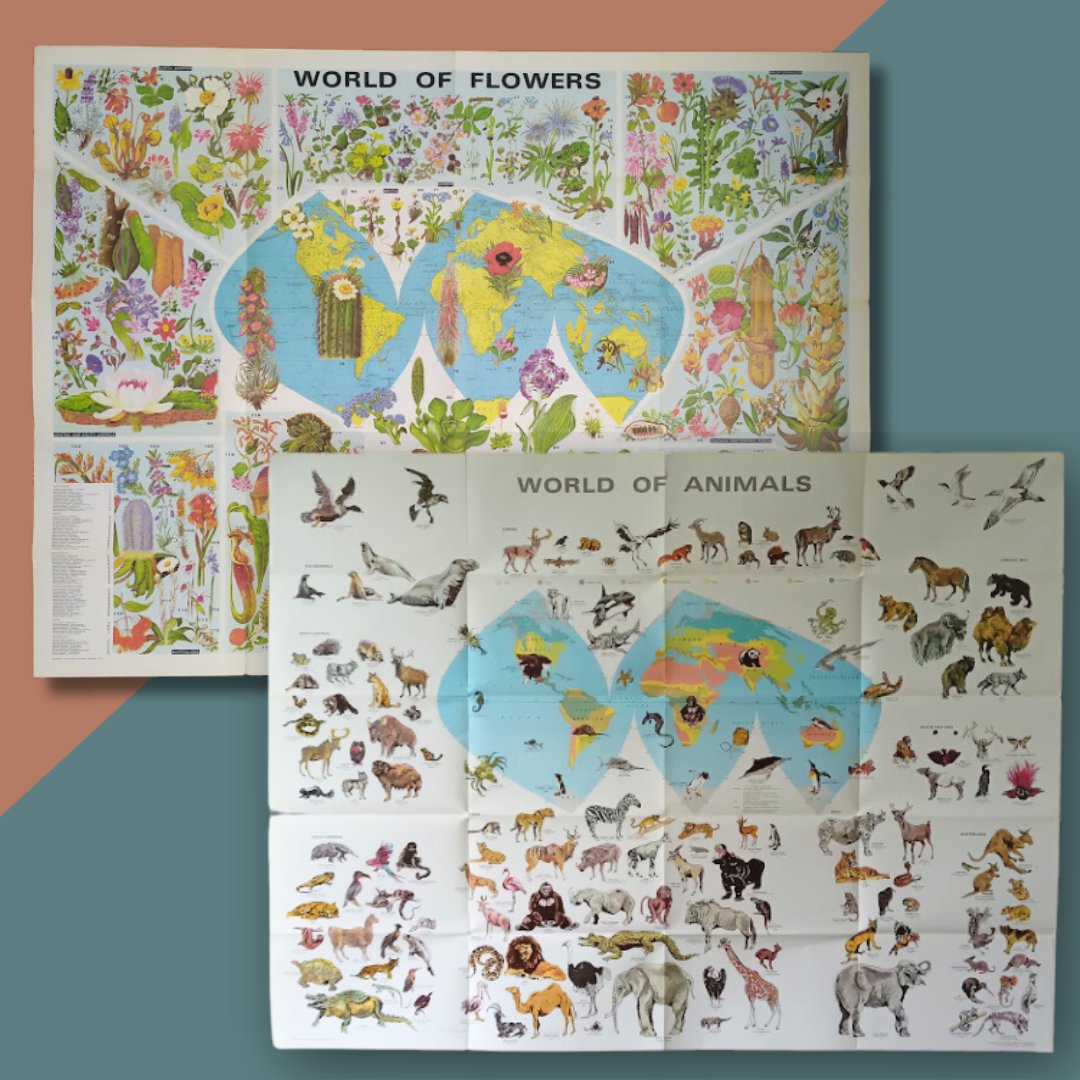
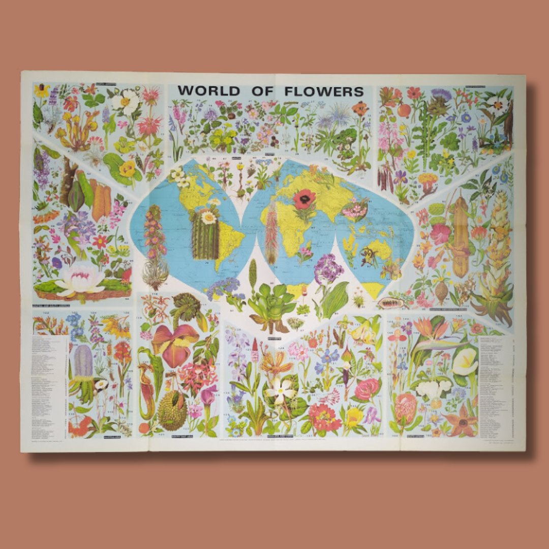
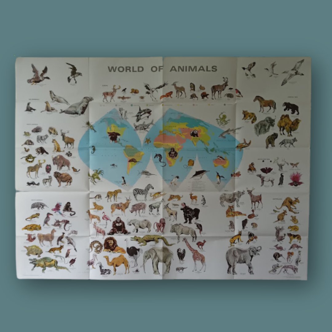
📜 "World of Flowers" by Barbara Everard, created in the 1970s 🌸 🦁 "World of Animals", a vibrant and educational showcase of the wonders of wildlife. 🌟 Size: 100x70 cm for both maps – perfect for adding a retro touch to your home or as a unique Christmas gift! 🎁
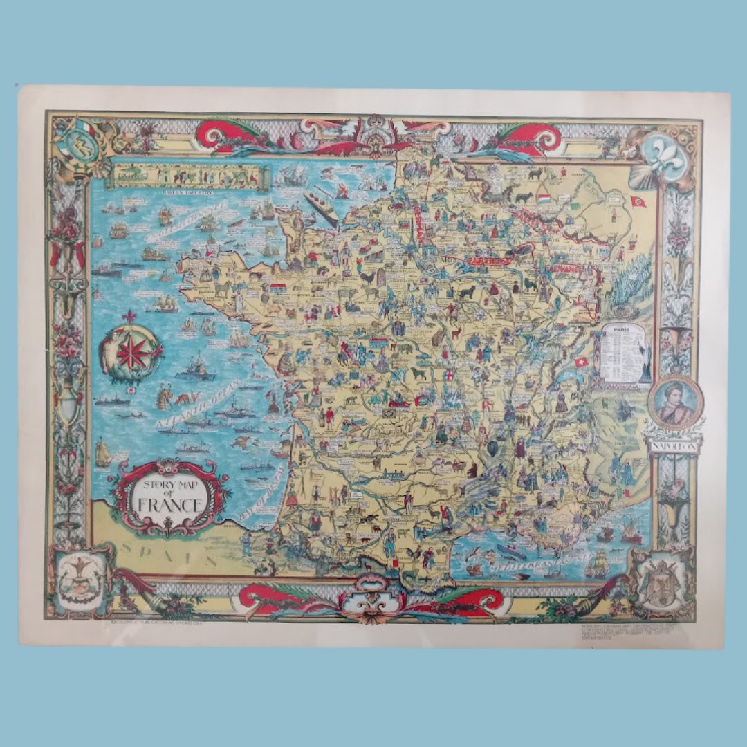
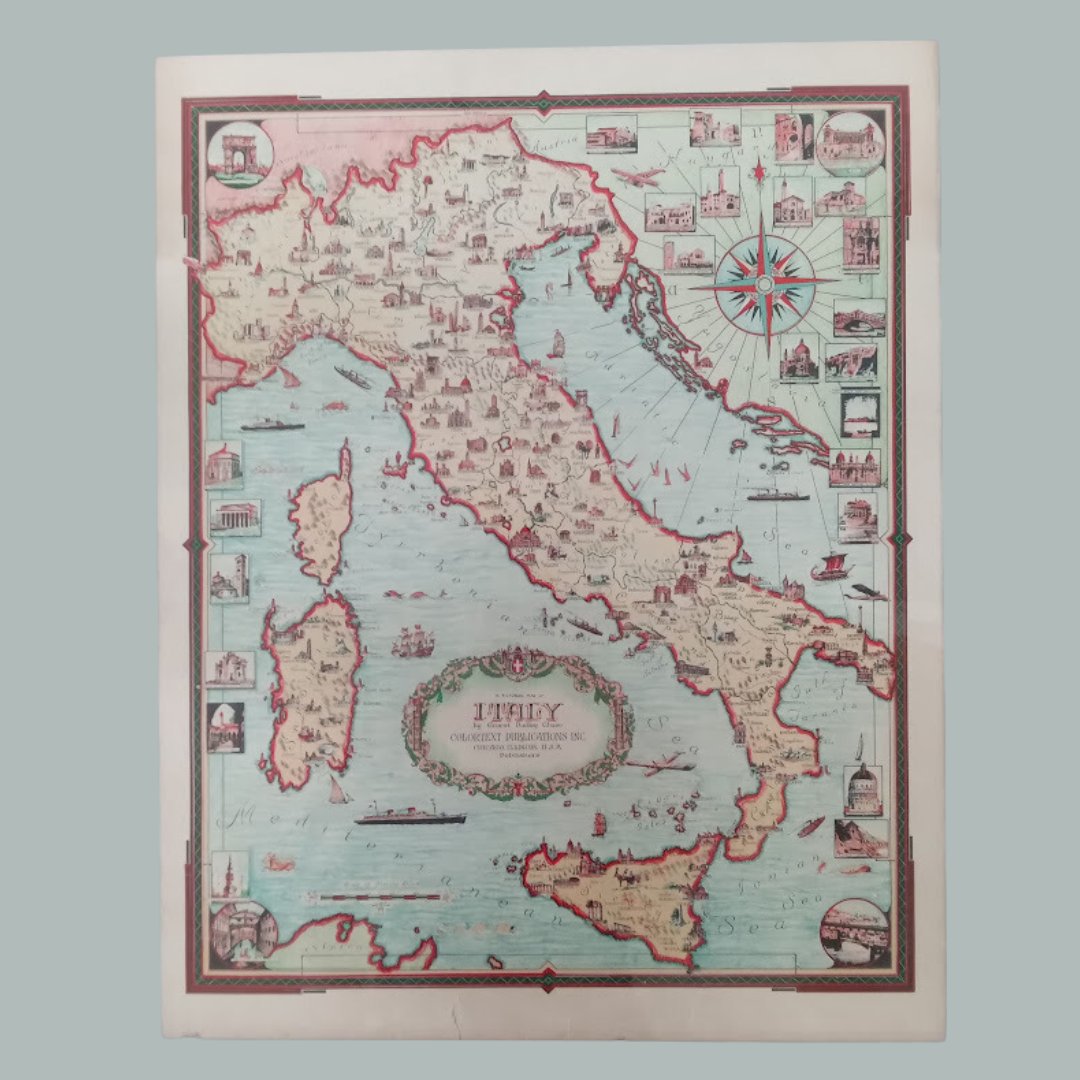
🗺️ Journey through Italy and France with these beautifully illustrated vintage maps! Each map is filled with cultural icons and landmarks, capturing the essence of two historic countries. Perfect for map lovers, history enthusiasts, and travel dreamers! 🇮🇹🇫🇷✨

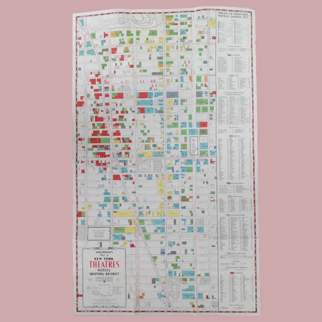
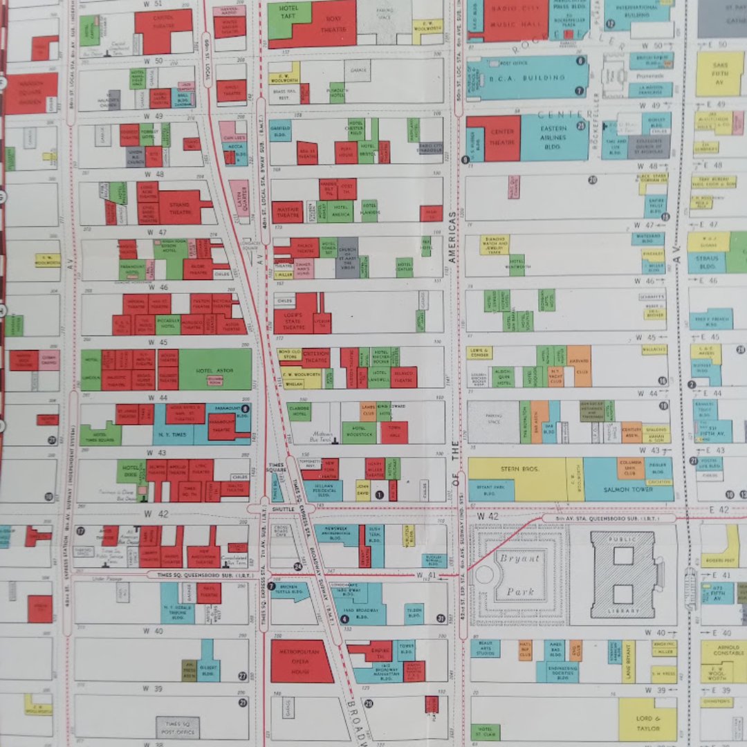
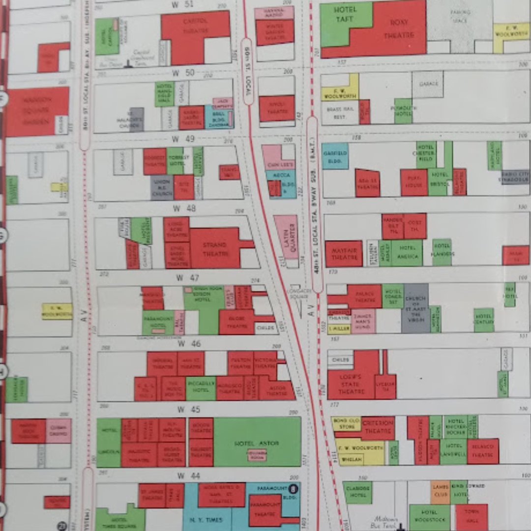
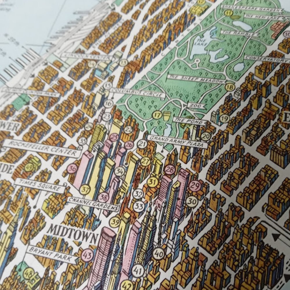
🎭 Dive into the golden age of New York’s theatres with this vintage map showcasing the iconic Broadway and Theatre District! A colorful guide to the era’s theatres, hotels, and shops, perfect for lovers of NYC’s stage and history. 🌆✨ #VintageMaps
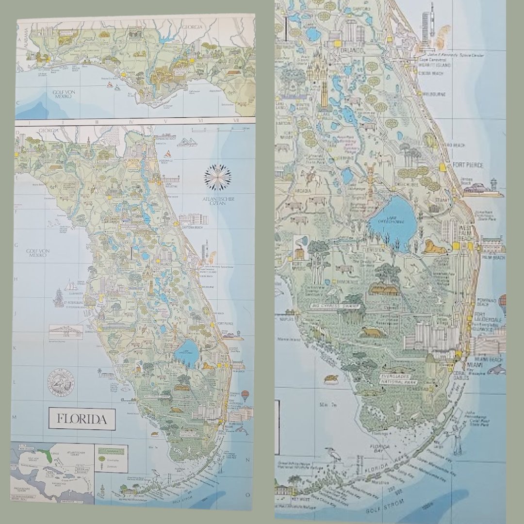
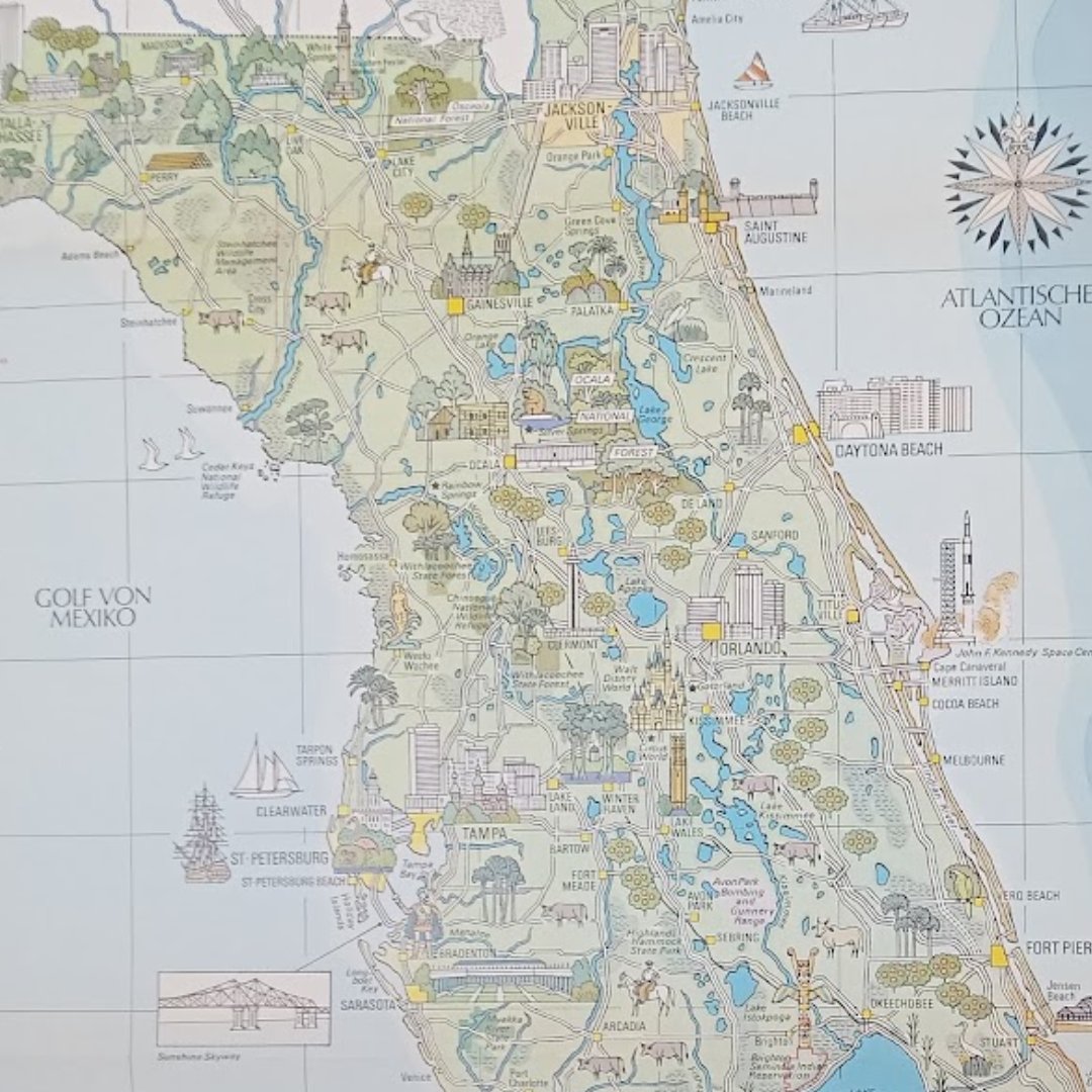
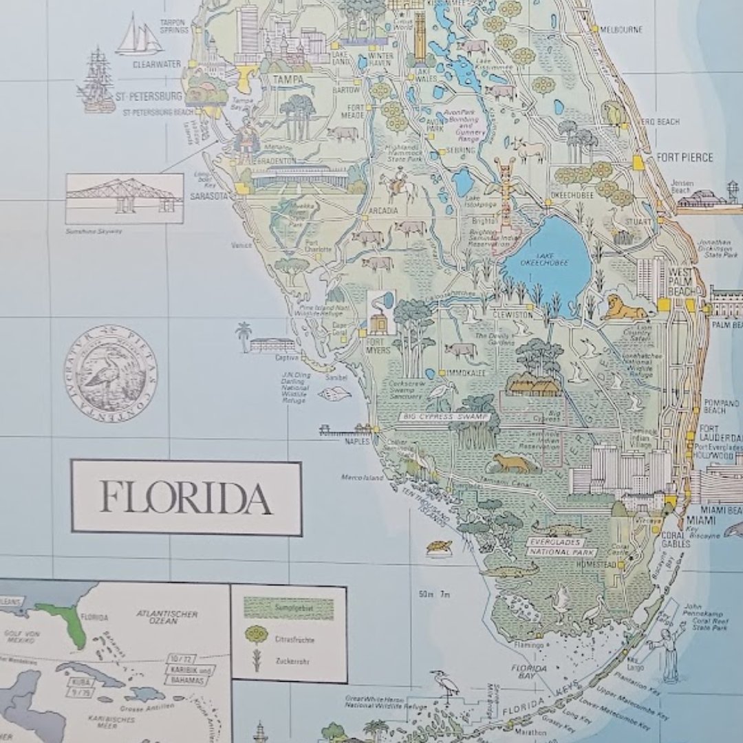
🗺️ Explore Florida through this beautifully detailed vintage map! From the Everglades to bustling cities, this map captures the Sunshine State’s natural wonders and cultural landmarks. Perfect for collectors and travel lovers! 🌴✨
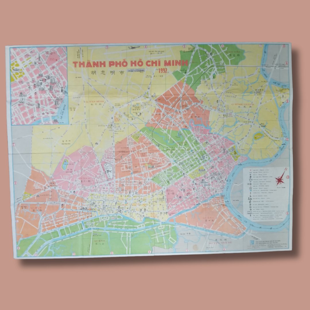
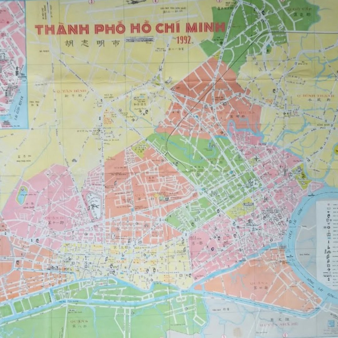
🗺️ Discover the vibrant history of Ho Chi Minh City with this 1992 map! A colorful snapshot of Vietnam's cultural and urban landscape. Perfect for lovers of geography, history, and vintage cartography. A unique gift idea for any collector! ✨

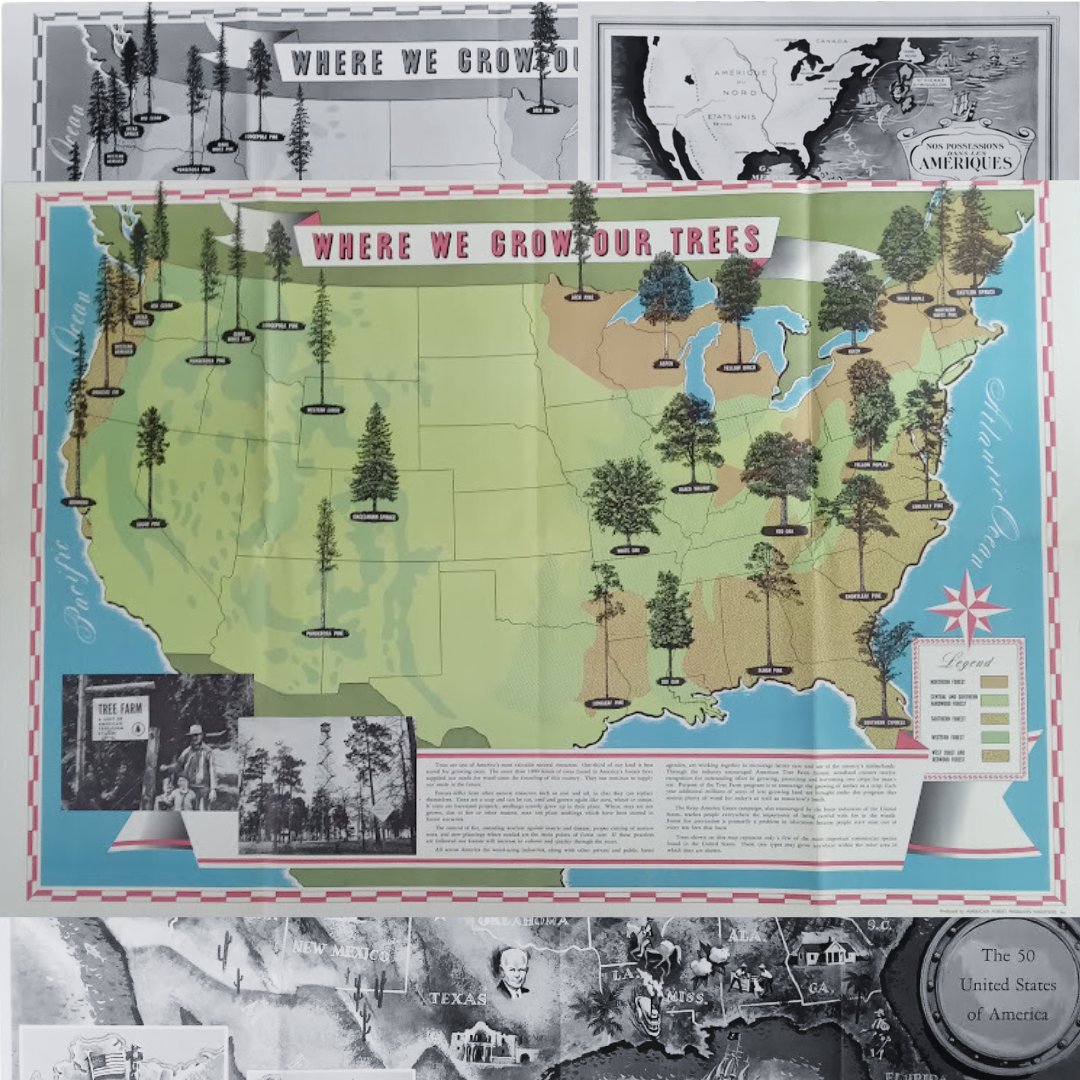
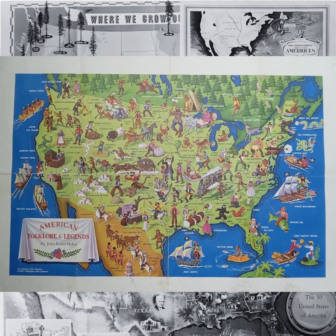
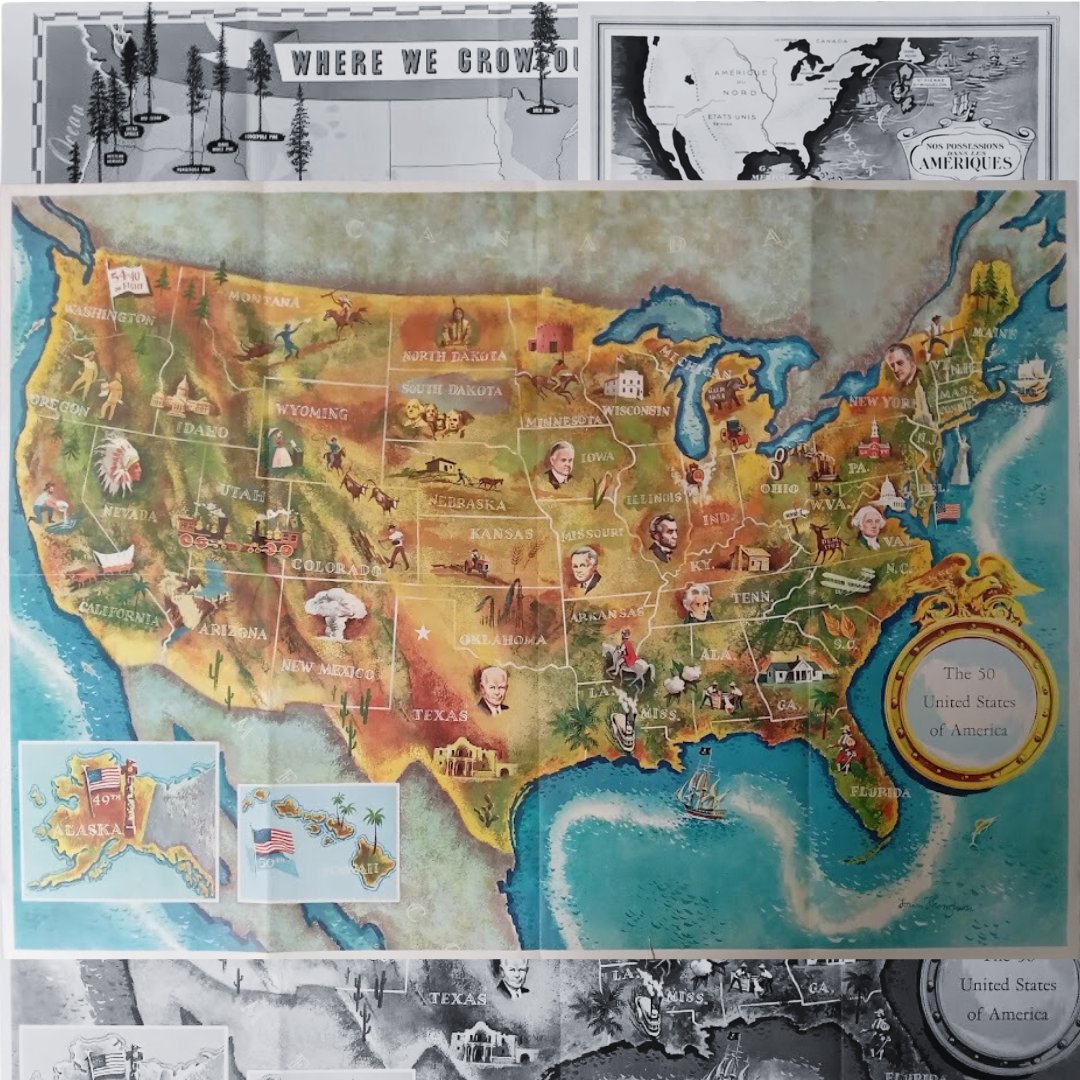
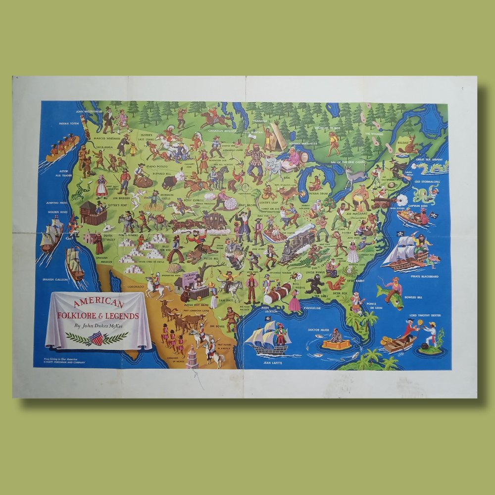
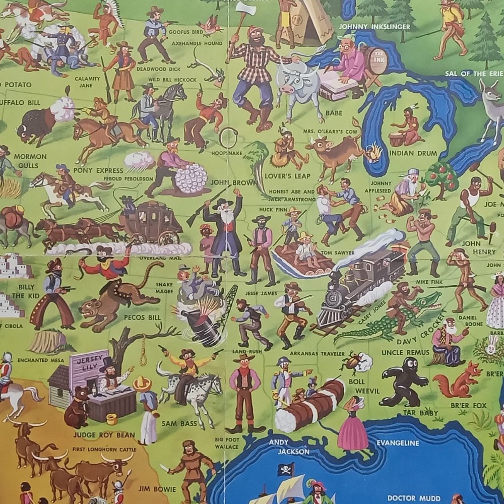
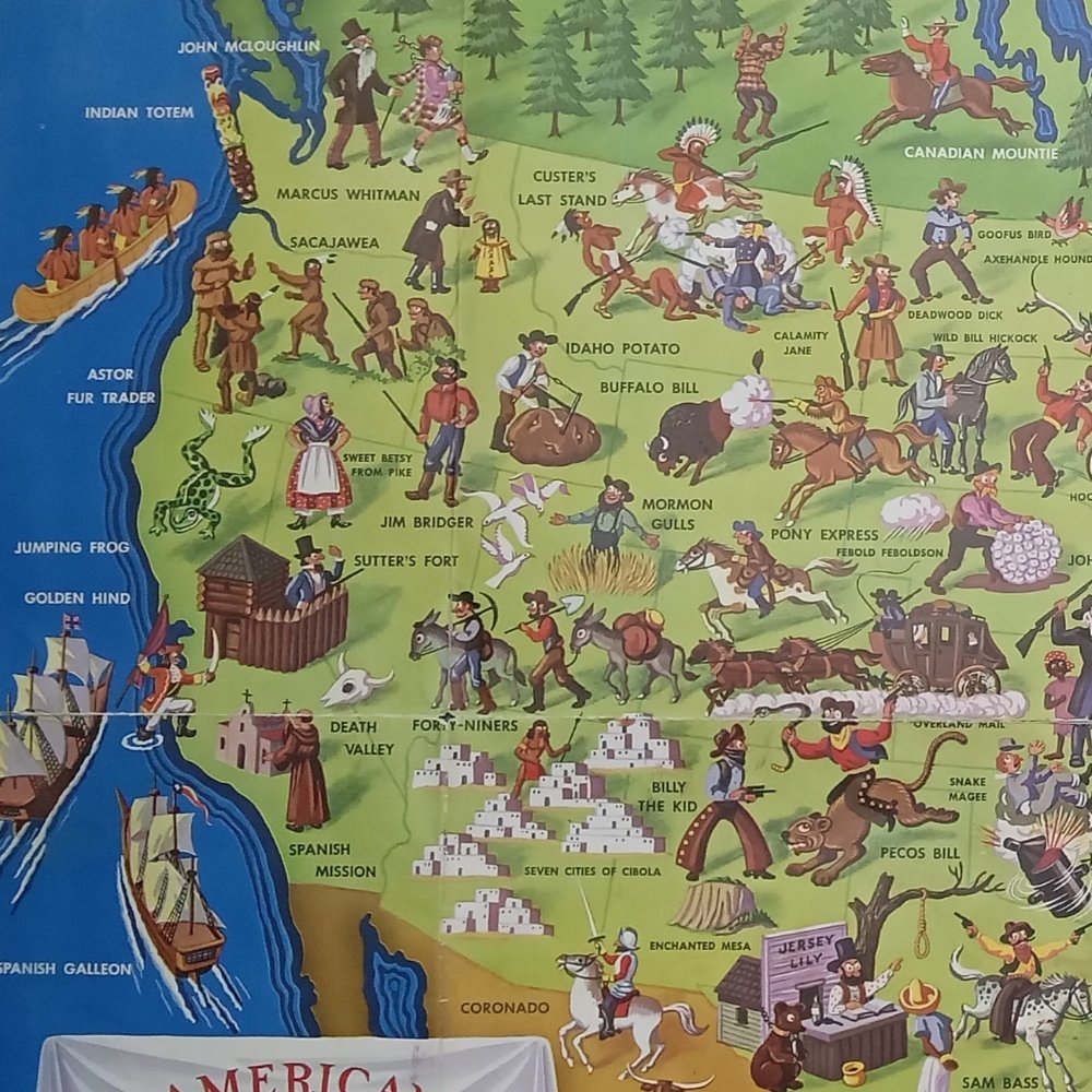
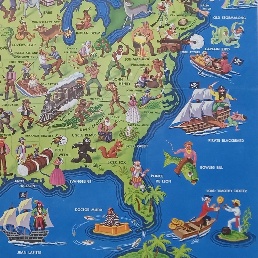
🗺️ Discover the charm of vintage maps! These unique illustrations capture American history, folklore, and nature. Perfect for decorating, exploring, or gifting, they’re treasures for geography and art lovers. A timeless gift for those who dream of journeys past! ✨

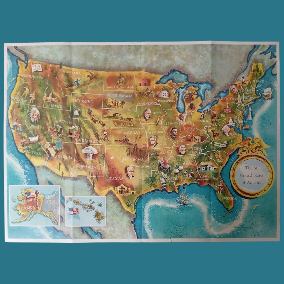
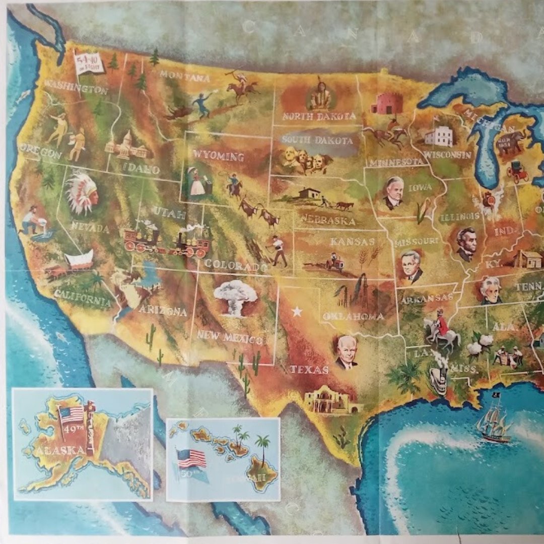
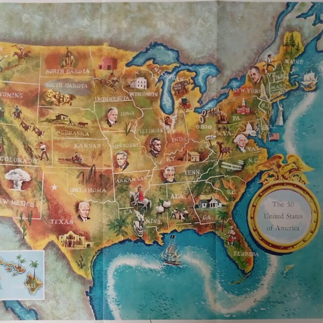
🗺️ Discover this vintage map of the United States featuring American presidents! A nod to past leaders as the U.S. prepares to choose its next one in 2024. Trump or Harris? Who will join this historic lineage? A treasure for history and politics enthusiasts! 🇺🇸✨
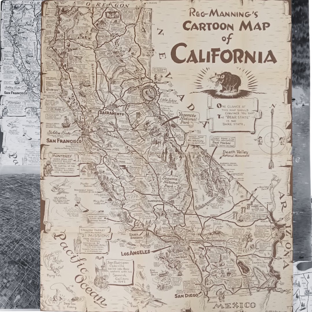
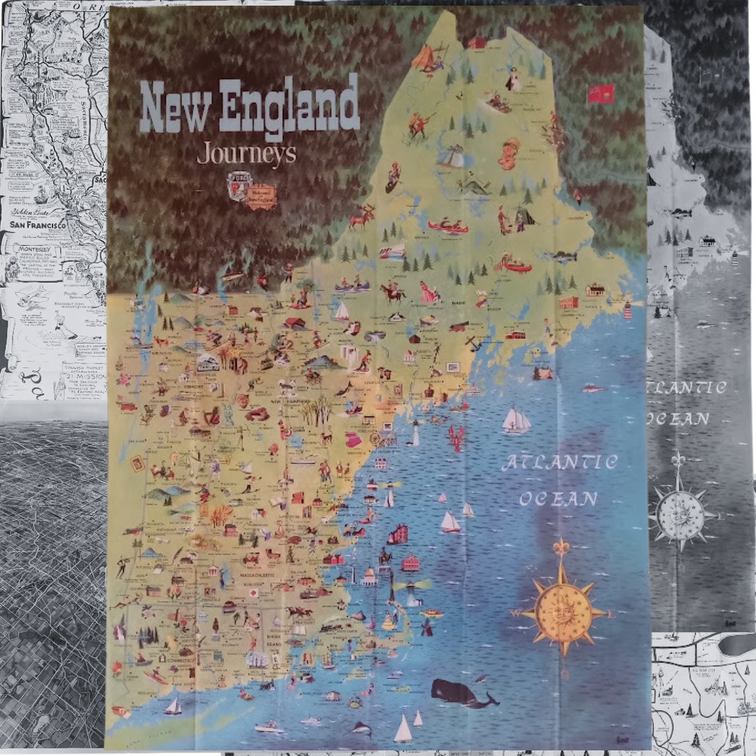
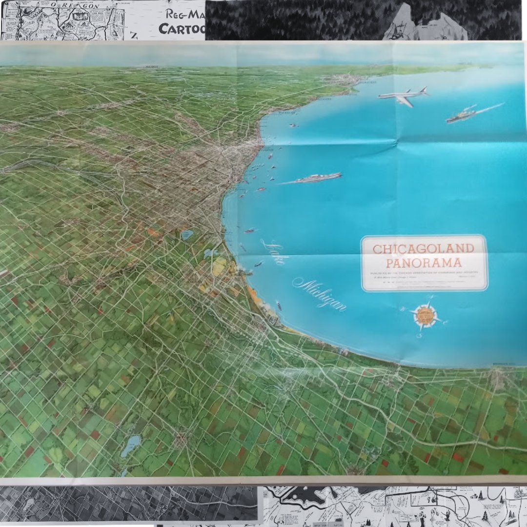
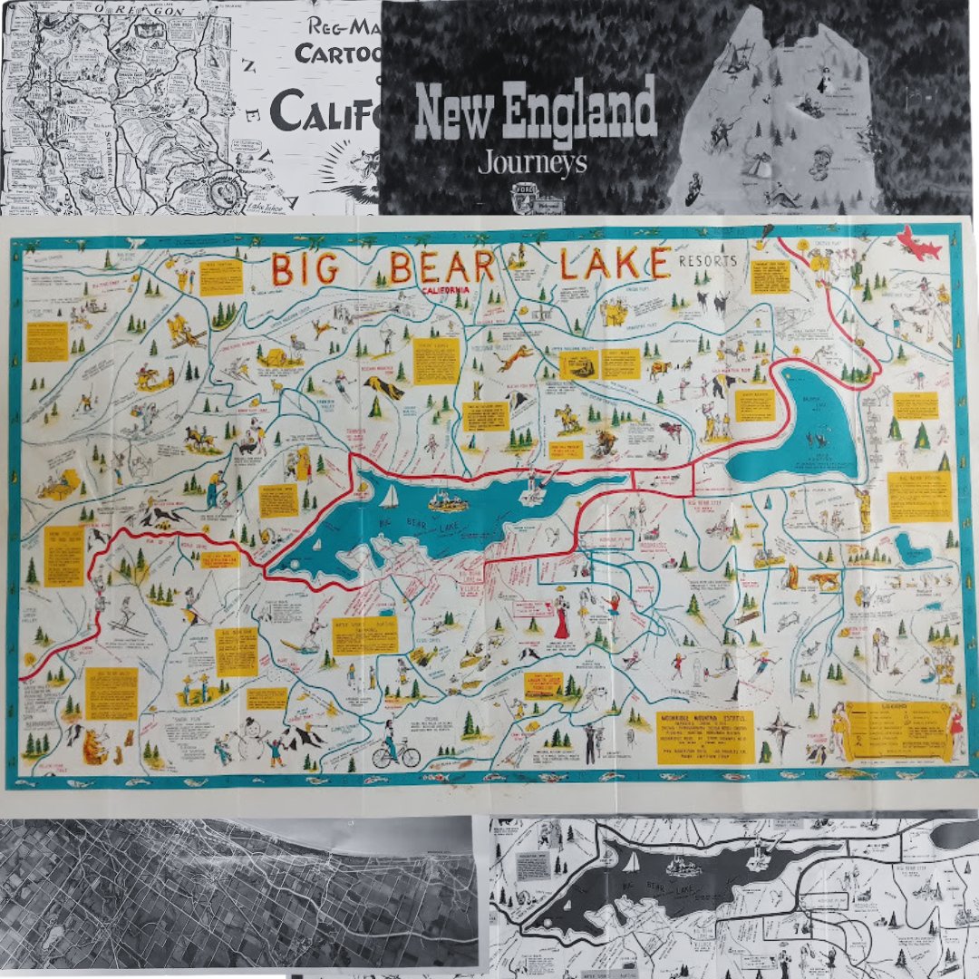
🌍 Dive into the past with these vintage maps! Each one tells a unique story: California in 1939 by Reg Manning, New England in the 1950s, Chicagoland’s panoramic view, and Big Bear Lake in 1963. Perfect gift idea for travel, geography, and vintage lovers! 🗺️
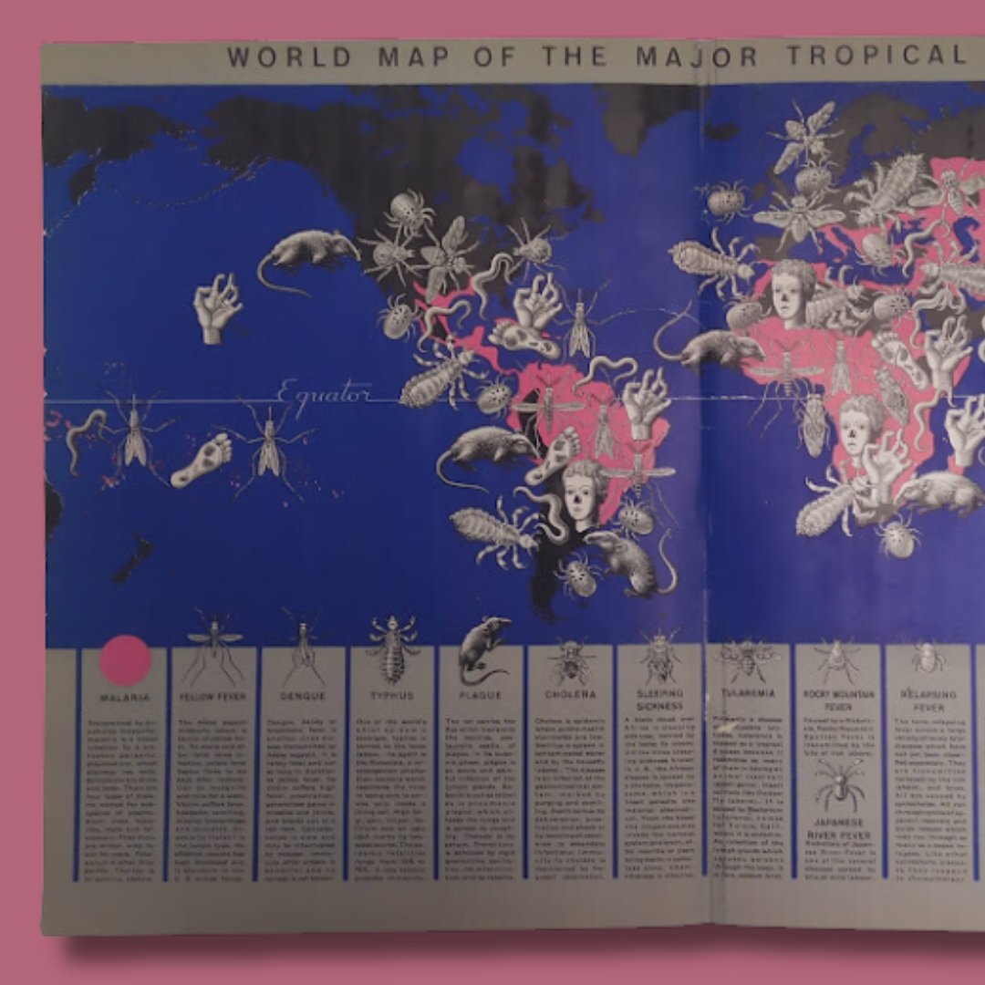
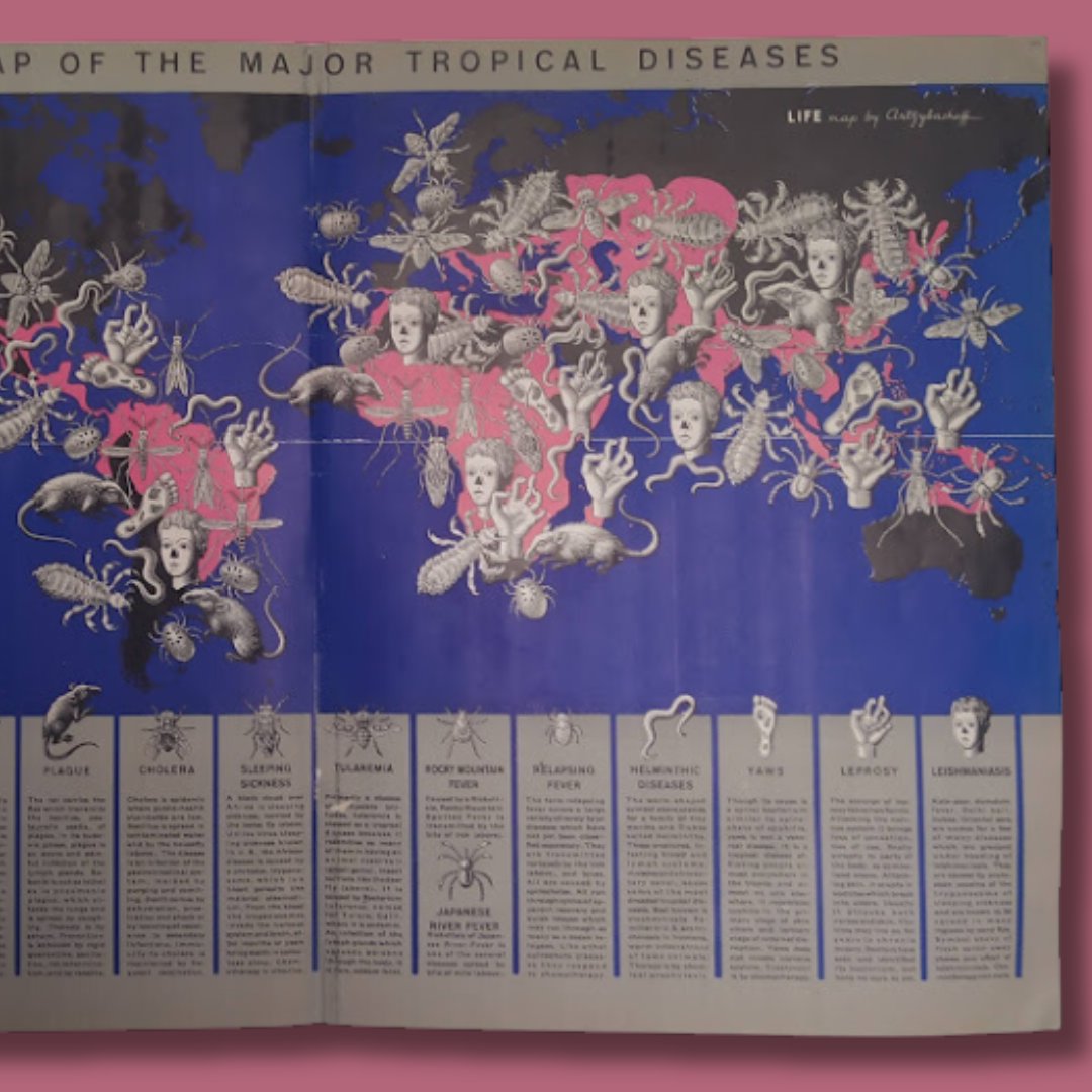
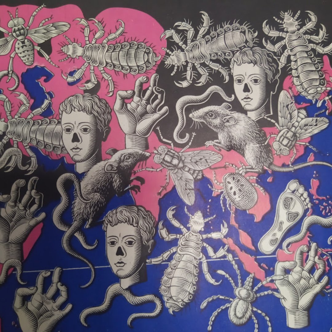
🎃 In the 1940s, the famous illustrator Boris Artsybasheff crafted a map of tropical nightmares! A world where terrifying creatures come to life: bloodthirsty tsetse flies, vicious ticks, and nightmare-inducing worms ready to strike 50x35 cm Want to know more? Send me a message!

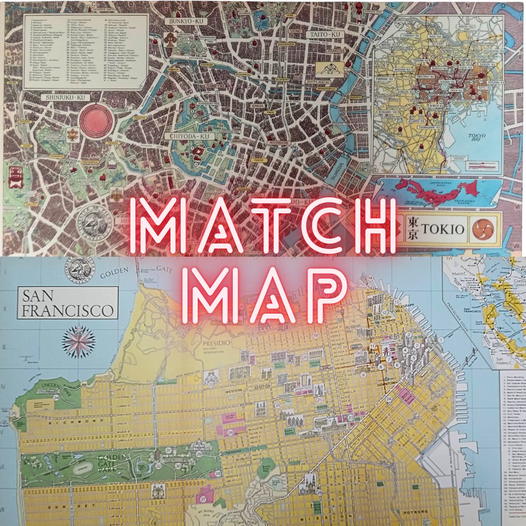
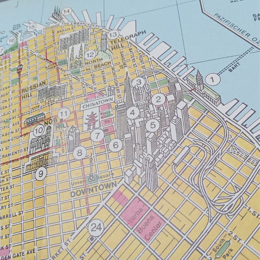
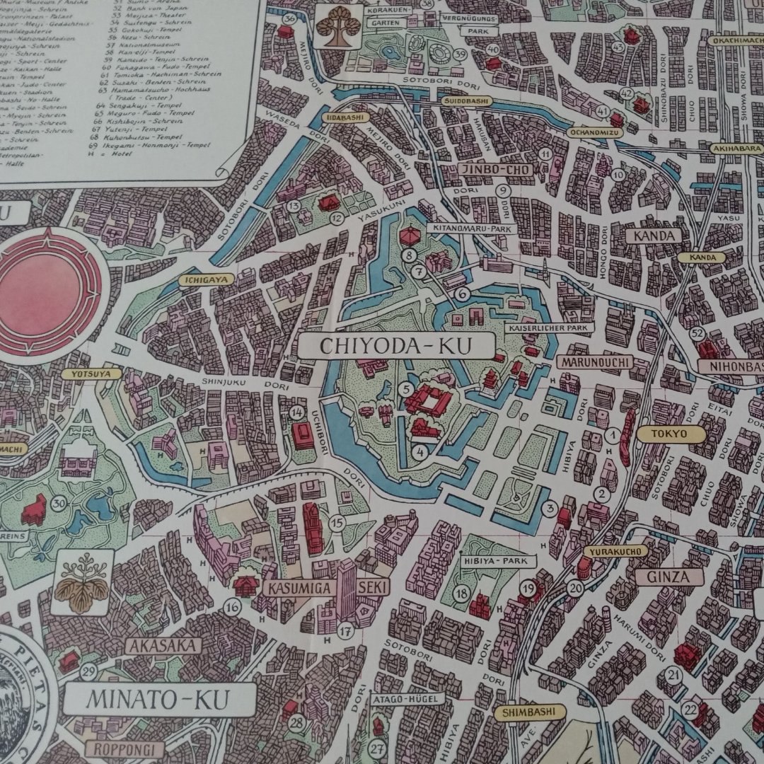
📍 Match Map Challenge! 🌎 Tokyo 🗼 or San Francisco 🌉 — which vintage map would you explore first? ✨ Details: Tokyo Map (in German) - 1970/80, Size: 27 x 55 cm San Francisco Map (in German) - 1970/80, Size: 27 x 55 cm 👇 Let us know in the comments! Tokyo or San Francisco?
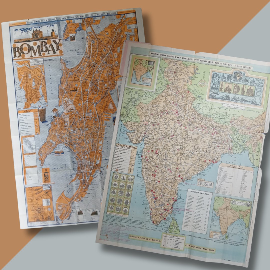
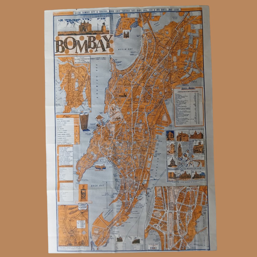
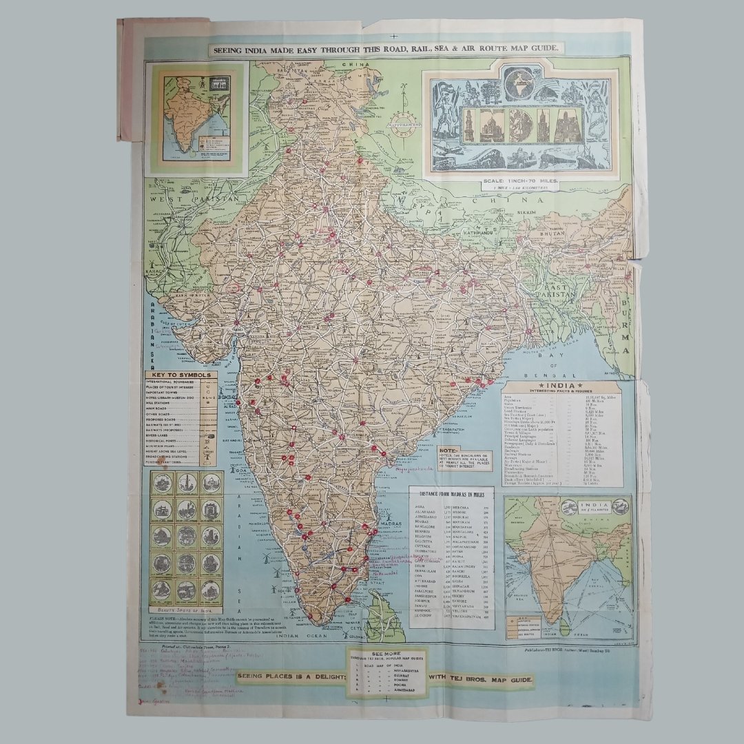
📍 Bombay Map (1960/70's): 50*74 cm. 🌏 India Map (1960’s): 64*84 cm.
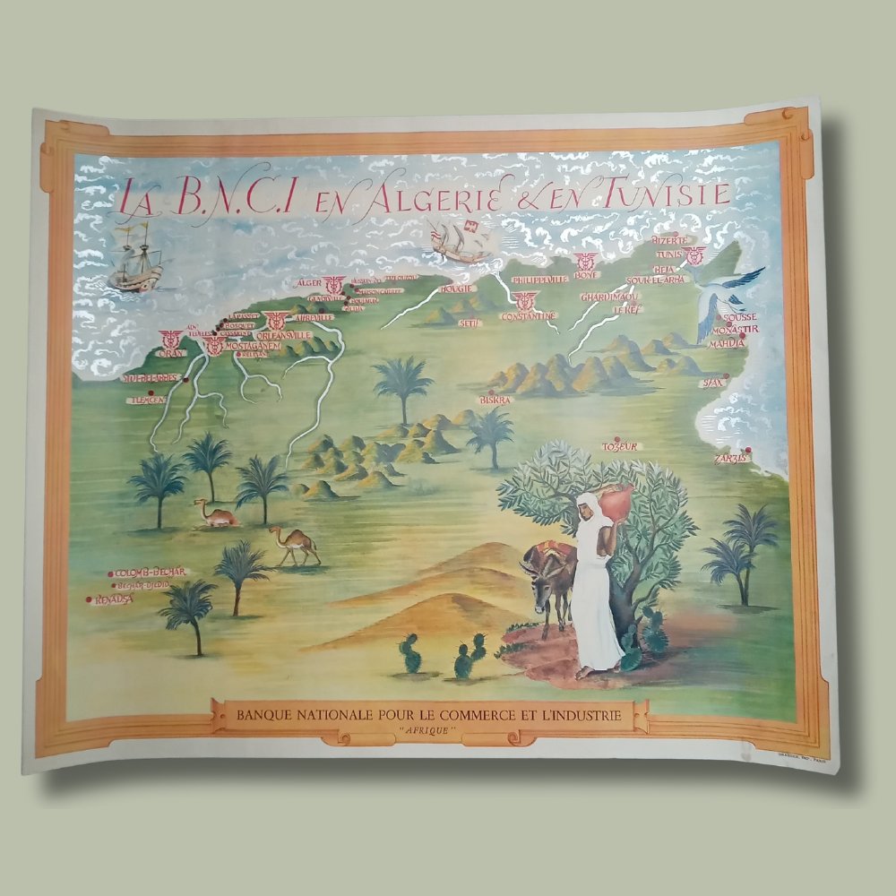
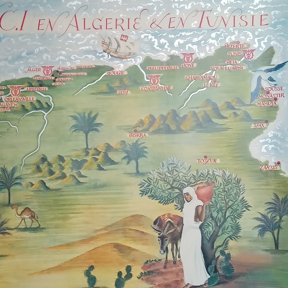
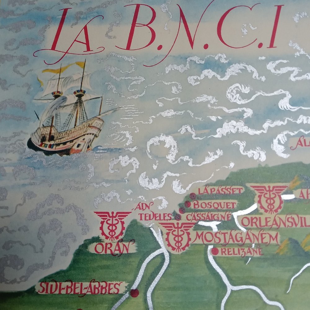
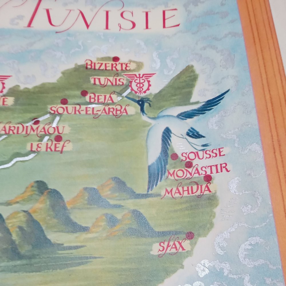
Discover this illustrated map of Algeria and Tunisia, published in 1940 by the Banque Nationale pour le Commerce et l'Industrie. Dimensions: 53.7 * 43.9 cm. r
"American Folklore & Legends" by John Dukes McKee, measures 62x91 cm. 1940's
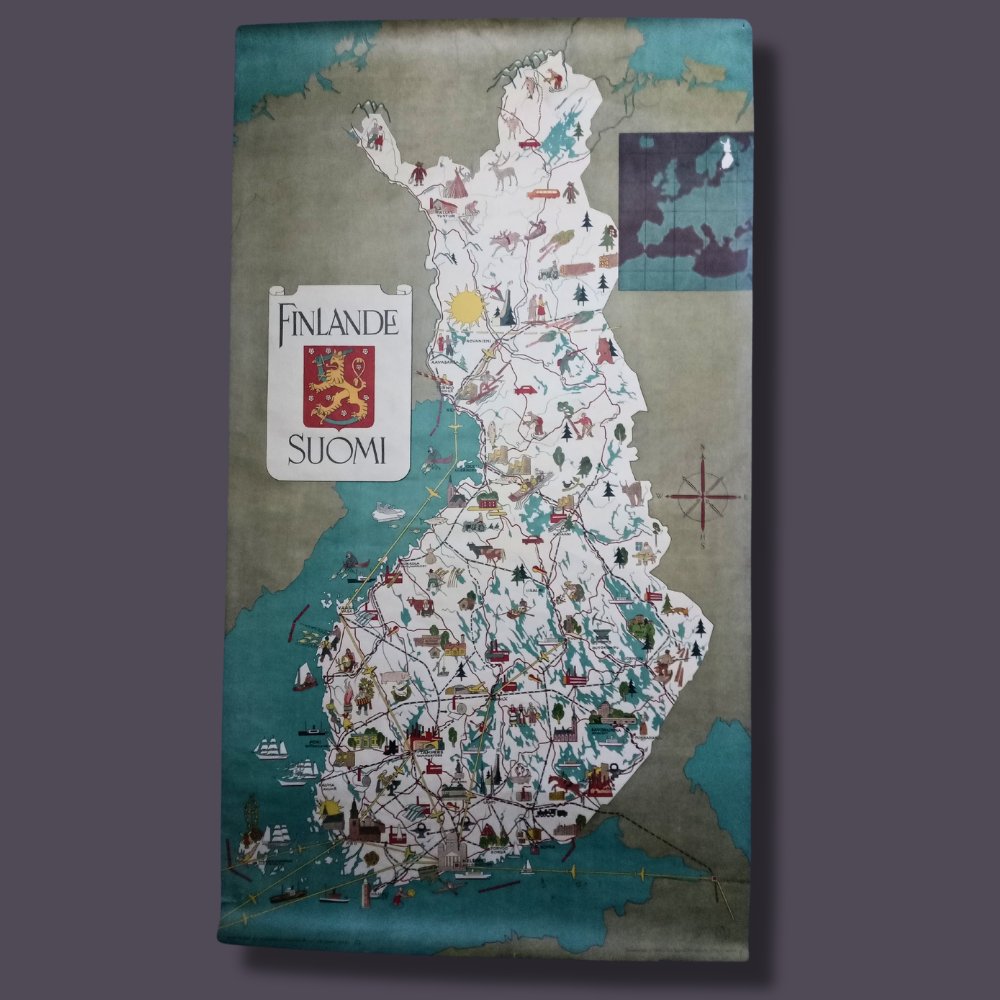
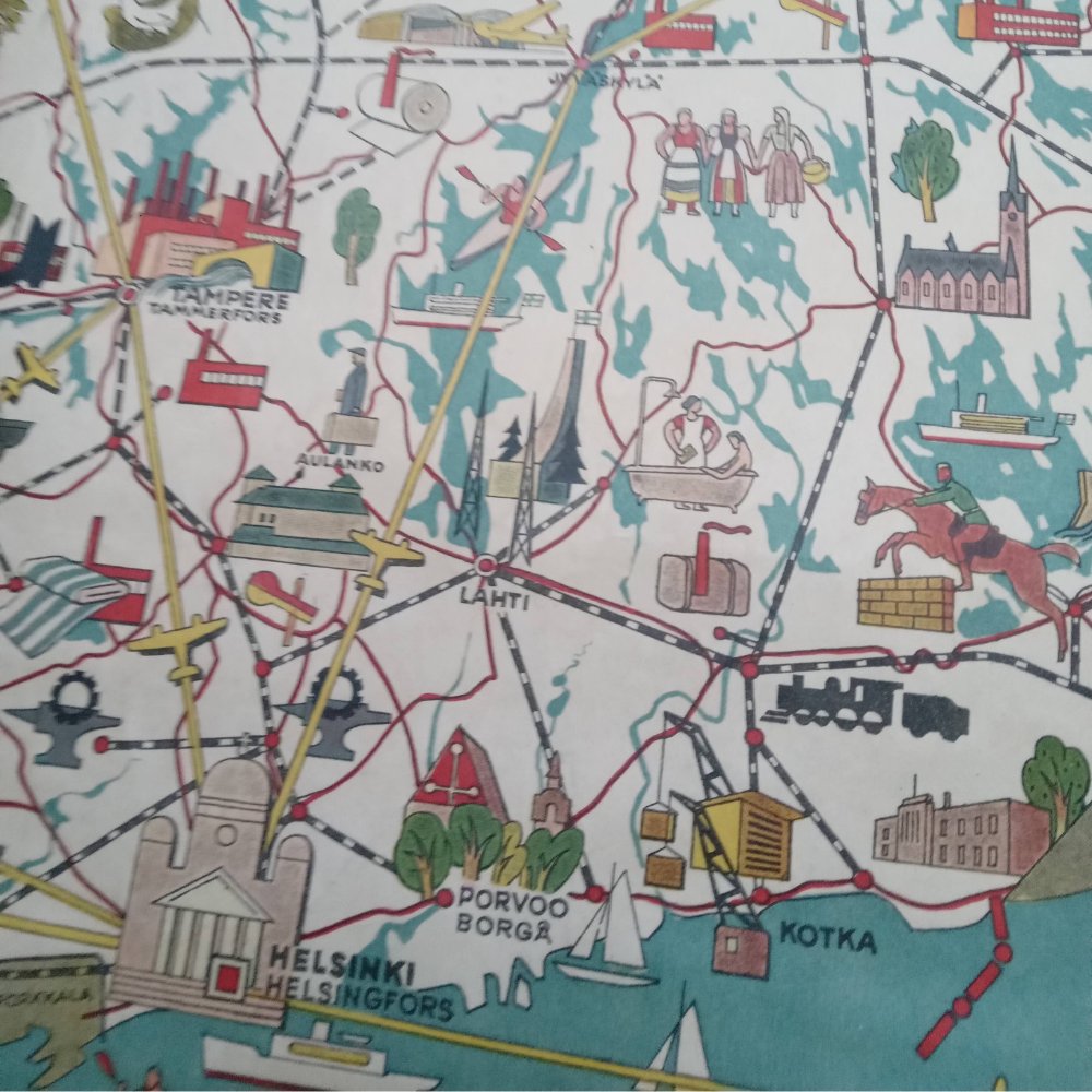
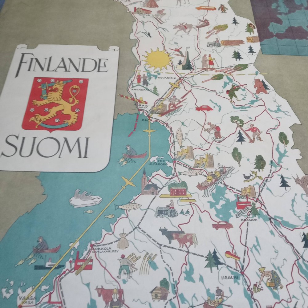
Finland 1949 poster Full-length: 84 x 47 cm Original design, pictorial map Other maps available via the link in bio. If you have any questions or comments, don't hesitate to send me a message! Thanks .
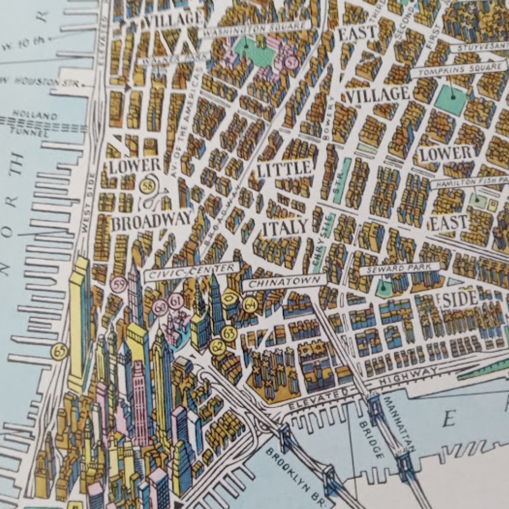
New York City poster/map Small format: 55*27 cm Probably from the late 70s or early 80s. Original design in the spirit of Hermann Bollmann's bird's-eye views! Other maps available via the link in bio. If you have any questions or comments, send me a message!


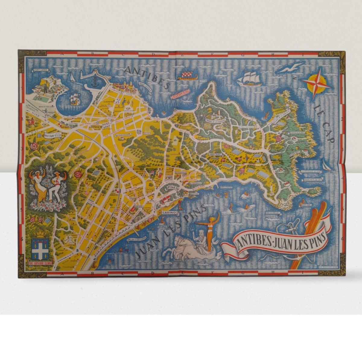
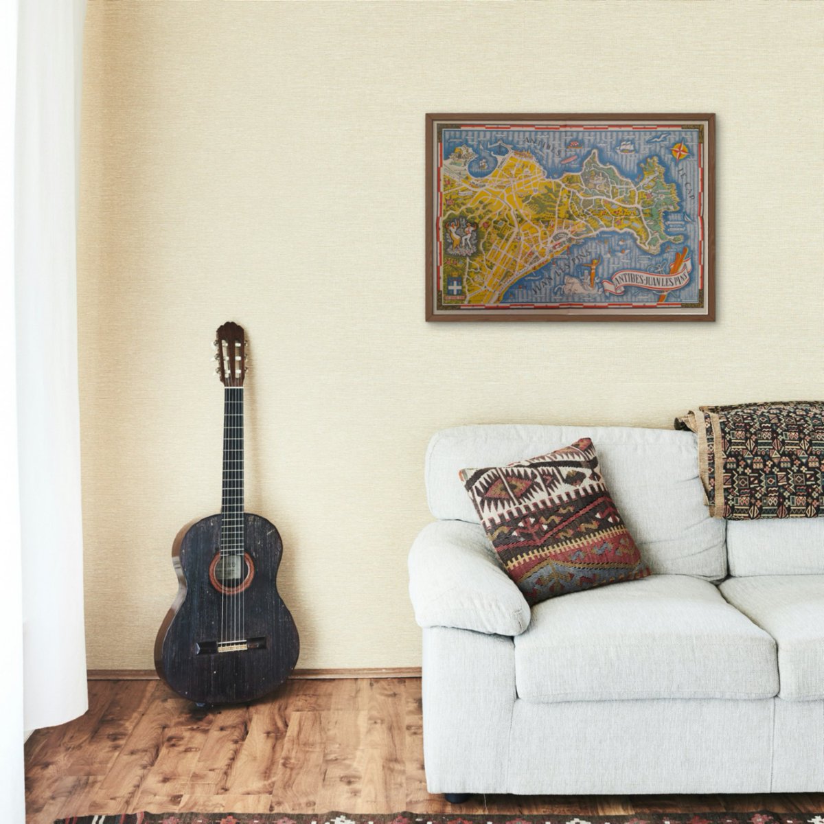
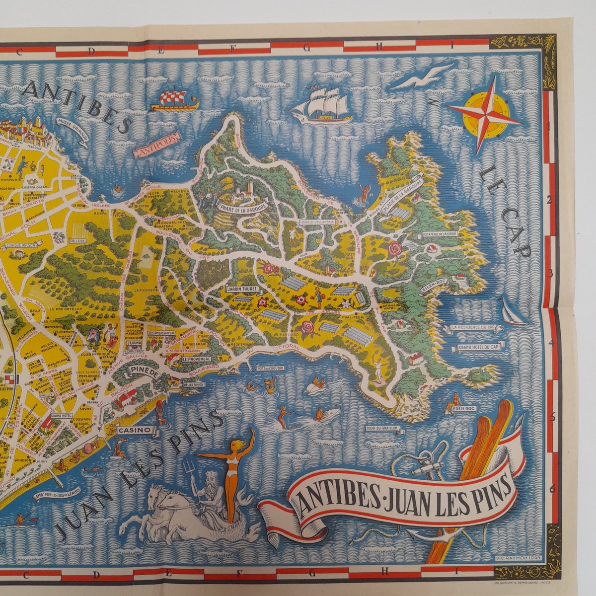
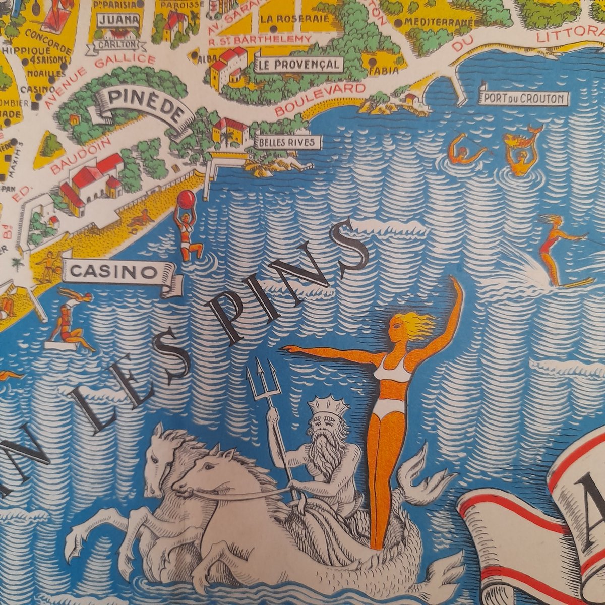
A beautiful map from the late 1930s, drawn by Vic Raymon, measures around 44*63cm .Juan-les-Pins
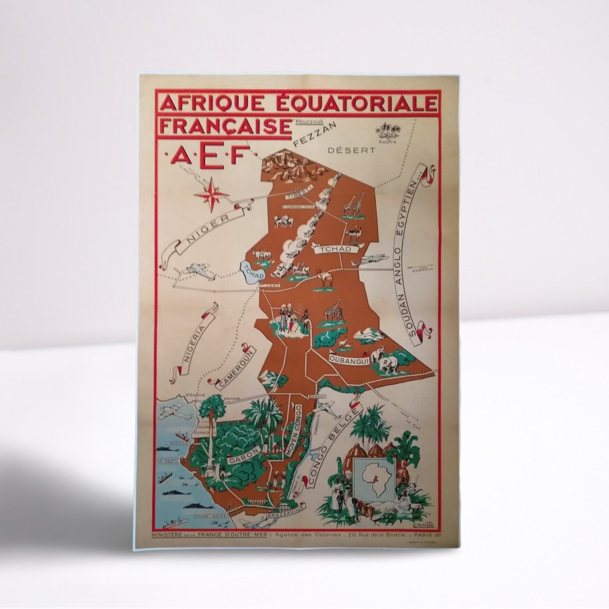
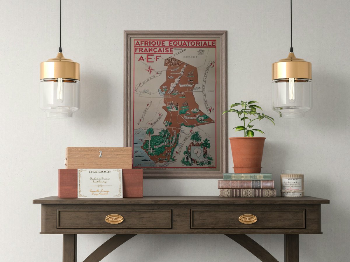
Lovely 50s poster by Léo Craste, l'Afrique Equatoriale Française! 120*80 cm #oldmap #pictorialmap #vintagemap #map #africamap #leocraste #oldposter #postervintage #pictorialposter #tourismap #oldprint #poster #vintageprint #cartedumonde #voyagerautrement #arttravel #travelmap
The full Moon isn't until July 21, but here's a sneak peek at our satellite with a nice selection of Moon maps from various years! Which one do you prefer?
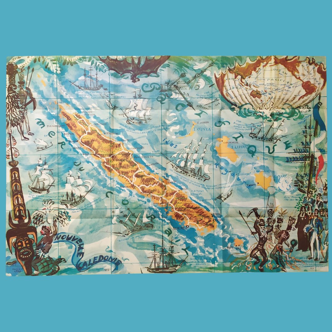
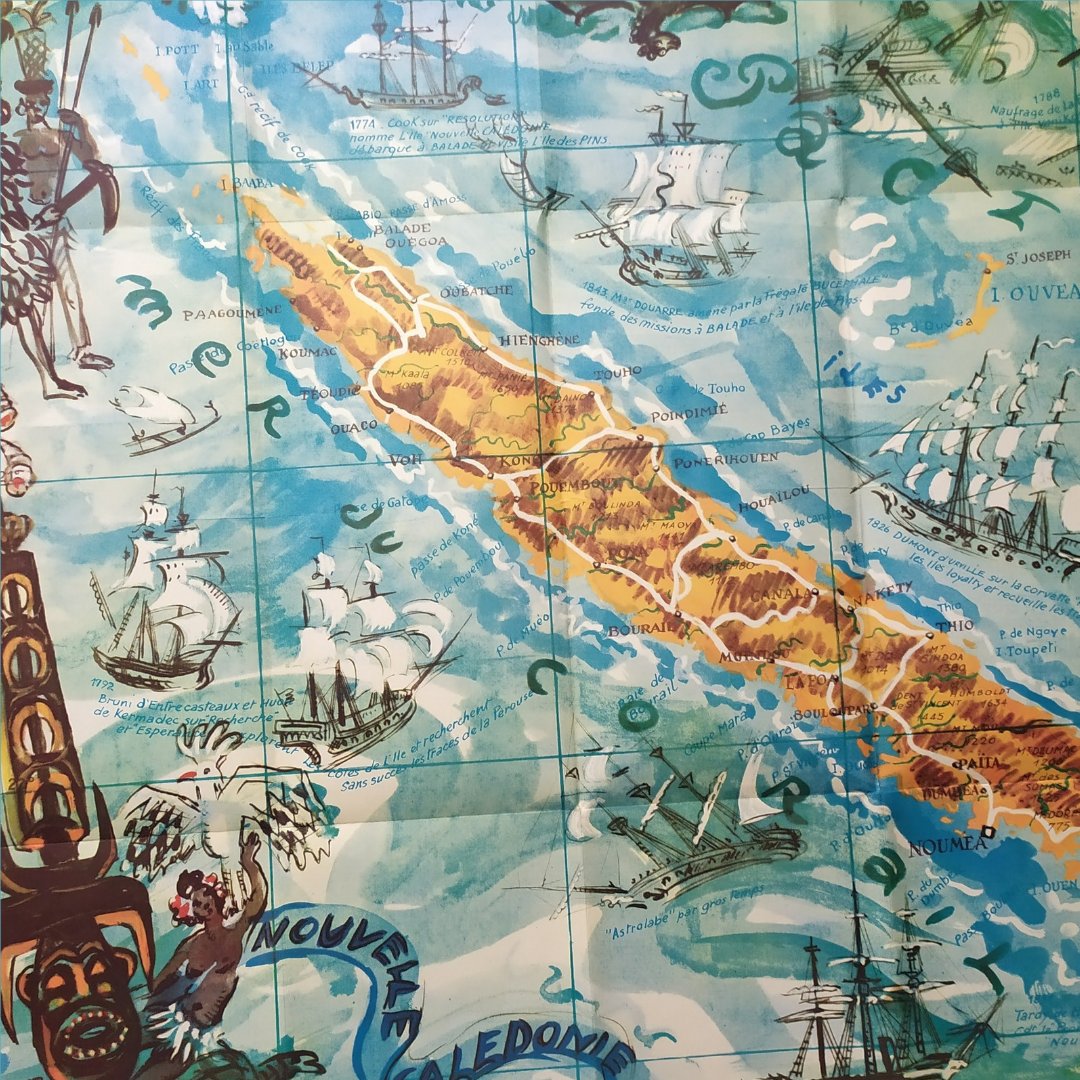
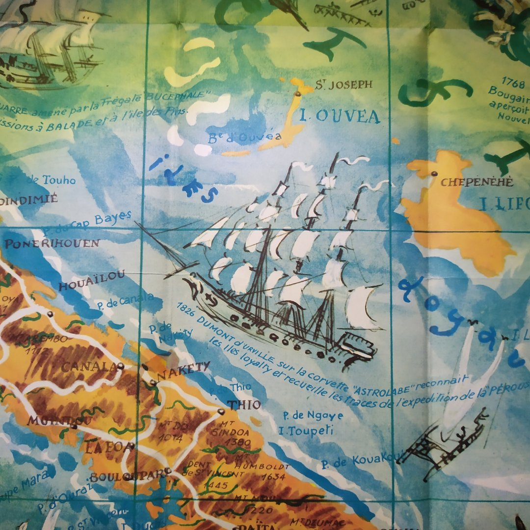
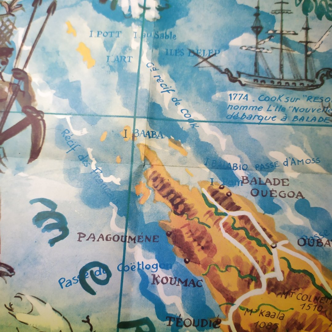
Discover this superb colorful map of New Caledonia 🌴✨, created in 1953 in Paris by Monique Cras, famous French painter and creator of tourist posters. Her work, rich in historical and cultural detail, perfectly captures the spirit of this exotic Southwest Pacific destination!
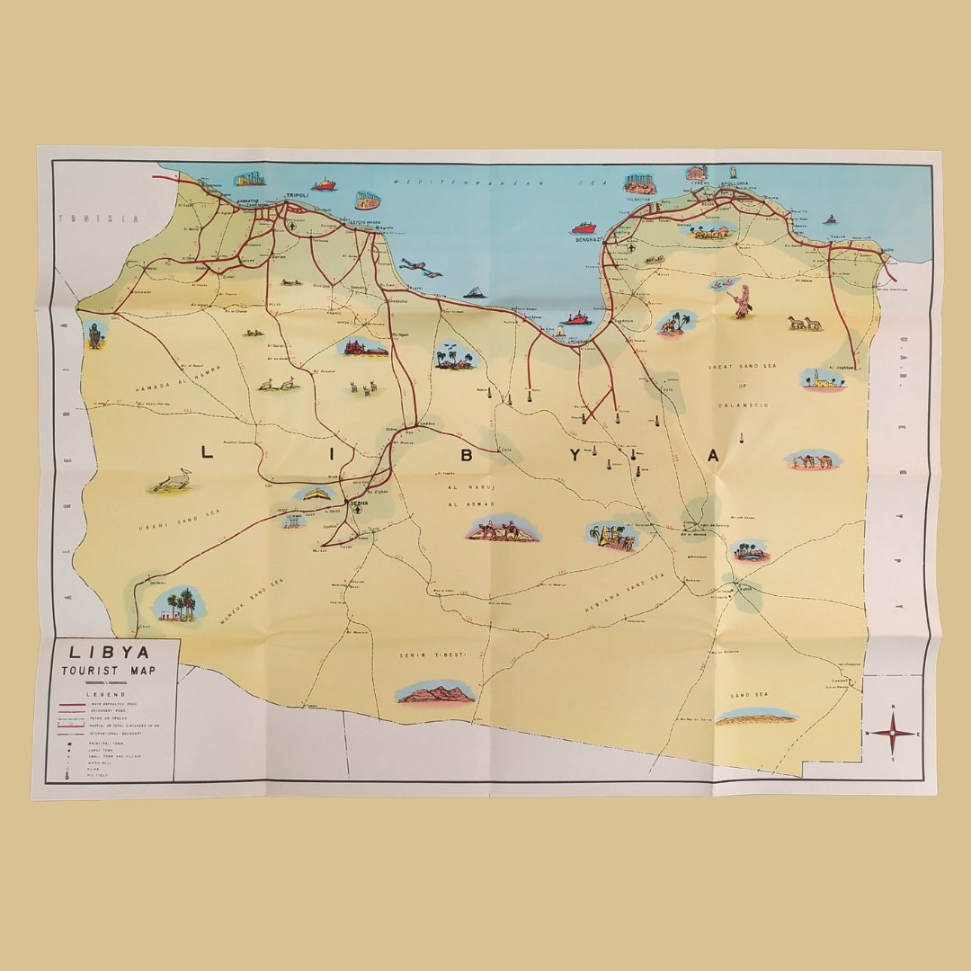
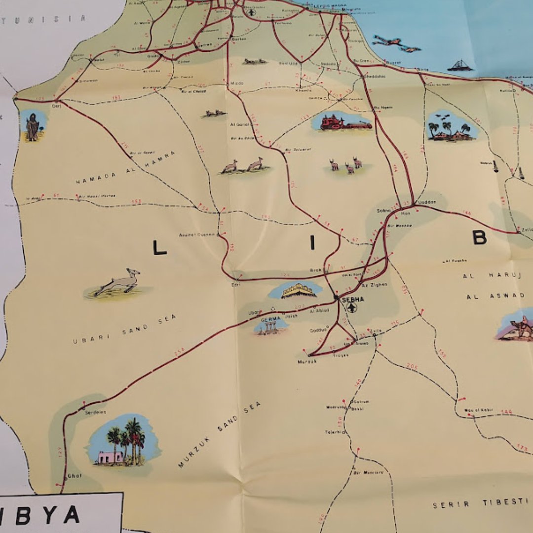
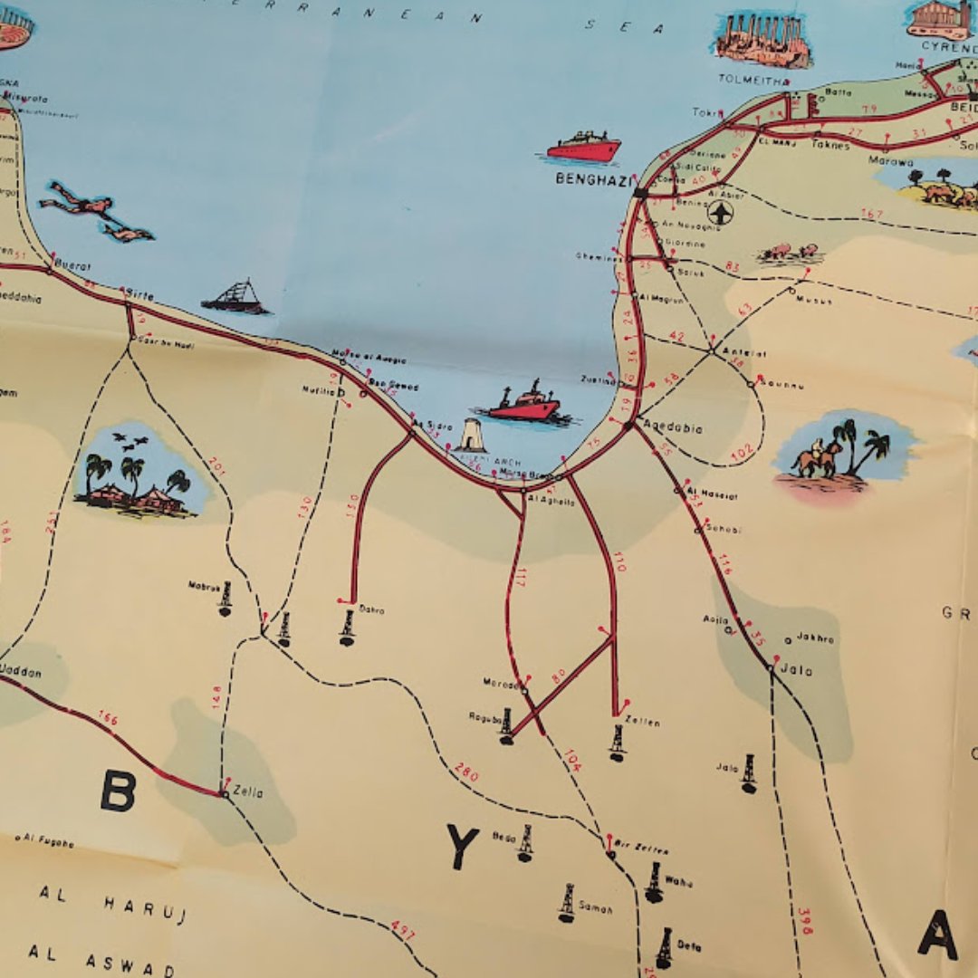
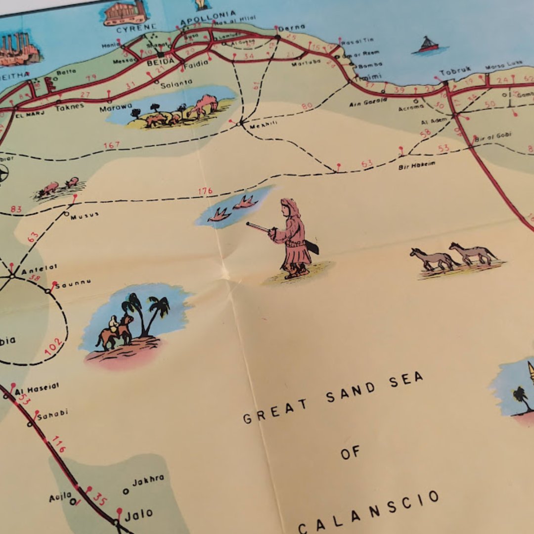
Discover this pictorial map of Libya from the 1950s, measuring 66*47 cm. Dive into the history and art of cartography with this unique piece that showcases the cultural and geographical richness of the era. 🌍✨ Double-tap if you love it!


United States Xu hướng
- 1. 49ers N/A
- 2. 49ers N/A
- 3. Bills N/A
- 4. Josh Allen N/A
- 5. Niners N/A
- 6. Super Bowl N/A
- 7. Bo Nix N/A
- 8. Broncos N/A
- 9. Cooks N/A
- 10. finn N/A
- 11. Denver N/A
- 12. Stidham N/A
- 13. Purdy N/A
- 14. Buffalo N/A
- 15. Sam Darnold N/A
- 16. gaten N/A
- 17. sabrina N/A
- 18. Cancun N/A
- 19. #FTTB N/A
- 20. McDermott N/A

Something went wrong.
Something went wrong.