
Leo
@some_maps
Today's amazing numerical weather models produce tons of free data, which I like to visualize.
You might like


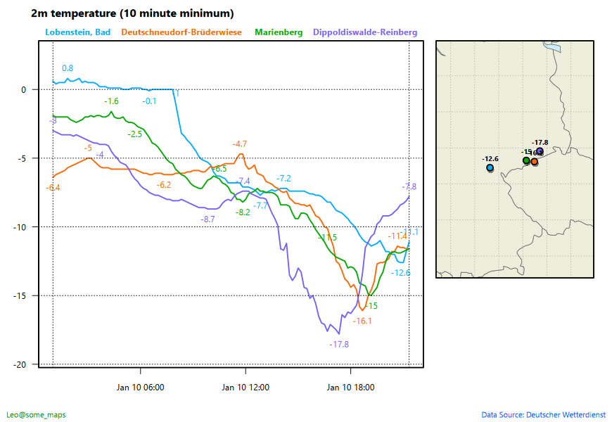
Minimum temperatures for four weather stations in Germany. Surprisingly, all four stations report increasing temperatures... #winter
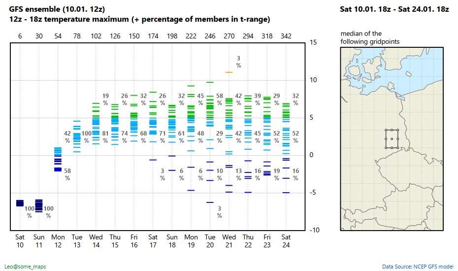
Daily temperature maxima in the GFS ensemble (plus "probabilities" for the given temperature intervals). Median of 9 gridpoints in eastern Germany. #GFS #weather #winter
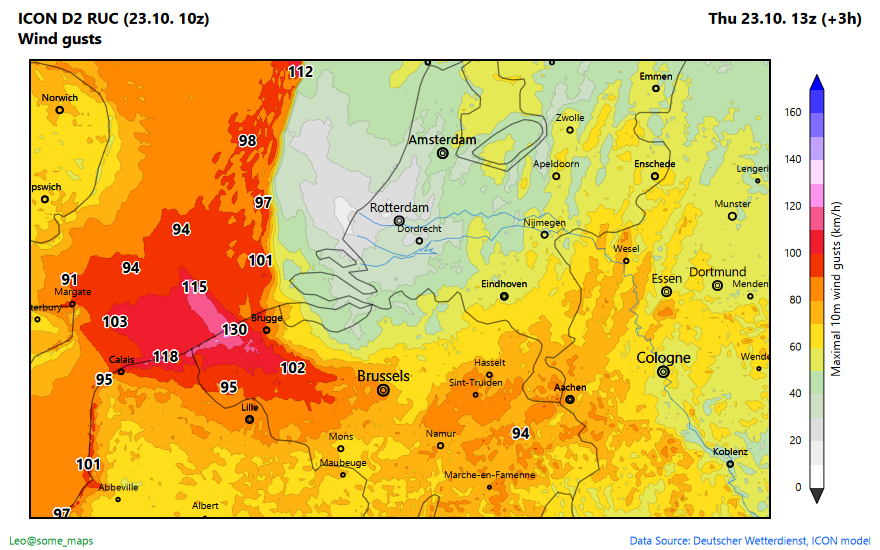
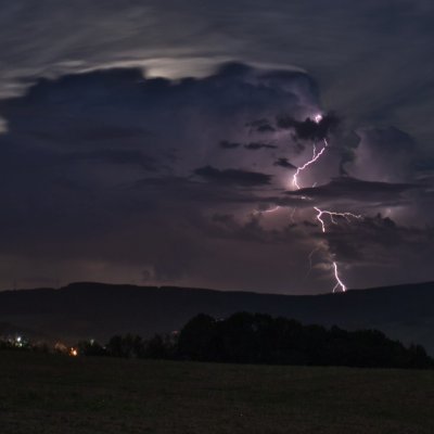
This is the ICON D2 RUC nowcast model with its weather interpretation for storm #Goretti. #winter #storm #snow
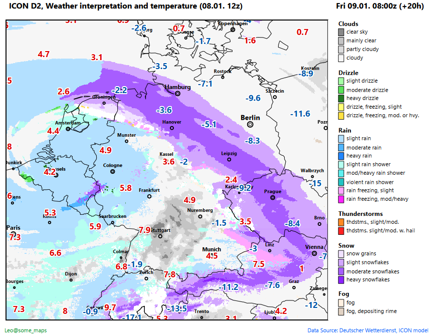
Weather interpretation and temperature for tomorrow 8z. Not the end of the world, just a rare #winter cyclone. #StormGoretti #Goretti #Elli #Hautkopft_of_Ulm
ICON D2, snow depth for tomorrow (boxes show box-wise averages). #snow #winter #ELLI #StormGoretti #Goretti
Snow depth in the ICON D2 model. Boxes show areas with mean depth > 10cm (per girdpoints). Actual snow depth will sometimes be (considerably) higher due to the high winds. #StormGoretti #ELLI #schnee #winter
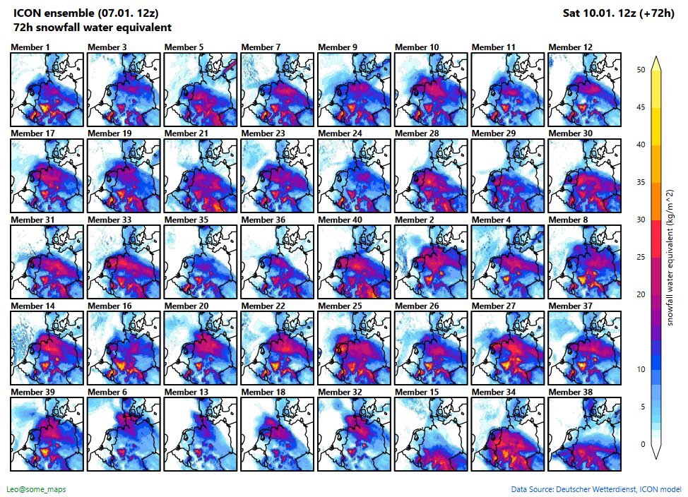
Snow depth in cm for Friday. Boxes show areas with mean snow depth >10cm (calculated over gridpoints in the boxes). Note that ICON D2 model forecasts extend only up to +48h. #snow #winter #schnee #crybabysociety
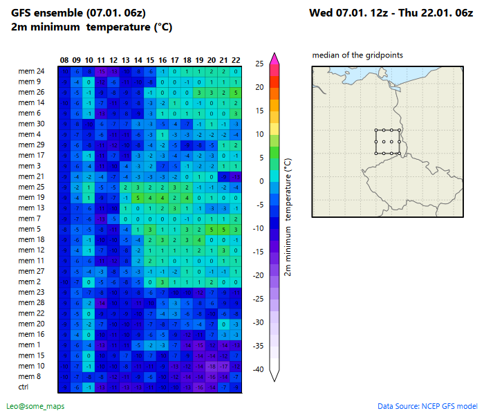
2m minimum temperature at 6z in the morning. GEFS ensemble. Median of the 12 depicted gridpoints. #brr #winter
A nice winter storm is on its way. Wind speeds in the ICON D2 model of DWD. #winter #snow #crybabysociety
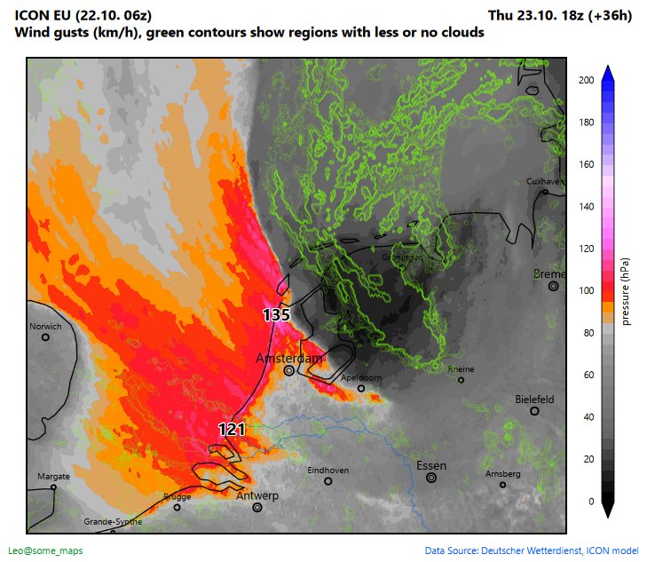
Is this as close to a real #storm eye experience as it gets in central europe? ICON D2 gust wind speeds for tomorrow. The green contours show a patch with almost no wind, no clouds. It's not an eye, but it's not a tropical storm anyway.
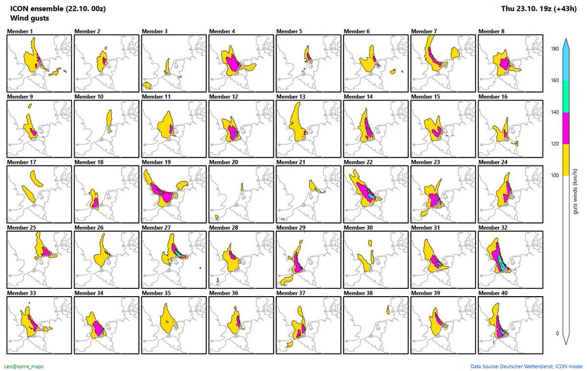
These are all 40 members of the ICON EU ensemble model for tomorrow's #storm. Still many different scenarios.


United States Trends
- 1. FINALLY DID IT N/A
- 2. The Jito N/A
- 3. #BTSComeback2026 N/A
- 4. Good Tuesday N/A
- 5. Tomlin 2.059 posts
- 6. Core CPI 4.335 posts
- 7. HELP IS ON ITS WAY N/A
- 8. BTS WORLD TOUR IS COMING 1.571 posts
- 9. #BTSTour2026 N/A
- 10. BTS COMEBACK IS COMING N/A
- 11. Taco Tuesday N/A
- 12. Son of Man N/A
- 13. #SwiftDay N/A
- 14. #tuesdayvibe N/A
- 15. #InternationalLaw N/A
- 16. Temporary Protected Status N/A
- 17. Founders Day N/A
- 18. 12,000 Iranians N/A
- 19. December CPI N/A
- 20. 2.7% YoY N/A
You might like


Something went wrong.
Something went wrong.