Channel 3 First Alert Weather Team
@wcaxweather
Weather updates from the WCAX First Alert Weather Team | Covering Vermont, New York's North Country & New Hampshire's Upper Valley for 70 Years
Tal vez te guste


Pockets of freezing rain possible in northern New York! We're tracking some freezing moving through and just north of northern New York. We could see pockets of freezing rain through mid-morning. This could lead to slick spots, mainly around and north of route 11.
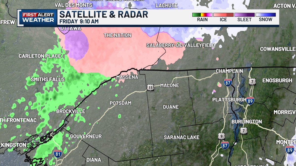
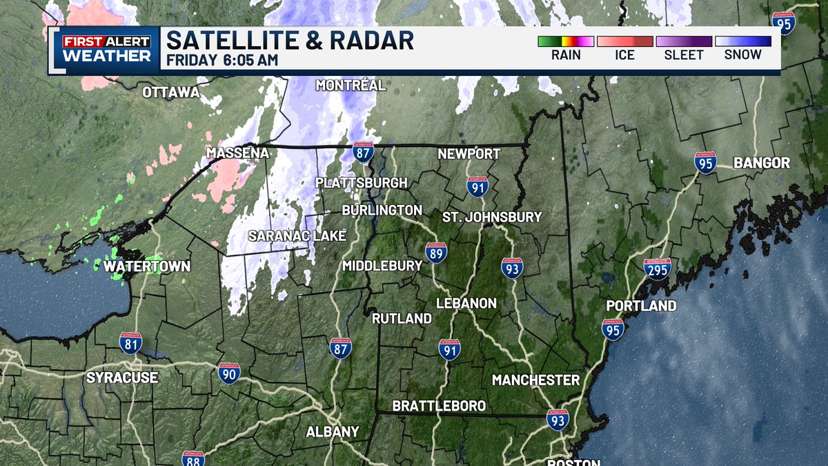
A few light snow and mix showers are moving across northern New York early this morning. Some snowflakes could be reaching the Champlain Valley in the next hour, but it won't last long. The better chance for precipitation comes this afternoon as rain showers move through.
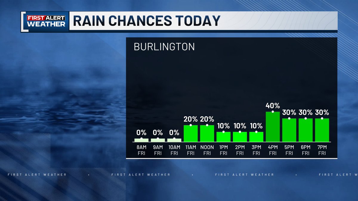
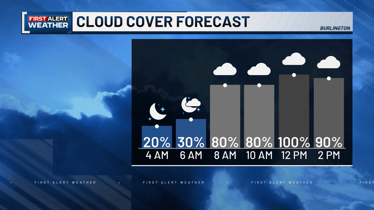
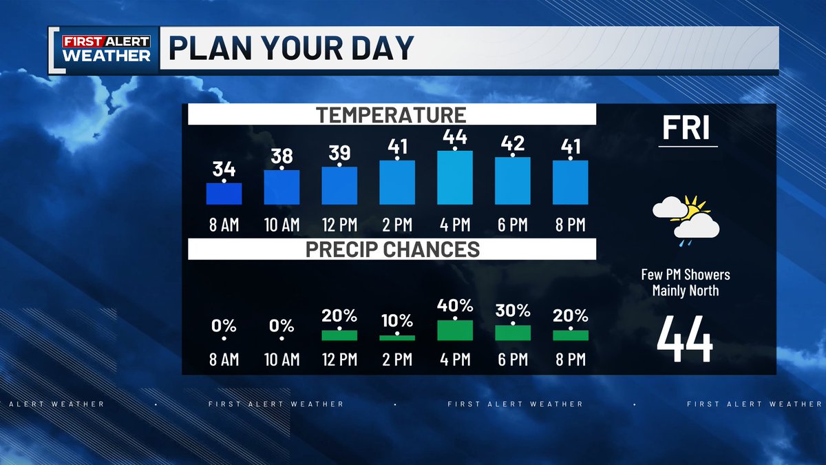
Hopefully you enjoyed the sunshine of the past few days because clouds are moving in again☁ But the clouds are keeping us a bit warmer this morning and we'll stay a bit warmer today with highs in the low and mid-40s. But we'll also be seeing a few showers this afternoon.
Another cold night last night, especially in Saranac Lake. But conditions tonight won't be nearly as frigid. There's a few temperature swings in our forecast, when to expect those can be found here.
Thanksgiving is ONE WEEK away! Here's your first look at the holiday forecast. As of right now, Thanksgiving day looks mostly dry with some breaks of sun. But the day before, the day quite a few people will be traveling for Thanksgiving, is looking wet.
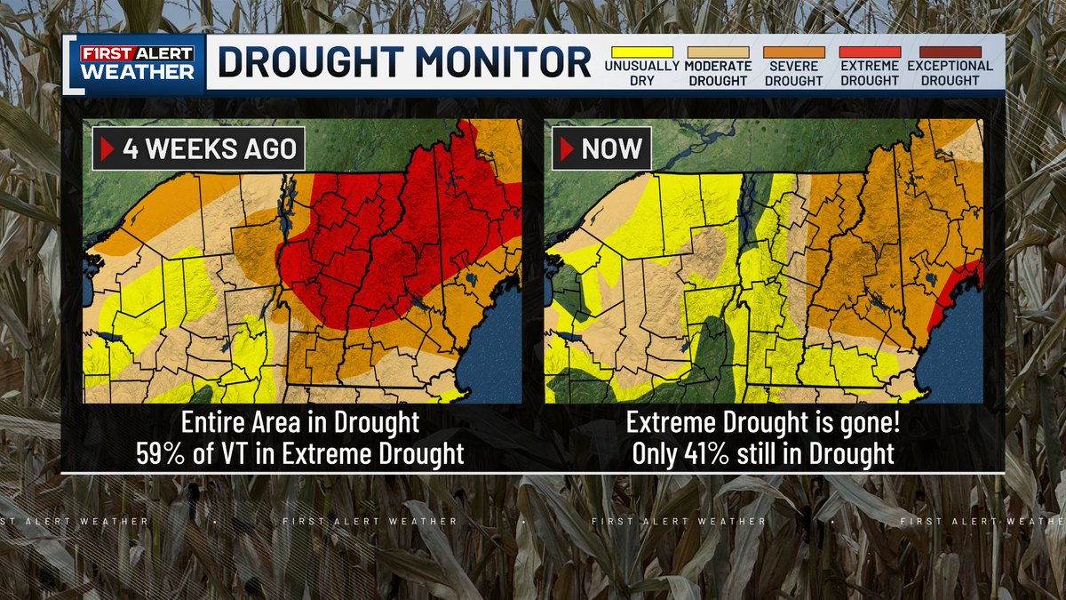
🌧DRASTIC IMPROVEMENTS TO DROUGHT CONDITIONS🎉 More than HALF OF VERMONT is officially out of the drought! Only 41% of the state is still in a drought and the extreme drought conditions are gone. The drought receded quickly, just a month ago 100% of our region was in a drought.
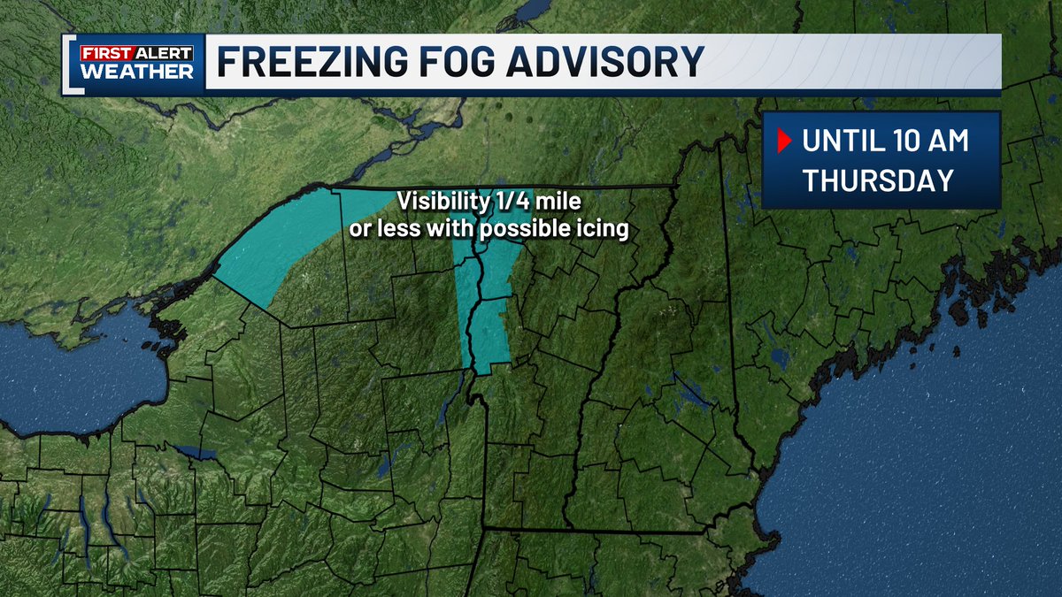
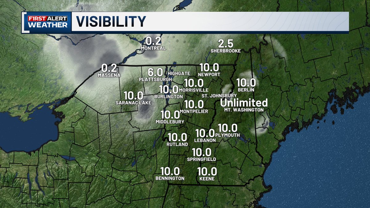
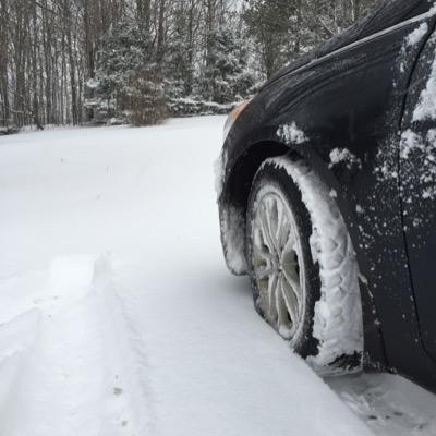
A Freezing Fog Advisory has been issued for the Champlain Valley and St. Lawrence Valley🌫 The advisory will remain in effect until 10am. Visibility could be reduced to 1/4 of a mile at times. Black ice is possible this morning, especially on bridges and overpasses!
After Saranac Lake was the coldest place in the lower 48 last night, all eyes are on if they'll do it again with another cold night tonight!
We've been seeing temperatures trending below average so far this month. All of last week and the beginning of this week have had daily high temperatures that were below average with highs only reaching the 30s and low 40s.
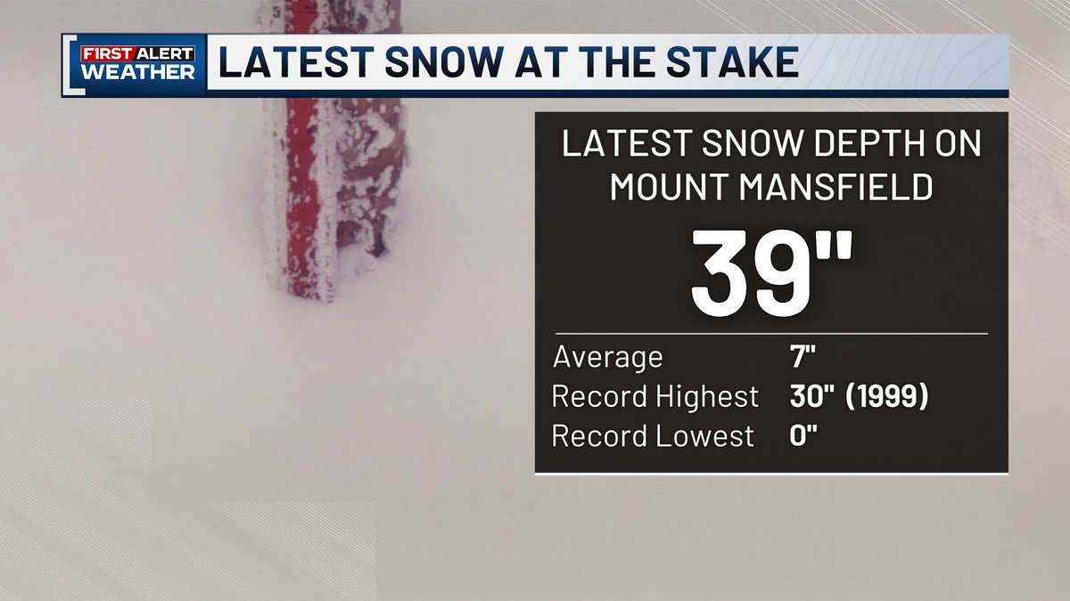
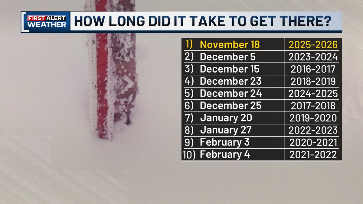
It's pretty early to be seeing this much snow at the stake🏔 As of yesterday evening, there were 39" of snow on Mount Mansfield! This breaks the previous daily record of 30" set in 1999. It's also the earliest we've seen 39" of snow at the stake in the last ten years.
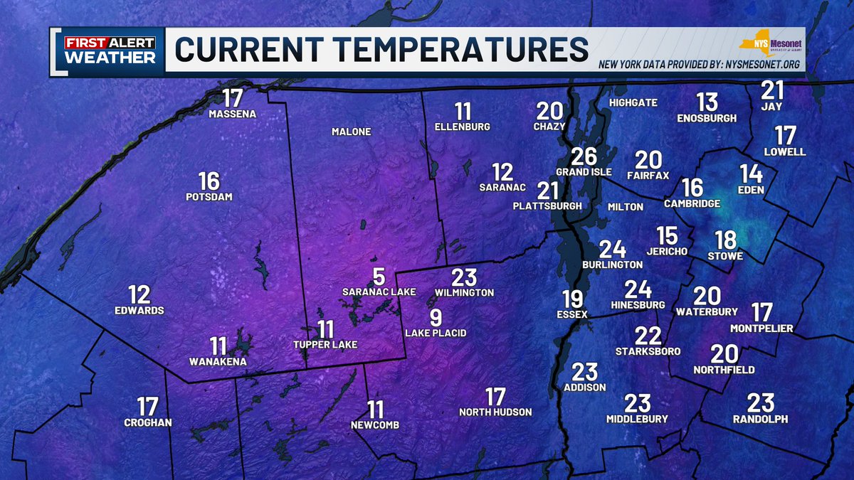
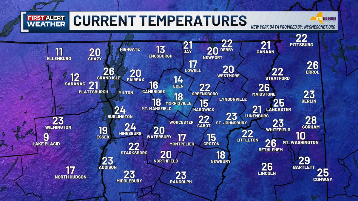
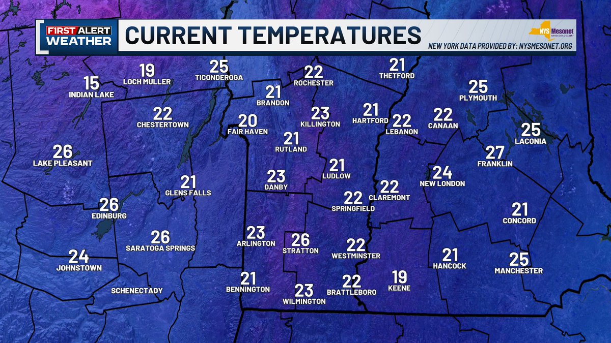
Grab your winter coat and leave time to defrost your car this morning! Our region is the coldest in the contiguous US this morning. Most of our region is waking up to temperatures in the teens and 20s. Parts of northern New York are even down in the single digits!

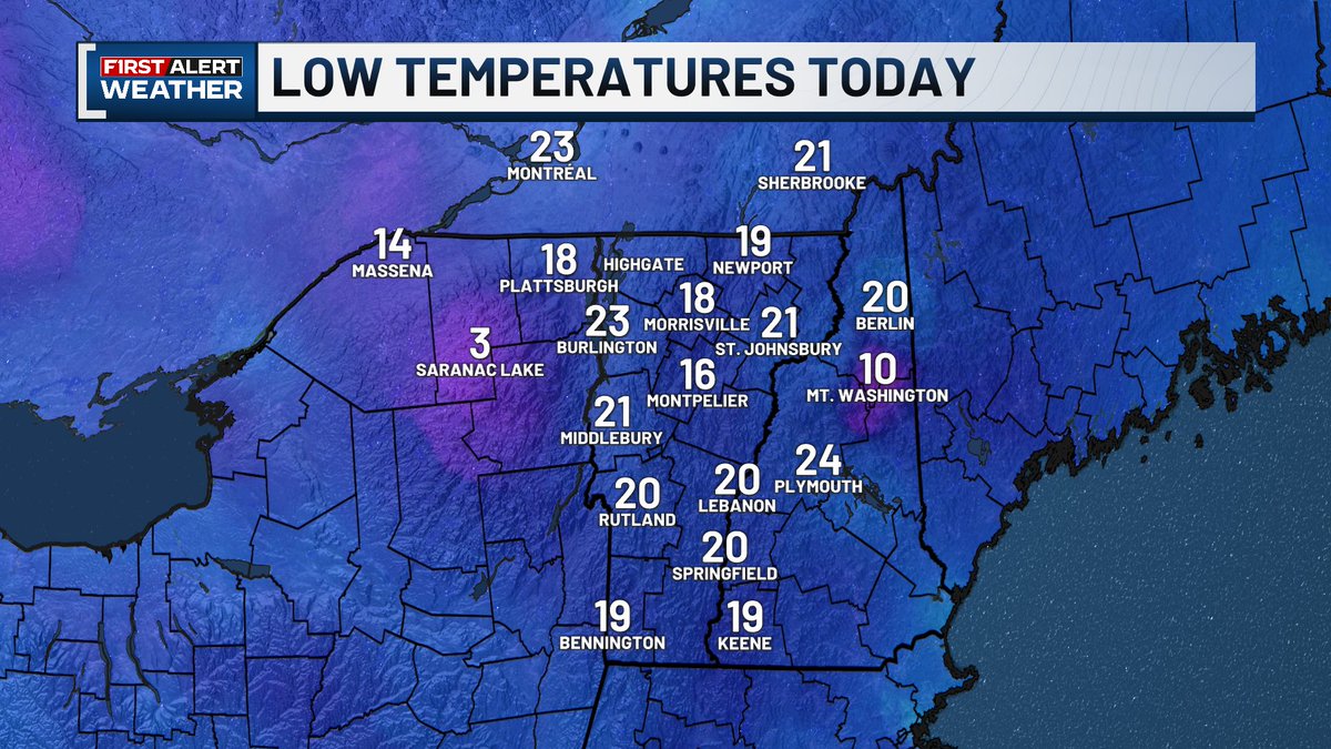
Brrrrrr! Temperatures are down to the teens and 20s for most of us this morning. Even some SINGLE DIGITS in Saranac Lake and Lake Placid!
Tomorrow will be cold but at least we'll have sunshine and calm winds! Also here's a quick rundown on what the record setting November Mount Mansfield Snow could spell for winter.
The breeze today is making things chilly! Actual temperatures are in the 30s to low 40s across the region, but wind chill values are in the upper 20s and low 30s. The breeze will calm overnight, but we'll still be cold tomorrow morning.
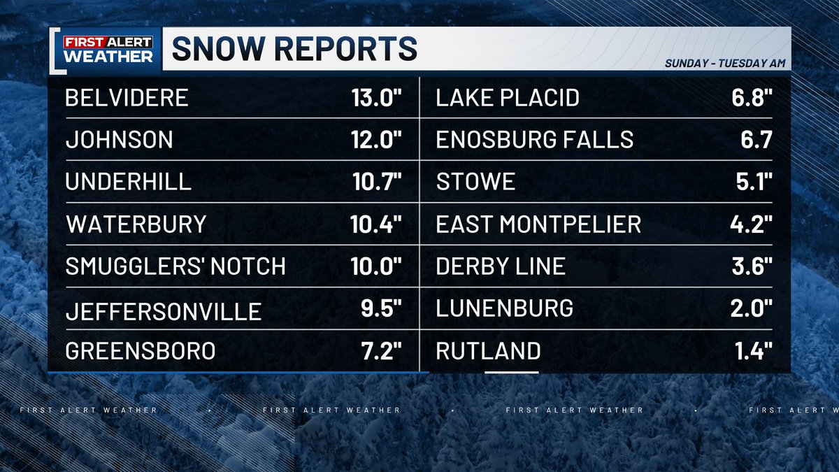
❄Final snowfall reports are in❄ Belvidere reported more than a foot of new snow between Sunday and this morning! And the rest of the mountain towns certainly saw a healthy dose of snow with many reports of more than 10"! Totals dropped quickly away from the mountains.
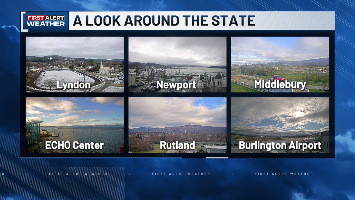
Sunshine is starting to break through the clouds this morning! But as usual, the northeastern parts of our region are holding onto the clouds.
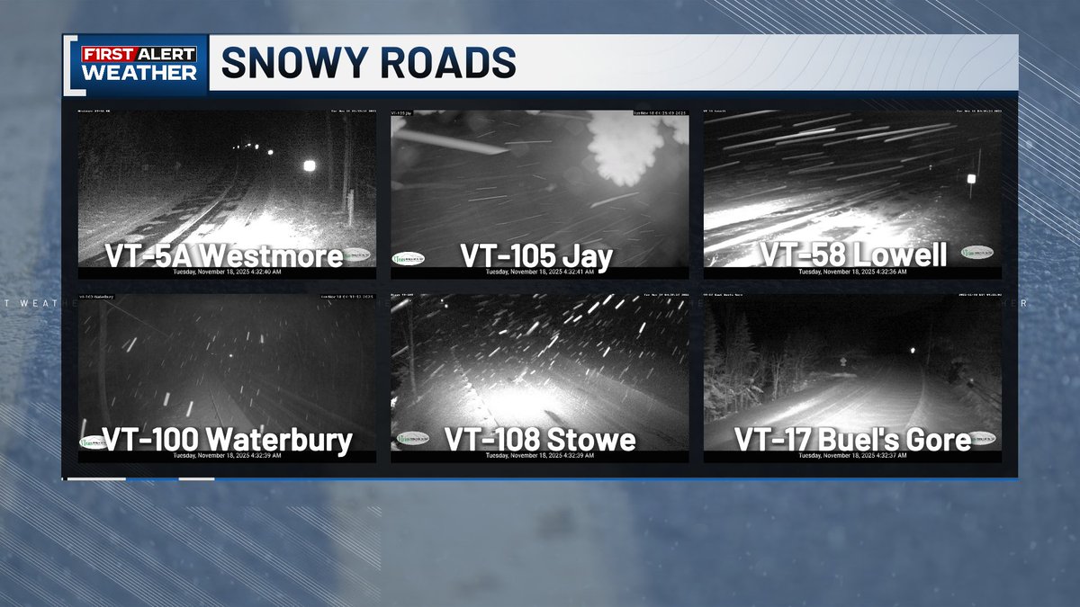
Still seeing light snow in the mountains early this morning. Roads through the mountains will likely still have slick spots. The snow will be coming to an end today and we'll even be seeing breaks of sunshine this afternoon!
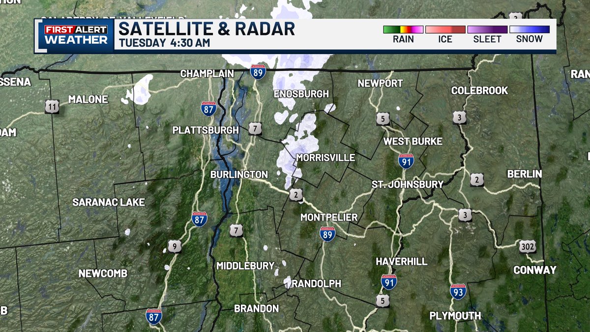
Bundle up: We'll see wind chills in the teens and low 20s early Tuesday. Northern mountain snow continues tonight, but wraps up through Tuesday with drier air moving in. The rest of us stay dry with sunshine emerging through Tuesday afternoon.


United States Tendencias
- 1. Ukraine 521K posts
- 2. #KayJewelers N/A
- 3. #Veloragpt N/A
- 4. Putin 177K posts
- 5. #pilotstwtselfieday 1,033 posts
- 6. Geraldo 2,793 posts
- 7. #FursuitFriday 13.9K posts
- 8. Anthony Joshua 4,468 posts
- 9. Le Cowboy N/A
- 10. Start Cade N/A
- 11. NOTAM 4,132 posts
- 12. #FanCashDropPromotion 4,190 posts
- 13. Trump and Mamdani 12.4K posts
- 14. Chris DeMarco N/A
- 15. Zelensky 112K posts
- 16. Kenyon 2,221 posts
- 17. NATO 66.8K posts
- 18. Happy Thanksgiving 3,540 posts
- 19. Mark Kelly 77.4K posts
- 20. Carlton 4,644 posts
Tal vez te guste
-
 MyNBC5
@MyNBC5 -
 Channel 3 News
@wcax -
 Seven Days
@sevendaysvt -
 Vermont State Police
@VTStatePolice -
 VT Emergency Mgmt
@vemvt -
 Jack Thurston
@JackThurstonVT -
 NWS Burlington
@NWSBurlington -
 ABC22 & FOX44
@WVNYWFFF -
 Vermont.gov
@vermontgov -
 Vermont Edition
@vermontedition -
 vermontbiz
@vermontbiz -
 Vermont State Parks
@VTStateParks -
 Rutland Herald
@RutlandHerald -
 Vermont Alert
@VermontAlert
Something went wrong.
Something went wrong.