#3_4fire resultados da pesquisa


New Incident: #3_4Fire Southwest of Red Bank road in Tehama county is 1000 acres. @CALFIRETGU fire.ca.gov/incidents/2020…

#3_4Fire Southwest of Red Bank road in Tehama county is 7000 acres. @CALFIRETGU fire.ca.gov/incidents/2020…

#ElkhornFire (previously #3_4Fire) Southwest of Red Bank road in Tehama county is 15,250 acres. @CALFIRETGU fire.ca.gov/incidents/2020…
#3_4Fire will now be called #ElkhornFire Southwest of Red Bank Rd in Tehama County is 15,250 acres and 0% contained. #CALFIRETGU2020


#3_4Fire Southwest of Red Bank road in Tehama county is 7000 acres. CALFIRETGU fire.ca.gov/incidents/2020… #QuakeFactor


#RT @CAL_FIRE: #3_4Fire Southwest of Red Bank road in Tehama county is 7000 acres. @CALFIRETGU fire.ca.gov/incidents/2020…

🔥 8/19 At 9:21 am, #3_4Fire Southwest of Red Bank Rd in Tehama County is 1000 acres. #CALFIRETGU2020 🔗 #TehamaCounty #California #DAT #CaliforniaFires

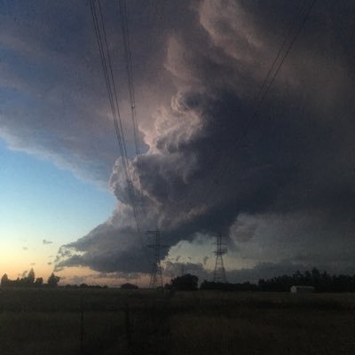
This is a new column west of the RoundMt/Paskenta Cam. There is at least short range spotting being observed with this fire. It is in the mountains south of the of the #3_4Fire and North of the #DoeFire and #IvoryFire in Glenn County.
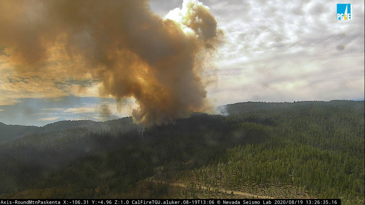
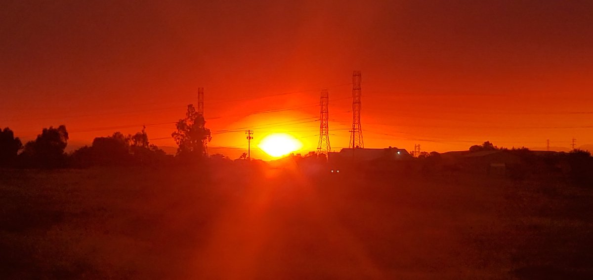
Here’s a quick clip of the fire west of Paskenta. I still haven’t seen a name on it yet. The #3_4Fire is still showing brightly from Red Bluff, while the fires to the south have laid down From my vantage point as of 21:30.
#RT @CAL_FIRE: #3_4Fire Southwest of Red Bank road in Tehama county is 7000 acres. @CALFIRETGU fire.ca.gov/incidents/2020…

The 3-4 Fire is about to overtake this ALERTWildfire camera in the mountains west of Red Bluff, CA. These trees were burned to a crisp in less then 3 minutes #3_4Fire - alertwildfire.org/shastamodoc/in…
Something went wrong.
Something went wrong.
United States Trends
- 1. Kuwait N/A
- 2. F-15 N/A
- 3. #IndustryHBO N/A
- 4. #ActorAwards N/A
- 5. Oscar N/A
- 6. Yasmin N/A
- 7. Zendaya N/A
- 8. Harrison Ford N/A
- 9. #BaddiesUSA N/A
- 10. Lebanon N/A
- 11. Sinners N/A
- 12. #IranWar N/A
- 13. #RHOP N/A
- 14. Hezbollah N/A
- 15. Michael B Jordan N/A
- 16. Harper N/A
- 17. Neemias Queta N/A
- 18. Iron Beam N/A
- 19. Tom Holland N/A
- 20. Kuminga N/A