#aerialview search results

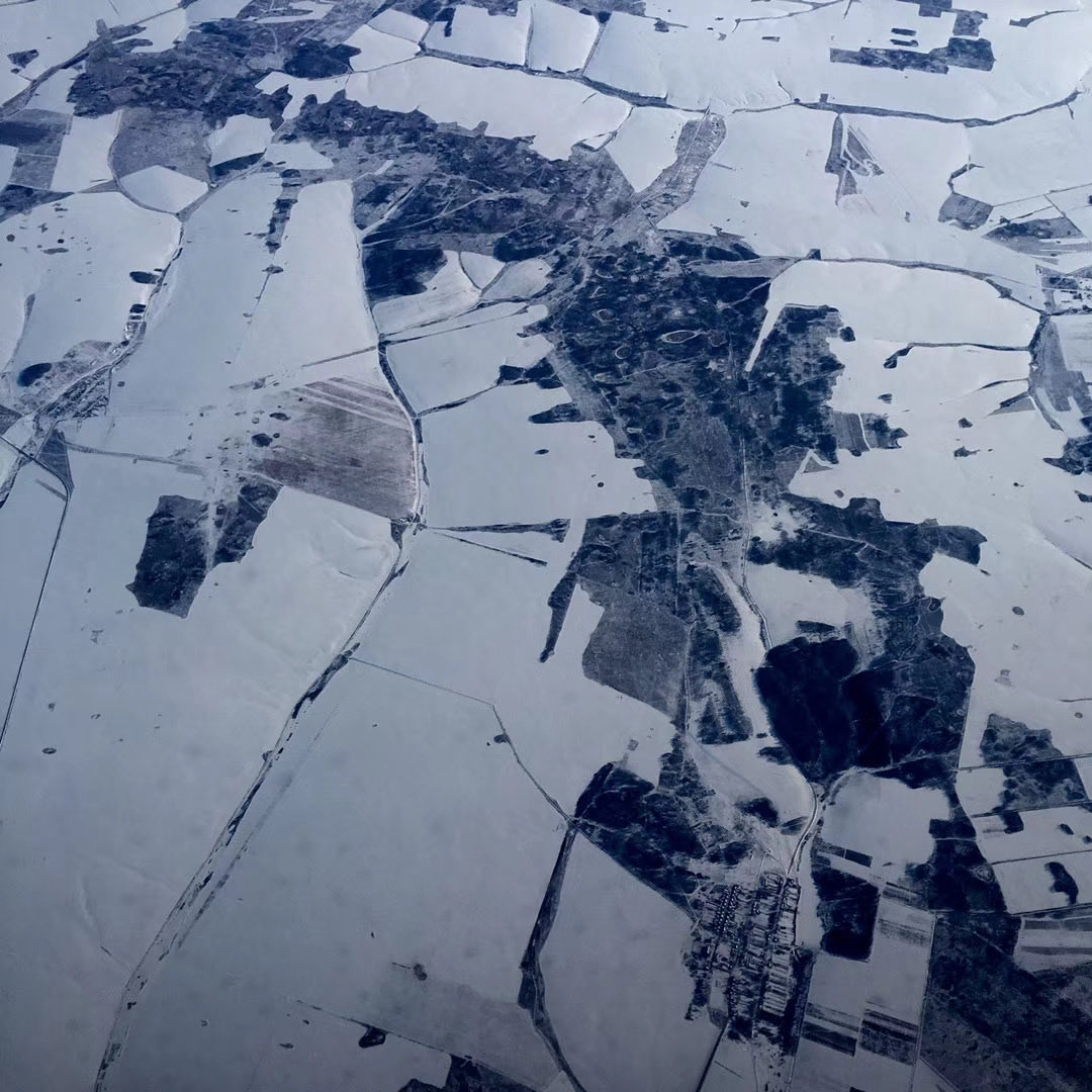
Witness the breathtaking beauty of Earth from above. Rivers carve through landscapes, and fields stretch to the horizon in this stunning aerial view. #AerialView #Nature


مولاناشیخ ادریس شہید کی نماز جنازہ کے فضائی مناظر #MaulanaIdrees #FuneralPrayer #AerialView #BreakingNews #Pakistan #Janaza #IslamicScholars #nptv #nptvdigital #nationpulsetv

✈️ Shortly after passing above the French Alps, we watched a beautiful river bathed in golden light at sunset from the airplane, at 11,000 meters above sea level — a truly fantastic view from the sky. #AerialView #TravelMoments


Baitu (White Rabbit) Temple is situated in Jian'an District, #Xuchang City. It was established during the Northern and Southern Dynasties period over fifteen centuries ago. (video by 莲城小飞象) #aerialview #Chinatravel

Ever seen a sea that looks like milk? Meet the "Milk Sea" in Qionghai, Hainan—where coral-white shores meet turquoise waters. No filter needed. ✨ #Qionghai #MilkSea #AerialView #Hainan #beach

Nestled between lush hills and the open sea, Shimei Bay International Yacht Club in Wanning City, Hainan Province, offers sweeping coastal views, gentle waves, and a picture-perfect yacht-lined bay. #AerialView #Yacht #ScenicBeauty #HainanTravel #watersports

Aerial view in Heqing, Dali 🕊️ An ancient tree and Jade Dragon Snow Mountain sharing the same horizon. #Heqing #Dali #AerialView #AncientTree #JadeDragonSnowMountain 🏔️🌳
A stunning drone view where speed meets serenity. Train No. 20923 Tirunelveli – Gandhidham Humsafar Express glides through the breathtaking wind farms of Aralvaymozhi #SouthernRailway #AerialView #IndianRailways #Tirunelveli #Humsafar

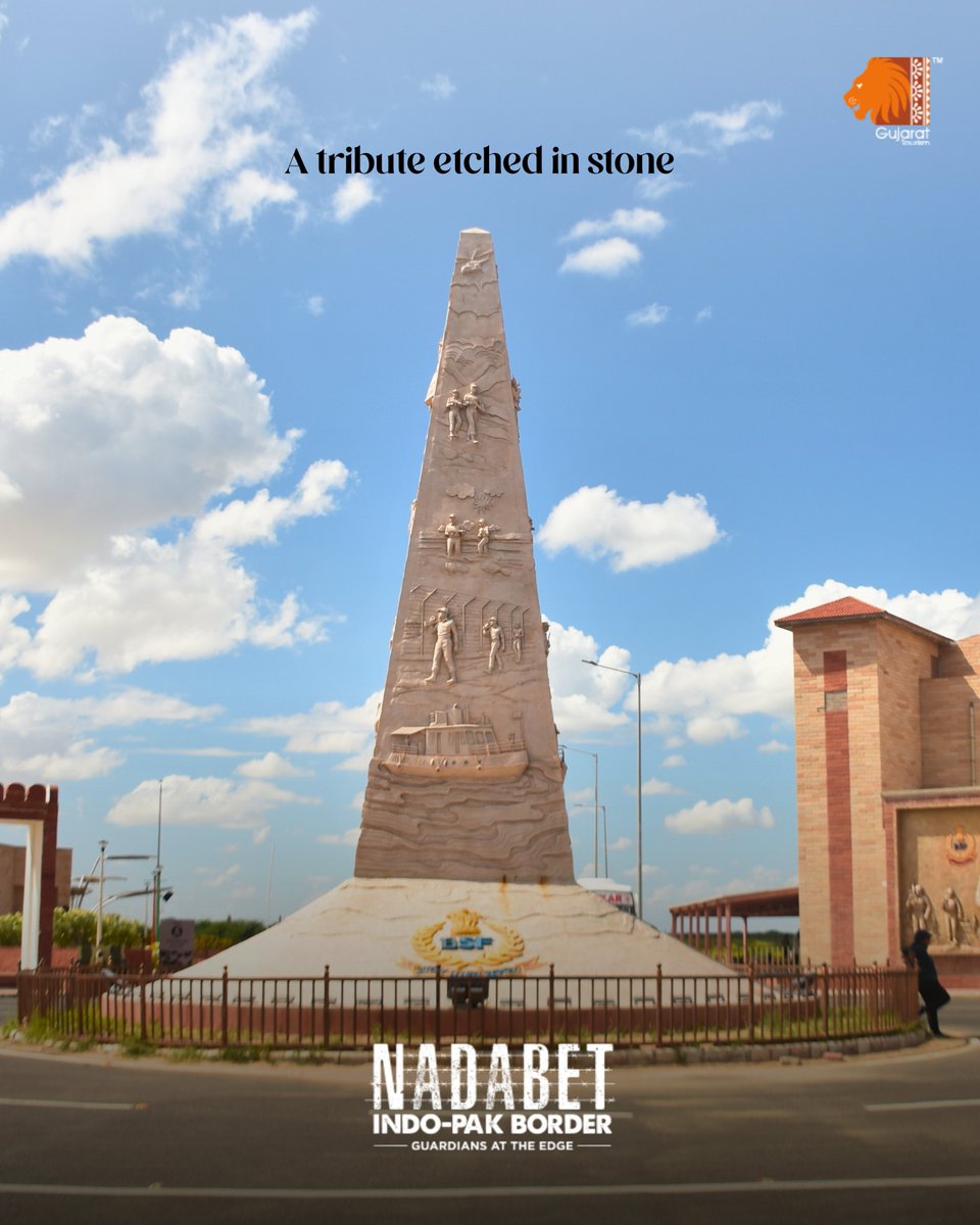
A silent salute to unmatched bravery. The BSF Stambh at Nadabet reminds us of the strength and sacrifice that stand watch at our borders. #Nadabet #AerialView #BorderTourism #ExploreGujarat #incredibleindia
A helicopter view over Lijiang 🚁🏔️ Seeing the city from above hits different. #Lijiang #AerialView #HelicopterRide #YunnanScenery
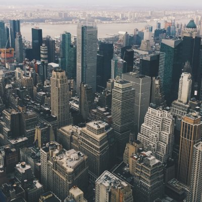
Check out this #NYC #aerialview #skyscraper #cityscape photograph that I have for sale! fineartamerica.com/featured/nyc-f… #NewYorkCity #Manhattan #wallartforsale #fineartphotography #homedecor #homedesign #photography #photographylovers

Chongqing's sunset from the plane: golden glow wraps the 3D city, rivers shimmer like gold ribbons. 🌇 📷Hengxingdejuxie #Chongqing #Sunset #AerialView #Skyline #travelchina
Witness the breathtaking beauty of Earth from above. Rivers carve through landscapes, and fields stretch to the horizon in this stunning aerial view. #AerialView #Nature
مولاناشیخ ادریس شہید کی نماز جنازہ کے فضائی مناظر #MaulanaIdrees #FuneralPrayer #AerialView #BreakingNews #Pakistan #Janaza #IslamicScholars #nptv #nptvdigital #nationpulsetv

POV: When lands want to spell your name itself! A fascinating aerial view captured by NASA’s Landsat satellites. Nature speaks its own language! Available on swiggy & zomato #ramkibandi #nasaLandSat #aerialview #earthfromabove #landscapephotography


#TravelPhotography #AerialView #DronePhotography #Paradise #Wanderlust #TravelGoals #NatureLovers #SeaAndSky #PacificOcean #CoastalLiving #AlohaSpirit #VacationVibes #SummerEveryday #ExploreHawaii #IslandHopping #CrystalClearWater #BeachPhotography #TravelGram #TikTokTravel

One solution. Endless possibilities. 🚀 Why risk it when drones can do it? ⚡ HD Aerial Imaging ⚡ Instant Insights ⚡ Safe Remote Access 📩 [email protected] #AerialView #InspectionTech #WorkSmarter #DroneOperator #TechInnovation


As Far As Your Eyes Can See... Aerial view from a chairlift in Gatlinburg, Tennessee. #photography #art #aerialview

Check out this #Piran #Slovenia #aerialview #sunset #cityscape photograph that I have for sale! fineartamerica.com/featured/sunse… #sunsetphotography #adriatic #seascape #wallartforsale #fineartphotography #homedecor #homedesign #photographylovers #photography

16-second aerial view! Mist drifts in from the sea, and the bridge rises into the clouds — the Xiamen–Kinmen Bridge's springtime advection fog is here! #AerialView #Bridge #ChinaTech @ChineseEmbinAus @ChineseEmbinUS @ShayeFan @ChinaEmbajada @AmbCina @ChinaEmbinCH @Logan_ology

Seen from above, the land softens into color and shape— almost like an abstract painting. Nothing arranged, yet everything feels in place. by Pang Xiaowei #PangXiaowei #Photography #AerialView #AbstractNature #EarthTones #MinimalMood

🖼️ Cloud shadows 🧑🎨 Viktor Zarubin 🏛️ Belvedere Visit myopenmuseum.com for more art. #cloud #aerialview #viktorzarubin #zarubin #countryside #aerial #nuage #nubes #art #arte #fineart #belasartes #beauxarts #painting #pintura #peinture


Bengaluru's infrastructure got a major new upgrade - Double Decker Flyover - from HSR to Ragigudda - Full Video! #AerialView #silkboardmemes

On Iceland's coast at dawn, the wind pushes the clouds low, and the sea looks like a silver mirror. The camera rises slowly, and the volcanoes and black sand beach wake up together. This trip is pure healing—come with me. @BBCTravel @or_ian25542 @NatGeo #AerialView

Capture stunning moments from above! 📸✈️ Professional drone photography & videography awaits! #DroneServices #Photography #AerialView blueboxdigital.com/florida-profes…

Pesona Pantai Kaur dari Udara | Keindahan Pagi dengan Langit Biru Kaur, ... youtu.be/X-6FheNV-9c?si… lewat @YouTube #PantaiKaur #DroneIndonesia #AerialView #ExploreBengkulu #KeindahanAlam #IndonesiaIndah #TravelIndonesia


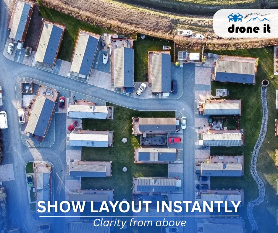
Top-down aerial views are perfect for showcasing layout, spacing and accessibility in residential developments. 📲 07762 656187 🌐 droneit.biz #PropertyDevelopment #AerialView #HousingDevelopment #DroneRealEstate #SiteOverview #UKPropertyMarket #DroneMapping

Aerial view of a red tractor working in lush green farmland, tilling the muddy field to prepare it for the next planting season. #FarmTractor #AerialView #AgriculturalWork #RuralFarming #FieldPreparation
The moment the drone rises, the whole valley seems to open up. Rivers bend through it, forests roll like waves, and the distant snow peaks stay quiet like a backdrop. There's not much complica... @DroneDJ @EarthPix @a_lser62320 #AerialView #OpenLandscape #ForestWaves #SnowPeaks

The camera drifts over Norway’s fjords, with the mist opening like an old photo. Then it glides across the English countryside and Italy’s coastline. It feels so quiet, like time itself has... @Er52Gal31600 #NorwayFjords #CoastalCliffs #AerialView #MistyValley #CountrysideRoad
Italy’s vineyards spread out in rows like gentle sentences written on the earth. The drone passes over field edges and farmhouses, and sunlight makes every leaf glow. I always feel that growing up should be like this... @LonelyPlanet @NatGeo @AveSkip40949 #AerialView #FieldEdge


✈️ Shortly after passing above the French Alps, we watched a beautiful river bathed in golden light at sunset from the airplane, at 11,000 meters above sea level — a truly fantastic view from the sky. #AerialView #TravelMoments
Fly Taos Sky is a local flight operator offering sight-seeing tours, flight training, aircraft rentals and management out of Taos Regional Airport. newmexiconomad.com/fly-taos-sky/ #charterflights #aerialview #NewMexico #travel #adventure #vacation #scenic


Winding alpine roads are a work of art in the Swiss Alps 😍 dreamstime.com/aerial-view-wi… #SwissAlps #MountainRoad #AerialView #GoldenSlopes #AlpineDream #DronePhotography #ScenicDrive


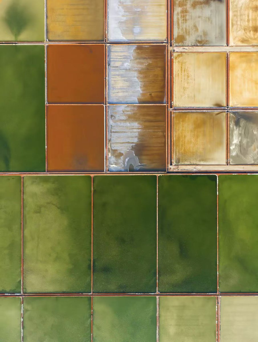
An aerial view reveals the salt ponds as a striking geometric pattern of vibrant colors.🌈✨ 📸@几奥 #AerialView #DroneShot #SaltPonds #VibrantColors


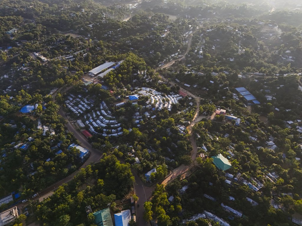
The area where we have been residing for the past nine years, characterized by limited space and facilities. #aerialshot #aerialview #Rohingyacamp #refugeecamp #Aerialphotography

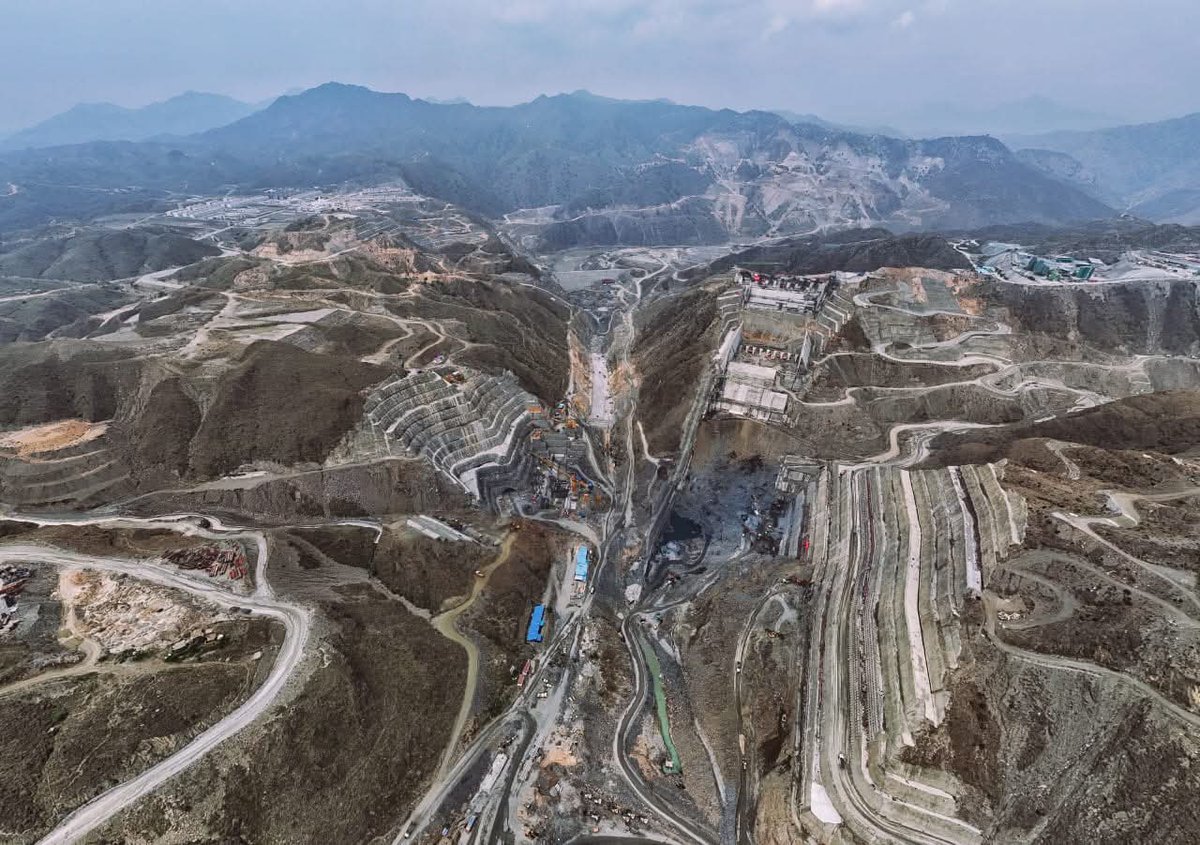
𝐏𝐫𝐨𝐠𝐫𝐞𝐬𝐬 𝐢𝐧 𝐌𝐨𝐭𝐢𝐨𝐧—𝐀 𝐕𝐢𝐞𝐰 𝐟𝐫𝐨𝐦 𝐀𝐛𝐨𝐯𝐞! These breathtaking aerial views of the Mohmand Dam site capture the scale, complexity, and ambition of one of Pakistan’s most significant hydropower projects. © Energy China Pakistan #MohmandDam #AerialView


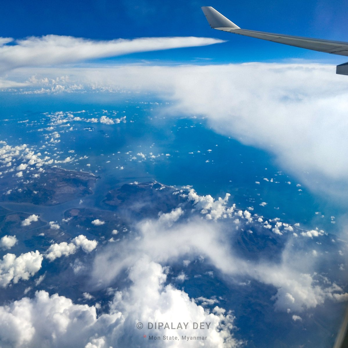
38,000ft above Ye District in Mon State of Myanmar 🇲🇲! A bird's-eye perspective of the Andaman Sea, a river delta and distant view of the Marcos Island, partially veiled by clouds. A snapshot captured with a wing view ✈️🌫️ 🙂. #AerialView #WingWednesday #A330

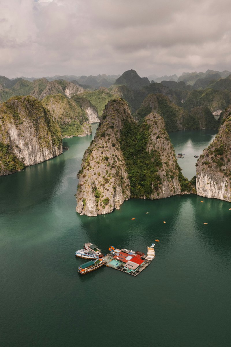
Floating through paradise 🌿 📍 Halong Bay, Vietnam 📸 Thomas Boxma on Unsplash #Vietnam #HalongBay #aerialview #exploringtheglobe #beautifuldestinations #travelinspiration


Something went wrong.
Something went wrong.
United States Trends
- 1. Austin Reaves N/A
- 2. #DaredevilBornAgain N/A
- 3. Luka N/A
- 4. Jared McCain N/A
- 5. Laravia N/A
- 6. Shai N/A
- 7. #LakeShow N/A
- 8. Thunder N/A
- 9. Boldy N/A
- 10. #WWENXT N/A
- 11. Vivek N/A
- 12. Indiana N/A
- 13. Harden N/A
- 14. Logan Webb N/A
- 15. #Lakers N/A
- 16. #GoAvsGo N/A
- 17. Vando N/A
- 18. Framber N/A
- 19. Fisk N/A
- 20. Chet N/A