#hurricane search results

The Atlantic #hurricane season is not quite over yet, but for all intents and purposes anything meaningful is likely done. This was the season of the Bermuda recurve as was signaled this spring by the seasonal models. Some notables: - No US Hurricane landfalls (last time was


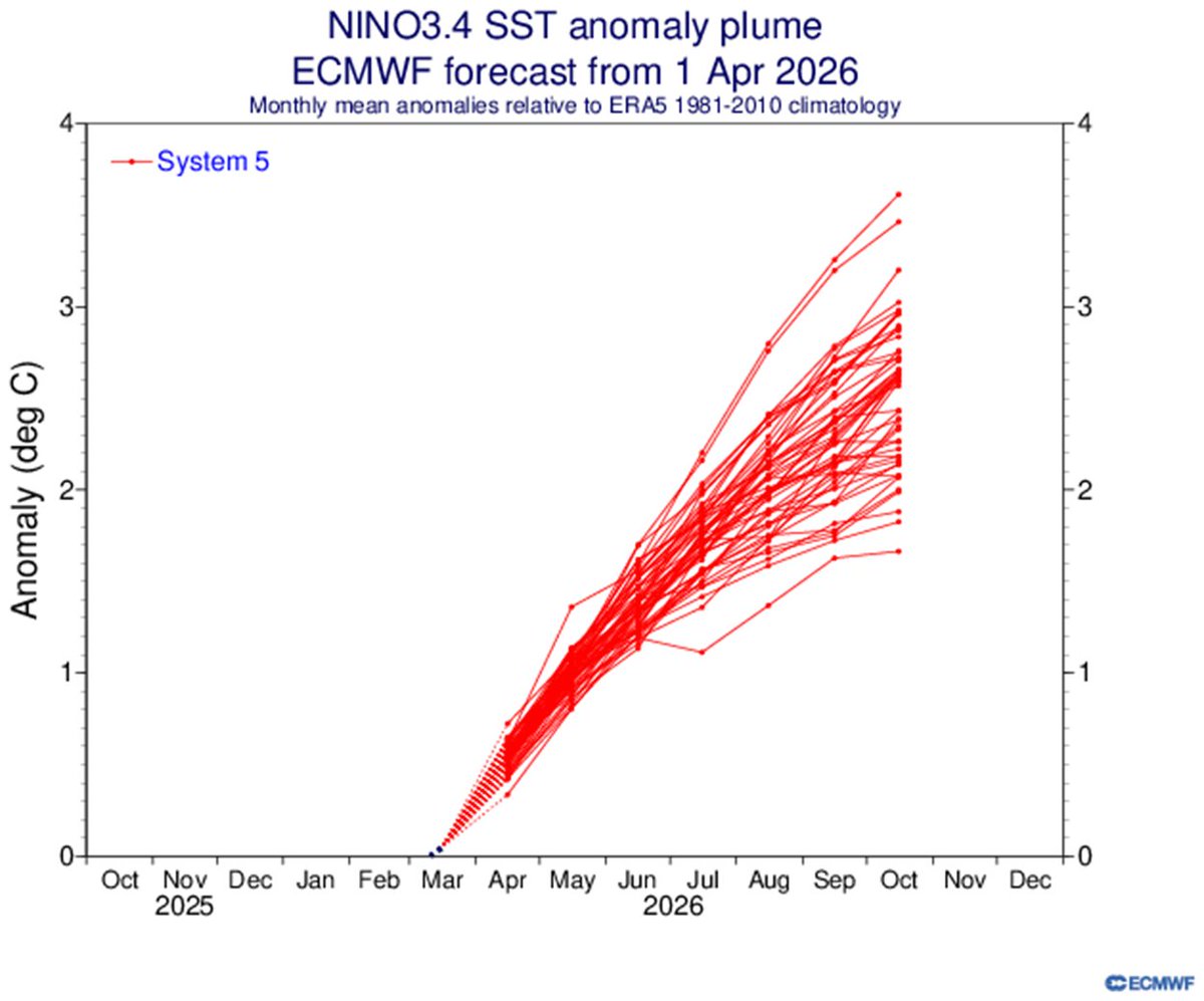
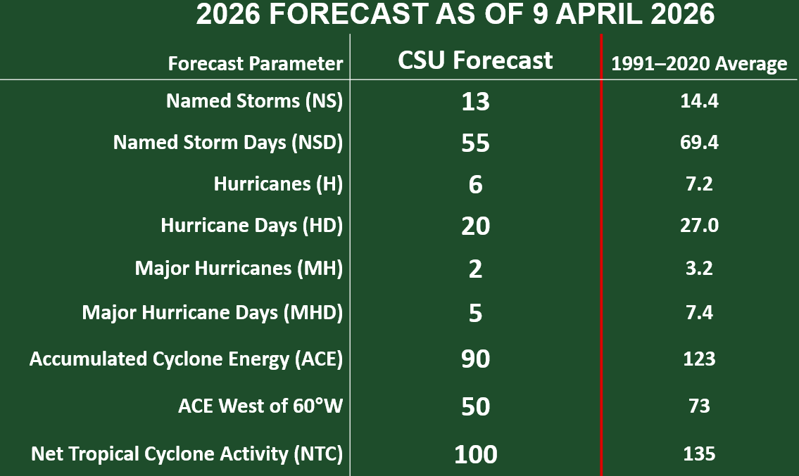
The primary reason for CSU's somewhat below-normal Atlantic #hurricane season forecast is a high likelihood for a robust #ElNino. El Nino typically decreases Atlantic hurricane activity via increases in Caribbean/tropical Atlantic vertical wind shear.


New: Melissa has been officially retired by the World Meteorological Organization today due to the destruction #Hurricane #Melissa caused in #Jamaica in October. It is being replaced by the name Molly on the list of rotating names. Image via Copernicus Sentinel-2

The WMO Hurricane Committee has retired the name Melissa because of the destruction it caused in the Caribbean in 2025. It will be replaced by Molly on the list of rotating names. bit.ly/4shPDrQ
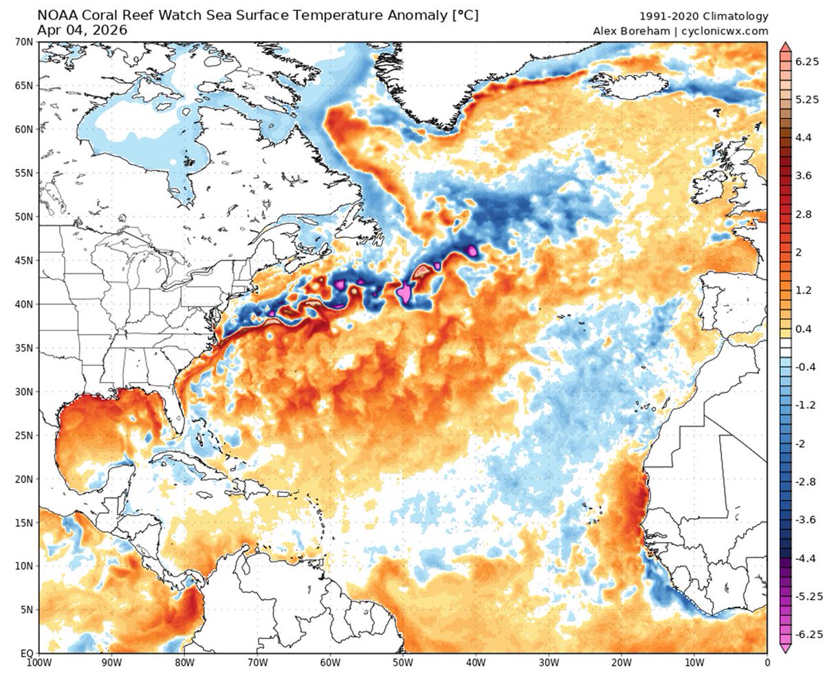
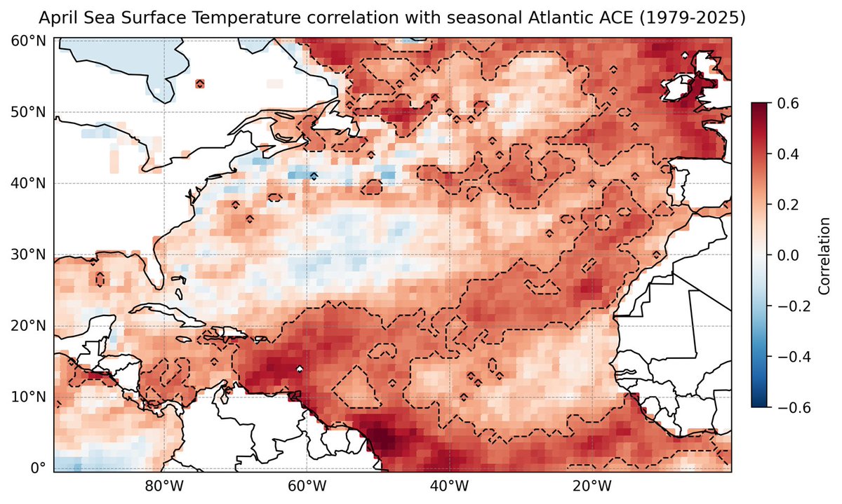
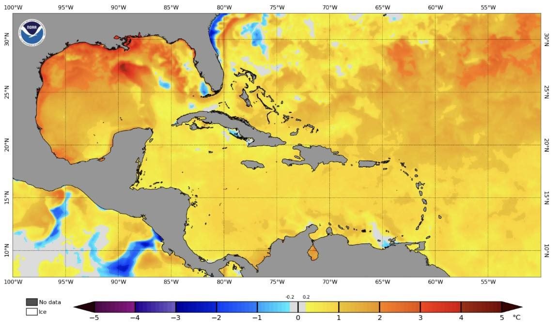
The Caribbean is slightly warmer than normal, while the eastern and central tropical Atlantic are slightly cooler than normal. This pattern of Atlantic sea surface temperatures provides mixed signals regarding the potential for an above- or below-normal Atlantic #hurricane season

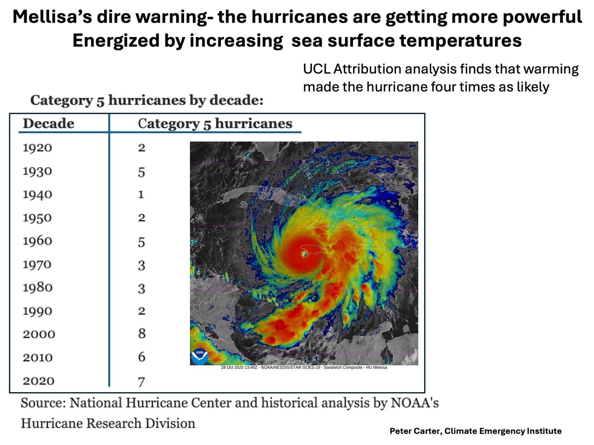
HURRICANE MELISSA MADE 4 TIMES AS LIKELY BY WARMING Category 5 hurricanes are increasing, which will continue under today's accelerating global warming. #melissa #climatechange #hurricane #globalwarming

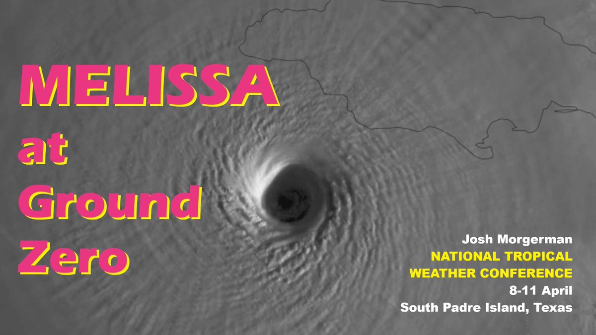
Who's going to National Tropical Weather Conference? It's 8-11 April on South Padre Island, TX. This is my FAVORITE #hurricane conference. My presentation this year is gonna be intense: Hurricane MELISSA at Ground Zero. BE THERE. & come say hi. REGISTER: hurricanecenterlive.com
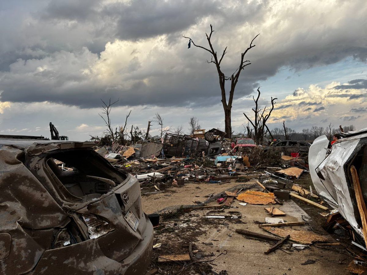
The NHC released its *official* report on #Hurricane #MELISSA. This incredible storm now sits at the very top of Atlantic hurricane history: * Peak intensity was bumped up to 165 knots, tying it with ALLEN 1980 for highest wind speed in Atlantic hurricane database. * Landfall
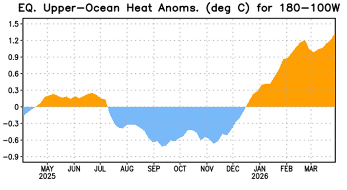
My friend, Dr. @Hal_Needham, pointed out SSTs in W Gulf—especially off TX, LA, & MS—are abnormally warm. We're likely to have El Niño during #hurricane season—which depresses Atlantic activity—but prematurely warm Gulf could help early-season naughtiness close to American shores.

#FlashbackFriday who remembers??? #keywest #hurricane More: PartyinKeyWest.com/wp/ Follow us: @PartyInKeyWest Hashtag us: #PartyInKeyWest

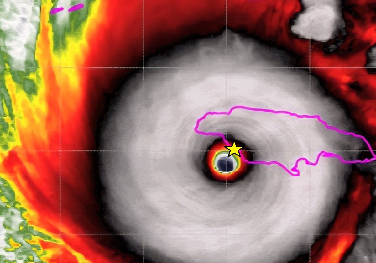
Who's attending National Hurricane Conference? Come to #Hurricane #MELISSA Workshop: 10:30 am Wednesday in Salon 11 (2nd floor). National Hurricane Center, Aircraft Operations Center, & I will analyze this incredible storm from multiple angles & perspectives. Mine? Ground Zero.

CSU's four analogs for the 2026 Atlantic seasonal #hurricane forecast are: 2006, 2009, 2015 and 2023. Analogs are selected based on robust #ElNino and above-normal sea surface temperatures during August-October.


Atlantic seasonal #hurricane forecast from @ColoradoStateU calls for somewhat below-normal season: 13 named storms, 6 hurricanes & 2 major hurricanes. High likelihood of robust #ElNino and associated increases in vertical wind shear the primary factor. tropical.colostate.edu/Forecast/2026-…
#Cyclone #MITCHELL, equivalent to Cat-1 #hurricane, is approaching Western #Australia. It's coming in at weird angle, so it's hard to pinpoint location & timing of landfall. Could be anywhere from Onslow to North West Cape Sunday. System looks lopsided but should strengthen.

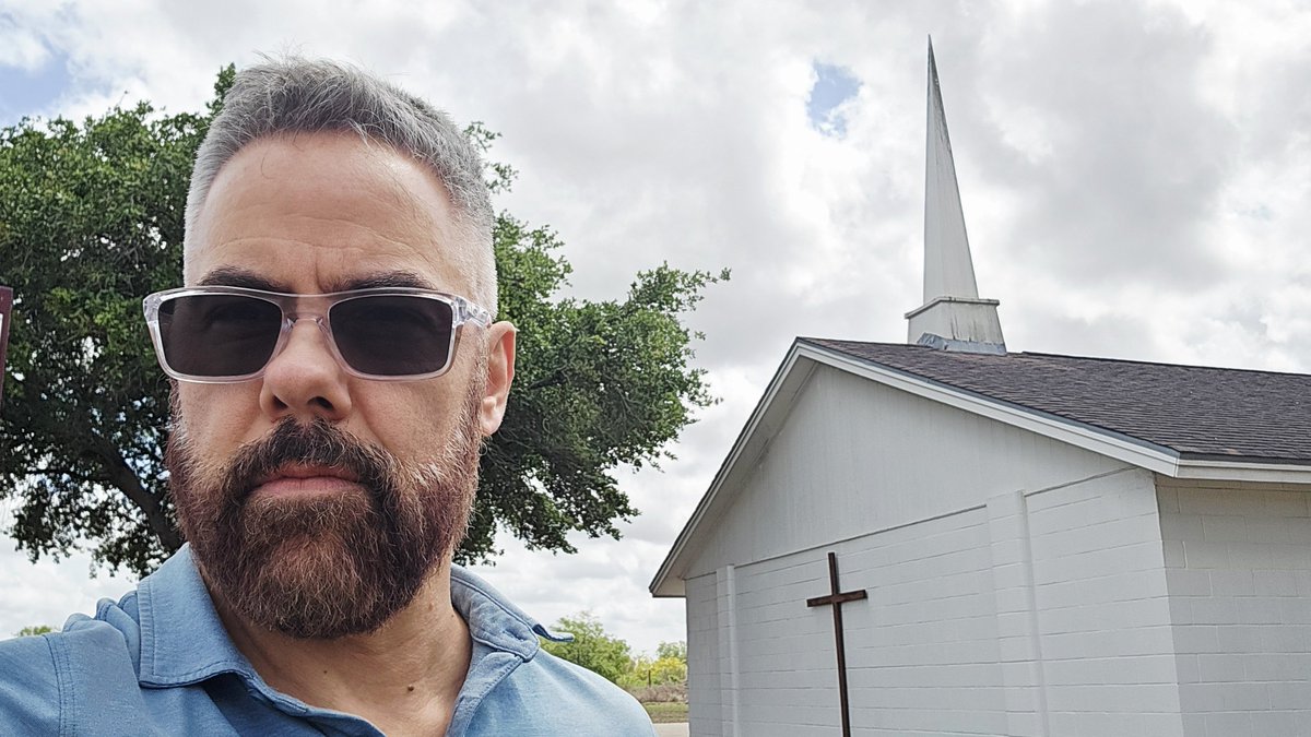
Driving through South Texas. My annual pilgrimage to the li'l roadside church in Riviera where I rode out my first Gulf #hurricane in 1999. I'd chased before, but this is where the obsession really started. 27 years later, I remember only random details: the roar of the winds,
Tracks of all known Category-5 #hurricane landfalls in North America, updated to include #MELISSA in #Jamaica. This only includes storms that were Cat 5 at *landfall* (meaning when center crossed coast). Labor Day 1935, DORIAN 2019, & MELISSA 2025 are in 3-way tie for strongest.
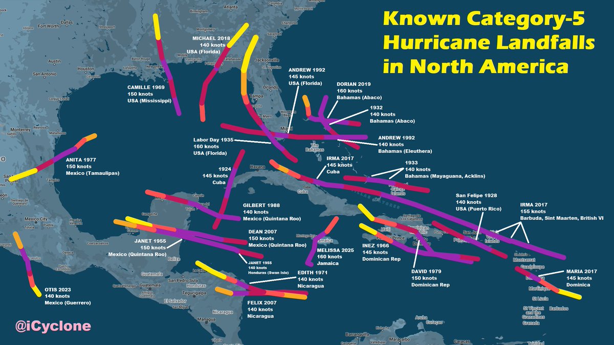
Breaking: Hurricane #Melissa now tied for the strongest storm ever in the Atlantic with winds upgraded to 190 mph winds. Tied with #Hurricane Allen in 1980! New info comes from NHC post season analysis.


🌪️ABD'nin #Michigan eyaletindeki Union City'de meydana gelen kasırga büyük yıkıma neden oldu❗ #WeatherAlert #Hurricane #unioncity furkanhaber.net
Stills from a shoot last week—for a new series of video shorts. The concept: epic #hurricane tales in tight, 7-minute episodes. Working title: #HurricaneChronicles. These stills are from the IDA episode. Imagine what I brought for MELISSA. Coming soon to @WeatherNation.

Gulf sunrise from @HurricaneCon on South Padre Island, Texas. CSU will release its first Atlantic seasonal #hurricane forecast for 2026 this morning at 10am EDT.


Something went wrong.
Something went wrong.
United States Trends
- 1. Secret Service N/A
- 2. Jokic N/A
- 3. President N/A
- 4. Butler N/A
- 5. Staged N/A
- 6. WHCD N/A
- 7. White House N/A
- 8. Nuggets N/A
- 9. Cole Allen N/A
- 10. Ayo Dosunmu N/A
- 11. McDaniels N/A
- 12. Torrance N/A
- 13. POTUS N/A
- 14. Donte N/A
- 15. Wolves N/A
- 16. Washington Hilton N/A
- 17. Cole Tomas Allen N/A
- 18. Erika Kirk N/A
- 19. Adelman N/A
- 20. Shooter N/A