#maptrivia search results

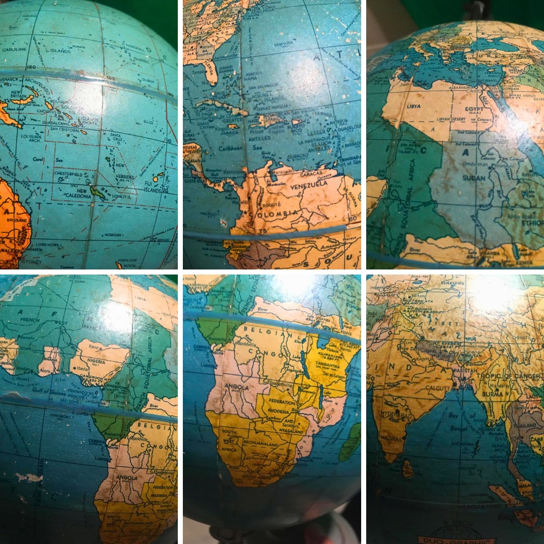
10 points to whoever can solve this globe trivia. How old is this item? #maptrivia #geography Source: Reddit

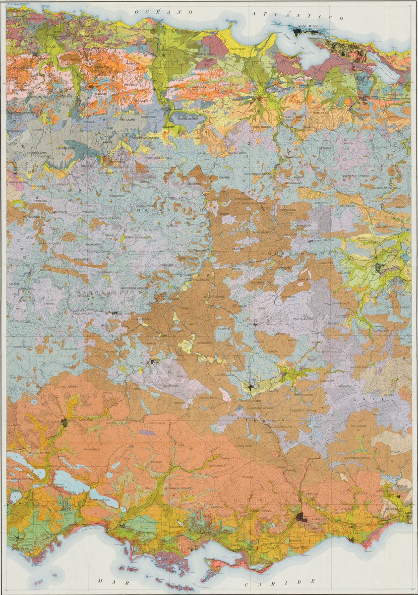
15 points to whoever can identify the purpose, author, and date of this map. Our image shows roughly half of the entire map. #maptrivia #map #geography
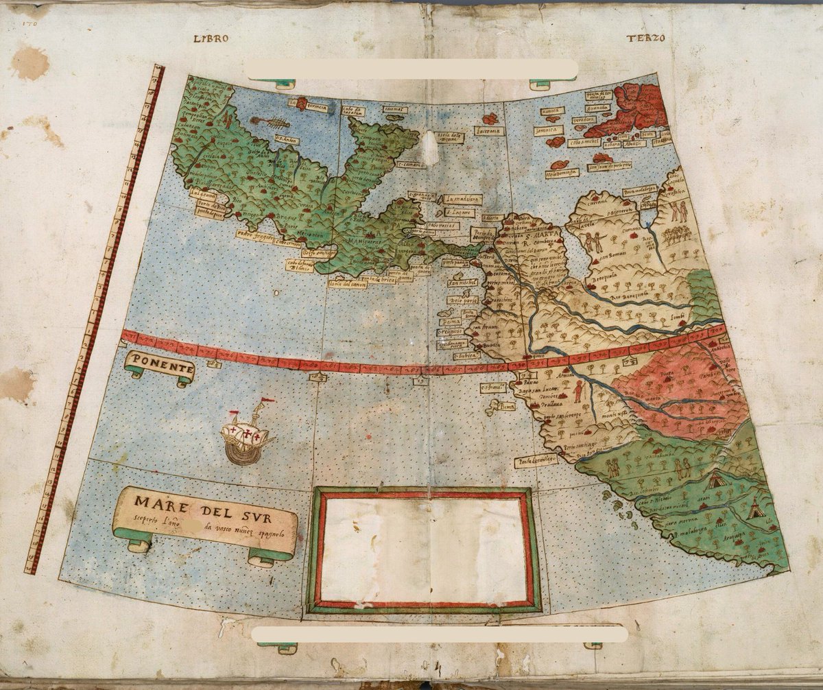
10 points to whoever can name the date this map was published. This map depicting Central and South America and the Pacific lacks a note box. Source material notes that this might mean a revision was intended but never completed. #maptrivia #geoint

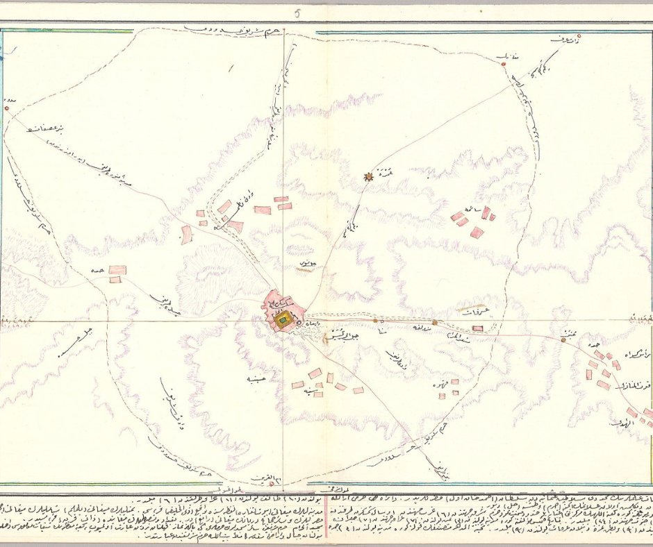
10 points to whoever can name the author or subject of this 1895 manuscript map. #map #geography #maptrivia


10 points to whoever can provide the date and overall function of this map. #history #maptrivia #map #geography

15 points to whoever knows the historical purpose of this map. For those who studied geography, it's likely a no-brainer. As an additional challenge, what systems did this map inspire? #mapofthemonth #map #maptrivia

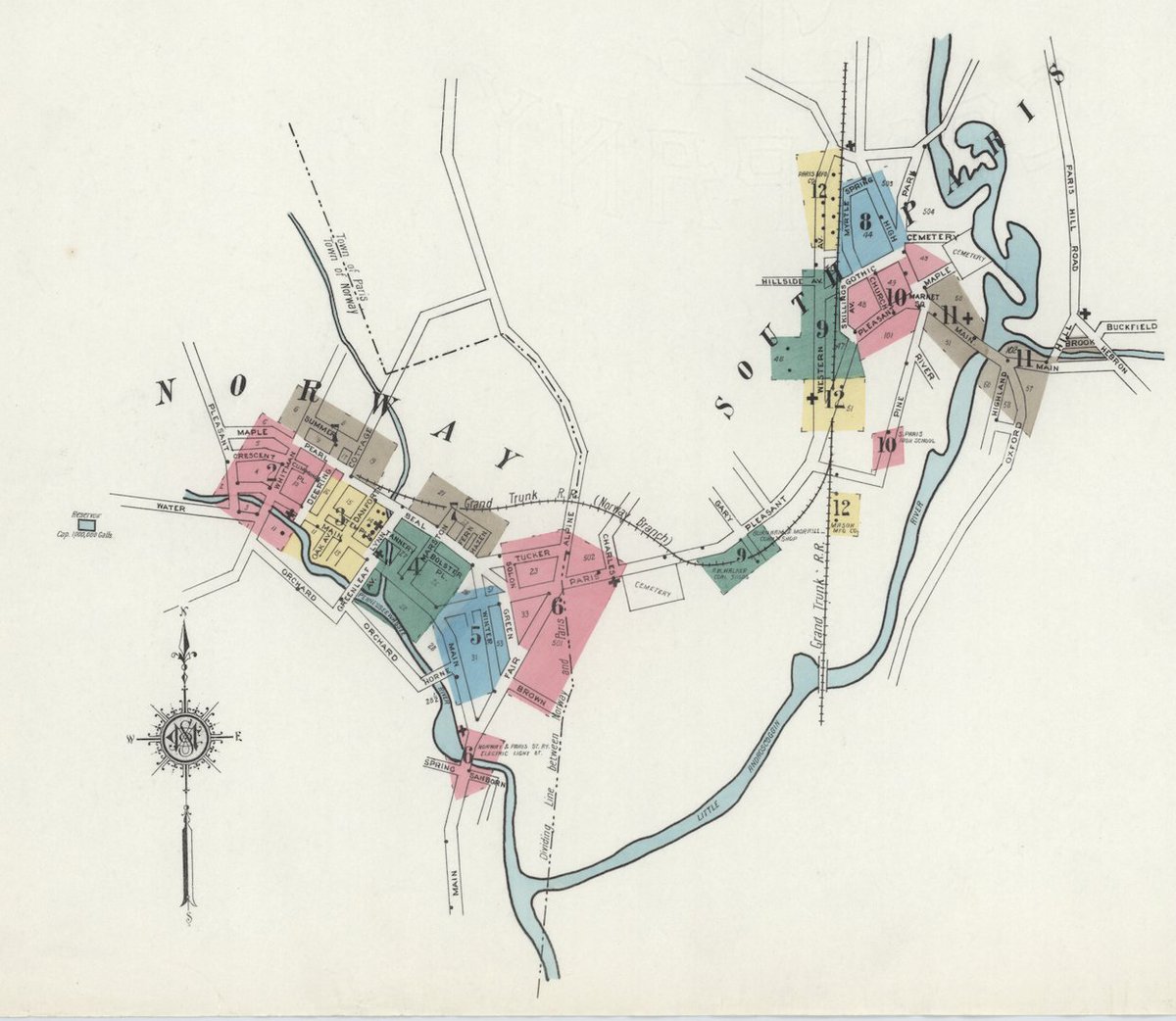
Today's map is a cut-out from a historical print. The color boxes correspond with the map's purpose, 10 points to whoever can identify the publisher and year. #maptrivia #geography #map
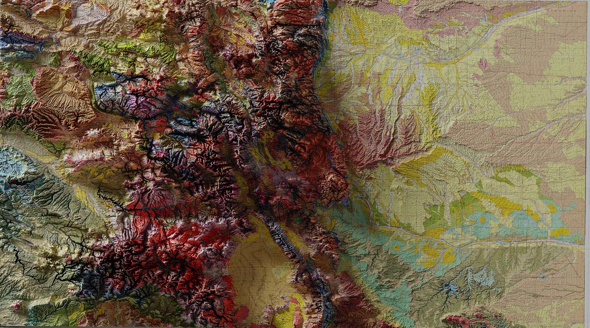
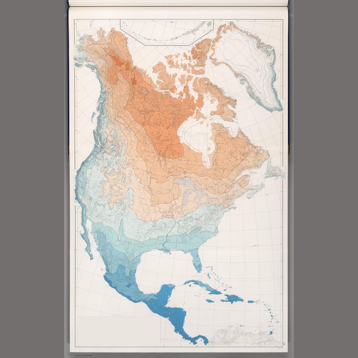
10 points to whoever can identify what the color variations in the map indicate. The legend has been cropped out. Good luck! #maptrivia #geography #map
10 points to whoever can name the publisher, year, or purpose of this map. That information has been covered for today's map trivia. Good luck! #map #maptrivia #geography

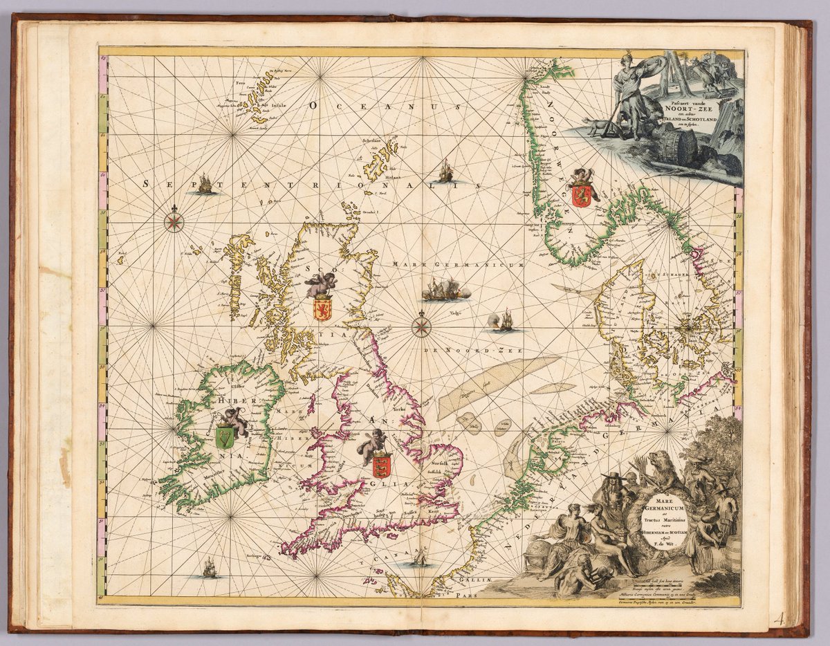
10 points to whoever can identify the date this map was produced. In honor of St. Patrick's Day, this map includes Ireland, England, Denmark and Scotland. This fantastic example of 17th-century Dutch cartography was hand colored. #maps #themoreyouknow #maptrivia
For 10 points, who can identify the subject of this map? The key has been covered, but we'll provide a clue. This map was published in 1979. Good luck! #maptrivia #geography #map
For 10 points, who can identify the publication date, location, or author of this map? This map is part of a group of supplements created the year after the original item. Good luck! #map #maptrivia #geography

Today's map is described as an exceedingly rare work. Researchers have not been able to locate another copy of this map in public or private collections. 10 points to anyone who can determine the subject and publication information. Good luck! #maptrivia #trivia #geography

For 10 points, who can identify the distinguishing element of this map? The title and other identifying information have been covered. This map is not the first of its kind, but this 1608 edition is the first with a new element. Good luck! #maptrivia #trivia #geography #map


Mind blown! Did you know that Ontario's border with the US spans 2700km WATER and just 1km LAND? Talk about a long coastline! #MapTrivia #OntarioFacts en.wikipedia.org/wiki/Height_of…
For 10 points, who can identify the distinguishing element of this map? The title and other identifying information have been covered. This map is not the first of its kind, but this 1608 edition is the first with a new element. Good luck! #maptrivia #trivia #geography #map
Mind blown! Did you know that Ontario's border with the US spans 2700km WATER and just 1km LAND? Talk about a long coastline! #MapTrivia #OntarioFacts en.wikipedia.org/wiki/Height_of…
Today's map is described as an exceedingly rare work. Researchers have not been able to locate another copy of this map in public or private collections. 10 points to anyone who can determine the subject and publication information. Good luck! #maptrivia #trivia #geography
For 10 points, who can identify the subject of this map? The key has been covered, but we'll provide a clue. This map was published in 1979. Good luck! #maptrivia #geography #map
For 10 points, who can identify the publication date, location, or author of this map? This map is part of a group of supplements created the year after the original item. Good luck! #map #maptrivia #geography
10 points to whoever can solve this globe trivia. How old is this item? #maptrivia #geography Source: Reddit
10 points to whoever can name the author or subject of this 1895 manuscript map. #map #geography #maptrivia
10 points to whoever can provide the date and overall function of this map. #history #maptrivia #map #geography
10 points to whoever can name the date this map was published. This map depicting Central and South America and the Pacific lacks a note box. Source material notes that this might mean a revision was intended but never completed. #maptrivia #geoint
10 points to whoever can identify what the color variations in the map indicate. The legend has been cropped out. Good luck! #maptrivia #geography #map
15 points to whoever can identify the purpose, author, and date of this map. Our image shows roughly half of the entire map. #maptrivia #map #geography
10 points to whoever can name the publisher, year, or purpose of this map. That information has been covered for today's map trivia. Good luck! #map #maptrivia #geography
For 10 points, who can identify the subject of this map? The key has been covered, but we'll provide a clue. This map was published in 1979. Good luck! #maptrivia #geography #map
Today's map is a cut-out from a historical print. The color boxes correspond with the map's purpose, 10 points to whoever can identify the publisher and year. #maptrivia #geography #map
15 points to whoever knows the historical purpose of this map. For those who studied geography, it's likely a no-brainer. As an additional challenge, what systems did this map inspire? #mapofthemonth #map #maptrivia
For 10 points, who can identify the publication date, location, or author of this map? This map is part of a group of supplements created the year after the original item. Good luck! #map #maptrivia #geography
10 points to whoever can identify the date this map was produced. In honor of St. Patrick's Day, this map includes Ireland, England, Denmark and Scotland. This fantastic example of 17th-century Dutch cartography was hand colored. #maps #themoreyouknow #maptrivia
For 10 points, who can identify the distinguishing element of this map? The title and other identifying information have been covered. This map is not the first of its kind, but this 1608 edition is the first with a new element. Good luck! #maptrivia #trivia #geography #map
Today's map is described as an exceedingly rare work. Researchers have not been able to locate another copy of this map in public or private collections. 10 points to anyone who can determine the subject and publication information. Good luck! #maptrivia #trivia #geography
Something went wrong.
Something went wrong.
United States Trends
- 1. #BaddiesUSA 59.2K posts
- 2. Rams 29.2K posts
- 3. #LAShortnSweet 21.2K posts
- 4. Scotty 9,710 posts
- 5. Cowboys 100K posts
- 6. Chip Kelly 8,597 posts
- 7. Eagles 140K posts
- 8. #TROLLBOY 1,958 posts
- 9. #ITWelcomeToDerry 15.2K posts
- 10. Raiders 67.4K posts
- 11. Stafford 15K posts
- 12. sabrina 61.1K posts
- 13. Stacey 25.6K posts
- 14. Bucs 12.2K posts
- 15. TOP CALL 3,289 posts
- 16. #RHOP 12K posts
- 17. Baker 20.9K posts
- 18. Ahna 7,069 posts
- 19. billie 18.9K posts
- 20. Vin Diesel 1,210 posts