#nasaworldview search results


Kot zanimivost nekaj dodatne vlage in s tem energije v ozračje bo ponoči in jutri prispeval tudi nekdanji tropski ciklon #Tammy 🌀 Ta se nahaja v bližini Bermudskega otočja, 6000 km stran od nas. Oblačno reko je danes lepo ujel Nasin satelit. #NASAWorldView

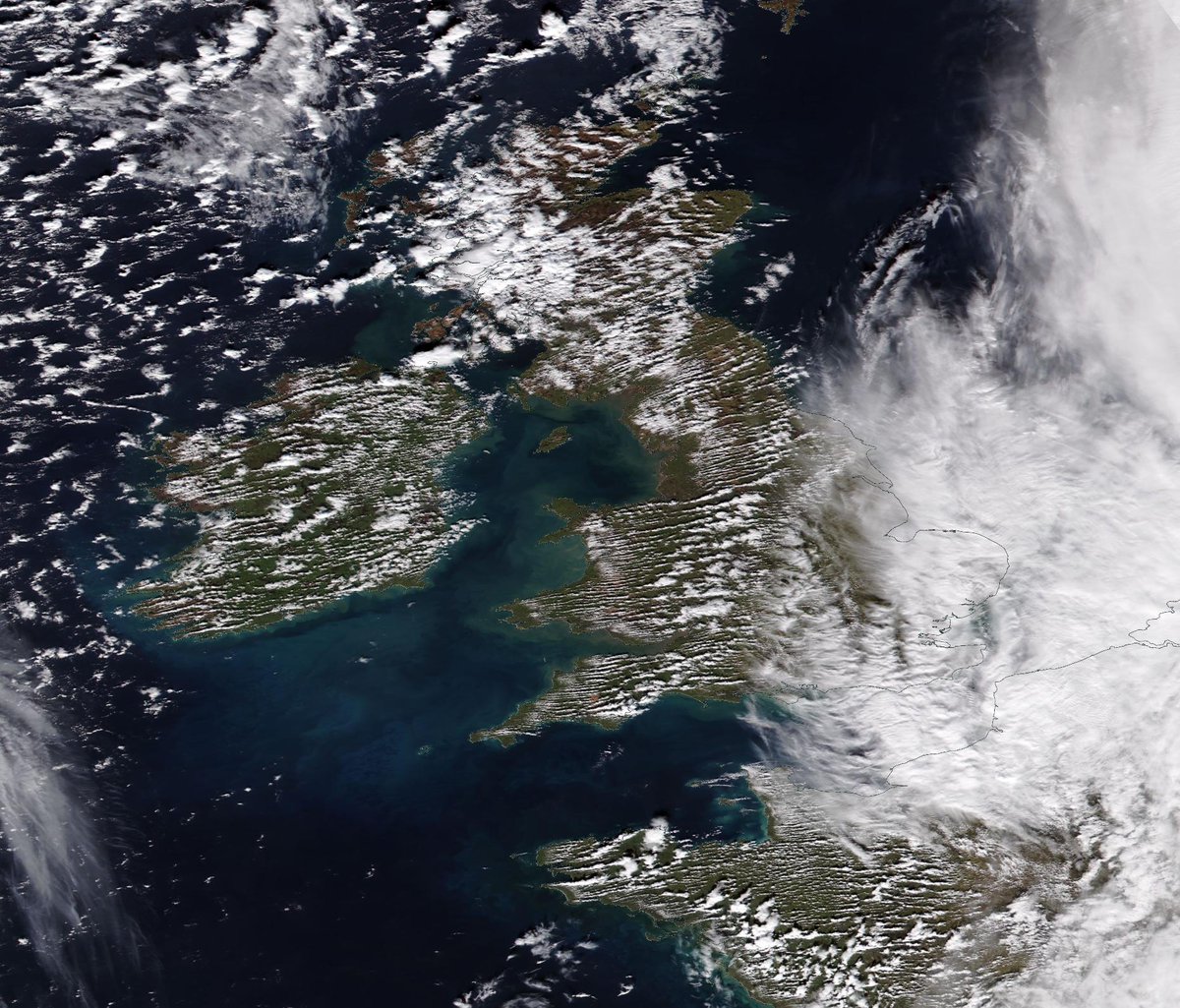
Almost cloud-free across most of Scotland today. Here's the view from space, via #NASAworldview. go.nasa.gov/4hFzvuv


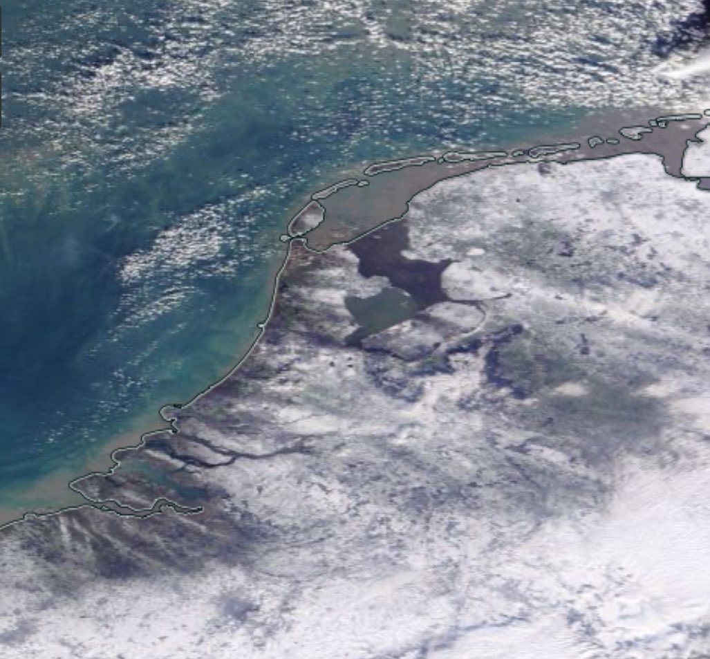
Margo has called this the #NASAWorldview Camouflage layer. Images down through the years of the Siberian Shelf Seas.


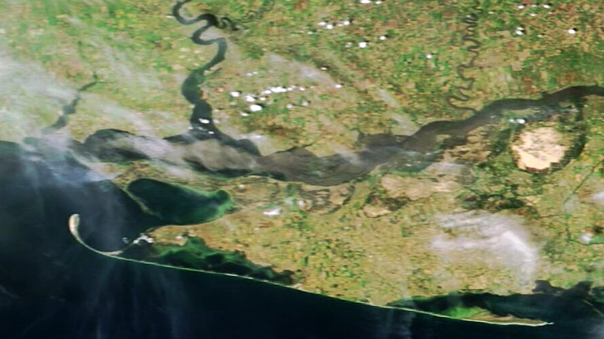
Massive flooding in southern Ukraine makes Dnieper River look like the Amazon TODAY. Sediment loaded plume muddies whole estuary. Lowlands are totally inundated. Besides Kherson, left bank tows at Russia´s occupated area have been hit hard too. #Kakhovka #NASAWorldView

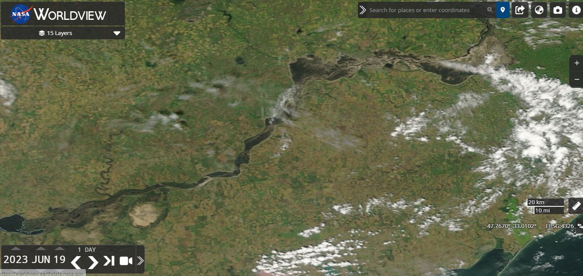
According to #NASAWorldview, something happened to #RiverDnipro between 19th & 20th June: worldview.earthdata.nasa.gov/?v=31.94078405…
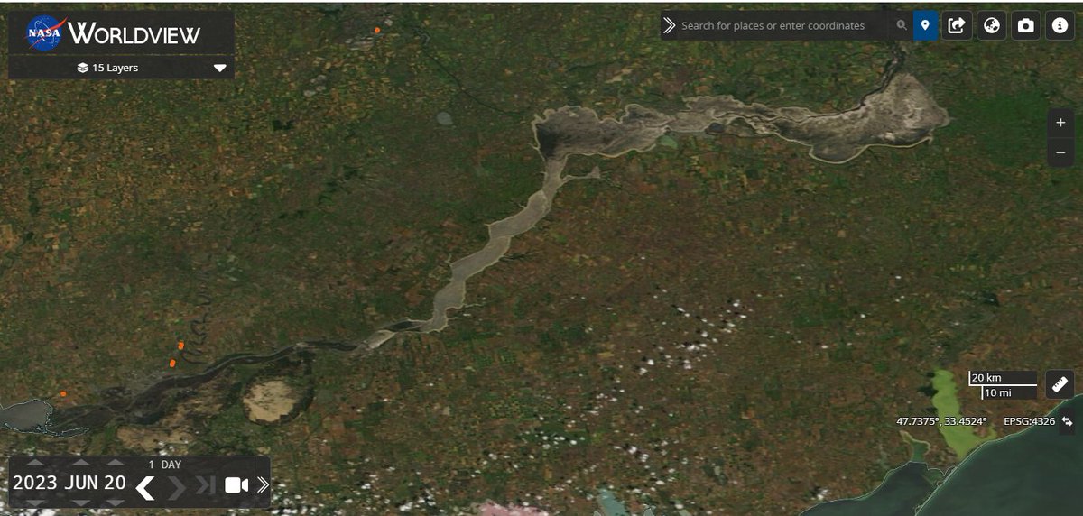

The Kakhovka Reservoir has practically turned into a Dry Wasteland after the Destruction of the Kakhovka Dam and Hydroelectric Power Plant, while this continues to be a Massive Humanitarian Disaster the Ecological Impact to the Dnipro River-Basin as well as the surrounding Region…
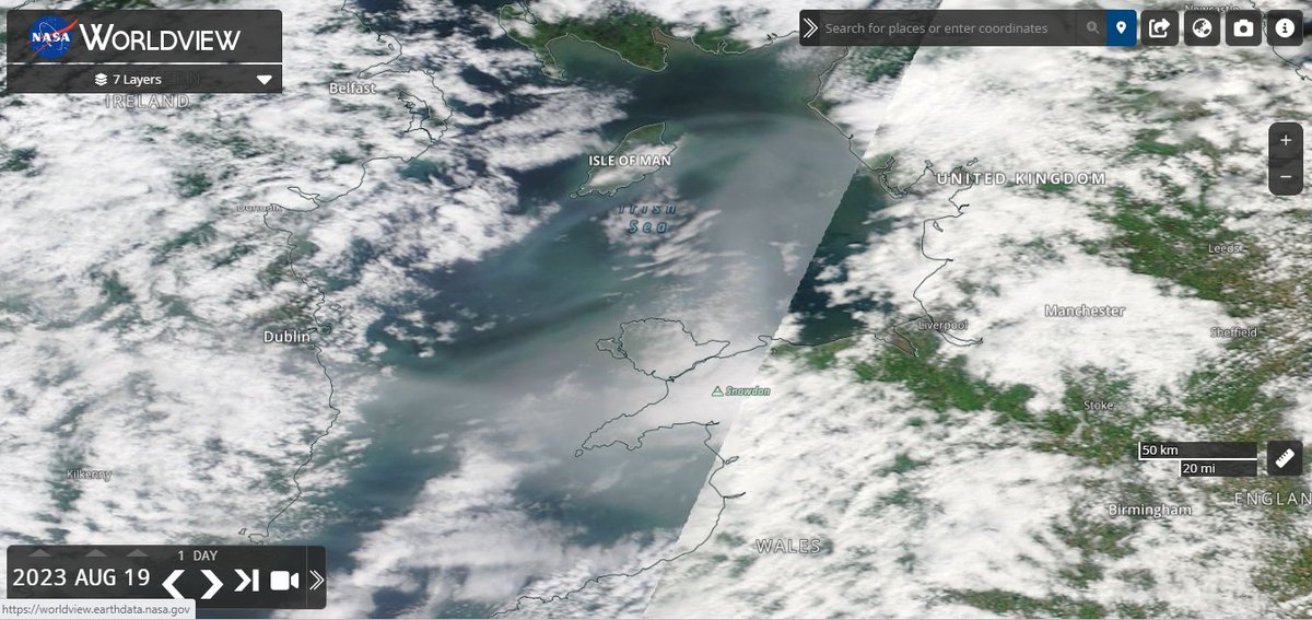
For some reason theres no #NASAWorldview for today. It made me think of the #IrishSea yesterday: worldview.earthdata.nasa.gov/?v=-7.71160044…

You may have noticed some smoke on the satellite image we shared earlier today. This has most likely come from one of the several wildfires outbreaks we have across the Northern Hemisphere at the moment This incredible image of the smoke was captured by @clairestruma over…

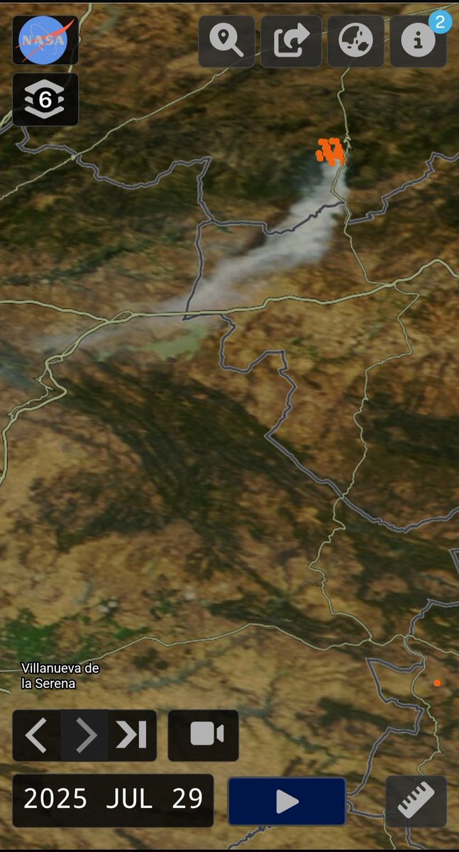
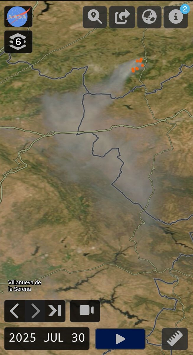
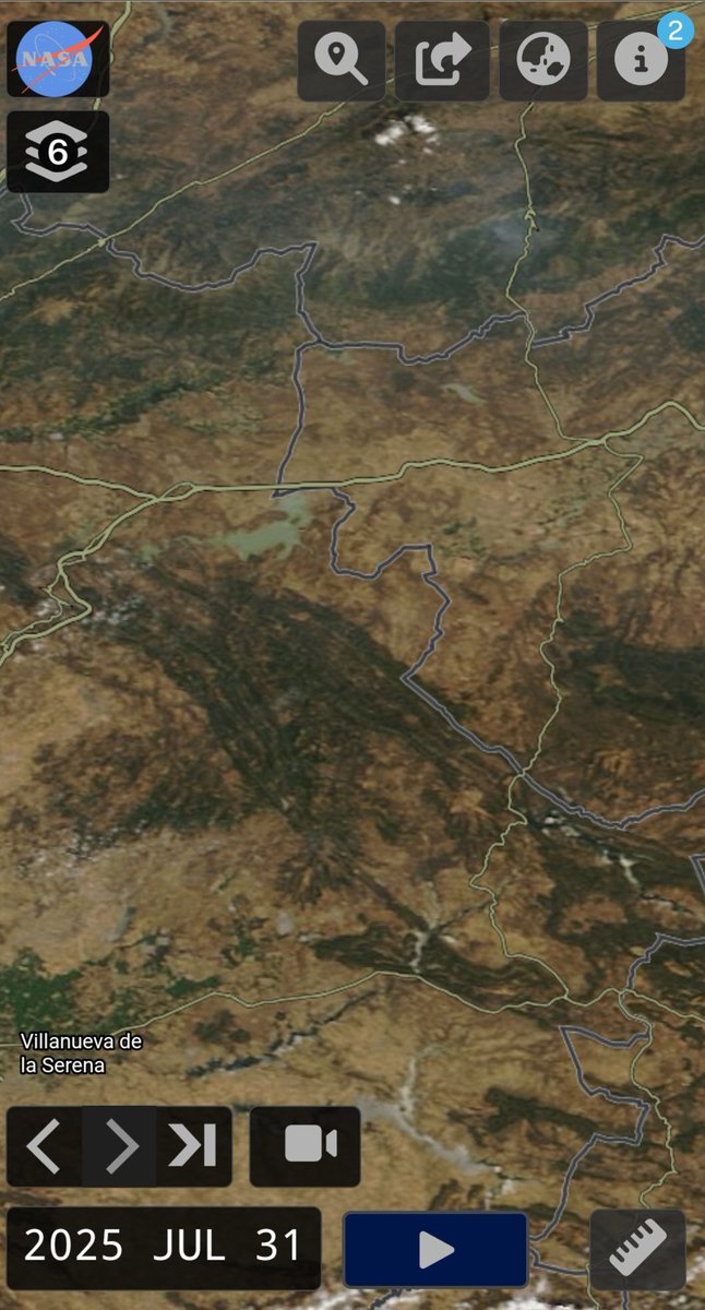
La columna de humo del #IFCuevasDelValle alcanzó, latitudinalmente, Villanueva de La Serena. #NASAWorldview go.nasa.gov/4ofF4Ez
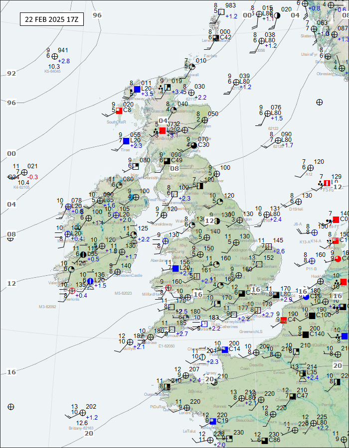
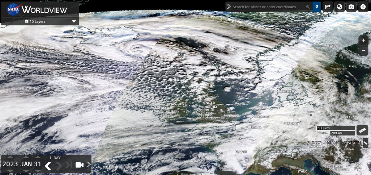
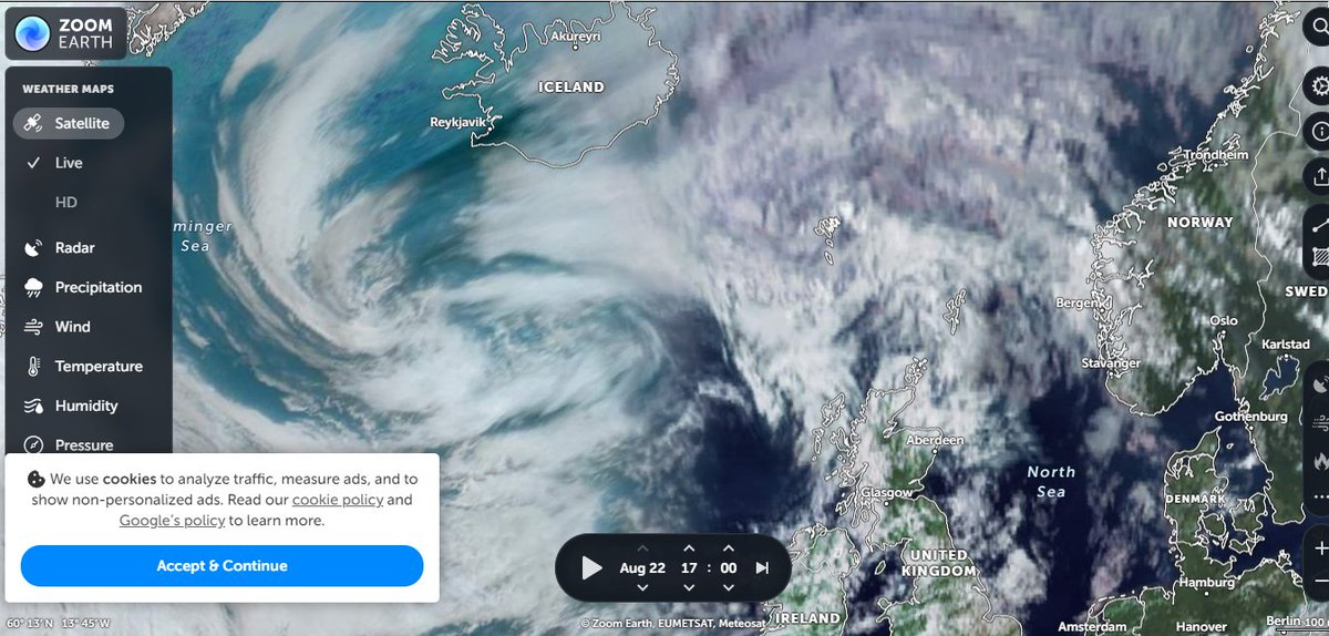
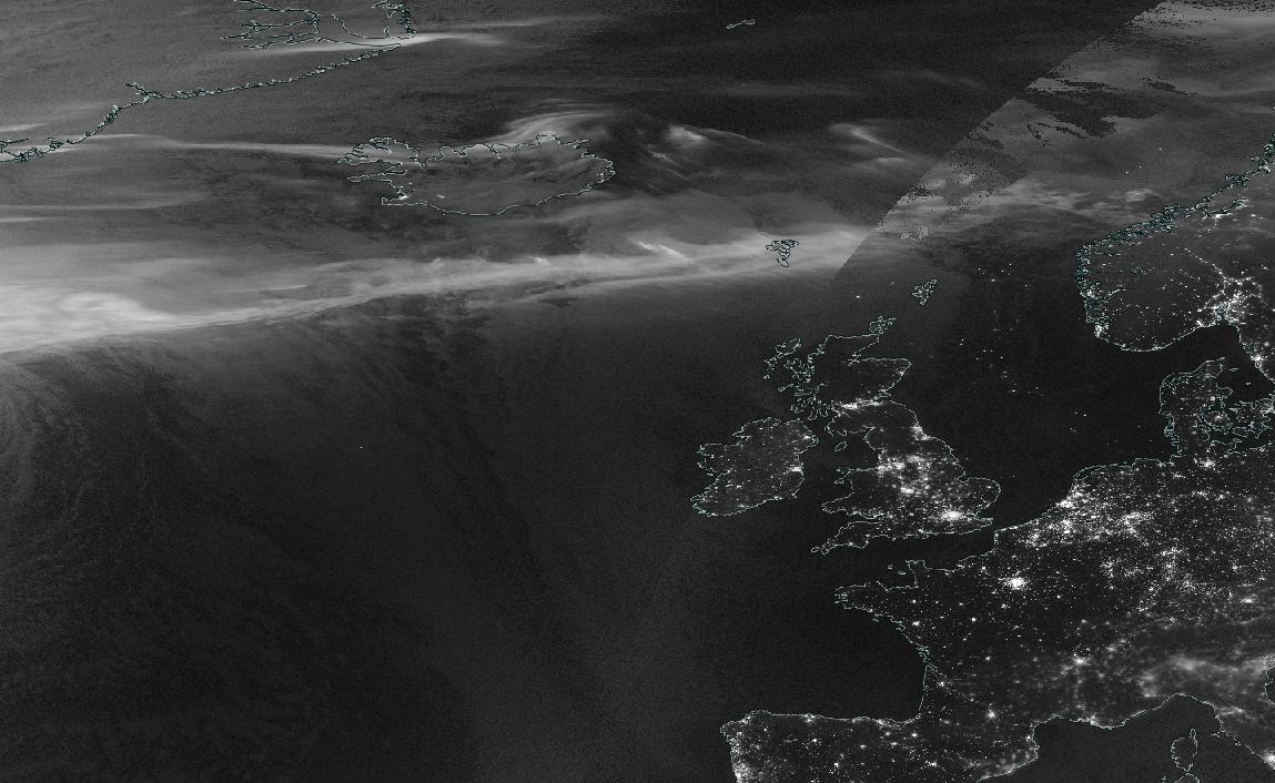
Doesn't look much like 9 metre waves? On #NASAWorldview, the image appeared this afternoon, the storm appeared seemingly behind schedule, still near #Iceland.
🌊 A swathe of severe gales will create some very rough sea conditions around Scotland during the next 24 hours ⚠️ Very high sea states with waves of over 9 metres are possible in the northwest for a time


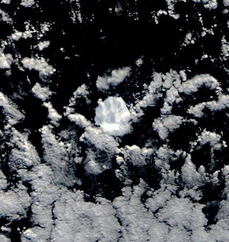
The last significant chunk of #MolarBerg, aka D28. Molar Berg was the biggest ice block to come off the Amery Ice Shelf in more than 50 years. It split in two in February. Only the larger section, D28a, survives. Now 260 sq km. 2/3rds the area of the Isle of Wight #NasaWorldview
#NASAWorldview is still off while #ZoomEarth shows purple and black north of #UK, and doesn't show land to the east, whether thats usual: zoom.earth/maps/satellite… @CarolineCoramUK

This #EarthDay, explore global Earth science data imagery of our ever-changing planet. View tropical cyclones developing, reservoirs filling after torrential rain, wildfires spreading, and urban centers expanding. View your World with #NASAWorldview: go.nasa.gov/3LaEuGB

Check out what I found in #NASAWorldview - go.nasa.gov/3Zankgd
In our new Data Tool-in-Focus, learn to use #NASAWorldview, an imagery mapping and visualization application that lets users view natural events as they develop, explore changes over time with imagery from past decades, download data, and more! go.nasa.gov/3IY5WWo
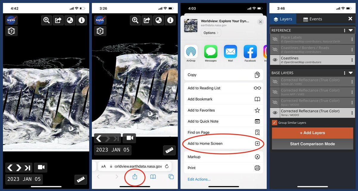
Tips for Using Worldview on Mobile Devices Did you know that #NASAWorldview can be used on mobile devices? The functionality is a bit different than accessing it via a browser on your desktop computer or laptop, but you can do a lot of the same things! go.nasa.gov/3R7lQD0

A week after heavy rainfall from #TCJasper began in NQ and we are now getting some satellite imagery of the flood plumes #NASAWorldview (go.nasa.gov/3tmHmKx). This is the Daintree River plume, which you can see extending around Low Isles and likely well into the mid-shelf.
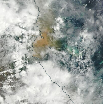
La columna de humo del #IFCuevasDelValle alcanzó, latitudinalmente, Villanueva de La Serena. #NASAWorldview go.nasa.gov/4ofF4Ez
Almost cloud-free across most of Scotland today. Here's the view from space, via #NASAworldview. go.nasa.gov/4hFzvuv
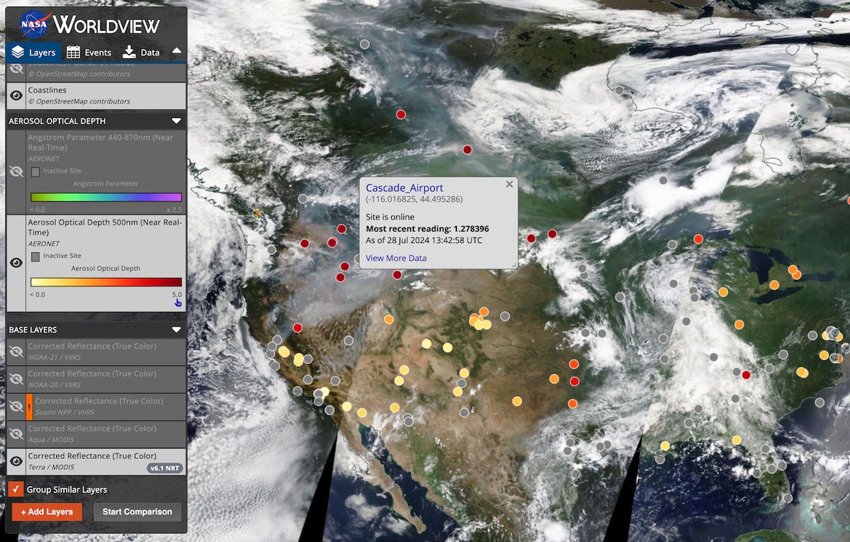
Four imagery layers from the Aerosol Robotic Network (AERONET) are now available in #NASAWorldview. These ground-based aerosol measurements can be used with satellite-based aerosol imagery already in Worldview. ➡️Learn more about these new layers: go.nasa.gov/3yFtde8
It doesn't seem to show on #NASAWorldview? There was a large amount to the east: worldview.earthdata.nasa.gov/?v=-57.0256276…
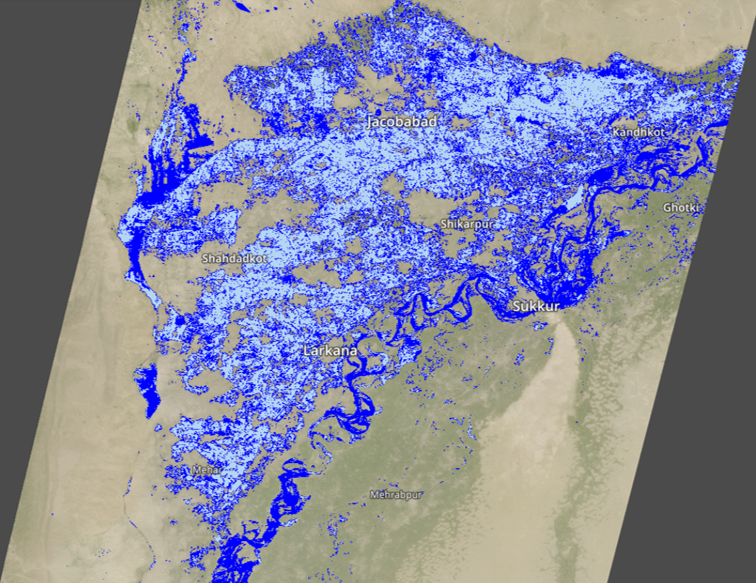
Did you know that the @NASAJPL Observational Products for End-Users from Remote Sensing Analysis (OPERA) near-global Dynamic Surface Water eXtent (DSWx) 30-meter data imagery layer is available in #NASAWorldview? ➡️Learn more in a new Tour Story: go.nasa.gov/3wupKhj

Geoengineering / chemtrails fully visible over the UK 13 April 2024 - Blatant lines in the sky #NASAWorldview - go.nasa.gov/44sYoEN
The last significant chunk of #MolarBerg, aka D28. Molar Berg was the biggest ice block to come off the Amery Ice Shelf in more than 50 years. It split in two in February. Only the larger section, D28a, survives. Now 260 sq km. 2/3rds the area of the Isle of Wight #NasaWorldview
Kot zanimivost nekaj dodatne vlage in s tem energije v ozračje bo ponoči in jutri prispeval tudi nekdanji tropski ciklon #Tammy 🌀 Ta se nahaja v bližini Bermudskega otočja, 6000 km stran od nas. Oblačno reko je danes lepo ujel Nasin satelit. #NASAWorldView
Almost cloud-free across most of Scotland today. Here's the view from space, via #NASAworldview. go.nasa.gov/4hFzvuv
Margo has called this the #NASAWorldview Camouflage layer. Images down through the years of the Siberian Shelf Seas.
Massive flooding in southern Ukraine makes Dnieper River look like the Amazon TODAY. Sediment loaded plume muddies whole estuary. Lowlands are totally inundated. Besides Kherson, left bank tows at Russia´s occupated area have been hit hard too. #Kakhovka #NASAWorldView
According to #NASAWorldview, something happened to #RiverDnipro between 19th & 20th June: worldview.earthdata.nasa.gov/?v=31.94078405…
The Kakhovka Reservoir has practically turned into a Dry Wasteland after the Destruction of the Kakhovka Dam and Hydroelectric Power Plant, while this continues to be a Massive Humanitarian Disaster the Ecological Impact to the Dnipro River-Basin as well as the surrounding Region…
The last significant chunk of #MolarBerg, aka D28. Molar Berg was the biggest ice block to come off the Amery Ice Shelf in more than 50 years. It split in two in February. Only the larger section, D28a, survives. Now 260 sq km. 2/3rds the area of the Isle of Wight #NasaWorldview
For some reason theres no #NASAWorldview for today. It made me think of the #IrishSea yesterday: worldview.earthdata.nasa.gov/?v=-7.71160044…
You may have noticed some smoke on the satellite image we shared earlier today. This has most likely come from one of the several wildfires outbreaks we have across the Northern Hemisphere at the moment This incredible image of the smoke was captured by @clairestruma over…
#NASAWorldview is still off while #ZoomEarth shows purple and black north of #UK, and doesn't show land to the east, whether thats usual: zoom.earth/maps/satellite… @CarolineCoramUK
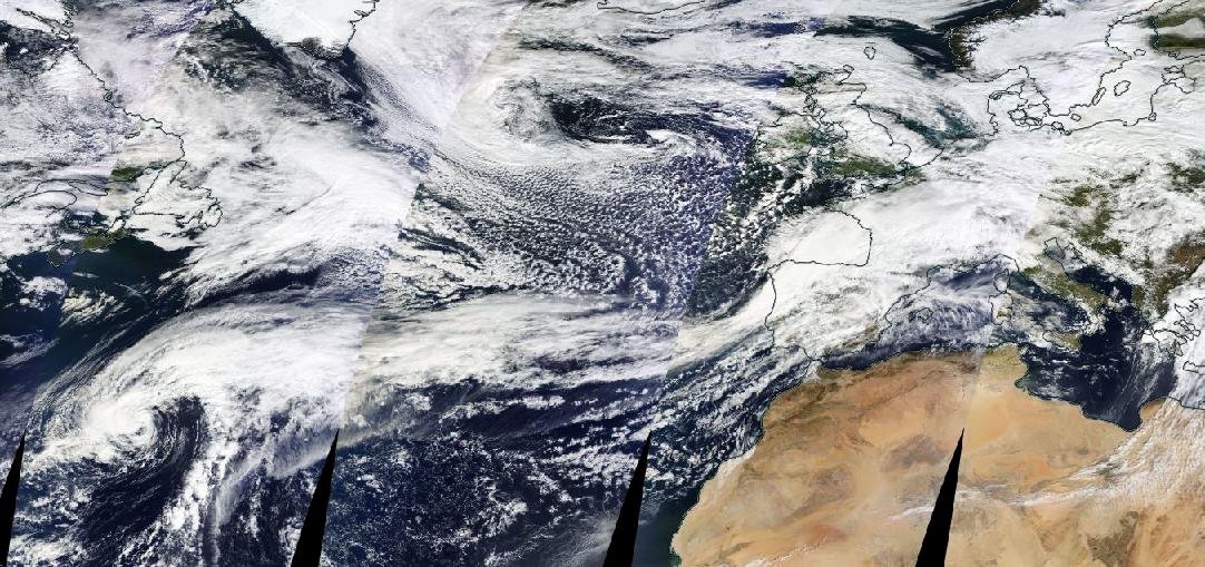
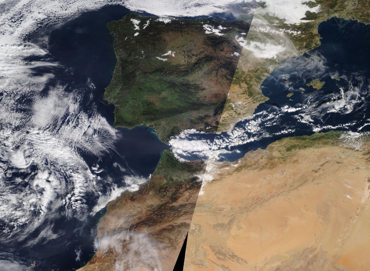
Imagen #satelite #NASAWorldview @NASAEarth Llamativo verde en O de #Iberia y N de @Marruecos #nieblas Valle del Ebro y algunos interiores. #Nieve en #Pirineos (escasa, nula en #Navarra ) y #SierraNevada, ausente en #Atlas #Nubes por #levante en #Alborán #EstrechodeGibraltar
A week after heavy rainfall from #TCJasper began in NQ and we are now getting some satellite imagery of the flood plumes #NASAWorldview (go.nasa.gov/3tmHmKx). This is the Daintree River plume, which you can see extending around Low Isles and likely well into the mid-shelf.
La columna de humo del #IFCuevasDelValle alcanzó, latitudinalmente, Villanueva de La Serena. #NASAWorldview go.nasa.gov/4ofF4Ez
Doesn't look much like 9 metre waves? On #NASAWorldview, the image appeared this afternoon, the storm appeared seemingly behind schedule, still near #Iceland.
🌊 A swathe of severe gales will create some very rough sea conditions around Scotland during the next 24 hours ⚠️ Very high sea states with waves of over 9 metres are possible in the northwest for a time
This #EarthDay, explore global Earth science data imagery of our ever-changing planet. View tropical cyclones developing, reservoirs filling after torrential rain, wildfires spreading, and urban centers expanding. View your World with #NASAWorldview: go.nasa.gov/3LaEuGB
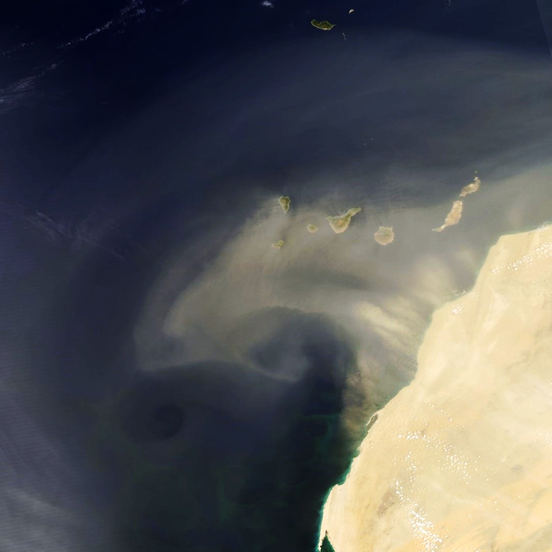
HOJE Grande pluma de poeira do Deserto do Saara entra mais de 600 km no Oceano Atlântico, sobre as Ilhas Canárias, África. Imagem do satélite AQUA em go.nasa.gov/3M4qZt5 #NASAWorldView no RT animação de imagens do satélite GOES-16 #Marrocos


Check out what I found in #NASAWorldview - go.nasa.gov/41vimg7 Last night's #Aurora as seen by the VIIRS/Suomi NPP satellite🛰️
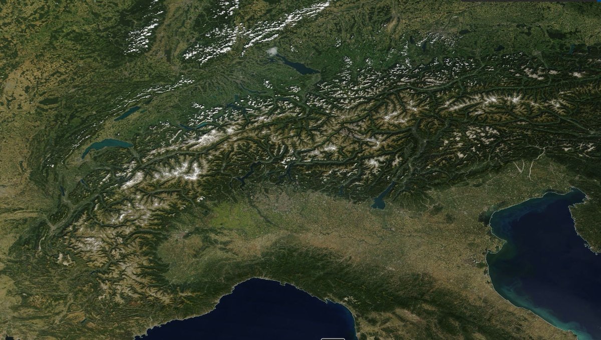
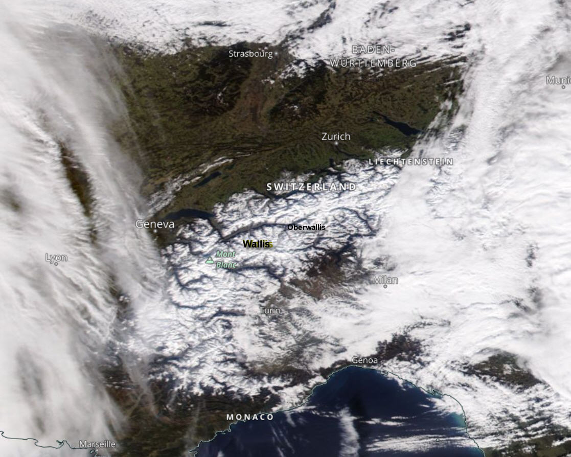
De W-Alpen gezien vanuit de ruimte #NasaWorldView. Het tussenhoog met zonnevenster zorgde nog voor een paar uur zon. Inmiddels is het hier in Oberwallis vanuit het westen weer geheel dicht getrokken met hogere #warmtefront bewolking
Something went wrong.
Something went wrong.
United States Trends
- 1. Black Friday 396K posts
- 2. Egg Bowl 4,448 posts
- 3. Mississippi State 2,795 posts
- 4. Kamario Taylor N/A
- 5. Emmett Johnson N/A
- 6. #SkylineSweeps N/A
- 7. NextNRG Inc 1,794 posts
- 8. Scott Stricklin N/A
- 9. Wetjen N/A
- 10. Trinidad Chambliss N/A
- 11. #Rashmer 24.2K posts
- 12. Solo Ball N/A
- 13. Sumrall 1,284 posts
- 14. #FanCashDropPromotion 1,817 posts
- 15. #Huskers N/A
- 16. Porsha N/A
- 17. Black Ops 7 XP 2,210 posts
- 18. #HMxCODSweepstakes N/A
- 19. Fisch 1,104 posts
- 20. Kewan Lacy N/A