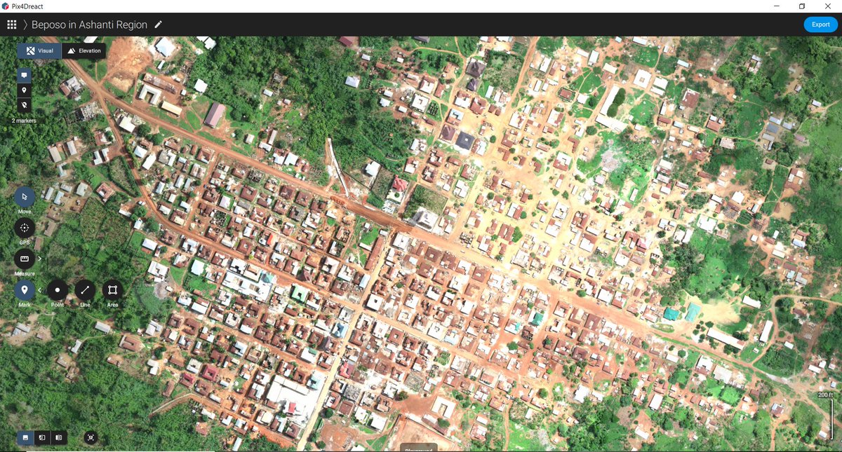
#pix4dreact 搜尋結果

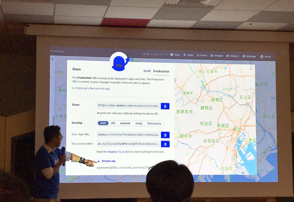
Mapbox/OpenStreetMap meet JP & hands-on#01 に参加させて頂きました! ✏️ 🗺 次回はPix4D日本オフィスとして、新製品 #Pix4Dreact について発表させて頂きます! 11月6日、WeWork日比谷にてお会いしましょう🤗 @mapbox_jp @mapconcierge #mapboxjpmeetup


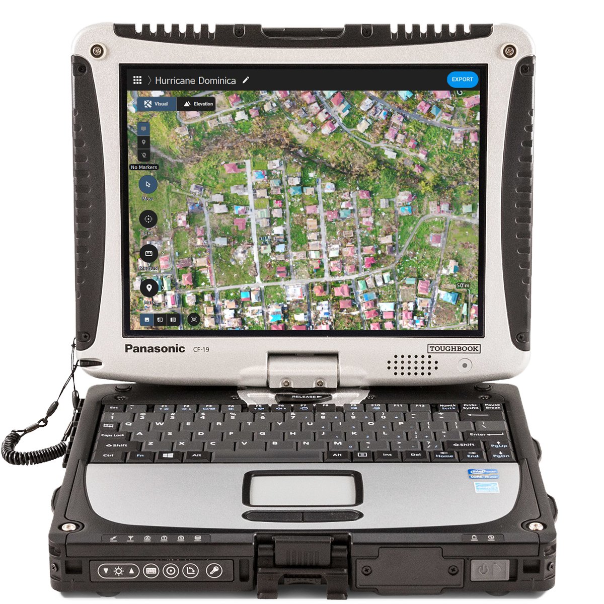
Check out how @droneresponders used Drones and Pix4Dreact to map the aftermath of hurricane Dorian and much more. Via @ExpoUAV news. #dronesforgood #pix4dreact ow.ly/6geG50y0MPj


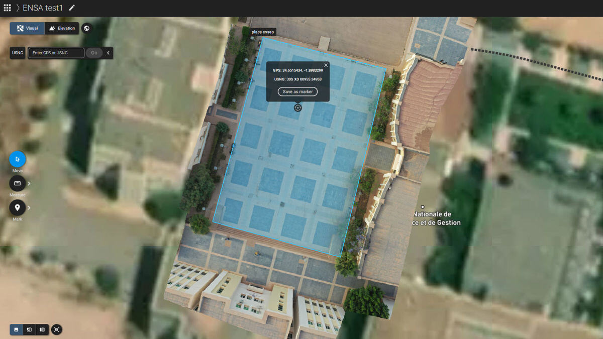
So far #Pix4Dreact from @pix4d is the #fastest 2D #processing soft we have used, thanks to @gab_rug for the intro. It's super #fast, works #offline with #exporting #annotation & #reporting capabilities. In less than an #hour, we #processed over 1600 #images of our project site.

A week ago @Geoconnexion wrote about our Pix4Dreact launch! Have you tried it yet? ow.ly/hmsS50wX2Fm #pix4dreact #2Dfastmapping #publicsafefy #emergencyresponse
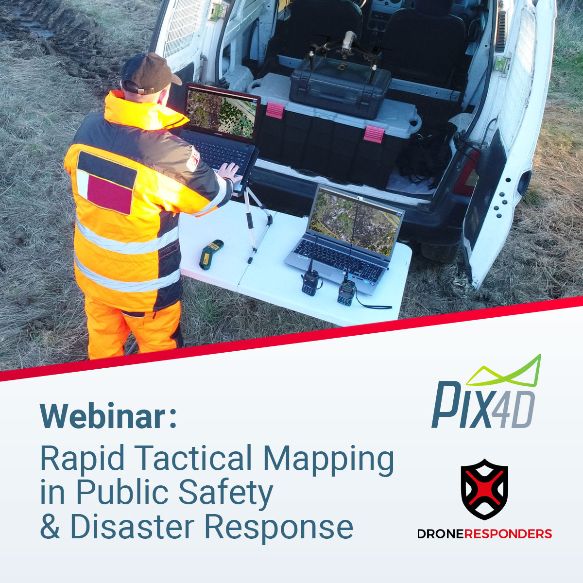
Our UK partner COPTRZ is promoting a webinar tomorrow about Drones, Payloads & Software for Search & Rescue. Don't miss it - Register Now. ow.ly/qs8250wRprT #pix4dreact #emergencyresponse

⚠️ Reminder that we are hosting a free webinar next week (Dec 10)! Learn from actual Public Safety professionals about their use of #Pix4Dreact in real world situations with tangible results. Register now! 🔗 ow.ly/o6E650xr4FR

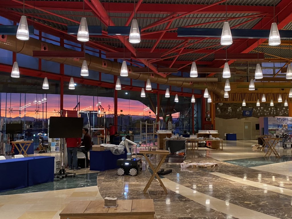
Here’s a look at at the classroom section of the #pix4dreact workshop presented by @pix4d and @Parrot!

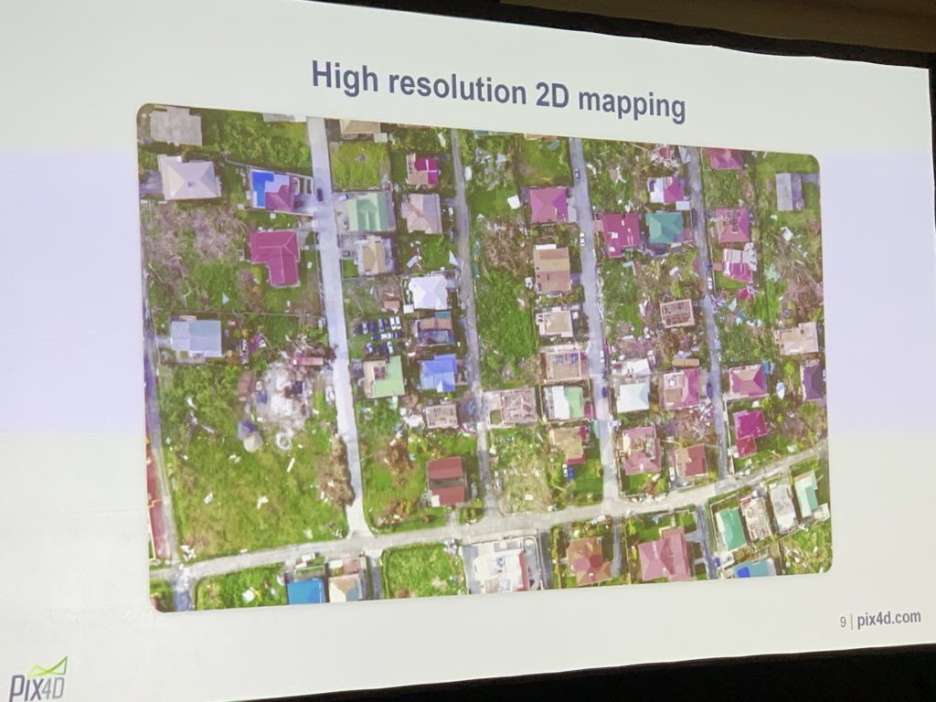
[ブログ] 9月にバハマに上陸したハリケーン「ドリアン」の被害状況の把握と復興計画のために、カナダのNGO、GlobalMedicが #Pix4Dreact を使用しました。インターネット接続が無い状況でもドローン画像からの高速マッピングが可能です。 #災害対応 #dronesforgood 👉ow.ly/N7EM50wTsU2
![pix4d_japan's tweet image. [ブログ] 9月にバハマに上陸したハリケーン「ドリアン」の被害状況の把握と復興計画のために、カナダのNGO、GlobalMedicが #Pix4Dreact を使用しました。インターネット接続が無い状況でもドローン画像からの高速マッピングが可能です。
#災害対応 #dronesforgood
👉ow.ly/N7EM50wTsU2](https://pbs.twimg.com/media/EHrmxldWwAsZL0e.jpg)
A big thank you to everyone who joined our #DronesForGood session on #Pix4Dreact, our new 2D fast-mapping software for emergency response and public safety at the Commercial UAV Show! See you at booth 40! Try Pix4Dreact for free bit.ly/34WJ7fy


Yesterday, we posted how happy we are with @pix4d being a #UTAC2020 sponsor! Pix4D will be hosting the #drone mapping class and showcasing their new software #Pix4Dreact—a rapid-mapping tool proving useful for emergency response operations—to @UTACglobal attendees. #FLYMOTION
Discover #PIX4Dreact, the #emergencyresponse fast mapping software, and the viDoc RTK Rover, the terrestrial scanner, with Aerialsolutions at @Infopol_Xpo112 on May 10 - 12! Meeting point: Booth 3128!
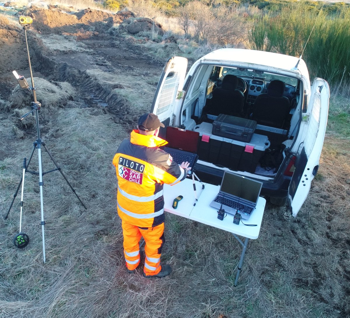

All is ready!! Mañana empieza el European Robotic Forum. #erf2020 Ven a conocer las aplicaciones de nuestros rpas para trabajar en SAR, el software #Pix4Dreact, y los sistemas GNSS RTK #ReachM2 para navegación y guiado de vehículos @eu_Robotics @pix4d @emlid @Fycma @PTAMalaga


🌏 Empowering the youth for positive change with #PIX4Dreact. Morocco Flying Labs and Pix4D educate students to tackle local challenges through mapping skills and #photogrammetry. Teaching future generations to use drones for good: hubs.li/Q02hHfNh0 #DronesForGood


Here we go! Pix4Dreact. High speed, high resolution 2D mapping for first responders by @pix4d #djiairworks #pix4dreact.


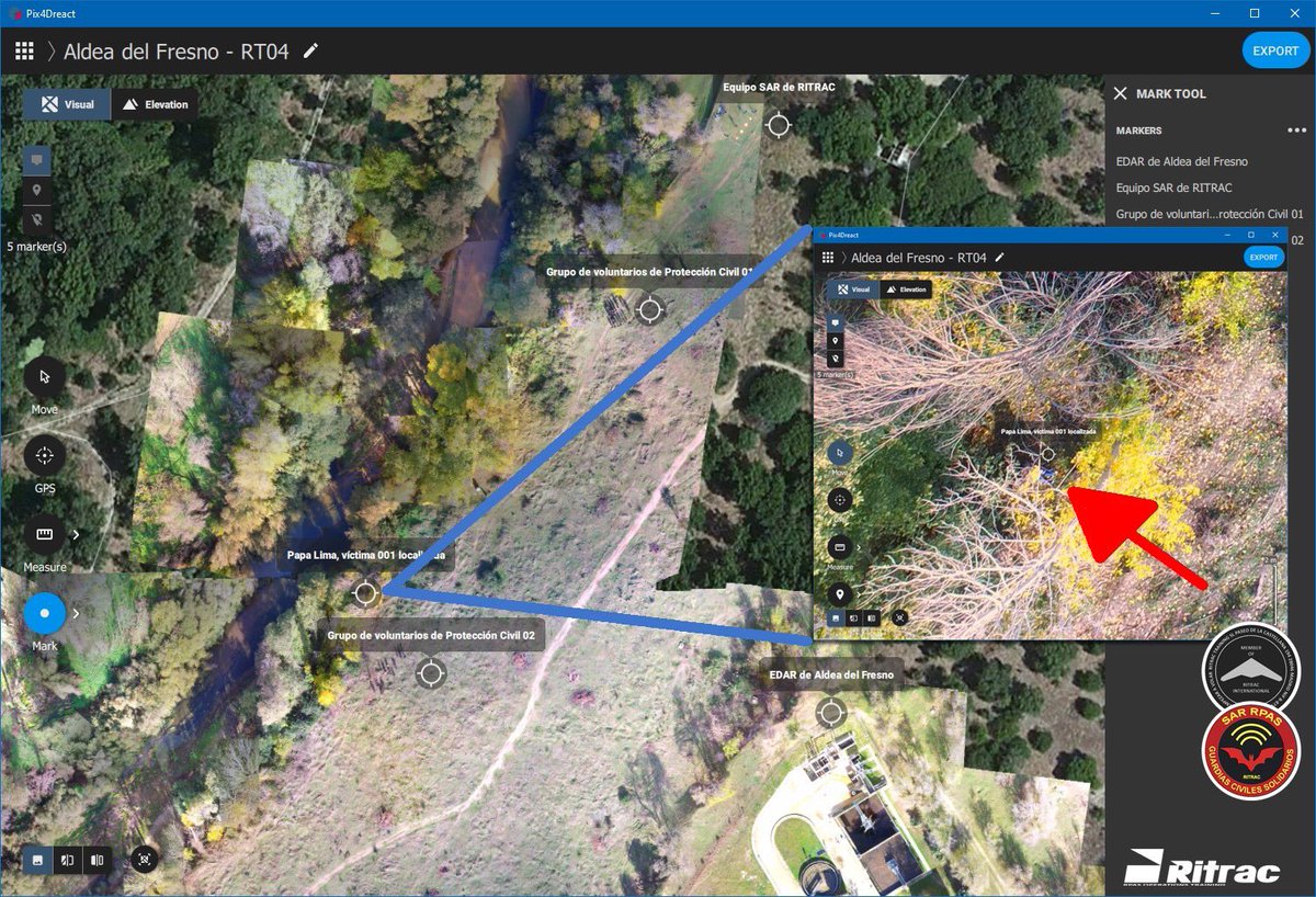
Simulacro de riada de 1979 en Aldea del Fresno del pasado sábado 23 de noviembre de 2019. Procesamos el material obtenido con nuestros #RPAS y procedemos a localizar a las victimas en el lugar de la #emergencia. Ejemplo utilizando software de procesado de imágenes #Pix4DREACT

Fast-mapping fixed-wing #drone meets fast-mapping #photogrammetry software. Learn how #Pix4Dreact and the #eBeeX provide emergency responders with essential mapping data, quickly and reliably. bit.ly/2P96X1k

Our friends at @pix4d have released a new #drone mapping #software solution designed with emergency responders in mind. #Pix4Dreact quickly creates 2D maps to help decide the necessary moves to save lives in disastrous conditions. Learn more here: bit.ly/2BAx0YV
Drones played a vital role in damage assessment after Hurricane Ian. #PIX4Dreact was used to create high-resolution 2D maps, enabling a detailed analysis of the damage. The aerial maps created were used to advise for better preparedness in the future: hubs.li/Q025fY-y0

Students use #PIX4Dreact to learn #photogrammetry, processing drone images to create maps, identifying spaces & buildings for situational awareness. Advantages: ➡️ Immediate area assessment ➡️ Enhanced coordination ➡️ Offline processing Read more here: hubs.li/Q02DpvKv0
Something went wrong.
Something went wrong.
United States Trends
- 1. Caleb 54.4K posts
- 2. Bears 80.2K posts
- 3. Packers 67.3K posts
- 4. Jeff Kent 5,732 posts
- 5. #GoPackGo 11.8K posts
- 6. Notre Dame 170K posts
- 7. Ben Johnson 6,764 posts
- 8. DJ Moore 3,100 posts
- 9. Nixon 14.2K posts
- 10. Raiders 34.9K posts
- 11. #ChiefsKingdom 2,783 posts
- 12. Shedeur 114K posts
- 13. Kmet 1,670 posts
- 14. ESPN 121K posts
- 15. Browns 80K posts
- 16. Mattingly 3,355 posts
- 17. Mattingly 3,355 posts
- 18. McDuffie 1,071 posts
- 19. Bonds 21.8K posts
- 20. Parsons 6,881 posts