#spatialdatascience2025 검색 결과

ISRO has released the scientific data from the X-Ray astronomy mission XPoSat to the scientific community. Initially, around 143 GB of scientific data have been released, and more to follow. The datasets, as well as the supporting tools can be accessed from the portal of the…


Ready to explore how data can drive rural innovation? Don’t miss Groundswell SVP Michael Leeds at the #2025RuralRenaissanceRoadshow! His insights are perfect for anyone interested in the intersection of technology, sustainability & rural development. 🔗 ruralrenaissance.com


Every handful of soil tells a story—and now, thanks to citizen science, people everywhere are helping write the next chapter. Whether you're using your smartphone, sensors, or just your curiosity, you can be part of a global movement monitoring and protecting the very ground we…

Here’s how much the South Atlantic Anomaly has spread from 2014 to 2025, and somehow scientists are baffled and don’t know why this is happening! The weak magnetic field area is spreading because we are undergoing a geomagnetic excursion that accelerated in the 1990s! The SAA…

The pathbreaking #PMGatiShakti National Master Plan has come a long way since its launch four years ago. Today, it has transformed the way India approaches infrastructure planning and development, laying a solid foundation for smarter, faster, and more sustainable growth. At…


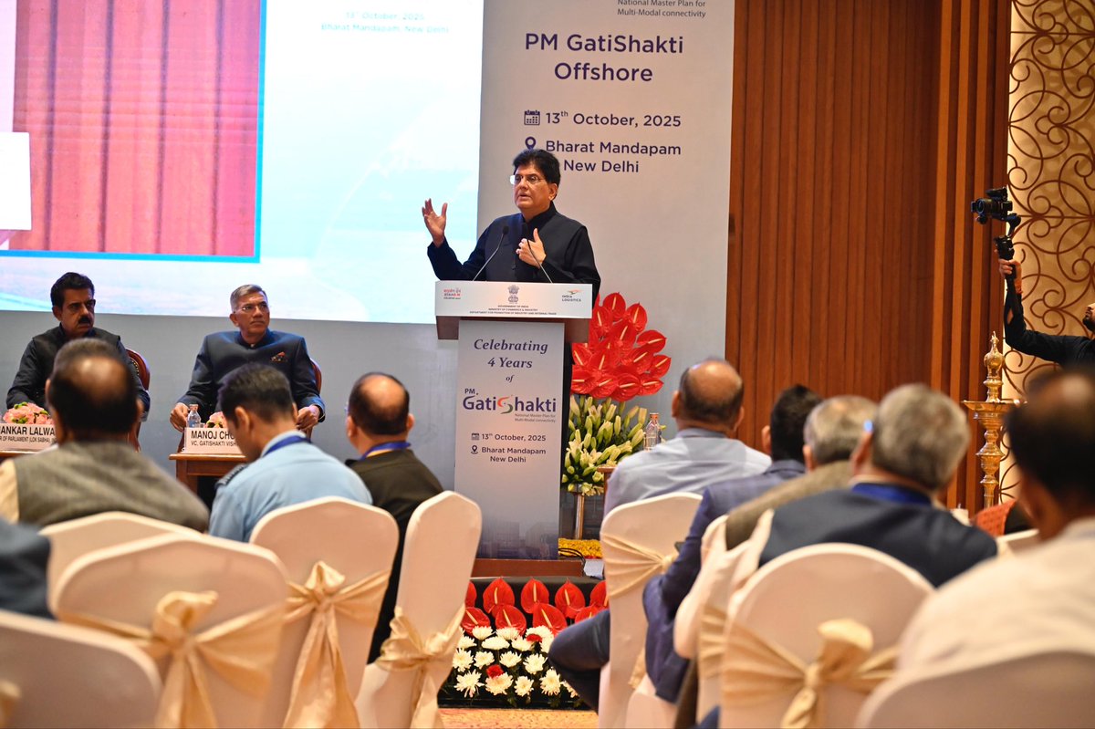

New horizons for India's Blue Economy & Green Energy. Launched today, the #PMGatiShakti - Offshore initiative is a digital platform for integrated planning of offshore development. This unites key data from multiple ministries to drive projects in offshore wind, resource…

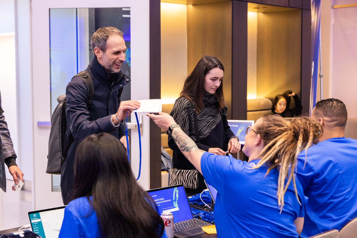
Good morning and welcome to the hands-on workshops at #SDSC25 New York. ☕️ We’re ready for a full day of spatial analysis. Follow us for more updates as the day unfolds!


When every bank has its own blockchain, Space and Time becomes the database that connects them all. The single source of verifiable truth that proves every balance, transaction, and audit trail.


Europe, the space journey is yours. As @ESA turns 50, the EU proudly stands as a key partner, investing nearly €15 billion in our space programmes. From Galileo precision navigation to @CopernicusEU earth observation, and soon IRIS² secure connectivity. Let the sky unite us.


Introducing SpatialVID: A massive new video dataset for 3D spatial intelligence Crucial for training next-gen models, it features over 7,000 hours of diverse, in-the-wild video with dense annotations like camera poses, depth maps, and dynamic masks.


The future of space intelligence is sovereign and AI-first, because intelligence can’t wait. NextGen delivers 30 cm-class clarity, on-orbit analytics, and an AI-first design for real-time #EarthObservation. Explore what’s next: satellogic.com/products/space… #EO #SpaceTech
One Nation, One Mission! Watch how in 4 years, #PMGatiShakti has evolved from a planning tool into a nationwide movement.

Data Science Roadmap amzn.to/4e3kB0Q #python #datascience #machinelearning #deeplearning #ai #artificialintelligence #programming #developer #softwaredeveloper #computerscience #calculus #linearalgebra #algebra #maths #mathematics


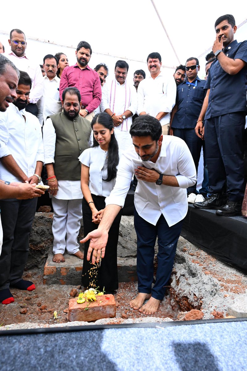
#Visakhapatnam welcomes another marquee global investment as the foundation stone was laid for Sify’s AI Edge Data Center and an Open Cable Landing Station at Rushikonda–Madhurawada IT Park today. This milestone strengthens sea-cable connectivity and AI infrastructure,…


South Atlantic Anomaly, weak spot in Earth’s magnetic field, expanding steadily since 2014 watchers.news/epicenter/sout… Background information: The Coming Geomagnetic Pole Shift sunfellow.com/magnetic-pole-… Ancient Civilizations & Earth Disaster Cycles rumble.com/c/AncientCivil…


"Climate change and weather extremes affect everyone, everywhere. Countries should not retreat from supporting the early warning systems and related technologies that save lives," writes Petteri Taalas in a new #ScienceEditorial. scim.ag/42zw5EZ


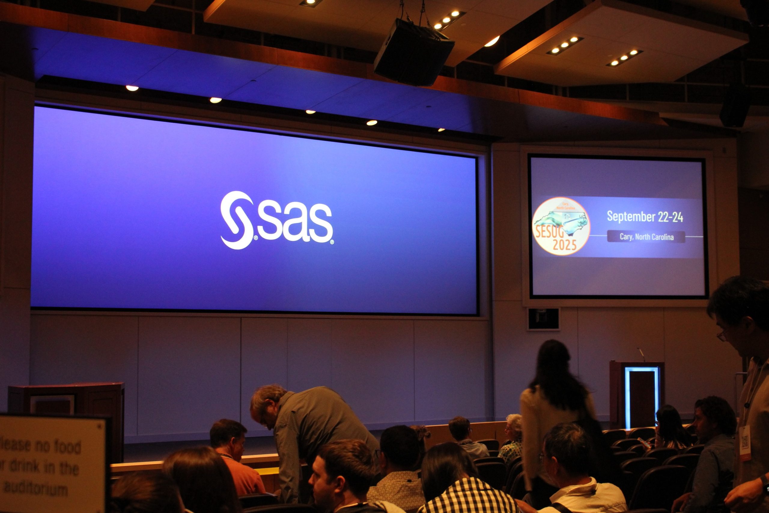
Workflows transformed. Careers inspired. Connections made. Discover why SESUG continues to shape the SAS community in 2025. 2.sas.com/6010AI4Uu

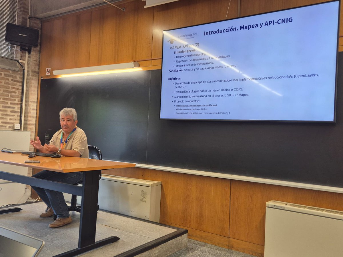
En las Jornadas de #SIG Libre #Geotech & #SpatialDataScience2025 en la @univgirona participaron Aurelio Aragón (CNIG) y Eduardo Castilla (Junta de Andalucía) con la presentación “Ha nacido una estrella: API-IDEE. Convergencia y fusión de API para una Administración más eficiente”

Som a les Jornades de #SIG Lliure #Geotech & #SpatialDataScience2025 a la @univgirona presentant el visor #Menut: una eina web interactiva pque permet accedir i descarregar les imatges processades de la primera missió satel·lària d'observació de la Terra #NewSpace #GEOSTART


Hoy en las Jornadas de #SIG Libre #Geotech & #SpatialDataScience2025 en la @univgirona ha participado Jose Antonio Moreno (Subdirector del Área de Infraestructuras de Información del IECA) con la presentación SIG Corporativo de la Junta de Andalucía (SIGCJA): 18 años de éxito.

Hoy han comenzado las Jornadas de #SIG Libre #Geotech & #SpatialDataScience2025 en la @univgirona 🗣️@IECA_Andalucia participará en estas jornadas con varias presentaciones Más información 👇 jornadassiglibre.org/#intro #siglibre2025 #geodatascience2025


🗺️ ¡Mañana comienzan las Jornadas de SIG Libre⁉️ #Geotech & #SpatialDataScience2025! En la Universitat de Girona del 17 al 18 de sept 🔗 Más ℹ️: jornadassiglibre.org

🗺️ ¡Últimos días para inscribirse en las Jornadas de SIG Libre⁉️ #Geotech & #SpatialDataScience2025! ¡¡Inscríbete antes del 5 de septiembre!! En la Universitat de Girona del 17 al 18 de sept 🔗 Más ℹ️: jornadassiglibre.org

🌍Del 17 al 18 septiembre @IECA_Andalucia participará en las Jornadas de #SIG Libre #Geotech & #SpatialDataScience2025 en la @univgirona con varias presentaciones 📝Inscripciones hasta 10 septiembre Más información👇 jornadassiglibre.org #siglibre2025 #geodatascience2025

🗺️ Jornadas de #SIG Libre #Geotech & #SpatialDataScience2025! Las jornadas serán en la @univgirona del 17 al 18 sept 🗣️@IECA_Andalucia participará en estas jornadas con varias presentaciones Más información 👇 #siglibre2025 #geodatascience2025
🗺️ ¡Quieres participar en las Jornadas de SIG Libre⁉️ #Geotech & #SpatialDataScience2025! ¡¡Inscríbete antes del 5 de septiembre!! Las jornadas serán en la Universitat de Girona del 17 al 18 de sept 🔗 Más ℹ️: jornadassiglibre.org

🗺️ ¡Quieres participar en las Jornadas de SIG Libre⁉️ #Geotech & #SpatialDataScience2025! ¡¡Inscríbete antes del 5 de septiembre!! Las jornadas serán en la Universitat de Girona del 17 al 18 de sept 🔗 Más ℹ️: jornadassiglibre.org
🗺️ ¡Quieres participar en las Jornadas de SIG Libre⁉️ #Geotech & #SpatialDataScience2025! 📢 Hasta el 28 de marzo puedes enviar tu comunicación, lightning talk o workshop! Las jornadas serán en la Universitat de Girona del 17 al 18 de sept 🔗 Más ℹ️: jornadassiglibre.org

Something went wrong.
Something went wrong.
United States Trends
- 1. D’Angelo 265K posts
- 2. Brown Sugar 19.7K posts
- 3. Pentagon 106K posts
- 4. Young Republicans 10.9K posts
- 5. #PortfolioDay 14.4K posts
- 6. Drew Struzan 25.5K posts
- 7. Politico 155K posts
- 8. Black Messiah 10.1K posts
- 9. Big 12 N/A
- 10. Scream 5 N/A
- 11. Voodoo 20.3K posts
- 12. Jeff Albert N/A
- 13. Soybeans 4,295 posts
- 14. Venables 3,355 posts
- 15. Baldwin 20K posts
- 16. Merino 11.2K posts
- 17. VPNs 1,348 posts
- 18. Happy Birthday Charlie 141K posts
- 19. How Does It Feel 8,814 posts
- 20. Powell 43K posts