#summitfire search results


#SummitFire in Agua Dulce fire is 5 acres with 7 copters, Air Attack, Lead Plane, and 2 LAT's assigned. Currently helitack crews are being inserted.

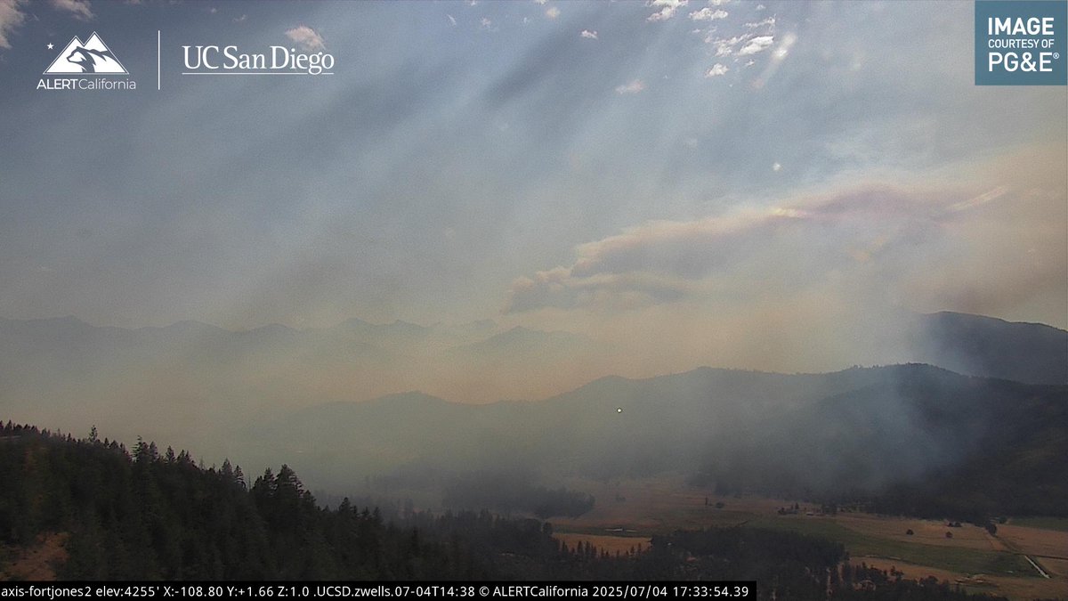
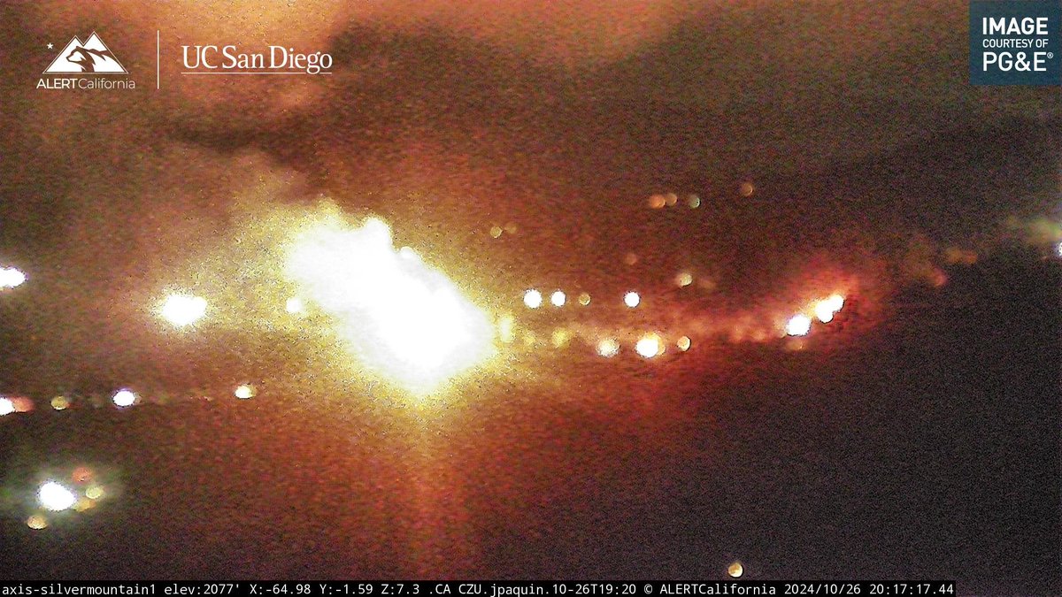
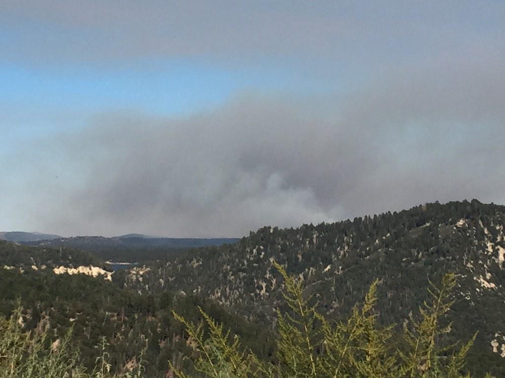
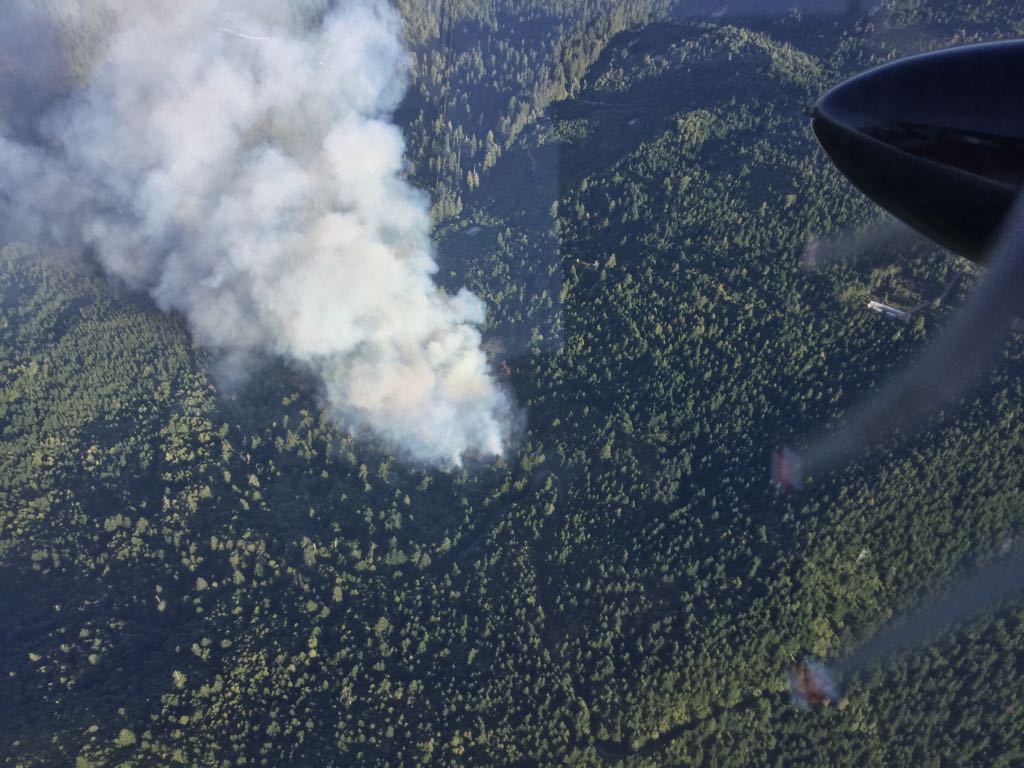
#SummitFire the fire is now 250+ acres, and is currently Pyrocu. The lightning Fires are waking up. #NoNameFire is now 3.6 acres.
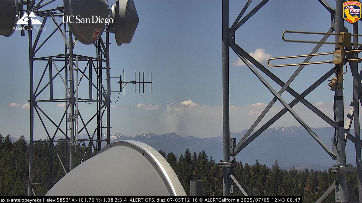


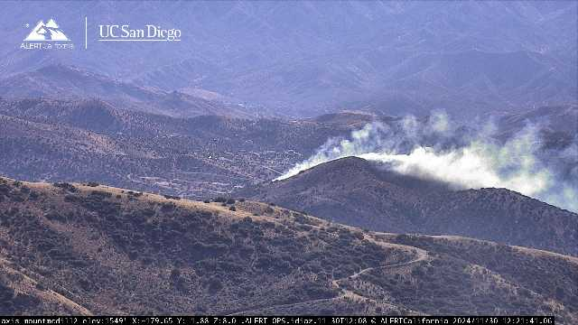
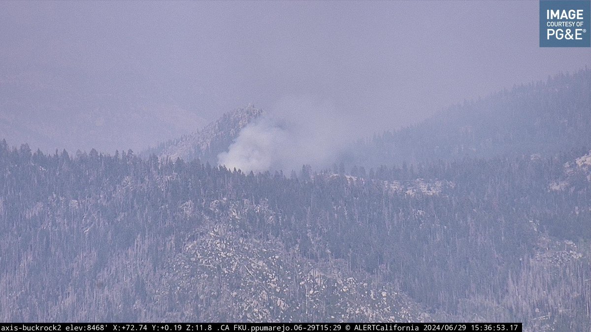
The lightning caused #SummitFire in the Klamath NF appears to have a very small PyroCu. The fire was last mapped at 243 acres with spot fires across the PCT.


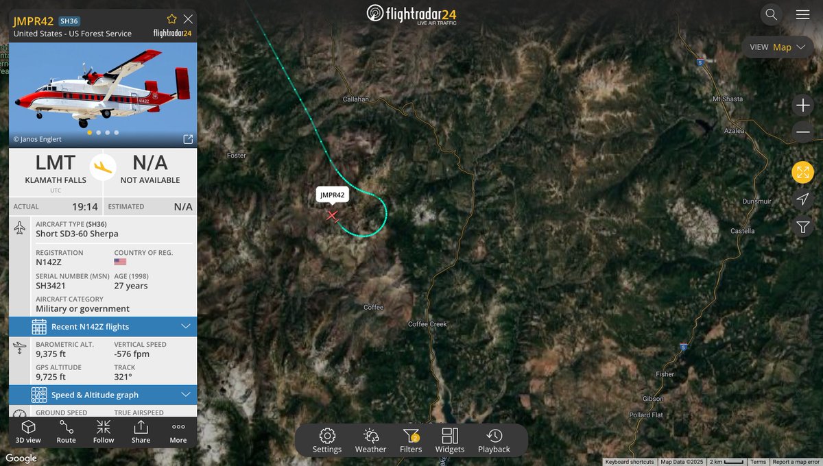
Jumper 42 is overhead the #SummitFire, which is 3 acres burning deep within the Marble Mountain Wilderness. flight tracking via @flightradar24
#SummitFire In @Klamath_NF seeing a large increase in activity, make no mistake about it that's a smoke column not a cloud.

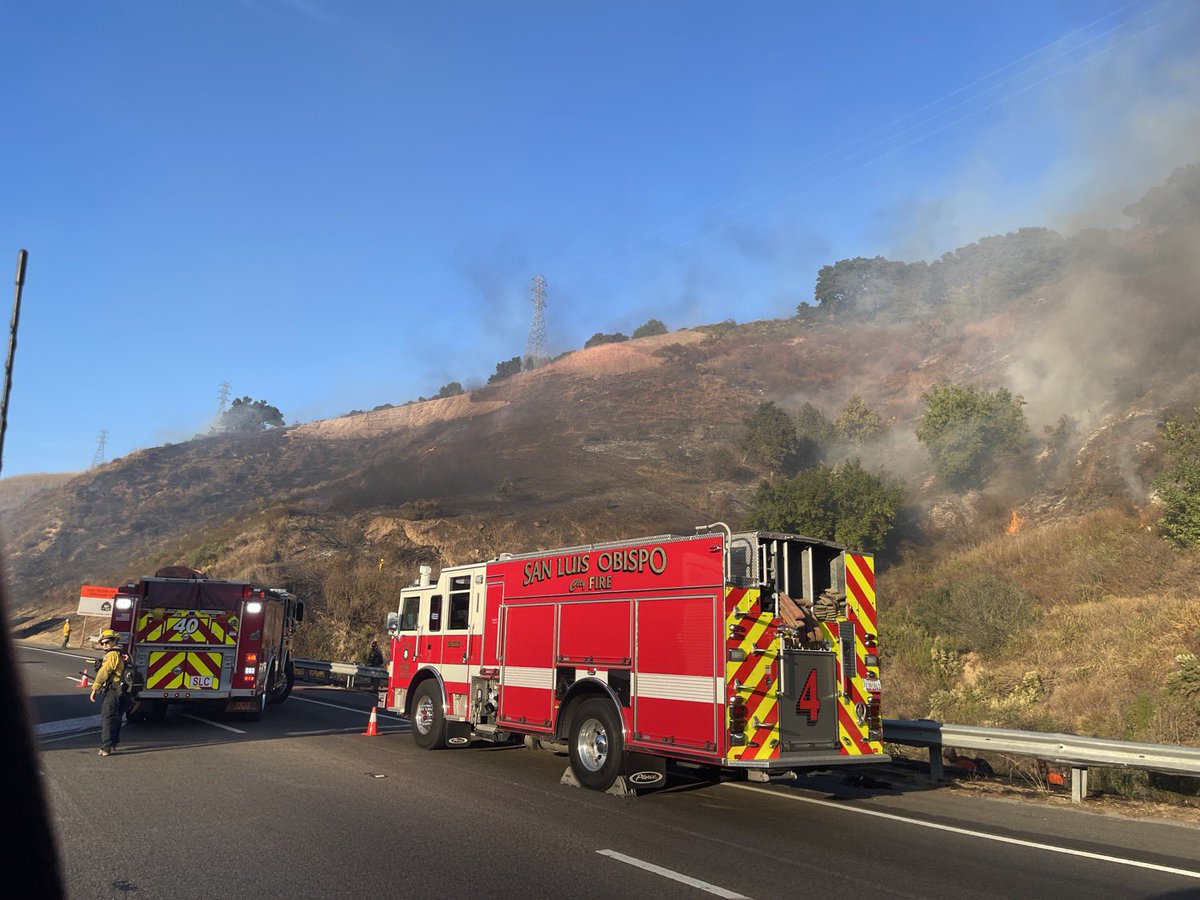
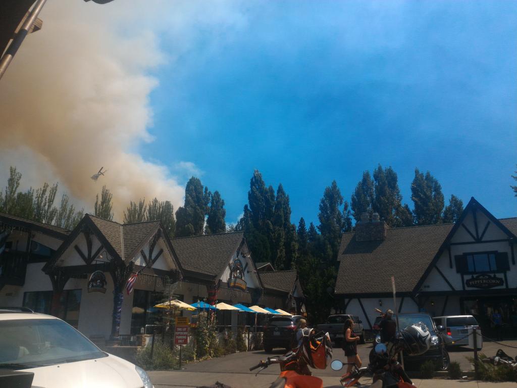
We are now tracking the #SummitFire near Los Gatos and off Highway 17 in Santa Cruz County. The fire is currently 1 acre with progress being made. Evacuations underway along Alta Vista.
Per IC- The #SummitFire is now 7 acres with the potential for 20 acres in the next hour. The incident command has also requested an investigator for a code D. All dozer team responses are being continued.
We are now tracking the #SummitFire off North Escondido Canyon Road in Acton. This is a 1st alarm dispatch, with the first engines arriving on the scene momentarily.

We are now tracking a new start in @SBCOUNTYFIRE, vehicle fire with extension to brush; this will be the #SummitFire, a full first alarm is en route.
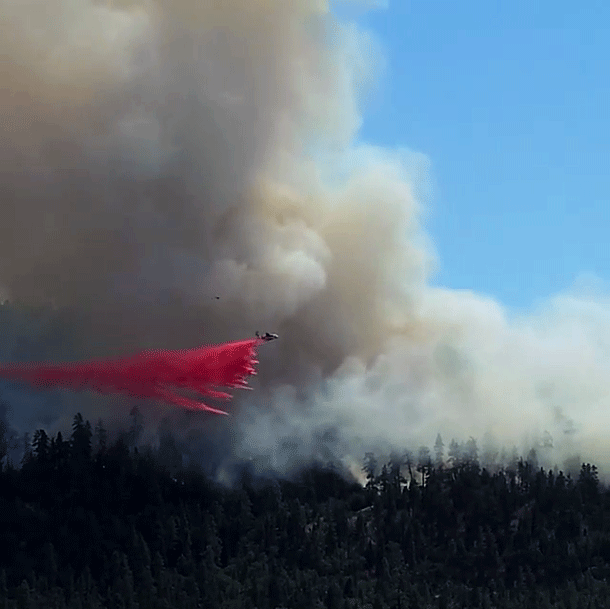
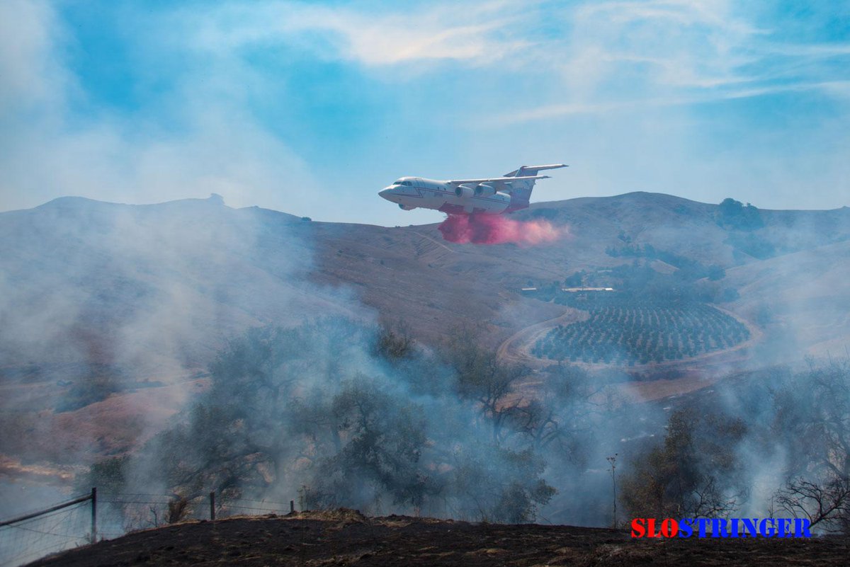
#SummitFire With no acreage yet. Definitely has to be decent size. Helicopters and tankers working the fire. Air Attack 6 is overhead ops.alertcalifornia.org/cam-console/18…
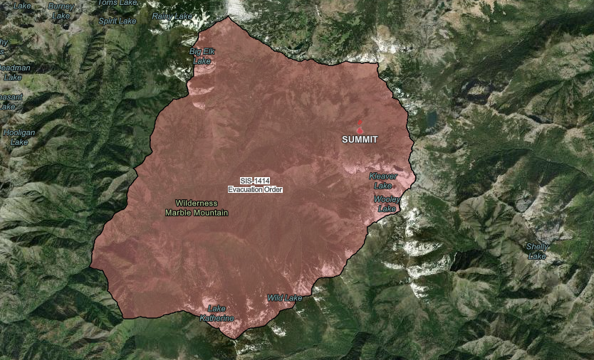
#SummitFire Was worried about this one, According to radio traffic activity is picking. High winds in the area so the fire is spotting, limited access and lots of dead fuel. Evacuations have been ordered for SIS-1414.

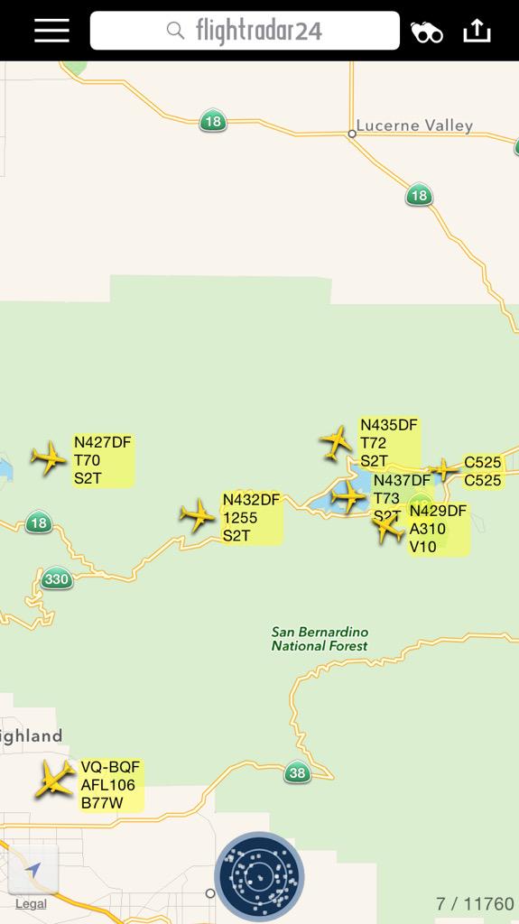
Summit Fire @ Summit Valley Rd & Hesperia Dump Rd, Hesperia - #SummitFire share.watchduty.org/i/22065
#SummitFire making good progress, now 7 acres. Investigators have been requested to the incident. Tanker 107 just made his drop.
#SummitFire in Agua Dulce fire is 5 acres with 7 copters, Air Attack, Lead Plane, and 2 LAT's assigned. Currently helitack crews are being inserted.
#SummitFire Evacuation Orders have been extended to the East.
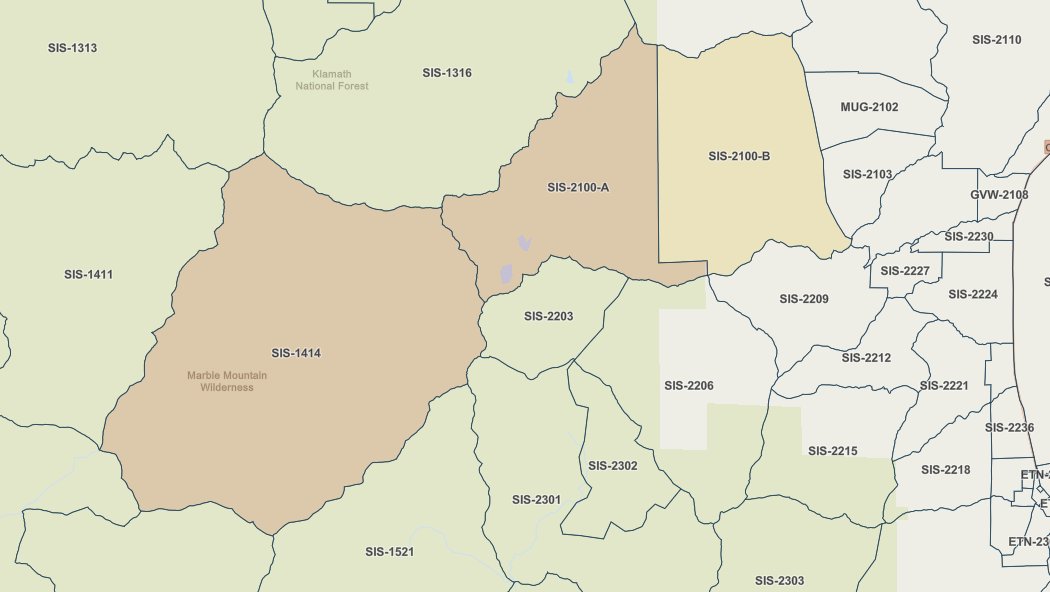
#SummitFire Was worried about this one, According to radio traffic activity is picking. High winds in the area so the fire is spotting, limited access and lots of dead fuel. Evacuations have been ordered for SIS-1414.

InfernoWatch will now be tracking the #SummitFire in Siskiyo Co. Coverage will start with the usual "NEW START" indicating that coverage for a new fire has started.

CALFIRE_SLO: Vegetation Fire: Units are responding to a vegetation fire at the summit of Highway 46 W. A welding truck was reported on fire. #SummitFire

Vegetation Fire: Units are responding to a vegetation fire at the summit of Highway 46 W. A welding truck was reported on fire. #SummitFire

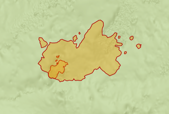
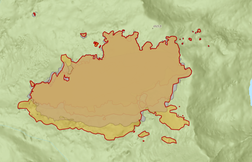
The perimeter of the Marble Complex is 100 percent contained. The Jacket and Summit Fires were started by lightning at the end of June/early July. #CAfire #JacketFire #SummitFire #MarbleComplex #KlamathCo #KlamathNF #MarbleMountains actionnewsnow.com/news/marble-co…
actionnewsnow.com
Marble Complex: 747 acres burned, full containment of perimeter achieved
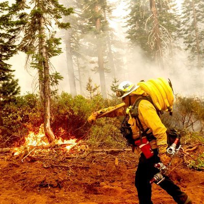
Hundreds of firefighters tackled challenging conditions, battling through rugged terrain and extreme weather
Shasta County: #GreenFire 19,022 acres 79% contained Siskiyou County: #ButteFire 1 acre 0% contained #SummitFire 700 acres 90% contained #ButlerFire 21,070 acres 38% contained Trinity County: #OakFire 2.7 acres 0% contained Tuolumne County: #BoneyardFire 227 acres 55% contained
Siskiyou County: #SummitFire 700 acres 90% contained #ButlerFire 18,855 acres 10% contained
UPDATE (#SummitFire): ALL EVACUATIONS HAVE BEEN LIFTED. Acreage is 701 with 70% containment. This will be the last update unless conditions change.
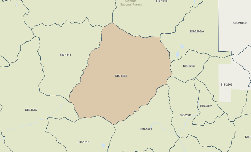
UPDATE (#SummitFire): containment is now at 65%. Evacuation areas [MANDATORY] SIS-1414, SIS-2100-A are still in effect.

Progress Continues on Marble Complex as Summit Fire Reaches 65% Containment kymkemp.com/2025/07/16/pro… #MarbleComplex #SummitFire #JacketFire #KlamathNF #WildfireUpdate #SiskiyouCounty #FireContainment #Evacuations #ForestClosures
kymkemp.com
Progress Continues on Marble Complex as Summit Fire Reaches 65% Containment
With no new growth and increasing containment, crews are scaling back on the Marble Complex fires, as evacuation warnings are lifted and suppression repair begins near the Summit Fire.
UPDATE (#SummitFire): NO change. Evac zone K61 is still under mandatory evacuation orders.
UPDATE (#SummitFire): NO change to containment and acreage. the voluntary evacuation warning for SIS-2100-B has been lifted but Mandatory evacuations remain for SIS-2100-A and SIS-1414.
UPDATE (#SummitFire): the fire is at 700 acres with 58% containment.
UPDATE (#SummitFire): the fire is at 706 acres with 35% containment.

Firefighters are making strong progress on the #Marble Complex fires in #SiskiyouCounty, with the #SummitFire now fully surrounded by control lines and the #JacketFire in patrol status. krcrtv.com/weather/wildfi…
krcrtv.com
Progress made on Marble Complex; crews box in Summit Fire
Firefighters are steadily advancing on the Marble Complex fires, with the Summit Fire remaining the main focus due to daily growth.The U.S. Forest Service (USF
UPDATE (#SummitFire): the fire is at 705 acres with 35% containment.
UPDATE on the Marble Complex in Siskiyou County. #MarbleComplex #SummitFire #JacketFire #CAfire #SiskiyouCo #KlamathNF actionnewsnow.com/news/klamath-n…
actionnewsnow.com
Marble Complex: 747 acres burned, full containment of perimeter achieved
Hundreds of firefighters tackled challenging conditions, battling through rugged terrain and extreme weather
Our 7/13 intel summary for the #GreenFire, #ButlerFire, and #SummitFire is live on YouTube. We also talk about the Forest Service's use/misuse of language around the term 'Full Suppression', and their unwillingness to message AT ALL about 'Resource Benefits' from fires.

youtube.com
YouTube
Northern California Fire Report - 7/13/2025
UPDATE (#SummitFire): the fire is at 663.6 acres with 28% containment. Evacuations remain the same.
Tonight's Lookout Livestream will catch you up on today's major growth on the #GreenFire, NE of Redding, the steep and wild #ButlerFire, near Somes Bar, and the not-much growth on the #SummitFire, near Etna. the-lookout.org/2025/07/11/gre…

Smoke from Butler and Summit Fires Impacts Regional Air Quality; Health Precautions Advised kymkemp.com/2025/07/11/smo… #AirQuality #ButlerFire #SummitFire #OrleansComplex #MarbleComplex #SmokeAdvisory #HumboldtCounty #WildfireSmoke
kymkemp.com
Smoke from Butler and Summit Fires Impacts Regional Air Quality; Health Precautions Advised
Smoke from active wildfires in Siskiyou County is affecting air quality across Humboldt, Del Norte, and Trinity counties, with conditions ranging from Good to Unhealthy for Sensitive Groups depending…


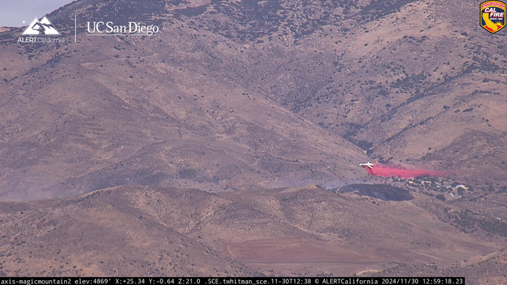
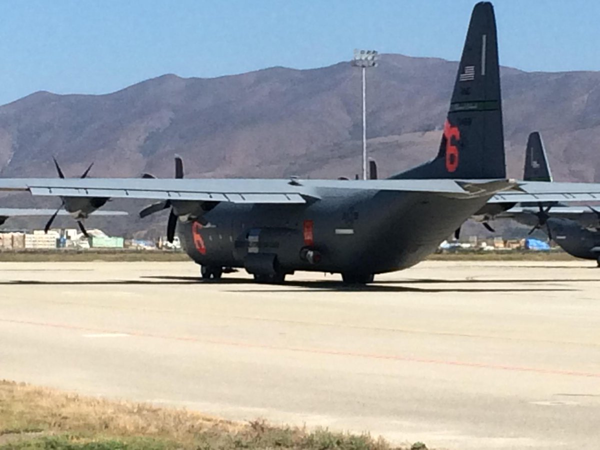
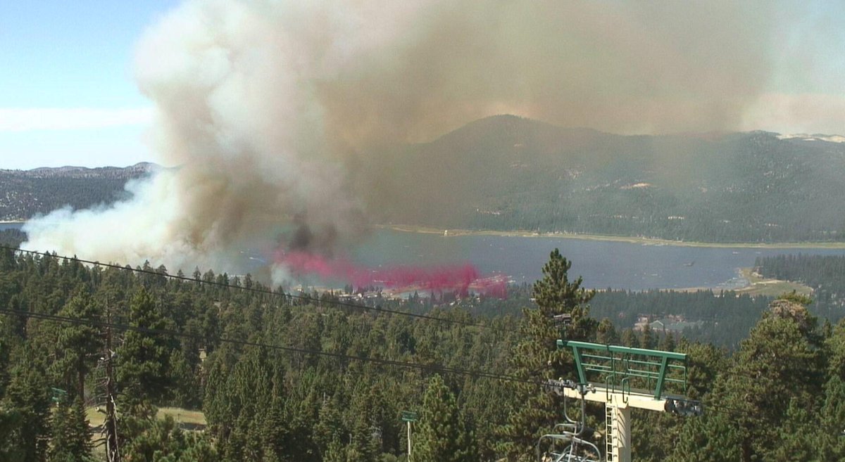
#MAFFS C130s #146AW @AirGuardCAHQ launching to #SummitFire near BigBear in support @forestservice #KeepingCASafe


#SummitFire the fire is now 250+ acres, and is currently Pyrocu. The lightning Fires are waking up. #NoNameFire is now 3.6 acres.


#SummitFire In @Klamath_NF seeing a large increase in activity, make no mistake about it that's a smoke column not a cloud.


![CAL_FIRE's tweet image. #SummitFire [final] west of Willow Creek (Humboldt County) is 100% contained at 21 acres.](https://pbs.twimg.com/media/CqOdD8iVMAApVgl.jpg)
We are now tracking the #SummitFire near Los Gatos and off Highway 17 in Santa Cruz County. The fire is currently 1 acre with progress being made. Evacuations underway along Alta Vista.
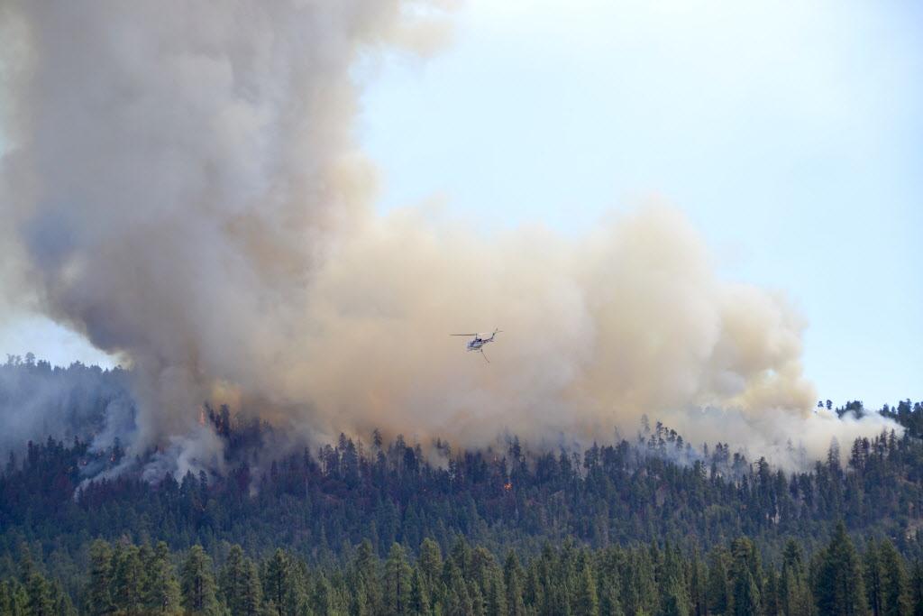
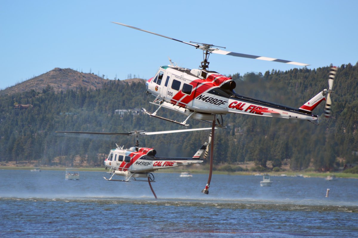
#CALFIRE #SummitFire CALFIRE Copters 301 & 305 GettingWater2DropOnRecentBigBearFire.Kudos CF DeputyChief Steve Shaw.
#SummitFire [update] 8 miles west of Willow Creek (Humboldt County) is now 21 acres and 30% contained.
![CAL_FIRE's tweet image. #SummitFire [update] 8 miles west of Willow Creek (Humboldt County) is now 21 acres and 30% contained.](https://pbs.twimg.com/media/Cp1RRmHUEAAmhZl.jpg)
RT @DeborahForeman So grateful for the men & women firefighters helping #bearvalley #bigbearlake #summitfire #bigbear

Something went wrong.
Something went wrong.
United States Trends
- 1. DJ Moore N/A
- 2. Bears N/A
- 3. Josh Allen N/A
- 4. Beane N/A
- 5. Poles N/A
- 6. Jayson Tatum N/A
- 7. Luther Burden N/A
- 8. Britney N/A
- 9. Crosby N/A
- 10. AJ Brown N/A
- 11. #INDvENG N/A
- 12. Loveland N/A
- 13. Luther N/A
- 14. Chabad N/A
- 15. Joe Brady N/A
- 16. Parayko N/A
- 17. Keon Coleman N/A
- 18. #T20WC2026 N/A
- 19. Nic Roy N/A
- 20. Kimiko N/A