#toolsesh ผลการค้นหา

4/4 #WSTC6 #ToolSesh Comparing poop 💩 data to visual observations, we found similar proportions of the main prey. ➡️Faecal #metabarcoding would be a reliable method to track changes in diets over time. ➕We can identify more species and monitor adult diets for the 1st time.

3/4 #WSTC6 #ToolSesh We identified 23 🐟 species in the diets of Common Terns, with an average of 2.5 species per 💩. Adult and chick diets were largely similar. We also collected Roseate Tern 💩. They showed a preference for sand lance (sand eels) at this colony. #TeamTern

1/4 #WSTC6 #ToolSesh Our marine ecosystems are changing rapidly. Monitoring seabird diets can tell us about these changes but collecting seabird diet data can be tricky. Collecting faecal samples 💩 during routine monitoring can help. #poopscience #metabarcoding
3 #WSTC5 #ToolSesh I created a tabletop game with painted toy ducks to represent a matrix population model: transition values from top row (year 1) to left-most column (year 2) determined by dice e.g. roll 4 or more = 1 duckling per adult; roll 4 or 5 = 75% survival for adults


1/4 #WSTC6 #ToolSesh CIAs exclude rapid #ClimateChange impacts thus lack spatial-temporal appropriate baselines linking ecosystem components to #Seabirds population dynamics #cumulative #impact #assessment #offshorewind @BEScott_abdn @TrifonovaNeda @JNCC_UK @beisgovuk @UoABioSci


4/4 #WSTC5 #ToolSesh Ongoing validation & testing analysis will look at how environmental variables influence data quality by contributing to ‘clutter’ & frequency of erroneous data points in relation to operating environment. Thank you! @ERI_UHI

3/4 #WSTC6 #ToolSesh A spatial-temporal nested #BayesianNetwork linking habitat variations to trophic trade-offs will identify pressure pathways keystone components and ecosystem resilience #cumulative #impact #assessment #OffshoreWind #seabird @JNCC_UK @beisgovuk #MarineScotland

4/4 #WSTC6 #ToolSesh Creating more #Strategic #Environmental #Assessment guidelines linked to #MSFD to inform meaningful planning based on a robust bottom-up/top-down monitoring #cumulative #impact #assessment #offshorewind @JNCC_UK @beisgovuk #MarineScotland #TheCrownEstate

2/4 #WSTC6 #ToolSesh A holistic-pragmatic bottom-up/top-down ecosystem-based approach linking #ClimateChange oceanic drivers to MRED to temporall-spatially assess the #cumulative #impact #assessment #OffshoreWind @JNCC_UK @beisgovuk @MccipOrgUK #MarineScotland #TheCrownEstate

2/4 #WSTC5 #ToolSesh Accurate height data can be key to useful bird flight data. LRF integrates a laser-rangefinder & inclinometer to measure height. Using a structure of known height (a) & UAV at diff heights (b), the accuracy & precision of LRF measurements were tested @ERI_UHI


3/4 This work aims to address the current limitations of VPS techniques (e.g. investigating factors known to influence observer detection). The real-world relevance of such questions increases as our use of these habitats increases #WSTC6 #ToolSesh #marinerenewables #aquaculture

2/4 A widely used technique for assessing seabird abundance and distribution within nearshore areas is vantage point surveys (VPS) from the shore. However, the ability of VPS to gather data can be compromised by several limitations. #WSTC6 #ToolSesh #ornithology #seabirds


3/4 #WSTC5 #ToolSesh 34% of chicks ready to fledge (colonies and rescued), showed a low #WettabilityIndex. For the birds tracked in 2018, only those with an index indicating a #WaterproofPlumage successfully dispersed, others stopped transmitting soon after landing on water.

3/4 #WSTC5 #ToolSesh Target movement characteristics may also influence LRF data quality. Using a UAV as a test target, tortuosity & speed were investigated. Correlation analysis shows that UAV/GPS & LRF tracks less correlated when highly tortuous but no effect of speed @ERI_UHI


2/4 #WSTC8 #ToolSesh Goal: develop scalable colony (aerial) survey protocol. Objectives: estimating colony prevalence & tern abundance. Study design included Phase 1-with 2 Strata (coastal, 1 km inland; 1km x 1km grid) & Phase 2 ground counts at colonies located during Phase 1.

1/4 #WSTC5 #ToolSesh Tech to collect data from birds in flight is often adapted, rather than developed, for, this use. Validation & performance testing before deployment can help inform the usefulness & limitations of such tools. One such tool is the ornithodolite (LRF) @ERI_UHI

3/4 #WSTC8 #ToolSesh We surveyed 2,293 of 3,786 cells (61%) in Stratum 1 and covered almost 2700km of coastline; estimated density of 23 Aleutian Terns per 100km; 10 of 49 colonies had Aleutian Terns; estimated 1,485 ALTEs. Statewide estimate was ~5,000 ALTEs (Renner et al. 2015)

1/4 #Seabirds are increasingly subject to anthropogenic activity arising from human developments, particularly in nearshore areas. Therefore, regulators need to quantify seabird use of these habitats to understand the potential for interactions with developments. #WSTC6 #ToolSesh


#WSTC8 #DigSesh #ToolSesh Big applause and many thanks to all the presenters for a super interesting combined session on Digital Imaging and Tools and Techniques in #seabird #research @AlexCoCastro @nattenstein @sweet_starling @CostagliolaRay @seabirdK
#WSTC8 #Toolsesh Again, further reading available for those interested! jstor.org/stable/1623?se… link.springer.com/article/10.100…
4/4 #WSTC8 #ToolSesh #Yearofterns Finalizing 2021 analysis &report; In 2022 address issues of colony accessibility (need helicopter) and estimate of detection probability before we scale up to a statewide effort in 2023. Please share any info you may have on tern colony locations

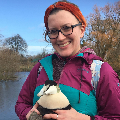
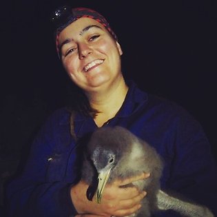
#WSTC8 #Toolsesh Apparently! I wasn't expecting it when we set out, we were looking for pellets mostly (on the ground), but saw so much more poop we decided to scoop it up and try to sift through it for identifiable bits. Worth it!😄
3/4 #WSTC8 #ToolSesh We surveyed 2,293 of 3,786 cells (61%) in Stratum 1 and covered almost 2700km of coastline; estimated density of 23 Aleutian Terns per 100km; 10 of 49 colonies had Aleutian Terns; estimated 1,485 ALTEs. Statewide estimate was ~5,000 ALTEs (Renner et al. 2015)
2/4 #WSTC8 #ToolSesh Goal: develop scalable colony (aerial) survey protocol. Objectives: estimating colony prevalence & tern abundance. Study design included Phase 1-with 2 Strata (coastal, 1 km inland; 1km x 1km grid) & Phase 2 ground counts at colonies located during Phase 1.
1/4 #WSTC8 #ToolSesh #Yearofterns The Aleutian Tern (ALTE) is one of Alaska's most imperiled seabirds owing to population declines of >80% at known colonies in recent decades. In 2021, we tested a colony survey and monitoring framework in southwest Alaska.

4/4 #WSTC8 #ToolSesh We also aim to uncover particular scanning protocols observers can adopt to ensure that counts of #seabirds are as accurate as possible. For example, changing the speed at which observers scan and the direction of scans (i.e. with or against the current).

Thank you so much @CostagliolaRay Are there any questions for Melissa? #WSTC8 #DigSesh #ToolSesh
3/4 #WSTC8 #ToolSesh This work will use individual-based modelling (IBM) to assess the influence of different dive times of #seabirds and different current speeds (high, medium, & low) on the accuracy of seabird counts made by observers undertaking traditional VP surveys.
#WSTC8 #ToolSesh Studies on subject of offshore renewables as "artificial reefs" for edible crab and saithe: sciencedirect.com/science/articl… onlinelibrary.wiley.com/doi/10.1002/we…
2/4 #WSTC8 #ToolSesh These biases are exaggerated within high energy environments due to the dynamic nature of these areas. This is of particular relevance to tidal stream and wave energy generation. #ornithology #marinerenewables
1/4 #WSTC8 #ToolSesh Land-based vantage point (VP) surveys are a widely used method of collecting #seabird abundance and distribution data for environmental impact assessments. However, VP surveys are prone to biases due to detectability issues.

#WSTC8 #DigSesh The next presenter in #ToolSesh is Melissa Costagliola-Ray @CostagliolaRay From @ERI_UHI @BrydenCentre_EU Using individual-based modelling to investigate the potential biases of land-based vantage point surveys for assessing seabird abundance #Monitoring
Thank you very much Emma @sweet_starling for this great presentation! There is still time for questions Remember to add #WSTC8 #DigSesh #ToolSesh
#WSTC8 #ToolSesh no worries, good question!🦀such as velvet & edible (main prey found) are found at bottom of seafloor, which is also where most commercial tidal turbine structures are...incidentally saithe also known to aggregate at offshore structures so attraction relevant!
#WSTC8 #Toolsesh Nope! I've heard metabarcoding could have been an option (do you know more?) but we opted for cost & logistic effectiveness in this one😅
#WSTC8 #ToolSesh Next on #DigSesh we have Emma Caulfield @sweet_starling from University College Cork presenting “Semi-automated counts on drone imagery of breeding seabirds using free accessible software” #DigitalImaging #Conservation

3/4 #WSTC6 #ToolSesh We identified 23 🐟 species in the diets of Common Terns, with an average of 2.5 species per 💩. Adult and chick diets were largely similar. We also collected Roseate Tern 💩. They showed a preference for sand lance (sand eels) at this colony. #TeamTern
4/4 #WSTC6 #ToolSesh Comparing poop 💩 data to visual observations, we found similar proportions of the main prey. ➡️Faecal #metabarcoding would be a reliable method to track changes in diets over time. ➕We can identify more species and monitor adult diets for the 1st time.

2/4 #WSTC5 #ToolSesh Time-lapse photography is most applicable to study animals frequently present at a location or to study frequently repeated behaviors, SO it is particularly relevant to study colonial animals such as seabirds and seals, breeding in large groups.

1/4 #WSTC6 #ToolSesh CIAs exclude rapid #ClimateChange impacts thus lack spatial-temporal appropriate baselines linking ecosystem components to #Seabirds population dynamics #cumulative #impact #assessment #offshorewind @BEScott_abdn @TrifonovaNeda @JNCC_UK @beisgovuk @UoABioSci

I hope you're enjoying the #WSTC5 so far. Next up, we've got our 'Tools and Techniques' session, with 6 amazing presenters. Don't forget to include the conference and session (#ToolSesh) hashtags when asking questions & presenting. Here we go! 🐧🐧🐧 #Seabirds #Ornithology

3/4 #WSTC5 #ToolSesh 34% of chicks ready to fledge (colonies and rescued), showed a low #WettabilityIndex. For the birds tracked in 2018, only those with an index indicating a #WaterproofPlumage successfully dispersed, others stopped transmitting soon after landing on water.
4/4 #WSTC6 #ToolSesh Creating more #Strategic #Environmental #Assessment guidelines linked to #MSFD to inform meaningful planning based on a robust bottom-up/top-down monitoring #cumulative #impact #assessment #offshorewind @JNCC_UK @beisgovuk #MarineScotland #TheCrownEstate
2/4 #WSTC6 #ToolSesh A holistic-pragmatic bottom-up/top-down ecosystem-based approach linking #ClimateChange oceanic drivers to MRED to temporall-spatially assess the #cumulative #impact #assessment #OffshoreWind @JNCC_UK @beisgovuk @MccipOrgUK #MarineScotland #TheCrownEstate

Today at 3:45pm EDT. Our own Anne-Marie Runfola presents @ World Seabird Twitter Conference - "Seabird Sighting! How to Create a Citizen Science Program with Far-reaching Results." #WSTC6 #ToolSesh #CitizenScience

Get ready for the next session in #WSTC8 Digital Imaging and Tools and Techniques Sessions #DigSesh #ToolSesh From 15:30 to 16:20 UTC I’m all set here, at lunchtime in Argentina!

3/4 #WSTC6 #ToolSesh A spatial-temporal nested #BayesianNetwork linking habitat variations to trophic trade-offs will identify pressure pathways keystone components and ecosystem resilience #cumulative #impact #assessment #OffshoreWind #seabird @JNCC_UK @beisgovuk #MarineScotland
4/4 #WSTC5 #ToolSesh Ongoing validation & testing analysis will look at how environmental variables influence data quality by contributing to ‘clutter’ & frequency of erroneous data points in relation to operating environment. Thank you! @ERI_UHI
3/4 This work aims to address the current limitations of VPS techniques (e.g. investigating factors known to influence observer detection). The real-world relevance of such questions increases as our use of these habitats increases #WSTC6 #ToolSesh #marinerenewables #aquaculture
2/4 A widely used technique for assessing seabird abundance and distribution within nearshore areas is vantage point surveys (VPS) from the shore. However, the ability of VPS to gather data can be compromised by several limitations. #WSTC6 #ToolSesh #ornithology #seabirds


2/4 #WSTC5 #ToolSesh Accurate height data can be key to useful bird flight data. LRF integrates a laser-rangefinder & inclinometer to measure height. Using a structure of known height (a) & UAV at diff heights (b), the accuracy & precision of LRF measurements were tested @ERI_UHI
The third presenter for our #ToolSesh #WSTC5 is @nmlargey. Nicola is a PhD candidate studying bird flight characteristics & habitat use to understand how wind farms impact birds at @ThinkUHI. If you don't know what an ornithodolite is, come find out! #Seabirds #ornithology

3/4 #WSTC5 #ToolSesh Target movement characteristics may also influence LRF data quality. Using a UAV as a test target, tortuosity & speed were investigated. Correlation analysis shows that UAV/GPS & LRF tracks less correlated when highly tortuous but no effect of speed @ERI_UHI
1/4 #WSTC5 #ToolSesh Tech to collect data from birds in flight is often adapted, rather than developed, for, this use. Validation & performance testing before deployment can help inform the usefulness & limitations of such tools. One such tool is the ornithodolite (LRF) @ERI_UHI
Something went wrong.
Something went wrong.
United States Trends
- 1. #WWERaw 43.9K posts
- 2. Cowboys 29.3K posts
- 3. Ceedee 3,916 posts
- 4. Sheamus 2,319 posts
- 5. John Cena 30.2K posts
- 6. Maxx Crosby N/A
- 7. #RawOnNetflix 1,161 posts
- 8. #RaiderNation 2,156 posts
- 9. Rey Mysterio 1,755 posts
- 10. #MondayNightFootball N/A
- 11. National Anthem 10.4K posts
- 12. Schotty N/A
- 13. Geno 6,570 posts
- 14. Survivor Series 4,568 posts
- 15. James Franklin 11.5K posts
- 16. Virginia Tech 11.2K posts
- 17. Jalen Duren 1,603 posts
- 18. The War and Treaty N/A
- 19. Evan Mobley N/A
- 20. Monday Night Raw 4,959 posts