#watewx search results

@NWSMorristown is sending survey teams to West Knoxville and Loudon County later this morning to survey damage resulting from yesterday's severe storms. #TNwx #WATEwx

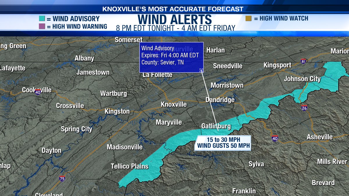
A Wind Advisory has been issued for the highest peaks of the Smokies. This will go into effect tonight at 8 PM EDT and extend through 4 AM EDT Friday morning. Winds may gust up to 50 mph! #TNwx #WATEwx

Today will be hot and humid with highs in the mid 90s. There is a 30% chance for a few spotty showers and thunderstorms late this afternoon. #TNwx #WATEwx

Law enforcement is reporting that several trees are down as a result of a severe thunderstorm near the Mooresburg community in Hawkins County. #TNwx #WATEwx
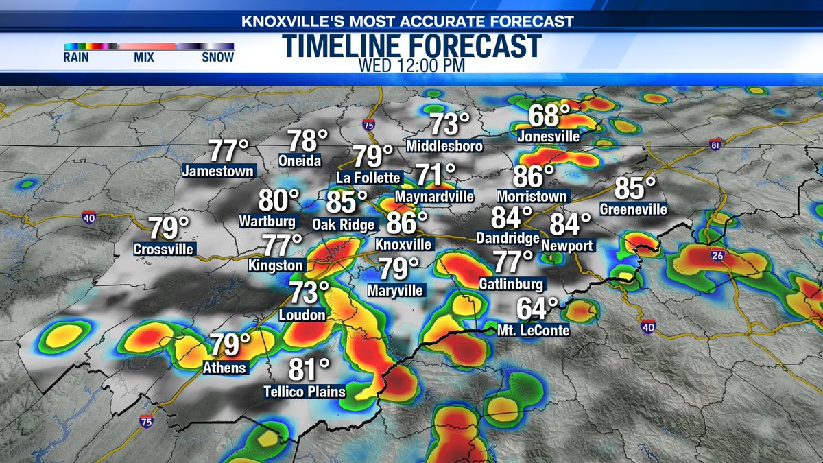
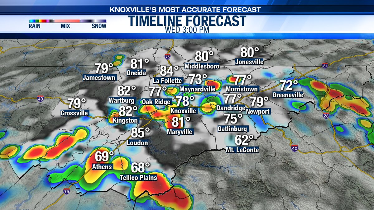
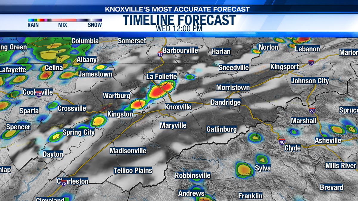
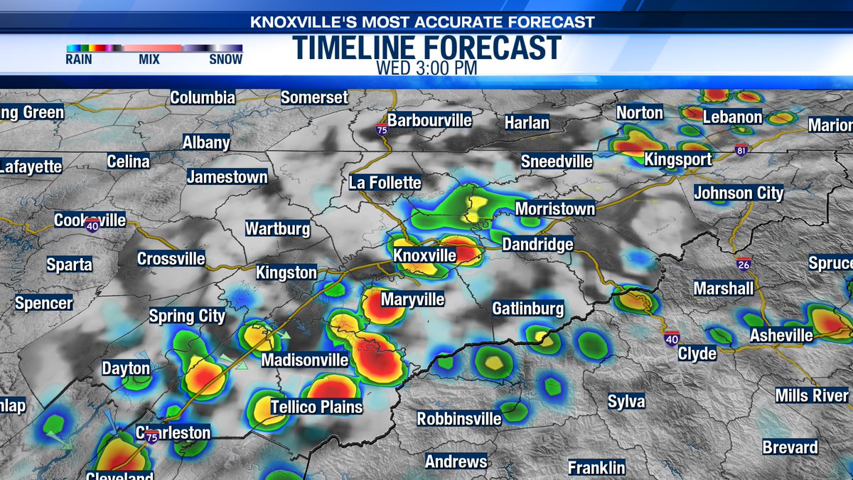
Spotty storms are on tap this afternoon with an elevated rain chance for Wednesday. Be sure to keep the umbrella handy! Rain may be heavy at times and could result in some localized flooding. #TNwx #WATEwx
Spotty rain showers are on tap for your Monday! Rain chances will increase around lunchtime with showers possible through this afternoon. #TNwx #WATEwx


Get ready for a warm day! Highs this afternoon reach into the mid 80s with some breaks of sunshine! #TNwx #WATEwx
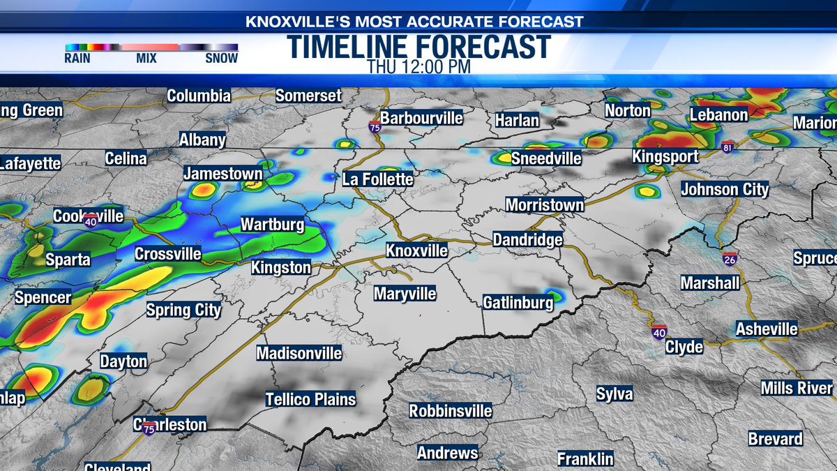
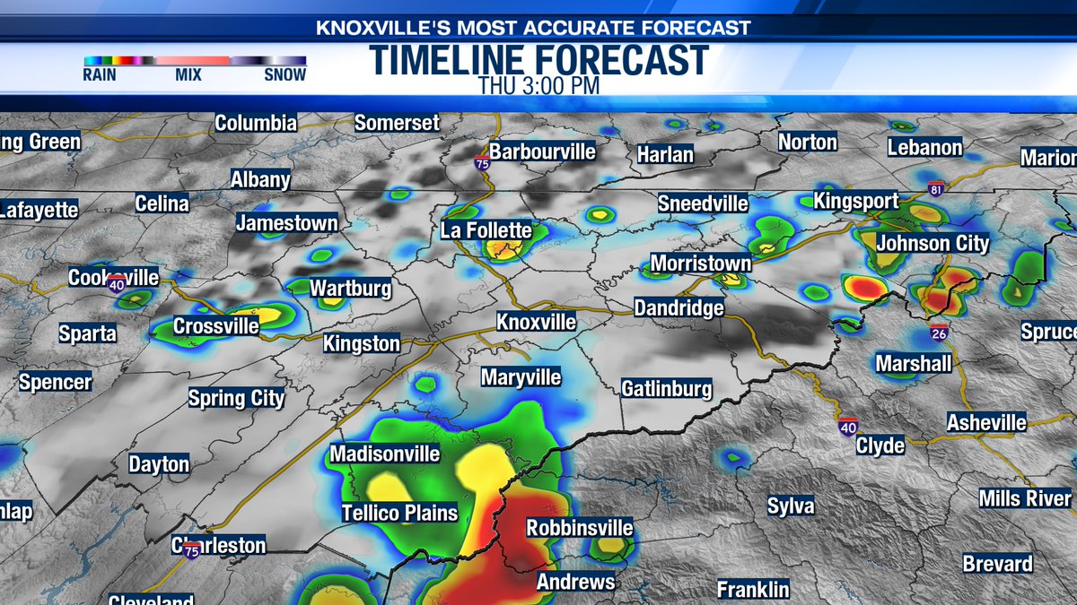
Rounds of rain and storms are expected today. Rain may be heavy at times and could lead to localized or flash flooding. Please stay safe! #TNwx #WATEwx

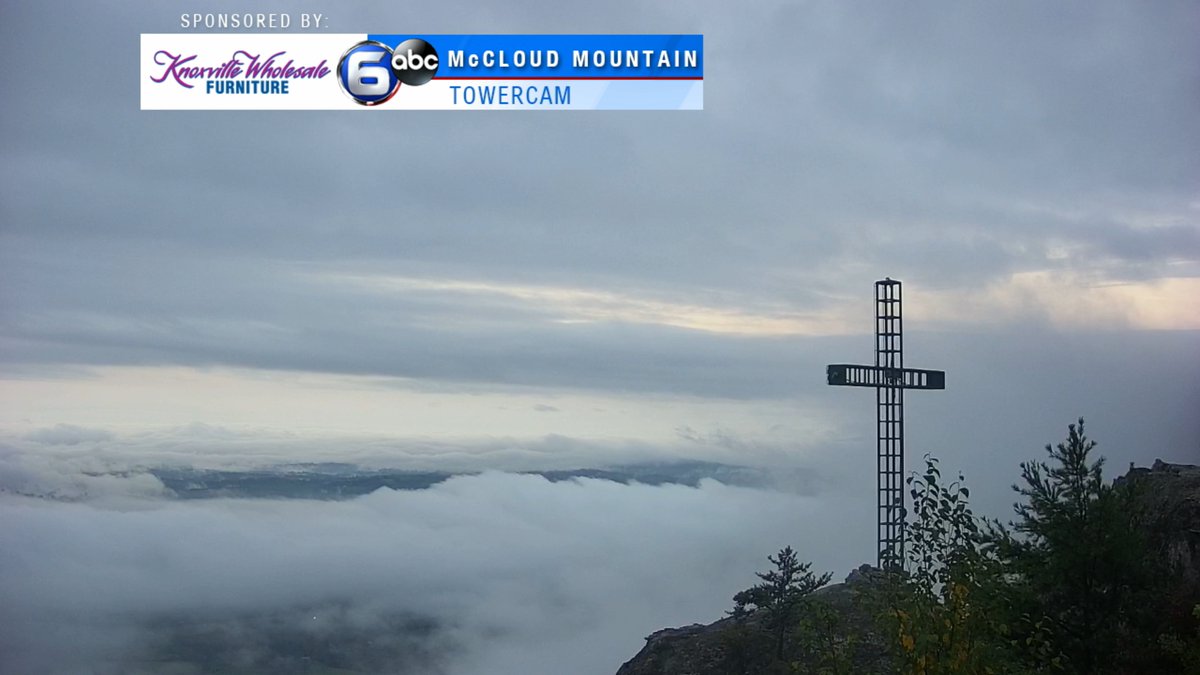
Check out the sunrise this morning over McCloud Mountain! Share your sunrise photos below! #TNwx #WATEwx

Good Morning! I am tracking a few showers over Southeast Kentucky right now. Rain chances will increase this afternoon, especially for areas along and South of I-40. #TNwx #WATEwx
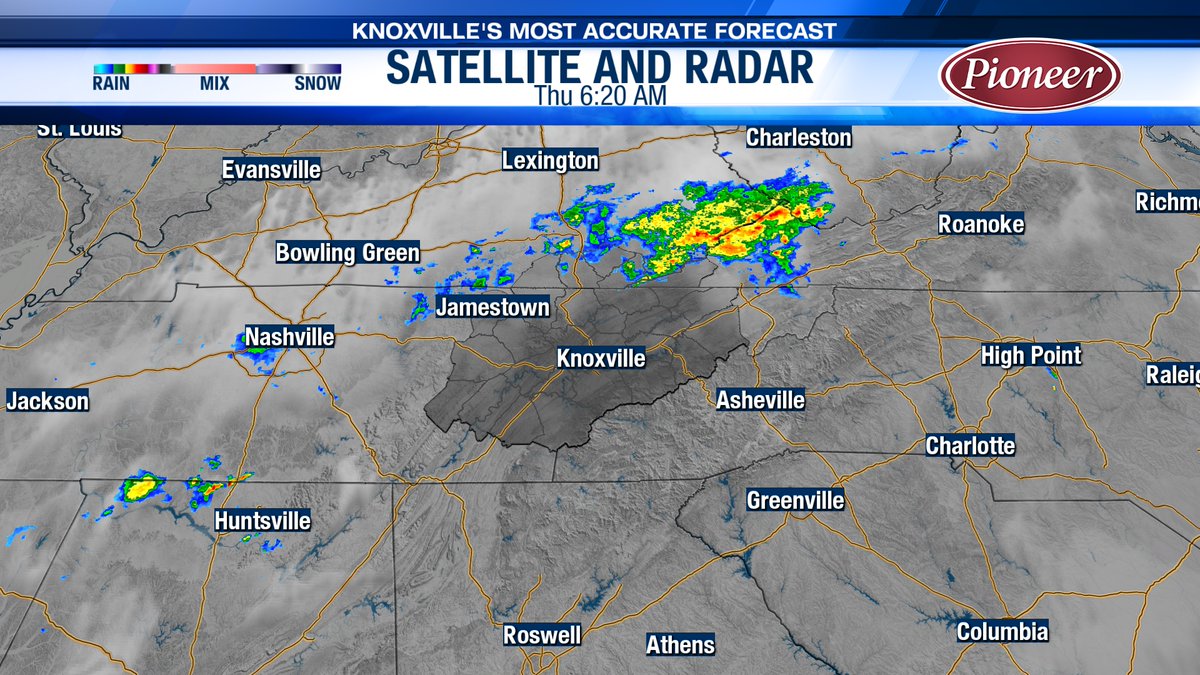
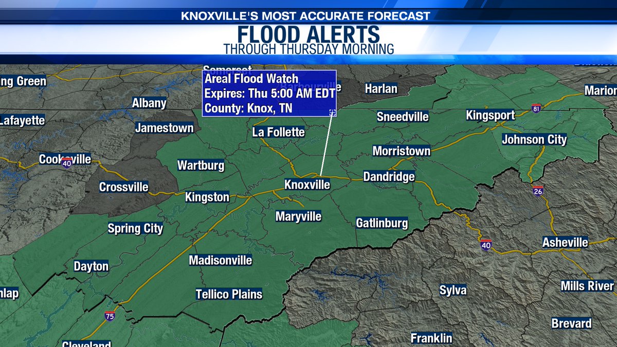
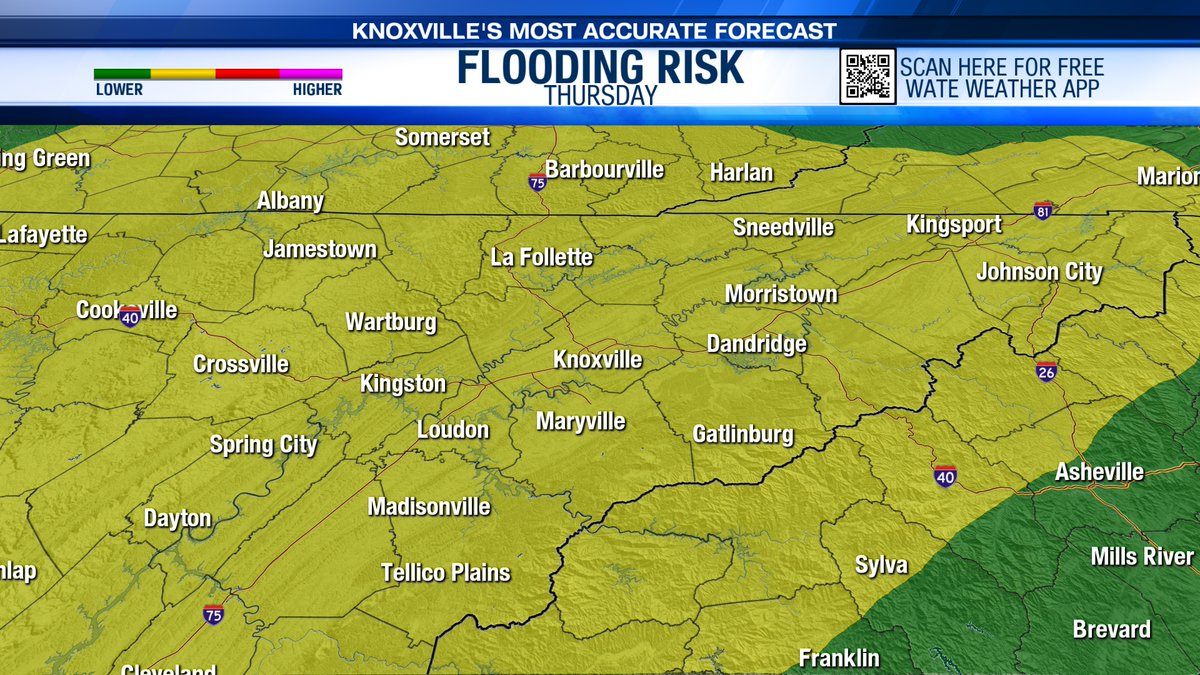
The Flood Watch has been extended through Thursday morning as scattered rain and storms may lead to some localized and flash flooding today and tonight. Remember, turn around don't drown! #TNwx #WATEwx
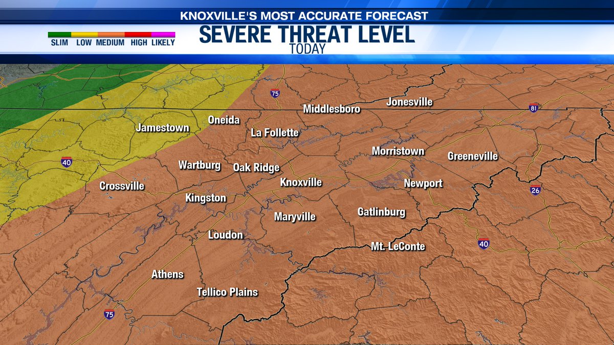
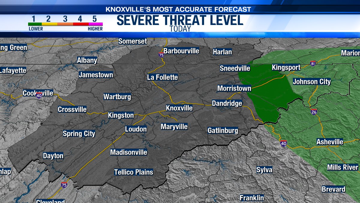
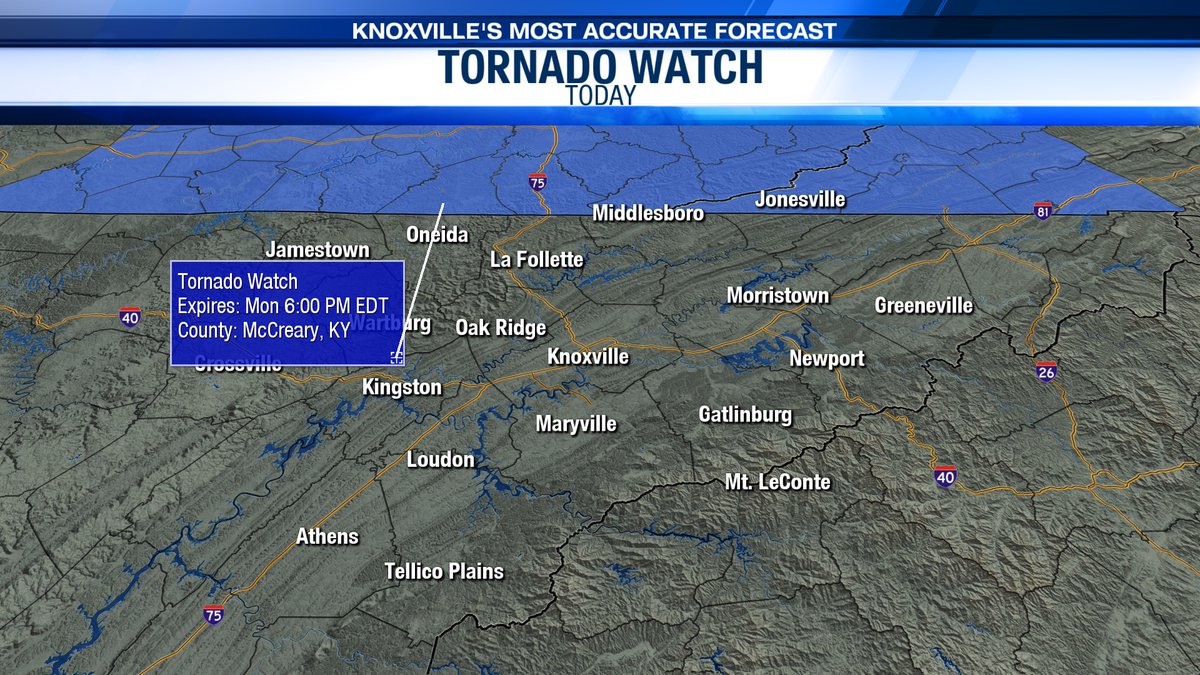
TORNADO WATCH in effect until 7:00 PM 8/7/23 for all of East Tennessee. This means conditions are favorable for tornado development. Please have a plan to seek shelter this afternoon. #TNwx #WATEwx

Weather AWARE - Strong to severe thunderstorms are expected this afternoon. All modes of severe weather are possible. #TNwx #WATEwx wate.com/weather


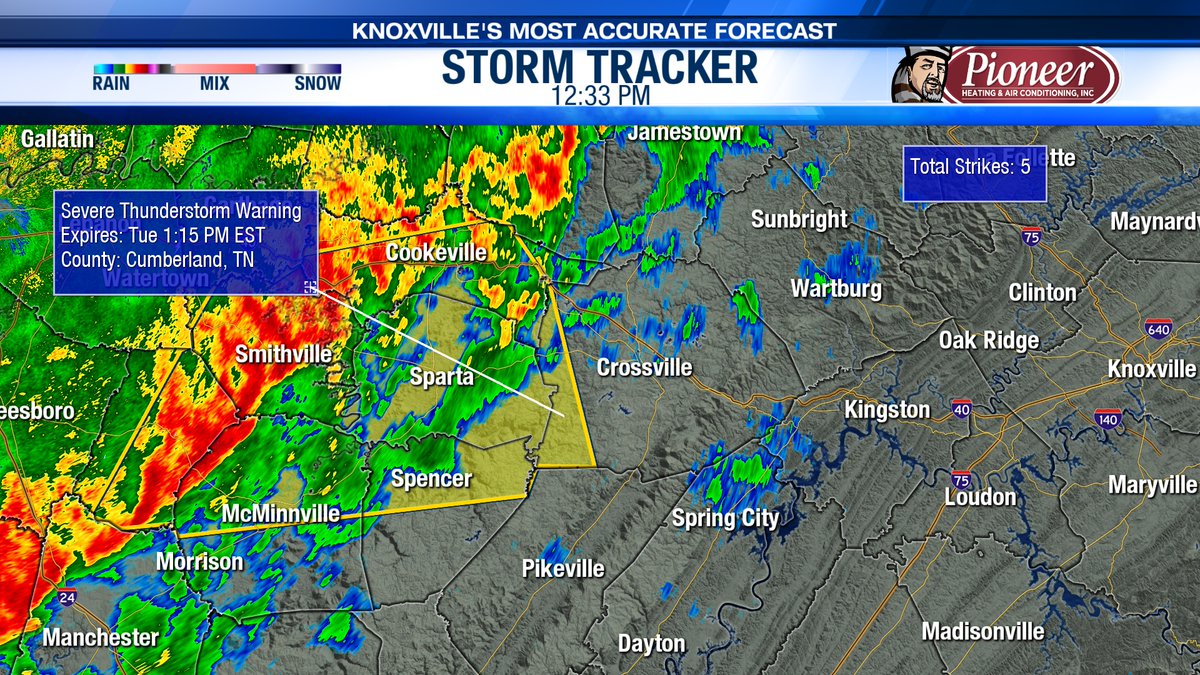
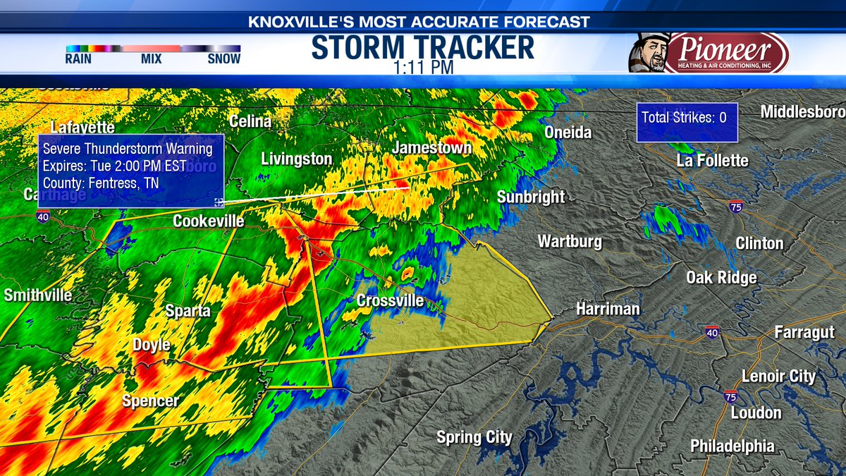
A Severe Thunderstorm Warning has been issued for Cumberland County through 1:15 pm ET (12:15 CT). 60 mph wind speeds will be expected with this storm - be sure to head indoors! #TNwx #WATEwx
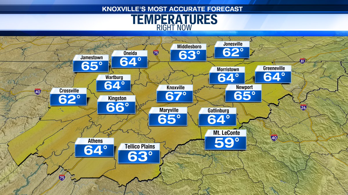
We will see mainly cloudy skies today with slightly cooler highs in the low 60s. A stray shower will be possible through early this evening. #TNwx #WATEwx
Even with the chance for showers and storms this afternoon, it will still feel hot and sticky outside! Check out our "feels like" temperatures for later this afternoon. #TNwx #WATEwx

Some isolated dense fog will be possible early Wednesday morning. Temperatures early tomorrow are a touch cooler in the mid to upper 50s. #TNwx #WATEwx

The Flood Watch has been extended through Thursday morning as scattered rain and storms may lead to some localized and flash flooding today and tonight. Remember, turn around don't drown! #TNwx #WATEwx
Our flood risk today remains elevated for the entire area at a level 2/4. Heavy rainfall will be possible with the threat for localized and flash flooding. Please make sure to never drive through flooded roadways! #TNwx #WATEwx

Rounds of rain and storms are expected today. Rain may be heavy at times and could lead to localized or flash flooding. Please stay safe! #TNwx #WATEwx
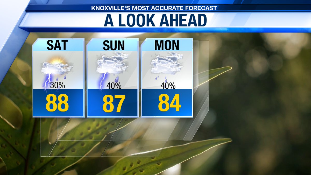
Here's a look at what you can expect the next few days! There will be a few showers and storms tomorrow with highs in the upper 80s. Rain chances increase by Sunday. #TNwx #WATEwx
Rain chances will decrease tonight with hit-or-miss afternoon showers and storms possible Friday and Saturday. #TNwx #WATEwx


Scattered showers and thunderstorms are expected today. Some may produce some heavy rainfall and gusty winds, but the overall severe weather risk is limited. #TNwx #WATEwx
Check out this beautiful shot over McCloud Mountain this morning! Keep the umbrella handy today! #TNwx #WATEwx
Good Morning! I am tracking a few showers over Southeast Kentucky right now. Rain chances will increase this afternoon, especially for areas along and South of I-40. #TNwx #WATEwx
Here is a look at rain chances through the weekend! The pattern will be unsettled at times with the chance for scattered showers and storms. #TNwx #WATEwx

Even with the chance for showers and storms this afternoon, it will still feel hot and sticky outside! Check out our "feels like" temperatures for later this afternoon. #TNwx #WATEwx
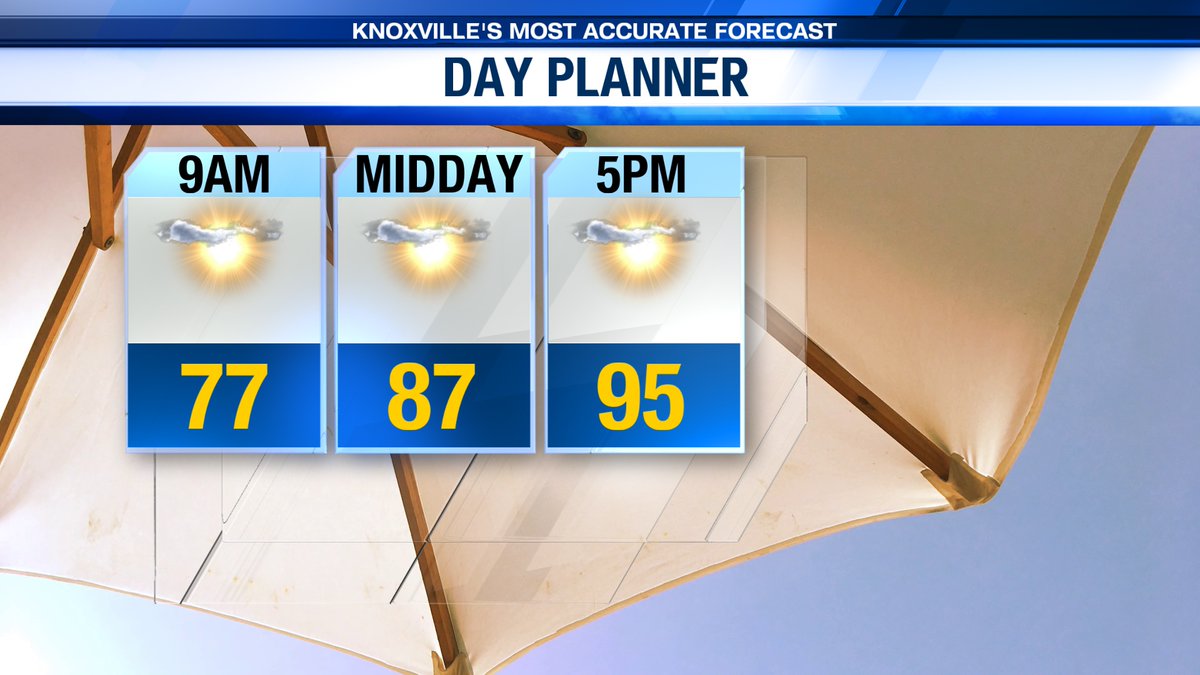
Scattered showers and thunderstorms are expected later this afternoon and into this evening. It will stay hot and sticky today with highs in the low 90s and "feels like" temperatures in the upper 90s to near 100° for many. #TNwx #WATEwx
Good Morning! I am already tracking some scattered showers and rumbles across the area. Grab the umbrella as you head out the door and tune in now for more details on today's rain chance! #TNwx #WATEwx
Spotty storms are on tap this afternoon with an elevated rain chance for Wednesday. Be sure to keep the umbrella handy! Rain may be heavy at times and could result in some localized flooding. #TNwx #WATEwx
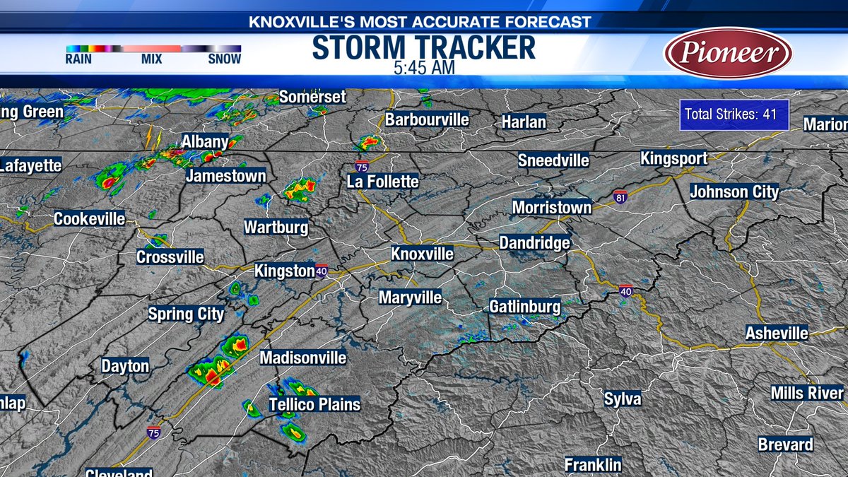
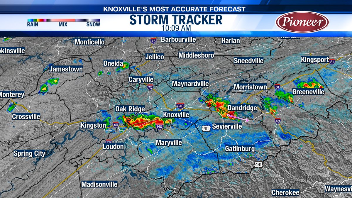
I am tracking a few thunderstorms right now across East Tennessee. Heavy rainfall and frequent lightning will be possible. Take it slow on the roads! #TNwx #WATEwx
Today will be hot and humid with highs in the mid 90s. There is a 30% chance for a few spotty showers and thunderstorms late this afternoon. #TNwx #WATEwx
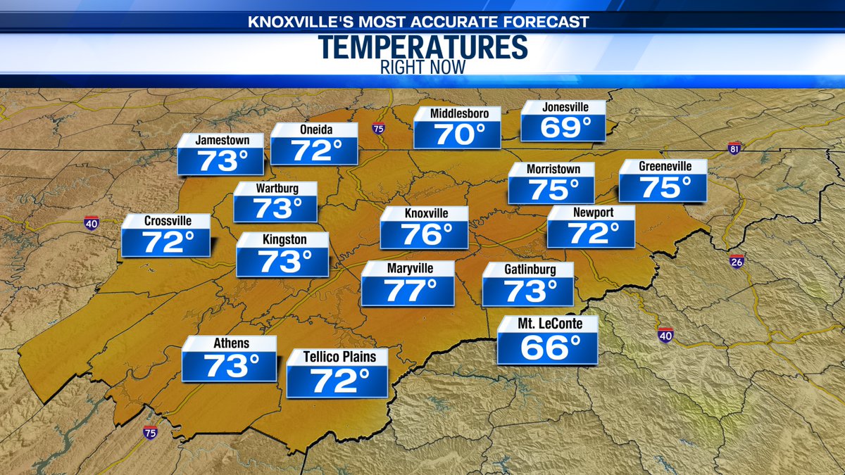
Good Morning! It is a mild start to your Tuesday with sticky conditions for many. Today will be hot and steamy before a pattern shift tomorrow. Tune in now for more details! #TNwx #WATEwx

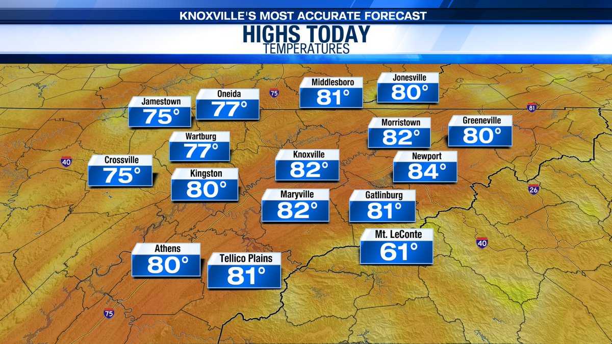
The heat continues this afternoon with highs in the mid 90s and "feels like" temperatures in the upper 90s for the Valley! #TNwx #WATEwx
Spotty storms are on tap this afternoon with an elevated rain chance for Wednesday. Be sure to keep the umbrella handy! Rain may be heavy at times and could result in some localized flooding. #TNwx #WATEwx
I am tracking a few thunderstorms right now across East Tennessee. Heavy rainfall and frequent lightning will be possible. Take it slow on the roads! #TNwx #WATEwx
Good Morning! I am tracking a few showers over Southeast Kentucky right now. Rain chances will increase this afternoon, especially for areas along and South of I-40. #TNwx #WATEwx
A Wind Advisory has been issued for the highest peaks of the Smokies. This will go into effect tonight at 8 PM EDT and extend through 4 AM EDT Friday morning. Winds may gust up to 50 mph! #TNwx #WATEwx
It continues to be warm this afternoon with increasing clouds and a slim shower chance. #TNwx #WATEwx
Good Morning! I am already tracking some scattered showers and rumbles across the area. Grab the umbrella as you head out the door and tune in now for more details on today's rain chance! #TNwx #WATEwx
Rounds of rain and storms are expected today. Rain may be heavy at times and could lead to localized or flash flooding. Please stay safe! #TNwx #WATEwx
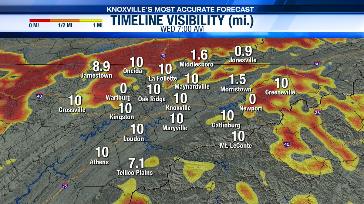
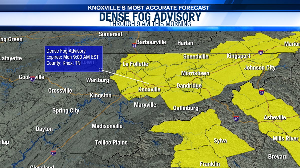
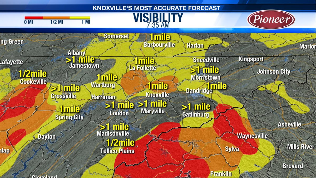
We have another foggy start this morning! A Dense Fog Advisory has been issued for the Valley and areas to the east as visibility will be under 1/4 of a mile at times. #TNwx #WATEwx
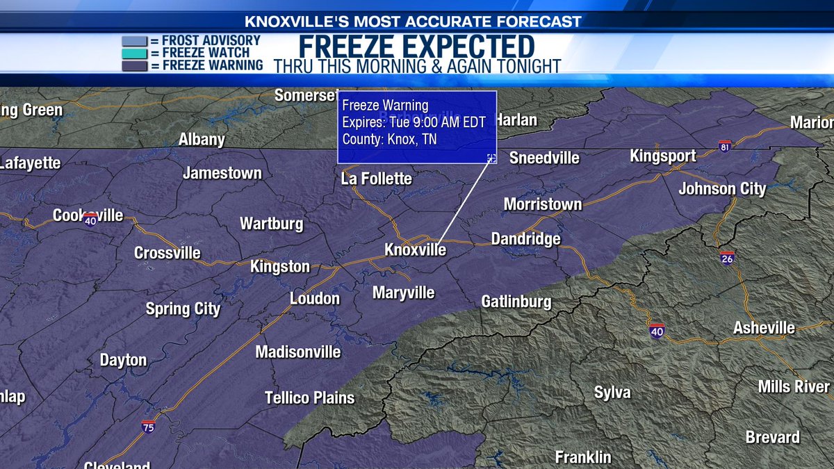
A Freeze Warning continues this morning for much of East Tennessee. Widespread frost is expected as you begin your Monday! Another Freeze Warning will get issued late tonight and extend through Tuesday morning as lows tumble back into the 20s tonight. #TNwx #WATEwx
TORNADO WATCH in effect until 6:00 PM 8/7/23 for our southeastern Kentucky counties. This means conditions are favorable for tornadoes to form as severe storms move through. Have a plan to seek shelter this afternoon. #TNwx #WATEwx

A Severe Thunderstorm Warning has been issued for Cumberland and Fentress Counties through 2 pm. 60 mph wind speeds will be expected with this storm - be sure to head indoors! #TNwx #WATEwx Details: wate.com/weather/weathe…
Patchy dense fog continues to be a concern in spots this morning. Take it slow on the roads as you head out the door! #TNwx #WATEwx
The Flood Watch has been extended through Thursday morning as scattered rain and storms may lead to some localized and flash flooding today and tonight. Remember, turn around don't drown! #TNwx #WATEwx
The heat continues this afternoon with highs in the mid 90s and "feels like" temperatures in the upper 90s for the Valley! #TNwx #WATEwx
Here's a look at what you can expect the next few days! There will be a few showers and storms tomorrow with highs in the upper 80s. Rain chances increase by Sunday. #TNwx #WATEwx
Even with the chance for showers and storms this afternoon, it will still feel hot and sticky outside! Check out our "feels like" temperatures for later this afternoon. #TNwx #WATEwx
Good Morning! It is a mild start to your Tuesday with sticky conditions for many. Today will be hot and steamy before a pattern shift tomorrow. Tune in now for more details! #TNwx #WATEwx
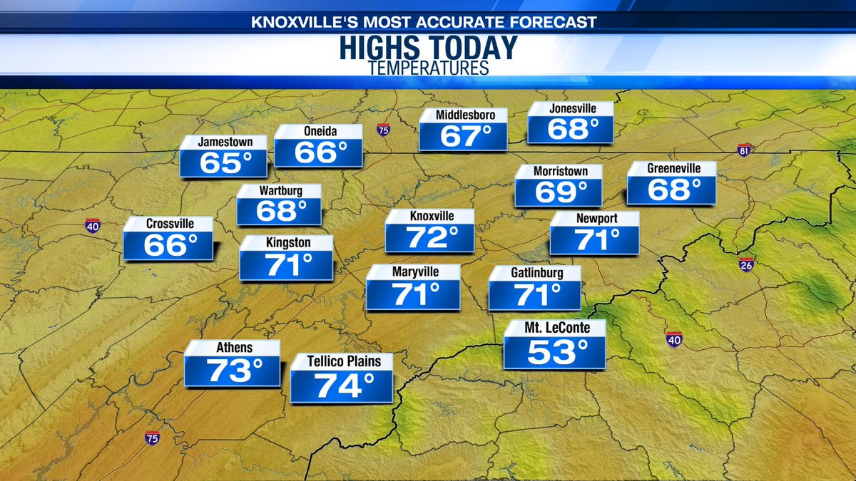
We will see some breaks of sunshine this afternoon with highs in the upper 60s and low 70s! #TNwx #WATEwx
Heavy rain moves in Thursday. We could see some localized flooding especially in flood prone, low lying areas. Remember: "turn around, don't drown!" #TNwx #WATEwx wate.com/weather
Something went wrong.
Something went wrong.
United States Trends
- 1. #WrestleMania N/A
- 2. #WrestleMania N/A
- 3. Luke Kennard N/A
- 4. Bengals N/A
- 5. Lakers N/A
- 6. #LakeShow N/A
- 7. Porter Martone N/A
- 8. Giants N/A
- 9. Rockets N/A
- 10. #IgniteTheOrange N/A
- 11. Pat McAfee N/A
- 12. Dexter Lawrence N/A
- 13. Orton N/A
- 14. #UFCWinnipeg N/A
- 15. Sengun N/A
- 16. Bianca N/A
- 17. Paige N/A
- 18. Flyers N/A
- 19. Crosby N/A
- 20. Ayton N/A