#wildcatfire search results


#WildcatFire A new wildfire in the Cascades has popped up! 10 acres in size with air support coming in, 1 attack plane overhead with 2 scoopers just arriving... this is likely due to thunderstorms which were east of Mt. Rainer... Expect more possible fire starts later... #wawx


#WildcatFire in Washington near or in Mount Rainier National Park, 1,000+ acres, massive smoke plume.


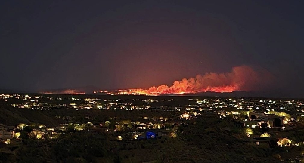
13,000 acres of AZ’s largest National Forest is on fire right now. What preventative measures has Governor Katie Hobbs done to protect our state? Don’t let Governor Katie Hobbs Maui our Scottsdale! #WildcatFire #tonto


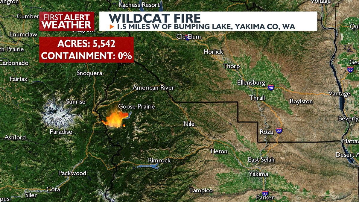
🔥#WILDCATFIRE GROWS TO 5,500 ACRES: Hot & dry conditions will promote more rapid growth today, but cooler and wetter weather should assist firefighters heading into next week! #wawx


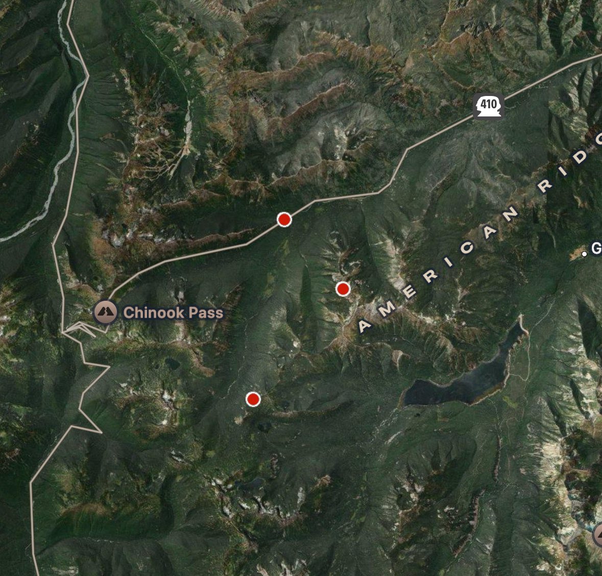
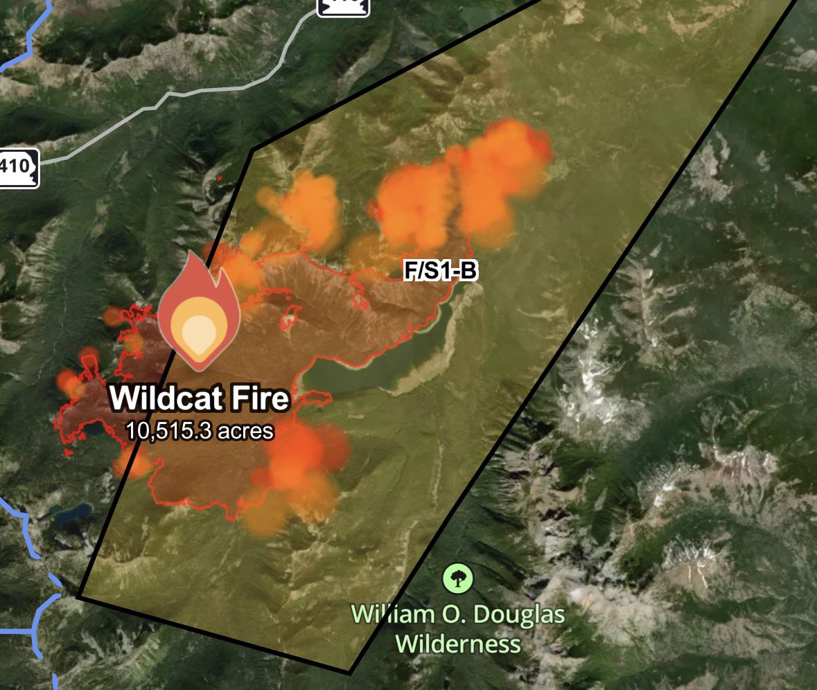
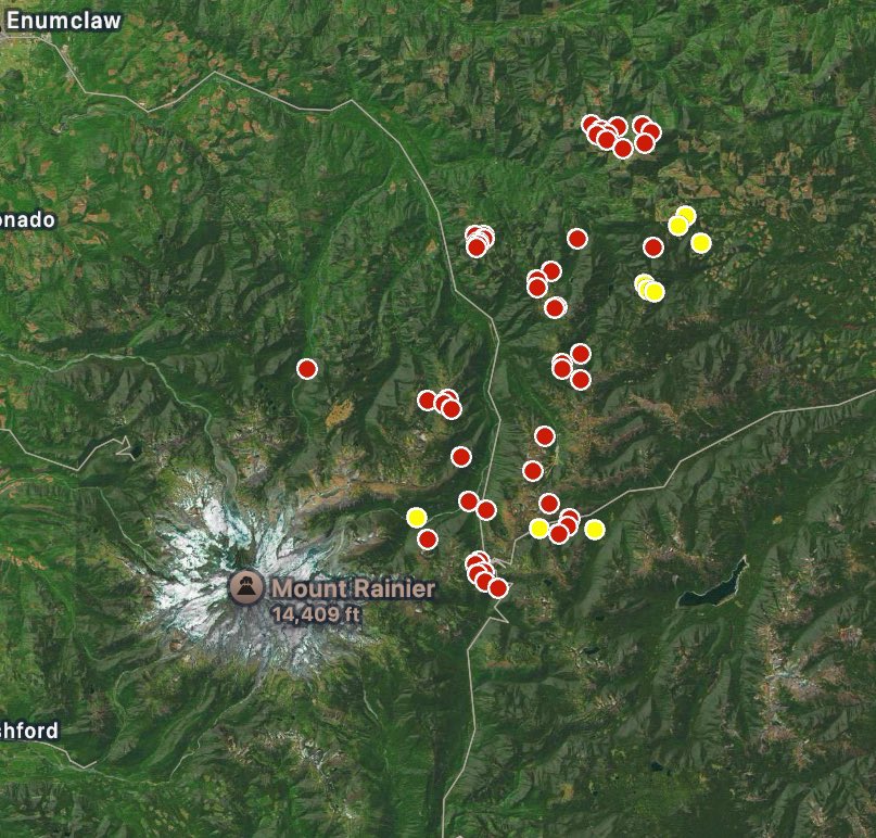
#WildcatFire [Update] Evacuation Warnings are in place for the area pictures below. Grid numbers 4341, 4342, 4241, and 4242.
![CALFIRESANDIEGO's tweet image. #WildcatFire [Update] Evacuation Warnings are in place for the area pictures below. Grid numbers 4341, 4342, 4241, and 4242.](https://pbs.twimg.com/media/FzGpbaPaMAEQrxd.jpg)
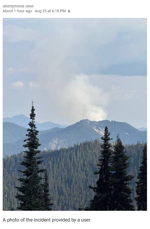
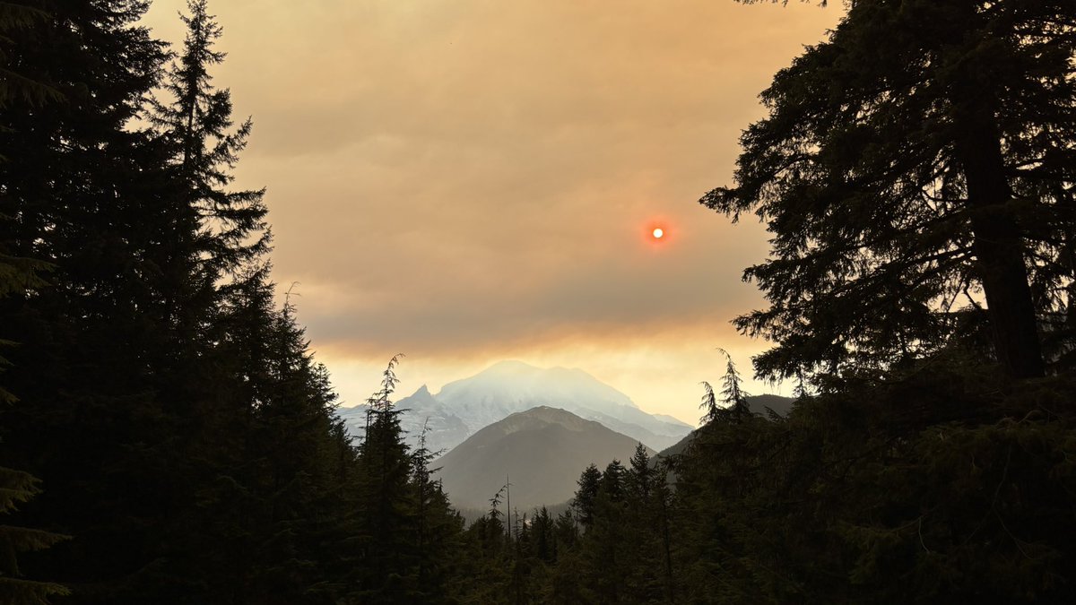
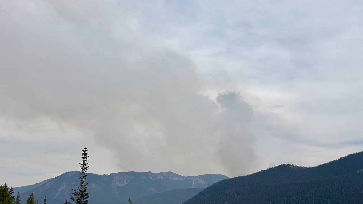
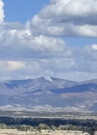
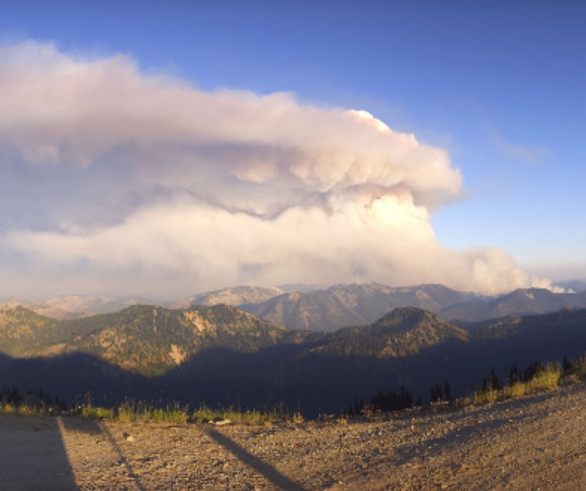
Blurry phone photo of the #WildcatFire pyrocumulus cloud and a barren Mt. Rainier as seen from northern Bainbridge Island around 6:10 PM Saturday. #wawx


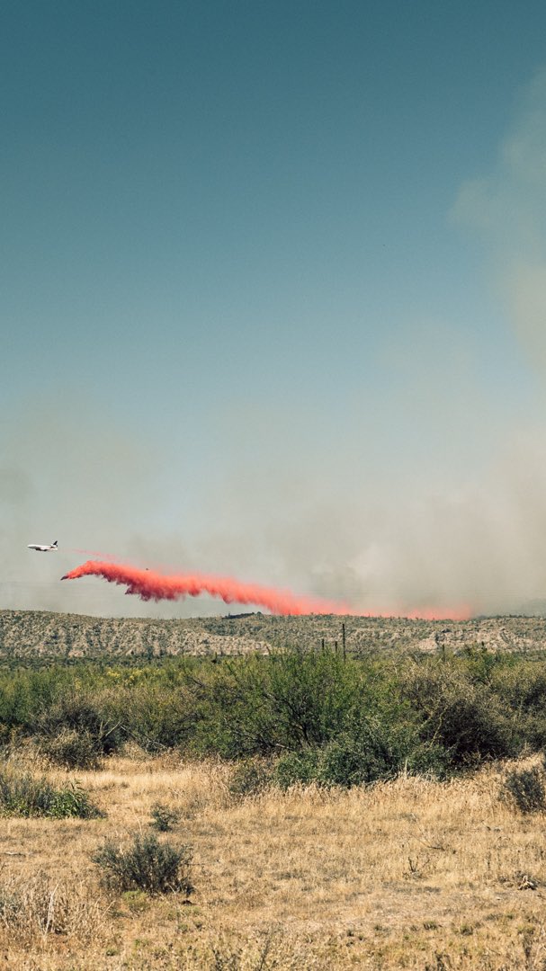
A #WildcatFire in Tonto National Forest near Cave Creek has burned 5,000 acres. Road closures and evacuations were prompted. 📍Tonto National Forest is a little over an hour east of Phoenix #AZwx


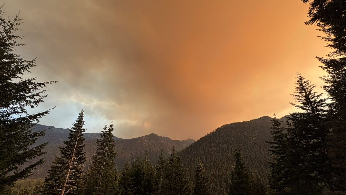
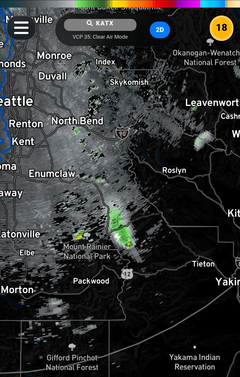
Holy cow.. Look at the dark shadow from the #WildcatFire just east of Mt. Rainier 😮. The fire behavior is just incredible today.. #wawx #pnw #wilfire
WOW…we’ve got lightning in the #WildcatFire now. This is a pyrocumulonimbus cloud, and the fire is rapidly growing. Extraordinary. #wawx

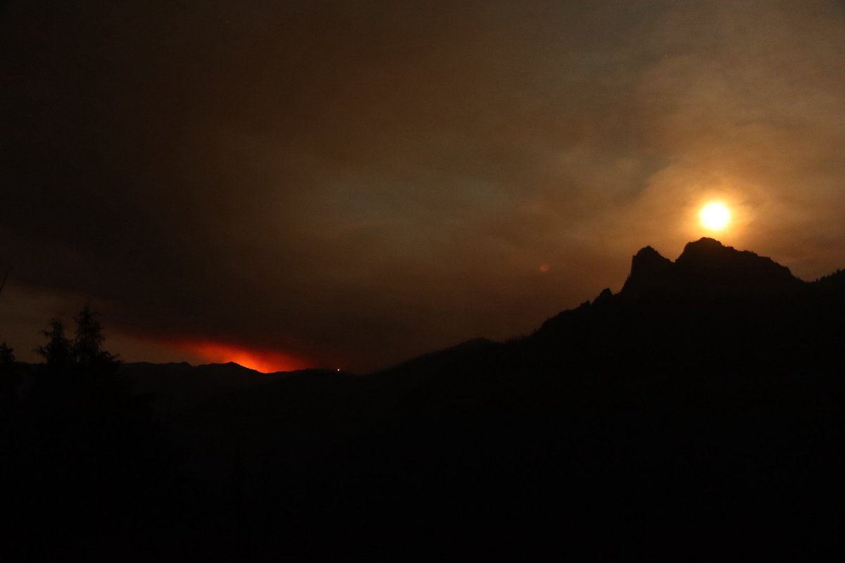
Caught a glimpse of the #WildcatFire off of SR-410 earlier this evening as the full moon rose behind Tahtlum Peak #wawx

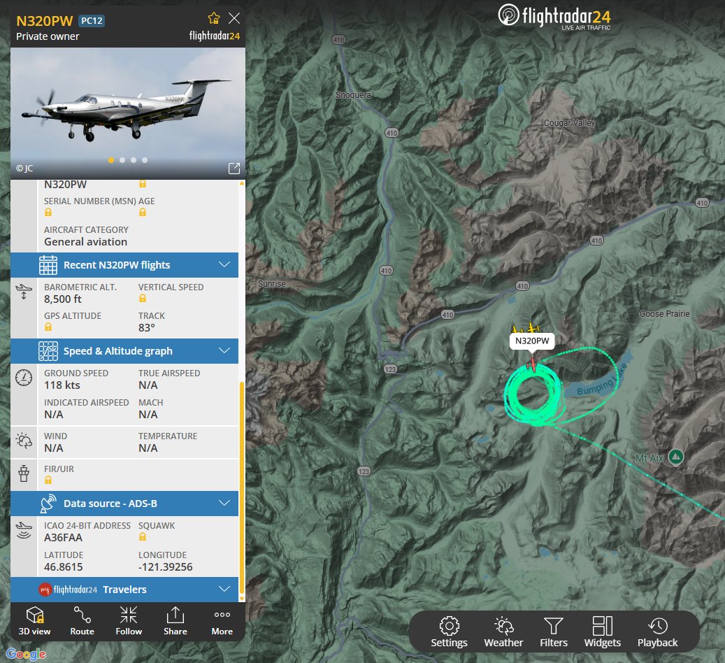
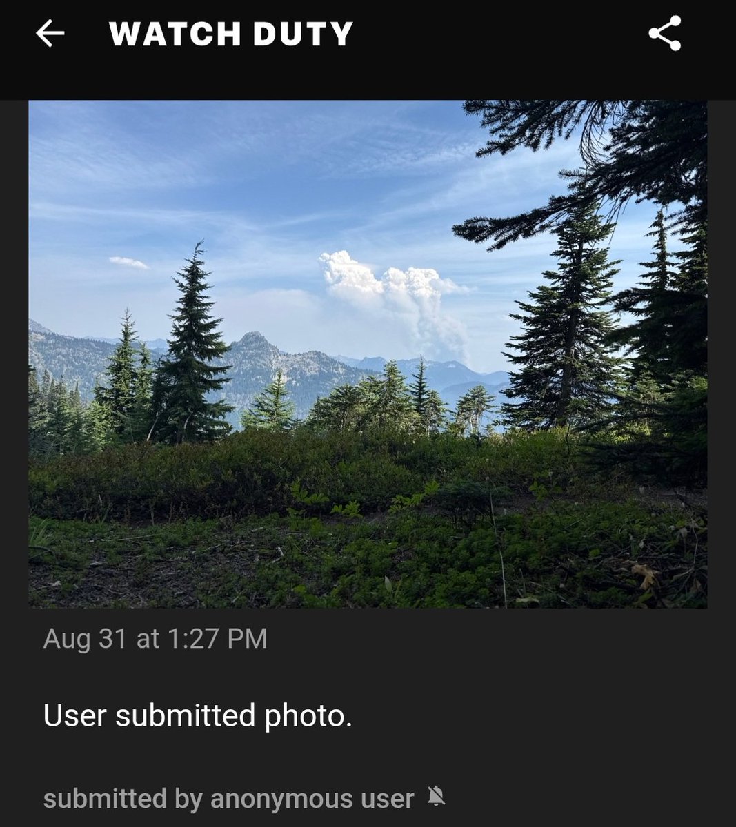
WA: the #WildcatFire E of Mt. Rainier has burned 260+ acres w/no containment. Aircraft operating: PC12 N320PW as Air Attack 651 B429 N426PJ Type 3 Heli (Photo from @watchdutyapp) @sipjack1776 @Wa_fire_watch @LadyAstroJet


#WildcatFire #WAOWF inciweb.wildfire.gov/incident-publi… Wildcat Fire: Updated Publication Added: Wildcat Fire
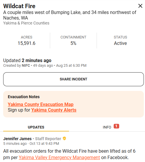
#WildcatFire This fire has been marked as fully contained and should stay confined to its boundaries, FINAL UPDATE
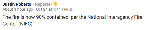
#WildcatFire Some great news from crews working on the Wildcat Fire! Containment has been increased from 40% to 90%, this fire is nearing its full end with even more rain and snow in the forecast! Fire season is over!! 🎉

In just now from Watch Duty from the #WildcatFire burning near Crystal Mountain, near 410. Great news, all evacuation orders have been lifted which was the Level 2 evacuation remaining. #wawx

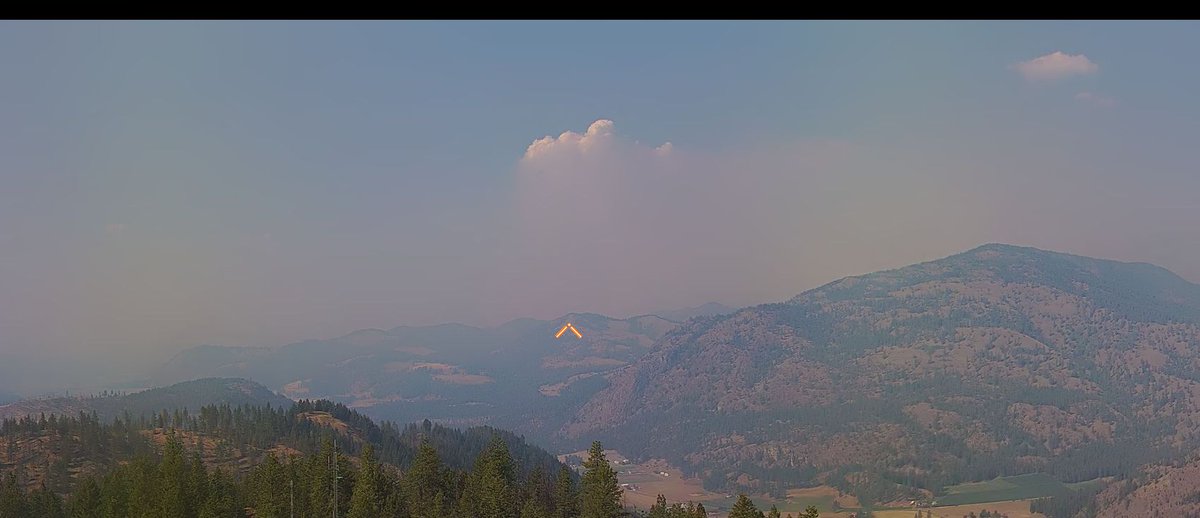
NEW FIRE START: #WildcatFire - Beaver County, estimated 10 acres. Smoke may be visible from I-70/I-15. Firefighters are working in challenging, inaccessible terrain, with local engine & Initial Attack resources on scene. Cause is under investigation. Do not report. #ffslkmg

🔥 Here’s the #WildcatFire burning in Beaver County, southeast of Cove Fort with smoke 💨 likely visible from I-15 & I-70. 🌧️ Rain is expected in the area. The fire was reported earlier Thursday morning in inaccessible terrain resulting in a long hike for ground crews. Last

New 🔥 Start: #WildcatFire - Fishlake NF (Beaver Co.) Est 10 acres. Smoke may be visible from I-70/I-15. Firefighters are working in challenging, inaccessible terrain, with local engine & Initial Attack resources on scene. Cause is under investigation. Do not report. #ffslkmg


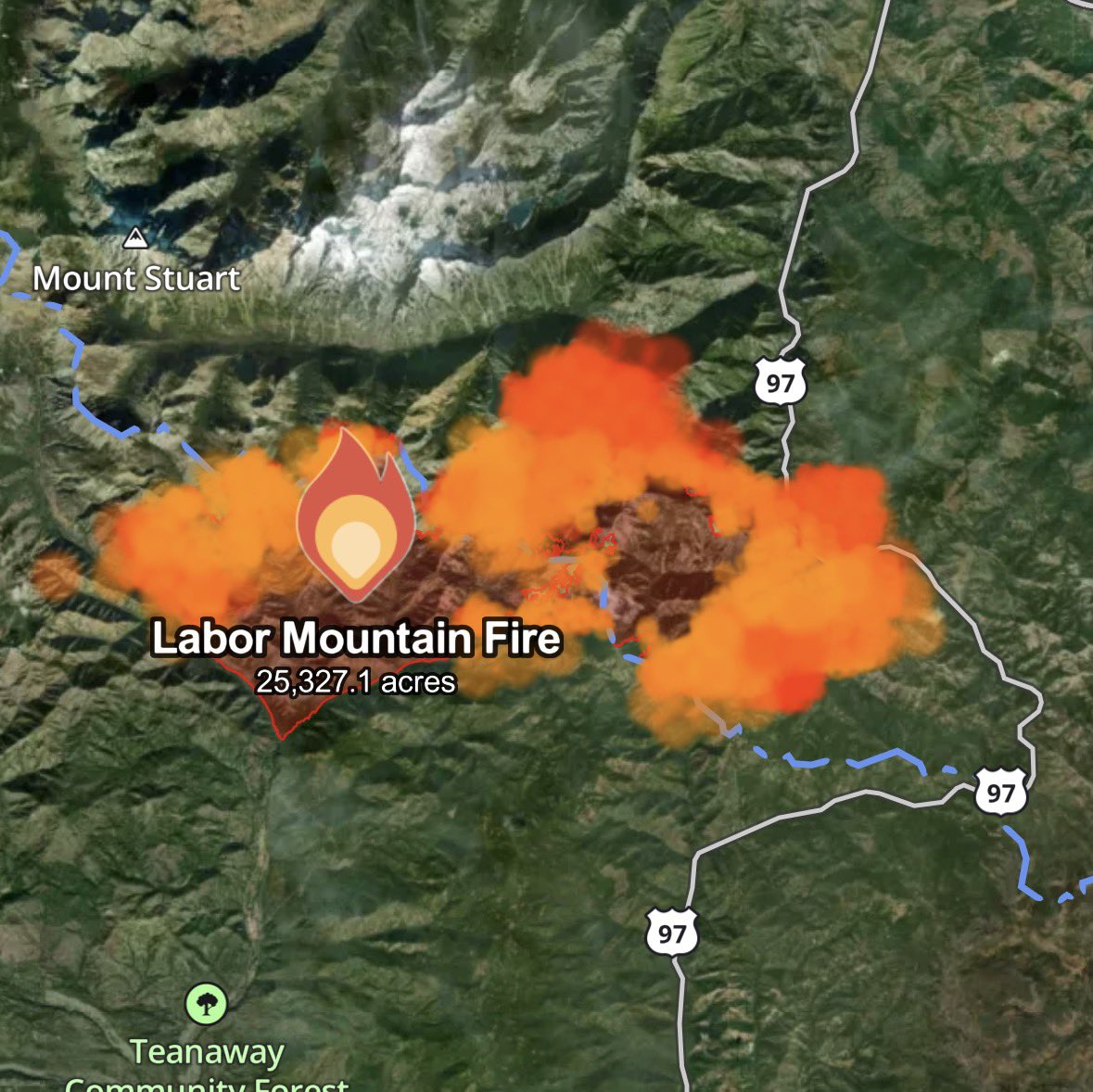
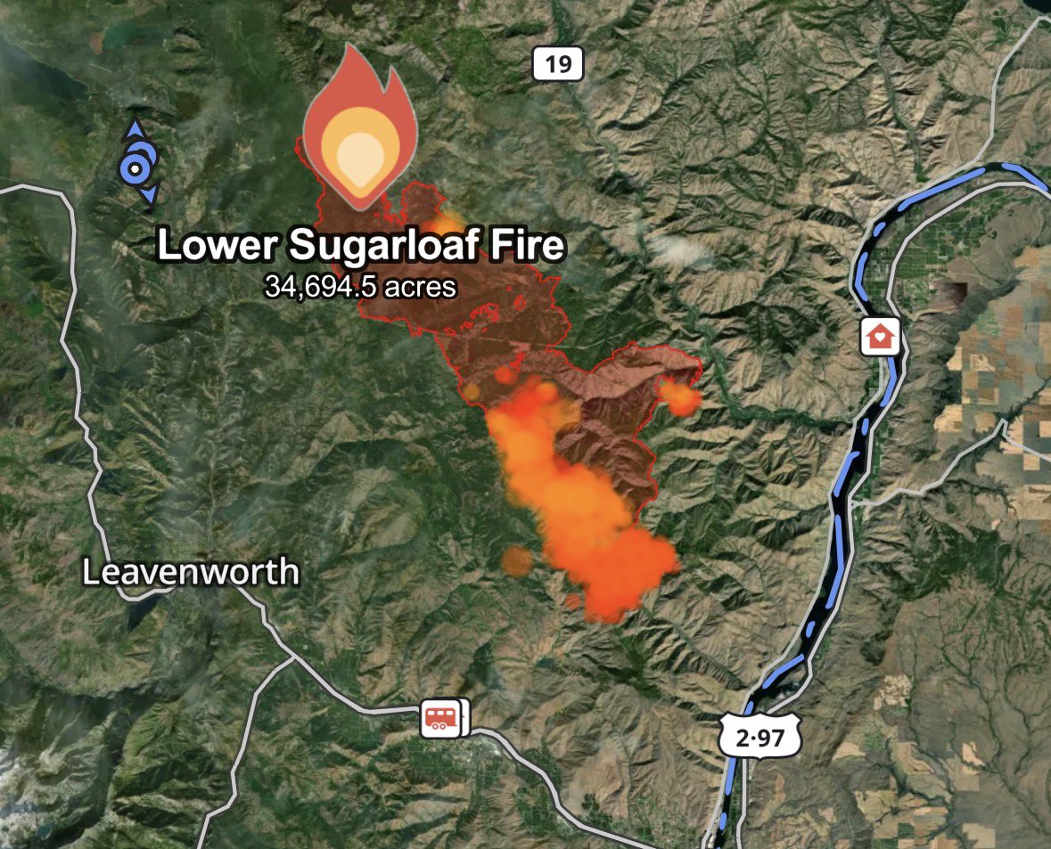
This View of major wildfires across Washington State was captured live from @sen's 4K external camera payload on the @Space_Station at 3:22 pm PDT this afternoon. #WildcatFire #LowerSugarloafFire #LaborMountainFire @PortlandGov @CityofSeattle @SpokaneCity @NWSSeattle
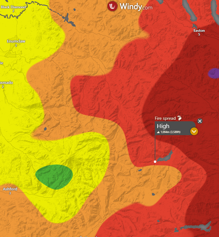
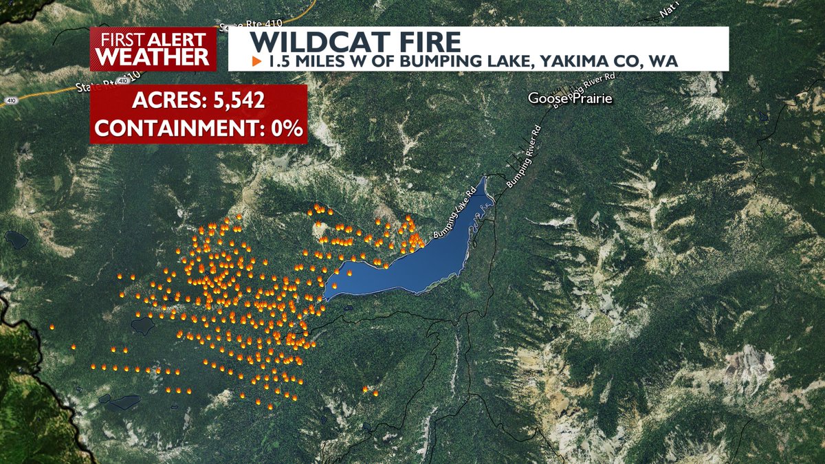
Thursday was a bad day for fires in the Cascades. The #LaborMountainFire crossed US-97 and grew nearly 8K acres. The #LowerSugarloafFire grew 4K acres to the SE, with new level 3 evacuations. The #WildcatFire grew too, getting very close to Goose Prairie. #wawx

We need support on the #wafire #wildcatfire. There are historic and lived in homes directly in the path, and with one way in/out it's too dangerous for firefighters. We need #airsupport quickly for #bumpinglake and #gooseprairie.
Blurry phone photo of the #WildcatFire pyrocumulus cloud and a barren Mt. Rainier as seen from northern Bainbridge Island around 6:10 PM Saturday. #wawx
Drone shot on the evening of Tuesday, Sept. 2nd, as the smoke plume from the #WildcatFire blew north over Cle Elum. The fire would go on to grow over 3,000 acres in the ensuing 24 hours. #wawx

Nice storm over the #WildcatFire right now, hopefully bringing some much needed rain without too much lightning! #wawx


. @NWSEastern IMET trainee en route to #WildcatFire near Naches, WA #WAwx #WAFires @NWSPendleton @OkaWenNF inciweb.wildfire.gov/incident-infor… Map courtesy Inciweb

. @NWSMedford IMET en route to #WildcatFire near Naches, WA #WAwx #WAFires @NWSPendleton @OkaWenNF inciweb.wildfire.gov/incident-infor… Photo courtesy Inciweb


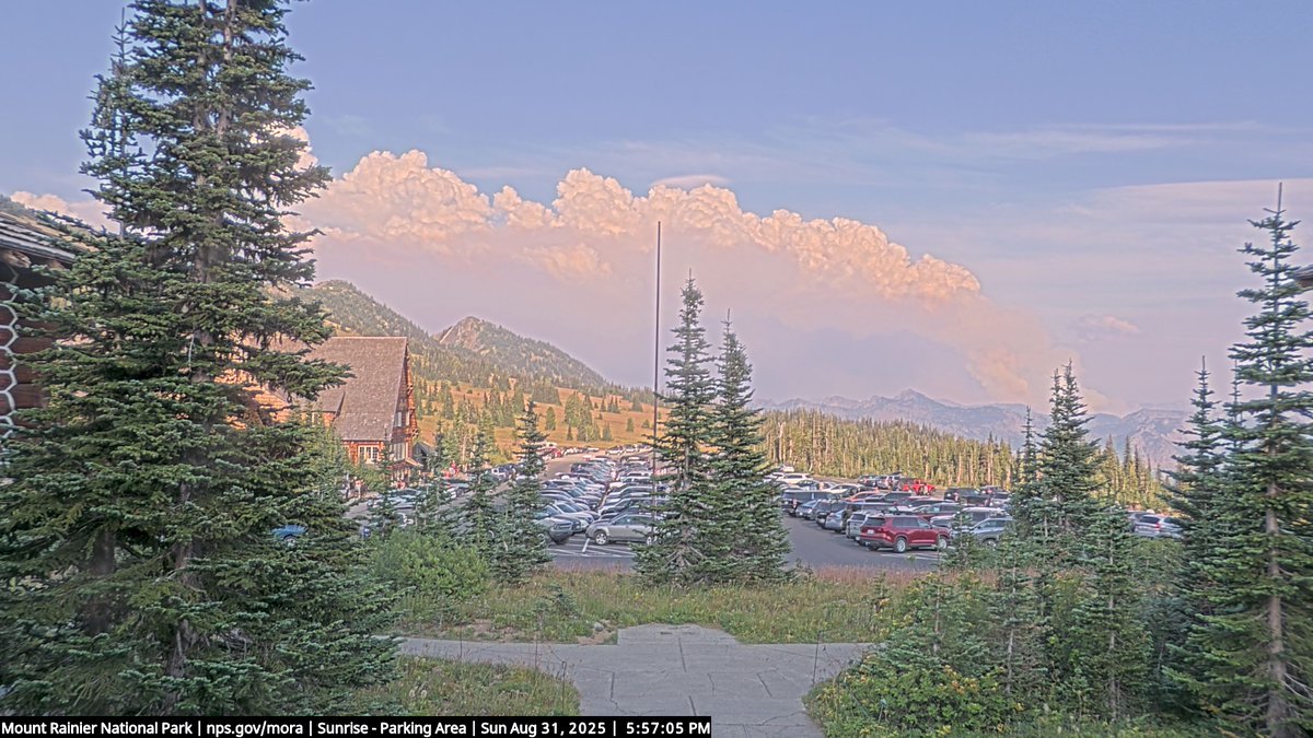
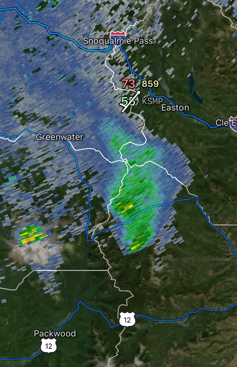
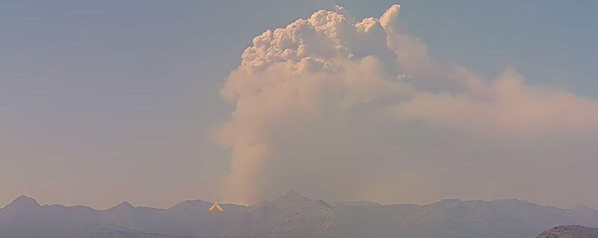
A view of the #WildcatFire producing a pyrocumulus cloud this afternoon, on the 1:40 PM Crystal Mountain summit camera shot. The fire is producing clouds estimated by radar to be 26,000 feet high. #wawx
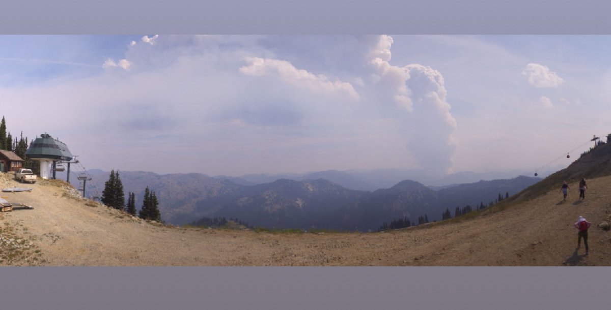

The #WildcatFire is burning so hot that it just generated its own thunderstorm, also known as a pyrocumulonimbus! This will likely cause the fire to spread even more via lightning strikes caused by it. Basically creating a wildfire feedback loop...🌩🔥 #wawx
Blurry phone photo of the #WildcatFire pyrocumulus cloud and a barren Mt. Rainier as seen from northern Bainbridge Island around 6:10 PM Saturday. #wawx
WA: the #WildcatFire E of Mt. Rainier has burned 260+ acres w/no containment. Aircraft operating: PC12 N320PW as Air Attack 651 B429 N426PJ Type 3 Heli (Photo from @watchdutyapp) @sipjack1776 @Wa_fire_watch @LadyAstroJet
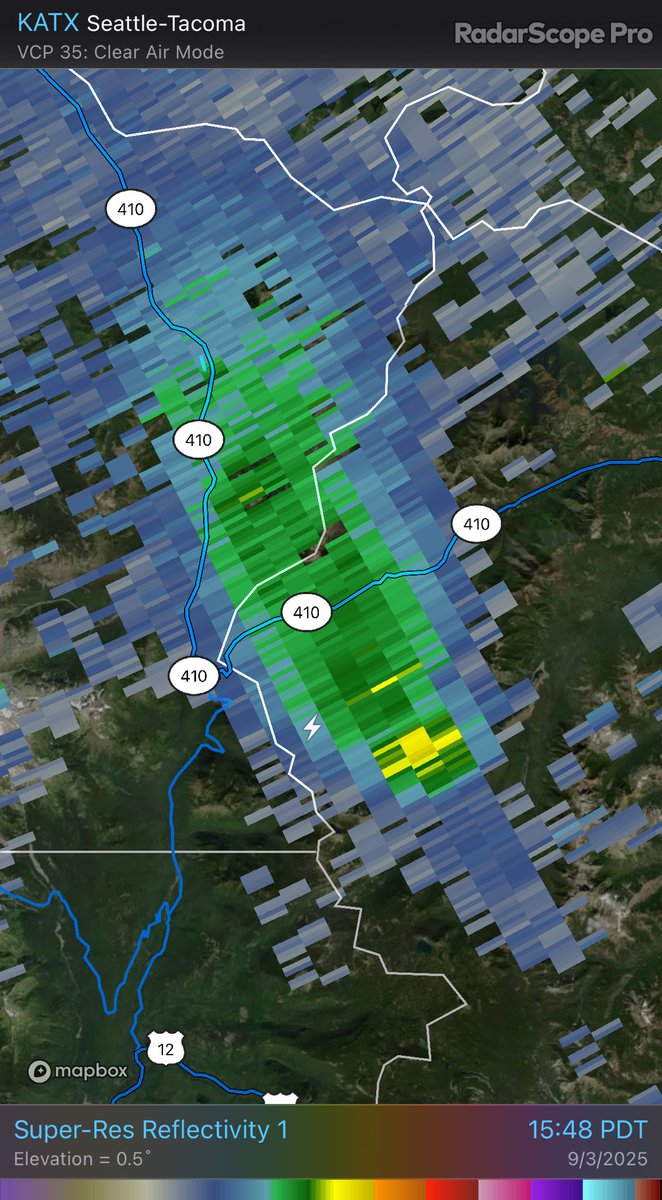
The #WildcatFire is going crazy this evening, with a large pyrocumulus cloud visible from the Crystal Mountain summit webcam, with the fire growing to the north. The fire is also clearly visible on the Seattle radar. #wawx

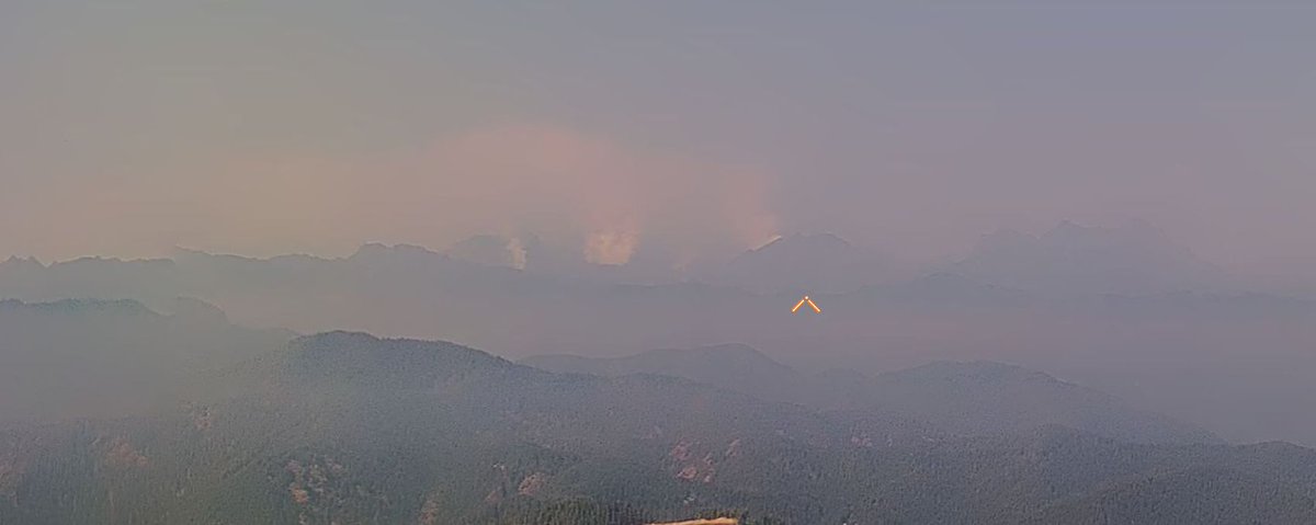
3 smoke plumes in one image…as seen from I-90 just east of Cle Elum…the huge plume from the #WildcatFire at left, then the #LaborMountainFire near Mt. Stuart in the center, and the pyrocumulus cloud from the #LowerSugarloafFire peeking over the ridge at right. #wawx

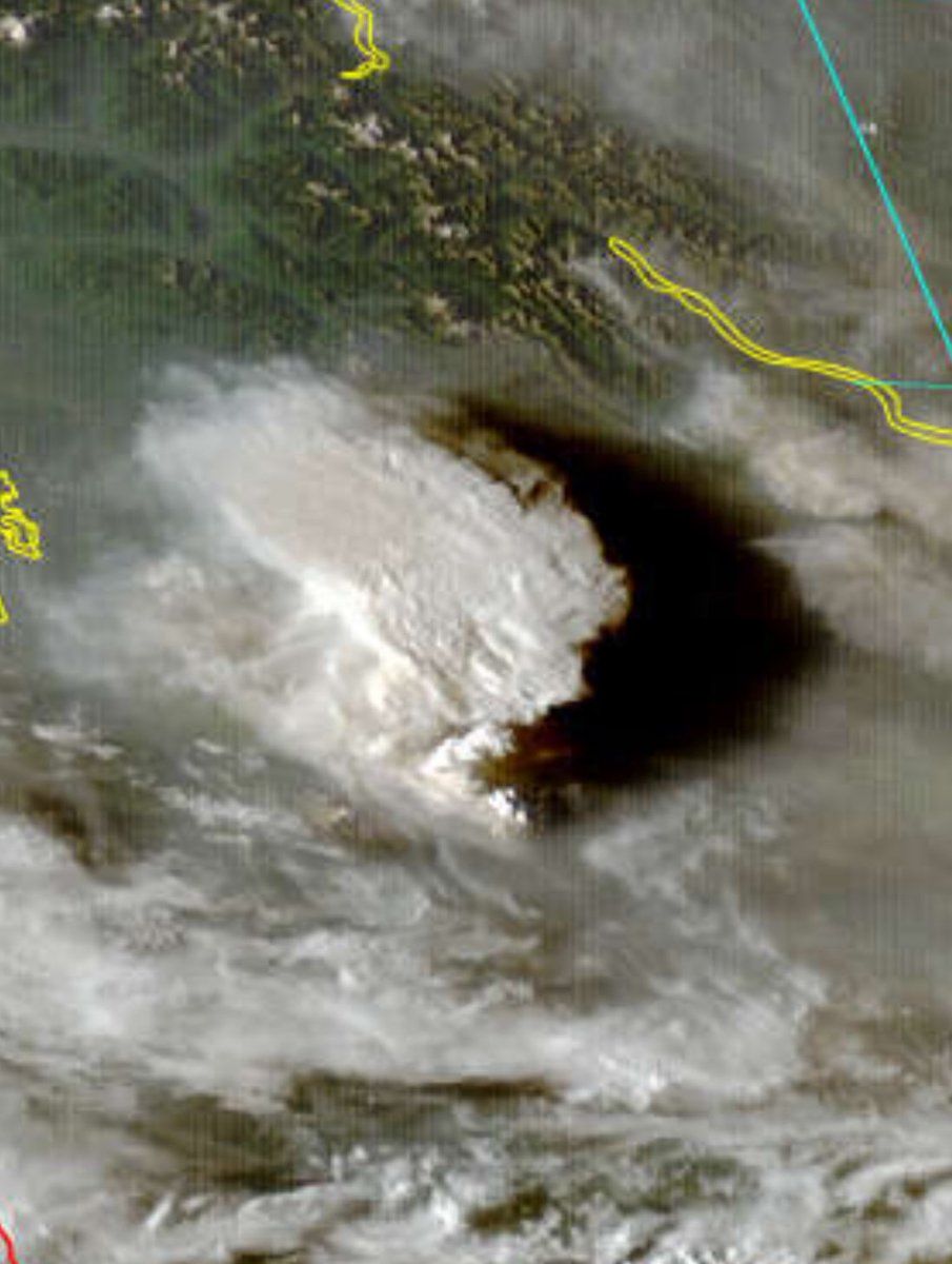
3:15 PM satellite: Seeing a major pyrocumulonimbus cloud (radar estimated 32,000 feet) off the #WildcatFire, while the #LowerSugarloafFire is producing a smaller pyrocumulus cloud too. The #BearGulchFire and multiple fires clustered in NE WA are producing major smoke too. #wawx

A #WildcatFire in Tonto National Forest near Cave Creek has burned 5,000 acres. Road closures and evacuations were prompted. 📍Tonto National Forest is a little over an hour east of Phoenix #AZwx
5:40 PM view from the Crystal Mountain live camera. The #WildcatFire is showing very active fire behavior, with a pyrocumulus cloud ongoing for 3+ hours. The fire is listed at 1,000 acres, but is likely far larger than that now. #wawx

New 🔥 Start: #WildcatFire - Fishlake NF (Beaver Co.) Est 10 acres. Smoke may be visible from I-70/I-15. Firefighters are working in challenging, inaccessible terrain, with local engine & Initial Attack resources on scene. Cause is under investigation. Do not report. #ffslkmg
We’ve got shower and thunderstorm activity moving NW this morning off the Cascades. How far it lasts is questionable, but decaying storms are producing some rain over Thurston County (high-based storms), and there has been lightning over the Cascades near the #WildcatFire. #wawx


Not a CAL FIRE incident/ assisting: #WildcatFire near Forest Service Road 10S069 and Trimmer Springs Road, Pine Flat in Fresno County. Lead agency: @Sierra_NF fire.ca.gov/incidents/2023…
#WildcatFire, #BearGulchFire, #LowerSugarloafFire, and #CrownCreekFire/#BlackhawkMountainFire all burning actively this afternoon. Read the latest WA Smoke Blog for more info ➡️ wasmoke.blogspot.com #wawx #wawildfire
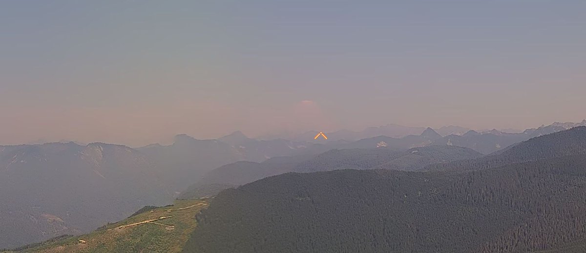
Caught a glimpse of the #WildcatFire off of SR-410 earlier this evening as the full moon rose behind Tahtlum Peak #wawx
Sobering view from the Crystal Mountain summit webcam at 7:10 PM Tuesday, as the #WildcatFire explodes with a pyrocumulus cloud and has now grown to 2,200 acres, an increase of 1,000 acres since Monday. #wawx
Something went wrong.
Something went wrong.
United States Trends
- 1. Good Friday N/A
- 2. Ohtani N/A
- 3. #HERALoverWithLinglingKwong N/A
- 4. RED FRIDAY N/A
- 5. #OrmKornxCentralChidlom N/A
- 6. #FridayVibes N/A
- 7. #hololivefesEXPO26_DAY1 N/A
- 8. Etherean N/A
- 9. Maradona N/A
- 10. John Carlson N/A
- 11. Happy Friyay N/A
- 12. #OnlyFriendsDreamOnEP2 N/A
- 13. LINGLING HERA CUSHION N/A
- 14. Wordle 1,721 X N/A
- 15. Messi N/A
- 16. Finally Friday N/A
- 17. Gerald N/A
- 18. Ghana N/A
- 19. harry styles N/A
- 20. Rosen N/A