#koco5 search results

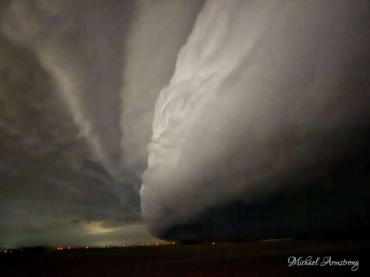
Terrible tornadoes tonight in northern OK. This was just west of Braman just after 7 pm. Now the south side of Enid and Vance Air Force Base has been hit by strong tornado. Please be praying for those impacted and those responding. #koco5 @koconews #okwx

166 crash at the Chandler exit on the Turner Turnpike. I counted approx 15 vehicles involved including at least 5 tractor-trailers. WB still being diverted into Chandler at 3 pm. #okwx #koco5 https://t.co/8GO2xLkprf" 2/2

Super Scoopers in action today! They were dropping water right over us as they were attacking the fire in Logan County along Indian Meridian. #okfire #koco5
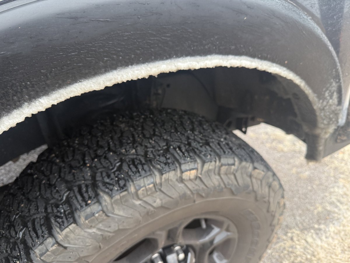
Veterans Memorial Park - Blanchard, OK. Snow increasing. Roads beginning to get covered. #okwx #koco5

State Senator Warren Hamilton interviewed with #KOCO5 about Oklahoma’s new law leading the nation to #protectchildren with the death penalty on the 1st offense for those convicted of rape of child. koco.com/article/oklaho…

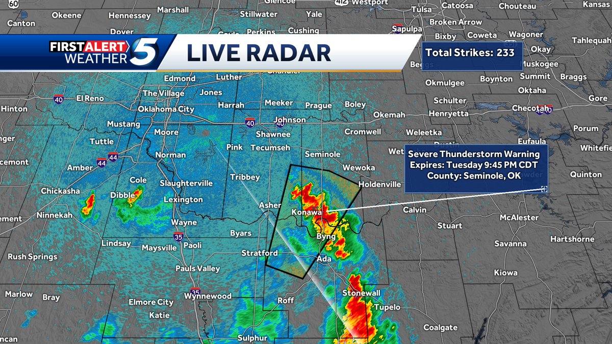
Tuesday 9:38 pm. Severe t-storm warning continues for parts of Seminole County until 9:45 pm for wind gusts up to 70 mph. #okwx #koco5
Monday 2:50 pm. Storms have been intensifying in Western OK over the past 20-30 min. 1 storm near Hammon is now warned for winds up to 60 mph, and quarter size hail until 3:30 pm. Storms are nearly stationary. #okwx #koco5
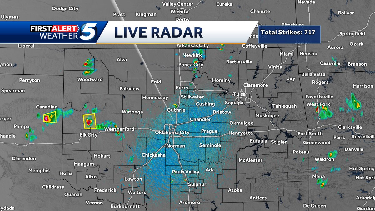
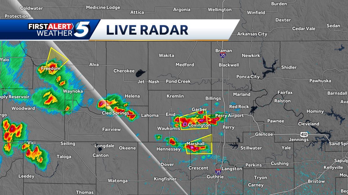
5:35 pm update. Severe storms located near Freedom, Marshall, and just southeast of Enid. Quarters and winds to 60 mph possible. Moving east and northeast at about 20 mph. No storms moving into the OKC Metro over at least the next 1/2 hour. #okwx #koco5
So many fires. Multiple structures have burned sw of Stillwater, OK. Between Range Rd and Country Club. #koco5 #okwx

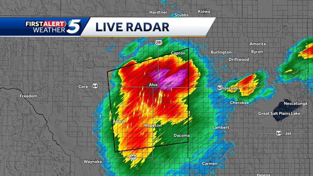
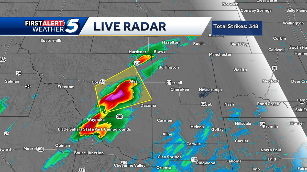
9:15 pm Update. Severe thunderstorm continues over Alva with the possibility of wind gusts to 60 mph and hail to the size of half dollars. The storm is moving northeast at 15 mph. #okwx #koco5
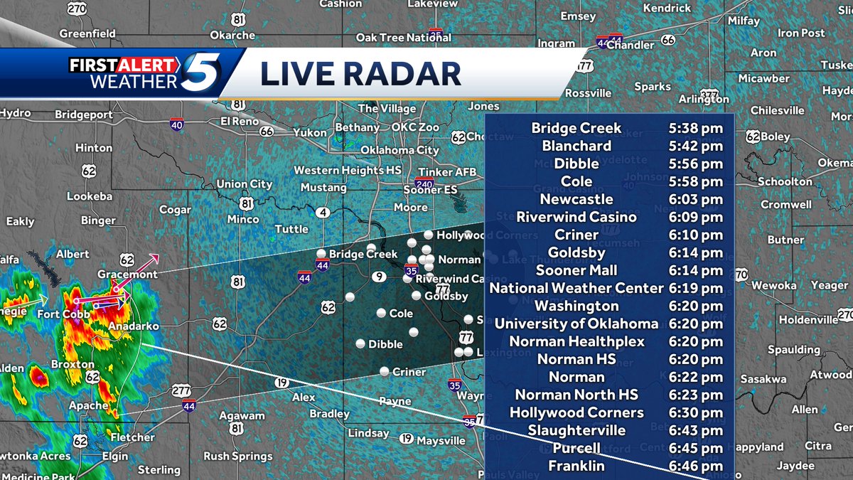
Saturday 4:10 pm. Tracking storms moving toward the OU game in Norman. They are not severe at this time, but they do have cloud-to-ground lightning and heavy rain. ETA is 6:15 to 6:20 pm in Norman if they hold together. #okwx #koco5
Wow. What a powerful storm that moved through Northern Oklahoma tonight with numerous tornado warnings and 70-80 mph winds. #okwx #koco5 @KOCOdamonlane @koconews
5:39 pm Wednesday. A storm in NW Oklahoma has intensified to severe levels with wind gusts to 60 mph possible. This storm is moving ne at 10 mph toward Alva. Another strong storm is located near Waynoka, but is not severe warned at this time. #okwx #koco5

Something went wrong.
Something went wrong.
United States Trends
- 1. Lemon N/A
- 2. #NFLDraft N/A
- 3. Jaden McDaniels N/A
- 4. Bain N/A
- 5. Ty Simpson N/A
- 6. Knicks N/A
- 7. Rams N/A
- 8. Jets N/A
- 9. Caleb Downs N/A
- 10. Steelers N/A
- 11. Nuggets N/A
- 12. Beane N/A
- 13. Stafford N/A
- 14. Eagles N/A
- 15. #wojakcto N/A
- 16. McVay N/A
- 17. Cowboys N/A
- 18. Brunson N/A
- 19. Reese N/A
- 20. Enid N/A