#spatialmodel 搜尋結果
All the magic is #spatialModel, we continue to show case the charm of Spatial Modleler @HexGeospatial #HxGNLocal

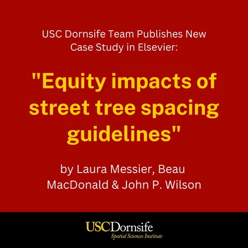
When it comes to tree spacing, there's more than meets the eye. 🌳 @USCDornsife SSI's Laura Messier, Beau MacDonald & John P. Wilson used a #spatialmodel to compare tree capacity in a low- and high-income LA neighborhood in this #casestudy: sciencedirect.com/science/articl…
RT Building a Spatial Model to Classify Global Urbanity Levels dlvr.it/S1w41x #urbanity #spatialmodel #spatialanalysis #urbanclassification

New #spatialmodel explores the effect of reduced trade costs on resource allocation, agricultural productivity and #structuralchange after bridge construction over the #JamunaRiver connecting a poorer region to a more developed region in #Bangladesh. bit.ly/2Nr3TLt

New #spatialmodel explores the effect of reduced trade costs on resource allocation, agricultural productivity and #structuralchange after bridge construction over the #JamunaRiver connecting a poorer region to a more developed region in #Bangladesh. bit.ly/2Nr3TLt

How many samples are needed to prepare for a robust #spatialmodel? Join the first 2022 #VECMAP webinar with MOOD partner @AviaGIS on Fri 25.2 at 12 PM CET to discuss the importance of this step! Info®istration: bit.ly/3BaThKE #riskmapping @GuyHendrickx3

Tomorrow: How many samples are needed to prepare for a robust #spatialmodel? Join the first 2022 #VECMAP webinar with MOOD partner @AviaGIS on Fri 25.2 at 12 PM CET to discuss the importance of this step! Info®istration: bit.ly/3BaThKE #riskmapping @GuyHendrickx3

Spatial #DataScience involves a skillset ranging from the visualization of data on a map to modeling spatially correlated errors. Thinking spatially can help you to build powerful models that outperform the typical data science tools. #SpatialModel hubs.ly/H0jZYMt0
This research is about "Spatial Model of Deforestation in Jambi Province for The Periode 1990–2011" More info: journal.ipb.ac.id/index.php/jmht… Thank you for your research: Putu Ananta Wijaya, M. Buce Saleh, Tatang Tiryana #deforestation #clustering #spatialmodel #typologies #landsat

Zhu, Zheng; A Unified Exposure Prediction Approach for... #Spatialmodel #airpollution rave.ohiolink.edu/etdc/view?acc_…
Paulien Hogeweg, et al, #Evolutionary Conflict Leads to Innovation: Symmetry Breaking #SpatialModel mdpi.com/2075-1729/7/4/… @UtrechtUni
See how our #DataScience team designed a #SpatialModel which is able to classify urbanity levels globally & with high granularity, visualized using our #BigQuery Tiler. hubs.ly/H0Sxynr0
Spatial #DataScience involves a skillset ranging from the visualization of data on a map to modelling spatially correlated errors. Thinking spatially can help you to build powerful models that outperform the typical data science tools. #SpatialModel hubs.ly/H0kl3qn0
Hi all, Please, check out our new article combining different methods to discover and map subtidal seagrass meadows onlinelibrary.wiley.com/doi/abs/10.100… #seagrass #mapping #Spatialmodel #Ireland @RyanInstitute @BPSNUIGalway
ve ne siete accorti? il lato sinistro del @pdnetwork ha più simpatia per il @Mov5Stelle che il suo lato destro-renziano. #SpatialModel
Learn how to extend #ERDASIMAGINE #SpatialModel outside of the Box. Use the CommandLine operator bit.ly/modelcommands
Looking for an easy way to build your #SpatialModel library? Look no further: hexgeo.co/spatialrecipes
When it comes to tree spacing, there's more than meets the eye. 🌳 @USCDornsife SSI's Laura Messier, Beau MacDonald & John P. Wilson used a #spatialmodel to compare tree capacity in a low- and high-income LA neighborhood in this #casestudy: sciencedirect.com/science/articl…

Tomorrow: How many samples are needed to prepare for a robust #spatialmodel? Join the first 2022 #VECMAP webinar with MOOD partner @AviaGIS on Fri 25.2 at 12 PM CET to discuss the importance of this step! Info®istration: bit.ly/3BaThKE #riskmapping @GuyHendrickx3

How many samples are needed to prepare for a robust #spatialmodel? Join the first 2022 #VECMAP webinar with MOOD partner @AviaGIS on Fri 25.2 at 12 PM CET to discuss the importance of this step! Info®istration: bit.ly/3BaThKE #riskmapping @GuyHendrickx3

See how our #DataScience team designed a #SpatialModel which is able to classify urbanity levels globally & with high granularity, visualized using our #BigQuery Tiler. hubs.ly/H0Sxynr0
RT Building a Spatial Model to Classify Global Urbanity Levels dlvr.it/S1w41x #urbanity #spatialmodel #spatialanalysis #urbanclassification

(2/3) We combine multiple @CopernicusEU data in a #spatialmodel, monthly environmental #suitability maps for #transhumance in the border region between #Chad and the #CentralAfricanRepublic
This research is about "Spatial Model of Deforestation in Jambi Province for The Periode 1990–2011" More info: journal.ipb.ac.id/index.php/jmht… Thank you for your research: Putu Ananta Wijaya, M. Buce Saleh, Tatang Tiryana #deforestation #clustering #spatialmodel #typologies #landsat

All the magic is #spatialModel, we continue to show case the charm of Spatial Modleler @HexGeospatial #HxGNLocal

When it comes to tree spacing, there's more than meets the eye. 🌳 @USCDornsife SSI's Laura Messier, Beau MacDonald & John P. Wilson used a #spatialmodel to compare tree capacity in a low- and high-income LA neighborhood in this #casestudy: sciencedirect.com/science/articl…

New #spatialmodel explores the effect of reduced trade costs on resource allocation, agricultural productivity and #structuralchange after bridge construction over the #JamunaRiver connecting a poorer region to a more developed region in #Bangladesh. bit.ly/2Nr3TLt

How many samples are needed to prepare for a robust #spatialmodel? Join the first 2022 #VECMAP webinar with MOOD partner @AviaGIS on Fri 25.2 at 12 PM CET to discuss the importance of this step! Info®istration: bit.ly/3BaThKE #riskmapping @GuyHendrickx3

RT Building a Spatial Model to Classify Global Urbanity Levels dlvr.it/S1w41x #urbanity #spatialmodel #spatialanalysis #urbanclassification

New #spatialmodel explores the effect of reduced trade costs on resource allocation, agricultural productivity and #structuralchange after bridge construction over the #JamunaRiver connecting a poorer region to a more developed region in #Bangladesh. bit.ly/2Nr3TLt

Tomorrow: How many samples are needed to prepare for a robust #spatialmodel? Join the first 2022 #VECMAP webinar with MOOD partner @AviaGIS on Fri 25.2 at 12 PM CET to discuss the importance of this step! Info®istration: bit.ly/3BaThKE #riskmapping @GuyHendrickx3

This research is about "Spatial Model of Deforestation in Jambi Province for The Periode 1990–2011" More info: journal.ipb.ac.id/index.php/jmht… Thank you for your research: Putu Ananta Wijaya, M. Buce Saleh, Tatang Tiryana #deforestation #clustering #spatialmodel #typologies #landsat

Something went wrong.
Something went wrong.
United States Trends
- 1. Pat Spencer 2,061 posts
- 2. Jimmy Butler 2,302 posts
- 3. Podz 2,710 posts
- 4. Kerr 4,541 posts
- 5. Seth Curry 3,314 posts
- 6. Mark Pope 1,809 posts
- 7. Hield 1,343 posts
- 8. Derek Dixon 1,152 posts
- 9. #DubNation 1,307 posts
- 10. Carter Hart 3,590 posts
- 11. Brunson 7,233 posts
- 12. Connor Bedard 2,057 posts
- 13. Knicks 14.2K posts
- 14. Kentucky 29.4K posts
- 15. Jaylen Brown 8,439 posts
- 16. Caleb Wilson 1,078 posts
- 17. Notre Dame 38.3K posts
- 18. Celtics 16K posts
- 19. Van Epps 130K posts
- 20. Bama 24.6K posts


