#thunderstorms search results
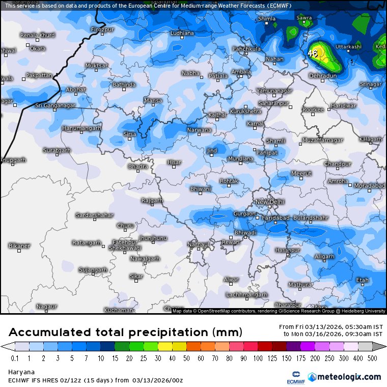
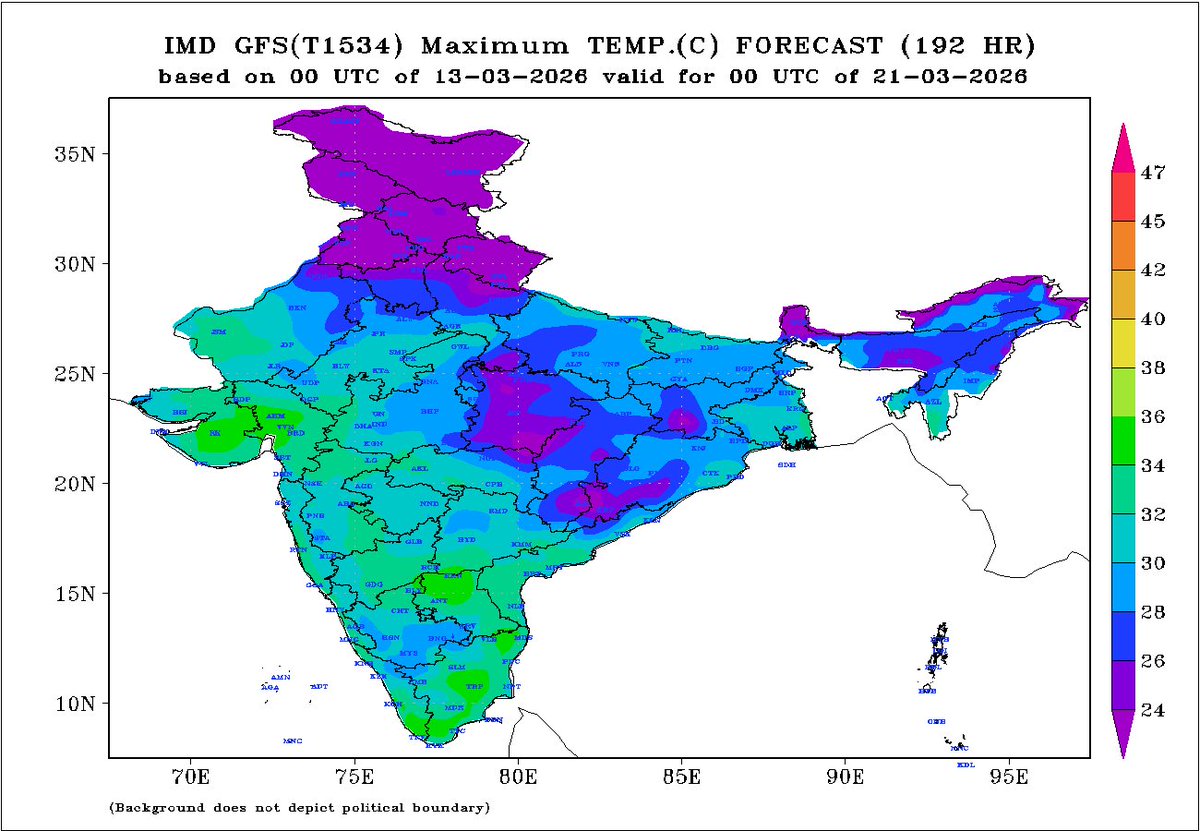
The wrath of march heat is about to end, Spring to make a strong comeback in 2nd half of March as an approaching western disturbance along with east #India wind discontinuity to trigger #rains, #thunderstorms and #hailstorms in #Punjab #Haryana #Delhi #UttarPradesh on Sunday,

⚡🔴Another spell is #developing over Pakistan it is expected to hit the valley this evening and will be slightly more intense than the previous one There is also a possibility of #thunderstorms, lightning, and hail


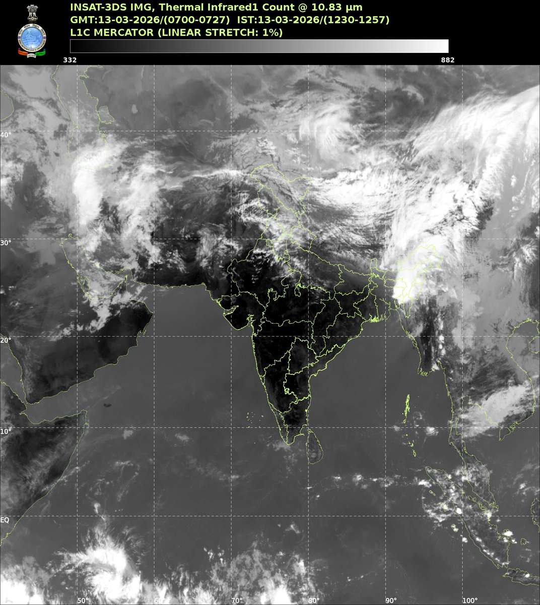
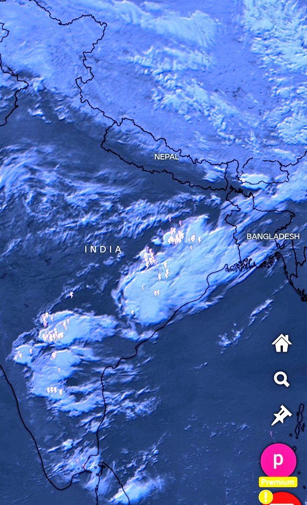
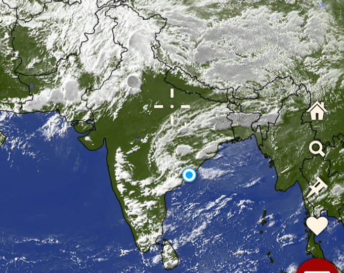
Wow! 🌟 Stunning chain of massive thunderstorms stretching from South India to Northeast India for the second day! Did you catch it? #Weather #Thunderstorms #India अद्भुत! 😍 दक्षिण भारत से लेकर पूर्वोत्तर भारत तक विशाल गरज के तूफानों की एक लंबी श्रृंखला देखना दूसरे दिन भी हैरान
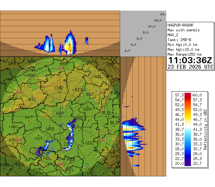
Nagpur Radar Max Reflectivity indicates Thunderstorms with Lightning activity is happening over South of Nagpur Districts, Chandarpur Districts and the system is approaching towards Bhandara and Gadchiroli districts of Vidharbha #NagpurWeather #Thunderstorms #LightningAlert


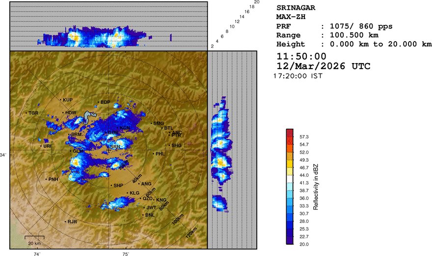
Heavy rain , #thunderstorms continue over parts of Northern Kashmir from last 3 days including Central Kashmir ⚡🌧️ South stays Dry except light rain in some areas

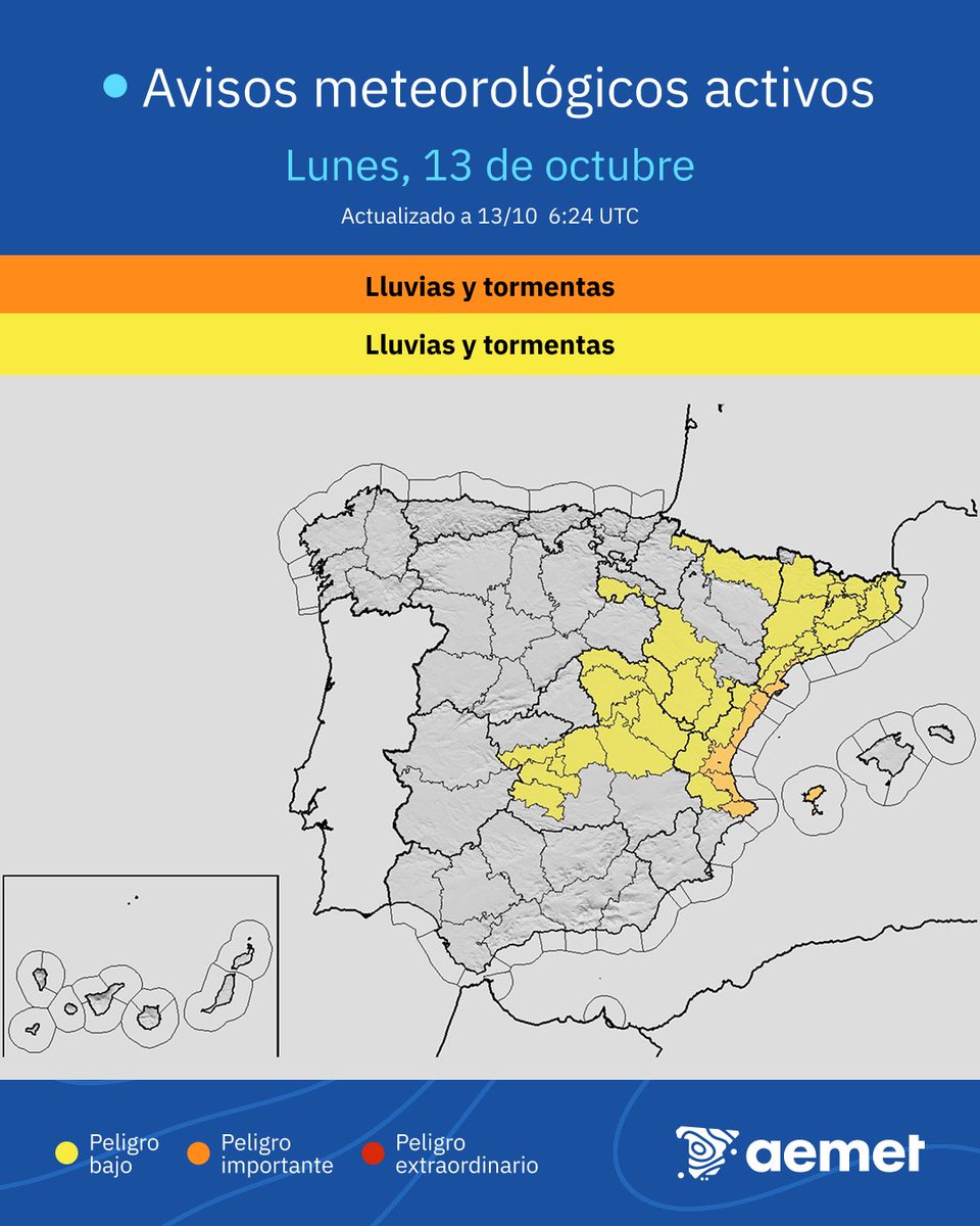
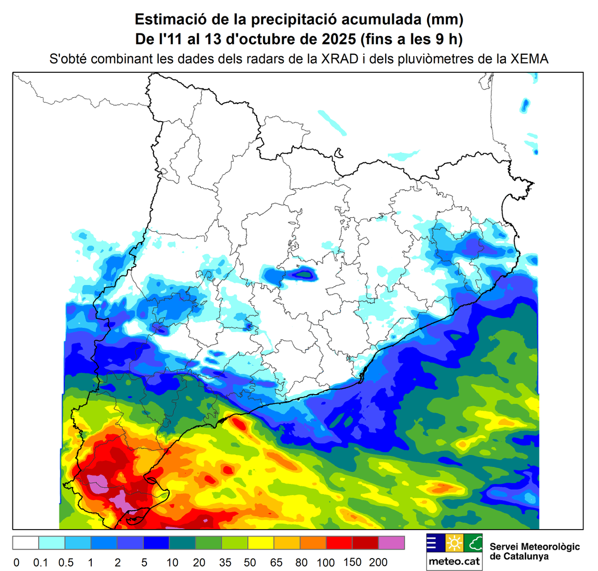
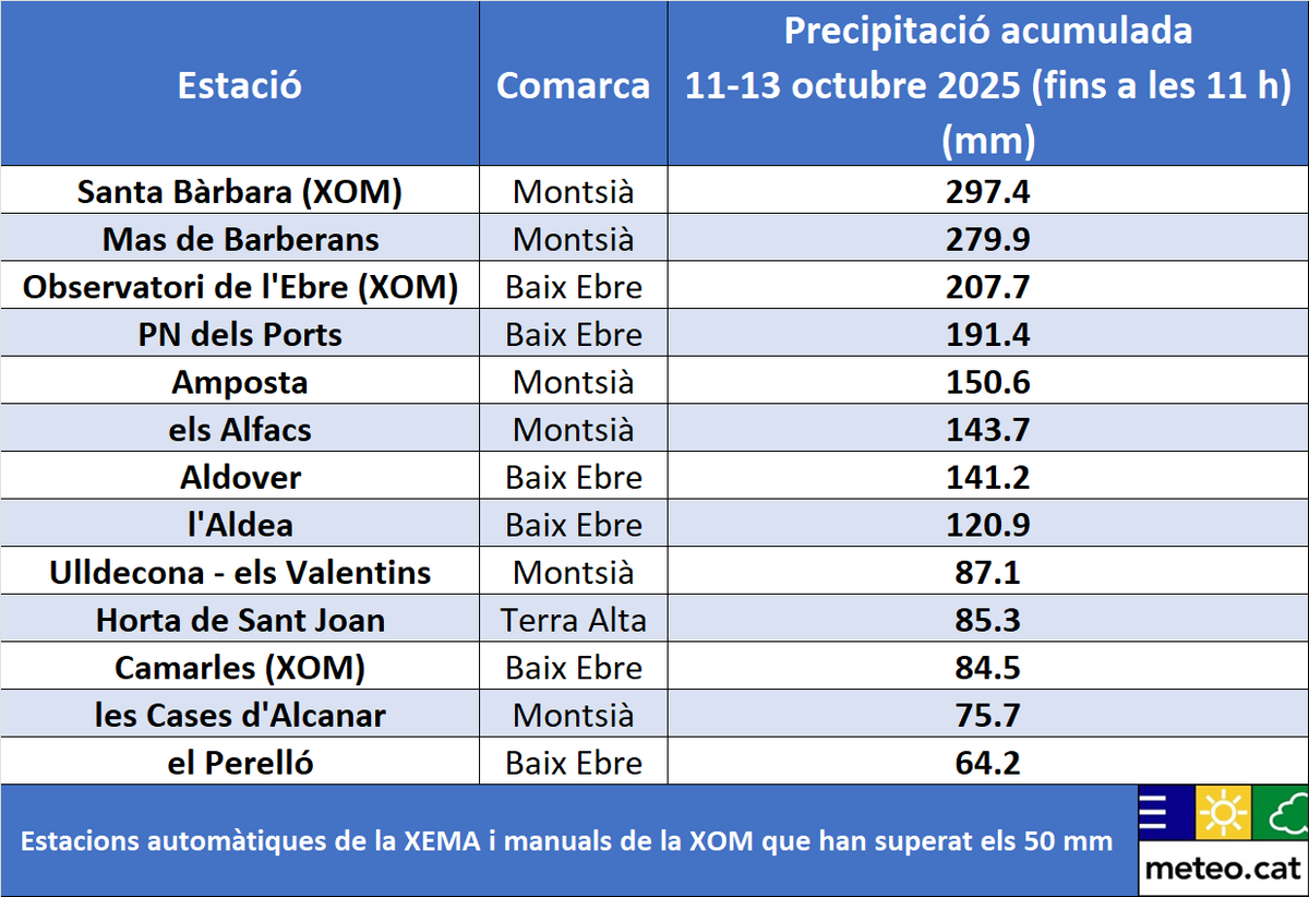
Nearly 300mm has fallen since the 11th October at Santa Bárbara in the far south of Catalonia just west of the River Ebro Delta. Further #thunderstorms erupting from the south this morning for this area and further south over Valencia area. Amber warning in force for 60mm/hr

Entre dissabte i dilluns al matí s'han recollit més de 200 mm de pluja a sectors del Baix Ebre i del Montsià, on algunes estacions @meteocat freguen els 300 mm 297 mm a Santa Bàrbara 280 mm a Mas de Barberans Els aiguats d'ahir diumenge van deixar quantitats localment superiors

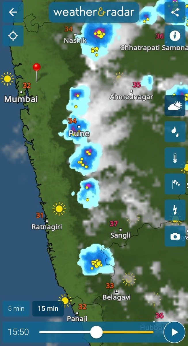
As expected, #Thunderstorms are popping up over interior leeward side at #Deccan #Maharashtra right along the #LWD convergence line. 🌩️ Meanwhile, massive #hailstorm reports are coming in from areas of western #Pune. ❄️⚡ 1st video from #Hinjawadi. VC: @vineet_mausam 2nd video


Massive #thunderstorms lashing parts of west / South #Chennai and suburbs with very slow moving storms leading to #heavyrains of 40-even 100mm at some places !!🌧️⛈️ #TNRains #APRains #ChennaiRains


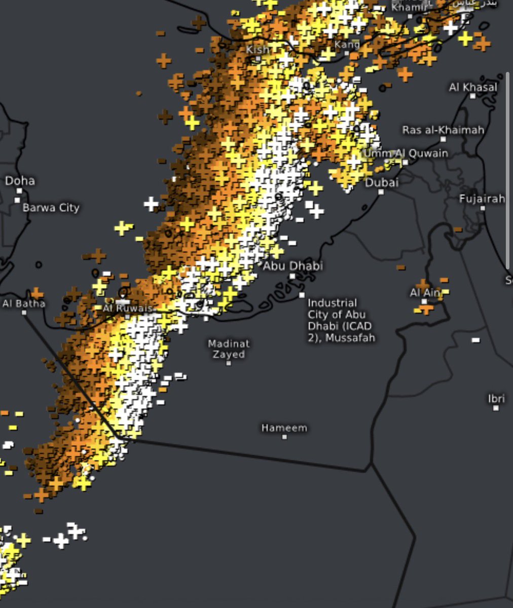
Severe #thunderstorms approaching #Dubai and #AbuDhabi now, nasty conditions coming up in the next few hours, lightning stretches the whole length of the UAE. ⛈️
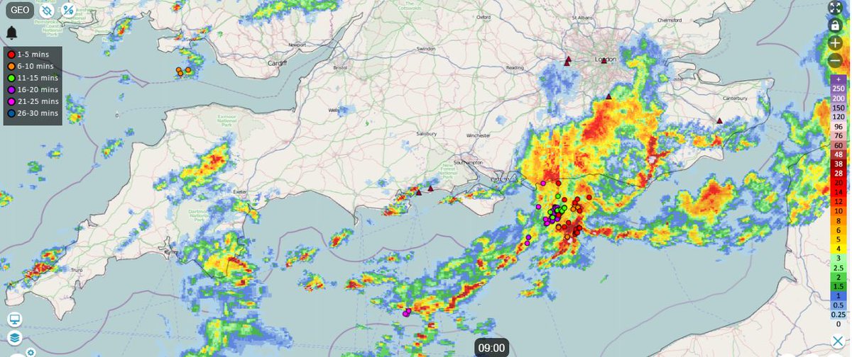
Seasonably warm SSTs (17-18C) through the English Channel and seas around SW England / S Wales beneath cold air aloft (-23C to -25C at 500 hPa) supporting some #thunderstorms near coastal areas this morning

🚨⚡️#Thunderstorms approaching #Auckland from the west. A zone from the City to the Airport is most in the path. FlightRadar shows planes banking after taking off to avoid the storms, like this Jetstar flight to Chch, which initially turned northwards, not southwards.


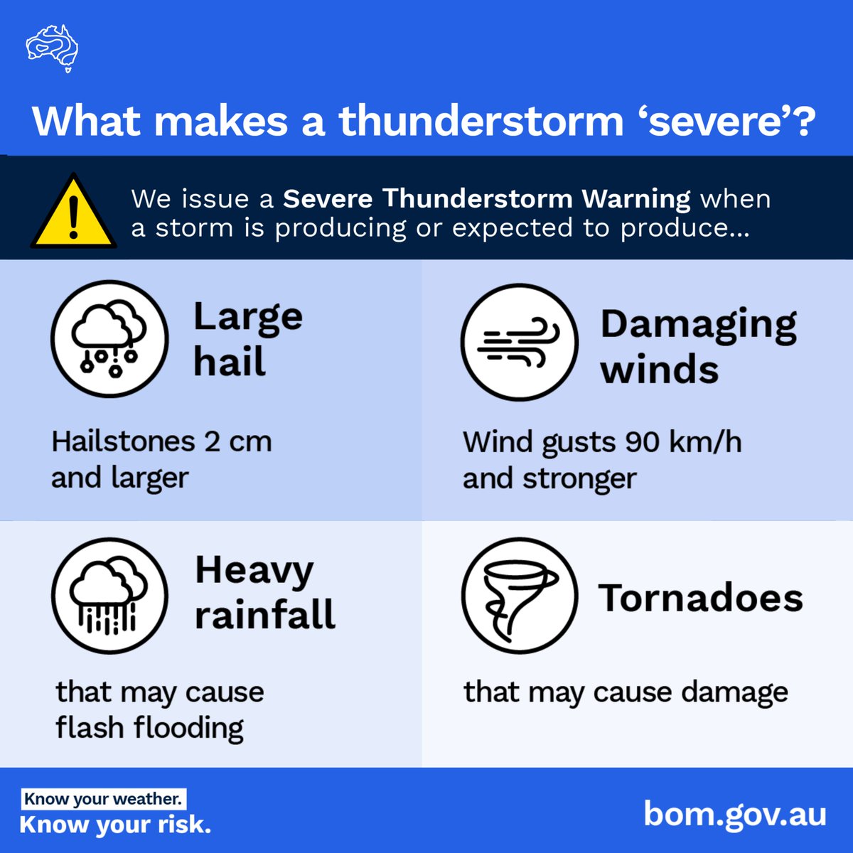
⚠️ Severe #thunderstorms possible for parts of #SouthAustralia and #Victoria today, then could develop across eastern #NewSouthWales and #ACT on Thursday. #Melbourne, #Canberra and #Sydney could all be impacted. Latest forecasts and warnings: bom.gov.au

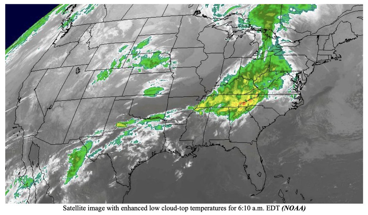
1/ Ag weather outlook from the @usda_oce, April 28: Later today, the threat of #severe #thunderstorms will shift into the mid-South. By mid-week, any lingering severe weather will stretch from the middle Atlantic States to the Gulf Coast. bit.ly/3Rn0a2F

భారతదేశంలోని 70% రాష్ట్రాలను తాకుతున్న ఉరుములతో కూడిన వర్షాలు. వడగాలుల తీవ్రత నుండి ఉపశమనం. -వాతావరణ శాఖ #imd #thunderstorms #UANow

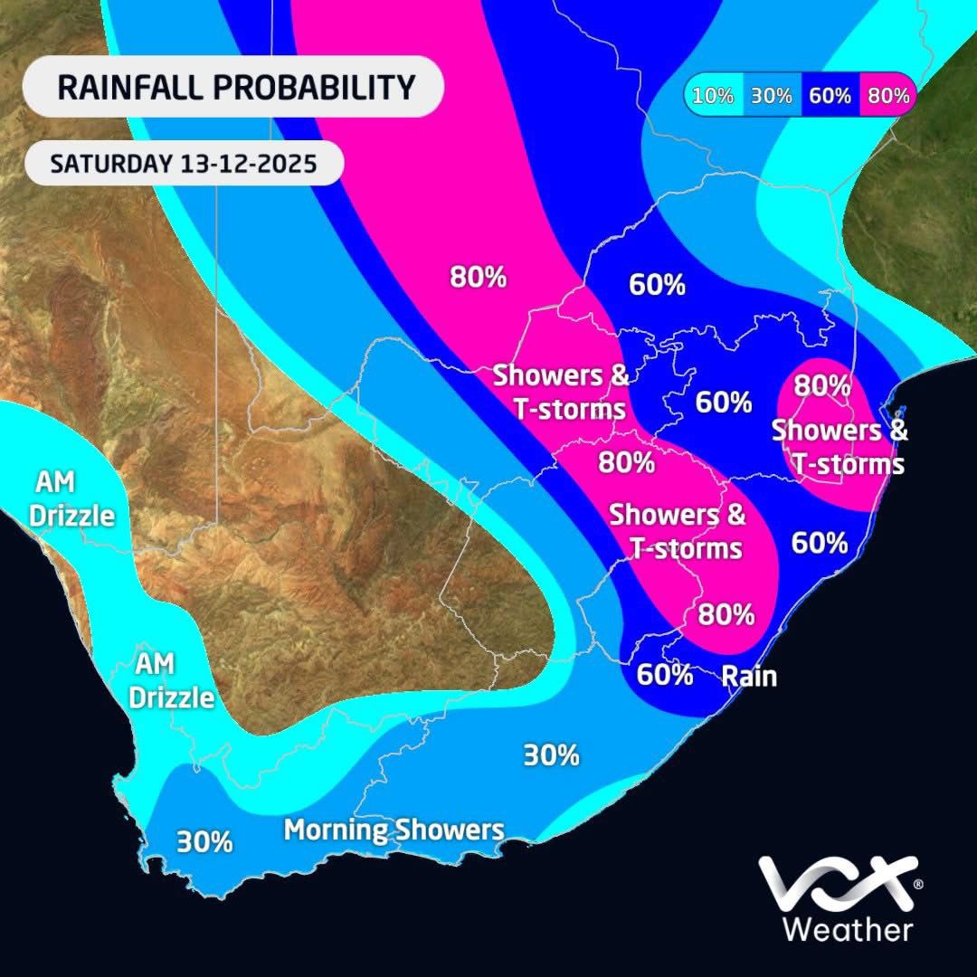
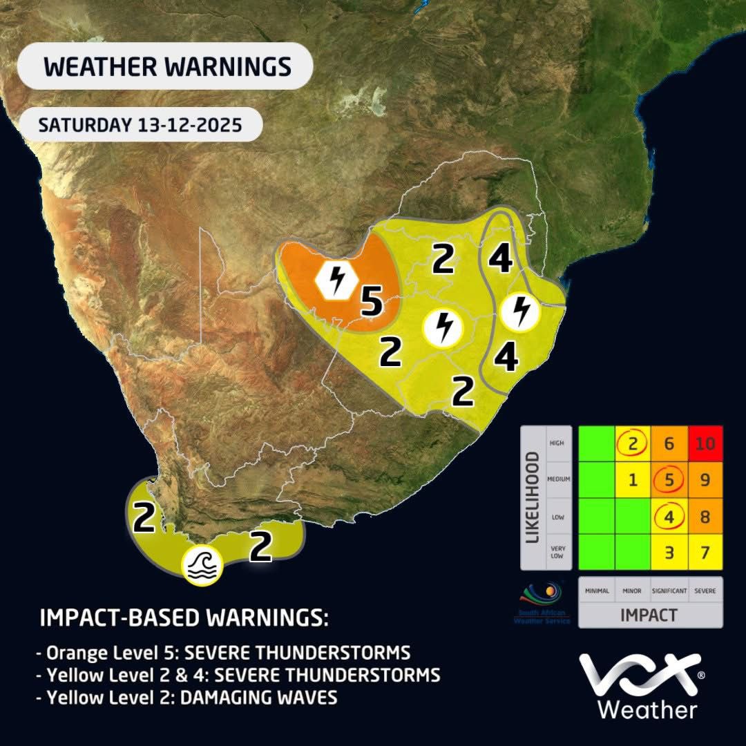
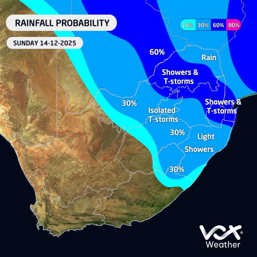
WEATHER MAPS and WARNINGS for this WEEKEND – 13 to 14 December 2025 ⚠️SAWS WARNINGS ⚠️ 🟠L5: STORMS in NW & parts of FS 🟡L2&4: STORMS in parts of FS, NW, GP, LP, MP & KZN 🟡L2: WAVES between Saldanha bay & Plett #VoxWeather #thunderstorms #flooding #heavyrain #weekend

Something went wrong.
Something went wrong.
United States Trends
- 1. OPEC N/A
- 2. Fauci N/A
- 3. Rob Thomson N/A
- 4. King Charles N/A
- 5. Don Mattingly N/A
- 6. #lovelygrey N/A
- 7. Marie Harf N/A
- 8. David Morens N/A
- 9. Kevin Long N/A
- 10. Petal N/A
- 11. Dombrowski N/A
- 12. Topper N/A
- 13. Brad Stevens N/A
- 14. Ariana N/A
- 15. Kid Rock N/A
- 16. The UAE N/A
- 17. Steel Wool N/A
- 18. Ted Lasso N/A
- 19. Tyran Stokes N/A
- 20. Laura Dern N/A