#wesh2storms search results

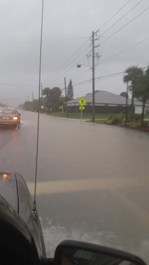
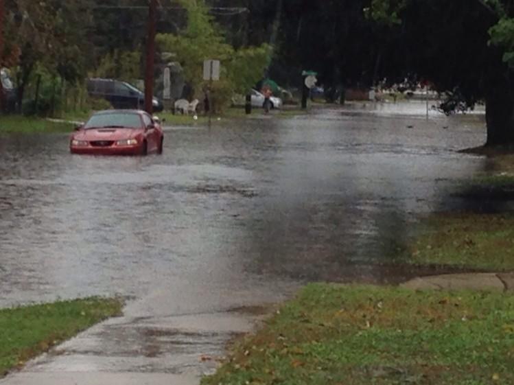
We're getting reports of flooding in #NewSmyrnaBeach. If you can take pics safely, tweet them to us #wesh2storms:
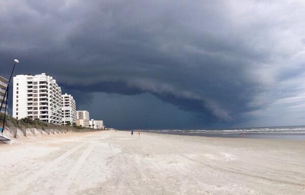
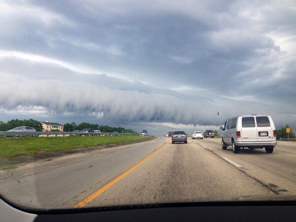
Picture: Strong storm in view this afternoon in Florida: RT @pattylauren57: #wesh2storms New Smyrna Beach

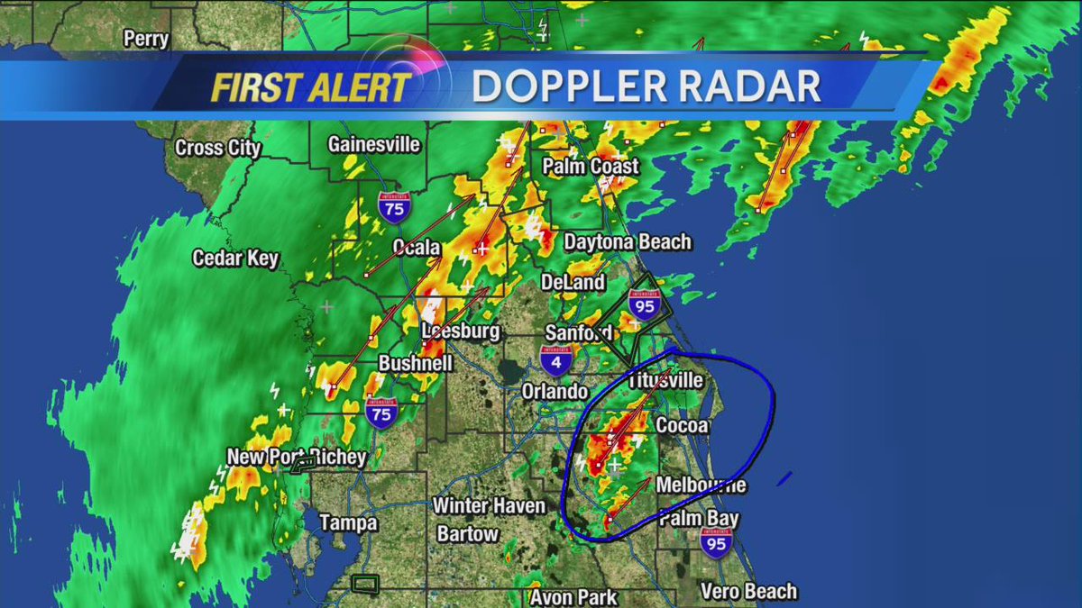
Worst of the weather moving out shortly #CocoaBeach, winds gusted to 41mph per report at pier! #wesh2storms

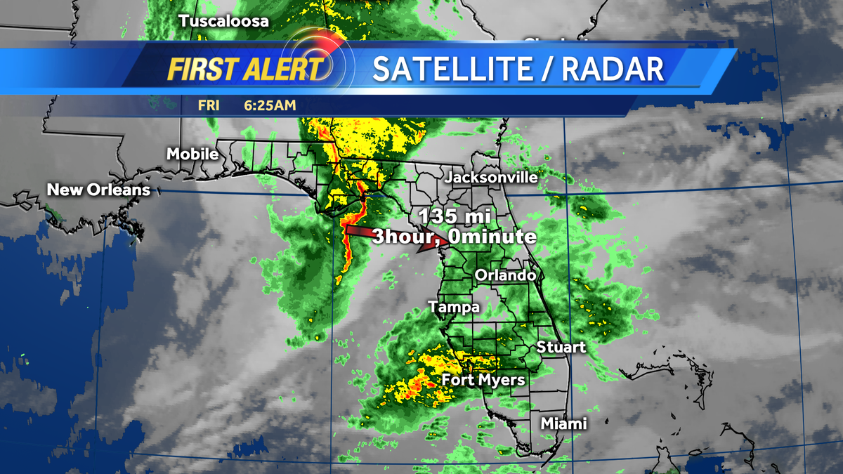
A line of storms in Marion Co is heading east at 45 mph. Gusty winds up to 50 mph possible. #cflwx #WESH2storms


RT @jasonbrewerwesh: Just found our first shower in Lake Co. - tracking rain chances on @wesh2sunrise! #wesh2storms

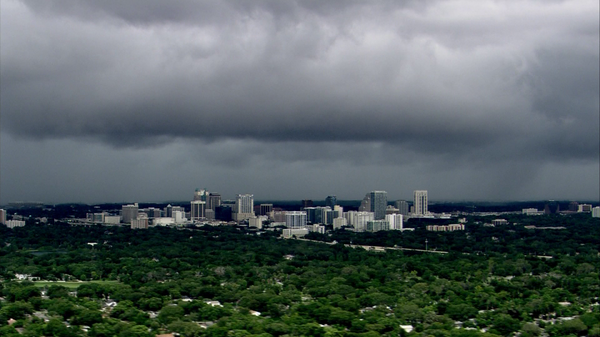
RT @Zoomjockey2: Central Florida afternoon. Looking toward Ocoee & Winter Garden. #wesh2storms #Lightning #Orlando


Send us your photos of the weather where you are. Use the hashtag #WESH2Storms
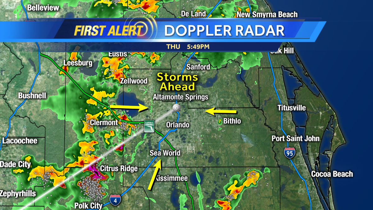
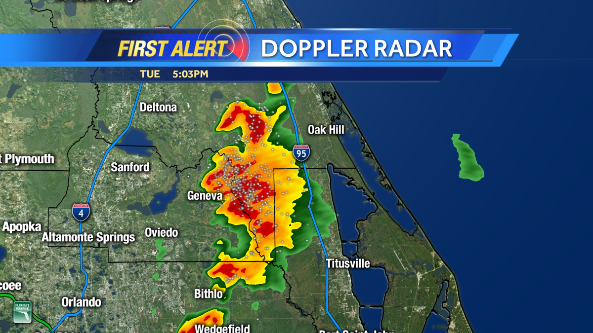
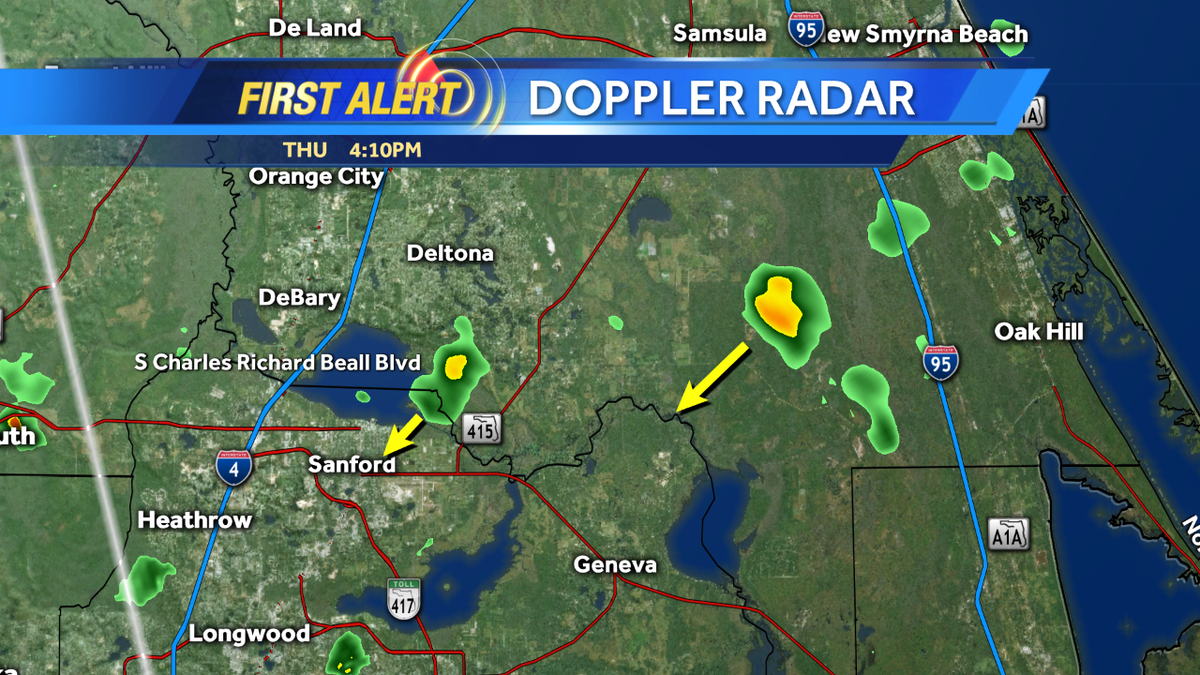
RT @jasonbrewerwesh: At 5 on @WESH - Watching strong storms near #Geneva. Radar tour coming. #WESH2Storms

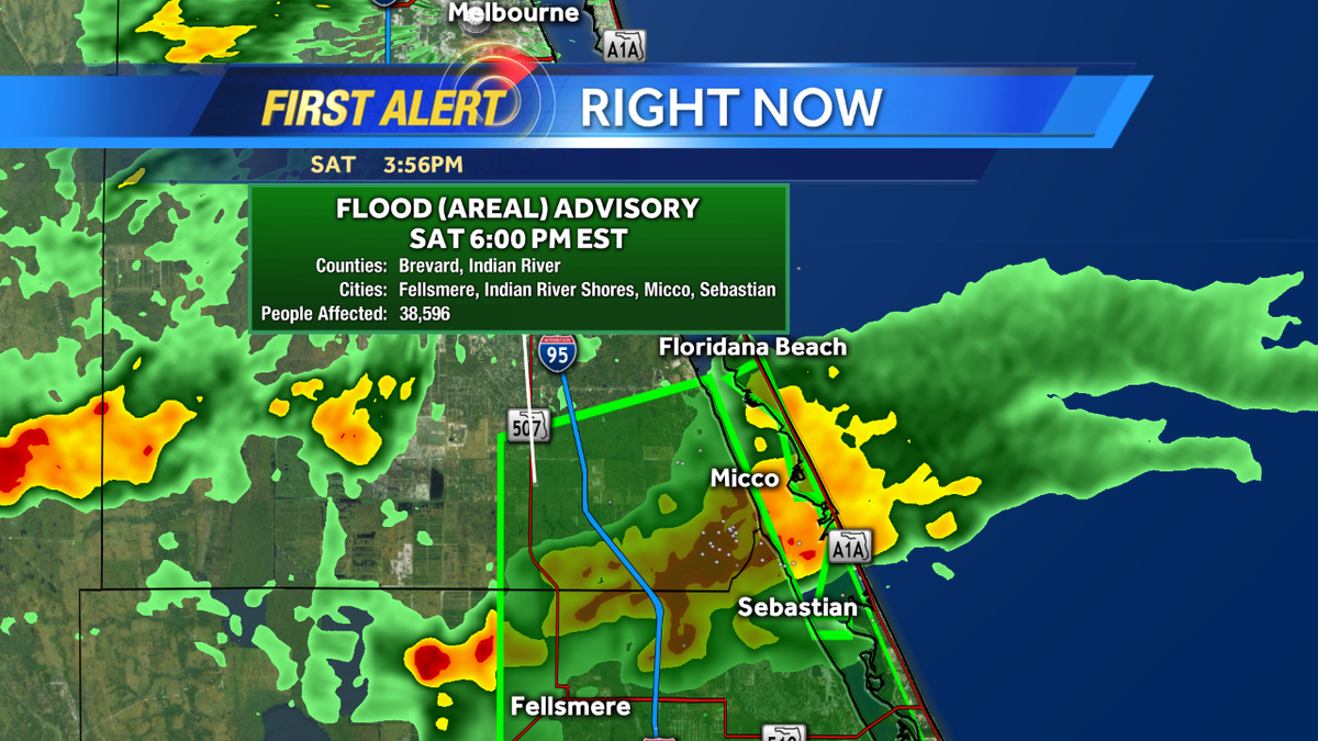
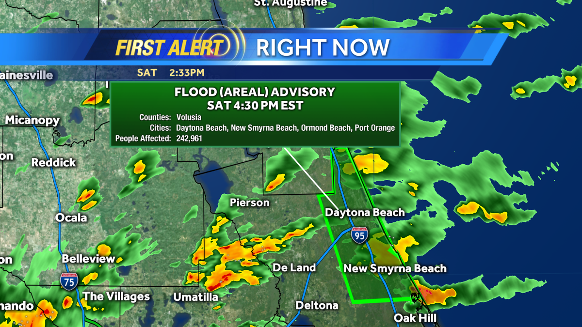
New Flood Advisory posted for southern Brevard County due to 2"-ish having fallen with more coming down #WESH2Storms
RT @EricBurrisWESH: Tracking showers this morning, so drive safely if you have early plans today... #WESH2Storms
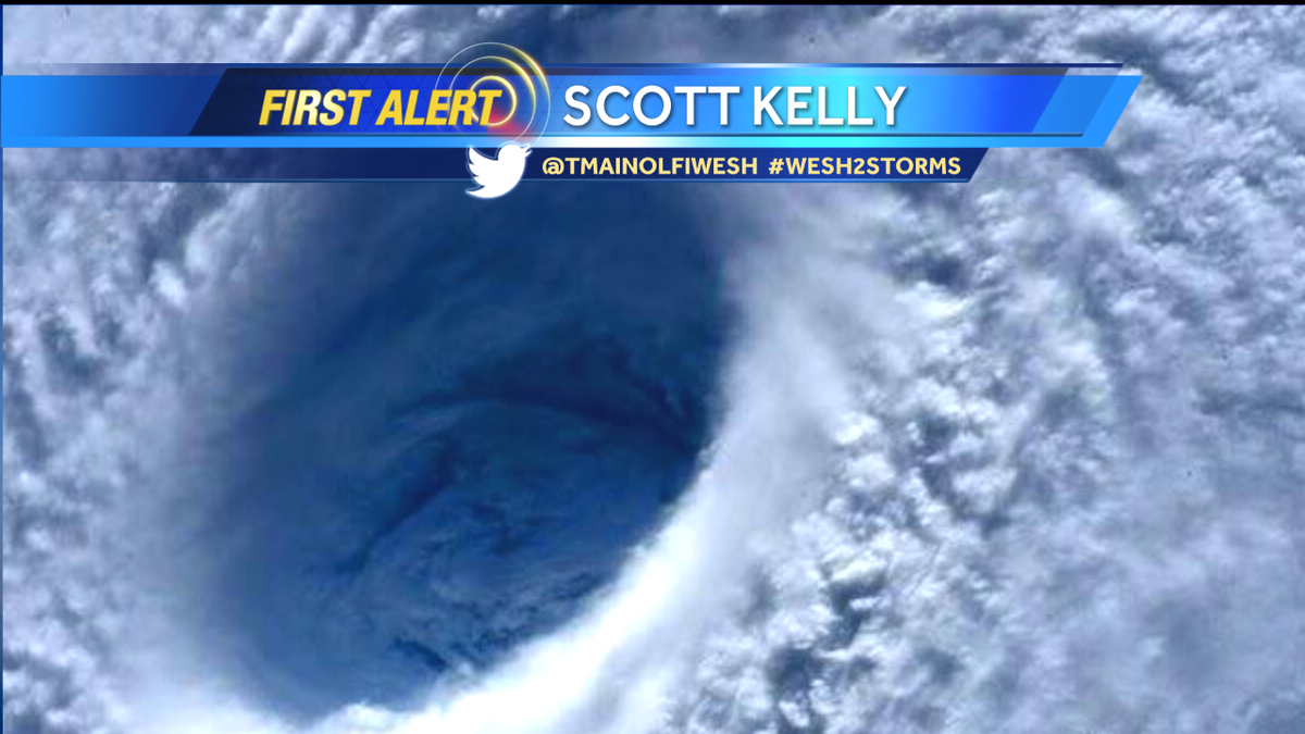
One of my favorite pictures of the day was from astronaut #ScottKelly of the #HurricanePatricia. #wesh2storms

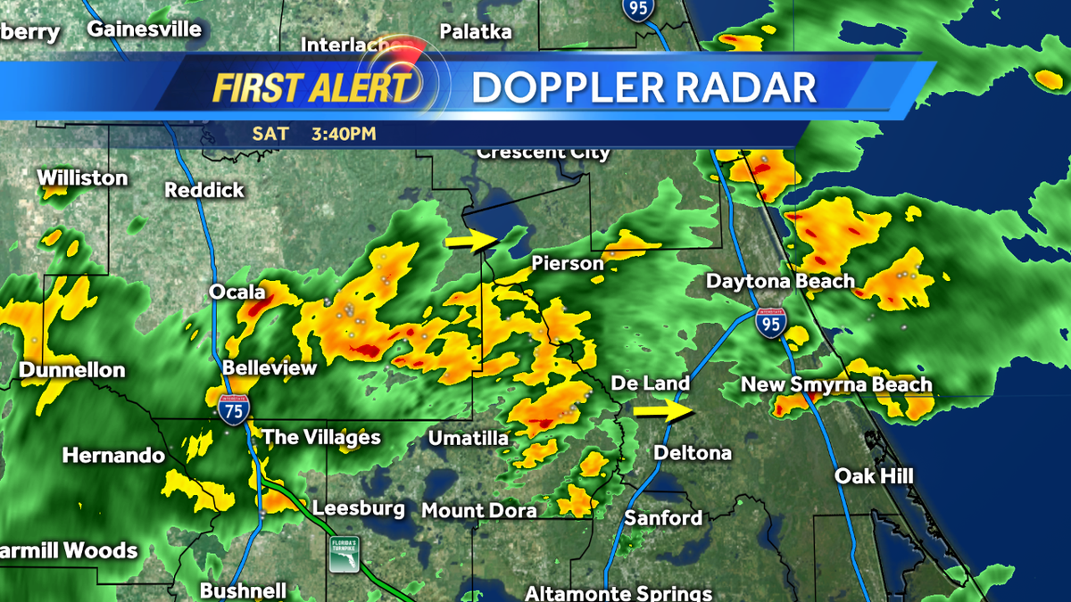
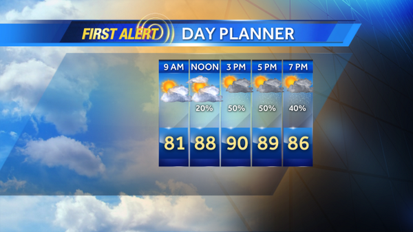
At 10&11 on @WESH - @TMainolfiWESH has your weekend forecast and details on rain chances!! #WESH2Storms ⚡️🌦 ☀️


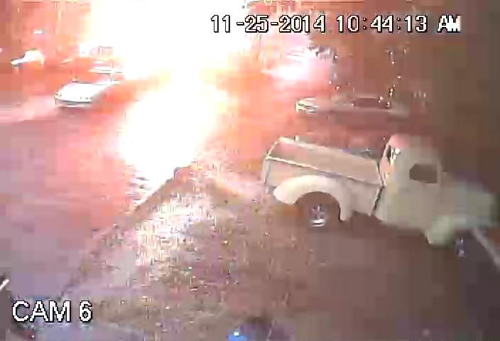
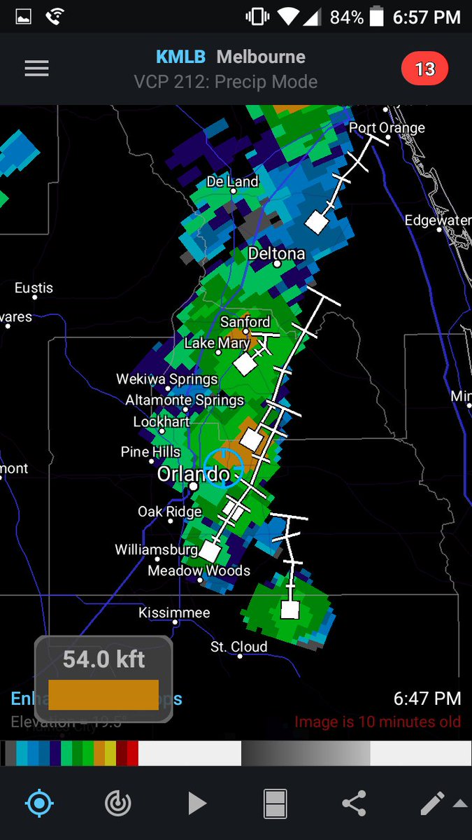
@BShieldsWFTV @TMainolfiWESH:storms still @ 54,000 ft even after collision 20+ min ago! #wesh2storms #stormalert9

UPDATE: No reports of significant damage anywhere in unincorporated Osceola County, officials say. #WESH2Storms

A line of storms in Marion Co is heading east at 45 mph. Gusty winds up to 50 mph possible. #cflwx #WESH2storms
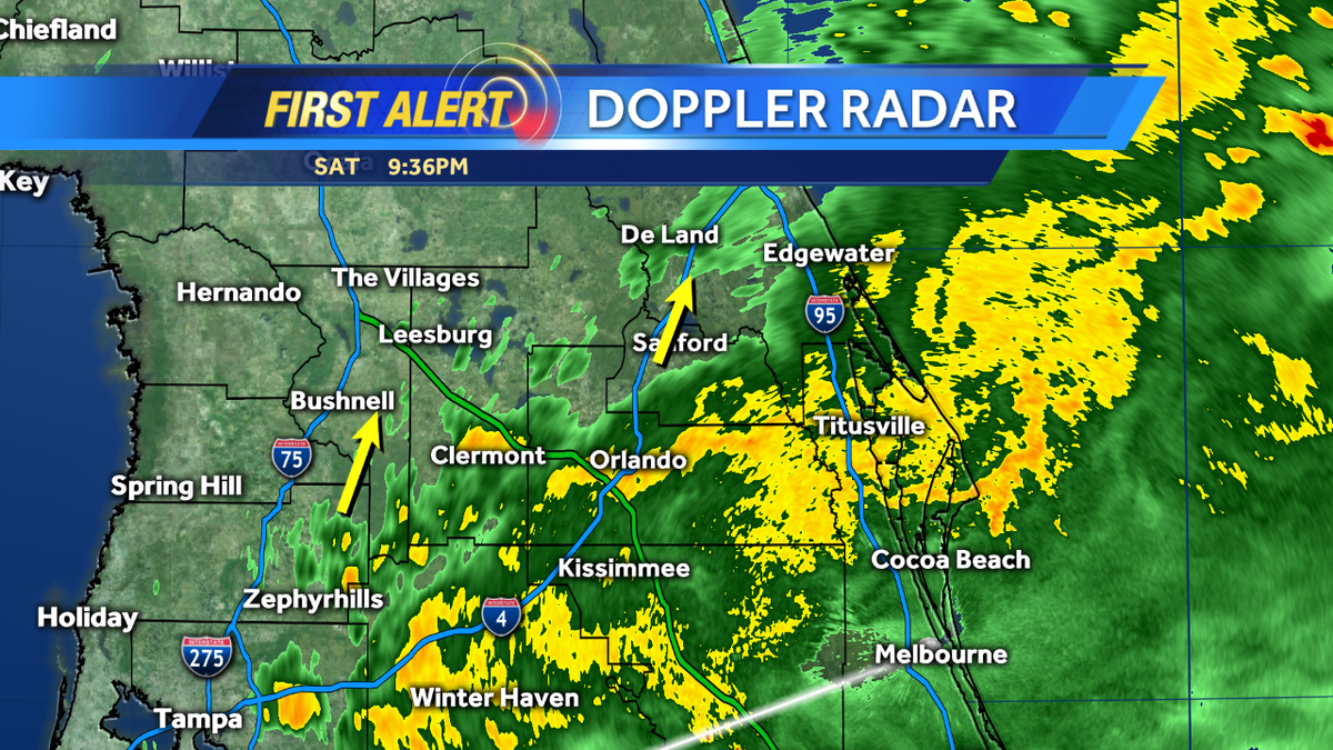
Line of storms pushing closer. Leading edge arrives in west Central Florida by late morning. #cflwx #WESH2storms
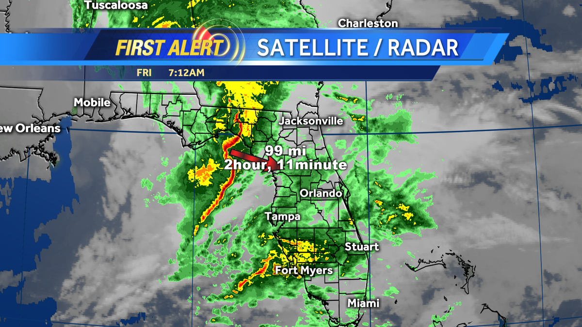
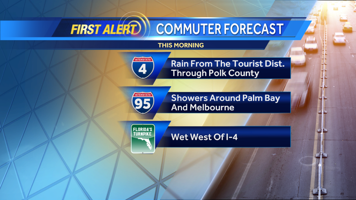
Light rain for AM commute but a strong line of storms will move into Central #FL by late AM. #cflwx #WESH2storms
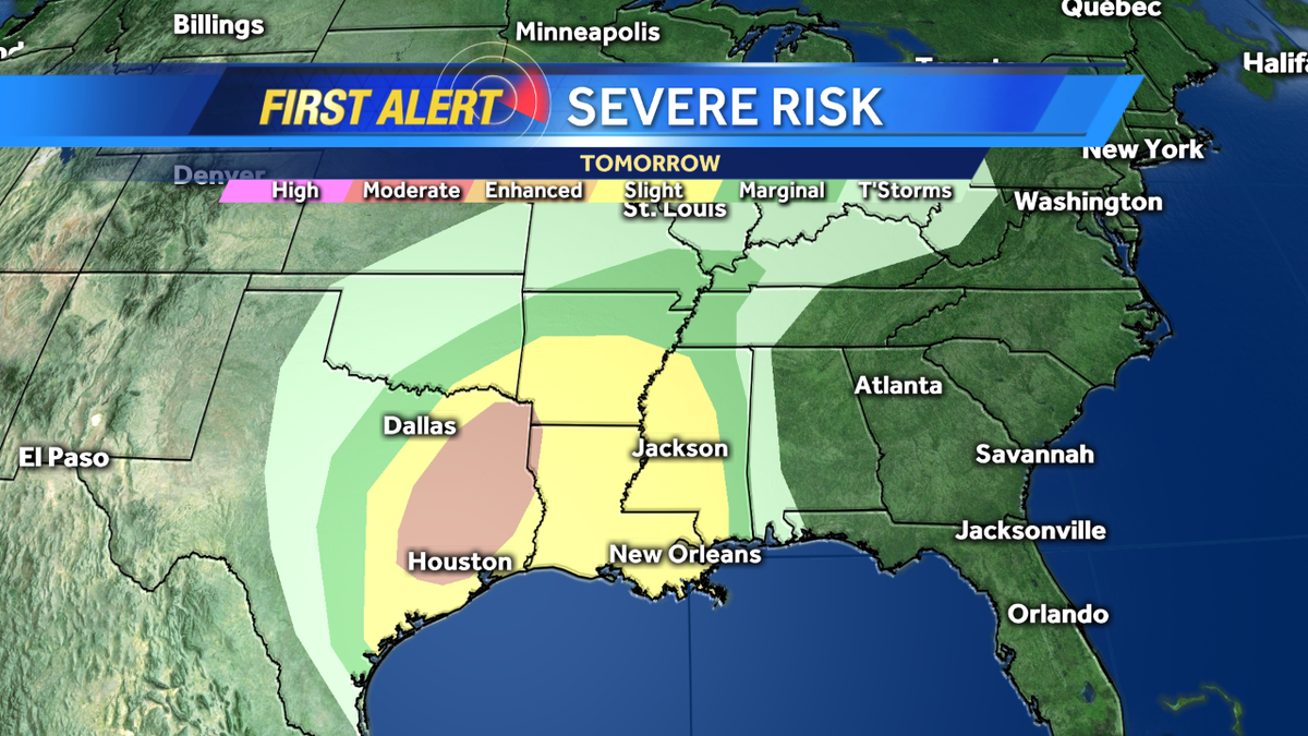
Sad to say once again severe weather will be a factor for much of the deep south from TX over to MS... #WESH2Storms
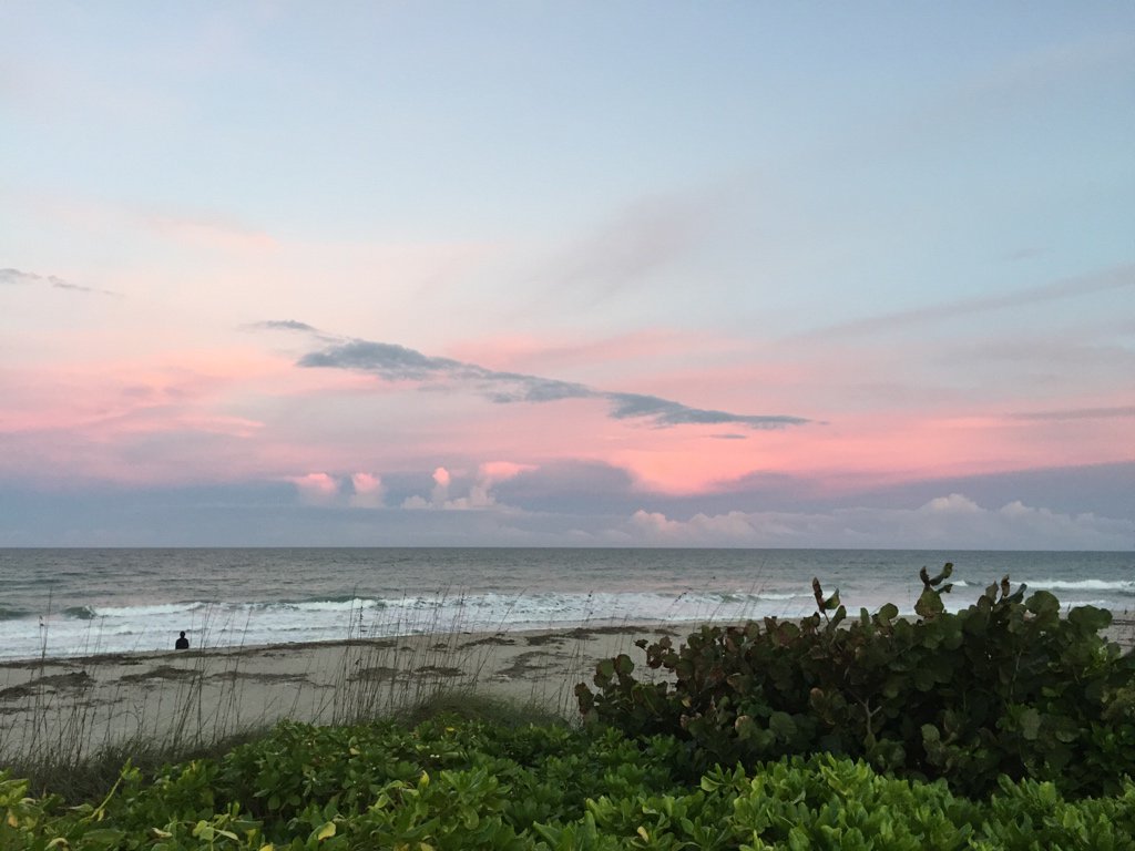
Fantastic sunset tonight in Indialantic #WESH2Storms @TMainolfiWESH @amysweezey @jasonbrewerwesh @EricBurrisWESH
Oh, the rain shield is lifting northward. Please drive safe if you have outdoor plans tonight... #WESH2Storms
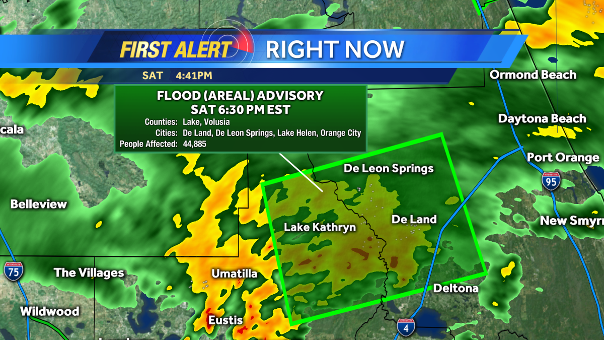
New Flood Advisory for Lake and Volusia for 2" already fallen and another 1-2" possible. Drive safe! #WESH2Storms
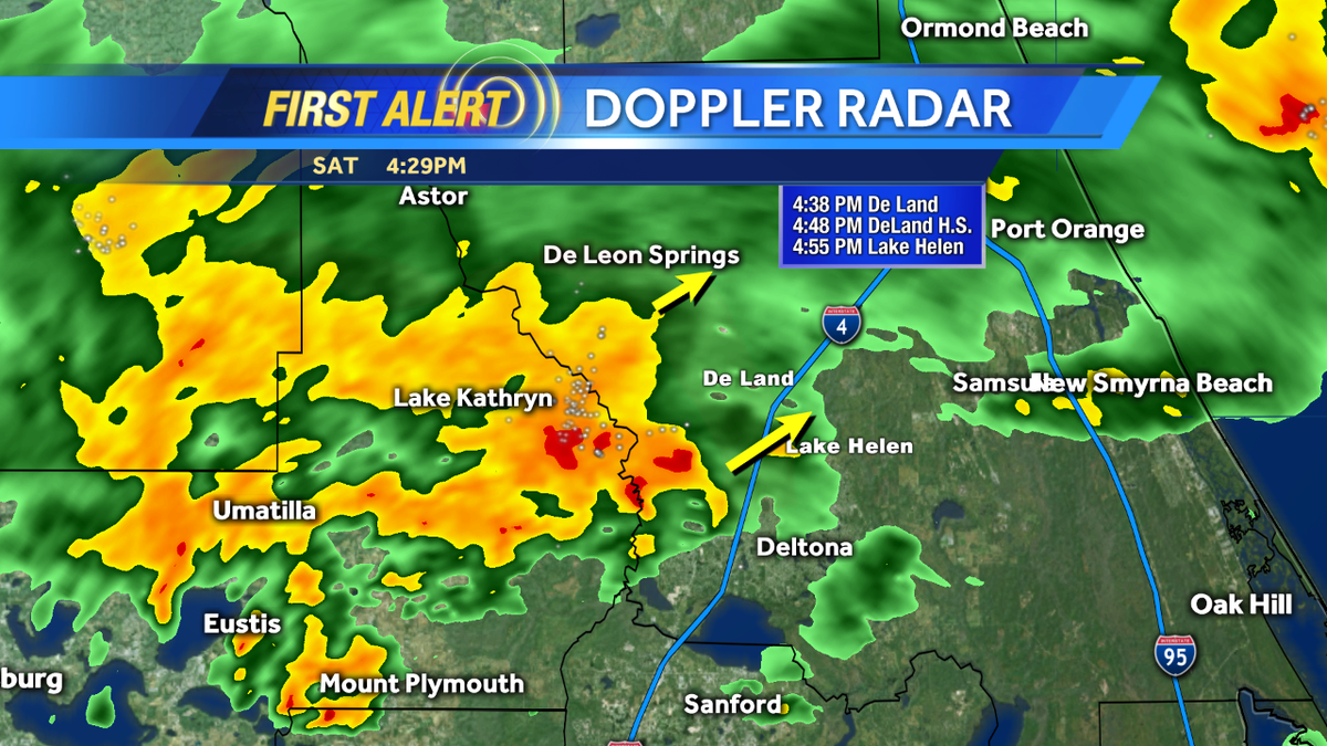
Heavier rain moving into Deland and Lake Helen. Here's a look at arrival times. SLOW MOVING #WESH2Storms
New Flood Advisory posted for southern Brevard County due to 2"-ish having fallen with more coming down #WESH2Storms
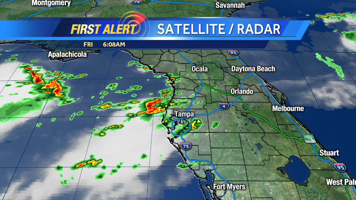
Still tracking decent downpours and even a few thunderstorms across our north coverage area. Drive safe #WESH2Storms
With more than 4" of rain having fallen at Daytona Int'l and more falling, NWS issued a Flood Advisory #WESH2Storms
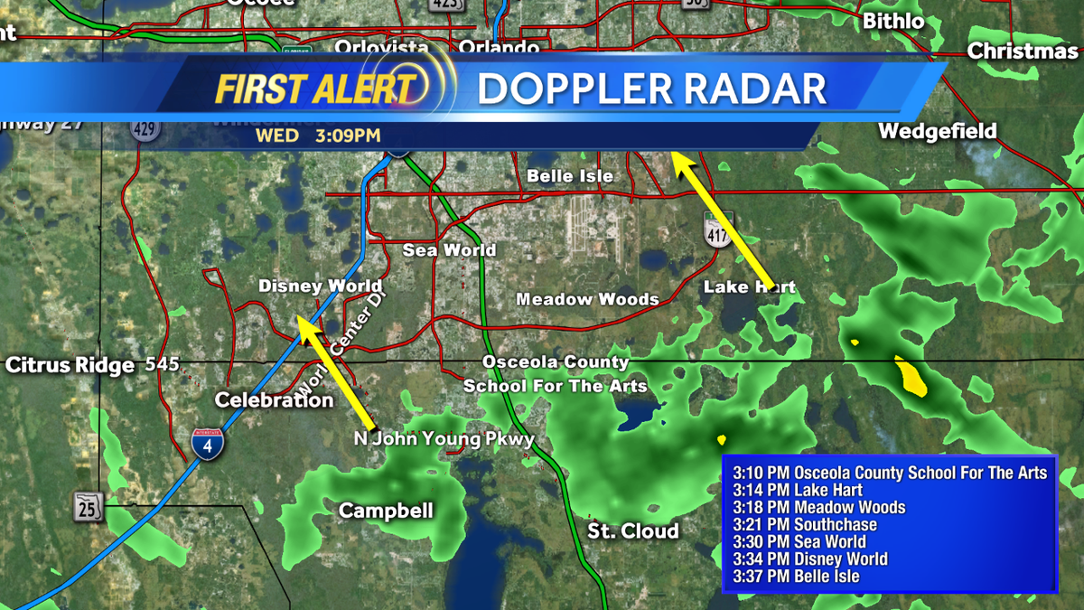
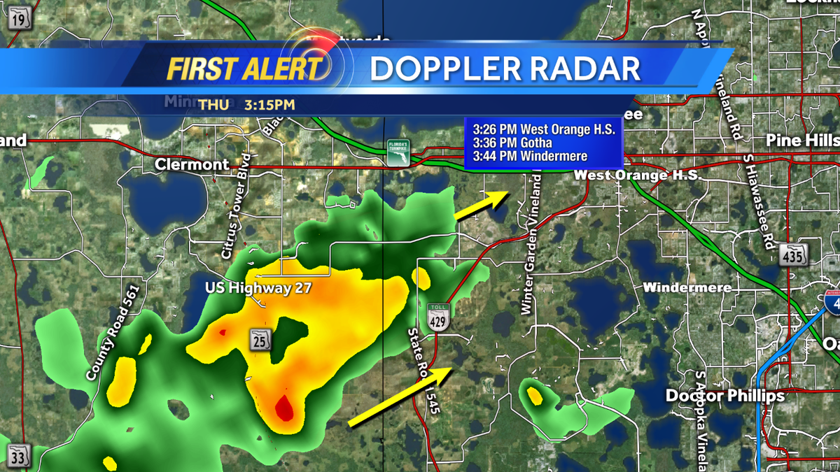
Areas near Gotha and Windermere should get ready for arriving rains! Here's a look at arrival times #WESH2Storms
Picture: Strong storm in view this afternoon in Florida: RT @pattylauren57: #wesh2storms New Smyrna Beach
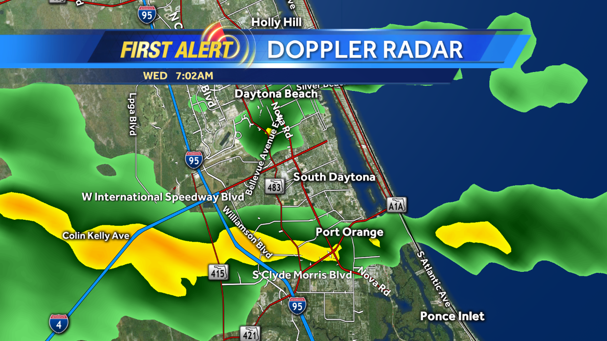
Good morning- Decent rains over Port Orange back over to the I-4/I-95 interchange. Be safe out there! #WESH2Storms
A few showers around Volusia County, but are moving on into Seminole County. Heads up friends! #WESH2Storms


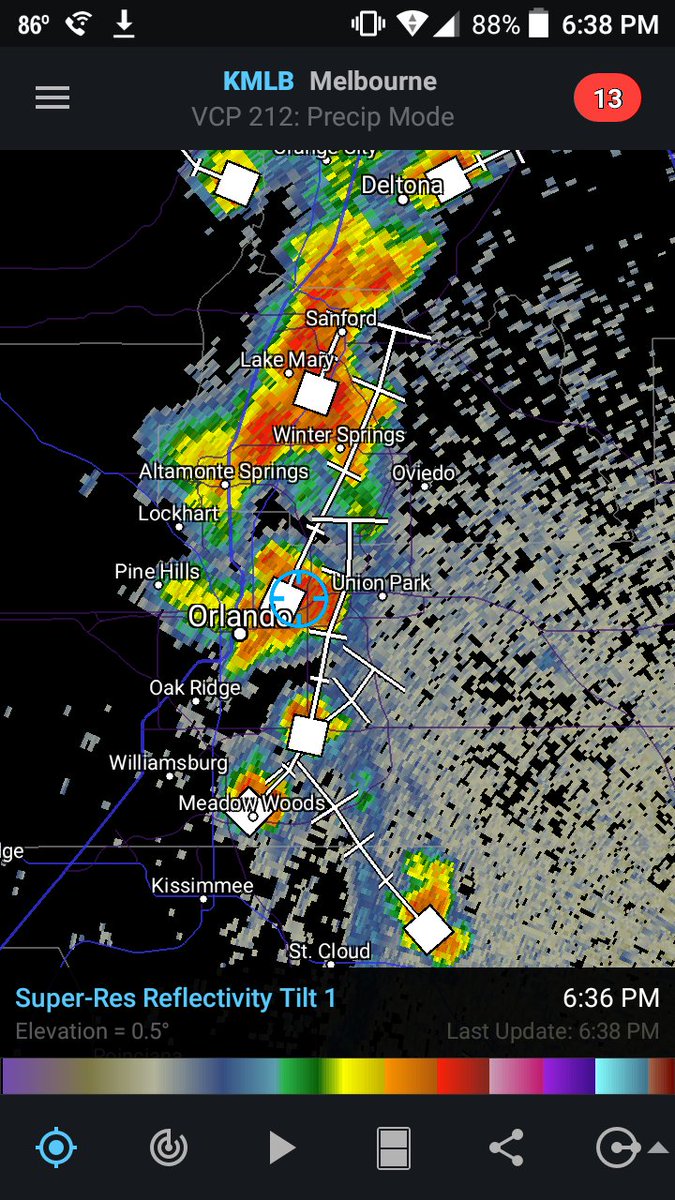
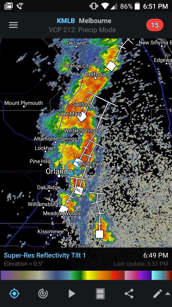
Heavy Rain again moving over #Orange county. Plenty of lightning & heavy rain. A quick 1" of rain likely.#wesh2storms


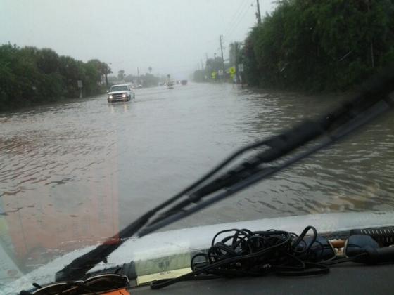
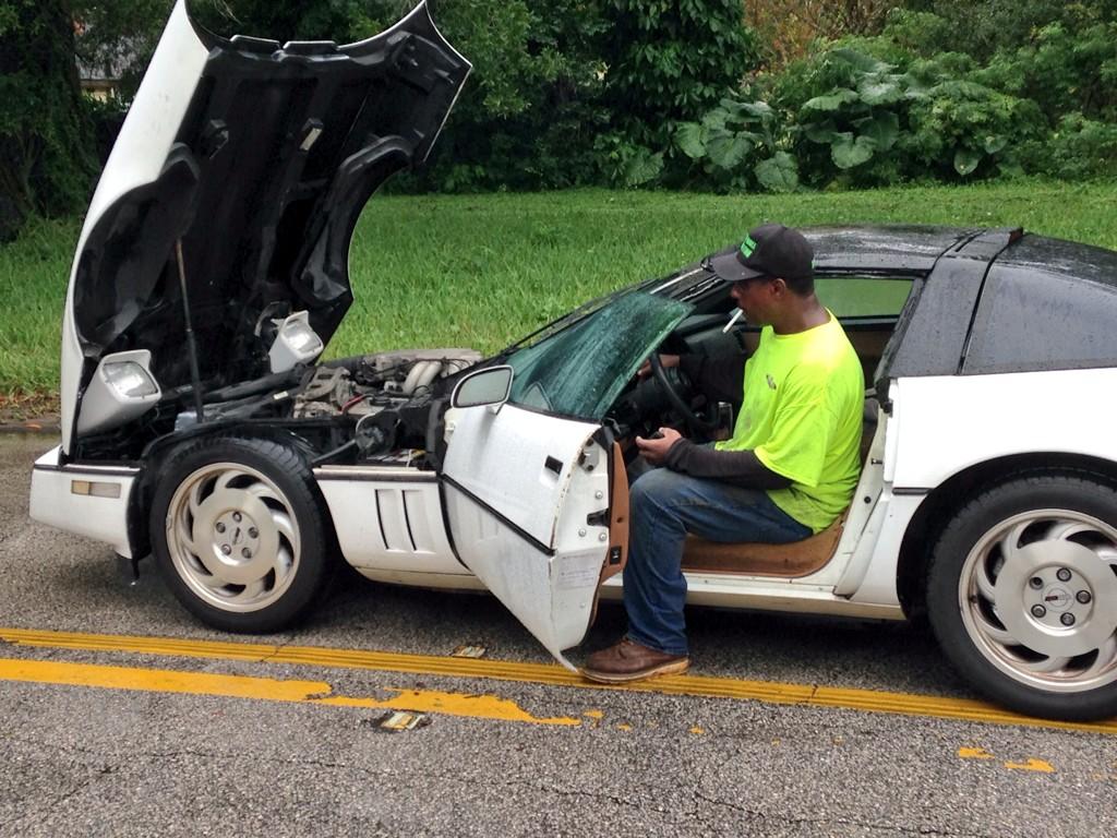
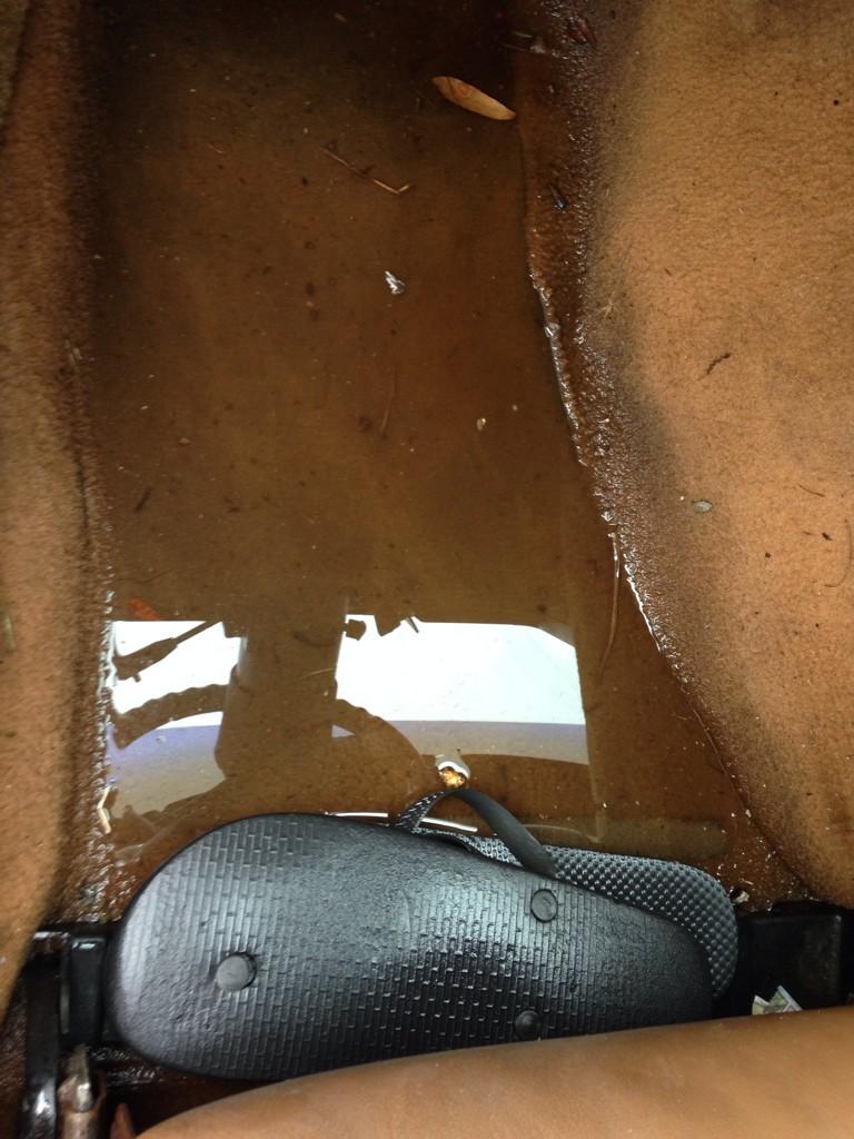
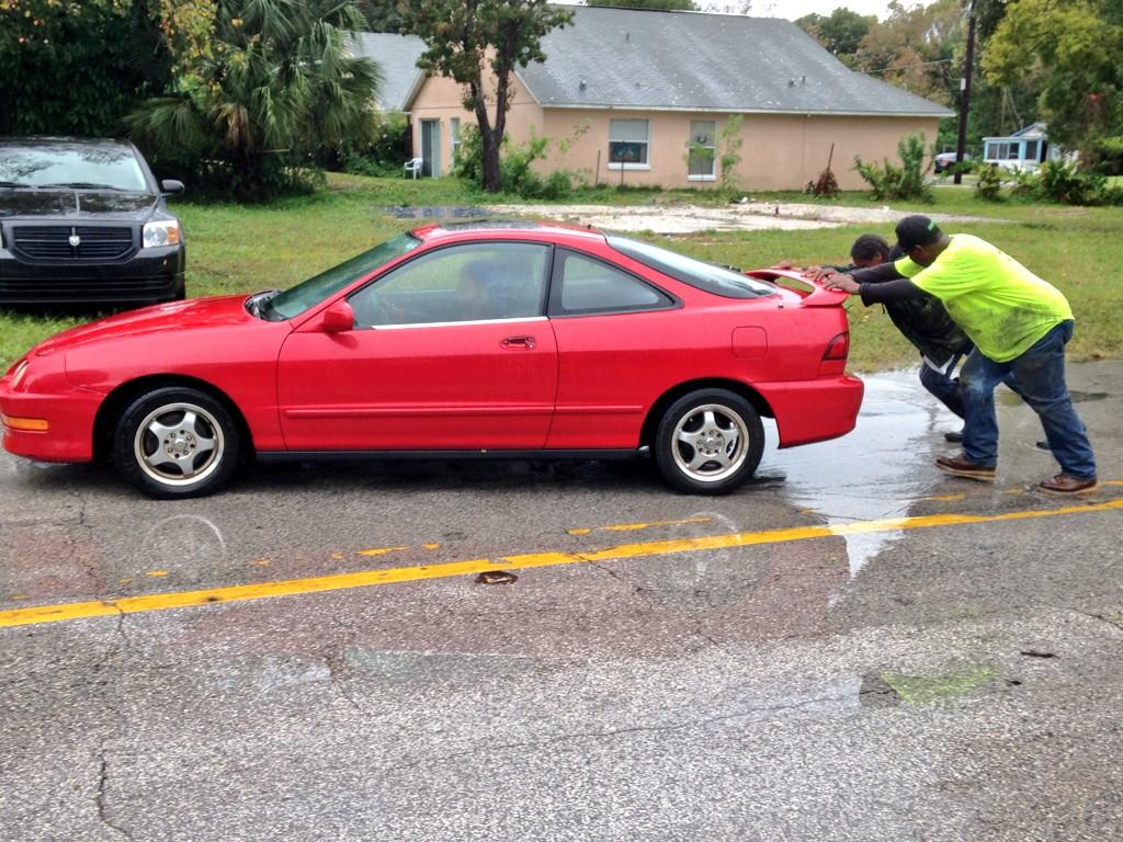
PHOTOS: 1) Corvette started, finally. 2) Water on floorboard. 3) Tony & Thearl pushing stranded car. #WESH2Storms
RT @Zoomjockey2: Central Florida afternoon. Looking toward Ocoee & Winter Garden. #wesh2storms #Lightning #Orlando
Line of storms pushing closer. Leading edge arrives in west Central Florida by late morning. #cflwx #WESH2storms


Areas near Gotha and Windermere should get ready for arriving rains! Here's a look at arrival times #WESH2Storms
New Flood Advisory posted for southern Brevard County due to 2"-ish having fallen with more coming down #WESH2Storms
Thursday's sea breeze collision happens inland/East thru evening commute. Here's FutureCast: #cflwx #wesh2storms

RT @jasonbrewerwesh: Just found our first shower in Lake Co. - tracking rain chances on @wesh2sunrise! #wesh2storms


Something went wrong.
Something went wrong.
United States Trends
- 1. Good Tuesday N/A
- 2. #AguilaNoCazaMosca N/A
- 3. #KeepBrawlAlive N/A
- 4. #AMAs N/A
- 5. Globalstar N/A
- 6. Artist of the Year N/A
- 7. FACE Act N/A
- 8. Happy 414 N/A
- 9. #TuesdayMotivation N/A
- 10. #TuesdayVibes N/A
- 11. Biden DOJ N/A
- 12. Aang N/A
- 13. Titleist N/A
- 14. Korra N/A
- 15. Vitaly N/A
- 16. Meloni N/A
- 17. Rich Starry N/A
- 18. Ants N/A
- 19. Stearns N/A
- 20. Iron Maiden N/A