
Advanced Storm Tracking
@ASTracking
This is for early warnings especially before storms show up and I will let you know where. Other weather information as well, but mostly severe activity.
At the Same Time Of Severe Weather Returning we will see the Potential For Tornado Risks to increase over Time but it will be limited, Yes we are already going to see Large Hail and Tornado Potential Storms Leading towards the end of the new week. Stay Safe, I'll keep you posted.

Severe Weather is Returning Towards the End of This Weekend that's coming up. Starting This week we will start to see some potential strong to severe activity as NWS highlights that #spc. So start preparing, have back up plans, Stay safe.

Days ago but that lightning with the city in the background is amazing.

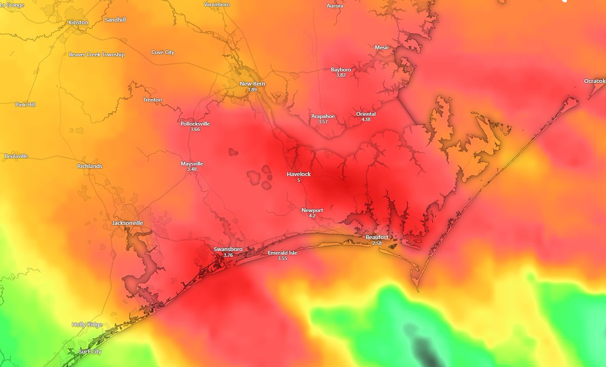
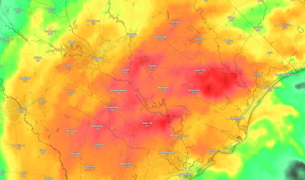
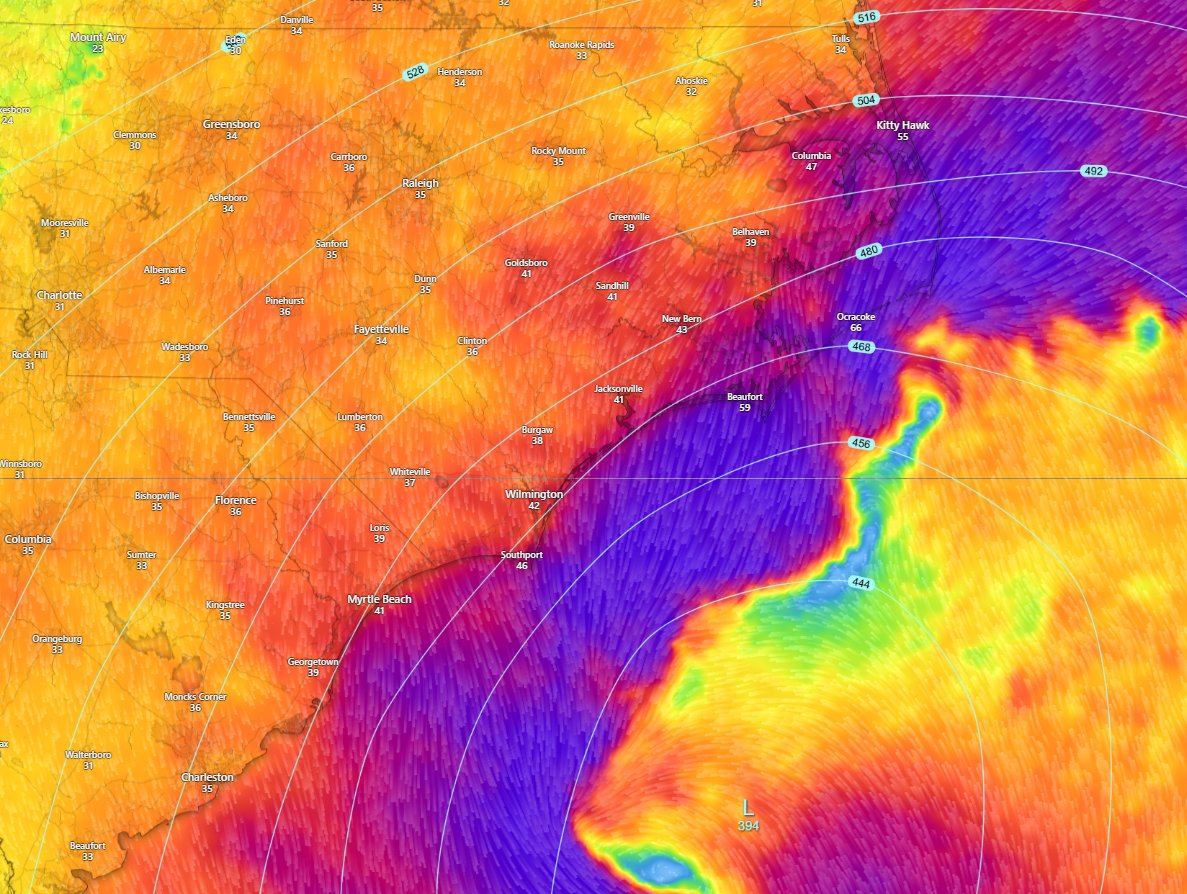
Rain Accumulation until 2am a few inches for a few areas. Heavy Showers expected soon to move onto land. North carolina shortly and into tomorrow south carolina will get a decent amount.
Currently: Some Decent conditions for Spin is around the green circled area but theres potential for tornados or waterspouts out along the black lined area. Stay safe while these showers and storms continue to move across.

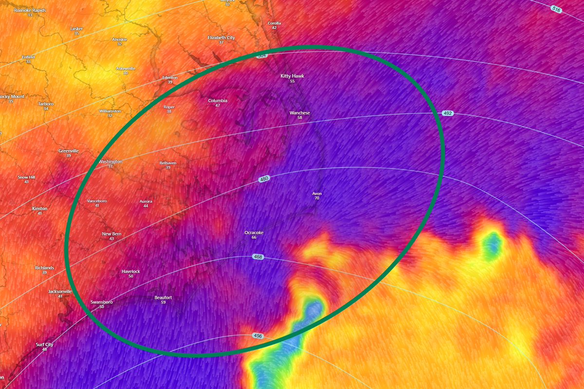
Carolina States: Outerbanks could be feeling up to 60-70mph wind gusts into the night while I find this plausible, there will be strong gusts across the coastal carolinas. Stay safe!
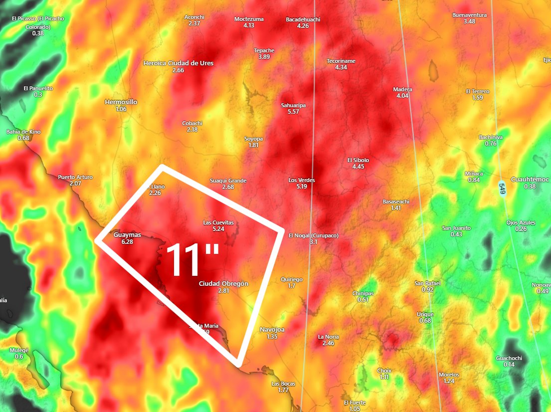
Mexico is getting alot of action with rain and storms with flooding possibility to be destructive the next 2 days. If you know family or anyone that these areas please let them know.
NOR-EASTER BRINGING SHOWERS AND GUSTY WINDS TO THE EASTERN US AND SOME DISAGREEMENTS BETWEEN.
Snow is on The Table for This Month Get Excited for Winter Storm Potential!


#mexico could see another devastating amount of rainfall the next day or so around the surrounding cities. Not looking to good. #mxwx #mexicoweather
SEVERE WEATHER IS COMING TOWARDS MID TO THE END OF OCTOBER, SNOW AS WELL BUT STORMS FOR TEXAS AND OKLAHOMA. OTHER AREAS ARE EXPECTED TO SEE SOME ACTIVITY. THIS END OF THE MONTH DOES LOOK INTERESTING.
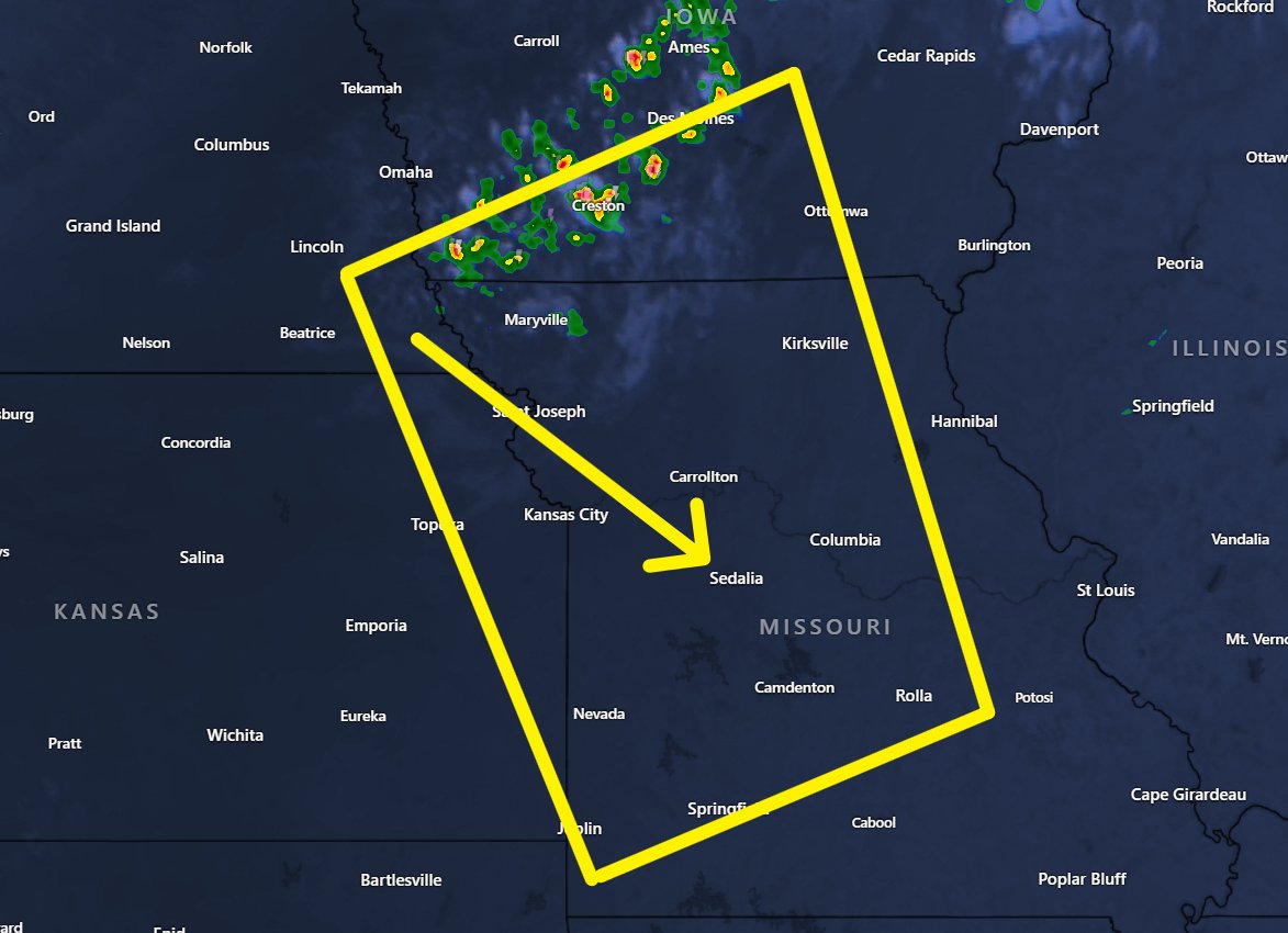
Starting to see some Thunderstorms over Southern Iowa and if you remember my previous posts about strong storms possible for missouri and eastern kansas stay weather as these countinue to move in a southeasterly direction. Pay attention to alerts.
Most models agree that the area of lower pressure that will develop into a non-tropical low for our nor-easter will develop along these areas and thats why we in florida are catching some variable weather with showers and storms. Flooding is the main concern.

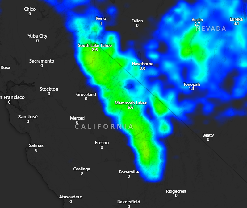
Snow Yes Snow for the Eastern California mountains. Later Next week we could see a Decent Storm Roll through that will bring showers and storms and gusty winds but on top of that 1-2 feet of snow in some areas. Stay weather aware.
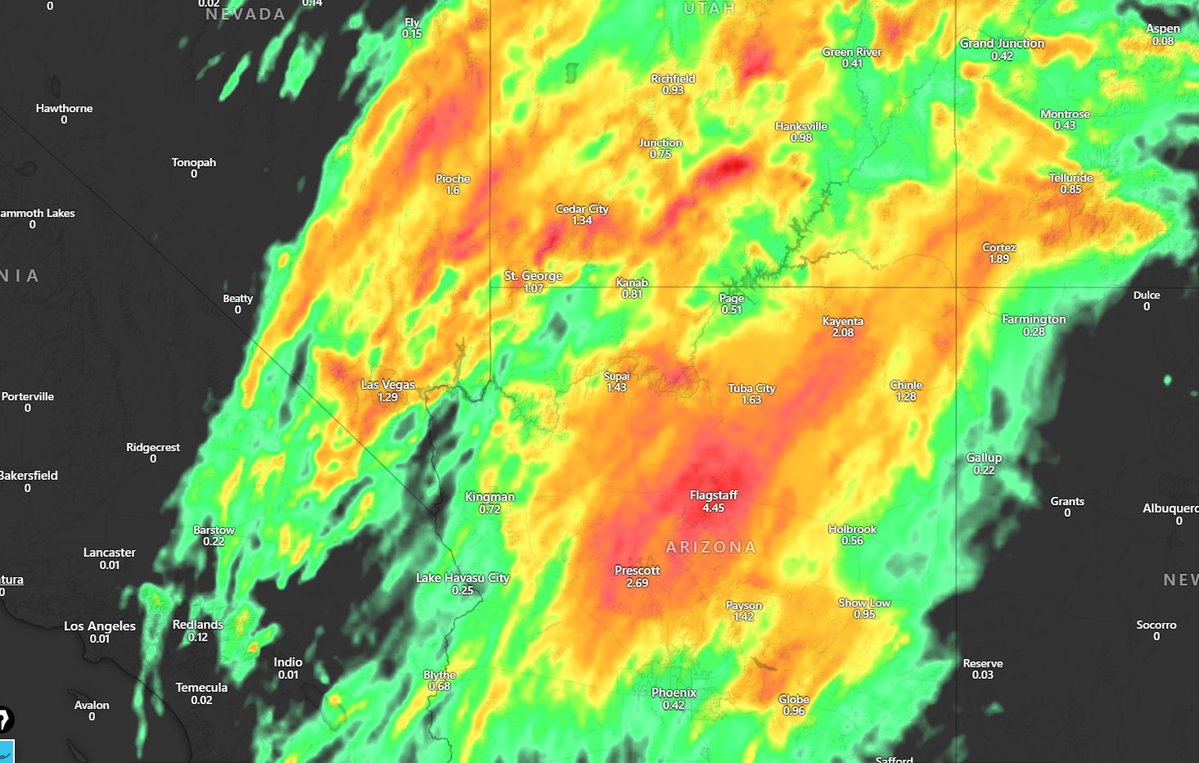
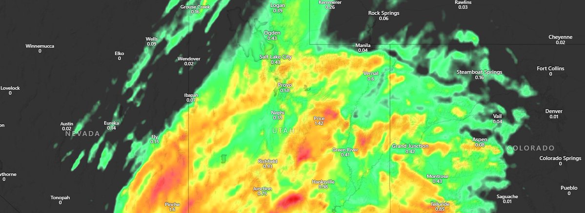
Flooding Risk For Southwestern United States, especially where arizona seems to be the center of it all.
Rain Accumulation until Saturday Morning and seeing some agreement where most of the rain will increase for Arizona and Some other areas so stay weather aware.

Potential Flooding Concerns for our florida!
Friday 10th I said it before but looking like some good strong storms will be likely but there are some conditions that I'm waiting for. Stay safe if you live in this area.


⚠️Flood Watch⚠️ 📍Mohave County in Arizona and portions of San Bernardino County in California ⏰11:00 am Thursday - 11:00 pm Saturday ⛈️Multiple rounds of showers & thunderstorms will move through the area over the next few days thanks to moisture from Priscilla. #CAwx #AZwx


United States Trends
- 1. Jets 75.9K posts
- 2. Jets 75.9K posts
- 3. Justin Fields 6,555 posts
- 4. Aaron Glenn 3,885 posts
- 5. #HardRockBet 3,086 posts
- 6. Garrett Wilson 2,886 posts
- 7. London 208K posts
- 8. Sean Payton 1,260 posts
- 9. HAPPY BIRTHDAY JIMIN 121K posts
- 10. #OurMuseJimin 165K posts
- 11. Tyrod 1,161 posts
- 12. Bo Nix 2,520 posts
- 13. #DENvsNYJ 1,884 posts
- 14. #JetUp 1,759 posts
- 15. Peart 1,833 posts
- 16. #30YearsofLove 148K posts
- 17. Bam Knight N/A
- 18. Sherwood 1,183 posts
- 19. Kurt Warner N/A
- 20. Hail Mary 2,499 posts
Something went wrong.
Something went wrong.