
Mike
@Adaptamap
An exciting, new start-up devoted to changing the way students and researchers work with maps.
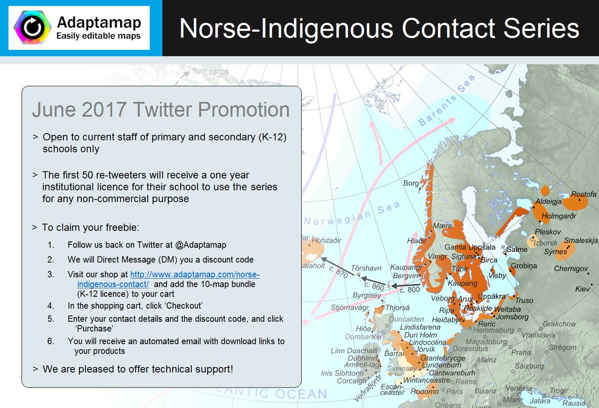
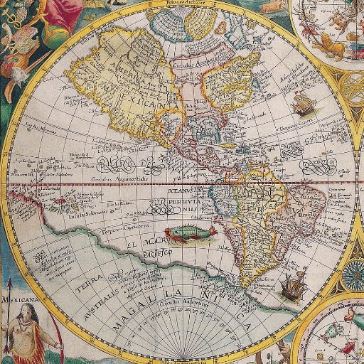
Teachers! The first 50 RTs will receive a FREE 1-YR LICENCE for our groundbreaking series of 10 maps illustrating Norse-Indigenous contact!
Parlez-vous français? ᐃᓄᒃᑎᑑᓲᖑᕖᑦ? Uqaqtuq Inuinnaqtun? Kalaallit oqalusinnaavit? Taler du dansk? Please help! bit.ly/2sOPgHz
Teachers! The first 50 RTs will receive a FREE 1-YR LICENCE for our groundbreaking series of 10 maps illustrating Norse-Indigenous contact!
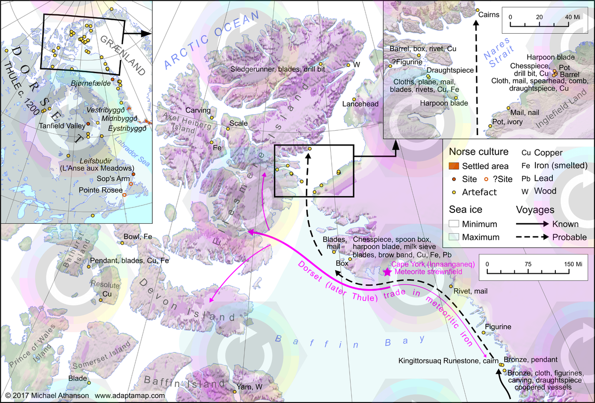
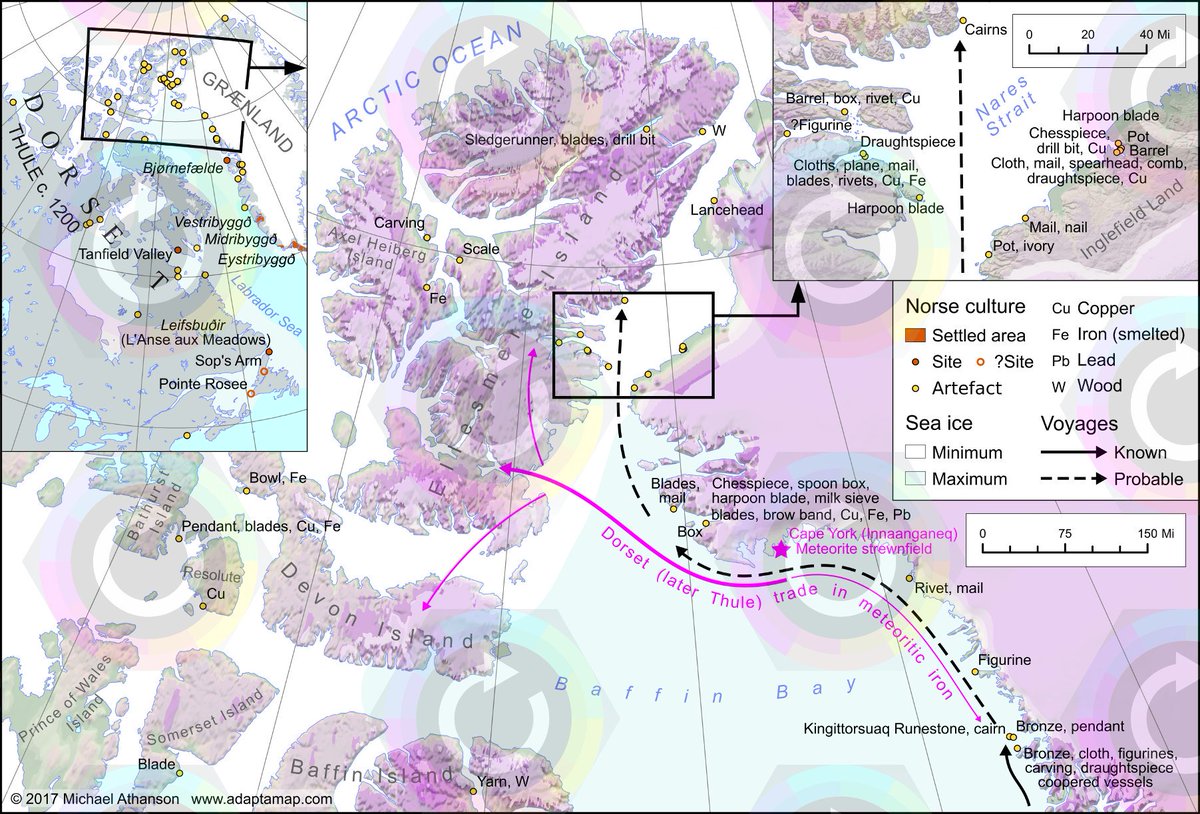
#History buffs and #map nerds! Check out our new series on Norse-Indigenous contact in the Arctic, c 985-1400 bit.ly/2rQqZnX
Many thanks for the RT! Please follow us back so we can send you the discount code!
Gratis digital kort til skoler! Venligst retweet? Vi håber at oversætte til dansk og kalaallisut @Nationalmuseet @arktiskinstitut @natmus_gl
Teachers! The first 50 RTs will receive a FREE 1-YR LICENCE for our groundbreaking series of 10 maps illustrating Norse-Indigenous contact!
Free, editable maps for schools! Any chance of an RT please? @CanGeoEdu @RCGS_SGRC @GISAmbassador @NatGeoEducation @JamesGIS @RGS_IBG
Teachers! The first 50 RTs will receive a FREE 1-YR LICENCE for our groundbreaking series of 10 maps illustrating Norse-Indigenous contact!
High-quality historic maps in a layered, editable (SVG) format. Take a look! #Edtech #k12 #education #elearning
Teachers! The first 50 RTs will receive a FREE 1-YR LICENCE for our groundbreaking series of 10 maps illustrating Norse-Indigenous contact!

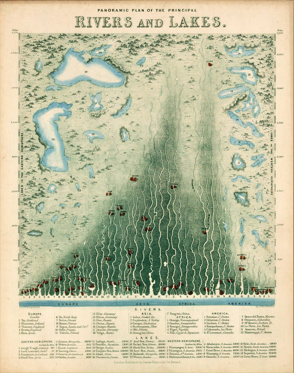
Marvellous vintage (1851) #infographic compares length of #rivers and size of lakes. ow.ly/R3n1308Z4OM #geography #hydrology #history

Night lights change in the Middle East between 2012 and 2016 earthobservatory.nasa.gov/IOTD/view.php?… via @NASAEarth
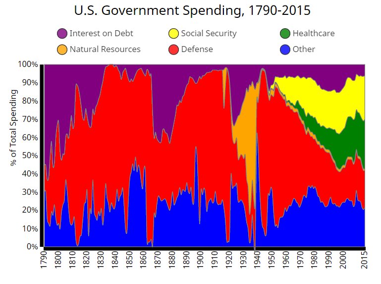
The history of federal US government spending, 1790-2015 metrocosm.com/history-of-us-…

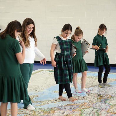
The @NatGeo Kids Giant Traveling Map of Europe visited Ellis this spring, no passport required! Read more: bit.ly/2rS4ezE

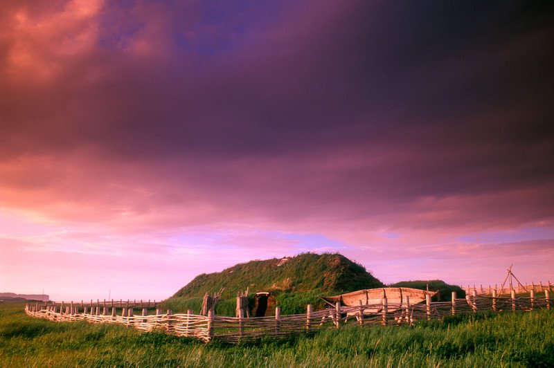
The #ParksContest offers you a chance to #ExploreNL & dive into #Viking history! L'#AnseauxMeadowsNHS #DiscoveryPass ow.ly/95i4308STZQ
Teachers! Watch this space -- big Twitter promo starts tomorrow (Thurs) at noon ET (17.00 GMT).. We'll be giving away $3k of map licences!

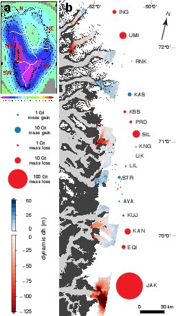
As glaciers in #Greenland loose mass, they thin and retreat inland, but how far inland can they go? #ImageOfTheWeek blogs.egu.eu/divisions/cr/2…

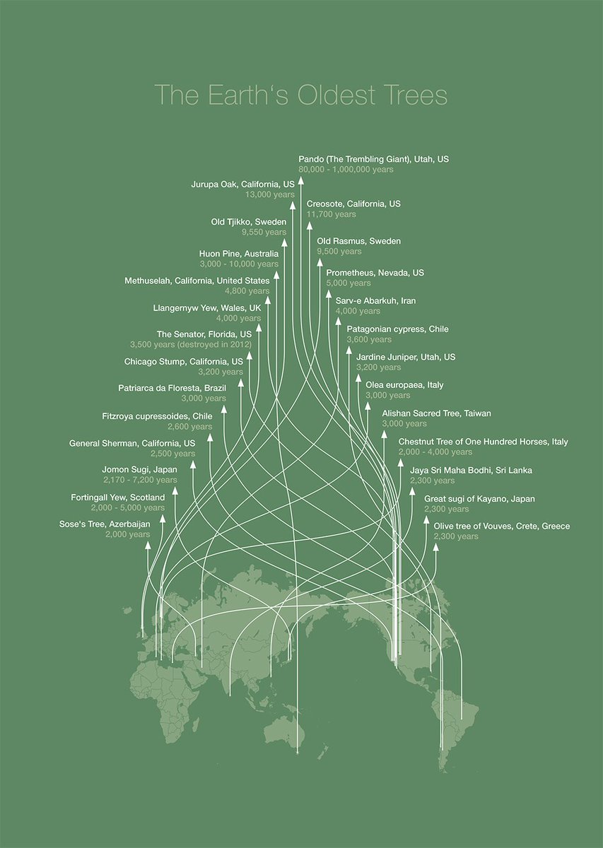
Gorgeous #dataviz by @paukee shows #geography and age of oldest #trees. via naturalrecall.org HT @galka_max

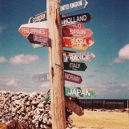
This is the best thing I've seen this week.


United States Trends
- 1. Zverev N/A
- 2. Alcaraz N/A
- 3. #TheTraitorsUS N/A
- 4. Cooper Flagg N/A
- 5. Don Toliver N/A
- 6. Colton N/A
- 7. Candiace N/A
- 8. Iron Lung N/A
- 9. #COCKCOIN N/A
- 10. #zzzSpecialProgram N/A
- 11. Lisa N/A
- 12. OpenClaw N/A
- 13. #River N/A
- 14. #zzzero N/A
- 15. Warsh N/A
- 16. Dillon Brooks N/A
- 17. Hornets N/A
- 18. Benedict N/A
- 19. Yam Yam N/A
- 20. Amber Rose N/A
Something went wrong.
Something went wrong.