
All-Things-Spatial
@AllThingSpatial
Turning humble maps and satellite images into location intelligence. Discover how you can benefit...
You might like


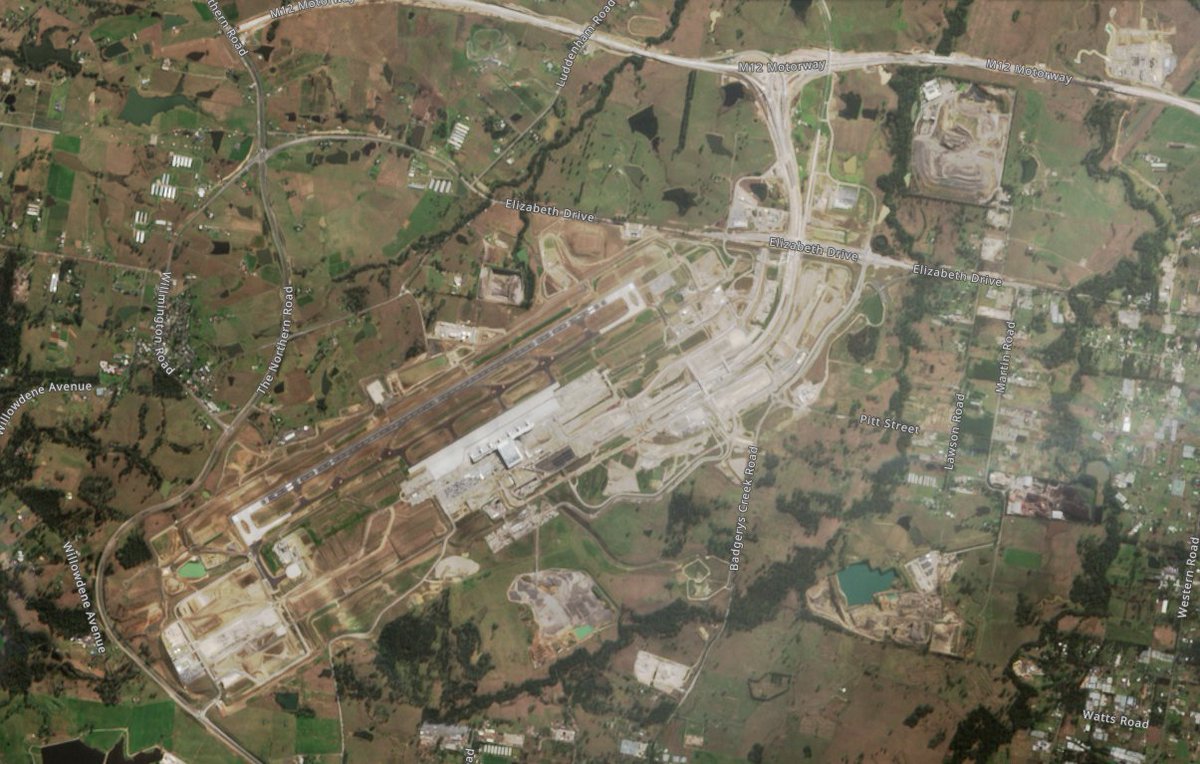
Progress with the Nancy Bird Walton Airport - Badgerys Creek Western Sydney, Australia - 4 years in the making... Sentinel-2 🛰️ imagery 2024.07.22 courtesy of @CopernicusEU and EO Browser x.com/AllThingSpatia…
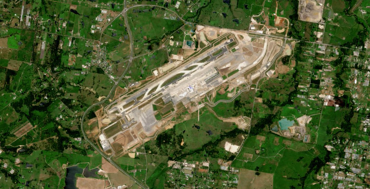
Nancy Bird Walton Airport - Badgerys Creek Western Sydney #Australia Sentinel-2 🛰️ imagery 2022.11.20 #SatelliteImagery @CopernicusEU
Snow in Australian Alps: AQUA 🛰️ MODIS bands 3-6-7 (red tint indicates extents of snow cover on the ground).

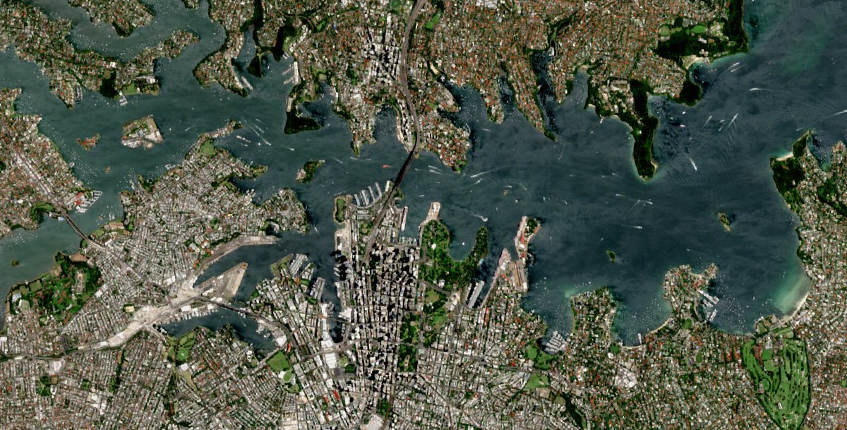
Sydney CBD - Sydney Opera House - Sydney Harbour #Australia Sentinel-2 🛰️imagery 2022.11.20 (10m resolution) #SatelliteImagery #OpenData @CopernicusEU
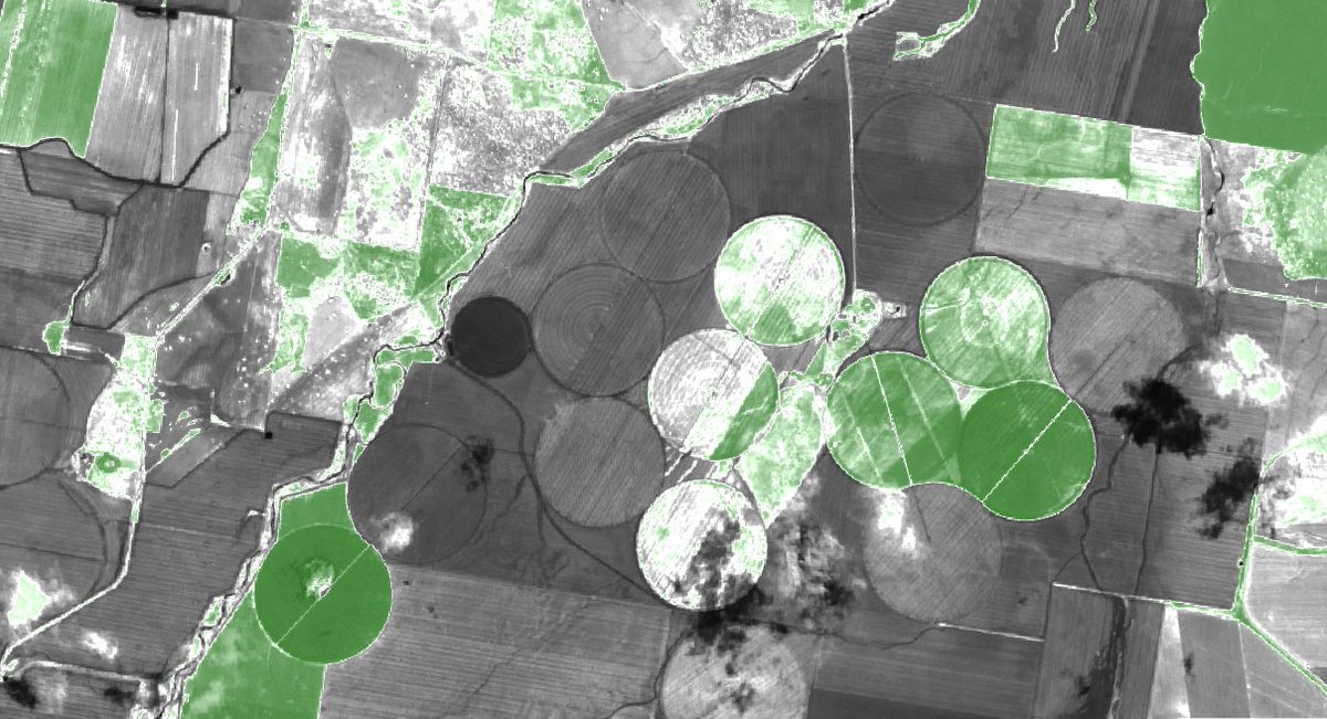
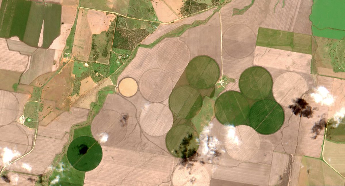
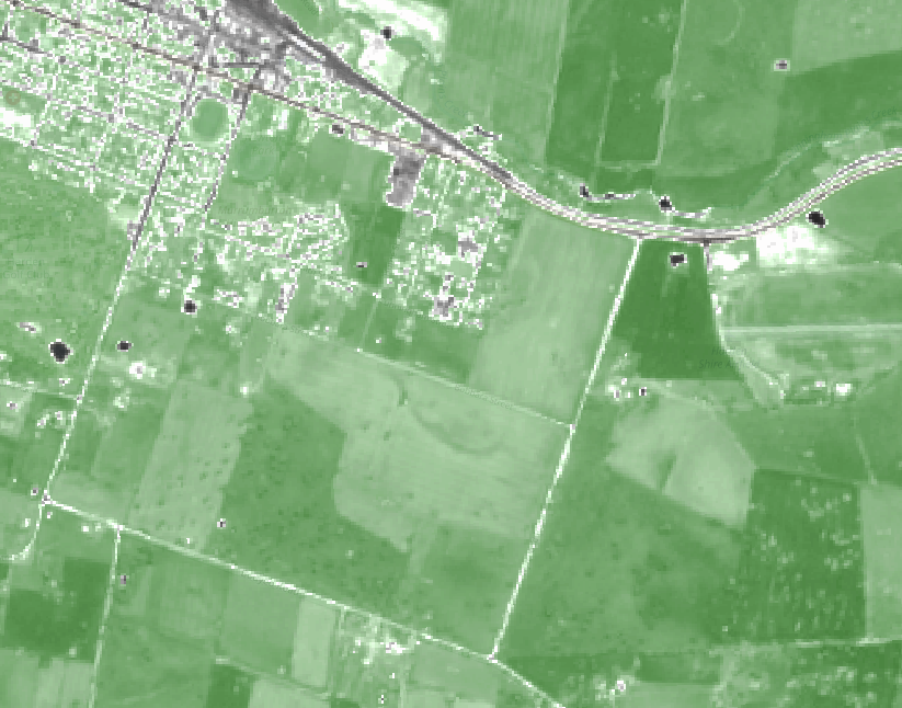
Rural landscapes - Australia #Sentinel2 image 2021.11.15 segmented NDVI and true colour RGB #EarthObservation #remotesensing
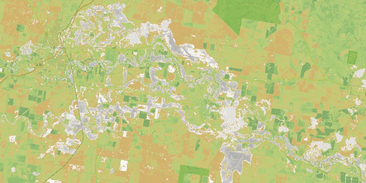
Forbes, NSW 🇦🇺 flood extents derived from 2021.11.18 Sentinel2 #satellite image (red overlay are perennial rivers, streams & water bodies) #NSWFloods #EarthObservation


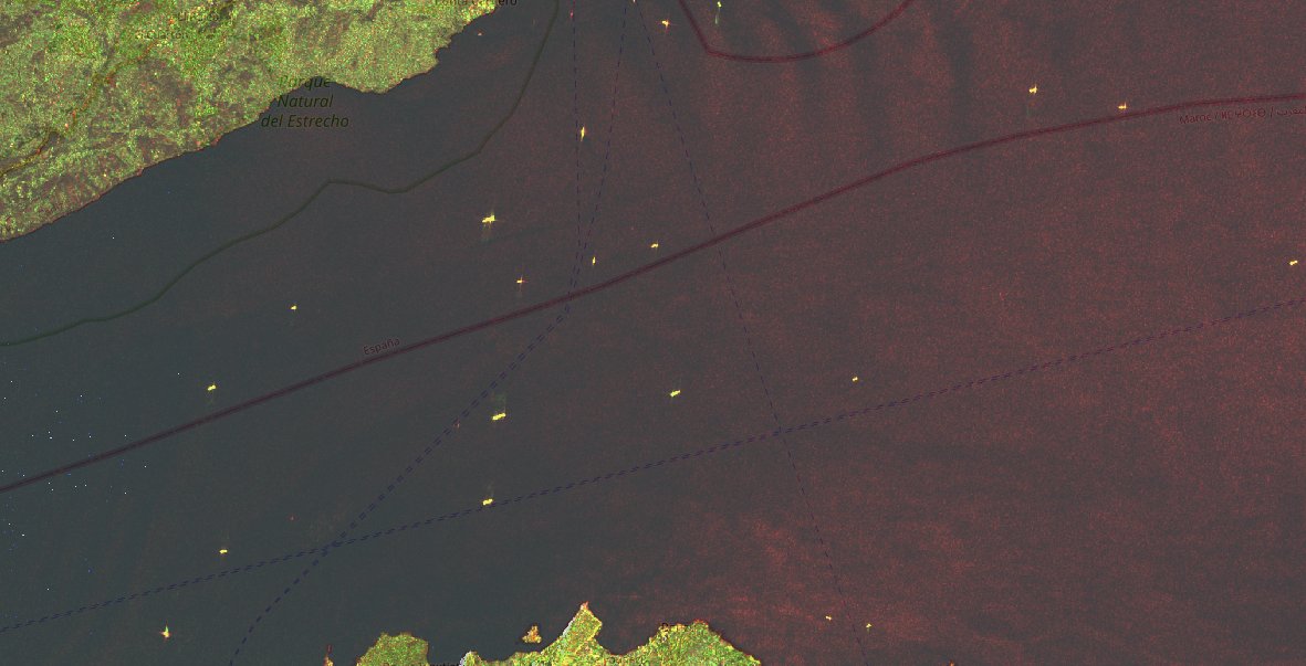
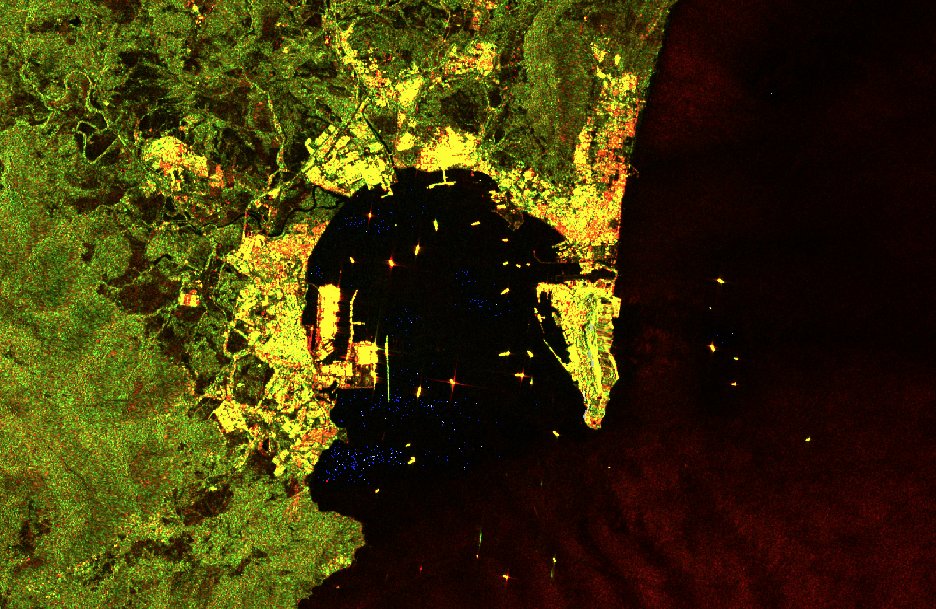
Experiment with #Sentinel1 backscatter data 2021.11.09: . ship traffic in Strait of Gibraltar . Bay of Gibraltar RGB image: VV channel for red, VH channel for green and the ratio |VH| / |VV| for blue #EarthObservation
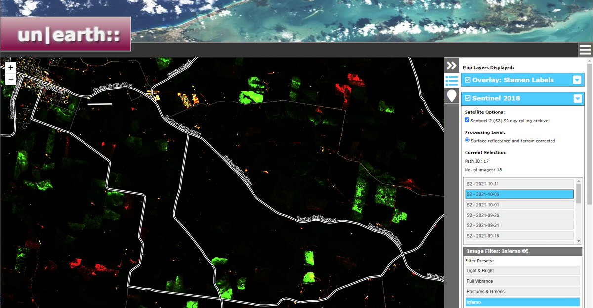
Blooming canola crops causing issues for #EarthObservation indicators like NDVI (close up of top left corner, light green shows canola crops). Inferno filter gives extra highlight to identify such fields correctly. #Sentinel-2 #SatelliteImagery: by mapxplorer.com/unearth.html

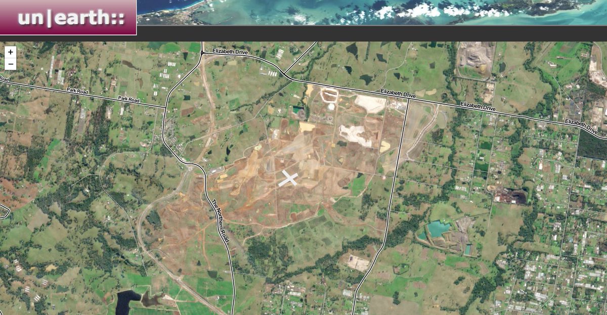
This is #Australia: Sydney #airport construction progress - Badgerys Creek (Western Sydney) Airport #Sentinel2 🛰️ 2020.06.18 #SatelliteImagery @CopernicusEU #map by MapXplorer.com #AusEcon #OpenSource


United States Trends
- 1. Sedition 166K posts
- 2. Cheney 84.5K posts
- 3. Lamelo 5,655 posts
- 4. Seditious 90.4K posts
- 5. Texans 19.8K posts
- 6. First Take 46.2K posts
- 7. Seager 1,152 posts
- 8. Constitution 111K posts
- 9. Jeanie 1,982 posts
- 10. Commander in Chief 51.1K posts
- 11. Coast Guard 22.6K posts
- 12. Mark Walter 1,471 posts
- 13. UCMJ 9,613 posts
- 14. Trump and Vance 36.4K posts
- 15. Cam Newton 4,465 posts
- 16. Last Ronin 1,226 posts
- 17. UNLAWFUL 75.7K posts
- 18. Shayy 14.1K posts
- 19. Elon Musk 265K posts
- 20. Dizzy 7,177 posts


Something went wrong.
Something went wrong.