
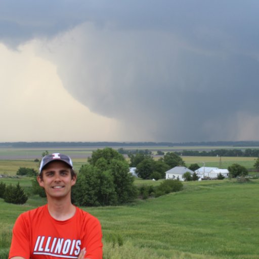
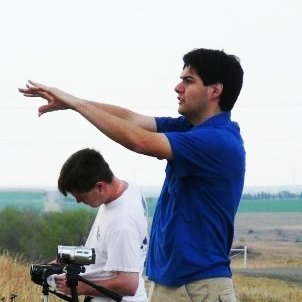
Hunter Anderson
@ColdCoreCowboy
Lilapsophile who enjoys isoplething & analoging. Meteorologist | SCSU AHS | Job 36:26-30 | Married to K | Opinions are mine & don't reflect my employer's.
You might like


Normally don't do a post like this, but wanted to say happy 27th birthday to my (Twitterless) wife, Kristin.☺️ WAIT, did I mention we got married?! This was back on Sept 14th...😅 I want to prioritize my marriage, so I'll remain less active on SM. Much love to you all🙏💙


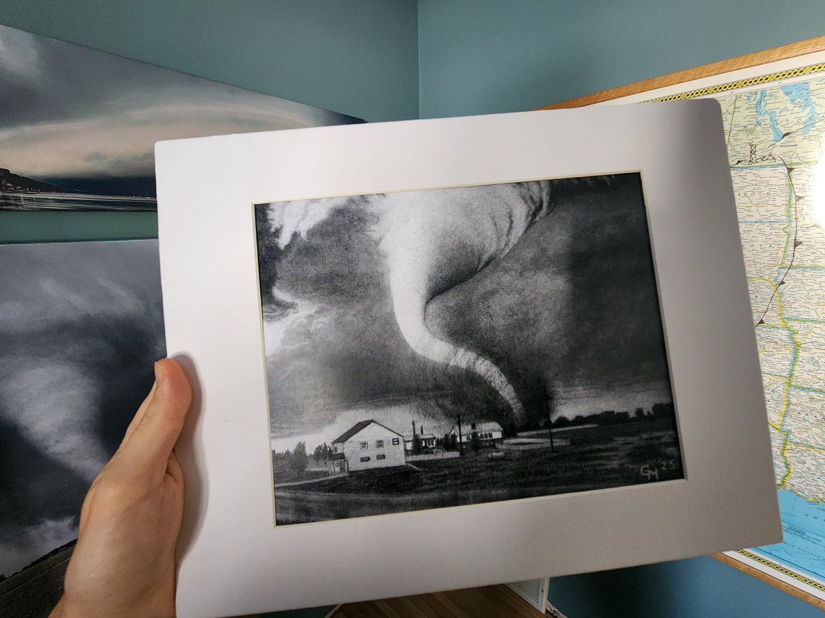
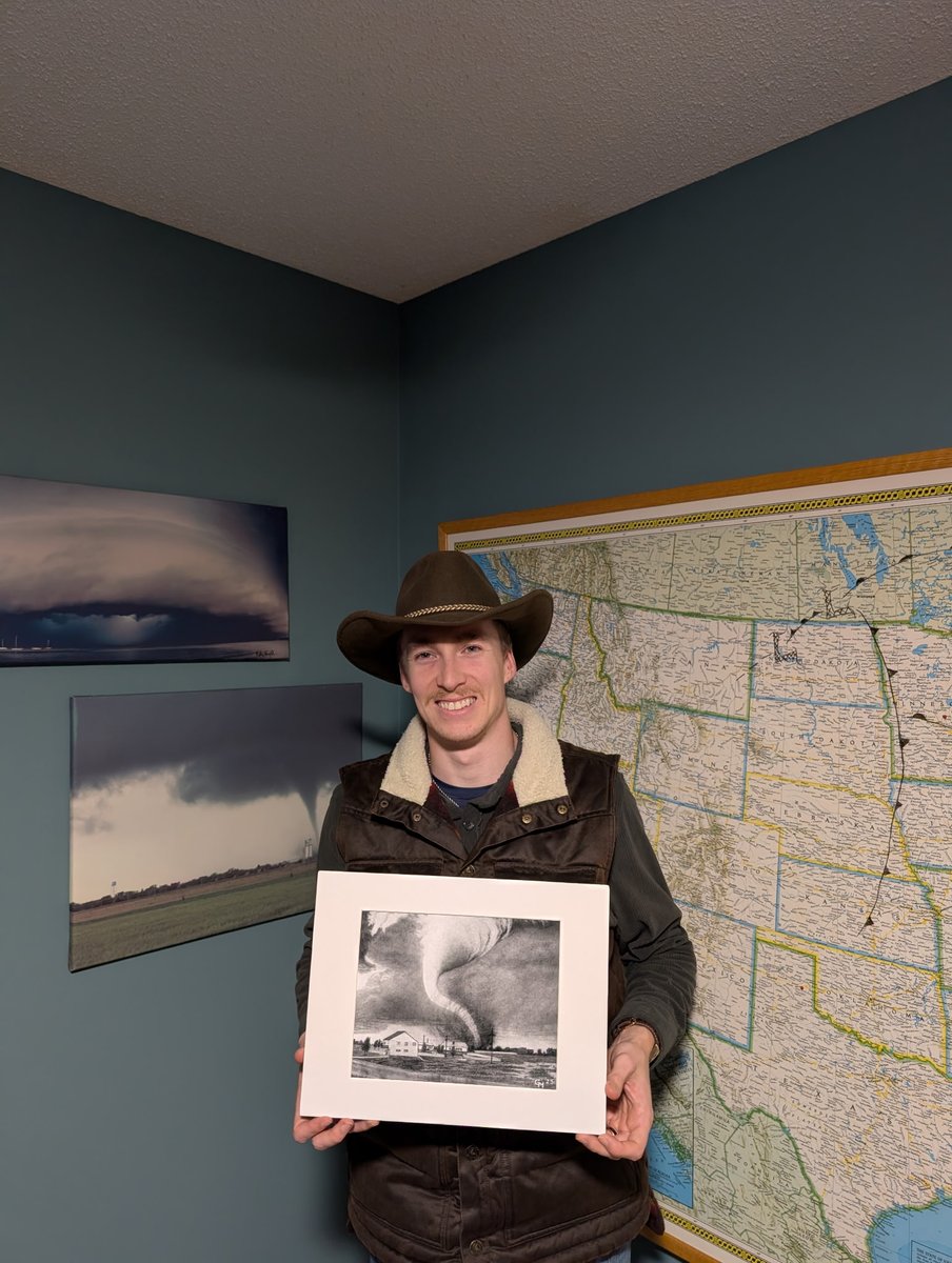
"Tracy" is now properly framed & on full display at CCHQ. Everyone needs at least one of @GregMcwx's masterpieces!
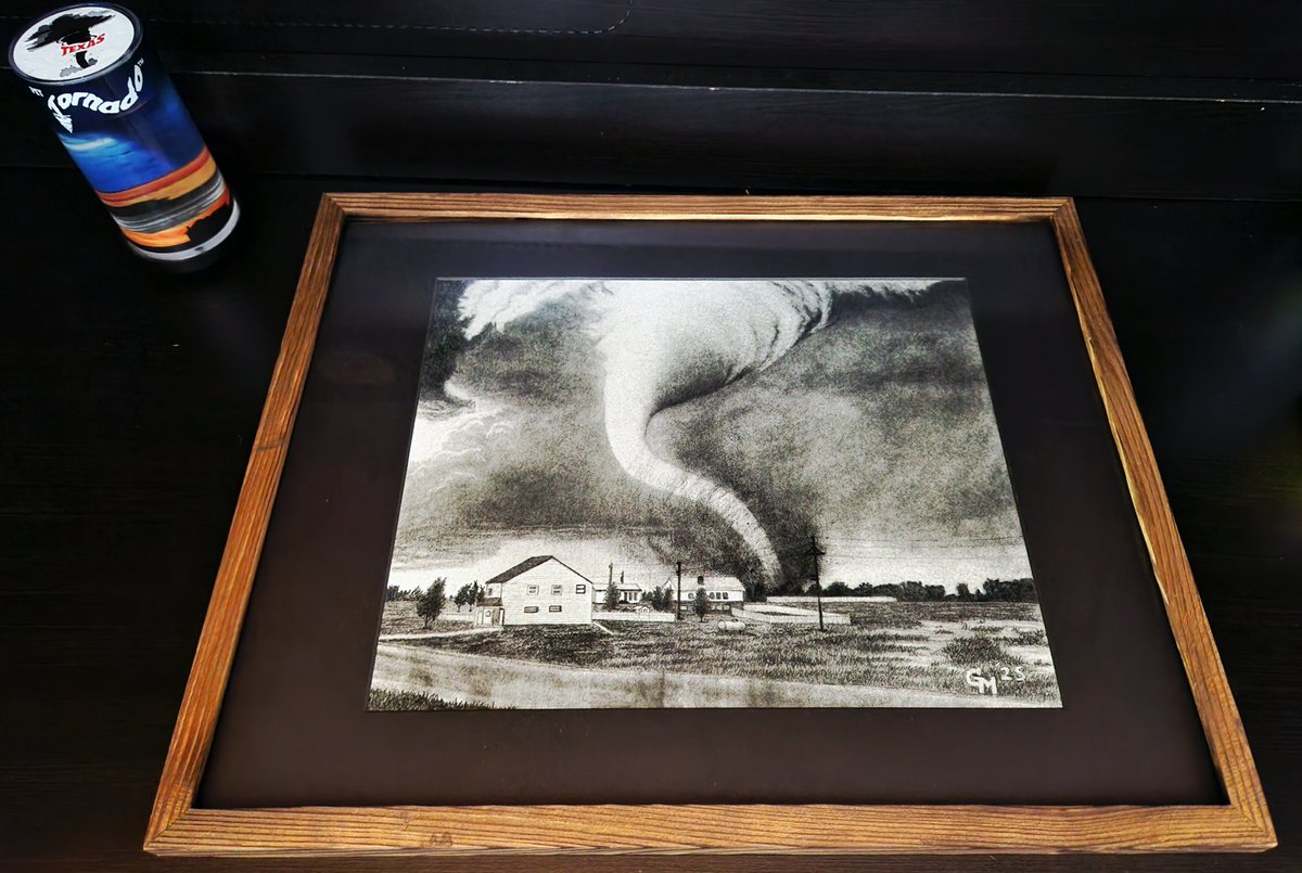
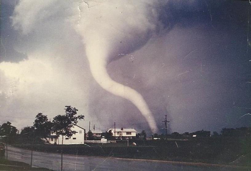
Blessed to receive the first copy of @GregMcwx's June 13, 1968 Tracy, MN F5 rework. This metaphysical spectacle is in its own echelon regarding tornado legend & ghastly natural beauty. Can't wait to frame this masterpiece & display it at CCHQ!
One of the better weather discussions you'll ever see on this app, Tomer is top-tier. Historically, the synoptics favor a major icing event, especially where cold-air-damming will be most pronounced in (southern) Appalachia. Meanwhile I'll be "chilling" in -30F air in MN 🙃.

[Monday, January 19 Analysis] A major cross-country snow and ice storm is increasingly likely this weekend. Confidence is growing in a widespread swath of over 12" of snow & a significant ice storm. I'll cover the big picture & forecast uncertainties in this thread:

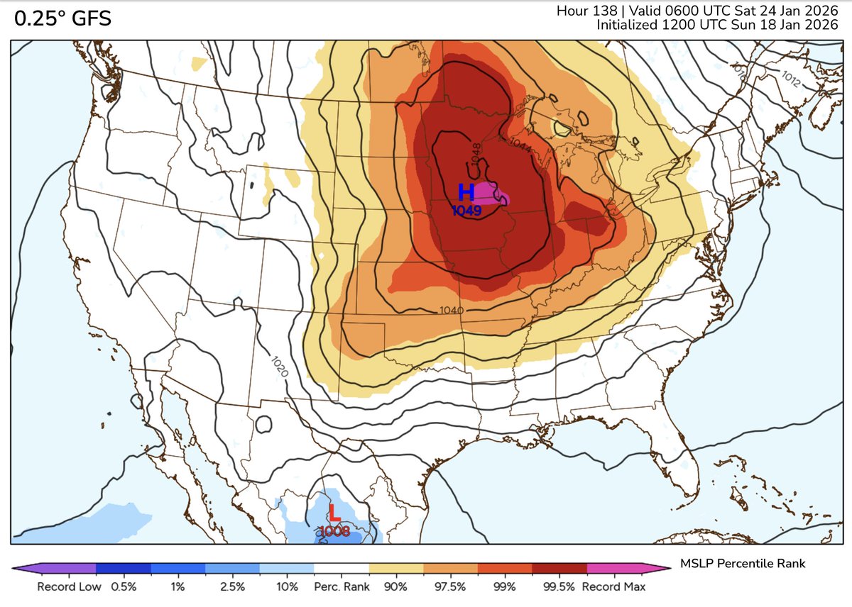
The 12z GFS drops a record breaking, ~1050mb surface high down into Minnesota at day 5. Holy 💩
This is why cold core 500mb lows (CC500L) get my stamp of approval!

Have never heard the "technical" phrase "bombogenetic cyclone" before but have heard/used "explosive cyclogenesis" per the AMS or *shudders* "bombogenesis". Just lots of buzzwordin' going on. *hops off Doswell soapbox*
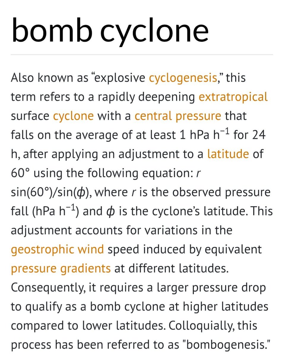

The system affecting the Great Lakes, Upper Midwest, Ohio Valley and Northeast *is* in fact a “bomb cyclone.” While it sounds like media buzz, it is a real term (technically a “bombogenetic cyclone”), and describes a system that rapidly strengthens (deepens). We’ll skip the…

Blessed to receive the first copy of @GregMcwx's June 13, 1968 Tracy, MN F5 rework. This metaphysical spectacle is in its own echelon regarding tornado legend & ghastly natural beauty. Can't wait to frame this masterpiece & display it at CCHQ!
Merry Torchmas 😍
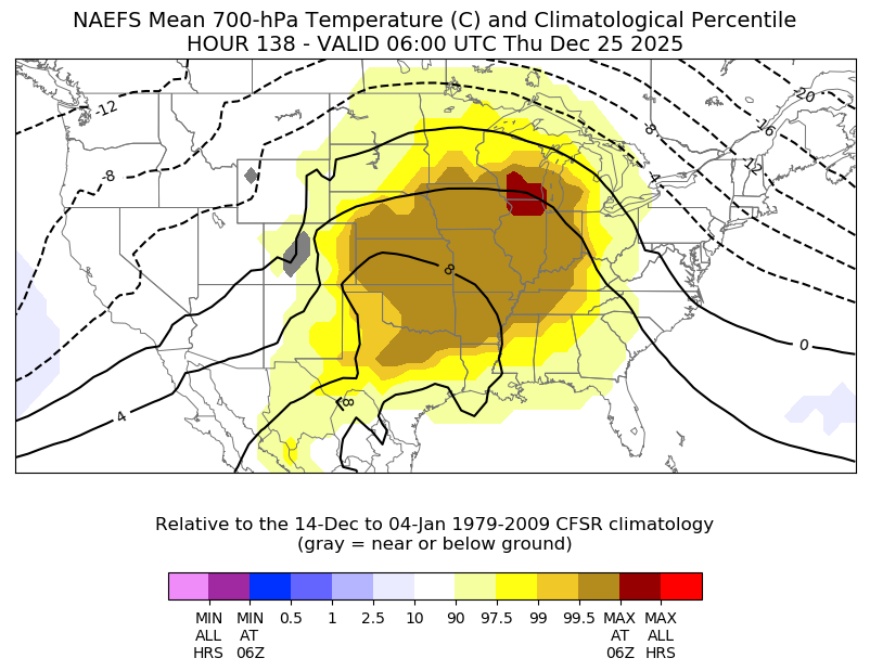
H850 temperatures also are projected to be in the 99th percentile across the central CONUS, with some climatological hourly maximums also indicated across northern IL and southern Wisconsin.
Honestly surprised by these results. I guess we're in the minority, Chuck. 🥲
Been on this app for over a decade and I've never posted a poll. Better late than never?
18 vote · Final results
Snowfall from today (12/09) Total: 5.25" Location: 1mi NNW of Golden Valley, MN @NWSTwinCities #mnwx
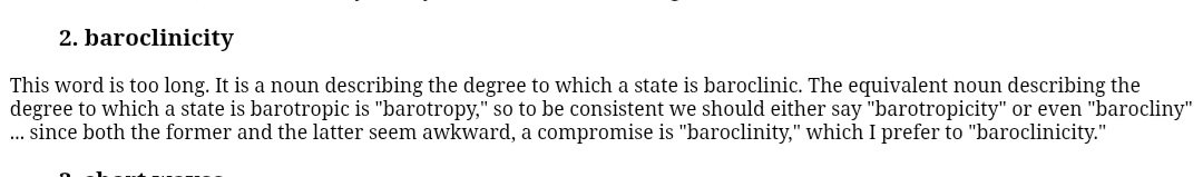
Working on the finishing touches of the 1968 Tracy, MN F5 tornado. The tones never look right in these photos.
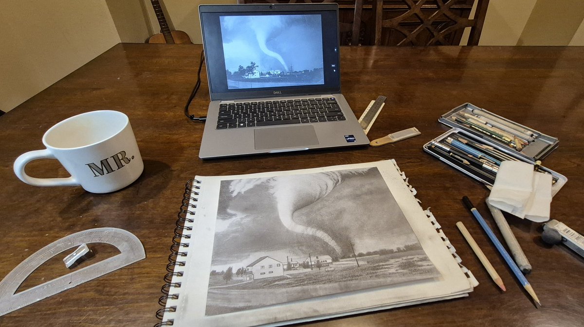
Attempts to imitate observations from reality into numerical modeling has been ongoing in meteorology academia for decades. This work from @wxkylegillett is another leap forward. Excited to read his insights into the physical/dynamical processes at play from these RFD "nudgers".

Adding to some recent discussion...I have so much cool stuff from my Master's work that I can't wait to share with you all. TLDR for now: From observations, we know that rear-flank storm interactions may be important to torgen. Now we have simulations to support that.
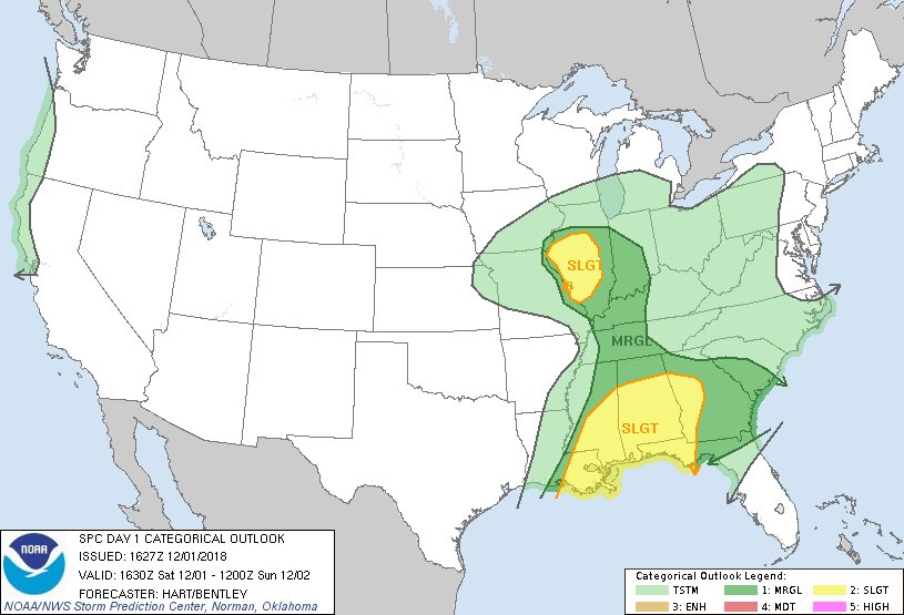
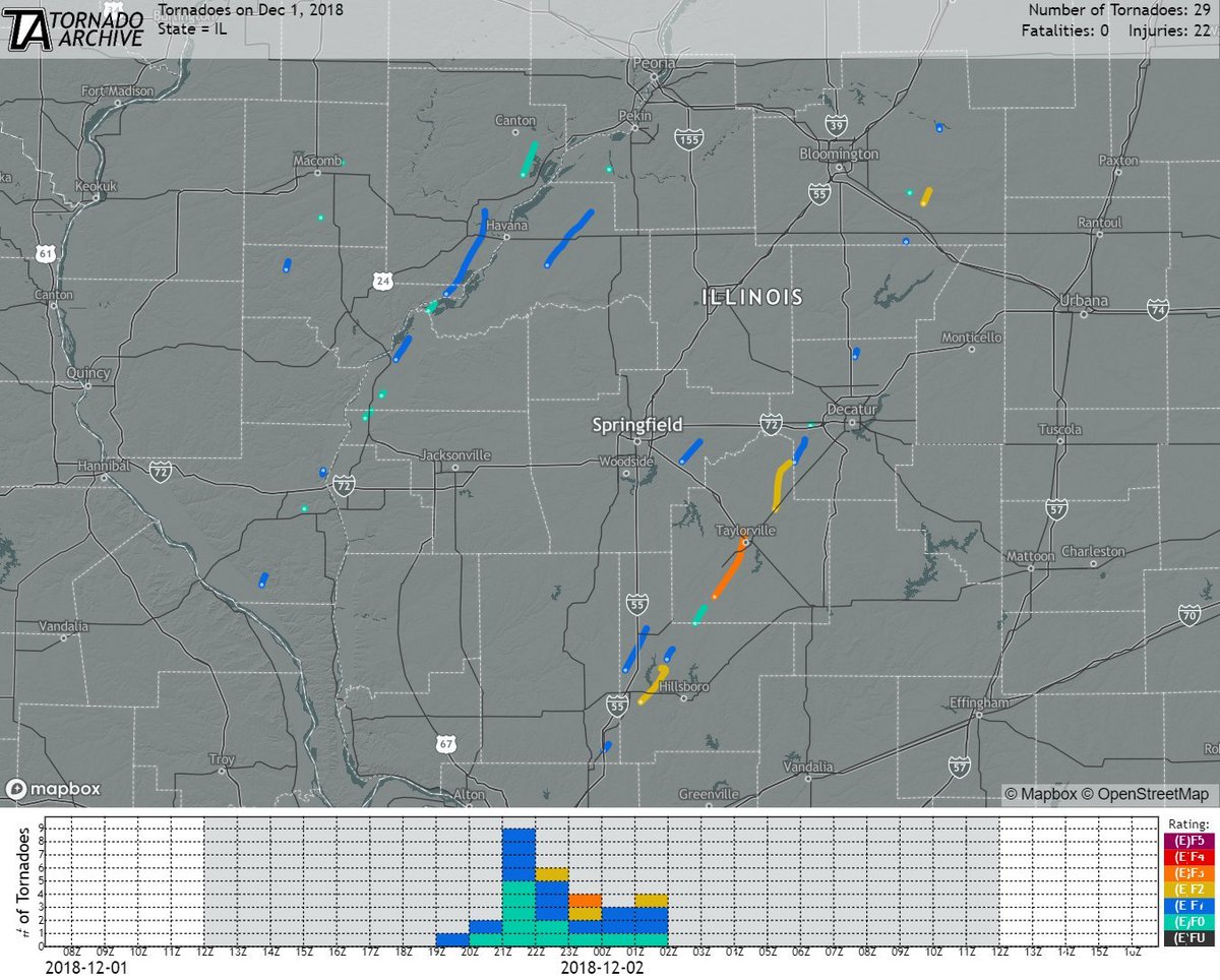
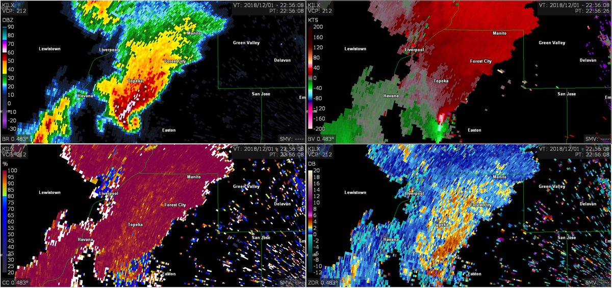
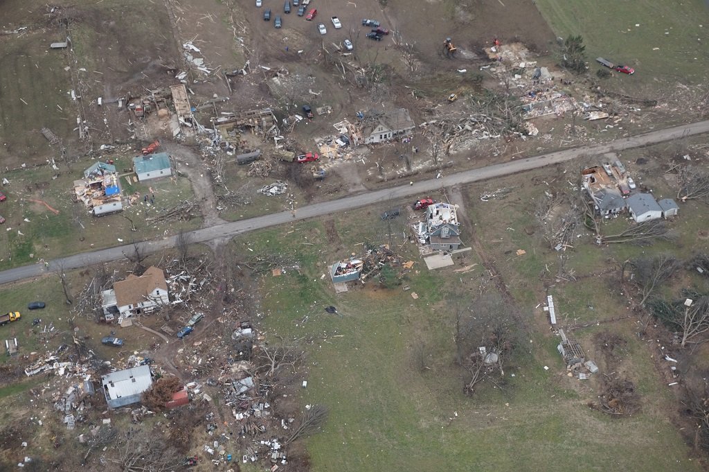
7 year anniversary of a historic CC500L tornado outbreak.

December 1, 2018: Illinois experienced its largest December outbreak. 29 tornadoes, four of which were significant (EF2+), impacted the western & central parts of the state. A half-mile-wide EF3 damaged/destroyed over 500 homes in Taylorville. 22 people were injured. #wxhistory
Delayed report. Total snowfall from Saturday-Sunday morning (11/29-30) Total: 4.50" Location: 1mi NNW of Golden Valley, MN @NWSTwinCities #mnwx
SNB0245 (11/26) SNE1340 (11/26) Total: 2.00" Location: 1mi NNW of Golden Valley, MN -Quite a bit of melting through first couple hours of event & widespread drifting from 30-40 mph gusts. @NWSTwinCities #mnwx


United States Trends
- 1. Jamal Murray N/A
- 2. Air Force One N/A
- 3. Luis Robert N/A
- 4. Acuna N/A
- 5. #LakeShow N/A
- 6. Nuggets N/A
- 7. White Sox N/A
- 8. Spurs N/A
- 9. Reed Sheppard N/A
- 10. Baker N/A
- 11. Davos N/A
- 12. UCLA N/A
- 13. #kubball N/A
- 14. Marcus Smart N/A
- 15. Joint Base Andrews N/A
- 16. Rockets N/A
- 17. Grassley N/A
- 18. #RHOSLC N/A
- 19. Purdue N/A
- 20. Melvin Council N/A
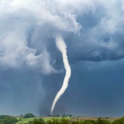
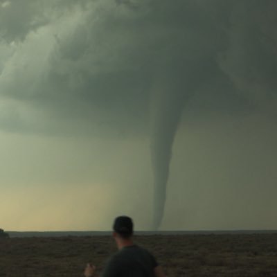
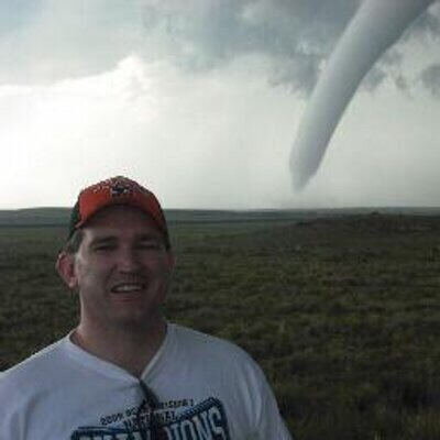
You might like
-
 Stephen Jones
@Tornado_Steejo -
 Jake Thompson
@ChaserJake94 -
 Gabe Garfield
@WxGabe -
 TwisterKidmedia
@TwoDogsWx -
 Nolan Meister
@Nolan_Meister -
 Roger Edwards
@SkyPixWeather -
 Atmospheric Chaos
@ColtForney -
 Taylor Wright
@taylorwrightwx -
 Ed Sweeney
@EasternChaser -
 Paxton Biggs
@PaxBiggs -
 Joey M. Marino🌪️
@WxJmar93 -
 Greg McLaughlin
@GregMcwx -
 Winston Wells
@WellsWx -
 Tyler Olson
@TylerOlsonWX -
 Joey Krastel
@NimbusStorms
Something went wrong.
Something went wrong.