David Demko
@DavidDemkoWx
Meteorologist • Wx Data & Forensics • Engineer • http://TwisterData.com • Storm Chasing • Mountains & Plains Roamer • OBKY Native
You might like


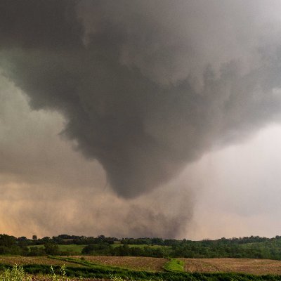
May 9, 2016 | Katie, Oklahoma Witnessing strong tornadoes with no shroud of obscuring precipitation around them feels like catching lightning in a bottle.

This is an awful development. Unidata has done more for the advancement of the atmospheric sciences and broad technology/scientific collaboration through open data, open-source software, accessible training and educational initiatives — among other things — than I can count.

Due to the current gap in funding from the U.S. National Science Foundation, the NSF Unidata Program is pausing most operations. Nearly all staff will be furloughed until funds from our existing NSF grant become available. For more information, see buff.ly/d2TC1Oy

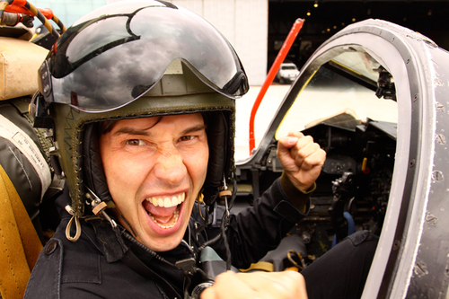
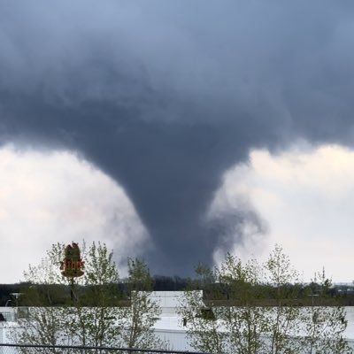
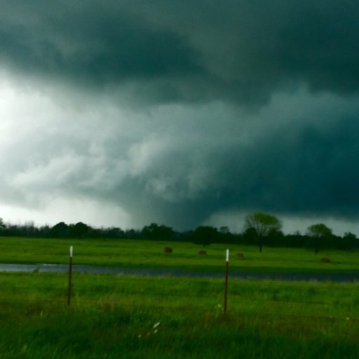
One of many tornadoes produced by supercell “A” during the May 3, 1999 tornado outbreak. This is tornado A8 as I observed it approaching the municipal airport on the northwest side of Chickasha, Oklahoma. The next tornado in this supercell’s sequence was A9 — the Moore F5.

After hitting 70°F on Saturday, winter is showing off again. Measured 5” new snow depth and 23°F as of 10:30 AM MT at 8460’ 1 mile ESE Nederland in western Boulder County. #cowx @NWSBoulder


As mentioned by @NWSSPC 20Z Day 1 outlook update maintaining the High Risk — check out the dramatic effect deep-layer ascent has had lifting the capping inversion into veritable irrelevance across the Mid South as shown by @NWSLittleRock soundings between 12Z to 18Z. Wowzers!


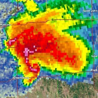
Well. This is a pretty framable VAD hodo from Paducah, KY at this time. Tornado outbreak ongoing.

Palmer Divide magic. I got a fantasic aerial view of the persistent remnant deep snowpack on the Palmer Divide while flying near Limon, Colorado this afternoon. Sharp cutoff line between snow and no snow visible too toward the horizon, looking northeast away from the PD. #cowx

This has been an utterly fantastic year for auroras! This is just a phone pic that I took of tonight’s display from Brainard Lake in western Boulder County, Colorado. #cowx #Boulder #Aurora


United States Trends
- 1. Pond 226K posts
- 2. Kim Davis 7,227 posts
- 3. #IDontWantToOverreactBUT 1,161 posts
- 4. Marines 43.8K posts
- 5. Semper Fi 8,901 posts
- 6. Go Birds 7,799 posts
- 7. #MYNZ N/A
- 8. Obergefell 4,743 posts
- 9. #MondayMotivation 43.2K posts
- 10. Veterans Day 21.3K posts
- 11. #5SOS_SELFIEDAY N/A
- 12. Edmund Fitzgerald 7,213 posts
- 13. #USMC 2,218 posts
- 14. Correísmo Nunca Más N/A
- 15. Good Monday 52.4K posts
- 16. Ken Burns N/A
- 17. JUST ANNOUNCED 32.5K posts
- 18. GeForce Season N/A
- 19. The BBC 583K posts
- 20. Victory Monday 4,086 posts
You might like
-
 Chaser Chat
@ChaserChat -
 Central Plains Weather
@CentralPlainsWx -
 Sam Dienst
@samdienst -
 Ryan Argenti
@ryanargenti -
 Weather Champs®
@WeatherChamps -
 🌪️ The WX Store🌪️
@TheWXStore -
 Scott Currens
@scott_currens -
 Mark Overbeck
@Mrk_WX -
 Synoptic Data
@SynopticData -
 Brennen Round
@Dossockies_MNSE -
 Paul Andrew
@Pandrew_Wx -
 ⛈️ MaxTXwx 🇺🇸
@maxtxwx -
 Cole Makos
@colemakoswx -
 Connor Moriarty
@cmoriarty79 -
 James H
@JamesH_WX
Something went wrong.
Something went wrong.