
ETX Prepares ~ All Hazards Preparedness
@ETXprepare
In GREGG Cnty TX & Founded: 2011~ Helping People in NETX w/ just the Facts; by increasing public awareness for Weather,Fire,Disasters & All Hazards information.
You might like


Elevated Fire 🔥 Risk for Longview/ Gregg and surrounding counties. Please abound outside burning and report any smoke or flames to 911. Thank you!
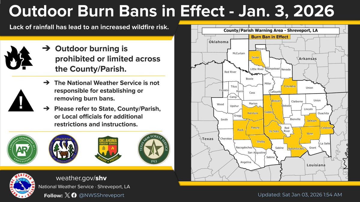
Numerous counties and parishes across our region have issued burn bans in recent days. This map reflects those that we have been able to confirm, but please contact your local area officials to check the status where you live if you plan to burn outdoors. #arwx #lawx #okwx #txwx
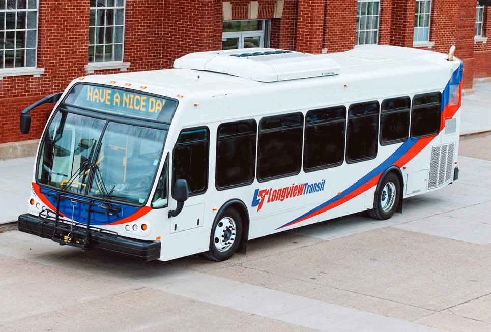
Please Share - Don’t Drink and Drive when FREE rides are available tonight!

Ring in the New Year safely, Longview! Longview Transit is offering FREE rides within the Longview city limits on New Year’s Eve.🕗 Service runs from around 8:00 p.m. to 3:00 a.m.📍 Rides are available to or from any Longview destination. Book by calling 903-753-2287 -Share this
Urgent ‼️ Fire 🔥 Alert for All East Texas. Please report any smoke or flames to 911 today!! Please Share. DO NOT Do outdoor burning.
Longview/ Gregg county and ETX. From @NWSShreveport ! The first significant surge of Arctic air looks poised to shift south from Canada across much of the eastern U.S. Sunday night into Monday morning. Temperatures should fall into the upper teens and 20s in our region.
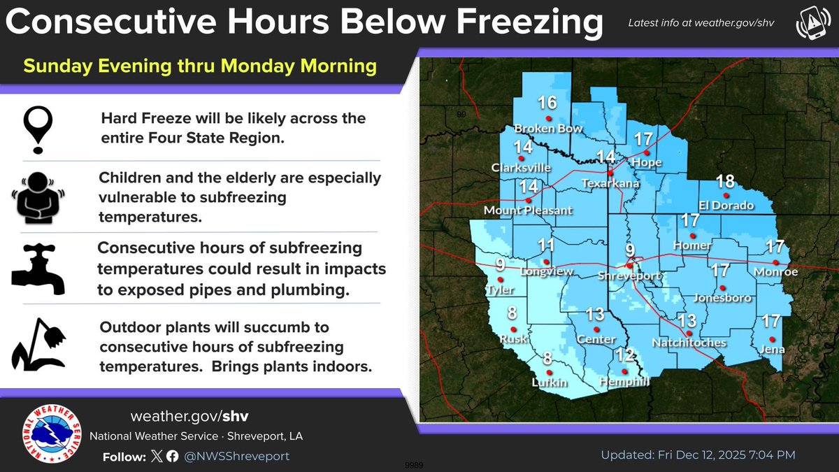
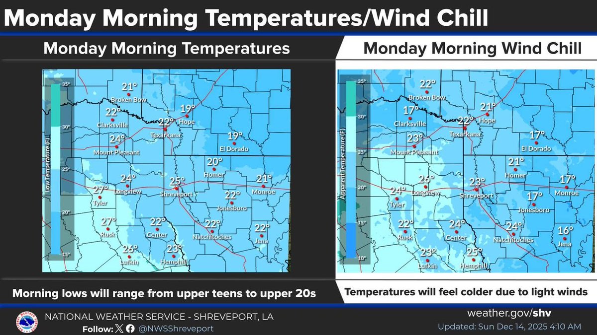

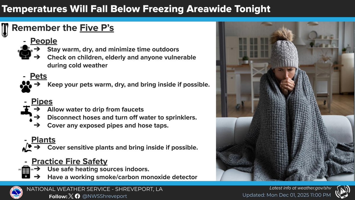
Longview/ Gregg county NWS Shreveport be orated for the cold!! Freezing temperatures are expected areawide overnight. Please remember to practice the Five P's of Cold Weather Safety Precautions.
NOTICE! This is an incredible achievement of Longview Fire Dept. Congrats It takes a long time to gather the data& go thru the survey. This may save some money on homeowners policy. Longview Attains Elite ISO Class 01/1X Public Protection Classification. cvcpl.us/79gWoFp
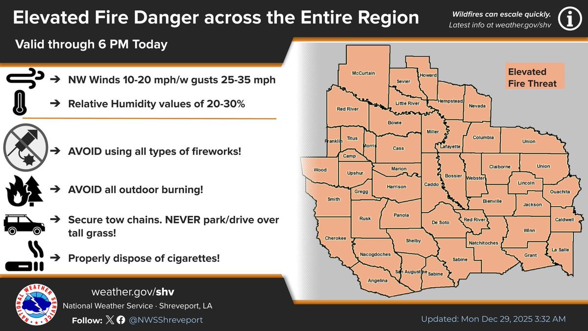
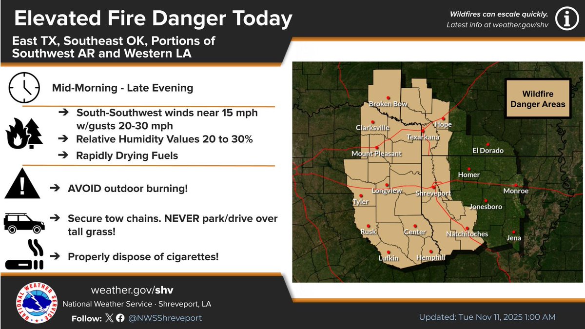
‼️ For 11-11-25 !!! Gregg county and East Texas. ELEVATED Fire 🔥 Risk…. Report all smoke to 911… See map below…Dry conditions, low relative humidities, and gusty south-southwest winds will result in elevated fire danger conditions today across East Texas. Please Share !
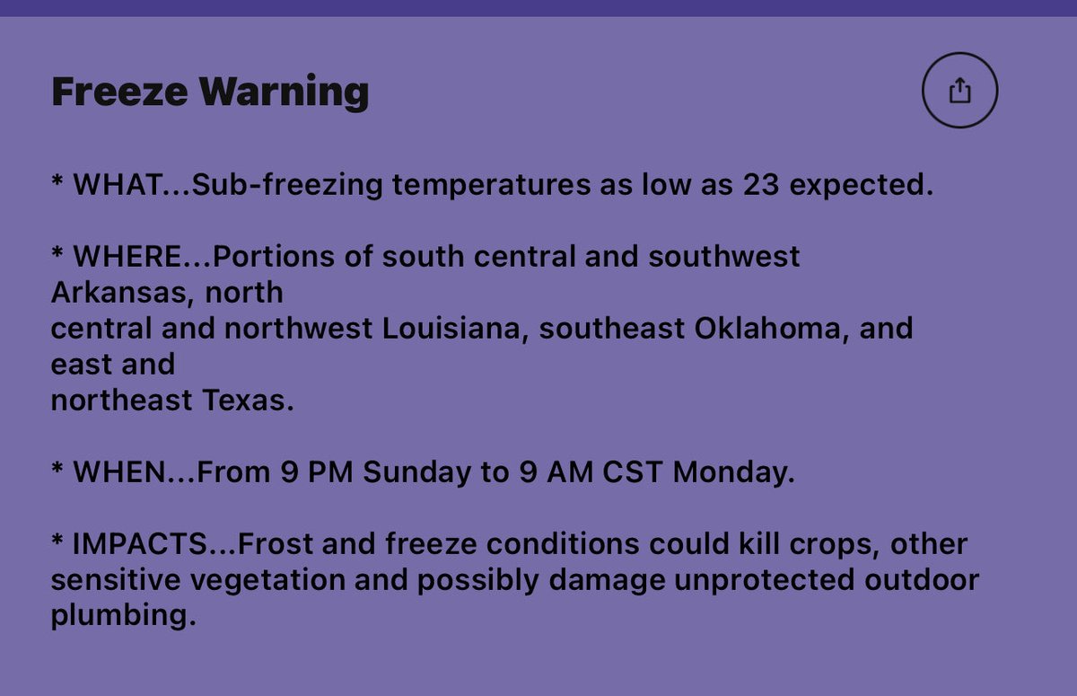
For Longview/ Gregg and surrounding counties. NWS has now upgraded the Freeze Watch to a WARNING! 9 pm Sunday to 9am Monday. This means a significant freeze is imminent! Check furnaces, CO2 detectors, disconnect hoses from the houses, cover plants, give animals shelter
FDA Recall. - Uncle Ben’s Rice - sold at Target, Amazon , HEB and other retailers. Click on link for more information!!! fda.gov/safety/recalls…

For Southern Gregg county.
Severe Thunderstorm Warning including Lake Cherokee TX, New London TX and Easton TX until 7:45 PM CDT
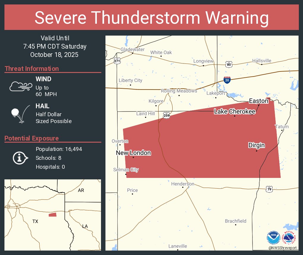
From @NWSShreveport
Today for Longview/ Gregg county stay alert !!‼️
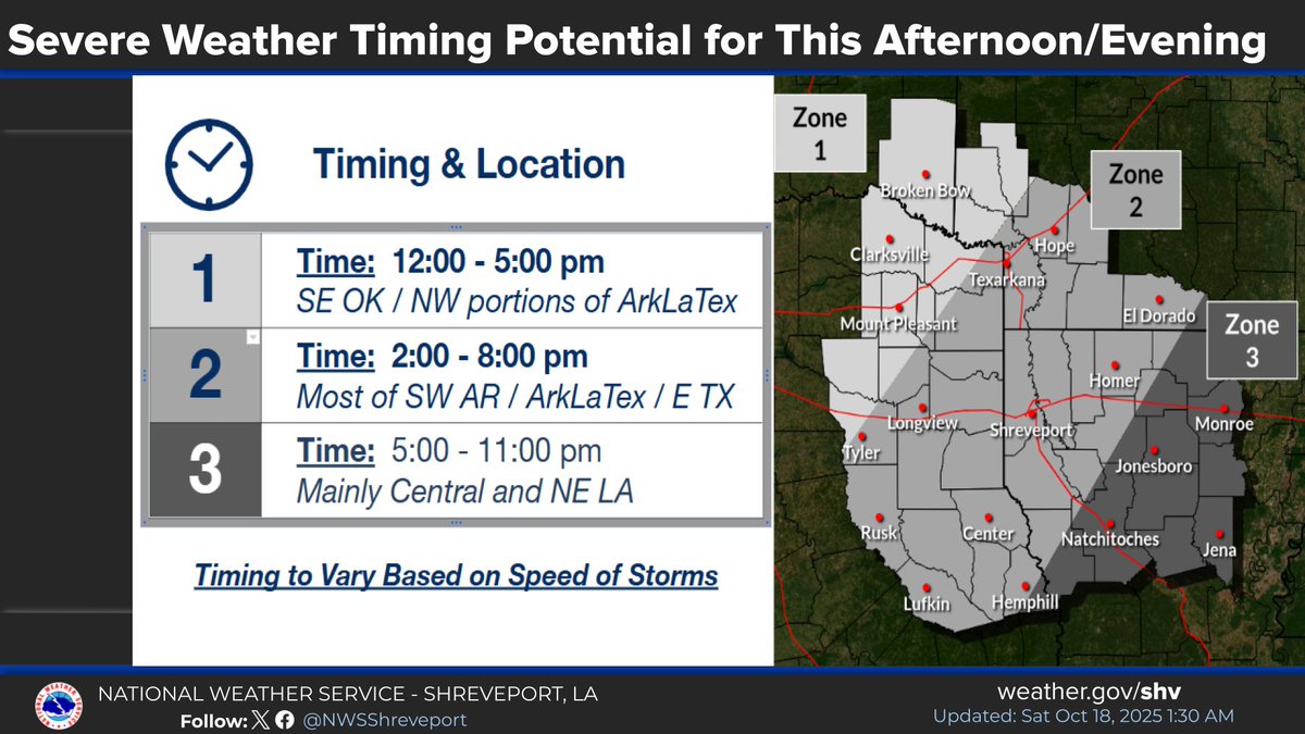
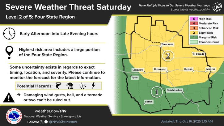
There is a chance for severe thunderstorms throughout much of this afternoon and evening as a deep trough and a cold front sweep across our Four-State area through tonight. The graphic below represents the most likely timing of potential severe weather impacts across the region.
For Longview / Gregg county TODAY. and majority of ETX. Stay alert & share!!
A tornado watch has been issued for parts of Arkansas, Louisiana, Oklahoma and Texas until 9 PM CDT
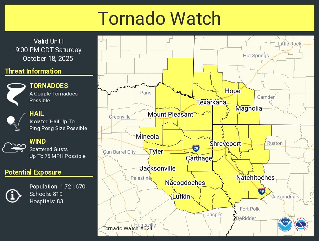
For Longview / Gregg county stay alert!!!
Vigilancia de Tornado ha sido emitida para partes de Arkansas, Louisiana, Oklahoma y Texas hasta las 9 PM CDT
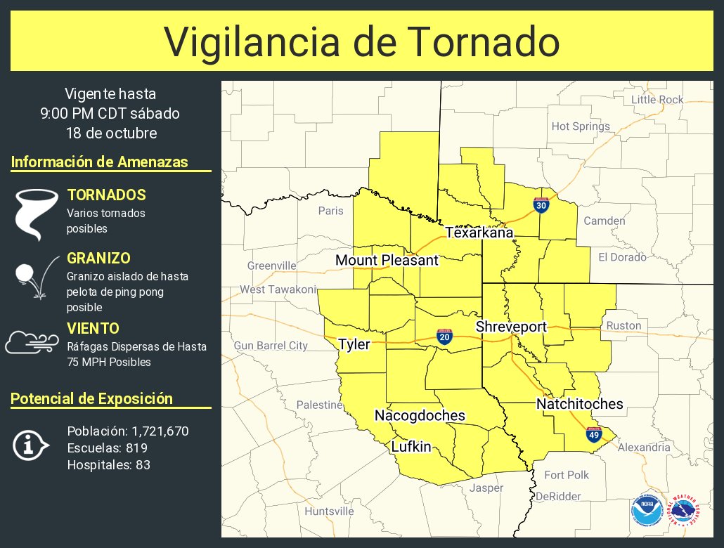
Vigilancia de Tornado ha sido emitida para partes de Arkansas, Louisiana, Oklahoma y Texas hasta las 9 PM CDT
From @NWSShreveport : Saturday 10-18-25-good coverage of thunderstorms throughout Saturday & into the evening. Strong to possibly Severe Thunderstorms may produce damaging winds, hail & isolated tornadoes ahead of our next cold front overnight. Stay alert. Keep NOAA radios ON.


United States Trends
- 1. Verizon N/A
- 2. The Jupiter N/A
- 3. Chukwueze N/A
- 4. Nigeria N/A
- 5. Dante Moore N/A
- 6. Albacete N/A
- 7. Kratos N/A
- 8. Real Madrid N/A
- 9. Morocco N/A
- 10. #AFCON2025 N/A
- 11. FINALLY DID IT N/A
- 12. T-Mobile N/A
- 13. #NIGMOR N/A
- 14. J Cole N/A
- 15. Calvin Bassey N/A
- 16. Internal N/A
- 17. Arbeloa N/A
- 18. Ranger N/A
- 19. Sanchez N/A
- 20. #pmsseatgeekwordsearch N/A


Something went wrong.
Something went wrong.